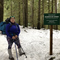
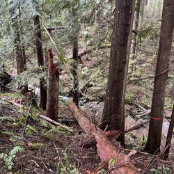
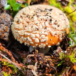
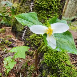
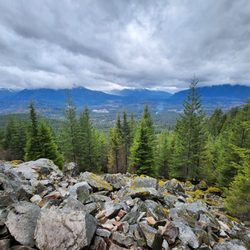
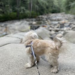
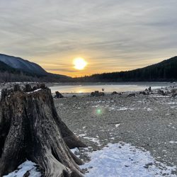
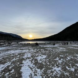
Snow Lake Photos


More like Snow Lake
Recommended Reviews - Snow Lake
Start your review...

Reviews With Photos

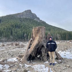
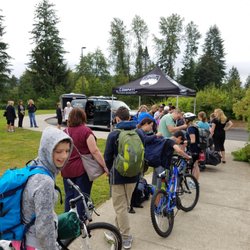
- Get next to the lake to see the igredient!! - We came here on a Sunday and the huge parking lot was quite full, but we managed to get the last few spots around 10:30 am. Tons of people parked poorly, leaving less space for others to park. Be extra careful driving in the parking lot as people lack common sense and won't move when you drive next to them lol. There is a bathroom next to the parking lot, but they ran out of toilet paper when we came down in the afternoon. There is a sign talking about explosives, but we believe it'd be fine if we stay on the trail lol. The road condition was alright, and the higher you get, the more rocks there are on the road. I didn't think it was particularly difficult as my friends and I were talking nonstop. Once you get to the top, you get to choose to go to the left for the overlook or go down further to get closer to the lake. I did the former the first time I was here, and surprisingly I had the energy to walk further this time. We went all the way down for the lake and that part was more muddy. We didn't go to the lake access, but stayed on the trail to the right and got to an area with less people next to the water. Our friend even jumped in for a swim. The weather was extremely nice, so it was a bit hot eating lunch there for like 30 minutes. The view was totally worth it as you can only see the beautiful igredient of color from green to blue when you get close. Each way is about 3.2-3.3 miles. We spent 2 hours up and 1.5 hour down. I burned 902 calories based on my watch. There were tons of people on the trail and tons of dogs too. I actually didn't see a lot of parents with children on their back here. We did witness a kid crying because he didn't want to go down to the lake as he could see the lake from the top. Poor guy must be exhausted... The parking lot was still quite full when we came down, but there were more space in the back (about 60% full). Make sure to wear hiking boots as the road near the top was almost 90% rocks.

We started off early in the morning and arrived at 8AM. There were maybe only 3-4 cars there already but I think they were backpackers because we didn't see anyone coming down on the way up. The lot has a $5 fee that you can either pay online or with the parking slips, if there's any available. At 8AM, the temperature was still low and it was kind of cloudy. The entire hike up, we were pretty much in shade until we got to the top where the trees opened up and the sun starting to climb over the mountain ridge. The incline is a beast at the last stretch so don't overexert in the beginning. It's really rocky and dusty and there were multiple times where I stubbed my feet or my ankle rolled. We took a short break at the very top and then continued our way down towards the lake, which took maybe another 20 minutes. It was so beautiful down there! Quiet and serene, the waters were crystal clear. You almost feel bad if you disturb the peace. On another side of the lake, we saw some people swimming in the waters! The hike overall took us about 3-4 hours, as expected from AllTrails. I thought it was really worth it, but come early! There were a lot of people just starting the hike when we finished and the sun was already beating down at that point. And the lot looked pretty full by the time we got back.

Snow Lake is a spectacular moderate ~7 mile out-and-back hike with so many different views. I came here this past weekend and it was incredibly beautiful to see all of the leaves change color for fall! I love that this hike is a mixture of forest, rocky, and water. In the beginning it's basically dirt and forest and as you progress, it gets super rocky (probably not ideal for someone with weak ankles). Definitely do yourself a favor and wear waterproof hiking boots because of the rocks and streams of water throughout the trail. The trail is fairly easy to follow and has a pretty steady incline but nothing unbearable if you're an avid hiker. The trail is also fairly narrow so you can expect to stop at certain points to let others pass. I didn't see any snow this time of year which is a bummer but still found the view of lake to be so breathtaking even with the fog in sight. Restrooms are available to the left of the trailhead and there is one toilet stop close to the end of the trail. There is a big parking lot right in front of the trailhead. We got done with the hike around 1230 and there were still spots available but I imagine it can fill up pretty fast in the warmer months.

Incredible hiking journey that I can confidently deem as one of the best trails I have ever taken. The experience was filled with breathtaking landscapes thrilling challenges and a sense of excitement from start to finish. If you're an avid hiker seeking an unforgettable adventure this trail should be at the top of your list. From the moment I began my journey I was mesmerized by the diverse scenarios that greeted me at every turn. The trail seamlessly transitioned from lush green forests to vast open meadows providing an ever-changing backdrop that kept me in awe. The vibrantly colored wildflowers illuminated the surroundings bringing a sense of serenity and tranquility to the entire hike. As I ventured further the trail presented me with a series of exciting scenarios and obstacles. The rugged terrain challenged both my physical endurance and mental agility but the rewards were well worth it. I found myself navigating through narrow cliffs crossing babbling streams and scrambling over rocks. Each step brought a new sense of accomplishment and a deeper connection with nature. One of the most captivating aspects of this trail was the endless surprises it had in store. Every corner I turned revealed something new to discover ensuring that I was constantly engaged with my surroundings. Whether it was stumbling upon a hidden stream I was consistently captivated by the trail's ability to amaze and inspire. Furthermore throughout my hike I found that boredom simply had no place on this trail. The ever-changing landscapes intriguing wildlife encounters and the peaceful symphony of nature kept my senses heightened and my curiosity peaked. The trail provided a perfect balance between challenging sections that tested my hiking skills and serene stretches that allowed me to appreciate the beauty of my surroundings. In conclusion this trail is a must for any hiking enthusiast seeking the ultimate adventure. From its incredible variety of stunning landscapes to the thrill of conquering its challenges you'll find yourself constantly amazed and engaged. Prepare to be awed by the mesmerizing scenarios that unfold along the way ensuring that you won't have a dull moment throughout your hike. This unforgettable journey will leave you with memories to cherish and a profound connection to the wonders of nature.

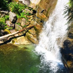
Strenuous and technical hike. Approximately 7 miles round trip. Technical because you really need to watch your footing on this trail. Rocks are everywhere!! For real, and tree roots. You could miss spectacular views watching your footing. So, stop! Smell the mountain air. Enjoy the scenery. You hike up, up, up, and then down into the lake area. Snow lake is absolutely gorgeous! Down at the lake's edge seating is rocky so I recommend bringing a small towel or blanket to sit on. The water was amazingly refreshing. Next hike, I'll bring water shoes as navigating the lake bottom bare foot was a bit painful. But so worth it to get wet and cool my body temperature off. The trail does loop around to the other side of the lake too. My group had our snacks and headed back. Be ready and careful. Bring sufficient snacks, sunscreen, and bug spray. The parking lot is rocky too. A bathroom is at the bottom but it is well, yucky. You do need a pass for this hike and a machine at the parking lot sells them. It was broken so, you'd be ok. I always carpool with my girlfriends who have passes: lucky me. Stay hydrated, go early! And cheers! Happy yelping.


The most amazing hike but I'd call it moderately difficult for someone who doesn't to do hikes that have 2k+ elevation. I think what made it more taxing was navigating over the roots, stones and large rocks. When you get to the switchbacks- after taking the nice jaunt thru the forested area with large rocks slides- your cardio hits you! There are tons of new stairs (thanks WTA!!) from 2022 work and boy it's a stair master workout!! The views atop the rock are spectacular! There was a good deal of snow and slippery slush down below on the lower trail to the lake. There's also a box toilet off the trail if you're in need of some peaceful nature to do your business. You can go into the lake but it's a super cool dip and the rocks are slippery. We saw people trail running and kept wondering how in the heck they could run over the large and small rocks everywhere!! We had hiking poles and SUPER glad we did to help hoist us up the trail and then navigate over the rocks on the way down since they constantly moved.

This hike is very rocky! There are a couple of waterfalls as well and wet rocks make for some slippery surfaces. Definitely be careful and take it slow as some rocks are wobbly too. I was planning on buying hiking shoes but held off due to laziness. I really wish I bought them before this but after the hike I went out to buy some hiking shoes. It costs $5 for a pass. After you park you get an envelope and put the money in there and slip the envelope in the box. Then you display the pass on your windshield. Bring a pen if you don't already have one in your car (if not you should because it's really useful). When you get to about the two mile mark you will see a sign that points in two directions. To go to Snow Lake take a sharp right turn. If you continue straight you will reach a smaller lake called Source Lake and apparently also known as Gem Lake. I didn't see the sign (I think I was jogging at that part) and continued straight and I ran into Source Lake. I was confused for 20 minutes on how to continue going up to Snow Lake from there. I eventually turned back to see the sign I missed before and continued going up. It was rocky going down to Snow Lake and a little icy as well when I went. It was foggy so we didn't get the greatest pictures but it was still a good view. Source Lake was nice but Snow Lake is a lot nicer even with the fog. This was definitely one of the harder hikes I've done but mainly because I don't think I had the right shoes. It took about two hours going to both Source and Snow Lake and it took 1.5 hours going down. I think it's an intermediate level hike but with enough stops and of course water this hike is doable. Some notes: -There are restrooms at the beginning as well as at Snow Lake -There is a lot of parking although it might get packed on weekends/summers

Let me preface by saying that I am NOT a hiker. So, if you are a not a hiker like me and hesitant to try, I say give it a shot. Great photo opportunities. Fun hike- not too long or too short. About three miles round trip. The view when we got there was well worth it. Be warned - take mosquito repellant as there are millions of the little buggers! The only negative was that it was difficult to find the trailhead from the road as there were no signs on the road or in the parking lot directing one to the trailhead. We followed the google maps app on the iPhone and got there fine, but there weren't any signs until we got to the very well marked trailhead. If you're in the mood for the outdoors, fantastic views and not a lot of people at Mt. Rainier National Park, the Bench and Snow Lakes Trail is a definite must see.

Got to the parking lot about a quarter after 8AM on a Monday, lots of parking available still. The path goes steadily uphill for a while with awesome views of the I-90 although it was pretty hazy due to fires. The path then goes down to Snow Lake which was pretty, not very many people, bugs were annoying but I put on bug spray before the hike and re-applied throughout the hike. The path is pretty rocky between the parking lot and Snow Lake.


It's a pretty good hike, the way there is uphill and it took us about 2 hours. Once on top there is a spot with good views of the lake (a little climb on the boulders). After that there is another 20min hike downhill to get to the lake. The water is a little cold, but it's worth jumping in the water. Tip: Get your swimming suit! Water shoes are handy to avoid stepping on the rocks Get some bug spray Water! Snacks Camera Oh and 5$ cash for the parking

Not my favorite trail. When I go hiking I prefer a level of solitude and this is definitely not the place for it. Arrived at 8:30am on a Sunday and the parking was already spilling over into the overflow parking. Northwest Forest Pass required or its $5 cash at the trailhead. The biggest drawback to this trail is how incredible popular it is. There isn't a lot of shade for a good part of it, and my fiancé and I encountered quite a few parties with no trail etiquette. Please make it enjoyable for everyone by: 1) not cutting switchbacks; 2) keeping your audio to yourself. Not everyone wants to be "blessed" by your music choices. 3) can't believe I have to say this, but picking up after your dog. If you choose to bring a dog, pack it in or bury it. 4) staying to the inside of the trail if someone wants to pass you. 5) letting people on the harder side of the trail pass first. We navigated this just fine. It's a fine trail for solo women travelers - if you're worried about going on a trail, there's plenty of traffic. Once we got to the lake, people were shouting across the lake at each other and it kind of felt like a party lake. Wasn't relaxing at all. Spent maybe 25 minutes at the lake before turning and heading back. 2 hours in, 2-ish hours out. By the time we were about halfway back, we were constantly stopping to let the uphill traffic pass. Not a relaxing trail by any means, but it was a nice view. And a general warning to everyone hiking - TAKE EVERYTHING OUT OF YOUR CAR before you go. All your jackets, all your snacks, all your change and sunglasses and national park passes. Leave your windows all the way rolled up and take all backpacks, duffels, satchels, purses, etc. Never leave anything in your car. Thanks and happy hiking!

5 months ago
Gorgeous place! We were able to go snowshoeing for free! Plenty of parking on the side of the road. Highly recommend bringing hiking poles since it's super icy this season! read more


Definitely arrive early because the lot with fill up fast! A NW Forest pass is required for parking. This trail is very rocky so make sure to have good hiking shoes and trekking poles. There was also lots of bugs on this trail so definitely pack bug spray as well. The view is beautiful, a little crowded but I came around 7:30am so it wasn't too bad. read more


Another stunning PNW hike. Gorgeous at any season. The hike is lined by wildflowers in the summer, and gold / red brush in the fall. It descends into a breathtaking alpine lake. About a 6 mile round trip. It's rocky so I recommend hiking boots / shoes for sure! read more


- Get next to the lake to see the igredient!! - We came here on a Sunday and the huge parking lot was quite full, but we managed to get the last few spots around 10:30 am. Tons of people parked poorly, leaving less space for others to park. Be extra careful driving in the parking lot as people lack common sense and won't move when you drive next to them lol. There is a bathroom next to the parking lot, but they ran out of toilet paper when we came down in the afternoon. There is a sign talking about explosives, but we believe it'd be fine if we stay on the trail lol. The road condition was alright, and the higher you get, the more rocks there are on the road. I didn't think it was particularly difficult as my friends and I were talking nonstop. Once you get to the top, you get to choose to go to the left for the overlook or go down further to get closer to the lake. I did the former the first time I was here, and surprisingly I had the energy to walk further this time. We went all the way down for the lake and that part was more muddy. We didn't go to the lake access, but stayed on the trail to the right and got to an area with less people next to the water. Our friend even jumped in for a swim. The weather was extremely nice, so it was a bit hot eating lunch there for like 30 minutes. The view was totally worth it as you can only see the beautiful igredient of color from green to blue when you get close. Each way is about 3.2-3.3 miles. We spent 2 hours up and 1.5 hour down. I burned 902 calories based on my watch. There were tons of people on the trail and tons of dogs too. I actually didn't see a lot of parents with children on their back here. We did witness a kid crying because he didn't want to go down to the lake as he could see the lake from the top. Poor guy must be exhausted... The parking lot was still quite full when we came down, but there were more space in the back (about 60% full). Make sure to wear hiking boots as the road near the top was almost 90% rocks. read more


We started off early in the morning and arrived at 8AM. There were maybe only 3-4 cars there already but I think they were backpackers because we didn't see anyone coming down on the way up. The lot has a $5 fee that you can either pay online or with the parking slips, if there's any available. At 8AM, the temperature was still low and it was kind of cloudy. The entire hike up, we were pretty much in shade until we got to the top where the trees opened up and the sun starting to climb over the mountain ridge. The incline is a beast at the last stretch so don't overexert in the beginning. It's really rocky and dusty and there were multiple times where I stubbed my feet or my ankle rolled. We took a short break at the very top and then continued our way down towards the lake, which took maybe another 20 minutes. It was so beautiful down there! Quiet and serene, the waters were crystal clear. You almost feel bad if you disturb the peace. On another side of the lake, we saw some people swimming in the waters! The hike overall took us about 3-4 hours, as expected from AllTrails. I thought it was really worth it, but come early! There were a lot of people just starting the hike when we finished and the sun was already beating down at that point. And the lot looked pretty full by the time we got back. read more


Snow Lake is a spectacular moderate ~7 mile out-and-back hike with so many different views. I came here this past weekend and it was incredibly beautiful to see all of the leaves change color for fall! I love that this hike is a mixture of forest, rocky, and water. In the beginning it's basically dirt and forest and as you progress, it gets super rocky (probably not ideal for someone with weak ankles). Definitely do yourself a favor and wear waterproof hiking boots because of the rocks and streams of water throughout the trail. The trail is fairly easy to follow and has a pretty steady incline but nothing unbearable if you're an avid hiker. The trail is also fairly narrow so you can expect to stop at certain points to let others pass. I didn't see any snow this time of year which is a bummer but still found the view of lake to be so breathtaking even with the fog in sight. Restrooms are available to the left of the trailhead and there is one toilet stop close to the end of the trail. There is a big parking lot right in front of the trailhead. We got done with the hike around 1230 and there were still spots available but I imagine it can fill up pretty fast in the warmer months. read more


3 years ago
Incredible hiking journey that I can confidently deem as one of the best trails I have ever taken. The experience was filled with breathtaking landscapes thrilling challenges and a sense of excitement from start to finish. If you're an avid hiker seeking an unforgettable adventure this trail should be at the top of your list. From the moment I began my journey I was mesmerized by the diverse scenarios that greeted me at every turn. The trail seamlessly transitioned from lush green forests to vast open meadows providing an ever-changing backdrop that kept me in awe. The vibrantly colored wildflowers illuminated the surroundings bringing a sense of serenity and tranquility to the entire hike. As I ventured further the trail presented me with a series of exciting scenarios and obstacles. The rugged terrain challenged both my physical endurance and mental agility but the rewards were well worth it. I found myself navigating through narrow cliffs crossing babbling streams and scrambling over rocks. Each step brought a new sense of accomplishment and a deeper connection with nature. One of the most captivating aspects of this trail was the endless surprises it had in store. Every corner I turned revealed something new to discover ensuring that I was constantly engaged with my surroundings. Whether it was stumbling upon a hidden stream I was consistently captivated by the trail's ability to amaze and inspire. Furthermore throughout my hike I found that boredom simply had no place on this trail. The ever-changing landscapes intriguing wildlife encounters and the peaceful symphony of nature kept my senses heightened and my curiosity peaked. The trail provided a perfect balance between challenging sections that tested my hiking skills and serene stretches that allowed me to appreciate the beauty of my surroundings. In conclusion this trail is a must for any hiking enthusiast seeking the ultimate adventure. From its incredible variety of stunning landscapes to the thrill of conquering its challenges you'll find yourself constantly amazed and engaged. Prepare to be awed by the mesmerizing scenarios that unfold along the way ensuring that you won't have a dull moment throughout your hike. This unforgettable journey will leave you with memories to cherish and a profound connection to the wonders of nature. read more


3 years ago
Strenuous and technical hike. Approximately 7 miles round trip. Technical because you really need to watch your footing on this trail. Rocks are everywhere!! For real, and tree roots. You could miss spectacular views watching your footing. So, stop! Smell the mountain air. Enjoy the scenery. You hike up, up, up, and then down into the lake area. Snow lake is absolutely gorgeous! Down at the lake's edge seating is rocky so I recommend bringing a small towel or blanket to sit on. The water was amazingly refreshing. Next hike, I'll bring water shoes as navigating the lake bottom bare foot was a bit painful. But so worth it to get wet and cool my body temperature off. The trail does loop around to the other side of the lake too. My group had our snacks and headed back. Be ready and careful. Bring sufficient snacks, sunscreen, and bug spray. The parking lot is rocky too. A bathroom is at the bottom but it is well, yucky. You do need a pass for this hike and a machine at the parking lot sells them. It was broken so, you'd be ok. I always carpool with my girlfriends who have passes: lucky me. Stay hydrated, go early! And cheers! Happy yelping. read more


Hiked Snow Lake a few times, the last time was a few months ago during the rain and snow. Surprisingly there were quite a number of people going up that were ill-prepared (wearing jeans and sneakers). This can be a dangerous hike during the winter due to avalanches. read more


3 years ago
The most amazing hike but I'd call it moderately difficult for someone who doesn't to do hikes that have 2k+ elevation. I think what made it more taxing was navigating over the roots, stones and large rocks. When you get to the switchbacks- after taking the nice jaunt thru the forested area with large rocks slides- your cardio hits you! There are tons of new stairs (thanks WTA!!) from 2022 work and boy it's a stair master workout!! The views atop the rock are spectacular! There was a good deal of snow and slippery slush down below on the lower trail to the lake. There's also a box toilet off the trail if you're in need of some peaceful nature to do your business. You can go into the lake but it's a super cool dip and the rocks are slippery. We saw people trail running and kept wondering how in the heck they could run over the large and small rocks everywhere!! We had hiking poles and SUPER glad we did to help hoist us up the trail and then navigate over the rocks on the way down since they constantly moved. read more


2 years ago
This hike is very rocky! There are a couple of waterfalls as well and wet rocks make for some slippery surfaces. Definitely be careful and take it slow as some rocks are wobbly too. I was planning on buying hiking shoes but held off due to laziness. I really wish I bought them before this but after the hike I went out to buy some hiking shoes. It costs $5 for a pass. After you park you get an envelope and put the money in there and slip the envelope in the box. Then you display the pass on your windshield. Bring a pen if you don't already have one in your car (if not you should because it's really useful). When you get to about the two mile mark you will see a sign that points in two directions. To go to Snow Lake take a sharp right turn. If you continue straight you will reach a smaller lake called Source Lake and apparently also known as Gem Lake. I didn't see the sign (I think I was jogging at that part) and continued straight and I ran into Source Lake. I was confused for 20 minutes on how to continue going up to Snow Lake from there. I eventually turned back to see the sign I missed before and continued going up. It was rocky going down to Snow Lake and a little icy as well when I went. It was foggy so we didn't get the greatest pictures but it was still a good view. Source Lake was nice but Snow Lake is a lot nicer even with the fog. This was definitely one of the harder hikes I've done but mainly because I don't think I had the right shoes. It took about two hours going to both Source and Snow Lake and it took 1.5 hours going down. I think it's an intermediate level hike but with enough stops and of course water this hike is doable. Some notes: -There are restrooms at the beginning as well as at Snow Lake -There is a lot of parking although it might get packed on weekends/summers read more


6 years ago
Let me preface by saying that I am NOT a hiker. So, if you are a not a hiker like me and hesitant to try, I say give it a shot. Great photo opportunities. Fun hike- not too long or too short. About three miles round trip. The view when we got there was well worth it. Be warned - take mosquito repellant as there are millions of the little buggers! The only negative was that it was difficult to find the trailhead from the road as there were no signs on the road or in the parking lot directing one to the trailhead. We followed the google maps app on the iPhone and got there fine, but there weren't any signs until we got to the very well marked trailhead. If you're in the mood for the outdoors, fantastic views and not a lot of people at Mt. Rainier National Park, the Bench and Snow Lakes Trail is a definite must see. read more


Got to the parking lot about a quarter after 8AM on a Monday, lots of parking available still. The path goes steadily uphill for a while with awesome views of the I-90 although it was pretty hazy due to fires. The path then goes down to Snow Lake which was pretty, not very many people, bugs were annoying but I put on bug spray before the hike and re-applied throughout the hike. The path is pretty rocky between the parking lot and Snow Lake. read more

It's a pretty good hike, the way there is uphill and it took us about 2 hours. Once on top there is a spot with good views of the lake (a little climb on the boulders). After that there is another 20min hike downhill to get to the lake. The water is a little cold, but it's worth jumping in the water. Tip: Get your swimming suit! Water shoes are handy to avoid stepping on the rocks Get some bug spray Water! Snacks Camera Oh and 5$ cash for the parking read more


Not my favorite trail. When I go hiking I prefer a level of solitude and this is definitely not the place for it. Arrived at 8:30am on a Sunday and the parking was already spilling over into the overflow parking. Northwest Forest Pass required or its $5 cash at the trailhead. The biggest drawback to this trail is how incredible popular it is. There isn't a lot of shade for a good part of it, and my fiancé and I encountered quite a few parties with no trail etiquette. Please make it enjoyable for everyone by: 1) not cutting switchbacks; 2) keeping your audio to yourself. Not everyone wants to be "blessed" by your music choices. 3) can't believe I have to say this, but picking up after your dog. If you choose to bring a dog, pack it in or bury it. 4) staying to the inside of the trail if someone wants to pass you. 5) letting people on the harder side of the trail pass first. We navigated this just fine. It's a fine trail for solo women travelers - if you're worried about going on a trail, there's plenty of traffic. Once we got to the lake, people were shouting across the lake at each other and it kind of felt like a party lake. Wasn't relaxing at all. Spent maybe 25 minutes at the lake before turning and heading back. 2 hours in, 2-ish hours out. By the time we were about halfway back, we were constantly stopping to let the uphill traffic pass. Not a relaxing trail by any means, but it was a nice view. And a general warning to everyone hiking - TAKE EVERYTHING OUT OF YOUR CAR before you go. All your jackets, all your snacks, all your change and sunglasses and national park passes. Leave your windows all the way rolled up and take all backpacks, duffels, satchels, purses, etc. Never leave anything in your car. Thanks and happy hiking! read more


 - Hiking Near Me - North Bend, Washington")

2 years ago
Beautiful hike - roughly 7.5 miles RT to the lookout and then down to the lake and back. This is definitely not "easy" as some of the trail descriptions have said, but it is also not very difficult. I brought a friend from Arizona to do this hike and having not spent much time being active this summer she suffered. I didn't find any one part of the hike to be overwhelmingly steep or treacherous, but it felt longer than some of the 7 milers I've done in my time. This could have been because we stopped to rest every time there was shade, but we were still able to make it to the lake in about 3 hours. The day we went was very warm and so we took off our socks and shoes and got in the lake! What a delightful way to spend the afternoon floating around. This also helped keep us cool on the way back down the hike. Everyone has said this hike is very crowded, but I didn't find it to be any more crowded than most hikes I do in the summers. I was paranoid of the biting flies that everyone posted about and found that as long as I was moving, nothing tried to bother me. The second I stopped with my friend I could hear insects buzzing about. If I was doing a solo hike I probably would have put headphones in just to avoid hearing the bugs. As others have said, hiking boots are highly recommended for this hike. I made the mistake of misplacing my hiking boots in my car and ended up just wearing my runners. While running the trail downhill I landed on my left foot really hard and had to limp my way home. Luckily I had the forethought to bring my trekking poles. This definitely saved me. As for the heat, while the trail is mostly exposed when you get up to elevation the breeze cools down significantly and I didn't find it to be unbearable at all - and don't get me wrong, I sweat A LOT usually. Highly recommend this hike - next time I will go the extra mile (literally) to Gem Lake. read more


3 years ago
Snow Lake is one of my favorite hikes. It's pretty moderate, 6.4 miles roundtrip (or 8 miles if you hike down to the lake - worth it!) with 1000ft elevation gain, and the view is AWESOME. I usually go in the summer, so snow on the trail isn't a problem.. and wearing regular sneakers, shorts and a tee is totally fine. I think if you go during other times of the year though, you'll want to layer up and wear shoes good for snow. Lastly, plan to spend at least 3-4 hours hiking and enjoying the lake, so bring water and snacks :) NOTE: WTA directions aren't very good, and can get you lost - don't use them! Use USDA Forest Services or just turn left upon exiting #52 off of i90 east and then take the second right. Continue for 1.5 miles (you'll pass by ski lodges) and park in the large gravel lot to the left. You won't see any signs for Snow Lake but the trailhead is on the right. read more


12 years ago
This was definitely my favorite hike of the summer. On most other hikes, I feel like I'm trapped in a forest and am generally just surrounded by trees until I make it to a lookout point. On this hike, there are definitely a lot of trees but there is also a lot of open space too. The hike never gets boring. As mentioned in other reviews, the path does get very rocky. On this hike, I realized how big of a difference having hiking boots would have made this trek as I rolled my ankle several times. Once you get to the top, you still have about a 3/4 mile hike down to the lake which is absolutely stunning. Yes, this hike is challenging at times, but I would consider it less challenging than Mt. Si and the payout is much better as well. read more


7 years ago
It's the best lake view near Seattle, WA. Snow Lake is only about 50 minutes drive from Downtown Seattle. Go to I-90 East to Exit 52, signed Snoqualmie Pass West then turn left then take second right travel about 1.3 miles to the Alpental Ski area parking lot. Parking fee is $5 cash or Northwest Forest Pass. Snow Lake - 7. 2 Miles Round-Trip. Snow Lake is located 3.3 miles from Snow Lake Trailhead in the Alpental Ski Area. From the main parking lot for Alpental Ski Area, cross Alpental Road and head uphill 20 yards to the trailhead on the right side of the road, across from the double bathrooms in the upper lot. Go early or prepare friendly. It gets crowded by 11 am. It's so beautiful lake with crystal clear water. Bring some lunch and enjoy the beauty of Alpines Lakes Wilderness. read more


7 years ago
Really amazing hike but you'll want the right shoes and ample amounts of bug spray. It's not a super difficult hike though near the summit before descent to the lake it does get fairly steep. I went with many first time in Washington hikers and nobody seemed too daunted by the climb. Once you're down to the water it's really amazing. I went inside (early August) and the temperature was perfect. I do wish I had flip flops around though because the ground is fairly rocky and hard on the feet. Tons of mosquitos around the lake. Overall fantastic hike and would love to do again. read more


First hike of the summer for me and I can say it's pretty easy. Took my friend and I 1 1/2 hour up and another 20minutes down to the lake and what can I say! The view is just breath taking. The trail is pretty moderate, with a slight incline at first then it'll gradually gets tougher. There are parts of the trail that are pretty rocky so I recommend hiking boots. I hiked with my frees and I rolled my ankle going down a few times, and be careful with the lose rocks as well they'll come right under you, I learned that the hard way... Beautiful hike, perfect for kids and dogs. read more

9 years ago
This hike gets busy depending on what time of day or year you visit. Ton of kids, fellow hikers and dogs on the trail. Don't worry about parking as the lot literally has room for 100+ vehicles. NW Forest Pass required folks. If you aren't big on crowds, I don't recommend this hike. But Snow Lake is probably the best Lake you will see on I-90 that isn't too far from Seattle. I visited this trail with the sole purpose of hiking to Gem Lake. Gem Lake is about an additional 1.25 miles past Snow Lake. Hiking to the viewpoint from the trailhead is about 3.5 miles. The trail itself is pretty rocky so I highly recommend hiking boots for this one. Some parts of the trail are tight, so it's kinda of hard to pass others at certain points. At one point, there was a line of 15 people walking straight for about 10 minutes together. When the opportunity permits and you're outside of shade, take a minute to look around. You'll see the most amazing landscape of mountains during your journey. It's pretty rare on I-90 to find a hike where you see scenic views throughout your hike. Traditionally the payoff is presented when you reach your destination, but this hike has it throughout. Normally people hike to the viewpoint and turn around. It is the best view of Snow Lake, but I highly recommend hiking down to the waterfront. It's another mile of hiking but you can cleanse off all that sweat by jumping in the water. The water is cold AF btw nobody swims in that thing. Ok now to Gem Lake. I wanted to write this review for Gem Lake but I couldn't find it on Yelp. To get to Gem Lake you literally walk along Snow Lake for roughly half a mile. This part of the trail is more intimate. Not many people walk over to Gem Lake since they are so amazed at Snow Lake. But if you're like me and rather hike in a much peaceful quieter setting, then I highly recommend continuing on to Gem Lake. From Gem Lake to Snow Lake, there are a TON of views. Mountain ranges, different angles of Snow Lake, and streams. It gives you a huge perspective on how large Snow Lake actually is. If I could, I would skip the hike to Snow Lake and do this portion on repeat. Once you arrive to Gem Lake you won't see much people. I only saw about 5-8 hikers as opposed to the 100s I passed at Snow Lake. **Rated 4/5 due to congestion, would rate 5/5 otherwise. Happy Hiking! read more


6 years ago
Actually we only covered the source lake trail as around 4.4 miles belonging to part of snow lake trail. The waterfall, wild flowers, rocks, garden snakes, and thick snow will not let you down. You can even slide to the source lake to have a close look. What a beautiful views! read more


Such a beautiful hike with well maintained paths.. I have to say this is one of my favorite hikes that is 1 - closer to Seattle, 2 - easily doable within a few hours, 3 - as beautiful during the hike as it is when you get to the lookout point for the lake and even more so once you reach the lake itself! This hike is about 3.4 miles each way, so about 6.8 miles roundtrip! You park at the Alpental Ski area parking lot and start on your journey. There is an outhouse at the start of the hike and one down by the lake. The elevation gain isn't so bad but there are lots of rocks and boulders, so a good pair of hiking shoes will be worthwhile but not necessary - I did the hike in August with a pair of sneakers. You have an amazing view of the mountains on your way up and at the top, you get a view of the lake (~1.7 miles in). The map says it's another 1.7 miles to get from the top back down to the lake, but it is well worth it for a quick dip in the glacier water on a hot day. It was beautiful both up top and down by the lake cause you get two different views. A little hard to find your way back from the lake, so be prepared to remember trees/rocks/landmarks. You make your way back the same way you came. I think it took us about 2-3 hours one way, and we were going slower. Totally recommend it if you're unsure - the path was well kept and not difficult to maneuver. read more


13 years ago
I strangely love this hike more than I think I should. First thing's first, whoever listed Snow Lake being in North Bend is the biggest scumbag on this planet right now. It's nowhere around North Bend, it's closer to Snoqualmie Pass. The roads and the park itself are unmarked, for the most part. Luckily I wasn't navigating as I inadvertently tend to overlook smaller details because I'm a dumbass and would have kept driving. You will need to drive through Alpental ski resort until you reach a large parking lot and the trail is at the end of it. If you do this hike at a steady pace and only stopping at worthy landmarks for photos, this is going to be a challenging hike. I go on hikes fairly frequently and I didn't think this was easy. By the end of it, my thighs were in pain. Going to Snow Lake wasn't too bad at around ~4.5 miles round trip. You can go much further than that and we decided to visit the next lake after Snow Lake, which was Gem Lake. I thought the trek to Gem Lake was only 8 miles but it appears to be more like 10 miles. I typically aim to underachieve but I guess that day was my day to shine like a star. We ended up taking about 3-4 extended breaks and it took us 6 hours to complete. Time accordingly. The only accurate way I can to describe the hike to Gem Lake is to vaguely outline the emotional trip I experienced during his hike. It reads a little like How to be an Advanced Psycho 401. It was pure elation at the beginning of the hike, to wondering how the hell I was going to make the trek back to the car without dying by the hands of jagged boulders, to a fuck-my-life moment thinking I may die before accomplishing my long-term goal of having a long-term goal, to loving my life at the top of Snow Lake, to feeling debilitating fear of swarming bees halfway to Gem Lake, to relief of walking on flat plains, to wishing death upon flies and bees and all insects, to wondering when the pain was going to end, to loving my life once again at Gem Lake. And repeat on the way back to the car. There's a $5 recreation pass, plus a hiker's pass that you will need to fill out afterward. Use the directions on the wta.org website. Always check weather conditions because it tends to get a little unpredictable here, whether it's been snowed over or if it's all clear like the day I went. This is a highly rocky terrain, more so than I remember, so proceed with caution. There are god damned rocks everywhere and only about 1/4 of them are useful in that they were put there to resemble stairs that want you to slip and die a slow death. I'd be wary of going on a damp, wet day. You should pack tons of water, sunscreen, bug repellent, and food. I would say this trail is worth visiting and is something that everyone, whether a novice or seasoned hiker, should do if hiking tickles your fancy whatsoever. Snow Lake/Gem Lake is split by many different terrains ranging from large boulders to beautiful foliage, wild flowers, bushes with blueberries, clear glacial lakes, and flat lands. If you're able to get lucky to go on a day with clear skies and low-70s, I would consider it a successful day. read more


13 years ago
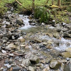
It is a gift to live in the PNW. A ferry ride can take you to the jungle, a car can take you to the desert--and to the mountains. As I review places I like to hike, I'll try and refrain from repeating this sentiment, but I'll tell you that it would be hard. I am an avid hiker: have backpack, will travel, kind of person. Kilimanjaro in 2014. Word. Snow Lake is one of my favorite short hikes in the area. Once Snoqualmie closes for snowboarding, you know it's time to hit Snow Lake. It's about 8 miles and is a modest hike, with amazing waterfall views, mixed terrain, shady tree alcoves, and certainly, Snow Lake itself. I've done this hike with people and dogs. Please take care; most of the trail is well-defined, but if it's snowy, you'll want to bring walking sticks. I had a heart-stopping moment when my dog lost her traction on part of the snow-covered trail (April) and I watched her slide 20 feet before she was able to dig in to the snow... ...A mere 10 feet from the cliff's edge. I just swallowed hard writing this, remembering how I I threw myself down the slope and slid on my stomach trying to catch her leash. But my kick-a** dog dug in, looked around, stood up and wide-walked her way back to me. I never took her again lol Snow Lake is beautiful and seems untouched, even with the numerous hikers that come here. You hike down a steady declining trail to it. And let me tell you, the dogs have a great time playing in the shallow water at the rocky shore. It's a great place to breakfast (I say breakfast because I am prone to early, rooster-killing hiking times. If you can see the trail, it's light enough for me!) Add this to your list, summer time is a good time to go. Spring and an early freeze Fall will require a little more prep. read more

11 years ago
The first time I hiked up Snow Lake the weather was horrible so I could barely see anything. All showers and clouds. I finally got another chance to revisit this beautiful lake! Source Lake is another lake on this trail. I went to Snow Lake first since it is the most visited lake in the Alpine Wilderness. Difficulty: Easy Time: About 2.5 hours round trip (Including the trip to Source Lake) SNOW LAKE: Trail: Easy, accessible and nicely maintained. The trail starts off with a few log steps with a moderate grade incline. Then the trail flattens out for a short period through the forest. About a mile into the hike, the trail leaves the forest and enters through the talus slope. There are beautiful views from the surrounding mountains along this area. About 2 miles into the hike, the trail forks off into two pathway. Up to the right to Snow Lake. Down to the left to Source Lake. There are some short switchbacks with a mild grade incline. As you get close to the destination, the trail becomes rougher and rocky in some parts. As you reach the top, you will catch a glimpse of the beautiful lake. You will then descend for about 1/4 of a mile to the Lake. Even though the weather was gloomy, at least it wasn't cloudy. The views from the surrounding mountains that circled the lake was beautiful! SOURCE LAKE: TRAIL: The trail to source lake is about 1/2 mile from the 2 mile mark junction. The trail starts off very flat but very rocky. There is a little bit of an incline along the terrain but it is very mild. As the trail opens up, you will see Source Lake on the bottom. The lake itself is very small. However, the views from the valleys, mountains and wild flowers surrounding this lake was very picturesque! I highly recommend checking out this area if you have time. Lots of wild flowers blooming! read more


It felt like the middle of some Elven wilderness when Kim E and I finally huffed and puffed our way to Snow Lake. An unreal, vivid shade of blue from melted snow (hence its name), a hushed stillness and just plain ... beautiful. Oh and I took a picture of a flutterby. If only I hadn't suffered so many bodily injuries in one measly 8 mile hike, I would post pictures but it might make you lost your appetite. I'm talking 6 inch spider bite (I drew pen marks to make sure it wasn't getting larger) on my thigh and somehow I fell into Snow Lake and gouged a giant hole on the bottom of my foot on sharp rocks. Thankfully, a fellow hiker had an epic first aid kit and wrapped up my foot nicely. Still had to limp back down 4 miles though, ouch!! The hike itself didn't have as much shade or greenery as I would have liked, the majority of the footing was actually quite rocky. But being my first hike in oh I don't know, years and years, the effort wasn't too strenuous so I'd recommend it to beginners too. So my advice? Bring a first aid kit, dip your feet in the lake but don't make any sudden movements and slather on some sunscreen/bug spray in high heat. And I definitely saw plenty of canines having a grand old time splashing in the lake and dashing up the rocks, so take Fido too. read more


11 years ago
Difficulty: Moderate Time: 3 hours (including the hike to Source Lake) Gear: Nike free runs + hiking stick Group: 2 People Temp: 85 (+/-) Snow Lake: I hiked up/ down to Snow Lake day ago and had read the mix reviews about how its easy or how moderate it is. Can confirm, as someone without proper hiking gear wearing Nike free runs, this hike was pretty moderate. The distance to the peak before you descend to snowlake is pretty quick. The reason why you may feel like it is taking a while is that the TRAIL is very rocky. Reading someone of reviews suggests that you may be susceptible to spraining your ankles. False. You just weren't careful enough. I do agree that this hike can become very rocky with includes and can become difficult coming back down but its very moderate and average hike. The trail itself starts off with a nice include of stairs in a well shaded but open area. It has a great dirt path with some pebbles along the way for about a mile. The path will eventually flatten out and you'll be walking on a path of dirt and large rocks. Its a great feel and the view is AMAZING. It really does feel like youre on an adventure. About 2 miles or alittle bit before 2, the trail splits between Source lake and Snow lake. Choosing the Snow path will include a couple of switch backs that are VERY rocky. So be careful. No need to rush, just take your time and enjoy the view of our ascension. There is a moderate gain in incline but its mainly the large rocks which are like a stair case. Once you reach the top, I suggest heading left. There, you will climb on top of this large rock and will be able to see the whole lake as well as the trail leading down to it. You have (2) options at this point. (1) to the left of the large mass you're on is a trail that will connect you to the mail trail leading you to the lake. This trail is the road less traveled and not as refined. However, it definitely adds to the experience. (2) you can climb back down and head to the refined path to the right. Regardless of your paths, you'll make it to the lake which is gorgeous. My friend and I spend about 30 minutes ontop of the rock just looking at the view. Its beautiful - a Kodak moment. The lake itself is beautiful, and the water is crisp and perfect for a nice warm day. Overall, the hike is moderate for sure. The high temperature of the day really is draining especially on the rocky paths, but the include/ decline is WORTH IT. I would suggest this hike for experienced and moderate beginner hikers. Its very fun! I would suggest hiking shoes because it'll definitely make this hike moderately easy and it'll be less stressful on your ankles. A hiking stick is actually amazing to have as it'll help give you that extra leg when walking on the rocky parts. With my free runs, however, it wasn't all that bad. Both me and my friend made it to the top and back with out problems....besides being sore the next day:) Give this place a shot!!!! read more


Snow Lake is a really accessible introduction to the area's alpine lakes. The trailhead is at Alpental, so there's a huge parking lot, and it's only about 1300 feet to get to the first views of the lake. The lake itself is big and beautiful, appearing dark blue from up above, the color changing to a light turquoise when you're next to the lake. Unfortunately, its accessibility means it's often accessed. On summer weekends with nice weather, you can expect lots of big groups and many new and/or ignorant hikers who can really try one's patience. I heard the trail referred to as a "Conga line" because it gets so crowded. So here's the PSA: 1. Don't leave stuff behind. That includes candy bar wrappers, bags of your dog's feces (there is no poo fairy to pick it up for you), articles of clothing, toilet paper, and food. 2. Be conscious of people around you. If you're walking slowly and there are faster people behind you, step aside and let them pass. 3. Limit your group size. I believe 12 is the limit. Despite what other reviewers might think, a group of 15 is not amusing. Most people stop at the first lake access point. If you head around the east side of the lake and go north, you'll climb a little but will quickly find more solitude. It's worth it to go the extra mile or so to Gem Lake, for the prettiness of the lake, the solitude, and the beautiful trail (mountains, tarns, stone paths). read more

 - Hiking Near Me - North Bend, Washington")

Easy hike that is perfect for kids and dogs, that isn't steep at all. A good portion of the trail is a bit rocky so wear good shoes. What's great about this hike is that it's only an hour away from Seattle. There is a GIANT parking lot and the road to the trail is well-paved and smooth. I would recommend going here on a week day because it's extremely popular due to its proximity and level of difficulty. Although it's about 6-7 miles roundtrip, it only takes about 3-4 hours total and the pay off is huge. Surrounded by a beautiful backdrop of mountains, the lake is crystal clear and blue, and if you're up for it, you can go swimming in it or dip your feet in for a nice cool-down. The water is usually covered in snow until mid-late summer time. However, I recently went on this hike a few days ago and the snow is already gone! The weather was around 80 degrees and since most of the trail is exposed, I got a little sun burned. So, if you're going on a nice sunny day, don't forget your sunscreen and extra water! read more

This hike is definitely a popular one, and for good reason. Went on this trail at about 1PM on a sunny Sunday afternoon and found that there were tons of people heading back, and thankfully it seemed that there weren't as many coming up. It's an 8 mile, round trip hike with only about 1300 ft elevation gain. The trail is pretty rocky and doesn't have a lot of forest shade, so on a hot summer day prepare to be in the sun. The lake itself is absolutely gorgeous and I would definitely recommend it for everyone, beginners and advanced hikers alike. This trail also requires a Northwest Forest Pass so pick one up at your nearest vendor for $5 before arriving. You can find your nearest vendor by going to their handy website (or if you've planned far enough in advance you could buy it online) http://www.fs.fed.us/r6/passespermits/vendors.php read more

Page 1 of 3
More info about Snow Lake
Ask the Community - Snow Lake
How's the weather there now? Safe in October? Is pass required besides
Review Highlights - Snow Lake


Why does Yelp recommend reviews?
3 reviews that are not currently recommended
The reviews below are not factored into the business's overall star rating.
12 years ago
6 years ago
10 years ago
Snow Lake - hiking - Updated July 2026
Best of North Bend
People found Snow Lake by searching for…
Swimming Holes in North Bend, Washington
Hiking Trails With Waterfalls in North Bend, Washington
Campgrounds in North Bend, Washington
Beaches in North Bend, Washington
Things to Do in North Bend, Washington
Fishing in North Bend, Washington
Hot Springs in North Bend, Washington
Swimming Lakes in North Bend, Washington
Parks in North Bend, Washington
Fishing Spots in North Bend, Washington
Rock Climbing in North Bend, Washington
Watch Sunset in North Bend, Washington
Scenic Drive in North Bend, Washington
Dog Friendly Beaches in North Bend, Washington
Easy Hikes in North Bend, Washington
Scenic View in North Bend, Washington
Playgrounds in North Bend, Washington
Photo Spots in North Bend, Washington
Scenic Spots in North Bend, Washington
Views in North Bend, Washington
Snow in North Bend, Washington
Things to See in North Bend, Washington
Trending Searches in North Bend, WA
4th Of July Fireworks near Snow Lake
Black Owned Nail Salons near Snow Lake
Off Road Trails near Snow Lake
Outdoor Activities near Snow Lake
Outdoor Basketball Courts near Snow Lake
Parks For Picnics near Snow Lake
Places To Walk Around near Snow Lake
Scenic Night View near Snow Lake
Scenic Overlook near Snow Lake
Strawberry Picking near Snow Lake
Volleyball Courts near Snow Lake
Browse Brands
Related Searches in North Bend, WA
Affordable Kayak Rental Services in North Bend, Washington
Best Fishing Locations and Guides in North Bend, Washington
Best Nature Trails for Hiking in North Bend, Washington
Best Places for Horseback Riding in North Bend, Washington
Best Waterfalls and Swimming Holes in North Bend, Washington
Check Out Off Road Trails in North Bend, Washington
Discover Dog Friendly Trails to Explore in North Bend, Washington
Discover Lakes & Ponds to Explore in North Bend, Washington
Discover Scenic Mountain Bike Trails Near North Bend, Washington
Discover Scenic Waterfall Spots in North Bend, Washington
Discover Top Boat Tours in North Bend, Washington for All Ages
Discover Top Nature Parks to Visit in North Bend, Washington
Discover Top State Parks to Visit in North Bend, Washington
Discover Walking Parks in North Bend, Washington Near You
Discover a Hiking Trail in North Bend, Washington
Discover the Best Beaches in North Bend, Washington
Discover the Best Fishing Lake in North Bend, Washington
Discover the Best Night Hike Trails in North Bend, Washington
Discover the Best Tide Pools in North Bend, Washington
Dog-Friendly Hikes With Dogs in North Bend, Washington
Enjoy Camping Adventures Around North Bend, Washington
Enjoy Exciting Mountain Biking Adventures in North Bend, Washington
Enjoy Kayaking Adventures in North Bend, Washington
Enjoy Tent Camping Spots Around North Bend, Washington
Enjoy Water Activities and Fun in North Bend, Washington
Enjoy a Beautiful Waterfall Hike in North Bend, Washington
Enjoy the Best Picnic Spots and Ideas in North Bend, Washington
Enjoy the Best Walking Path in North Bend, Washington
Enjoy the Best Walking Trails in North Bend, Washington
Experience Thrilling White Water Rafting in North Bend, Washington
Explore Beautiful Parks and Green Spaces in North Bend, Washington
Explore Boat Rentals for Every Need in North Bend, Washington
Explore Easy Hikes Perfect for All in North Bend, Washington
Explore Fun Activities to Do in North Bend, Washington
Explore Parks With Lakes to Visit in North Bend, Washington
Explore Popular Campgrounds Near North Bend, Washington
Explore Popular Picnic Areas Around North Bend, Washington
Explore Popular RV Parks Around North Bend, Washington
Explore Popular Scenic Views Near North Bend, Washington
Explore Top Dog Parks in North Bend, Washington Near You
Explore Top Marinas Near North Bend, Washington
Explore Top Water Parks in North Bend, Washington Today
Explore the Best Beach Spots in North Bend, Washington
Explore the Best Boating Spots in North Bend, Washington
Explore the Best Swimming Holes Around North Bend, Washington
Explore the Best Trail Options in North Bend, Washington
Explore the Scenic River in North Bend, Washington
Family Friendly Hiking With Kids in North Bend, Washington
Find Beautiful Views in North Bend, Washington
Find Parks and Recreation Activities in North Bend, Washington
Browse Articles
People who viewed Snow Lake also viewed
Rattlesnake Ledge Trail
214 reviews
Twin Falls Trailhead
143 reviews
Rattlesnake Lake
49 reviews
Franklin Falls Trailhead
142 reviews
Rattlesnake Ridge
170 reviews
Little Si
107 reviews
Snoqualmie Falls
864 reviews
Snoqualmie Point Park
18 reviews
Cherry Creek Falls Trail
43 reviews
Kanaskat-Palmer State Park
23 reviews