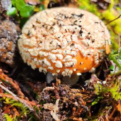
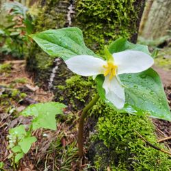
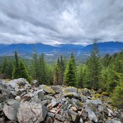
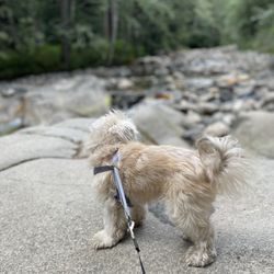
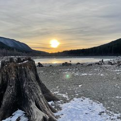
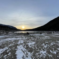
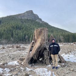
Twin Falls Trailhead Photos


You might also consider
More like Twin Falls Trailhead
Recommended Reviews - Twin Falls Trailhead
Start your review...

Reviews With Photos


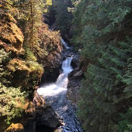
This place is a dream. The waterfalls are super breath taking and definitely a must if you find yourself in the area. Be aware of the look out areas there are many where you can capture phenomenal views. If you go on the weekend expect a big crowd with families and ppl with their pets. Like most places in the area for hiking the bathrooms will be kind of gross and the parking will be very limited but it's work every step.
Twin Falls is a wonderful hike that is beginner/family friendly. I recommend arriving early to be able to get a parking spot and bring your discover pass. The trail was very enjoyable and easy for my younger kids to complete with me. There is so much beauty to see here and it's overall an incredible way to spend the day!

It is one of the shorter hike in North Bend. My watch said about 3.2 miles from our street parking. The parking lot is not that big, come early. Discovery park needed, you can purchase one or pay for one day. The path can be narrow when it crowded. When you get to the bridge and see the water falls, that is your turn around point. You can keep on going but it will be another 7 miles to the lake. The trial can be muddy but pretty dry in general. It has elevation, so it can be tough if you want to stroll on the path.

If you have to use the restroom...don't use it here. It's atrocious. Right when you open the door it goes for what seems like miles and my friend almost threw up. The hike itself was gorgeous. We absolutely loved our experience. We got there on a Sunday around 10:30 and finished the 3.2 mile hike by 12:10pm. I highly recommend wear comfy clothes, sun block, and bug spray. This hike I'd categorize it as moderately hard/easy. Lots of incline parts but it's worth it towards the top. There's not a lot of signs guiding you so we had to ask a few people since there's a few parts where you're not sure if you should go right or left. There's a part where there's stairs going down. Note it's a dead end but it's an absolute beauty to see the waterfall from a distance. If you continue left to go up, you'll approach a bridge where you can get a great picture. We ended up getting bahn mi sandwiches and picnicked on rocks with the waterfall as our backdrop. I'd come back here again but prob won't anytime soon since there's so many other trails to hike.

Instantly one of my favorite trails in the area. I came mid week and in the afternoon to avoid the crowds I hear happen on the weekends. I was able to find a parking spot in the lot at the trailhead. There are a few bathrooms, but they're pretty disgusting. The trail Itself is mostly in the shade. Along the way there are what I called mini streams. They probably serve a purpose when the water level is higher. You can tell it is a well used trail by the various spots where people have trumped through to try to make a shortcut. That's a shame. I stayed on the trail itself which varies from switchbacks, staircases, to fairly wide trails. Some of it is pretty rocky and also has roots. You follow it through moss covered trees surrounded by ferns. At the beginning of the trail, there are various spots you can access the river. I wish I'd worn my bathing suit. As you head up to the waterfalls, there are two viewing points. The first one is for the Lower falls. Felt like being in a giant treehouse and was very high up. I'm afraid of heights and it was pretty scary. The second viewpoint at the top of the falls is merely a turn in the trail. As the trail continues if you want to keep going. It's an absolutely gorgeous area. I'm so happy I did it. I believe it's about 4 miles round-trip when you go to the top of the viewpoint for the upper Falls. And I do recommend a weekday visit to the spot. Happy trails! SYOY!

LOVE this trail! We came to see the falls, but enjoyed the trails and entire experience so much. There's a large parking lot and toilets. We arrived mid-morning, and by the time we we'd hiked to the upper falls and back it was packed...cars were parallel parked up the road, and others just waiting for someone to leave. Clearly an extremely popular trail...with good reason. There is another trailhead available to reach the falls, Homestead Valley Trailhead. I've heard it's the less busy route should you desire that, but the trail from the main trailhead is so gorgeous, I highly recommend it...just arrive early! You get a bit of everything on this 2 1/2 mile out & back trail: the rushing boulder-filled waters of the Snoqualmie River, lush forest with big, beautiful trees, 2 unique and awesome falls, and a pretty good workout while you take it all in. There are some decent climbs, steep stairs to a lower viewing area, wet crossings, bridges...some shade and some sun. Just a fun and lovely setting and a fabulous trail, a must do!

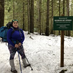
You can go to Twin Falls either through Twin Falls Trailhead or the slightly longer/more elevation Homestead Valley Trailhead (I think its one freeway exit past). Homestead Valley is way less travelled and the trailhead had relatively more parking - when I arrived at 9am on a Friday there were only a couple cars and was only maybe 1/10 full. There's also a restroom there. Homestead Valley to Twin Falls can get tight physically at times (a couple feet across with no room for others) and the foliage was more overgrown - there were a lot of times I had to duck to avoid hitting my head and brushed up against a ton of leaves. However, during my time, I only came across two people so it's really up to preference. If I come back to Twin Falls I'll probably pass on Homestead Valley and go through Twin Falls trailhead. Also Twin falls is beautiful - definitely take time to go on the side trails because it's amazing!

I've been on a few hikes over the years and those that reward you with a waterfall view are my favorite by far! With that said, I'm sure you can imagine how eager I was to see TWO waterfalls on this hike. The parking lot is on the smaller end, so when we arrived on a Friday around 11:00A, we snagged the last spot and others had already started parking along the side of the road. A Discover Pass is required, otherwise there is a $10 fee. A sign at the entrance of the trailhead reads that the distance to one waterfall is just 1.3 miles away which seems so short at first thought. I admit I am a newbie hiker, so the actual walk felt much longer. There were multiple times along the way where we couldn't help but think... Are we almost there?! The first portion of the hike runs along a calm river, then transitions into an incline and a few switchbacks before you can catch a glimpse of both waterfalls together from afar. We followed the pathway further until we reached a set of stairs that head down to a platform to view the first waterfall. From here you get an impressive view of the water cascading down a dramatic rock formation into the deep blue pool below. After heading back up the stairs, we continued to a bridge overlooking the second waterfall. This one seemed much more calm but nonetheless still spectacular. Watching and listening to it was so therapeutic! This bridge also presents an overhead view of the river below surrounded by all the lush greenery so you can really gauge the elevation you covered. Another staircase will lead you to an upper view of the waterfall, but it was slightly obstructed by foliage. We saw hikers of all ages take to this trail ranging from young children to seniors. While this is considered one of the more tame hikes, I wouldn't say it was super easy. The paths are pretty narrow in some places and some sections are also muddy. Many times, we'd also have to dodge around some of the overgrown plants. All four of us wore basic shoes (not hiking boots) and were able to complete the hike with only a couple minor slips. Just watch your step as there are many rocks and tree roots embedded in the soil, making for very uneven terrain. The hike overall was a great workout and it took us about 2.5 hours roundtrip, which included some time for snacking and enjoying the views. It's an amazing realization that all this water roars down from Snoqualmie Pass and runs all the way to Snoqualmie Falls. This is a great day hike for those who are looking to appreciate Washington's scenery without traveling far from Seattle.


Love our PNW hikes but I do think many other hikes are more worthwhile. Regardless, Twin Falls is a fun spot to check out and take some time to appreciate the outdoors. Most of the hike gets very muddy after rain which is annoying. Peak isn't too high so the viewpoints can be a bit underwhelming for a hike, but you really are here for the waterfalls. You'll notice a bridge with views of one waterfall, that's the main viewpoint and then just before that, there are steps down for another viewpoint. If you continue past the bridge and trek onwards, you'll find some benches. Further up leads to a road and a sign that indicates you've walked nearly a mile past the waterfalls, though there's nothing worth noting so once you see the waterfalls, you're done!

Hike 5!! This trail is famous for being family friendly.... But still if your family doesn't like stairs this is not the one for them. However, it is fairly short and the stairs are optional. We got here early enough because we've been told it might get busy, specially the parking lot. So 7:30ish was a good time to start avoiding crowds. Remember to bring your discovery pass. I would say it is a short hike 2.6 miles round trip, but we stopped by the River, hiked all the way up to the falls... took a bunch of pictures and came back. This could be done as fast as an hour and a half or take your time and enjoy it in two hours and a half's


The trail has many rolling hills you will climb as you get to the falls. There are neat wooden stairs and wooden platforms from where you can view the lower falls. If you continue to the upper falls you will cross a beautiful wooden bridge. 2.68 miles, 614 elevation gain, 1 hr 9 minutes to complete. read more


To kick off the New Year, I decided to be active and hike one of my favorite nearby Seattle trails. This one has it all: not too easy nor hard (580 foot elevation gain, ~2.5 miles round trip), riverfront views, a humongous 700 year old Douglass Fir, two massive boulders you can climb up, many natural swimming pools, and three viewpoints of a gorgeous cascade. Twin Falls appears to be a single fall but you have to go up to the third upper viewpoint with a bench to see the twin. You can go further and it continues into Ollalie State Park and joins Iron Horse Trail. Go early because it's a popular hike with a medium sized parking lot at the trailhead. Just be sure to remember you WA state Discovery Pass to display on your car. The trail is near Snoqualmie Pass but doesn't have all the snow other nearby trails get causing them to close seasonally. read more


2 years ago
Beautiful hike - very well maintained. It gets busy, if you need to park on the street make sure you're parked legally. Some of the WORST bathrooms I've ever encountered. read more


2 years ago
This place is a dream. The waterfalls are super breath taking and definitely a must if you find yourself in the area. Be aware of the look out areas there are many where you can capture phenomenal views. If you go on the weekend expect a big crowd with families and ppl with their pets. Like most places in the area for hiking the bathrooms will be kind of gross and the parking will be very limited but it's work every step. read more


Twin Falls is a wonderful hike that is beginner/family friendly. I recommend arriving early to be able to get a parking spot and bring your discover pass. The trail was very enjoyable and easy for my younger kids to complete with me. There is so much beauty to see here and it's overall an incredible way to spend the day! read more


It is one of the shorter hike in North Bend. My watch said about 3.2 miles from our street parking. The parking lot is not that big, come early. Discovery park needed, you can purchase one or pay for one day. The path can be narrow when it crowded. When you get to the bridge and see the water falls, that is your turn around point. You can keep on going but it will be another 7 miles to the lake. The trial can be muddy but pretty dry in general. It has elevation, so it can be tough if you want to stroll on the path. read more


4 years ago
If you have to use the restroom...don't use it here. It's atrocious. Right when you open the door it goes for what seems like miles and my friend almost threw up. The hike itself was gorgeous. We absolutely loved our experience. We got there on a Sunday around 10:30 and finished the 3.2 mile hike by 12:10pm. I highly recommend wear comfy clothes, sun block, and bug spray. This hike I'd categorize it as moderately hard/easy. Lots of incline parts but it's worth it towards the top. There's not a lot of signs guiding you so we had to ask a few people since there's a few parts where you're not sure if you should go right or left. There's a part where there's stairs going down. Note it's a dead end but it's an absolute beauty to see the waterfall from a distance. If you continue left to go up, you'll approach a bridge where you can get a great picture. We ended up getting bahn mi sandwiches and picnicked on rocks with the waterfall as our backdrop. I'd come back here again but prob won't anytime soon since there's so many other trails to hike. read more


2 years ago
Instantly one of my favorite trails in the area. I came mid week and in the afternoon to avoid the crowds I hear happen on the weekends. I was able to find a parking spot in the lot at the trailhead. There are a few bathrooms, but they're pretty disgusting. The trail Itself is mostly in the shade. Along the way there are what I called mini streams. They probably serve a purpose when the water level is higher. You can tell it is a well used trail by the various spots where people have trumped through to try to make a shortcut. That's a shame. I stayed on the trail itself which varies from switchbacks, staircases, to fairly wide trails. Some of it is pretty rocky and also has roots. You follow it through moss covered trees surrounded by ferns. At the beginning of the trail, there are various spots you can access the river. I wish I'd worn my bathing suit. As you head up to the waterfalls, there are two viewing points. The first one is for the Lower falls. Felt like being in a giant treehouse and was very high up. I'm afraid of heights and it was pretty scary. The second viewpoint at the top of the falls is merely a turn in the trail. As the trail continues if you want to keep going. It's an absolutely gorgeous area. I'm so happy I did it. I believe it's about 4 miles round-trip when you go to the top of the viewpoint for the upper Falls. And I do recommend a weekday visit to the spot. Happy trails! SYOY! read more


LOVE this trail! We came to see the falls, but enjoyed the trails and entire experience so much. There's a large parking lot and toilets. We arrived mid-morning, and by the time we we'd hiked to the upper falls and back it was packed...cars were parallel parked up the road, and others just waiting for someone to leave. Clearly an extremely popular trail...with good reason. There is another trailhead available to reach the falls, Homestead Valley Trailhead. I've heard it's the less busy route should you desire that, but the trail from the main trailhead is so gorgeous, I highly recommend it...just arrive early! You get a bit of everything on this 2 1/2 mile out & back trail: the rushing boulder-filled waters of the Snoqualmie River, lush forest with big, beautiful trees, 2 unique and awesome falls, and a pretty good workout while you take it all in. There are some decent climbs, steep stairs to a lower viewing area, wet crossings, bridges...some shade and some sun. Just a fun and lovely setting and a fabulous trail, a must do! read more


 - Hiking Near Me - North Bend, Washington")


You can go to Twin Falls either through Twin Falls Trailhead or the slightly longer/more elevation Homestead Valley Trailhead (I think its one freeway exit past). Homestead Valley is way less travelled and the trailhead had relatively more parking - when I arrived at 9am on a Friday there were only a couple cars and was only maybe 1/10 full. There's also a restroom there. Homestead Valley to Twin Falls can get tight physically at times (a couple feet across with no room for others) and the foliage was more overgrown - there were a lot of times I had to duck to avoid hitting my head and brushed up against a ton of leaves. However, during my time, I only came across two people so it's really up to preference. If I come back to Twin Falls I'll probably pass on Homestead Valley and go through Twin Falls trailhead. Also Twin falls is beautiful - definitely take time to go on the side trails because it's amazing! read more

5 years ago
I've been on a few hikes over the years and those that reward you with a waterfall view are my favorite by far! With that said, I'm sure you can imagine how eager I was to see TWO waterfalls on this hike. The parking lot is on the smaller end, so when we arrived on a Friday around 11:00A, we snagged the last spot and others had already started parking along the side of the road. A Discover Pass is required, otherwise there is a $10 fee. A sign at the entrance of the trailhead reads that the distance to one waterfall is just 1.3 miles away which seems so short at first thought. I admit I am a newbie hiker, so the actual walk felt much longer. There were multiple times along the way where we couldn't help but think... Are we almost there?! The first portion of the hike runs along a calm river, then transitions into an incline and a few switchbacks before you can catch a glimpse of both waterfalls together from afar. We followed the pathway further until we reached a set of stairs that head down to a platform to view the first waterfall. From here you get an impressive view of the water cascading down a dramatic rock formation into the deep blue pool below. After heading back up the stairs, we continued to a bridge overlooking the second waterfall. This one seemed much more calm but nonetheless still spectacular. Watching and listening to it was so therapeutic! This bridge also presents an overhead view of the river below surrounded by all the lush greenery so you can really gauge the elevation you covered. Another staircase will lead you to an upper view of the waterfall, but it was slightly obstructed by foliage. We saw hikers of all ages take to this trail ranging from young children to seniors. While this is considered one of the more tame hikes, I wouldn't say it was super easy. The paths are pretty narrow in some places and some sections are also muddy. Many times, we'd also have to dodge around some of the overgrown plants. All four of us wore basic shoes (not hiking boots) and were able to complete the hike with only a couple minor slips. Just watch your step as there are many rocks and tree roots embedded in the soil, making for very uneven terrain. The hike overall was a great workout and it took us about 2.5 hours roundtrip, which included some time for snacking and enjoying the views. It's an amazing realization that all this water roars down from Snoqualmie Pass and runs all the way to Snoqualmie Falls. This is a great day hike for those who are looking to appreciate Washington's scenery without traveling far from Seattle. read more


3 years ago
It is a family friendly hike, a few switchbacks here and there, but overall you can bring kids and dogs. You do need a pass for it and make sure you get there early or the park lot filled up and you'll have to hike to your hike! Beautiful falls! read more

4 years ago
Love our PNW hikes but I do think many other hikes are more worthwhile. Regardless, Twin Falls is a fun spot to check out and take some time to appreciate the outdoors. Most of the hike gets very muddy after rain which is annoying. Peak isn't too high so the viewpoints can be a bit underwhelming for a hike, but you really are here for the waterfalls. You'll notice a bridge with views of one waterfall, that's the main viewpoint and then just before that, there are steps down for another viewpoint. If you continue past the bridge and trek onwards, you'll find some benches. Further up leads to a road and a sign that indicates you've walked nearly a mile past the waterfalls, though there's nothing worth noting so once you see the waterfalls, you're done! read more


4 years ago
Hike 5!! This trail is famous for being family friendly.... But still if your family doesn't like stairs this is not the one for them. However, it is fairly short and the stairs are optional. We got here early enough because we've been told it might get busy, specially the parking lot. So 7:30ish was a good time to start avoiding crowds. Remember to bring your discovery pass. I would say it is a short hike 2.6 miles round trip, but we stopped by the River, hiked all the way up to the falls... took a bunch of pictures and came back. This could be done as fast as an hour and a half or take your time and enjoy it in two hours and a half's read more


2 years ago
Definitely worth coming. I recommend to be there around 9-10 am before all the parking area is packed. read more

This is a fun, fairly easy hike for just about anyone. I recommend late afternoon or early morning, as this is a very popular hike. Lots of families, groups, and dog friendly. On this day the trail was pretty clean, but AllTrails and other recent reviews, biggest complaints were doggie poop bags and people just leaving trash wherever, people please!! Pack it in, pack it out!! Very simple. This trail does have a few short steep climbs, but plenty of area wide enough to rest and allow others through, most people were good with trail etiquette, like allowing those going up, the right away on the narrow stairs... again simple stuff. Olallie state park has done a great job with the trails and bridges, beautiful views of multiple falls, only about a mile into this short hike, most of the trail is along the south fork of the Snoqualmie river, so views and sounds of the river most of the way. Plenty of stops to cool your feet of desired. Beautiful views of Mount Washington as well. Lots of wildflowers and butterflies at this time. Parking lot fills up fast, but there is also parking along the road leading to the trail. Just adds a bit to the hike. Great hike to enjoy anytime, but especially during the snow melt season, should be great for another few weeks! Happy Hiking! Yelping! Cheers! read more


7 years ago
This is a great spot for a leisurely morning hike, especially the morning after Thanksgiving when you're regretting how many glasses of wine you put away before the pumpkin pie was even brought out. We met a group here for this 2.6 mile roundtrip hike with a gradual 500 foot elevation gain. There is a huge parking lot making step one of getting me to sober up that much easier. There were plenty of parking spots and we used or Discover Pass to cover the fee. It's a well shaded trail with beautiful views of the PNW forest and a canvas of more spectrums of green than you ever believed existed. The vast majority of the trail only had a slight incline and was a relatively unchallenging hike. There is a vista point of the waterfalls and bridge about halfway in that is picture perfect. At the end of the trail you're rewarded with a view of the upper and lower falls and can walk across the bridge and snag some great pictures. It's a quick trip back and we returned to the car refreshed and hungry for Thanksgiving leftovers. read more


A family friendly Hike. Almost 2 miles of hike up to multiple falls. Trail was clean, but a little muddy in the final stretch. This trail do have some steep climbs followed by a downhill area. Still not a hard one for kids. They have maintained it really well. If you go with family or a group, it will be super fun. Towards the parking lot, there's a river access. Good for photo ops and kids to play in water. Parking is limited. If you have discover pass, it's covered. If you are planning for this, try to reach early. Loved this hike! Will do again in Summer! read more


3 years ago
Quick easy stroll in the woods with several water features and can relax rocks down from the falls. Lots of green. read more


6 years ago
Enjoyed walking a little over 3 miles round trip to see the Waterfalls. Good views of the forest area and 2 falls. A nice hike and there are areas to dip your feet in, take a short swim and even do a picnic. Good trails that are marked and great for families. The steps to see the waterfalls can be challenging going up if you are lacking endurance and stamina to keep up with the walking pace. Parking is pretty easy. If the small parking area right in front of the trail is packed, you can usually find parking on the side of the road. You will definitely need a Discover Pass. Otherwise, you'll have to pay for parking in the front. read more


3 years ago
Very beautiful place to hike! I am from the Midwest and was told when I came to Washington to enjoy nature and how beautiful it is. This trail did not disappoint and I'm glad my friend picked this place to come to! There are quite a few hills but nothing too crazy. The trails reminded me of a child story book picture. We got lucky with parking but if you get there at a busy time, you might be parking far away. The only downside is that the bathrooms smell like absolute garbage. read more


6 years ago
Date of visit: December 12, 2020 Started the morning with an early hike with friends that never says "NO" when it's time for an adventure. You can definitely trail run this one if you want. I would say about 99% of the people we saw on the trail had masks. After passing the second fall, there is not much view on the top. Hike stats - My gps showed me 7 miles, 1500 ft elevation gain and 2.5 hrs moving time. An easy - moderate hike. I really enjoyed the waterfalls and the portion along the river. The hike was the perfect distance and a bit uphill but not at all difficult. Just a little over an hour round trip. Hit the trail at 7:30am, was the only car in the parking lot, got back out around 9:00 and there were about 15 cars already in the parking lot. A little muddy and slick from the recent rains but otherwise trail is clear. Discovery Pass required. Forgot my discovery pass at home but luckily you can buy a day pass at the location. Going on a weekday or very early would be best. read more


8 years ago
One of those "easier" hikes in Washington if you can walk about 4 miles with some hills. Nothing too crazy and there is a trail you can follow so I guarantee you won't get lost as long as you stay on track. There is a river at the beginning where people usually have picnics or just throw rocks in the water and chill. As you continue up the hike, there will be a couple stops where you can truly appreciate nature and the views. It's beautiful out here and pictures don't do it justice. When you get close to the end, there will be a fork in the trail. You can end it at the first waterfall or continue on. There are stairs you walk down to see the falls; don't let the climb back up scare you from taking them. Definitely worth the views! The entire hike to the falls and back took about 3 hours at a relaxed pace and stops at a few sites. Going early is better if you want to beat the crowd and have a more peaceful experience. read more


5 years ago
Twin Falls is a perfect WA hike which is decently close to Seattle in the North Bend area. The trail is well-maintained and not too difficult, but the views are gorgeous and the falls are impressive. Loved it. read more


5 years ago
Nice little trail with a lot of up and downs. Green moldy trees are quite a lot. Quite wet during the winter but still a lot of fun. I'm a lame hiker and had to rest a lot, took us about 1h to finish. Somehow there isn't a clear trial end so we stopped shortly after the fall. If you see the stray trail in the middle, which is a stairway downwards, do take it. The view to the falls are better in the end. read more


5 years ago
Completely worth every foot step. I would suggest taking a picture of the map that's located at the beginning of the trail. As we were walking there were several picture worthy spots along the trail. This is a beginner friendly trail, just take your time and enjoy the view. 2.5 hours total trip. $10 discover parking pass. The meter is located on site, we paid with our card. There was a nice "mid way point" with a sitting area. The view from the mid point was amazing! We ate our snacks here & that gave us an extra boost while walking. Bring a sharpie to sign your name on the wood (once you get to the waterfall). I was so shocked to see we were standing on a tree! It's so beautiful. Then we walked up to the bridge to get another view of the waterfall. We went the second week of Nov. I wore Nike shoe, work out attire, and a medium density hooded raincoat (it rained once). Thicker shoes would be okay but not needed unless it's wet. read more


Really enjoyed this short sweet hike. Supposedly there are 2 routes, you can either hike up to the waterfall or hike down to the waterfall. We did the latter. The discovery pass is required for parking so make sure you have this or pay for parking if you don't want a ticket! The hike from the beginning of the trail to the waterfall says that it is less than a mile but after the whole hike, I clocked in at around 5 miles! I'm. It sure how that happened but it did. The waterfall is so much fun! Take your shoes and socks off and enjoy the refreshing water! There were some people that even took a swim. read more

6 years ago
It was a super fun hike! I usually don't even like hiking, but this state shit down got me going a little crazy so I had to leave my house. Which in other words means, anyone and their mom can do this hike because I am extremely out of shape and also have asthma and I was perfectly fine the whole time! I will also say tho that if you are afraid of catching the Rona go maybe consider another trail cuz this place was PACKED But all and all a great hike and you could get super close to the fall so it was nice:) read more


6 years ago
Sooo much fun!! Had a blast. We swam up near twin falls. The water wAs cold, but very refreshing. Picnic and all! The only issue is that people left dog/human feces. Otherwise so much fun! read more


3 years ago
I was shocked how beautiful and easy this hike was! I've been looking for a beginner hike that grandparents could enjoy that wasn't too hilly or long and this is definitely the one. The hike itself took 1 hour for us to leisurely hike.. we stopped to take pictures and completed both the upper and lower fall trails (I'd recommend doing both, it adds an extra 10 minutes). This hike has a very mild incline and isn't rocky at all. There are some steps at the end with a railing. I purchased a day pass at the parking lot with my credit card for $10. Pro tip: if you buy online beforehand & print it out you can save $5. This hike is great for anyone (kids, grandparents, dogs) and is on the closer end to Seattle. I'd highly recommend it. read more


We got here around 10 AM on July 4, and the parking lot was already full. People just parked along the street outside the lot, so it was fine. If you don't have a discover pass, it's $10 cash you can pay by placing it in an envelope available at the cash box near the trail entrance. There was a machine that takes credit card with the option to pay the $10 for one day or $30 for a discover pass, but it wasn't working that day so I wouldn't rely on this. There are bathrooms at the trailhead parking lot. No sink, just hand sanitizer. I'm always nervous using the bathrooms at parks, but I held my breath (literally) and it was fine. We were on the trail for about 2.5 hours, and this was with plenty of breaks to take photos. We turned when we reached the bench at the upper falls overlook. Per WTA.org, it's 2.6 miles round trip (out and back), though I'm not sure which end point they're measuring. It's 500 feet elevation gain. I don't consider myself in shape, so I'd say it was slightly challenging for me when we inclined up, but luckily it was a mix of flat and downhill so overall not that bad. It was also helpful that it wasn't too hot or sunny during the hike. The path is clear, very little to no trash seen. It's muddy in some spots, but not too bad. Dogs are allowed. To me, hikes are about the payoff, and I definitely considered these waterfalls worth it! You can go down some stairs where there are 2 small platforms for the lower falls view, or continue up a little more to the upper falls view. Both are worth seeing in my opinion. read more


The Twin Falls trail has one of the most beautiful waterfalls. It's not the amount of water or the rate at which the water runs, it's the way the water looks almost painted on the rocks. Check out the Yelp photos and you'll see what I mean. The Twin Falls trail is located in the Olallie State Park. As such, you'll need a Discovery Pass to park at the trailhead. Parking is a bit limited so you may need to wait a bit on busy days. This hike is easy with very little elevation gain, making it great for those who want gorgeous views without having to work hard to get them. Round trip, the distance hiked is only about 3.5 miles if you hike all the way to the upper falls. The only thing preventing you from completing the trip in an hour and a half is the time you'll spend ooing and ahhing over the beautiful scenery. However, if you do want more of the challenge, continuing hiking beyond the falls. Olallie State Park has a decent amount of land so you could easily fill your day with hiking and animal watching here. read more


 - Hiking Near Me - North Bend, Washington")
3 years ago
This is one of those hikes that's very handy on a day when you realize it's already noon and you really want some fresh air after all. But time is running short, and you have to saddle up and go get hiking--Twin Falls is there to salvage the afternoon and make it a hiking day after all. It's not too far out of town, the terrain isn't challenging, and the scenery is worth the effort. It's a beautiful secluded sylvan grotto even on cold wintry days. Perfect for getting you off the couch and making you feel like you did something with an afternoon off. read more

What a fun, easy-going hike to take your pups on! Twin Falls was only my 2nd Washington hike. (Wallace Falls was our first) And we picked it because we needed a relatively easy, quick hike to take our 10 month old puppy on for her first time. As it turns out, it was perfect for both our pups! First of all, let me just say that it was super-easy to get here. It's about 30 minutes from downtown, which was the perfect length car ride for our youngest pup, too. Also easy? Discovery parking passes, yo! I was able to buy my day pass online and print it the night before. When we arrived, we just jotted down our license plate number and popped it in the window! Easy-peasy, just how I like it. Side note: We wanted to get there a little before 8AM to make sure we got parking. However, we left a little late. By the time we arrived, there were two parking spaces left. We took one and the other was snatched up immediately afterward. If you want to ensure you get a lot parking spot (and not a street one), come EARLY. Like, super-shitty, "who voluntarily gets up this early"--early. Or at least a little before 8AM! As we started our hikes, we stopped to use the restrooms at the parking lot. I hope I'm not remembering this incorrectly, but I remember Wallace Falls having flushing toilets. Twin Falls does not. You get the endless black hole toilets here that scare the ish out of me. Like, I'd rather pee outside in mud and dirt. But I also know that this is just a personal phobia I have with those types of "hole in the ground" toilets. And, TBH, I still used it anyway, and I'm still alive to tell the story. Also, no sinks or soap--just hand sanitizer that was out in 2 out of the 3 restrooms. So that kind of sucked. On to the hike! What a gorgeous, lush trail of every shade of green imaginable! I loved the shady area covered in ferns and moss. And as you walked you'd find these mini, hidden little waterfalls in the woods (like SUPER tiny). The hike itself was not what I anticipated, but I was definitely pleasantly surprised. I guess I was expecting incline on the way up and decline on the way back. But on the way out to the Falls, it was honestly a mix of incline and decline, which was really cool! I mean, I can deal with my calves burning on some major inclines, but it's nice to switch it up and get a break. We went on a Sunday, so the trailhead was busy, but not too busy. I'd say every 5-10 minutes we'd see someone. Many parts of the trail can get narrow near areas that just drop off. So just be careful when passing others to not lose your footing. And we saw SO MANY dogs. Almost every group of people we saw had at least one dog with them. Just keep them on a leash and you're good to go! The views at the bridge and once you get towards the main "event" are spectacular. We stopped a few times to get pics with the dogs and such. What a beautiful place and the perfect, easy, first hike for our puppy. read more


Got time to spare for a quick and easy hike? With just a 45min ish drive from Seattle, Twin Falls is an excellent hike for those who are looking to warm up their hiking season or for those who are seeking a simple and scenic route to walk on. Note: Twin Falls is still accessible at Exit 34 (for those who rely on Google GPS) and Exit 38 (for those who rely on WTA directions). If you take Exit 34, just follow the GPS and make sure to have a Discover Pass on you (which can be purchased at nearby Safeways or gas stations). Once you hit the parking lot, the trail head is easily identified by the wooden sign. My group of friends and I got here a little before 10am and by then, the lot was pretty full. The Hiking Adventure: Overall, this hike was pretty easy. You'll see dogs, kids, elderly, all sorts of people taking on this hike. What's highly recommended is that you have sturdy shoes (hiking shoes not required but would help with some of the rockier parts of the hike). If you came from the Exit 34 side, this is how the hike goes. The trail starts off pretty flat and it's pretty wide enough that you can walk with another person beside you vs single file line. At about 0.75 miles in, you'll hit a nice looking point of the falls and there are wooden benches to sit and rest. Beyond the lookout point, you'll encounter the sign that states the closure of the trail. Should you decide to venture on beyond the fence/gate thing, the trail itself is still in pretty good shape! The only main precaution you would want to take is there are a couple of areas that were washed out, and walking slow is recommended. Once you get past the harder parts, the rest of the trail has a nice balance of inclines / switchbacks that will guarantee you sweatin' a bit. Most of the stairs were in solid form and bugs were minimal. When you reach the second fence/gate, this is the end of the "risky/dangerous" part of the hike. Beyond this point, you'll be hiking up to the other side of the trail of where things would have begin if you had taken Exit 38. Total time for hike: 2 hours approximately (time does include water breaks/pictures/ etc). Suggestion: As you walk, make sure to look to the side for smaller trails that lead to the river! Most of the little trails are pretty well defined and getting up close to the river is worth the effort for a nice lunch spot or for pictures. All in all, this was a great kickstarter to a hiking season in WA. :) read more


Page 1 of 4
More info about Twin Falls Trailhead
Ask the Community - Twin Falls Trailhead
Review Highlights - Twin Falls Trailhead
You might also consider


Why does Yelp recommend reviews?
3 reviews that are not currently recommended
The reviews below are not factored into the business's overall star rating.
10 months ago
8 years ago
12 years ago
Twin Falls Trailhead - hiking - Updated July 2026
Best of North Bend
People found Twin Falls Trailhead by searching for…
Swimming Holes in North Bend, Washington
Hiking Trails With Waterfalls in North Bend, Washington
Fishing in North Bend, Washington
Parks in North Bend, Washington
Scenic Drive in North Bend, Washington
Star Gazing in North Bend, Washington
Sunset View in North Bend, Washington
Scenic View in North Bend, Washington
Watch Sunset in North Bend, Washington
Swimming Lakes in North Bend, Washington
Places to Take Pictures in North Bend, Washington
Things to Do in North Bend, Washington
River Swimming in North Bend, Washington
Stairs Workout in North Bend, Washington
Easy Hikes in North Bend, Washington
Hiking With Kids in North Bend, Washington
Photo Spots in North Bend, Washington
Scenic Spots in North Bend, Washington
Lookout Points in North Bend, Washington
Attractions in North Bend, Washington
Picnic Areas in North Bend, Washington
Sunrise Hike in North Bend, Washington
Trending Searches in North Bend, WA
4th Of July Fireworks near Twin Falls Trailhead
Black Owned Nail Salons near Twin Falls Trailhead
Boat Rental near Twin Falls Trailhead
Cliff Jumping near Twin Falls Trailhead
Day Trips near Twin Falls Trailhead
Dog Friendly Trails near Twin Falls Trailhead
Fireworks near Twin Falls Trailhead
Jet Ski Rental near Twin Falls Trailhead
Kayak Rental near Twin Falls Trailhead
Lakes & Ponds near Twin Falls Trailhead
Outdoor Activities near Twin Falls Trailhead
Parks For Picnics near Twin Falls Trailhead
Places To Walk Around near Twin Falls Trailhead
Public Pools near Twin Falls Trailhead
Public Shower near Twin Falls Trailhead
River Swimming near Twin Falls Trailhead
Rock Quarry near Twin Falls Trailhead
Scenic Night View near Twin Falls Trailhead
Scenic Overlook near Twin Falls Trailhead
Secluded Spots near Twin Falls Trailhead
Soccer Store near Twin Falls Trailhead
Splash Pad near Twin Falls Trailhead
Strawberry Picking near Twin Falls Trailhead
Sunrise View near Twin Falls Trailhead
Swimming Holes near Twin Falls Trailhead
Swimming Lakes near Twin Falls Trailhead
Watch Sunset near Twin Falls Trailhead
Browse Articles
Browse Nearby
Browse Brands
Related Searches in North Bend, WA
Affordable Kayak Rental Services in North Bend, Washington
Best Fishing Locations and Guides in North Bend, Washington
Best Nature Trails for Hiking in North Bend, Washington
Best Places for Horseback Riding in North Bend, Washington
Check Out Off Road Trails in North Bend, Washington
Discover Dog Friendly Trails to Explore in North Bend, Washington
Discover Scenic Mountain Bike Trails Near North Bend, Washington
Discover Scenic Waterfall Spots in North Bend, Washington
Discover Top Nature Parks to Visit in North Bend, Washington
Discover Walking Parks in North Bend, Washington Near You
Discover a Hiking Trail in North Bend, Washington
Discover the Best Night Hike Trails in North Bend, Washington
Dog-Friendly Hikes With Dogs in North Bend, Washington
Enjoy Camping Adventures Around North Bend, Washington
Enjoy Exciting Mountain Biking Adventures in North Bend, Washington
Enjoy Kayaking Adventures in North Bend, Washington
Enjoy Tent Camping Spots Around North Bend, Washington
Enjoy a Beautiful Waterfall Hike in North Bend, Washington
Enjoy the Best Picnic Spots and Ideas in North Bend, Washington
Enjoy the Best Walking Path in North Bend, Washington
Enjoy the Best Walking Trails in North Bend, Washington
Experience Thrilling White Water Rafting in North Bend, Washington
Explore Beautiful Parks and Green Spaces in North Bend, Washington
Explore Easy Hikes Perfect for All in North Bend, Washington
Explore Fun Activities to Do in North Bend, Washington
Explore Popular Campgrounds Near North Bend, Washington
Explore the Best Beach Spots in North Bend, Washington
Explore the Best Swimming Holes Around North Bend, Washington
Explore the Best Trail Options in North Bend, Washington
Family Friendly Hiking With Kids in North Bend, Washington
Find Beautiful Views in North Bend, Washington
Find Popular Ziplining Spots Around North Bend, Washington
Find the Best Parks for Picnics in North Bend, Washington
Find the Best Scenic View Locations in North Bend, Washington
Great Places to Walk in North Bend, Washington
Hike the Popular Waterfall Trail in North Bend, Washington
Hiking Trails With Waterfalls in North Bend, Washington
Off Leash Dog Hiking Trails in North Bend, Washington
Plan a Scenic Drive Route Near North Bend, Washington
Popular Outdoor Activities to Try in North Bend, Washington
Popular Picnic Spots to Visit in North Bend, Washington
Safe River Swimming Areas in North Bend, Washington
Safe and Fun Parks for Kids in North Bend, Washington
Top Climbing Spots and Gyms in North Bend, Washington
Top Paddleboarding Activities in North Bend, Washington
Top Running Trails to Explore in North Bend, Washington
Top Swimming Lakes to Enjoy in North Bend, Washington
Top Swimming Spots and Pools in North Bend, Washington
Walk Dog Friendly Hiking Trails in North Bend, Washington
Walk the Best Paved Walking Trails in North Bend, Washington