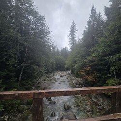
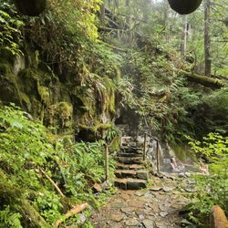
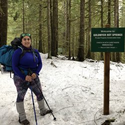
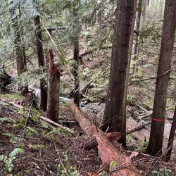
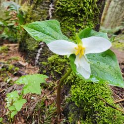
Mailbox Peak Photos


More like Mailbox Peak
Recommended Reviews - Mailbox Peak
Start your review...

Reviews With Photos

This iconic PNW hike certainly earns its reputation of being challenging, strenuous, rough and slightly dangerous, but beautifully rewarding. It's been on our bucket list for some time since moving to North Bend but it takes a pretty perfect combination to make it the ideal day for this hike. Firstly be sure you pick a day without our classic clouds and foggy mountainside- you want to be ultimately rewarded at the top with views of Rainier, neighboring Mt. Si, and the perfect silhouettes of Seattle and it's little sister Bellevue. Secondly, you had better have slept well and be up for 4000 ft elevation gain in less than 3 miles..you do the math. We woke up one Monday morning and said omg, today's the day that conditions were perfect and it was set to probably be our last big tackle of the summer. You'll need a Discover pass for the parking lot and there's one road that leads to both the new trailhead (first) and the old trailhead (second). If there's a challenge, our type A personalities take it- so we obviously went up the steeper, tougher, rougher old trail and down the slow decline of the new trail. We really enjoyed the loop lending to a change in scenery and variety for the long hike. The old trail is not for those without hiking experience or who haven't been actively hiking, it's truly difficult. It feels like you just ascend continuously without respite and most of the breaks we took were at an incline with gravity weighing on you because it rarely ever flattens out. The trail is lost often as it becomes just a maze of tree roots as you scramble up the mountain side. The trails merge at the last mile or so and you suddenly reach a mountainside rock scramble and you think-thank the hiking gods we've made it..then you get to the top of that and you see the actual summit with other victorious hikers looking like ants and well..you've come too far to turn back now so keep at it. The husband and I have done some tough climbs in our days together- Mt Si, Storm King, Tongariro Crossing in NZ .. and the husband of mine ranked this as #1 and for me I put it as #3 as far as challenges go but we definitely had to push each other that last 1/2 mile. The top is one of the best feelings ever. The actual mailbox with forgotten letters, ashes of a dear departed friend, and mementos frozen in time made the summit even more rewarding than just the view. There aren't many places to sit and lunch but we found a spot, got our pictures and headed down the new trail. Don't be fooled by the easy appearance of the 5 mile new trail after tackling the old trail, because I did.. and tripped on a root with 2 miles to go tearing some tendons and making it a very slow decline. A fellow hiker named Jonathan restored my faith in humanity and lent me his poles for those 2 miles making it much more manageable and I definitely recommend packing poles for the descent for anyone planning their trip. Mailbox Peak is certainly a hike that will win you bragging rights with it's 8.3 miles and 4,237 feet of elevation gain and certainly worthy of my 1,000th post. Just don't lose respect for this majestic beast or it will literally reach up and bite you like it did me! Come prepared with lots of water, snacks, poles, good hiking shoes, and be certain you are up for this challenge with lots of practice hikes..our dear rangers stay busy enough without rescuing hikers thinking this will be a pleasure trail.

I've never wanted to get mail so badly in my life. Mailbox Peak kicked my ass! As others say, this is not easy. It's a hard, strenuous hike with a reward at the end. So as long as there's beer in the mailbox! I left around 6:30am from Bellevue on a Saturday, and arrived around 7 where both lots right outside of the entrance were full. Then I saw people walking towards the entrance from further down the road, so assumed parking was full in the parking lot that's up the hill once you enter the entrance. I found one of the last parking spots further down where I saw people walking from, which still requires the Discover Pass. When I walked towards the trailhead I saw the parking lot mostly vacant! There were only a few cars there. My mistake for assuming it was full when I saw those walking along the road. I will say though by the time I left, this parking lot was completely full. This is also where the restrooms are, though not regularly maintained. Once you're at the trailhead, you can either take the old trail or new one. The old trail is much steeper, but gets you to where you're ultimately going sooner. The new trail is easier, but longer. But don't expect it to be a walk in the park. Either way, you're gonna sweat. Both trails eventually meet towards the top. You'll think you're nearly there when you see the rocks to scramble. Very wrong. You're getting close, but that's not the hard part. After you scramble the rocks, there's another steep dirt, rocky hill that you have to climb for where the mailbox is. It looks daunting after you've scrambled. When I realized this, I literally said, "Fuck!" too loud and everyone around me laughed and agreed. This was the hardest part for me. Once you're at the top, the area isn't very spacious for people to hang around and picnic, though that's what everyone does. For the most part, people are cool about getting out of the way and allowing people to take pictures by the mailbox. Inside the mailbox were beers and other offerings to the gods. The views of the Middle Fork Valley and Mt. Rainier cannot be missed. There's no greater feeling once you've made it to the mailbox. I spent an hour there with my snacks, drank all my water and just needed a break from the hike up. Going down is always hardest for me. The first hill is steep with dirt and rocks, so be careful going down. I slipped a few times from the dirt. I'd recommend bringing poles if you have 'em. I took the new trail going down, knowing it was gonna suck and my knees and feet always hurt when I hike down. It took me about 3.5 hours to go down on the new trail because of how slow I was going. My lower body was aching like hell. Mailbox Peak is definitely a bucket list item for all hikers in the area. It's an all-day workout that'll have you sore the next day. It's challenging, but if you can survive this, you can do all other hikes around. You got this!

Came on a Sunday morning around 7:30AM, parking lot was full. Went up old trail which was steep, didn't see too many people but definitely not empty either. Was about 5.1 miles up and took almost 2 hrs 15 mins. View at the top was great, weather was great too, no clouds and could see far out, 360 views. Quite a few people at the top, and there was a mailbox at the top! (Went down new trail which was less steep and better on the knees)

Finally hiked this and was surprised to find snow in mid-October. The view at the top is nice but the trail itself is a bit boring except for the last 4-500 feet which is a bit of a scramble. Micro-spikes and trekking poles recommended if going up when snow is on the trail as it can be icey near the top. It was a nice hike and good exercise but I prefer to hike a bit deeper in the wilderness with more waterfalls and scenery.

We arent avid hikers but we thought we could try this for fun as we have done hikes such as Tiger Mountain and Multnomah Falls. Little did we know that it would take us 5 hours to get up to the box and 2.5 hours to get down. 5 hours only because we took our sweet time enjoying nature/taking a break. If we didnt take so many breaks, we probably would have reached the top in 3 hours but I believe that time is also dependent on the trail. There are two trails that lead to the top. One is straight ahead which is the new trail and the one to the left which is the old trail. For first timers we took the left which we hear is the longer trail. It is also very steep with a lot of twists and turns. Either way, the old and new trail will meet in the middle to lead to a steeper hill. This hill will then lead you to a rocky stairway to the mailbox. Some even decided to just chill at the rocks before even going to the top as it takes abour 30 minutes to venture. Honestly all the hard work was worth it. Going down we decided to take the same trail since we were familiar of what we went down to. Would I go back anytime soon? Probably not because im still sore from the hike and keep in kind we went on the 4th of July (Saturday) and im reviewing this on Monday. So be prepared! This really isnt for the faint of heart. For parking, you would need the Discover Pass. However there is a mini parking lot/spots just outside the main lot where you are not required for the pass. When we arrived at 12 pm, we were pretty lucky to find a spot. It was packed.

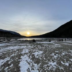
Mailbox is considered THE ultimate hike of Seattle. People start hiking Rattlesnake with aspirations of hiking Mailbox one day. Considered by many to be the ultimate test of your hiking ability and the most challenging hike in Seattle, this hike is not for the faint of heart or weak legs for that matter. If you want bragging rights, you need to hike the old trail though. There is a new trail which is a lot flatter and gives you the same views but no bragging rights. The old trail is just vertical and doesn't take prisoners. Many have failed hiking to the top and search and rescue has been invoked sometimes. It relents for a bit as it merges into the new trail and you may think you are done. However don't be fooled, the final part is the hardest and is a steep rocky climb to the peak. If you reach the top, 360 degree views await you. Its like being in heaven! Just look at the photos on a cloudy day! Also dont forget, its a great workout which means you can have noms later guilt free.

Hiking, I do a lot of it. I love people, I truly do, but seriously any hike off the I-90 is going to be packed, especially packed on sunny days. So be warned, even though it's a toughy of a hike, there's going to be quite a few people on the trail. With that being said, this was a fun hike! New trail distance: 9.4 miles out and back (old trail is like 5 miles out and back) elevation gain:4000 ft. (that's 800 ft less than hiking Half Dome in a shorter distance) Trail is well marked. Lots and lots of switch backs on the new trail. The old and new trail meet at 3+ miles in. From there it's another mile or so to the peak. The trail starts to get steep from here. You will eventually hike to above the tree line and hit a false summit. Keep going you're almost there! Once at the top you get great views. the mailbox was recently replaced, so not too many stickers on it yet (as of 4/30/16). Taking old trail up is going to be my next goal!

Oh boy! This trail definitely kicked my butt. The parking situation is not great so get here early if you can. I personally don't like hikes where I need to go through rocky steps and this hike doesn't have that so it's a plus. I also like that there are small streams that flows down the mountain so my dog can drink some water as we pass through each of them. Spikes(if the snow haven't fully melted) and trekking poles are definitely recommended. Oh! And don't forget your discover pass!!!

A stranger I came across while hiking told me that if I could hike the old mailbox peak trail 3 days in a row, I was physically ready to summit Mt. Rainier. I don't expect to be ready for Rainier after succeeding, but this was a challenge I wanted to take on for a while now. Did the hike 3 days in a row with different hike buddies each day. Feeling sore af, but accomplished. The plan is to continue to train for the eventual 14,000' icy summit. Until then, cheers from 4,800'

It's a tough hike but worth it! Would definitely recommend anyone looking for a challenge to get out at give this a shot. It took us around 5 hours round trip, and we were up at the summit for around 30 min. We took the "old" trail up (MUCH steeper) and then the "new" trail down. Bring lots of water - there really aren't many water sources on the trail.


It feels so good to be able to say that I conquered Mailbox Peak, the OLD trail. It is definitely one of the toughest hikes ever. Extremely steep, challenging and mentally draining. The new trail is longer (9.4 miles round trip) but not as steep and well maintained. I started hiking about 2 months ago and everyone keeps asking me "Have you done Mailbox Peak?" or "Is it harder than Mailbox Peak?" Everyone talks about how strenuous it was so that psyched me out. I initially wasn't planning on doing this hike till towards the end of summer when I was more fit. Out of the blue a friend and I had decided to conquer it so we can finally say that we did it. Difficulty: Hard Round trip: 5.4 miles Elevation gain: 4000ft Time: About 3.5 hours up, 2.5 hours down. (4000ft elevation gain over 2.7 miles is no joke, I still consider myself a novice hiker so I'm very slow!) Not kid friendly. Pet friendly. Drive: About a 45 minute drive from Seattle. Exit 34 off I-90. Easy and straight forward drive. No potholes of any kind. Parking: Two parking areas. Lower lot has a small parking area and parking on the side of the street. I did not pay attention to the upper parking lot but the gate closes at 7 pm so make sure you get back in time. We arrived around 9:30 am and there were already about 15 cars parked in the lower lot. Trail: From the lower parking lot, you will pass the new trail first. The old trail is just right ahead. We past by a group of hikers training for Mount Rainier. One of them stated that it was "scary steep" and for us to be extra careful. Great, just what we needed. The trail starts off in the sheltering forest and continues so for about 2/3 of the way. The path starts off with some switchbacks. I immediately wondered if I had taken the right trail. However, the not so many switchbacks in the beginning then fades out and the trail is immediately taken over with a moderate to severe grade incline of tree roots. All you see for a while are trees, dirt and roots. No defined trail anywhere, you are stepping over roots and roots. I actually didn't mind the roots that much because it gave us something to grab onto. The trees added great shade from the scorching sun. There are white diamond shape markers that are posted against the trees to direct you on the right path. Even with that, we got lost about 3 times, adding about 20-30 minutes onto our time. After what seems like forever, exiting the forest, the old trail then merges with the new trail. You will then hike parallel to the rocky terrain. From my understanding, there was no pathway parallel to the rocks back then. I was told I had to scramble to get to the top of the rocks. I guess they build a new, less dangerous pathway. It is still very steep. After reaching the top of the rocks, you have another 1/2 mile or so left. You will then see a false summit. This part is not shaded. This was the hardest part of the hike because it was so steep and there are lots of loose rocks. It was also mentally draining because you think you have reached the summit only to see that you have to keep going for a little bit more. Once I saw the mailbox, it was the best feeling because I had accomplished one of the hardest hikes (or maybe even the hardest hike) in the area! View: There is a nice view of Mount Rainier and of the nearby Valleys. However, even though there is a panoramic view, it is not as nice as I thought it would be. I was disappointing to have gone through that brutal trek for an "okay" view. I have gone on easier and more accessible hikes with much nicer views. They have recently replaced the mailbox. Crowds: I came on a Sunday morning. We arrived at the summit around 2 pm and there were about 15 people there. When going down, we past by about 40-50 people. Bugs: Lots of bugs! Bring bug spray. *Discover pass required*

7 months ago
What a beautiful and popular hike! Parking can be a beast so go early or later in the day if you don't want to have to hike from a remote spot far away from the start of the actual hike. I took my teen with me and we conquered it in about 7 hours round trip. We used the "new" trail up and back because I didn't want to hear my kid complaining about the brutal elevation gains on the old trail. We lucked out and had a clear, beautiful, sunny view. This won't always be the case and depending on the time of year you may not see much of anything at the top so plan accordingly and be mindful of the weather. We left a sticker and a heart shaped rock we found along the way in the mailbox before we hiked back. It's a fairly challenging hike if you are t in excellent shape- but it's doable if you use the new trail. Pack plenty of water and snacks and something to leave in the mailbox. read more


3 years ago
Mailbox is a niche hike that's pretty well known around here but not for the views. One of the hardest single day hikes in Washington, it's usually foggy up there but even when it's not, the view isn't all too exciting compared to other trails, well except for the mailbox. As a moderate hiker (once a month or so) in 2018, I was able to push through in 5 hours round trip. Four years later, I tackled Mailbox with only one hike beforehand in the previous 6 months and it took about 5 hours and 40 minutes. Went through the old trail and it's steep to the point where you'll likely feel your calves burning the whole way due to the flexion of your foot. As you enter the trailhead, the first Mailbox sign will be the new trail which is longer but overall easier because it's not a full incline hike. Go further and you'll find the old trail. Once you clear the forest, you'll see tons of boulders and rocks. Hopeful it's the end, you also won't see much in yet and you've still got a chunk of rock climbing left. Completing the hike will probably net you nearly a days worth of calories so you can feast afterwards. Pack some electrolytes, they're saviors. Our party of three hiked this on a collective 4 hours of sleep and some Gatorade was super helpful alongside caffeine. My quads started cramping near the boulders and it made this hike one of the worst I've experienced, but we managed to push through. With my experience, I highly recommend electrolytes because I had some Gatorade and a banana already yet was still dying. Push through to brag to your friends. read more


6 years ago
This iconic PNW hike certainly earns its reputation of being challenging, strenuous, rough and slightly dangerous, but beautifully rewarding. It's been on our bucket list for some time since moving to North Bend but it takes a pretty perfect combination to make it the ideal day for this hike. Firstly be sure you pick a day without our classic clouds and foggy mountainside- you want to be ultimately rewarded at the top with views of Rainier, neighboring Mt. Si, and the perfect silhouettes of Seattle and it's little sister Bellevue. Secondly, you had better have slept well and be up for 4000 ft elevation gain in less than 3 miles..you do the math. We woke up one Monday morning and said omg, today's the day that conditions were perfect and it was set to probably be our last big tackle of the summer. You'll need a Discover pass for the parking lot and there's one road that leads to both the new trailhead (first) and the old trailhead (second). If there's a challenge, our type A personalities take it- so we obviously went up the steeper, tougher, rougher old trail and down the slow decline of the new trail. We really enjoyed the loop lending to a change in scenery and variety for the long hike. The old trail is not for those without hiking experience or who haven't been actively hiking, it's truly difficult. It feels like you just ascend continuously without respite and most of the breaks we took were at an incline with gravity weighing on you because it rarely ever flattens out. The trail is lost often as it becomes just a maze of tree roots as you scramble up the mountain side. The trails merge at the last mile or so and you suddenly reach a mountainside rock scramble and you think-thank the hiking gods we've made it..then you get to the top of that and you see the actual summit with other victorious hikers looking like ants and well..you've come too far to turn back now so keep at it. The husband and I have done some tough climbs in our days together- Mt Si, Storm King, Tongariro Crossing in NZ .. and the husband of mine ranked this as #1 and for me I put it as #3 as far as challenges go but we definitely had to push each other that last 1/2 mile. The top is one of the best feelings ever. The actual mailbox with forgotten letters, ashes of a dear departed friend, and mementos frozen in time made the summit even more rewarding than just the view. There aren't many places to sit and lunch but we found a spot, got our pictures and headed down the new trail. Don't be fooled by the easy appearance of the 5 mile new trail after tackling the old trail, because I did.. and tripped on a root with 2 miles to go tearing some tendons and making it a very slow decline. A fellow hiker named Jonathan restored my faith in humanity and lent me his poles for those 2 miles making it much more manageable and I definitely recommend packing poles for the descent for anyone planning their trip. Mailbox Peak is certainly a hike that will win you bragging rights with it's 8.3 miles and 4,237 feet of elevation gain and certainly worthy of my 1,000th post. Just don't lose respect for this majestic beast or it will literally reach up and bite you like it did me! Come prepared with lots of water, snacks, poles, good hiking shoes, and be certain you are up for this challenge with lots of practice hikes..our dear rangers stay busy enough without rescuing hikers thinking this will be a pleasure trail. read more


6 years ago
I've never wanted to get mail so badly in my life. Mailbox Peak kicked my ass! As others say, this is not easy. It's a hard, strenuous hike with a reward at the end. So as long as there's beer in the mailbox! I left around 6:30am from Bellevue on a Saturday, and arrived around 7 where both lots right outside of the entrance were full. Then I saw people walking towards the entrance from further down the road, so assumed parking was full in the parking lot that's up the hill once you enter the entrance. I found one of the last parking spots further down where I saw people walking from, which still requires the Discover Pass. When I walked towards the trailhead I saw the parking lot mostly vacant! There were only a few cars there. My mistake for assuming it was full when I saw those walking along the road. I will say though by the time I left, this parking lot was completely full. This is also where the restrooms are, though not regularly maintained. Once you're at the trailhead, you can either take the old trail or new one. The old trail is much steeper, but gets you to where you're ultimately going sooner. The new trail is easier, but longer. But don't expect it to be a walk in the park. Either way, you're gonna sweat. Both trails eventually meet towards the top. You'll think you're nearly there when you see the rocks to scramble. Very wrong. You're getting close, but that's not the hard part. After you scramble the rocks, there's another steep dirt, rocky hill that you have to climb for where the mailbox is. It looks daunting after you've scrambled. When I realized this, I literally said, "Fuck!" too loud and everyone around me laughed and agreed. This was the hardest part for me. Once you're at the top, the area isn't very spacious for people to hang around and picnic, though that's what everyone does. For the most part, people are cool about getting out of the way and allowing people to take pictures by the mailbox. Inside the mailbox were beers and other offerings to the gods. The views of the Middle Fork Valley and Mt. Rainier cannot be missed. There's no greater feeling once you've made it to the mailbox. I spent an hour there with my snacks, drank all my water and just needed a break from the hike up. Going down is always hardest for me. The first hill is steep with dirt and rocks, so be careful going down. I slipped a few times from the dirt. I'd recommend bringing poles if you have 'em. I took the new trail going down, knowing it was gonna suck and my knees and feet always hurt when I hike down. It took me about 3.5 hours to go down on the new trail because of how slow I was going. My lower body was aching like hell. Mailbox Peak is definitely a bucket list item for all hikers in the area. It's an all-day workout that'll have you sore the next day. It's challenging, but if you can survive this, you can do all other hikes around. You got this! read more


3 years ago
Came on a Sunday morning around 7:30AM, parking lot was full. Went up old trail which was steep, didn't see too many people but definitely not empty either. Was about 5.1 miles up and took almost 2 hrs 15 mins. View at the top was great, weather was great too, no clouds and could see far out, 360 views. Quite a few people at the top, and there was a mailbox at the top! (Went down new trail which was less steep and better on the knees) read more


Finally hiked this and was surprised to find snow in mid-October. The view at the top is nice but the trail itself is a bit boring except for the last 4-500 feet which is a bit of a scramble. Micro-spikes and trekking poles recommended if going up when snow is on the trail as it can be icey near the top. It was a nice hike and good exercise but I prefer to hike a bit deeper in the wilderness with more waterfalls and scenery. read more


6 years ago
We arent avid hikers but we thought we could try this for fun as we have done hikes such as Tiger Mountain and Multnomah Falls. Little did we know that it would take us 5 hours to get up to the box and 2.5 hours to get down. 5 hours only because we took our sweet time enjoying nature/taking a break. If we didnt take so many breaks, we probably would have reached the top in 3 hours but I believe that time is also dependent on the trail. There are two trails that lead to the top. One is straight ahead which is the new trail and the one to the left which is the old trail. For first timers we took the left which we hear is the longer trail. It is also very steep with a lot of twists and turns. Either way, the old and new trail will meet in the middle to lead to a steeper hill. This hill will then lead you to a rocky stairway to the mailbox. Some even decided to just chill at the rocks before even going to the top as it takes abour 30 minutes to venture. Honestly all the hard work was worth it. Going down we decided to take the same trail since we were familiar of what we went down to. Would I go back anytime soon? Probably not because im still sore from the hike and keep in kind we went on the 4th of July (Saturday) and im reviewing this on Monday. So be prepared! This really isnt for the faint of heart. For parking, you would need the Discover Pass. However there is a mini parking lot/spots just outside the main lot where you are not required for the pass. When we arrived at 12 pm, we were pretty lucky to find a spot. It was packed. read more


Mailbox is considered THE ultimate hike of Seattle. People start hiking Rattlesnake with aspirations of hiking Mailbox one day. Considered by many to be the ultimate test of your hiking ability and the most challenging hike in Seattle, this hike is not for the faint of heart or weak legs for that matter. If you want bragging rights, you need to hike the old trail though. There is a new trail which is a lot flatter and gives you the same views but no bragging rights. The old trail is just vertical and doesn't take prisoners. Many have failed hiking to the top and search and rescue has been invoked sometimes. It relents for a bit as it merges into the new trail and you may think you are done. However don't be fooled, the final part is the hardest and is a steep rocky climb to the peak. If you reach the top, 360 degree views await you. Its like being in heaven! Just look at the photos on a cloudy day! Also dont forget, its a great workout which means you can have noms later guilt free. read more


Hiking, I do a lot of it. I love people, I truly do, but seriously any hike off the I-90 is going to be packed, especially packed on sunny days. So be warned, even though it's a toughy of a hike, there's going to be quite a few people on the trail. With that being said, this was a fun hike! New trail distance: 9.4 miles out and back (old trail is like 5 miles out and back) elevation gain:4000 ft. (that's 800 ft less than hiking Half Dome in a shorter distance) Trail is well marked. Lots and lots of switch backs on the new trail. The old and new trail meet at 3+ miles in. From there it's another mile or so to the peak. The trail starts to get steep from here. You will eventually hike to above the tree line and hit a false summit. Keep going you're almost there! Once at the top you get great views. the mailbox was recently replaced, so not too many stickers on it yet (as of 4/30/16). Taking old trail up is going to be my next goal! read more


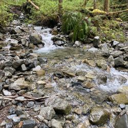
Oh boy! This trail definitely kicked my butt. The parking situation is not great so get here early if you can. I personally don't like hikes where I need to go through rocky steps and this hike doesn't have that so it's a plus. I also like that there are small streams that flows down the mountain so my dog can drink some water as we pass through each of them. Spikes(if the snow haven't fully melted) and trekking poles are definitely recommended. Oh! And don't forget your discover pass!!! read more


8 years ago
A stranger I came across while hiking told me that if I could hike the old mailbox peak trail 3 days in a row, I was physically ready to summit Mt. Rainier. I don't expect to be ready for Rainier after succeeding, but this was a challenge I wanted to take on for a while now. Did the hike 3 days in a row with different hike buddies each day. Feeling sore af, but accomplished. The plan is to continue to train for the eventual 14,000' icy summit. Until then, cheers from 4,800' read more

It's a tough hike but worth it! Would definitely recommend anyone looking for a challenge to get out at give this a shot. It took us around 5 hours round trip, and we were up at the summit for around 30 min. We took the "old" trail up (MUCH steeper) and then the "new" trail down. Bring lots of water - there really aren't many water sources on the trail. read more

8 years ago
Was a bit challenging, be prepared! Very good hike nonetheless, plan to visit again to make it to the top. Bring lots and lots of water. But the views are what's motivating to come back. Mailbox Peak, we shall meet again! read more


Beautiful view, well marked trail, a fun idea, and a great way to get outside. I am happy they offer the "new trail" since the old one is very steep and the new one is much easier for people who would prefer a longer hike with a slower increase in elevation read more


11 years ago
It feels so good to be able to say that I conquered Mailbox Peak, the OLD trail. It is definitely one of the toughest hikes ever. Extremely steep, challenging and mentally draining. The new trail is longer (9.4 miles round trip) but not as steep and well maintained. I started hiking about 2 months ago and everyone keeps asking me "Have you done Mailbox Peak?" or "Is it harder than Mailbox Peak?" Everyone talks about how strenuous it was so that psyched me out. I initially wasn't planning on doing this hike till towards the end of summer when I was more fit. Out of the blue a friend and I had decided to conquer it so we can finally say that we did it. Difficulty: Hard Round trip: 5.4 miles Elevation gain: 4000ft Time: About 3.5 hours up, 2.5 hours down. (4000ft elevation gain over 2.7 miles is no joke, I still consider myself a novice hiker so I'm very slow!) Not kid friendly. Pet friendly. Drive: About a 45 minute drive from Seattle. Exit 34 off I-90. Easy and straight forward drive. No potholes of any kind. Parking: Two parking areas. Lower lot has a small parking area and parking on the side of the street. I did not pay attention to the upper parking lot but the gate closes at 7 pm so make sure you get back in time. We arrived around 9:30 am and there were already about 15 cars parked in the lower lot. Trail: From the lower parking lot, you will pass the new trail first. The old trail is just right ahead. We past by a group of hikers training for Mount Rainier. One of them stated that it was "scary steep" and for us to be extra careful. Great, just what we needed. The trail starts off in the sheltering forest and continues so for about 2/3 of the way. The path starts off with some switchbacks. I immediately wondered if I had taken the right trail. However, the not so many switchbacks in the beginning then fades out and the trail is immediately taken over with a moderate to severe grade incline of tree roots. All you see for a while are trees, dirt and roots. No defined trail anywhere, you are stepping over roots and roots. I actually didn't mind the roots that much because it gave us something to grab onto. The trees added great shade from the scorching sun. There are white diamond shape markers that are posted against the trees to direct you on the right path. Even with that, we got lost about 3 times, adding about 20-30 minutes onto our time. After what seems like forever, exiting the forest, the old trail then merges with the new trail. You will then hike parallel to the rocky terrain. From my understanding, there was no pathway parallel to the rocks back then. I was told I had to scramble to get to the top of the rocks. I guess they build a new, less dangerous pathway. It is still very steep. After reaching the top of the rocks, you have another 1/2 mile or so left. You will then see a false summit. This part is not shaded. This was the hardest part of the hike because it was so steep and there are lots of loose rocks. It was also mentally draining because you think you have reached the summit only to see that you have to keep going for a little bit more. Once I saw the mailbox, it was the best feeling because I had accomplished one of the hardest hikes (or maybe even the hardest hike) in the area! View: There is a nice view of Mount Rainier and of the nearby Valleys. However, even though there is a panoramic view, it is not as nice as I thought it would be. I was disappointing to have gone through that brutal trek for an "okay" view. I have gone on easier and more accessible hikes with much nicer views. They have recently replaced the mailbox. Crowds: I came on a Sunday morning. We arrived at the summit around 2 pm and there were about 15 people there. When going down, we past by about 40-50 people. Bugs: Lots of bugs! Bring bug spray. *Discover pass required* read more


 - Hiking Near Me")


12 years ago
"Not for the faint of heart." That is an understatement if I have ever heard one. When I made the decision to move to the Pacific Northwest, I was very excited about a many number if things. I was most excited to get my hike on, Mother Nature blessed the PNW! I picked up a copy of the WTA Guide to the Pacific Northwest, that book became quickly worn, from the amount of late nights I spent fondling it's bewitching pages. At a point in my reading, my heart skipped a beat. When I recovered, I again read the description of Mailbox Peak; "This trail offers nothing for you but pain and heartbreak." I was simply smitten. "Oh Mailbox, you will be mine!", my heart declared. As I could find no willing partner to take on Mailbox Peak with me, I set off on my own. That first journey was a long, lonely and soul searching one. It was just me and Mother Nature in all of her glory. Larger than life trees, tiny snails, huge slugs, moss, tree roots, rocks. Blood. My hair was quickly wet with dew, my lungs full of clean, fresh air, my muscles burning with each step. During my ascent, I pondered many a thing. What is the meaning of my life? Am I really making a difference in this world? Am I on the right path? No, really, am I on the right path?! Don't expect a clearly marked trail, that is not something you will find. I eventually emerged from a canopy of trees and the light shined upon me. Nothing more glorious than the heat of the sun on my face after being covered in darkness for so long. After climbing for what seemed an eternity, I knew I must be nearing the top. The trail pressed on, as did I. When I felt my body could go no further, I saw her, the top of her peak! I climbed her hard, unyielding steps, one foot by one tired, aching foot, in front of another. When I met my Glory at the top of the mountain, Mother Nature and that dirty little mailbox were not the only ones witness. There was a very serious man propped up, ever so casual reading a book. "Pardon me, excuse me sir, I hate to bother you, but, um, can you take my photo?" One doesn't simply hike Mailbox Peak, one must obtain their proof of hike photo. The trophy. I want mine. I. Earned. It. Mr. Cranky Pants Hiker begrudgingly snapped my photo, a prize it was not. A year later, still troubled by my sad, little, hideous trophy, I was talked into going up the trail again. This time I decided to go up prepared; with high heels, a pretty dress, wine...and a photographer. As we had our photo shoot, complete with umbrellas and flashy things, hikers sat around befuddled by our goings on. I just stood there and smiled in my high heels made of wood, balancing on little sharp stones and rocks, my calf burning from the tear I obtained on the last, horrifying section up. This. This is what it feels like to be a supermodel. I love you Mailbox Peak, until we never meet again. xoxo read more


15 years ago
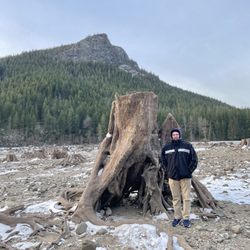
As everyone else says on their review, Mailbox Peak is no joke. It is a 2.5 mile Death March for the unprepared, and an ass kicking workout for the prepared. Don't let the mere 2.5 miles fool you, this is no less than 3x tougher than Mt Si. And that is why I love this hike! So you take that North Bend Exit for the truck stop, just east of the main downtown exit. Trail head is maybe 5 minutes off I-90. One thing I must emphasize is don't leave valuables in your car. I swear it seems there is always someone at the trail head who has had their car broken into. You walk up the forest service road about 1/2 mile until you get to the official entrance to Mailbox Peak trail head. I would post a picture of the warning sign, but someone else already did :) The first maybe 1/4 mile of trail you are meandering in a forested area with a few nice cold creeks running through. You will find these useful to soak your tired feet when you get back down. This little jaunt doesn't last long as the trail goes into full business mode with the quickness. No transition, no feeling out process, just you looking at this straight up, root stepped, steep as hell thing saying "DAMN!" Welcome to Mailbox Peak. This part of the trail you are under the tree canopy and more often than not you will run into some serious mud, roots, logs and assorted things you have to climb over or around. It looks like something out of Lord of The Rings..you would not be the least bit surprised to see a band of Orcs changing. The switchbacks are more like s-turns as they seem to not want to give you much of a break and just push you up up up the hill. If anyone says "it gets easier" or "you're almost there"...they are lying :) After what seems to be an eternity, eventually you will break out of the tree line and will finally have some nice scenery with lots of flowers and big views, but the most apparent view will be the huge boulder field in front of you. If you are not up to the scramble challenge, just follow the left edge of it, the trail will be apparent. Plenty of false summits, but I do think once you are out of the tree canopy, the going gets much easier and even if it is muddy, it seems there is more rock mixed in for better grip. Eventually you will reach the mailbox and if you see some business cards in there from some mortgage dude named Nick, I hear he is a good honest fella :) To make your Mailbox Peak trip more enjoyable (less agony), I would say bring the following: extra pair of socks to change at the top, lots of water and some food, 2 hiking poles so you don't fall on your butt on the way down, hiking boots with aggressive tread for the same reason, fully charged cell phone just in case, couple extra shirts to change at top out of your sweat soaked one, waterproof shell-windbreaker, headlamps with working batteries and a hiking buddy. I would give it less stars as it is no view-drab view until you get out of the treeline, but I give it extra stars for a complete ass-kicking physical sweated-through-20-shirts kind of a work out. read more


A wise hiker along the way said to me: "Smile, no one forced you to come here." Believe me, I tried REALLY hard to smile the whole time but I just couldn't! This hike is as intense as it gets. Like what many of the other reviewers have already mentioned, this is NOT a fun hike but the end result is completely worth it. You get the entire view of the Snoqualmie Valley and I-90 looks like a speck in the distance. This hike is practically all incline. Every time you feel like you've reached a flat area, it's flat for literally 5 seconds and then there goes the steep hill again. Some tips: - I would strongly recommend against wearing anything but hiking boots on this trail. I made the mistake of wearing my 3 1/2 year old Frees and I slipped twice on my way down. - Definitely bring a crap load of water. I normally don't drink that much water at all when I'm hiking and I went through 3 bottles easy. - Hiking sticks helped A LOT on the way down. I'm sure if I didn't have them, I would have called in sick and still be laying in bed right now. - Bring bug spray! There's so many mosquitoes! I got 3 bites and that was after spraying a load of bug spray and hanging a dryer sheet off my shorts. Can't imagine how many I would have gotten if I wasn't prepared. - Sunblock it up or you'll pan fry in the sun. - Last but not least, bring a good lunch so you can soak up the glory at the top. Have fun. You have been warned! read more


Glad I checked this hike off of my bucket list - I doubt I'll ever be back to visit the mailbox again unless I got a tip about a large sum of money hidden inside. Are you looking for a killer workout with killer views at the top to match? This is your hike. I had not anticipated whatsoever how difficult the climb would be (perhaps we were a bit fatigued by doing a long hike and half marathon on the days immediately prior to this hike) but still. It's tough. I would figure about 99% of each step you take will be a steep incline, with about 10 heavenly steps on flat ground interspersed between your climb. Most of the way, you will also be in the woods, amongst the peaceful tall trees. Once you pop out of the woods, you'll be able to spot your goal at the peak.....another 30 minutes or so climb up. I liked that this hike didn't take up the whole day - we were able to complete it up and down with some chill time at the top in under 4 1/2 hours. This genius at the top brought his Alite chair - smart idea since there's not really any comfy place to rest your tired legs. If there ever was a next time, I'd bring mine. Definitely a great one to check out and within reasonable driving distance from Seattle. read more


NO PAIN, NO GLORY This was NOT easy and many don't attempt or they attempt and sometimes not make it all the way up. It was brutal and painful but worth it all. Mind you, 4000 ft up is equivalent to 4 Sears towers (if I've done my math correctly). It is known to be the toughest mountain in PNW. Go hard or go home; the reward is one if the beautifulest eye-gasms I've had. Breath taking! Tips: hiking shoes, water, and start early. MY STORY On a whim with no preparation but a few snacks, one water bottle, Nike shoes, and an iPhone with no reception. What was I thinking? The incline was insane; going up was easier than going down. Felt never ending and all you see are trees trees trees with no sense of direction. The path fades as you get higher up the mountain. FOLLOW THE WHITE DIAMONDS ON THE TREES. After hours of incline and hours of starring at trees, the forest starts to finally open up. You get excited assuming you are near the top. LIES!!!!! The incline just continues through scrubs and under the scolding sun. At this point you are 2/3 up the mountain. THEN you see the hundreds of rocks on the side of the peak. There is a trail close by (find it) but it will take longer to get up. You have an option to risk getting hurt and climb the rocks to get to the top of the peak faster or take the trail. I thought that was the only option I had after already hiking for HOURS but it's not. The rocks were scary, it felt as if they were going to crumble down. At this point, there is NO SHADE. Many people get to this point and quit. The mountain is intimidating feeling as if it will never end. After you have climbed the rocks maybe about 1/4 a mile to get to the peak. The trail up is steep and very thin, hiking shoes would have been nice. Once at the top will be THE MAILBOX!! I literally almost gave up 100 ft from the mailbox. Touching that nasty mailbox was like gold. All that to touch a damn mailbox. Once there, the view was something else. I love the PNW, it's gorgeous in the summer. Here's the real struggle!!!! DOWNHILL. The incline is so steep, going down a couple hours with your toes smashing against the tip of your shoe was so uncomfortable. On top of that, I left my bottle water at the peak. We had no water for hours heading down. We started to get dehydrated and desperately rushed to a creek to get water. Overall, we survived after not knowing what we were getting into. First and likely my last visit to Mailbox! Love it but done and done. read more


13 years ago
Great trail for anyone looking to workout and challenge yourself ! This video shows the trail and the view from the top. http://www.youtube.com/watch?v=VwElvWdQZQg They are working on a brand new trail, which will follow the north slope of the mountain. It will be longer, but much easier. The new trail supposed to be open this coming fall 2013. read more


12 years ago
Difficulty- 6/6, Views- 4/6, Shade- 6/6, Dog Friendly- 2/6, Time 4-5 hours During the summer I hike almost weekly. That being said, this was a difficult hike even for me. However the most difficult park for me was the boredom, all of the wooded switchbacks with zero view make this a zero frill trail until you reach the top. I was grateful for the coolness of the shade as we hiked up, but I really would have enjoyed a bit of a view while we hiked up. The view at the top was nice, not the best view considering the work from the hike. Other less difficult trails offer a far better view: Sahale Arm, Glacier Peak, or even Chain Lakes trail to name just a few. Bring plenty of water and protein high snacks. Do not linger on the trail, step off to the side to take your breaks...they will be needed! If you choose to bring your dog, keep your dog on a leash. Your dog will also need breaks. This is not a dog friendly trail. The people of the trail will love your dog I am sure, but it will be hard on your dog. There is mud, a large patch of rocks to climb over and zero places for your pet to find water. Once you are past the tree line, there is zero shade to the last peak, Mailbox Peak. About 40 mins of intense straight up hiking/ climbing. As expected, there are some serious (intense) hikers on this trail, many training for Rainier or other mountain climbing adventures. Not the nicest of people, give them room, allow them to quickly pass and they should remain calm. Good Luck! read more


8 years ago
Oh man! If you're looking for a challenge then the old trail at Mailbox Peak is perfect for your next hiking adventure. I didn't anticipate how intense this hike was until I was about 30 minutes in. Not gonna lie, I wanted to quit immediately BUT my group and I fought through it and completed the trail. We went on a cloudy day so the view of Mount Rainier was barely visible but the mailbox was pretty cool. Bring something to stick inside that little box and take as much photos as possible! Bring snacks, water, more snacks and more water to enjoy while you're at the top. If you're looking to save your knees, take the new trail down. It's a bit longer and a little more crowded but whatever, you made it and that's what counts! There's also a Popeyes near the area so make that your post hike meal. read more

This hike is such a good one, whether you're doing the new trail or old, it's a great workout. The old trail hurts more, but is shorter, where the new trail is a calmer ascent until the two paths merge. Once you come to the Boulder Field, everyone yikes the same hike, and it's a climb to the top. After you're out of the boulder field, it only gets harder, with the last push up the peak. But luckily for you, people like me stock that can with yummy stouts and ales often! Definitely recommend this hike, and bringing goodies to leave in the mailbox. :) read more


Incredible. Amazing. Hard as hell. Dahh da dahhhh just walking up the- ITS STRAIT UP! THE WHOLE WAY! Yeah it's gnarly, but once you get up top, your life will be changed by the view, holy cow. Oh and bring lots of wind-breaking gear, it's cold at the top, even on a sunny day. Also, being crampons, and walking sticks (what are those called??) You're gonna have fun, trust me! Okay... Maybe not FUN but... It'll build character! read more


1. Strenuous 2. Challenging 3. True pacific northwest This hike is quite the workout. My legs are jello. I definitely was overly optimistic when I chose to climb mailbox peak as the first hike of the season. It was a great workout though. The worse part was coming down. I wouldn't recommend it for people with bad knees or ankles. Trying to keep from slipping and braking the whole way down killed my knees. XD Maybe one day...I'll pitch to Washington State parks the idea that we should have a gondola up top OR a series of slides. Wouldn't that be tons of fun? It would excite any child (and adults) to hike! read more


8 years ago
11 years ago
7 years ago
The "Old Trail" is the way to go up. It's shorter and it made me feel like an absolute animal at the top of the peak. I went up today with a friend and never felt like I didn't know where to go even though it was my first time. I took the "New Trail" down and it was way more open and not as steep. I was even able to run large tracts of it. My recommendation would be to challenge yourself on the way up and take the "Old Trail". Oh and get there early, it gets crowded after 7am. I think next time I'm going to summit it in the wee morning hours as a sunrise would be to die for up there. read more


16 years ago
You will know when you summit because, there is indeed a mailbox at the top! If you can hike this and walk the next day- you rock! Forget Rattlesnake and Mt. Si, head to Mailbox Peak for ULTIMATE panoramic views and the best work out ever. Rock scramble at the top is the best part. But if the thought of hopping over big rocks freaks you out, you can take the side trail and skip it and end up about the same spot a little ways up. Remember to pack food and water PA-LEASE! You will bunk out if you don't. This will make your heart race, and you need to plan 5 hours or more round trip. Trail conditions vary from muddy to snow to just plain dirty. Get an early start and leave yourself plenty of time to get down in the daylight. It gets really dark on the trail earlier than you would expect. read more

8 years ago
12 years ago
Other than pain, agony, and regret, here are some helpful tips: 1. Go on a weekend. Mailbox peak is currently closed for construction on the weekdays, you can only hike between Friday noon to Monday noon. If you go around Friday 12-4pm, the construction workers will lead you down the road towards the Mailbox trail parking lot and you can simply take the first right. 2. Navigate yourself to SE Middle Fork Road (and the intersection of LK Dorothy Road) to get to the trail. 3. Trailhead hides behind the warning sign. DO NOT CROSS THE BRIDGE. I walked over the bridge and wasted an hour walking through too many spider webs. 4. When hiking, follow the white diagonal signs nailed on the trees. I think you start to lose sanity and try to trailblaze directly up rather than to follow the curvy trails and it helps to check the white signs to know that you are hiking in the right direction. 5. The mailbox is a popular destination for flies. LOTS OF THEM. Bug repellent would be pleasant but not necessary. 6. I had the biggest blister on my toes after the hike. Wear thick, happy, supportive socks. Good luck and don't give up! read more


10 years ago
Its ok., just bring enough water with you and something to snack on at once you get to the top. Ignore my other review, I hopped on the wrong yelp account. read more


17 years ago
Do not ignore any of the reviews you may have read about this hike. It is probably the roughest hike I have done. The trail is 2.5 miles long and ascends to 4000 ft. Your reward for all that climbing? outstanding views and... a mailbox? Yeah, there's a mailbox at the peak (as the trail name might suggest). It is filled with various items (a pacifier, a restaurant pager, notebooks, etc). This hike will kick your butt but it is fun. Both going up AND going down it got a bit monotonous, though. read more

Page 1 of 3
More info about Mailbox Peak
North Bend, WA 98045
Directions
Visit Website
http://www.trailpeak.com/trail-MailBox-Peak-near-North-Bend-WA-5885
Hours
Indoor Amenities
Outdoor Amenities
Ask the Community - Mailbox Peak
Review Highlights - Mailbox Peak


Why does Yelp recommend reviews?
3 reviews that are not currently recommended
The reviews below are not factored into the business's overall star rating.
12 years ago
7 years ago
10 years ago
Mailbox Peak - hiking - Updated June 2026
Best of North Bend
People found Mailbox Peak by searching for…
Hiking Trails With Waterfalls in North Bend, Washington
Things to Do in North Bend, Washington
Rock Climbing in North Bend, Washington
Places to Take Pictures in North Bend, Washington
Mountain Bike Trails in North Bend, Washington
Scenic View in North Bend, Washington
Sunset View in North Bend, Washington
Scenic Drive in North Bend, Washington
Parks in North Bend, Washington
Stairs Workout in North Bend, Washington
Photo Spots in North Bend, Washington
Scenic Spots in North Bend, Washington
Off Road Trails in North Bend, Washington
Secret Spots in North Bend, Washington
Easy Hikes in North Bend, Washington
Fishing Spots in North Bend, Washington
Picnic Areas in North Bend, Washington
Sunrise Hike in North Bend, Washington
Sunrise View in North Bend, Washington
Fishing in North Bend, Washington
Attractions in North Bend, Washington
Natural Hot Springs in North Bend, Washington
Trending Searches in North Bend, WA
Black Owned Nail Salons near Mailbox Peak
Cliff Jumping near Mailbox Peak
Dog Friendly Trails near Mailbox Peak
Fishing Spots near Mailbox Peak
Jet Ski Rental near Mailbox Peak
Kayak Rental near Mailbox Peak
Lakes & Ponds near Mailbox Peak
Outdoor Activities near Mailbox Peak
Places To Walk Around near Mailbox Peak
Public Pools near Mailbox Peak
Public Shower near Mailbox Peak
River Swimming near Mailbox Peak
Scenic Night View near Mailbox Peak
Scenic Overlook near Mailbox Peak
Secluded Spots near Mailbox Peak
Soccer Store near Mailbox Peak
Strawberry Picking near Mailbox Peak
Sunrise View near Mailbox Peak
Swimming Holes near Mailbox Peak
Swimming Lakes near Mailbox Peak
Browse Articles
Browse Nearby
BEST of North Bend, Washington Restaurants near Mailbox Peak
BEST of North Bend, Washington Coffee near Mailbox Peak
BEST of North Bend, Washington Walking Trails near Mailbox Peak
BEST of North Bend, Washington Things to Do near Mailbox Peak
BEST of North Bend, Washington Breakfast near Mailbox Peak
BEST of North Bend, Washington Parks near Mailbox Peak
BEST of North Bend, Washington Campgrounds near Mailbox Peak
BEST of North Bend, Washington Caves near Mailbox Peak
BEST of North Bend, Washington Hot Springs near Mailbox Peak
Browse Brands
Related Searches in North Bend, WA
Affordable Kayak Rental Services in North Bend, Washington
Best Fishing Locations and Guides in North Bend, Washington
Best Nature Trails for Hiking in North Bend, Washington
Best Places for Horseback Riding in North Bend, Washington
Check Out Off Road Trails in North Bend, Washington
Discover Dog Friendly Trails to Explore in North Bend, Washington
Discover Scenic Mountain Bike Trails Near North Bend, Washington
Discover Scenic Waterfall Spots in North Bend, Washington
Discover Top Nature Parks to Visit in North Bend, Washington
Discover Walking Parks in North Bend, Washington Near You
Discover a Hiking Trail in North Bend, Washington
Discover the Best Night Hike Trails in North Bend, Washington
Dog-Friendly Hikes With Dogs in North Bend, Washington
Enjoy Camping Adventures Around North Bend, Washington
Enjoy Exciting Mountain Biking Adventures in North Bend, Washington
Enjoy Kayaking Adventures in North Bend, Washington
Enjoy Tent Camping Spots Around North Bend, Washington
Enjoy a Beautiful Waterfall Hike in North Bend, Washington
Enjoy the Best Picnic Spots and Ideas in North Bend, Washington
Enjoy the Best Walking Path in North Bend, Washington
Enjoy the Best Walking Trails in North Bend, Washington
Experience Thrilling White Water Rafting in North Bend, Washington
Explore Beautiful Parks and Green Spaces in North Bend, Washington
Explore Easy Hikes Perfect for All in North Bend, Washington
Explore Fun Activities to Do in North Bend, Washington
Explore Popular Campgrounds Near North Bend, Washington
Explore the Best Beach Spots in North Bend, Washington
Explore the Best Swimming Holes Around North Bend, Washington
Explore the Best Trail Options in North Bend, Washington
Family Friendly Hiking With Kids in North Bend, Washington
Find Beautiful Views in North Bend, Washington
Find Popular Ziplining Spots Around North Bend, Washington
Find the Best Parks for Picnics in North Bend, Washington
Find the Best Scenic View Locations in North Bend, Washington
Great Places to Walk in North Bend, Washington
Hike the Popular Waterfall Trail in North Bend, Washington
Hiking Trails With Waterfalls in North Bend, Washington
Off Leash Dog Hiking Trails in North Bend, Washington
Plan a Scenic Drive Route Near North Bend, Washington
Popular Outdoor Activities to Try in North Bend, Washington
Popular Picnic Spots to Visit in North Bend, Washington
Safe River Swimming Areas in North Bend, Washington
Safe and Fun Parks for Kids in North Bend, Washington
Top Climbing Spots and Gyms in North Bend, Washington
Top Paddleboarding Activities in North Bend, Washington
Top Running Trails to Explore in North Bend, Washington
Top Swimming Lakes to Enjoy in North Bend, Washington
Top Swimming Spots and Pools in North Bend, Washington
Walk Dog Friendly Hiking Trails in North Bend, Washington
Walk the Best Paved Walking Trails in North Bend, Washington
People who viewed Mailbox Peak also viewed
Cherry Creek Falls Trail
43 reviews
Twin Falls Trailhead
143 reviews
Poo Poo Point - Chirico Trail
166 reviews
Coal Creek Falls Trail
45 reviews
Lake Serene Peak
6 reviews
Bandera Mountain
13 reviews
Little Si
107 reviews
Mt Washington Trail
10 reviews
Cougar Mountain Regional Wildland Park
56 reviews
Big Creek Falls - Taylor River Trail
3 reviews