Teneriffe Falls Kamikaze Falls Hiking Photos


You might also consider


More like Teneriffe Falls Kamikaze Falls
Recommended Reviews - Teneriffe Falls Kamikaze Falls
Start your review...


Reviews With Photos


Yeeeehaw! Conquered these falls with a recovered sprained ankle :) Make sure you come here before 8am! Parking lot is super limiteeeeed and Discover Pass is required. Contrary to the warnings of the rocky trail of both Yelp & WTA (Washington Trail Association), this hike overall wasn't too bad. For me, I was pretty iffy on tackling this trail, especially when I had just recovered from a sprained ankle. Geared up with my trusty hiking boots and maintaining a never ending focus on the ground, this hike can easily be done. As mentioned by many others, you start off the first 2ish miles on flat ground with mild elevation gains. At this point, you can speed walk/jog if you want to speed up your hike. Once you hit the switchbacks, this is definitely where you want to spend the most attention to the rocky ground. Parts of the switchbacks are truly rocky (where you can't even see the soil) but if you have sturdy shoes on, you should be able to navigate through it easily. Not all of the switchbacks are rocky, so it's quite nice to have a tiny break in between. Pace yourself and make sure to look out at the pretty view as you climb up :) Once you start hearing the falls, you're more than halfway to your destination. Upon reaching the falls, you can either stay where you're at and take the pictures at the base OR you can attempt to climb up the big rok formation for even better pictures. Please keep in mind that it does take some effort to climb up and that this area gets super packed quickly. There is some standing/sitting room but it's better with a few people vs huge groups. Overall, awesome warm up hike. It took my group around 3hr to complete the 6.0mi round trip. There are some bugs here! o.o So take some spray if you're afraid of bugs. There is plenty of shade throughout the hike but bring some sunscreen since the rocky part of the trail doesn't offer much shade. Suggestion: If you find the hike to the fall itself too easy, consider doing the full on hike to the peak. It's another 1000+ elevation feet gain + additional mile but I heard it's quite the challenge and worth the view. :)

Great views on the way up. But was disappointed with the viewpoint and space around it. Parking was great! Finding which trail to go on, not so great. It gets confusing. But if you start climbing rocks, and i mean climbing rocks! Then you are on the right path. It's sketch yes but for my first tile i did take as many breaks as I needed especially at great views and where people still had space if needed to pass me up. Take a lot of water and snacks your gonna need it once you make it. I was winded for sure, and luckily i did just that because i needed the energy to make it back down lol. I hope you enjoy it though! Great quality time with my baby sisters and a lot of nagging from them LOL


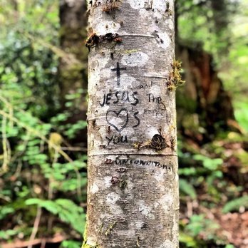
Teneriffe Falles (aka Kamikaze Falls) is a relatively smaller hike a bit further away from Mt. Si hiking area. You need to have a Discover Pass to park/hike this trail (either buy online or from other outdoor retail stores). The trail itself is 6.3 miles (round trip, to the falls and back to the entrance along the same route) and is quite well-paved, with about half of the way extremely well-paved, and another navigating up to the falls with rocks here and there. There were 4 people in our group and none of us was in much of a good shape either, given this hike was pretty much our official hike in this summer season. Yet, we all were able to complete the trail, given we consciously tried to pace ourselves so we walked more slowly with a mission to complete the trail, rather than be the fastest ibe to get up there. Unfortunately, the end of the trail was a little anti-climatic, which the trail just came to an end, with just a small area for a few people to admire the falls and without any proper end rest area for you to picnic/really relax. That said, the good part about this trail was that the trail was almost all shaded from the sun. Given that we hiked early in the morning, it was still quite pleasant to hike, even though the day we hike, the weather was sunny and supposed to hit 90Fs. P.S. There's limited parking spots at the trail entrance. Beware...get there early to make sure you get some parking spots...and don't be that rude person there that parks and blocks other cars from exiting the area. We got to the trail entrance around 8am and there were still some parking spots left. However, when we left around 11:30am, all parking spots were full. There were a few cars that parked in a way that would block some other cars from being able to back out and get out of the exit...I had no idea how those people would get out without having to wait for the drivers of those cars to come back and move their cars out.


A great day hike for anybody looking for an easy-intermediate hike. Teneriffe is pretty easy to find, and the parking lot is very small, so get there early! The trail starts out really easy - pretty much flat the entire way. Once you get to the sign pointing you to the Teneriffe trailhead, that's when it gets a little bit more steep. You'll experience several spots of incline from that point until the top. Along with the other reviewers, I did notice that it is a very rocky hike. I wouldn't say it's brutal or "not for weak-ankled people" because as long as you pay attention to where you're walking, you'll be fine. There are lots of sweeping views along the way, and plenty of places to take pictures! Keep in mind that currently, the falls are pretty much dried up. It was a little disappointing, but it's still really pretty. We climbed up the rocks a little bit... Definitely scary, but a cool experience! I'd be interested to come back and do this hike when the falls are around, or even during the winter to see the falls frozen!


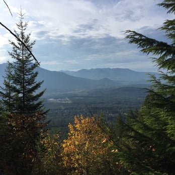
Wonderful day hike. Easy drive off I-90. Parking is hidden in front of a gated dirt road, so keep your eyes peeled. Hike is a little rough. Not for kids, it's steep and has drop offs. Also lots of growth (low maintenance trail). Perfect for getting up high quickly to a little secret: Kamikaze Falls! Beautiful and peaceful. Views of river, water falls, Snoqualmie valley, North Bend and the Cascade foothills. Bring your camera, water, good gripped shoes and hit the trail. About 3 or so miles up. Sit and relax and down you go.


Hiked this trail on 02/22. The initial part of the hike is almost like a stroll in a park, but the elevation gain is rapid towards the end. Lots of rocks on the way, brace your knees. We went off trail two times because a bit of the trail was hidden by fallen trees. It was cloudy so didn't see the view, but the lush waterfall at the end was a treat for the eyes!


My friend and I hiked Kamikaze on April 2nd at 10:30 in the morning. If there is snow obviously present, NON SLIP BOOTS/SPIKES/HIKING POLES are a must. There were at least two hikers I witnessed that day that were unprepared with running shoes and this is a dangerous hike to slip on. The parking lot only had another car present but when we came back 3-4 hours later, the lot still was relatively empty. In the beginning, the hike is easy because the path isn't rocky with flat ground and a dirt path. After 30 minutes of the hike, the elevation increases and an hour into it I started to see an increase of switchbacks. Then the jagged rocks started to come up then it was game on with the narrow path. The snow made this hike so fun due to an increase of caution and adrenaline with each step it took. At the top when seeing the falls there isn't a permanent resting area but it increased my curiosity with other peoples Instagram posts of the falls as a lot of hikers go off trail here. There was a group that took a detour at the top and obviously went to the summit, something I'm considering in the summer. On the way down the fresh snow was a great and not safe for an inexperienced hiker on a dangerous trail. Cool thing that I saw on this hike is there is a old black lab that lives near the parking lot and he follows people to the top guiding the way! I am totally coming back here again.


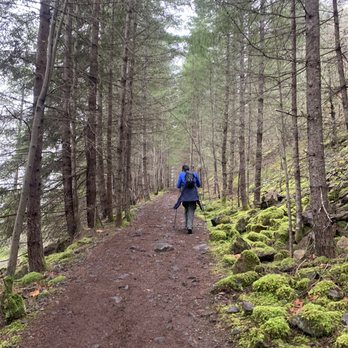
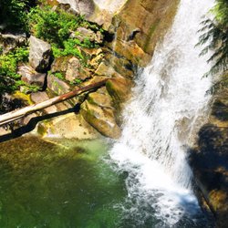
Difficulty: The website says easy to moderate. I think its more easy. Gains: 1400 ft Distance: 6 miles I came here at 10:30 am on a Tuesday. The weather wasn't that great. It was very cloudy, chilly and raining lightly. Of course given to the weather condition and the fact that it was a weekday there wasn't very many people at this trail. We saw only a few hikers on the way up the trail. Road: The road to very straight forward but the unmarked parking lot can easily be missed. This trail is on Mount Si Road, the trail head is off to the left with very few parking spots. Not very many places to park nearby too. Trail: This is a pretty easy hike. The first two miles is basically a flat walk down a wide dirt gravel road with a slight incline. The forest is rather well covered for the majority of the hike. The last mile before reaching the falls is where the trail picks up most of the elevation. There were about 22 switchbacks. The switchbacks aren't too bad but they are narrow, steep and very rocky. Some of the rocks on the switchbacks were very loose and uneven so make sure you have sturdy shoes. Overall, the trail is largely free of obstacles and not too strenuous. Bugs: Not too many bugs on this trail. View: The views along the switchbacks are pretty nice. You can see all the different mountains, valleys and highways. There are a few small streams connected to the fall on the way up. The waterfall was very strong and powerful. The trail will take you to the left side of the waterfall but there are so many trees it is much better to crossover the stream and see it from the right side. Tips: Make sure you wear appropriate shoes because the switchbacks are VERY rocky. Be careful when crossing the steam to get to the right side of the falls. *Discover Pass required*


If you go onto the wta.org website it says the hike is 6 miles, but it's really close to 8 miles. What a beautiful hike and a great reward towards the end... The trail starts out flat. Seems like you are walking the path forever before you start the incline up the mountain. As you get towards the top it gets a bit rocky and also more narrow. I saw a lot of kids on the trail but would probably recommend this more for "experienced" kid hikers. The waterfall is beautiful and the top is an incredible reward. It was a pretty awesome hike. I don't know why this place has two names for the same hike. Maybe someone can enlighten me.


So my friend and I were feeling spontaneous so we drove out here. I feel like we did not come at a common time - it was pretty empty, but not complaining! Make sure you purchase a Discover pass, parking very limited!! - easier hike, no crazy elevation, start going for almost a mile.. PSA: that is not the start of the hike, when you reach a sign that says "Tenneriffe trail" THEN you begin.... when we started it was completely flat I said "wow this is going to be way too leisure" haha A clearer trail somewhat disappears farther along the hike, we came across like rock boulders that you have to come across! I felt like I was rock climbing during one point of the trail. Make sure you have sturdy shoes on! A little disappointed when we reached the top, the waterfall was more like a "tricklefall" but it's okay, we made the best of it - had a photoshoot and lunch very near where the waterfall would have been!


Hike gets steep about 2 miles in. A big part of the trail is that sharp flakey uneven granite chips that make your feet feel like they had a shiatsu from an iron chef.. I hiked it in flip flops which probably isn't a good idea. The hike is about 3.3 miles up according to apple gps.. Check conditions as my shower has more water than the falls.. I'll probably check it out on the winter when it's iced over


We came on a clear sunny day, so of course a lot of people were here since it was a great day. The parking at the trailhead was already full when we got there, and we arrived at about 9 or 9:30am. The parking space here can fit about 20 cars. So we had to drive back down a little bit to the parking lot for Mount Si. It was about a mile walk from the Mount Si parking lot to the trailhead. I thought the walk wasn't bad at all since it was a nice day and a good amount of people had to do what we did. The first half of the hike was relatively easy because it was all leveled ground with a steady incline. But once we hit the switchbacks, it was all rocks and super steep. Not a good place to hike if you got bad knees or ankles. I think my friend said there were 22 switchbacks and I tried to count them but lost count after about maybe 5. After 5, all that was on my mind was to keep my eyes on the ground so I don't trip on a big rock and keep going. Towards the beginning of the switchbacks, there is a clear view of the mountains in the area. There are also some big rocks you can sit on and see the awesome view while you take a breather too! We got to the bottom of the waterfall and that was the highest we went. It's where most people stopped as well. I think there's about 1.5 miles more to reach the top. It was really refreshing where we stopped because of the misting from the waterfall. We stopped to take a break and have snack on some food before we went down. I would rate this hike as moderate. This was my first hike in years, and I don't exercise on a normal basis, or at all really, (I know I should though), but this hike wasn't too difficult for me. Once you get started and warmed up, it really isn't bad. But of course, this might be a breeze for people who hike normally. I was crazy sore after this hike, but it was worth it for the view and the experience! Would definitely recommend and do the hike again when I get the chance. Maybe next time, I will go all the way up!


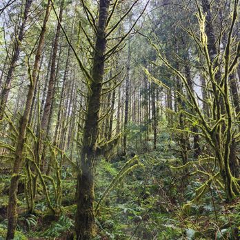
This was neither my favorite waterfall nor hike. I wondered why I hadn't put this one on my list previously. My mom found this one and decided she wanted to see the falls over the view from Little Si, so that is where we went on a very rainy weekend afternoon! There were breaks of sunshine, so the hike wasn't completely miserable. However, the many many wet rocks were not fun to maneuver around for a large part of the hike. If you are someone who has knee, foot, or ankle issues at all, I would avoid this hike. My ankle was in pain for several days after doing this hike. The rocks were just awful and really not worth it for this particular waterfall. The little flowers and mushrooms growing all along the path were nice little Easter eggs, and the view of I-90 and the surrounding mountains below from the midpoint were nice bonuses. Parking was plentiful and required a WA state parks pass - luckily now you can go online and pay for one/write the info on a slip of paper to display on your dash. Gone are the days of money in an envelope for the ranger! read more




10 years ago
I'm (water)falling for you, summer! Start on this hike early as the parking lot fills by 7:30AM on the weekends. As other reviewers have mentioned, a Discover Pass is required, which is $10 for one day or $30 for a year. Check out discoverpass.wa.gov for details on where/how you can purchase one! I'd say this hike is a great beginner-to-slightly-intermediate trail, mostly in regards to the terrain. While hiking boots are ideal, I was still able to complete this hike with regular sneakers. Approximately 6 miles long roundtrip, the hike begins with a well-marked and wide path that slowly gets narrow and rocky as the trail goes on. The majority of the hike is wooded and flat, with the elevation increasing slightly the second half of the hike with more switchbacks. The waterfall itself is beautiful and there's room along the side where you can clamber up and sit. It seems like a pet-friendly trail - we saw a good number of groups with their dogs. However, in terms of family-friendliness, the trail might be harder for younger kids due to the rockiness. A caveat is that depending on when you go during the year, there is the risk that the waterfall can be dry. :( So check the weather conditions carefully before you head over to this early morning hike! read more


Yeeeehaw! Conquered these falls with a recovered sprained ankle :) Make sure you come here before 8am! Parking lot is super limiteeeeed and Discover Pass is required. Contrary to the warnings of the rocky trail of both Yelp & WTA (Washington Trail Association), this hike overall wasn't too bad. For me, I was pretty iffy on tackling this trail, especially when I had just recovered from a sprained ankle. Geared up with my trusty hiking boots and maintaining a never ending focus on the ground, this hike can easily be done. As mentioned by many others, you start off the first 2ish miles on flat ground with mild elevation gains. At this point, you can speed walk/jog if you want to speed up your hike. Once you hit the switchbacks, this is definitely where you want to spend the most attention to the rocky ground. Parts of the switchbacks are truly rocky (where you can't even see the soil) but if you have sturdy shoes on, you should be able to navigate through it easily. Not all of the switchbacks are rocky, so it's quite nice to have a tiny break in between. Pace yourself and make sure to look out at the pretty view as you climb up :) Once you start hearing the falls, you're more than halfway to your destination. Upon reaching the falls, you can either stay where you're at and take the pictures at the base OR you can attempt to climb up the big rok formation for even better pictures. Please keep in mind that it does take some effort to climb up and that this area gets super packed quickly. There is some standing/sitting room but it's better with a few people vs huge groups. Overall, awesome warm up hike. It took my group around 3hr to complete the 6.0mi round trip. There are some bugs here! o.o So take some spray if you're afraid of bugs. There is plenty of shade throughout the hike but bring some sunscreen since the rocky part of the trail doesn't offer much shade. Suggestion: If you find the hike to the fall itself too easy, consider doing the full on hike to the peak. It's another 1000+ elevation feet gain + additional mile but I heard it's quite the challenge and worth the view. :) read more


7 years ago
Great views on the way up. But was disappointed with the viewpoint and space around it. Parking was great! Finding which trail to go on, not so great. It gets confusing. But if you start climbing rocks, and i mean climbing rocks! Then you are on the right path. It's sketch yes but for my first tile i did take as many breaks as I needed especially at great views and where people still had space if needed to pass me up. Take a lot of water and snacks your gonna need it once you make it. I was winded for sure, and luckily i did just that because i needed the energy to make it back down lol. I hope you enjoy it though! Great quality time with my baby sisters and a lot of nagging from them LOL read more


Teneriffe Falles (aka Kamikaze Falls) is a relatively smaller hike a bit further away from Mt. Si hiking area. You need to have a Discover Pass to park/hike this trail (either buy online or from other outdoor retail stores). The trail itself is 6.3 miles (round trip, to the falls and back to the entrance along the same route) and is quite well-paved, with about half of the way extremely well-paved, and another navigating up to the falls with rocks here and there. There were 4 people in our group and none of us was in much of a good shape either, given this hike was pretty much our official hike in this summer season. Yet, we all were able to complete the trail, given we consciously tried to pace ourselves so we walked more slowly with a mission to complete the trail, rather than be the fastest ibe to get up there. Unfortunately, the end of the trail was a little anti-climatic, which the trail just came to an end, with just a small area for a few people to admire the falls and without any proper end rest area for you to picnic/really relax. That said, the good part about this trail was that the trail was almost all shaded from the sun. Given that we hiked early in the morning, it was still quite pleasant to hike, even though the day we hike, the weather was sunny and supposed to hit 90Fs. P.S. There's limited parking spots at the trail entrance. Beware...get there early to make sure you get some parking spots...and don't be that rude person there that parks and blocks other cars from exiting the area. We got to the trail entrance around 8am and there were still some parking spots left. However, when we left around 11:30am, all parking spots were full. There were a few cars that parked in a way that would block some other cars from being able to back out and get out of the exit...I had no idea how those people would get out without having to wait for the drivers of those cars to come back and move their cars out. read more


A great day hike for anybody looking for an easy-intermediate hike. Teneriffe is pretty easy to find, and the parking lot is very small, so get there early! The trail starts out really easy - pretty much flat the entire way. Once you get to the sign pointing you to the Teneriffe trailhead, that's when it gets a little bit more steep. You'll experience several spots of incline from that point until the top. Along with the other reviewers, I did notice that it is a very rocky hike. I wouldn't say it's brutal or "not for weak-ankled people" because as long as you pay attention to where you're walking, you'll be fine. There are lots of sweeping views along the way, and plenty of places to take pictures! Keep in mind that currently, the falls are pretty much dried up. It was a little disappointing, but it's still really pretty. We climbed up the rocks a little bit... Definitely scary, but a cool experience! I'd be interested to come back and do this hike when the falls are around, or even during the winter to see the falls frozen! read more



12 years ago
Wonderful day hike. Easy drive off I-90. Parking is hidden in front of a gated dirt road, so keep your eyes peeled. Hike is a little rough. Not for kids, it's steep and has drop offs. Also lots of growth (low maintenance trail). Perfect for getting up high quickly to a little secret: Kamikaze Falls! Beautiful and peaceful. Views of river, water falls, Snoqualmie valley, North Bend and the Cascade foothills. Bring your camera, water, good gripped shoes and hit the trail. About 3 or so miles up. Sit and relax and down you go. read more


We've hiked this a few times and each time I still stare in amazement! This is a well marked hike that is beautiful rain or shine. Some parts get a little rocky but other than that it was a fun easy hike and a great way to start the day! read more


Hiked this trail on 02/22. The initial part of the hike is almost like a stroll in a park, but the elevation gain is rapid towards the end. Lots of rocks on the way, brace your knees. We went off trail two times because a bit of the trail was hidden by fallen trees. It was cloudy so didn't see the view, but the lush waterfall at the end was a treat for the eyes! read more




8 years ago
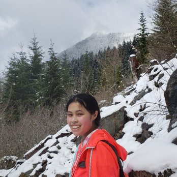
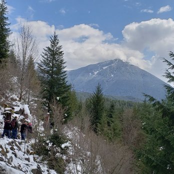
My friend and I hiked Kamikaze on April 2nd at 10:30 in the morning. If there is snow obviously present, NON SLIP BOOTS/SPIKES/HIKING POLES are a must. There were at least two hikers I witnessed that day that were unprepared with running shoes and this is a dangerous hike to slip on. The parking lot only had another car present but when we came back 3-4 hours later, the lot still was relatively empty. In the beginning, the hike is easy because the path isn't rocky with flat ground and a dirt path. After 30 minutes of the hike, the elevation increases and an hour into it I started to see an increase of switchbacks. Then the jagged rocks started to come up then it was game on with the narrow path. The snow made this hike so fun due to an increase of caution and adrenaline with each step it took. At the top when seeing the falls there isn't a permanent resting area but it increased my curiosity with other peoples Instagram posts of the falls as a lot of hikers go off trail here. There was a group that took a detour at the top and obviously went to the summit, something I'm considering in the summer. On the way down the fresh snow was a great and not safe for an inexperienced hiker on a dangerous trail. Cool thing that I saw on this hike is there is a old black lab that lives near the parking lot and he follows people to the top guiding the way! I am totally coming back here again. read more




11 years ago
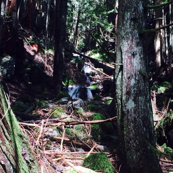
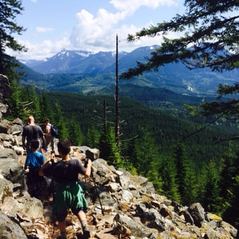
Difficulty: The website says easy to moderate. I think its more easy. Gains: 1400 ft Distance: 6 miles I came here at 10:30 am on a Tuesday. The weather wasn't that great. It was very cloudy, chilly and raining lightly. Of course given to the weather condition and the fact that it was a weekday there wasn't very many people at this trail. We saw only a few hikers on the way up the trail. Road: The road to very straight forward but the unmarked parking lot can easily be missed. This trail is on Mount Si Road, the trail head is off to the left with very few parking spots. Not very many places to park nearby too. Trail: This is a pretty easy hike. The first two miles is basically a flat walk down a wide dirt gravel road with a slight incline. The forest is rather well covered for the majority of the hike. The last mile before reaching the falls is where the trail picks up most of the elevation. There were about 22 switchbacks. The switchbacks aren't too bad but they are narrow, steep and very rocky. Some of the rocks on the switchbacks were very loose and uneven so make sure you have sturdy shoes. Overall, the trail is largely free of obstacles and not too strenuous. Bugs: Not too many bugs on this trail. View: The views along the switchbacks are pretty nice. You can see all the different mountains, valleys and highways. There are a few small streams connected to the fall on the way up. The waterfall was very strong and powerful. The trail will take you to the left side of the waterfall but there are so many trees it is much better to crossover the stream and see it from the right side. Tips: Make sure you wear appropriate shoes because the switchbacks are VERY rocky. Be careful when crossing the steam to get to the right side of the falls. *Discover Pass required* read more


If you go onto the wta.org website it says the hike is 6 miles, but it's really close to 8 miles. What a beautiful hike and a great reward towards the end... The trail starts out flat. Seems like you are walking the path forever before you start the incline up the mountain. As you get towards the top it gets a bit rocky and also more narrow. I saw a lot of kids on the trail but would probably recommend this more for "experienced" kid hikers. The waterfall is beautiful and the top is an incredible reward. It was a pretty awesome hike. I don't know why this place has two names for the same hike. Maybe someone can enlighten me. read more



9 years ago
So my friend and I were feeling spontaneous so we drove out here. I feel like we did not come at a common time - it was pretty empty, but not complaining! Make sure you purchase a Discover pass, parking very limited!! - easier hike, no crazy elevation, start going for almost a mile.. PSA: that is not the start of the hike, when you reach a sign that says "Tenneriffe trail" THEN you begin.... when we started it was completely flat I said "wow this is going to be way too leisure" haha A clearer trail somewhat disappears farther along the hike, we came across like rock boulders that you have to come across! I felt like I was rock climbing during one point of the trail. Make sure you have sturdy shoes on! A little disappointed when we reached the top, the waterfall was more like a "tricklefall" but it's okay, we made the best of it - had a photoshoot and lunch very near where the waterfall would have been! read more


8 years ago

Hike gets steep about 2 miles in. A big part of the trail is that sharp flakey uneven granite chips that make your feet feel like they had a shiatsu from an iron chef.. I hiked it in flip flops which probably isn't a good idea. The hike is about 3.3 miles up according to apple gps.. Check conditions as my shower has more water than the falls.. I'll probably check it out on the winter when it's iced over read more


7 years ago


11 years ago
We came on a clear sunny day, so of course a lot of people were here since it was a great day. The parking at the trailhead was already full when we got there, and we arrived at about 9 or 9:30am. The parking space here can fit about 20 cars. So we had to drive back down a little bit to the parking lot for Mount Si. It was about a mile walk from the Mount Si parking lot to the trailhead. I thought the walk wasn't bad at all since it was a nice day and a good amount of people had to do what we did. The first half of the hike was relatively easy because it was all leveled ground with a steady incline. But once we hit the switchbacks, it was all rocks and super steep. Not a good place to hike if you got bad knees or ankles. I think my friend said there were 22 switchbacks and I tried to count them but lost count after about maybe 5. After 5, all that was on my mind was to keep my eyes on the ground so I don't trip on a big rock and keep going. Towards the beginning of the switchbacks, there is a clear view of the mountains in the area. There are also some big rocks you can sit on and see the awesome view while you take a breather too! We got to the bottom of the waterfall and that was the highest we went. It's where most people stopped as well. I think there's about 1.5 miles more to reach the top. It was really refreshing where we stopped because of the misting from the waterfall. We stopped to take a break and have snack on some food before we went down. I would rate this hike as moderate. This was my first hike in years, and I don't exercise on a normal basis, or at all really, (I know I should though), but this hike wasn't too difficult for me. Once you get started and warmed up, it really isn't bad. But of course, this might be a breeze for people who hike normally. I was crazy sore after this hike, but it was worth it for the view and the experience! Would definitely recommend and do the hike again when I get the chance. Maybe next time, I will go all the way up! read more


9 years ago
Arrived a little after 9 am and there were still a few parking spots left. Great hike, lots of climbing over rocks, switchbacks, lots of water at the falls. Thankfully we finished before the real rain came! Will definitely go back. read more


10 years ago
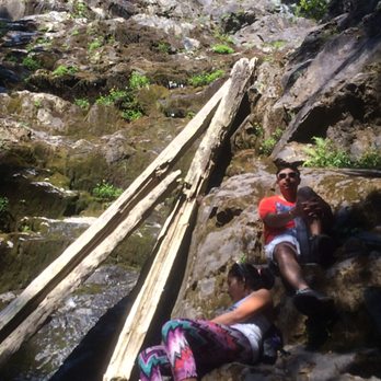
Beautiful hike! Wear ankle support but can do with sneakers too Coz it's a rocky trail! Carry lotsa water for sunny day. We went on a hot day in August and guess what- there was no waterfall! It was all dried up so we were obviously bummed a lil bit but hey- we still had fun! read more


10 years ago
So pretty! I did the hike on a day where the rain was coming down in buckets, but it was so worth it! It was a very fun and beautiful hike and I recommend it to all my friends. read more


9 years ago
Came here for a friend's birthday activity and had a fairly large group and dogs. We all really enjoyed the hike and the day we went didn't see too many people, which was nice. read more


8 years ago

10 years ago
Hiked on 4/30/2016. Arrived at 11am on a Saturday morning and there was only one parking spot left in the tiny lot (holds ~20cars). There wasn't a trail head sign until about half a mile into the trail so we weren't sure if we were going in the right direction at first. Luckily there is cell service throughout the whole hike so we knew we were on the right trail. First 2 miles was flat and super easy. it starts to get rocky and more of incline; definitely worked up a sweat climbing up. The rocks were very loose so would recommend investing in some hiking boots or watch your step so you don't roll your ankles. It was pretty crowded at the top, too many people and not enough place for everyone to comfortably sit around to enjoy lunch. We spent an hour at the top (to take pictures) and it got pretty chilly due to the waterfall. Recommend bringing an extra jacket to wear at the top of you plan to stay for more than 30 minutes. read more


11 years ago

11 years ago
10 years ago
More info about Teneriffe Falls Kamikaze Falls
North Bend, WA 98045
Directions
Hours
Outdoor Amenities
Ask the Community - Teneriffe Falls Kamikaze Falls
Review Highlights - Teneriffe Falls Kamikaze Falls
You might also consider




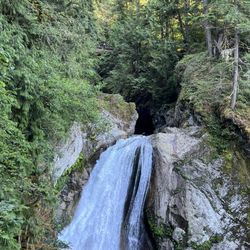



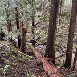
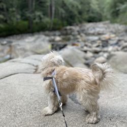
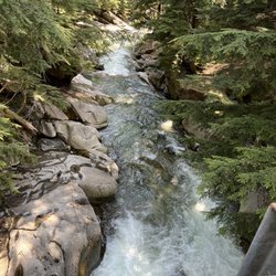






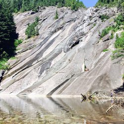



Teneriffe Falls Kamikaze Falls - hiking - Updated May 2026
Best of North Bend
People found Teneriffe Falls Kamikaze Falls by searching for…
Hiking Trails With Waterfalls in North Bend, Washington
Rock Climbing in North Bend, Washington
Things to Do in North Bend, Washington
Scenic Drive in North Bend, Washington
Places to Take Pictures in North Bend, Washington
Scenic View in North Bend, Washington
Easy Hikes in North Bend, Washington
Parks in North Bend, Washington
Secret Spots in North Bend, Washington
Scenic Spots in North Bend, Washington
Lookout Points in North Bend, Washington
Sunset View in North Bend, Washington
Picnic Areas in North Bend, Washington
Photo Spots in North Bend, Washington
Waterfalls and Swimming Holes in North Bend, Washington
Sunrise Hike in North Bend, Washington
Paved Walking Trails in North Bend, Washington
Things to Do on a Rainy Day in North Bend, Washington
Picnic Spots in North Bend, Washington
Waterfalls in North Bend, Washington
Dog Friendly Hiking Trails in North Bend, Washington
Off Road Trails in North Bend, Washington
Trending Searches in North Bend, WA
Boat Rental near Teneriffe Falls Kamikaze Falls
Botanical Gardens near Teneriffe Falls Kamikaze Falls
Bounce House Rentals near Teneriffe Falls Kamikaze Falls
Campgrounds near Teneriffe Falls Kamikaze Falls
Cliff Jumping near Teneriffe Falls Kamikaze Falls
Dog Friendly Things To Do near Teneriffe Falls Kamikaze Falls
Flower Fields near Teneriffe Falls Kamikaze Falls
Flower Shop near Teneriffe Falls Kamikaze Falls
Hair near Teneriffe Falls Kamikaze Falls
Lakes & Ponds near Teneriffe Falls Kamikaze Falls
Movie Theatre near Teneriffe Falls Kamikaze Falls
Nurseries & Gardening near Teneriffe Falls Kamikaze Falls
Outdoor Activities near Teneriffe Falls Kamikaze Falls
Outdoor Furniture Stores near Teneriffe Falls Kamikaze Falls
Party Equipment Rentals near Teneriffe Falls Kamikaze Falls
Pedicure near Teneriffe Falls Kamikaze Falls
Pick Your Own Farms near Teneriffe Falls Kamikaze Falls
Picnic Areas near Teneriffe Falls Kamikaze Falls
Places To Walk Around near Teneriffe Falls Kamikaze Falls
Rainy Day Activities near Teneriffe Falls Kamikaze Falls
Rock Quarry near Teneriffe Falls Kamikaze Falls
Running Trails near Teneriffe Falls Kamikaze Falls
Scenic Drive near Teneriffe Falls Kamikaze Falls
Secret Spots near Teneriffe Falls Kamikaze Falls
Strawberry Picking near Teneriffe Falls Kamikaze Falls
Sunrise View near Teneriffe Falls Kamikaze Falls
Swimming Holes near Teneriffe Falls Kamikaze Falls
Things To Do On A Rainy Day near Teneriffe Falls Kamikaze Falls
Browse Articles
Browse Nearby
BEST of North Bend, Washington Restaurants near Teneriffe Falls Kamikaze Falls
BEST of North Bend, Washington Coffee near Teneriffe Falls Kamikaze Falls
BEST of North Bend, Washington Walking Trails near Teneriffe Falls Kamikaze Falls
BEST of North Bend, Washington Things to Do near Teneriffe Falls Kamikaze Falls
BEST of North Bend, Washington Breakfast near Teneriffe Falls Kamikaze Falls
BEST of North Bend, Washington Parks near Teneriffe Falls Kamikaze Falls
BEST of North Bend, Washington Caves near Teneriffe Falls Kamikaze Falls
BEST of North Bend, Washington Campgrounds near Teneriffe Falls Kamikaze Falls
BEST of North Bend, Washington Hotels near Teneriffe Falls Kamikaze Falls
Browse Brands
Related Searches in North Bend, WA
Affordable Kayak Rental Services in North Bend, Washington
Best Fishing Locations and Guides in North Bend, Washington
Best Nature Trails for Hiking in North Bend, Washington
Best Places for Horseback Riding in North Bend, Washington
Check Out Off Road Trails in North Bend, Washington
Discover Dog Friendly Trails to Explore in North Bend, Washington
Discover Scenic Mountain Bike Trails Near North Bend, Washington
Discover Scenic Waterfall Spots in North Bend, Washington
Discover Top Nature Parks to Visit in North Bend, Washington
Discover Walking Parks in North Bend, Washington Near You
Discover a Hiking Trail in North Bend, Washington
Discover the Best Night Hike Trails in North Bend, Washington
Dog-Friendly Hikes With Dogs in North Bend, Washington
Enjoy Camping Adventures Around North Bend, Washington
Enjoy Exciting Mountain Biking Adventures in North Bend, Washington
Enjoy Kayaking Adventures in North Bend, Washington
Enjoy Tent Camping Spots Around North Bend, Washington
Enjoy a Beautiful Waterfall Hike in North Bend, Washington
Enjoy the Best Picnic Spots and Ideas in North Bend, Washington
Enjoy the Best Walking Path in North Bend, Washington
Enjoy the Best Walking Trails in North Bend, Washington
Experience Thrilling White Water Rafting in North Bend, Washington
Explore Beautiful Parks and Green Spaces in North Bend, Washington
Explore Easy Hikes Perfect for All in North Bend, Washington
Explore Fun Activities to Do in North Bend, Washington
Explore Popular Campgrounds Near North Bend, Washington
Explore the Best Beach Spots in North Bend, Washington
Explore the Best Swimming Holes Around North Bend, Washington
Explore the Best Trail Options in North Bend, Washington
Family Friendly Hiking With Kids in North Bend, Washington
Find Beautiful Views in North Bend, Washington
Find Popular Ziplining Spots Around North Bend, Washington
Find the Best Parks for Picnics in North Bend, Washington
Find the Best Scenic View Locations in North Bend, Washington
Great Places to Walk in North Bend, Washington
Hike the Popular Waterfall Trail in North Bend, Washington
Hiking Trails With Waterfalls in North Bend, Washington
Off Leash Dog Hiking Trails in North Bend, Washington
Plan a Scenic Drive Route Near North Bend, Washington
Popular Outdoor Activities to Try in North Bend, Washington
Popular Picnic Spots to Visit in North Bend, Washington
Safe River Swimming Areas in North Bend, Washington
Safe and Fun Parks for Kids in North Bend, Washington
Top Climbing Spots and Gyms in North Bend, Washington
Top Paddleboarding Activities in North Bend, Washington
Top Running Trails to Explore in North Bend, Washington
Top Swimming Lakes to Enjoy in North Bend, Washington
Top Swimming Spots and Pools in North Bend, Washington
Walk Dog Friendly Hiking Trails in North Bend, Washington
Walk the Best Paved Walking Trails in North Bend, Washington
People who viewed Teneriffe Falls Kamikaze Falls also viewed

Little Si
106 reviews

Poo Poo Point - Chirico Trail
166 reviews

Twin Falls Trailhead
143 reviews

Rattlesnake Ledge Trail
214 reviews

Big Creek Falls - Taylor River Trail
3 reviews

Granite Mountain
11 reviews

Red Town Trailhead
3 reviews

Snoqualmie Point Park
18 reviews

Bandera Mountain
13 reviews

Franklin Falls Trailhead
141 reviews