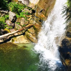
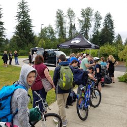
Little Si Photos


You might also consider
More like Little Si
Recommended Reviews - Little Si
Start your review...

Reviews With Photos

This was for Little Si and Boulder gardens trail. Good number of people for a cool kinda rainy Sunday in November. Every single dog was off leash except one owner who had three. Props to the ONE person who followed the rules. The trail is pretty muddy and slippery during the scramble up lots of large rocks/boulders. Hiking poles were very handy in this section. The leaves are still turning colors which made it really pretty during the second part of the hike. It's anticlimactic at the end where you're just in the middle of the forest that connects to other trails but no lookout at the end. The nice lookout is a short distance from the trailhead. It's a pretty steady incline in a short distance. Nice to get out on a Sunday. Saw three sets of poop bags on the way down near the trailhead. If you bring your dog you should keep your poop bag with you and not set it down.

A popular and beautiful hike near the Seattle area! My husband and I came around 7:30am and both main and overflow lots were filled (it was also a beautiful Saturday with great weather so we weren't surprised) luckily if you go back over the bridge, there's a green sign that says parking where you can park along the fence. By the time we finished our hike around 10:30/11am it was totally packed in that area! The main lot has 2 bathrooms available to use before starting the hike. Bathrooms had toilet paper but it still is pretty gross. No hand soap or sink to wash hands so bring some hand sanitizer. We brought water and some snacks. The hike was mostly shaded but a hat did come in handy especially at the top of the hike where it's less shaded. Hike is moderate. Uphill to the top and downhill to the bottom. We brought walking sticks which came in handy on the way down for me since I have short legs. Definitely best if you wear hiking shoes and bring sunscreen. This hike is doggo friendly! Overall, it took us about 2 hours to finish and we really enjoyed the hike!

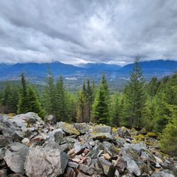
Little Si is a popular hike in the North Bend area located next to its larger neighbor Mount Si. It's only a 30 minutes from Seattle so it's a short drive if you want to get out of the city. I got here at 7:45am on a Friday morning and the parking lot was mostly empty. At the trailhead is a small parking lot with restrooms. If that parking lot is full, there is an overflow lot within walking distance. This hike is one of the few hikes that is supported by Trailhead Direct so you don't even need to drive here to take advantage of the hike. The hike was rocky to start with a good amount of incline. There was no one here which made for a very peaceful and quiet walk but I'm sure it gets very busy on the summer weekends. The hike was shaded from all the tall trees which helped so the sun was not beaming on me. The trail was clearly marked and was rocky with switchbacks near the top. I thought the view was pretty good with mountains and trees. It took about two hours total to go up and down and the roundtrip was 4.1 miles. When I got back to the trailhead at 9:30am the parking lot was full although the overflow lot was pretty much empty. Overall this hike was not super tough other than a couple of steep-ish inclines along the way and the views were good but not amazing. Given that Mount Si is tougher, that's a hike I'll tackle another day.
Little Si is a very popular moderate ~4mile hike that takes about ~2.5-3 hours depending on how fast you go. It's a fairly rocky hike that is mostly uphill so it's good to have some good hiking shoes, although it can probably be done in regular athletic shoes. It is also dog friendly! The trail is enclosed by lots of trees so it's a good hike to do in the rain because you don't get too wet. I always feel like I'm walking through Jurrasic Park because of all the big tree logs and mist. The trail is pretty easy to follow and there are distinct signs that guide you to the summit. There are also rocks for rock climbers and I am always so fascinated when I see them as I'm hiking. There are plenty of photo opportunities once you before and after you reach the summit! Because this is a very popular hike, I recommend getting here before 8 as parking is super limited. There is one main small parking lot that usually fills up by 730AM and an overflow parking lot right next to it. A Discover pass ($35/year) or day pass ($11.50) is needed to park and you have to purchase all of that online prior to hiking the trail. You unfortunately cannot park on the street.

I can't believe I haven't reviewed Little Si before! I've done it a few times over the years, and each time it's a great choice. Little Si is definitely one of the more popular trails in the area, so I definitely recommend arriving early. I got there at 8:30 and just barely got a spot. When I was coming down around 11, it was still super crazy packed. The bathrooms here are open (even during COVID) but they are NOT maintained regularly.... If you can, highly recommend just holding it. The hike itself is 3.7 miles roundtrip with an elevation gain of 1300 ft. The first half of the hike is really where the "hard" part of it is with the most incline. Once you get past that first half there's still SOME incline, but it's farther between and there's nice flat parts to catch you breath. Once you get to the top, there's two viewpoints. The first one is a smaller peak overlooking all the trees which is a great spot for photos and really gorgeous. The second peak is like a 2 minute walk off to the left with even better views. From start to finish (with taking a break at the top) it was about two and a half hours. Highly recommend whether you're a seasoned hiker or just getting started. Great views for not a crazy amount of work and it's a great way to get your day started.

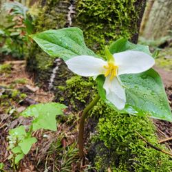
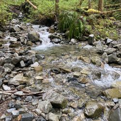
A fun plan B hike today, this one has been on my list since arriving in the PNW, but another always caught my interest first. Today, for example, planning to hike Rattlesnake Ridge on a off/un busy weekday (this one always crazy busy on weekends) but with the cloud cover, it wasn't worth it, much better to see in a sunny non smoky day... soon, for sure. Anyway... back to Little Si, much recommended by hiking coworkers as a great quick hike after work. It's definitely a good workout, being moderately uphill all the way, wrapping around the mountain, with a few zag zags to gain height without killing you. Lol very much like some of my favorite hikes in the redwoods and Big Sur. A few little distractions with a dare to rock climb.. nope! Looks a lot like a miniature El Capitain Yosemite! Fun and beautiful to look at, but we'll allow it to the more daredevils at heart. A little rainy today (big surprise!) definitely recommend poles, especially on the way down, slippery rocks n roots, take you time! Enjoy the views. It's beautiful after all the rain and snow, unlike my kick ass hike up Mount Si, in the fall. Definitely doing that one again.. soon. At the top, pretty cool views even with cloud cover and a little rain. Just me and a few 3 striped squirrels ( or one quick one?) he was definitely wanting a treat, but man! Was he quick.. zipping around! I finally caught his attention enough to toss a few healthy walnuts, if a squirrel can smile, I'll swear, that was one happy squirrel. Now! The best part of a climb up on the whole way up... it's all downhill going back. Enjoying the views and greenery, looking forward to trying Salmon berries soon. Grateful to see a few trilliums getting ready to bloom. The sound of a stream gurgling by in its way to the Snoqualmie River, always love the sound! It's a popular hiking trail, if the main parking lot fills, they have an overflow parking just down the road, you will need a discovery pass, which if you don't have, you can purchase at Ace Hardware in North Bend, not far away. This is definitely on my list of quick fun hikes as the daylight stays around longer through the summer. Loving nature! My doggy friends.. please pack it in, pack it out! Some things haven't changed from Cali, not cool to leave bags of pooch droppings, if you're not packing it out, it's better to kick it off the trail. NO ONE, wants to see bright bags of pooch poop. Just saying! Love dogs... all animals, in fact. Thanks to those who take responsibility for their four legged loved ones, much appreciated. Happy Hiking! SYOY! God bless and always..Cheers!

Such an awesome hike for a quick little getaway! There are two parking lots and the overflow lot has a nice little trail to the main lot, where the trailhead resides. FYI: Due to COVID19 the restrooms are not cleaned and stocked routinely. I was disappointed to see little baggies of dog droppings at the trailhead. Is it possible to have a trash can or recycle bin at the kiosk? At any rate, you can't take a bad picture on this trail. It's pretty crowded but majority of folks were maintain social distance requirements. Some folks wear masks and some don't. Highly recommend this hike for all skill levels!

Don't let the name fool you. "Little" Si trail is not so little. Nothing close to the difficulty of her big sister Mount Si trail but still a challenge. Little Si is 4.7 miles round trip and boasts a 1300 foot elevation gain. If you want to compare, Rattlesnake Ledge is 4 miles round trip with 1160 feet of elevation gain. Having forgot the above, I foolishly agreed to take an "easy" hike with a fit friend after a too-long hiking hiatus. I will admit there were a few "are we there yet" and "just give me a quick minute to catch my breath" moments during this last hike. I really could have used my hiking poles on the way down. Steeper than I remembered from my previous time on this trail. That being said, Little Si is a cool hike. So much beautiful green forest on a well-maintained trail with mossy beauty. And you get to watch rock climbers at one point. Pretty fun to watch if you're not squeamish. Parking here is a bit tough. There are two parking lots to support both Mount Si and Little Si. They will both be full by around 8am on the weekends. Plan accordingly and do not park on the roads or driveways. You will both get a ticket and anger others. You need a Discovery Pass to park here and unfortunately you can't buy a day pass in the parking lots. There is a Safeway store nearby where you can buy an annual pass if you need to.

Well, if I thought Little Si covered in Jurassic Park mists was breathtaking while staring at it from my backyard hot tub..being at its peak was a whole nother level my friends. We just love living in North Bend away from all the crazy traffic, with views only nature can craft, and our local wildlife like Rocket the raccoon who steals all the cat food off our porch. But the best perk is undoubtedly the trailheads all within a few minutes from our doorstep. A group of us from Yelp have been enjoying some local trails lately and this one was on the docket this weekend. Even shrouded in mists it boasted some breathtaking forest views with a nice gradual incline making this hike available to many different fitness levels. There are two parking lots that take the Discover Pass so make sure you pack yours or you can buy a day one with your smartphone. The 4.7 mile round trip hike gains 1200 feet in elevation for a total of 1550 feet at the peak. The trail winds through the beautiful green forest blanketed with moss, ferns, and mushrooms any fairy would be happy to perch upon. Some impressive moss covered rocks and fallen trees make for great photo ops and we noted a group climbing a rock wall for a bit more of a thrill. The view from the top for us was misty but we caught other glimpses from below the fog as we climbed that confirmed this hike gives stunning views of North Bend as well as the tranquil forest setting. Definitely worth your time and a perfect escape from our busy lives.

Date of visit: December 6, 2020 This hike was a good quick low-intermediate level trail. We arrived on a Sunday morning around 8:45 and there were 3 spaces left in the parking lot. Two parking lots that seem to fill up pretty fast so come early. Discover pass required for parking. Only 40 minutes from Seattle and you can hike to the top and back in two hours including time for pictures. Nice hike that has climbing walls along the way. It has a few strenuous areas especially at the beginning and near the end. Hikers were following social distancing. If you're looking to spend 2-3 hours in the nature give this a try. I saw rock climbers too. Absolutely gorgeous views from top. It's not the prettiest trail to walk on for PNW standards but views on top makes it worth the hike. The trailhead is well signed and easy to follow for the first mile. Then it gets a bit confusing because the rocks break up any semblance of a trail. Watch where people go or you may end up going slightly off trail. For the most part, it is easy to follow the trail as there is always someone in front of you, especially on the weekend when it can get really busy. I would recommend coming in the early morning or on a weekday to get parking. Can be crowded at peak times, travel in small groups if possible. Really recommend if you're not an avid hiker but wanna feel like one! Top were spectacular. Definitely will do this hike again in the future.


Probably one of my favorite hike only 30 mins away from Bellevue! This trail requires the discovery pass and the parking often fills up so be sure to arrive early like before 9 to get a spot! The trail is a steady uphill but only around 4 miles so it is a really good trail for beginner summit hikers! I really recommend bringing poles as it can help your knees for future hiking to come! I also love seeing people actually legit rock climbing as I walk along the trail and actually the first time I did this trail I got lost and ended up somewhere along the climbers route The top has around 3 different places to see a nice view! It can get crowded since it's a tight summit - not too much area to walk so keep that in mind. I suggest walking down to some rocks a little below the real summit and stopping there for some nice pictures and a snack! Can be accomplished around 3 hours round trip with some testing time at the top - a very cute 1/2 day hike year round!

I usually choose Rattlesnake to do sunrise hikes at, since it has such a beautiful lookout, but since Rattlesnake is closed, we decided to do Little Si for a sunrise hike instead! (Sunday) We started our hike up around 4:20am, and got up to the summit around 5:15am, so it took us about an hour with a few quick stops for water. Little Si is quite well maintained, so besides it being a rocky terrain, the hike up wasn't so bad, since the only thing we had to worry about was making sure our headlamps were lighting the path in front of us. Little Si is a typically busier trail, but since we hiked up to watch the sun rise, we were the only ones on the trail, and didn't see anyone else until we had already reached the summit for about 20 minutes or so. The view was so peaceful and amazing, and so worth waking up at 3 in the morning for! We started to head down the trail around 6:50am, and as we got closer to the trailhead, we were passing more and more people. Majority of people where wearing masks/face coverings, and everyone was courteous about letting each other pass in areas where the trail was more narrow. Don't forget that you need a Discover Pass if you plan on visiting Little Si, and I would recommend that you get there early so there aren't as many people during your hike.

Parking situation can get rough - on a Thursday afternoon at 5PM, the lot was packed. There is an overflow lot down the street with a direct path to walk over, which had a few parking spots left. I imagine it gets very busy on the weekend. Extremely basic bathroom at the bottom of the trailhead. Overall, a beautiful hike. The first quarter mile and last stretch are the steepest, but not too bad. A couple big steps needed. The middle area is gorgeous with shaded forestry. Beautiful view at the top. The hike does split midway through into the Little Si trail and Boulder Mountain, so make sure you're going left. We took about an hour 15 minutes going up at a decently leisurely rate and about 55 minutes coming down. read more


6 months ago
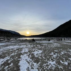
What a great New Year's Eve tradition. A hike with wonderful friends in with beautiful views! Approximately 6.1 miles round trip. The hike today was chill. With dogs a baby we stopped occasionally to check in on the furry friends. These stops allowed for a rest before heading up the steep section. The trail becomes very steep at the end. Nearly climbing straight up. But it is short and very doable. The wind picks up at the top. I recommend layers in the winter. The view at the top is just gorgeous. The parking lot at the trail head is small. Discovery pass needed. The bathroom is disgusting, FYI. If you rock climb there is a turn of for rock climbing. No thank you. Enjoy life and no regrets! Get outside as often as possible. Discovery Pass required. Also, a dog friendly trail for those who have fur babies. Do it. Get outside. SYOY read more


Beautiful short hike with lots of trees and greenery. A bit steep but it was worth the view! Was a bit scary at the top because I'm scared of heights but I was able to sit down and enjoy my snacks anyway. I would definitely recommend this hike for beginners who love a challenge! read more


2 years ago
This was for Little Si and Boulder gardens trail. Good number of people for a cool kinda rainy Sunday in November. Every single dog was off leash except one owner who had three. Props to the ONE person who followed the rules. The trail is pretty muddy and slippery during the scramble up lots of large rocks/boulders. Hiking poles were very handy in this section. The leaves are still turning colors which made it really pretty during the second part of the hike. It's anticlimactic at the end where you're just in the middle of the forest that connects to other trails but no lookout at the end. The nice lookout is a short distance from the trailhead. It's a pretty steady incline in a short distance. Nice to get out on a Sunday. Saw three sets of poop bags on the way down near the trailhead. If you bring your dog you should keep your poop bag with you and not set it down. read more


A popular and beautiful hike near the Seattle area! My husband and I came around 7:30am and both main and overflow lots were filled (it was also a beautiful Saturday with great weather so we weren't surprised) luckily if you go back over the bridge, there's a green sign that says parking where you can park along the fence. By the time we finished our hike around 10:30/11am it was totally packed in that area! The main lot has 2 bathrooms available to use before starting the hike. Bathrooms had toilet paper but it still is pretty gross. No hand soap or sink to wash hands so bring some hand sanitizer. We brought water and some snacks. The hike was mostly shaded but a hat did come in handy especially at the top of the hike where it's less shaded. Hike is moderate. Uphill to the top and downhill to the bottom. We brought walking sticks which came in handy on the way down for me since I have short legs. Definitely best if you wear hiking shoes and bring sunscreen. This hike is doggo friendly! Overall, it took us about 2 hours to finish and we really enjoyed the hike! read more


Little Si is a popular hike in the North Bend area located next to its larger neighbor Mount Si. It's only a 30 minutes from Seattle so it's a short drive if you want to get out of the city. I got here at 7:45am on a Friday morning and the parking lot was mostly empty. At the trailhead is a small parking lot with restrooms. If that parking lot is full, there is an overflow lot within walking distance. This hike is one of the few hikes that is supported by Trailhead Direct so you don't even need to drive here to take advantage of the hike. The hike was rocky to start with a good amount of incline. There was no one here which made for a very peaceful and quiet walk but I'm sure it gets very busy on the summer weekends. The hike was shaded from all the tall trees which helped so the sun was not beaming on me. The trail was clearly marked and was rocky with switchbacks near the top. I thought the view was pretty good with mountains and trees. It took about two hours total to go up and down and the roundtrip was 4.1 miles. When I got back to the trailhead at 9:30am the parking lot was full although the overflow lot was pretty much empty. Overall this hike was not super tough other than a couple of steep-ish inclines along the way and the views were good but not amazing. Given that Mount Si is tougher, that's a hike I'll tackle another day. read more


1 year ago
Little Si is a very popular moderate ~4mile hike that takes about ~2.5-3 hours depending on how fast you go. It's a fairly rocky hike that is mostly uphill so it's good to have some good hiking shoes, although it can probably be done in regular athletic shoes. It is also dog friendly! The trail is enclosed by lots of trees so it's a good hike to do in the rain because you don't get too wet. I always feel like I'm walking through Jurrasic Park because of all the big tree logs and mist. The trail is pretty easy to follow and there are distinct signs that guide you to the summit. There are also rocks for rock climbers and I am always so fascinated when I see them as I'm hiking. There are plenty of photo opportunities once you before and after you reach the summit! Because this is a very popular hike, I recommend getting here before 8 as parking is super limited. There is one main small parking lot that usually fills up by 730AM and an overflow parking lot right next to it. A Discover pass ($35/year) or day pass ($11.50) is needed to park and you have to purchase all of that online prior to hiking the trail. You unfortunately cannot park on the street. read more


I can't believe I haven't reviewed Little Si before! I've done it a few times over the years, and each time it's a great choice. Little Si is definitely one of the more popular trails in the area, so I definitely recommend arriving early. I got there at 8:30 and just barely got a spot. When I was coming down around 11, it was still super crazy packed. The bathrooms here are open (even during COVID) but they are NOT maintained regularly.... If you can, highly recommend just holding it. The hike itself is 3.7 miles roundtrip with an elevation gain of 1300 ft. The first half of the hike is really where the "hard" part of it is with the most incline. Once you get past that first half there's still SOME incline, but it's farther between and there's nice flat parts to catch you breath. Once you get to the top, there's two viewpoints. The first one is a smaller peak overlooking all the trees which is a great spot for photos and really gorgeous. The second peak is like a 2 minute walk off to the left with even better views. From start to finish (with taking a break at the top) it was about two and a half hours. Highly recommend whether you're a seasoned hiker or just getting started. Great views for not a crazy amount of work and it's a great way to get your day started. read more


A fun plan B hike today, this one has been on my list since arriving in the PNW, but another always caught my interest first. Today, for example, planning to hike Rattlesnake Ridge on a off/un busy weekday (this one always crazy busy on weekends) but with the cloud cover, it wasn't worth it, much better to see in a sunny non smoky day... soon, for sure. Anyway... back to Little Si, much recommended by hiking coworkers as a great quick hike after work. It's definitely a good workout, being moderately uphill all the way, wrapping around the mountain, with a few zag zags to gain height without killing you. Lol very much like some of my favorite hikes in the redwoods and Big Sur. A few little distractions with a dare to rock climb.. nope! Looks a lot like a miniature El Capitain Yosemite! Fun and beautiful to look at, but we'll allow it to the more daredevils at heart. A little rainy today (big surprise!) definitely recommend poles, especially on the way down, slippery rocks n roots, take you time! Enjoy the views. It's beautiful after all the rain and snow, unlike my kick ass hike up Mount Si, in the fall. Definitely doing that one again.. soon. At the top, pretty cool views even with cloud cover and a little rain. Just me and a few 3 striped squirrels ( or one quick one?) he was definitely wanting a treat, but man! Was he quick.. zipping around! I finally caught his attention enough to toss a few healthy walnuts, if a squirrel can smile, I'll swear, that was one happy squirrel. Now! The best part of a climb up on the whole way up... it's all downhill going back. Enjoying the views and greenery, looking forward to trying Salmon berries soon. Grateful to see a few trilliums getting ready to bloom. The sound of a stream gurgling by in its way to the Snoqualmie River, always love the sound! It's a popular hiking trail, if the main parking lot fills, they have an overflow parking just down the road, you will need a discovery pass, which if you don't have, you can purchase at Ace Hardware in North Bend, not far away. This is definitely on my list of quick fun hikes as the daylight stays around longer through the summer. Loving nature! My doggy friends.. please pack it in, pack it out! Some things haven't changed from Cali, not cool to leave bags of pooch droppings, if you're not packing it out, it's better to kick it off the trail. NO ONE, wants to see bright bags of pooch poop. Just saying! Love dogs... all animals, in fact. Thanks to those who take responsibility for their four legged loved ones, much appreciated. Happy Hiking! SYOY! God bless and always..Cheers! read more


6 years ago
Such an awesome hike for a quick little getaway! There are two parking lots and the overflow lot has a nice little trail to the main lot, where the trailhead resides. FYI: Due to COVID19 the restrooms are not cleaned and stocked routinely. I was disappointed to see little baggies of dog droppings at the trailhead. Is it possible to have a trash can or recycle bin at the kiosk? At any rate, you can't take a bad picture on this trail. It's pretty crowded but majority of folks were maintain social distance requirements. Some folks wear masks and some don't. Highly recommend this hike for all skill levels! read more


Don't let the name fool you. "Little" Si trail is not so little. Nothing close to the difficulty of her big sister Mount Si trail but still a challenge. Little Si is 4.7 miles round trip and boasts a 1300 foot elevation gain. If you want to compare, Rattlesnake Ledge is 4 miles round trip with 1160 feet of elevation gain. Having forgot the above, I foolishly agreed to take an "easy" hike with a fit friend after a too-long hiking hiatus. I will admit there were a few "are we there yet" and "just give me a quick minute to catch my breath" moments during this last hike. I really could have used my hiking poles on the way down. Steeper than I remembered from my previous time on this trail. That being said, Little Si is a cool hike. So much beautiful green forest on a well-maintained trail with mossy beauty. And you get to watch rock climbers at one point. Pretty fun to watch if you're not squeamish. Parking here is a bit tough. There are two parking lots to support both Mount Si and Little Si. They will both be full by around 8am on the weekends. Plan accordingly and do not park on the roads or driveways. You will both get a ticket and anger others. You need a Discovery Pass to park here and unfortunately you can't buy a day pass in the parking lots. There is a Safeway store nearby where you can buy an annual pass if you need to. read more


7 years ago
Well, if I thought Little Si covered in Jurassic Park mists was breathtaking while staring at it from my backyard hot tub..being at its peak was a whole nother level my friends. We just love living in North Bend away from all the crazy traffic, with views only nature can craft, and our local wildlife like Rocket the raccoon who steals all the cat food off our porch. But the best perk is undoubtedly the trailheads all within a few minutes from our doorstep. A group of us from Yelp have been enjoying some local trails lately and this one was on the docket this weekend. Even shrouded in mists it boasted some breathtaking forest views with a nice gradual incline making this hike available to many different fitness levels. There are two parking lots that take the Discover Pass so make sure you pack yours or you can buy a day one with your smartphone. The 4.7 mile round trip hike gains 1200 feet in elevation for a total of 1550 feet at the peak. The trail winds through the beautiful green forest blanketed with moss, ferns, and mushrooms any fairy would be happy to perch upon. Some impressive moss covered rocks and fallen trees make for great photo ops and we noted a group climbing a rock wall for a bit more of a thrill. The view from the top for us was misty but we caught other glimpses from below the fog as we climbed that confirmed this hike gives stunning views of North Bend as well as the tranquil forest setting. Definitely worth your time and a perfect escape from our busy lives. read more


6 years ago
Date of visit: December 6, 2020 This hike was a good quick low-intermediate level trail. We arrived on a Sunday morning around 8:45 and there were 3 spaces left in the parking lot. Two parking lots that seem to fill up pretty fast so come early. Discover pass required for parking. Only 40 minutes from Seattle and you can hike to the top and back in two hours including time for pictures. Nice hike that has climbing walls along the way. It has a few strenuous areas especially at the beginning and near the end. Hikers were following social distancing. If you're looking to spend 2-3 hours in the nature give this a try. I saw rock climbers too. Absolutely gorgeous views from top. It's not the prettiest trail to walk on for PNW standards but views on top makes it worth the hike. The trailhead is well signed and easy to follow for the first mile. Then it gets a bit confusing because the rocks break up any semblance of a trail. Watch where people go or you may end up going slightly off trail. For the most part, it is easy to follow the trail as there is always someone in front of you, especially on the weekend when it can get really busy. I would recommend coming in the early morning or on a weekday to get parking. Can be crowded at peak times, travel in small groups if possible. Really recommend if you're not an avid hiker but wanna feel like one! Top were spectacular. Definitely will do this hike again in the future. read more


Probably one of my favorite hike only 30 mins away from Bellevue! This trail requires the discovery pass and the parking often fills up so be sure to arrive early like before 9 to get a spot! The trail is a steady uphill but only around 4 miles so it is a really good trail for beginner summit hikers! I really recommend bringing poles as it can help your knees for future hiking to come! I also love seeing people actually legit rock climbing as I walk along the trail and actually the first time I did this trail I got lost and ended up somewhere along the climbers route The top has around 3 different places to see a nice view! It can get crowded since it's a tight summit - not too much area to walk so keep that in mind. I suggest walking down to some rocks a little below the real summit and stopping there for some nice pictures and a snack! Can be accomplished around 3 hours round trip with some testing time at the top - a very cute 1/2 day hike year round! read more


I usually choose Rattlesnake to do sunrise hikes at, since it has such a beautiful lookout, but since Rattlesnake is closed, we decided to do Little Si for a sunrise hike instead! (Sunday) We started our hike up around 4:20am, and got up to the summit around 5:15am, so it took us about an hour with a few quick stops for water. Little Si is quite well maintained, so besides it being a rocky terrain, the hike up wasn't so bad, since the only thing we had to worry about was making sure our headlamps were lighting the path in front of us. Little Si is a typically busier trail, but since we hiked up to watch the sun rise, we were the only ones on the trail, and didn't see anyone else until we had already reached the summit for about 20 minutes or so. The view was so peaceful and amazing, and so worth waking up at 3 in the morning for! We started to head down the trail around 6:50am, and as we got closer to the trailhead, we were passing more and more people. Majority of people where wearing masks/face coverings, and everyone was courteous about letting each other pass in areas where the trail was more narrow. Don't forget that you need a Discover Pass if you plan on visiting Little Si, and I would recommend that you get there early so there aren't as many people during your hike. read more


4 years ago
6 years ago
4 years ago
Did the Little Si trail including the Boulder garden trail which adds another 1.4 miles and 880 feet of elevation gain. The Boulder garden detour is ugly and not worth it unless you want to make the relatively easy little si hike a bit more difficult. There's a lot of slush and it is muddy as well, but overall a nice hike with good views at the top. read more


7 years ago
Since we couldn't make the Elite Event here this month, we decided to take a trip ourselves! It's about 30 mins from downtown Bellevue. The hike itself was exactly 2.5 hours up and back. I workout 5 times a week and still thought it was a nice little workout, even though it's listed as moderately easy. It was flat at a lot of parts, but also very incline heavy at other parts. The trail wasn't too empty, but also not too busy. There were gorgeous views both at the very beginning and end of the hike. The trees were so beautiful during this time (early October) and it was still warm enough that we weren't freezing. I'd highly recommend this for anyone looking for an easy or short hike! read more


Hiked Sat 2/27/16 Hiked 6 miles out and back Drove out here on a dreary Saturday morning to hike Lil Si. We thought there'd be a machine to buy a parking pass, but there was not. We drove back towards town and were able to pick up a pass at the first gas station we saw. They are $5 for the day passes, or $35 for the annual one. We ended parking in the overflow lot even though it was not 9 am yet. The hike was beautiful! Some say the trail isn't well marked, but I thought it was pretty easy to follow. There's a couple of lookout spots on the way up. The day we went it was super cloudy, so we didn't see much of a view, but it was still a pretty hike. I love how it's less than an hour outside of Seattle! read more


This hike was perfect. I would say it's for a moderate to advanced hiker. It actually might be just a bit too easy for an advanced hiker though. We got there around 10 on a Sunday and the primary lot was full but there was plenty of parking in the secondary lot. We clipped out Discovery Pass on the mirror, got my friend's dog out, filled up our water bottles and headed out. As many have mentioned, it's moderately steep getting up the first half mile or so. It's pretty rocky too. One thing I noticed is that the trail isn't really marked in many areas. Obviously the point is to just keep going up, but there are several sections that split off and make you think that there is another trail you should be going on. If you get into any areas that look like the foliage is growing pretty heavily or it looks like a rockslide area, then you're probably going the wrong way. Stay in the areas where it looks like feet have trampled the ground and formed a trail. There were several people on the trail that asked us if they were going the right way. While we were helpful, I would say, don't depend on other hikers to let you know which is the right way as they might be just as lost as you are. Plan your trail out. There are several lookout points along the way for you to take breaks and see the beautiful surroundings. I would say that this is a one water bottle trail depending on how hot it is. Wear appropriate shoes since I saw people walking in sandals and flip flops which probably is inappropriate for a 5-6 mile hike on uneven terrain. The trail does even out for about 1-1.5miles and then it's slightly uphill again until you reach the top. There were a lot of people just chilling at the top when we got up there and some people even just sat right in front of an area that many people were trying to get pictures on but at least they were in the shade I guess. All the other dogs, leashed and unleashed, as well as the other hikers were friendly and it seemed as though everyone respected the trail and the environment. I applaud the parents that were toting their kids up there in the kid backpacks or the baby slings. I feel like uneven steep trails like this are tricky when carrying kids and extra weight or even keeping track of little ones who dare to actually walk the trail, but to each their own. There was a black bear in the parking lot area as we were exiting the trail so be aware that there can be wildlife and what to do in the event of an emergency. I'll definitely be hiking this again, or taking on Mt Si or Rattlesnake Ridge or Mailbox. read more


Like many other reviewers have stated, Little Si is the perfect hike to start your hiking season. The trail is about 4.4 miles roundtrip and there are cool views along the way. What stood out to me the most were the rock climbers, random streams, cool shady trees and the "summit." This trail is very popular on the weekends so don't expect a quiet and peaceful sanctuary once you get up to the top. They don't allow groups of more than 12 and we were just under that number. Our group was kind of busy and I felt bad but then again, they set that limit for a reason and other hikers have to be wary of that fact going up. There are rocks for hikers to sit and rest on at the top, most people bring sandiwches and snacks to nom on while they take in the great views of Mt. Si and the rest of North Bend. Parking can be tricky so my recommendation is to come early (around 8-10am) and don't forget your Discover Pass! read more


7 years ago
I don't know how beautiful the view is when the weather is clear, We ran this in the rain and it was really awesome hike with friends today. It was soggy yet still breathtaking when we reached to the top, we missed the view in clouds/mist, and it's OK, because we are coming back for more hikes. I have a feeling I will still like the rainy hike the best. It's refreshing, and greener. Can't wait to do it again. read more


8 years ago
Let's start with the parking. You need to have a discover pass to park at the trailhead. There's a small parking lot and an overflow parking lot about 100 yards away. We got there on a Sunday at 9am and had to use the overflow lot. This is a great short (4ish miles round trip) hike about 45 mins from Seattle or 25 from the east side. The elevation gain is about 1300 feet in two miles, but it doesn't feel like you're constantly climbing. The trail is manicured pretty well, with rocks in spurts. You could do this hike with regular running shoes, but I'd recommend hiking shoes because of the rocks. Along the hike there's not many open areas for resting, but it's a short hike. Expect the trail to get crowed after 11am, if you want to beat the crowds you'll want to get there before 10am. The trail mostly covered and in the shade, until you get to the top of Little Si. I'd bring sunblock if you're going later in the day. You'll see plenty of dogs on this trail, we took our shiba inu and she had no problem. She would have sprinted up the hike if it wasn't for us holding her back. read more

4 years ago
Don't be fooled by "Little!" Only 5 miles round trip, but the elevation gain is 1200 ft. Can someone tell me why it's LITTLE!? Little Si is just before the Mt. Si trail. I didn't think Mt. Si was that hard when I hiked last year, just longer trail. Therefore, I suggested to hike Little Si as a warm up for the hike season to start with my friends. 4 human and 2 dogs went hiking here. It took us approximately 2 hours. The trail is quite muddy. It's mixed with mud, small rocks, big rocks, HUGH rocks, and branches poking out of the ground. I have to say it's very rough! But, hey, we made it and enjoyed the great view from the top and made it back to where we parked! Since this is a rough trail, I recommend wearing those high boots to ankle . My girlfriend twisted her ankle on the way down. read more


My gal pals and I headed up around 5:45 pm yesterday for our Tuesday night hike. Though the hike is only 5 miles round trip, there is some elevation gain. Not as bad as some other trails I've hiked but it's definitely not flat like some folks might tell you. The trail itself is a nice trail. Very green and tons of moss. I'm not usually a fan of moss but I like it in the trails. As you walk further into the trail you'll see or hear rock climbers which I thought was pretty cool. The view up top is OK. Nothing fancy. Take in the view, embrace mother nature and smell the fresh air. We're lucky we're not in LA where you'r sniffing smog instead. If you're a trail runner, Little Si is your place! P.S. Little Si requires a Discovery Pass so don't forget your pass or buy your pass before you head out. read more


18 years ago
A quick hike through nice wooded areas and then on top a view of part of the town. It is windy atop and it takes a less than an hour to get up there to over an hour, obviously depending on your cunning to ward off the giants and trolls, just joshing there are only giant trolls. Fun foe a Sunday hike with friends because most of the trail you can walk side by side and chit chat on daily events of growing carrots or how to pick out the perfect gift for the mail woman who is always chucking envelopes at you! To get there: I-90 east bound (no bondage involved if that is what you were thinking) take exit 3, North Bend, and proceed north on Bendigo Blvd.S. In less than a mile, turn right on E North Bend Way and proceed a little more than 1 mile to Mount Si road and turn left. Just after crossing the river and round the bend (no this is not a musical in the making) look for the new trailhead parking area. Little Si. Parking is free but hard to come by so good luck! There are facilities at the trailhead, again no indoor plumbing, so bring your hand sanitizer! read more


7 years ago
The parking is limited and the discovery pass is required. The trail is moderate, but kids (5+) friendly as well. Besides peaceful views, you'll also find the brave rock climbers on the cliffs. read more


What can I say, another great hike in North Bend. See, I really like Little Si and here's why... You get your elevation gain at the very beginning and then again at the end. The beginning isn't so bad - just when you get the blood pumping and your body ready to work, the hard part is over and you're in for a killer nature walk. About half way to the summit you come to a giant rock wall on your left hand side. If you're lucky and the weather is right, you'll see people climbing this rock wall which is really fun to watch. You then continue to meander through the woods feeling a little like Katniss from the Hunger Games. I mean, this trail is green and mossy and rocky and all things you love about the PNW. See- you're having such a great time figuring out how you would escape the tracker jackers, that you hardly notice the elevation gain is picking back up again about ¾ of a mile from the top. You think, okay, maybe this is just for this little piece of the trail. Nope. It's the rest of the way. I mean, this last part is no joke. You're stepping over rocks and tree roots all while working your way to the top. The view at the top while nice, isn't the best in town (Rattlesnake in my opinion). Pros: trees / greenery / mossy/ feeling like Katniss from HG / rock climbers Cons: not the bombest view in town / if you want a SUPER strenuous workout, this isn't the trail for you Also - important to note - you need a discover pass to park in the lot. Additionally, it's pretty covered for the majority of the trail so you may want to bring a headlamp if you're going to be hiking at night. read more

Getting back into hiking again is really quite fun, and difficult at the same time. Little si is definitely a good hike to start your hiking kick back into gear. Before you get to the top, there is a side drop off on the left side that is awesome!! it's scary and beautiful at the same time. It's a must go, and then the next hike is big si!!! :) read more


9 years ago
Great for a quick hike! You can get up this trail in under an hour when you're moving (3.3 miles RT). Great views at the end. A little rocky toward the beginning and a little muddy throughout but an overall basic hike, no gear needed here. Also if main lit is full there's lots of signs for overflow lot just down the road that you drove in on. Oh and you need a Discover Pass. read more

17 years ago
I'm reviewing a mountain, apparently. And that's good-- this was a good mountain. My first mountain. Can it really be called a mountain? Little Si kicked my ass. I mean really. I got sweaty and dirty and tan doing this thing. This was the most exercise I've ever done, I think. When I got to the top, a nice lady looked at me and probably saw how beat I was (I saw her and her friend earlier-- they passed my while power walking up the thing) and said "YOU MADE IT!" and it felt GOOD. I mean GOOOD. With three o's. The views were gorgeous and I fed peanuts to a ballsy squirrel who snatched them from my hand. It ruled. Hooray nice lady and hooray Little Si. I want to do it again. Then maybe I'll try the other one. read more

Page 1 of 3
More info about Little Si
North Bend, WA 98045
Directions
Visit Website
http://www.wta.org/go-hiking/hikes/little-si
Hours
Indoor Amenities
Outdoor Amenities
Little Si Reviews in Other Languages
Ask the Community - Little Si
Review Highlights - Little Si
You might also consider


Why does Yelp recommend reviews?
1 review that is not currently recommended
The reviews below are not factored into the business's overall star rating.
1 year ago
Little Si - hiking - Updated July 2026
Best of North Bend
People found Little Si by searching for…
Hiking Trails With Waterfalls in North Bend, Washington
Things to Do in North Bend, Washington
Rock Climbing in North Bend, Washington
Places to Take Pictures in North Bend, Washington
Scenic View in North Bend, Washington
Scenic Drive in North Bend, Washington
Stairs Workout in North Bend, Washington
Sunset View in North Bend, Washington
Easy Hikes in North Bend, Washington
Scenic Spots in North Bend, Washington
Photo Spots in North Bend, Washington
Parks in North Bend, Washington
Picnic Areas in North Bend, Washington
Things to Do on a Rainy Day in North Bend, Washington
Sunrise View in North Bend, Washington
Sunrise Hike in North Bend, Washington
Lookout Points in North Bend, Washington
Caves in North Bend, Washington
Hiking With Kids in North Bend, Washington
Playgrounds in North Bend, Washington
Star Gazing in North Bend, Washington
Watch Sunset in North Bend, Washington
Trending Searches in North Bend, WA
4th Of July Fireworks near Little Si
Black Owned Nail Salons near Little Si
Dog Friendly Trails near Little Si
Outdoor Activities near Little Si
Parks For Picnics near Little Si
Places To Walk Around near Little Si
Scenic Night View near Little Si
Scenic Overlook near Little Si
Browse Articles
Browse Nearby
BEST of North Bend, Washington Restaurants near Little Si
BEST of North Bend, Washington Coffee near Little Si
BEST of North Bend, Washington Walking Trails near Little Si
BEST of North Bend, Washington Things to Do near Little Si
BEST of North Bend, Washington Breakfast near Little Si
BEST of North Bend, Washington Parks near Little Si
BEST of North Bend, Washington Campgrounds near Little Si
Browse Brands
Related Searches in North Bend, WA
Affordable Kayak Rental Services in North Bend, Washington
Best Fishing Locations and Guides in North Bend, Washington
Best Nature Trails for Hiking in North Bend, Washington
Best Places for Horseback Riding in North Bend, Washington
Check Out Off Road Trails in North Bend, Washington
Discover Dog Friendly Trails to Explore in North Bend, Washington
Discover Scenic Mountain Bike Trails Near North Bend, Washington
Discover Scenic Waterfall Spots in North Bend, Washington
Discover Top Nature Parks to Visit in North Bend, Washington
Discover Walking Parks in North Bend, Washington Near You
Discover a Hiking Trail in North Bend, Washington
Discover the Best Night Hike Trails in North Bend, Washington
Dog-Friendly Hikes With Dogs in North Bend, Washington
Enjoy Camping Adventures Around North Bend, Washington
Enjoy Exciting Mountain Biking Adventures in North Bend, Washington
Enjoy Kayaking Adventures in North Bend, Washington
Enjoy Tent Camping Spots Around North Bend, Washington
Enjoy a Beautiful Waterfall Hike in North Bend, Washington
Enjoy the Best Picnic Spots and Ideas in North Bend, Washington
Enjoy the Best Walking Path in North Bend, Washington
Enjoy the Best Walking Trails in North Bend, Washington
Experience Thrilling White Water Rafting in North Bend, Washington
Explore Beautiful Parks and Green Spaces in North Bend, Washington
Explore Easy Hikes Perfect for All in North Bend, Washington
Explore Fun Activities to Do in North Bend, Washington
Explore Popular Campgrounds Near North Bend, Washington
Explore the Best Beach Spots in North Bend, Washington
Explore the Best Swimming Holes Around North Bend, Washington
Explore the Best Trail Options in North Bend, Washington
Family Friendly Hiking With Kids in North Bend, Washington
Find Beautiful Views in North Bend, Washington
Find Popular Ziplining Spots Around North Bend, Washington
Find the Best Parks for Picnics in North Bend, Washington
Find the Best Scenic View Locations in North Bend, Washington
Great Places to Walk in North Bend, Washington
Hike the Popular Waterfall Trail in North Bend, Washington
Hiking Trails With Waterfalls in North Bend, Washington
Off Leash Dog Hiking Trails in North Bend, Washington
Plan a Scenic Drive Route Near North Bend, Washington
Popular Outdoor Activities to Try in North Bend, Washington
Popular Picnic Spots to Visit in North Bend, Washington
Safe River Swimming Areas in North Bend, Washington
Safe and Fun Parks for Kids in North Bend, Washington
Top Climbing Spots and Gyms in North Bend, Washington
Top Paddleboarding Activities in North Bend, Washington
Top Running Trails to Explore in North Bend, Washington
Top Swimming Lakes to Enjoy in North Bend, Washington
Top Swimming Spots and Pools in North Bend, Washington
Walk Dog Friendly Hiking Trails in North Bend, Washington
Walk the Best Paved Walking Trails in North Bend, Washington