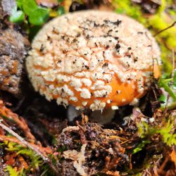
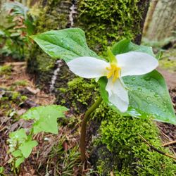
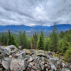
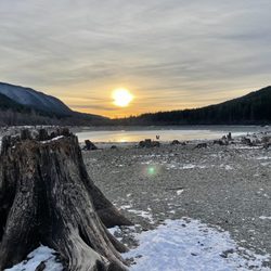
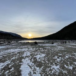
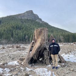
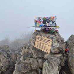
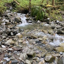
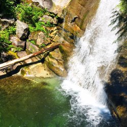
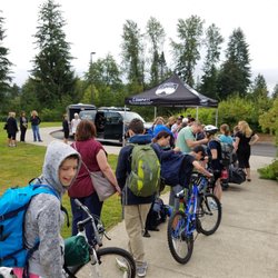
Granite Mountain Photos


You might also consider
More like Granite Mountain
Recommended Reviews - Granite Mountain
Start your review...

Reviews With Photos

Amazing trail ! It is not extremely difficult but it is long (10 miles ) so make sure you're mentally and physically prepared for that. You start out hiking through a Forrest but eventually you're just hiking in the open so make sure to have a hat, sunscreen and sunglasses. I came on a gorgeous early fall day and the leaves changing colors were spectacular. I'm sure it looks just as good in the spring with plenty of flowers. I would suggest trying to go on a clear day so you can see all the different peaks when you reach the top. I will definitely do this trail many many more times.

I came here in summer with my girlfriends. However, due to the time constraint, we had to head back before we reached to the top which was about 1 miles away (steep). Therefore, we didn't make it. Autumn is just around the corner and summer is staying late! I decided to return. I would love to do this hike with my girlfriends again. However, they were all out of town with their honeys. By being a single woman, I don't really have much, but I have a lot of time and absolutely enjoy outdoors. The trailhead is easy to find. It's off I-90 East Exit 47, turn left, over I-90, and turn left again, then, you are there! Be aware, the bathroom by the trailhead does not have a lock. I walked in when someone was using. And, someone walked in when I was using! It's kind funny! The Roundtrip is about 8.0 miles, the Elevation Gain is 3800 ft and the Highest Point is 5629 ft (http://www.wta.org/go-hiking/seasonal-hikes/hikes/granite-mountain-1). The distant of the hike is just like Mount Si. But, Granite Mountain is so much better! When I was there, I thought it was pretty difficult hike. It's all uphills to the lookout and all the way downhill back. When you go up, you use a lot of your leg muscles. When you go down, it puts a lot of pressure on your knees. Regardless, it's worthy it! From the lookout where I sat, I can see Mountain Rainier covered in snow on the top. If you walk around (cautiously), the 360 degree view would show you other mountains you may know of. I didn't think I would be sore when I finished my hike. But, this morning, I felt it, mostly, my butt! This mountain really worked me! After this hike, I even came up with this ridiculous idea. If a man I am dating can not finish this hike, he is OUT! This mountain has so much to offer. I saw so many people turned back due to the difficulties. It's a shame!
Roundtrip: 8.0 miles Elevation Gain: 3800 ft Highest Point: 5629 ft Difficulty: Moderate to strenuous in the summer, experts only in the winter. "Oh! I have slipped the surly bonds of Earth, and danced the skies on laughter-silvered wings;" John Gillespie Magee, Jr Seriously give this hike a try. I wish I could relive every moment of this hike again and again. The trail head had some people at it but I wouldn't go so far as to say it was crowded. After a slow mile meander up through a soft warm forest the trail forks. Go to the right for Granite Mountain. The trail does get a bit harder for the next mile. Then at about mile 2 it turns into an actual hike. It's never tortuous but I wouldn't take chain smoking out of shape friend up. After you break the tree line, depending on the time of year, you'll see blueberry fields and wild flowers. As picturesque and beautiful as you imagine it being; it's better. In the winter to early summer this can be an avalanche zone so BE CAREFULL! I've only hiked it in late summer. I might give it a go in winter but in snow shoes it'd be one hard core workout. After saying hello to deer friends and eating some blueberries you'll crest the ridge and some how end up in Narnia/Lord of the Rings. It's not only flat but there are alpine ponds, green grasses, shaded valleys, and trees and oh-my-god just go there in late summer! I felt like I was Jodie foster in Contact saying, "Poets... they should have sent poets." I would suggest taking a little break here, maybe on one of the giant flat rocks warmed by the sun. Eventually though Narnia will end and a steep hike will begin. This is the last push to the summit. It's pretty much a half mile stair climb up. If you've made it to this it's only a little bit longer. Once you reach the mountain top it's a 360 degrees view of... seriously just go. Don't forget to bring some tissue for your tears of joy. I'd pack three-four liters of water and food. I wore trail running shoes and was ok, but if I did it again I would wear real hiking boots. Also keep in mind that due to elevation change you might be warm and the bottom and freezing at the top.


7 years ago
A strenuous hike for real! It took us 8.5 hours total (lunch break, lots of small breaks to catch my breath and berry picking breaks) to get to the tower and get back down to the car. We climbed up and down those boulders thinking it was a short cut but I dont think it helped to shorten up anything. We got there at 10:15am and the small parking lot was filled so we drove outside to park along the road. Even though it was not in the parking lot but you still need to pay the $5/car fee to hike that trail. It took us 5.5 hours to get up to the tower which included lunch break and many breaks along the way. Sitting up there to enjoy the view for a while so it most likely took abt 2 hours to get back to the parking lot from the tower without stopping. (We stopped for 20 minutes to pick berries on the way down). Sooooooo much berries. It's an endless field of huckleberries and blueberries. You can pick for days and still no where done. Keep your empy bottle water to contain the berries on your way down. Make sure you have walking sticks/pole(s). It helps tremendously going up or down. read more


Great hike only an hour away from downtown Seattle and right off I-90, but be prepared to spend 2 and a half hours doing the stair master. Well worth it in the end as the 360* views of the PNW, including Mt Rainier, Mt Adams, Glacier Peak and more make it well worth the strenuous efforts up the trail. We lucked out with a bluebird day: sunny and 75. This hike is definitely on the harder side with 3500+ elevation gain in 4 miles and seemed to get harder the higher you go. Some people liked to make it harder for themselves at the end by climbing directly up the rocks, but I'd recommend sticking to the trail. You'll spend the first hour switchbacking within the tree line, then spend the next hour and a half watching Mt Rainier slowly grow over the near mountains. Enjoy some fresh blueberries along the way! You do need the NW forest pass to park in the lot, or you can pay a $5 daily fee, which they do have available in the parking lot. The lot apparently gets crowded on the weekend, but was fairly empty during the week. I don't believe you're allowed to hike with your dog off the leash, but since everyone's dog is "super friendly and well trained", people tend to do it anyway. read more


Amazing trail ! It is not extremely difficult but it is long (10 miles ) so make sure you're mentally and physically prepared for that. You start out hiking through a Forrest but eventually you're just hiking in the open so make sure to have a hat, sunscreen and sunglasses. I came on a gorgeous early fall day and the leaves changing colors were spectacular. I'm sure it looks just as good in the spring with plenty of flowers. I would suggest trying to go on a clear day so you can see all the different peaks when you reach the top. I will definitely do this trail many many more times. read more


I came here in summer with my girlfriends. However, due to the time constraint, we had to head back before we reached to the top which was about 1 miles away (steep). Therefore, we didn't make it. Autumn is just around the corner and summer is staying late! I decided to return. I would love to do this hike with my girlfriends again. However, they were all out of town with their honeys. By being a single woman, I don't really have much, but I have a lot of time and absolutely enjoy outdoors. The trailhead is easy to find. It's off I-90 East Exit 47, turn left, over I-90, and turn left again, then, you are there! Be aware, the bathroom by the trailhead does not have a lock. I walked in when someone was using. And, someone walked in when I was using! It's kind funny! The Roundtrip is about 8.0 miles, the Elevation Gain is 3800 ft and the Highest Point is 5629 ft (http://www.wta.org/go-hiking/seasonal-hikes/hikes/granite-mountain-1). The distant of the hike is just like Mount Si. But, Granite Mountain is so much better! When I was there, I thought it was pretty difficult hike. It's all uphills to the lookout and all the way downhill back. When you go up, you use a lot of your leg muscles. When you go down, it puts a lot of pressure on your knees. Regardless, it's worthy it! From the lookout where I sat, I can see Mountain Rainier covered in snow on the top. If you walk around (cautiously), the 360 degree view would show you other mountains you may know of. I didn't think I would be sore when I finished my hike. But, this morning, I felt it, mostly, my butt! This mountain really worked me! After this hike, I even came up with this ridiculous idea. If a man I am dating can not finish this hike, he is OUT! This mountain has so much to offer. I saw so many people turned back due to the difficulties. It's a shame! read more

15 years ago
Roundtrip: 8.0 miles Elevation Gain: 3800 ft Highest Point: 5629 ft Difficulty: Moderate to strenuous in the summer, experts only in the winter. "Oh! I have slipped the surly bonds of Earth, and danced the skies on laughter-silvered wings;" John Gillespie Magee, Jr Seriously give this hike a try. I wish I could relive every moment of this hike again and again. The trail head had some people at it but I wouldn't go so far as to say it was crowded. After a slow mile meander up through a soft warm forest the trail forks. Go to the right for Granite Mountain. The trail does get a bit harder for the next mile. Then at about mile 2 it turns into an actual hike. It's never tortuous but I wouldn't take chain smoking out of shape friend up. After you break the tree line, depending on the time of year, you'll see blueberry fields and wild flowers. As picturesque and beautiful as you imagine it being; it's better. In the winter to early summer this can be an avalanche zone so BE CAREFULL! I've only hiked it in late summer. I might give it a go in winter but in snow shoes it'd be one hard core workout. After saying hello to deer friends and eating some blueberries you'll crest the ridge and some how end up in Narnia/Lord of the Rings. It's not only flat but there are alpine ponds, green grasses, shaded valleys, and trees and oh-my-god just go there in late summer! I felt like I was Jodie foster in Contact saying, "Poets... they should have sent poets." I would suggest taking a little break here, maybe on one of the giant flat rocks warmed by the sun. Eventually though Narnia will end and a steep hike will begin. This is the last push to the summit. It's pretty much a half mile stair climb up. If you've made it to this it's only a little bit longer. Once you reach the mountain top it's a 360 degrees view of... seriously just go. Don't forget to bring some tissue for your tears of joy. I'd pack three-four liters of water and food. I wore trail running shoes and was ok, but if I did it again I would wear real hiking boots. Also keep in mind that due to elevation change you might be warm and the bottom and freezing at the top. read more


10 years ago
Fantastic hike but those with a dog beware the last portion to the top (lookout) is NOT for dogs! Not sure why some sites don't specify this. It is extremely difficult for dogs, or at least larger dogs you can't carry, to get up and over the boulders. Took our hiking savvy husky and she was not having it..it's pretty difficult for humans too. Great hike and fantastic views! Parking gets tight by 9 am on nice days. read more

10 years ago
More info about Granite Mountain
Ask the Community - Granite Mountain
Review Highlights - Granite Mountain
You might also consider


Granite Mountain - hiking - Updated July 2026
Best of North Bend
People found Granite Mountain by searching for…
Things to Do in North Bend, WA
Places to Take Pictures in North Bend, WA
Watch Sunset in North Bend, WA
Stairs Workout in North Bend, WA
Hiking Trails With Waterfalls in North Bend, WA
Flower Fields in North Bend, WA
Stair Climbing in North Bend, WA
Scenic Spots in North Bend, WA
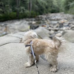
Dog Friendly Hiking Trails in North Bend, WA
Lookout Points in North Bend, WA
Off Road Trails in North Bend, WA
Sunrise View in North Bend, WA
Picnic Areas in North Bend, WA
Off Leash Dog Hikes in North Bend, WA
Hiking With Kids in North Bend, WA
Running Stairs in North Bend, WA
Trending Searches in North Bend, WA
Black Owned Nail Salons near Granite Mountain
Blueberry Picking near Granite Mountain
Boat Rental near Granite Mountain
Cliff Jumping near Granite Mountain
Day Trips near Granite Mountain
Dog Swimming near Granite Mountain
Jet Ski Rental near Granite Mountain
Kayak Rental near Granite Mountain
Lakes & Ponds near Granite Mountain
Off Road Trails near Granite Mountain
Outdoor Activities near Granite Mountain
Picnic Spots near Granite Mountain
Places To Walk Around near Granite Mountain
Public Pools near Granite Mountain
Public Shower near Granite Mountain
River Swimming near Granite Mountain
River Tubing near Granite Mountain
Rock Quarry near Granite Mountain
Running Trails near Granite Mountain
Scenic Night View near Granite Mountain
Scenic Overlook near Granite Mountain
Soccer Store near Granite Mountain
Splash Pad near Granite Mountain
Sunrise View near Granite Mountain
Swimming Holes near Granite Mountain
Swimming Lakes near Granite Mountain
Watch Sunset near Granite Mountain
Browse Articles
Browse Nearby
Browse Brands
Related Searches in North Bend, WA
Affordable Kayak Rental Services in North Bend, Washington
Best Fishing Locations and Guides in North Bend, Washington
Best Nature Trails for Hiking in North Bend, Washington
Best Places for Horseback Riding in North Bend, Washington
Check Out Off Road Trails in North Bend, Washington
Discover Dog Friendly Trails to Explore in North Bend, Washington
Discover Scenic Mountain Bike Trails Near North Bend, Washington
Discover Scenic Waterfall Spots in North Bend, Washington
Discover Top Nature Parks to Visit in North Bend, Washington
Discover Walking Parks in North Bend, Washington Near You
Discover a Hiking Trail in North Bend, Washington
Discover the Best Night Hike Trails in North Bend, Washington
Dog-Friendly Hikes With Dogs in North Bend, Washington
Enjoy Camping Adventures Around North Bend, Washington
Enjoy Exciting Mountain Biking Adventures in North Bend, Washington
Enjoy Kayaking Adventures in North Bend, Washington
Enjoy Tent Camping Spots Around North Bend, Washington
Enjoy a Beautiful Waterfall Hike in North Bend, Washington
Enjoy the Best Picnic Spots and Ideas in North Bend, Washington
Enjoy the Best Walking Path in North Bend, Washington
Enjoy the Best Walking Trails in North Bend, Washington
Experience Thrilling White Water Rafting in North Bend, Washington
Explore Beautiful Parks and Green Spaces in North Bend, Washington
Explore Easy Hikes Perfect for All in North Bend, Washington
Explore Fun Activities to Do in North Bend, Washington
Explore Popular Campgrounds Near North Bend, Washington
Explore the Best Beach Spots in North Bend, Washington
Explore the Best Swimming Holes Around North Bend, Washington
Explore the Best Trail Options in North Bend, Washington
Family Friendly Hiking With Kids in North Bend, Washington
Find Beautiful Views in North Bend, Washington
Find Popular Ziplining Spots Around North Bend, Washington
Find the Best Parks for Picnics in North Bend, Washington
Find the Best Scenic View Locations in North Bend, Washington
Great Places to Walk in North Bend, Washington
Hike the Popular Waterfall Trail in North Bend, Washington
Hiking Trails With Waterfalls in North Bend, Washington
Off Leash Dog Hiking Trails in North Bend, Washington
Plan a Scenic Drive Route Near North Bend, Washington
Popular Outdoor Activities to Try in North Bend, Washington
Popular Picnic Spots to Visit in North Bend, Washington
Safe River Swimming Areas in North Bend, Washington
Safe and Fun Parks for Kids in North Bend, Washington
Top Climbing Spots and Gyms in North Bend, Washington
Top Paddleboarding Activities in North Bend, Washington
Top Running Trails to Explore in North Bend, Washington
Top Swimming Lakes to Enjoy in North Bend, Washington
Top Swimming Spots and Pools in North Bend, Washington
Walk Dog Friendly Hiking Trails in North Bend, Washington
Walk the Best Paved Walking Trails in North Bend, Washington
People who viewed Granite Mountain also viewed
Teneriffe Falls Kamikaze Falls
29 reviews
Glacier Basin Trail
2 reviews
Taylor Mountain Trail
1 review
Iron Horse State Park
12 reviews
Rachel Lake Trailhead
11 reviews
Mirror Lake
4 reviews
Dirty Harry's Balcony
10 reviews
Salmon La Sac Campground
8 reviews
Talapus and Olallie Lakes
15 reviews
Cle Elum Fireman's Park
1 review