
CAMELBACK MOUNTAIN · YELP ASSISTANT
Ask Yelp Assistant
Camelback Mountain Photos


You might also consider


More like Camelback Mountain
Recommended Reviews - Camelback Mountain
Start your review...


Reviews With Photos


My legs are like jello, but I'd do it again! If you have the energy and the desire to scramble over rocky Crags, GO DO IT. It's hard. But fun. And you don't have to do the whole thing!


Very cool trail minutes away from most of the hotels and restaurants in Scottsdale. Warning for beginners-- It's more steep at certain sections than I originally expected and probably not for beginners but manageable for average to expert hikers. I do have to say I was surprised at how they allowed such small children and novice hikers with sandals and flip-flops climb some of the sections. Just as I was taking a few pictures we heard someone yelling from above at the next difficult section for help. Someone had just fallen and they immediately closed the trail and sent everyone back down. We cleared the area quickly to give the rescue teams room to work and didn't stick around to see what happened but heard later that the individual was sent to a hospital with non-life threatening injuries. Parking is VERY limited and normally full from opening to close. Be prepared to wait awhile for a spot or to park further away and start your hike from the street below. Clean restrooms were available at the start of the trail and the trail itself is very well maintained with informative signs along the path.


My son loves to hike so after the 2025 AAE Arizona Cup we opted to hike the Camelback Trail. Allegedly my son thought it was a short trail and not that hard. I missed the sign clearly stating otherwise on the way up. The trail starts off decent and even has handrails and steps for the first 1/3 of the trail. Gets you committed. Then there is a short lull of easier trail and then the serious rocks appear. For an old fat fellow that is out of shape it was challenging but very achievable. I made the complete round trip in about 2.5 hours. Younger more flexible and in shape can do it much quicker. Quite an enjoyable climb and awesome that it is very convenient to be to.


Overall, I loved the trail experience, but admittedly it was a very confusion, different that noted trek, so be ready! The Echo & Cholla trailhead lots were closed or full, we found street parking about a mile away from Cholla entrance- walking along the sidewalk near the golf course Once we hit the trailhead, the signage said Cholla 1.5miles into Echo Canyon 1.2miles to Bobby Rock loop .18miles...definitely not accurate We walked 2.3miles along Cholla, mostly slow, rock scrambling incline to the lookout point. At the top we saw Echo was just another way up&down the mountain, not necessarily a next trail The trail was very tiring, but I loved the challenge. A lot of the path areas were quite narrow, causing traffic jams with other hikers, a decent portion we got stuck waiting for people coming the other way. The top view was worth it, I definitely recommend this hike, but it was very different experience than noted. In total, we hiked 4.26miles Cholla out & back


I nearly died on this mountain. RESEARCH before you go. Both the Echo Canyon Trail and Cholla Trails are extremely difficult. Bring lots of water and good hiking shoes and know that you will be CLIMBING ROCKS AND BOULDERS. Also, if you're doing a sunset hike, bring a headlamp just in case. But GREAT VIEWS. As a cautionary tale - I decided to start at the Echo Canyon Trail around 5pm to try and see the sunset. It was way harder than I ever imagined with having to climb hand-over-hand on rails and scramble up rocks. By the time I reached the summit, the sun was setting and I had planned to continue onto the cholla trail for the descent. The trail is almost impossible to see on the way down if you didn't come up that way. I was pretty confused and lost and then I saw the little reflector things pasted to random boulders to guide the way. About 10-15 minutes into my descent, it was completely dark and I still had a mile to go. Here are my recommendations: DO NOT DO THIS AT NIGHT. It's really steep so make sure you watch your footing and TAKE IT SLOW. I slipped a few times and fell once and I got super lucky that I wasn't more injured so be careful! Don't have any pride while you're on this mountain - stop and get your bearings if you need to. Also, don't take the cholla trail at down at night ...... no one else did so I was hiking by myself for over 45 minutes. They all turned around and went back through the Echo Canyon Trail.


A must go when in the area! This hike is challenging but doable for those that are active. The view is amazing and so worth it.


Service was nothing short of amazing! Views were stunning! Food at our event was excellent to say the least. Highly recommend.


So wow, supa, Gohgeoussss views ya! :) Waking up to these views is worth the challenge. Centrally located and easily accessible. Wake up early to find a parking on the Echo Canyon side!


Very difficult and challenging mountain I have done both the echo canyon and cholla trails and reccomend both! The echo canyon is a bit longer and more gratifying (just more time to enjoy the climb), while the cholla trail is steep and quick (in terms of length). Parking will be a pain no matter which way you slice it. If you want to go all the way to the top, be prepared for some climbing as the rocks get steep and the trail requires more effort. But the views are worth it. Highly reccomend making it for Sunrise


Phenomenal place for a day hike. Great views all around. This trailhead is popular and parking is limited. Plan your hike early and bring snacks and hydration. Also I would recommend good hiking shoes. It is a double black diamond trail so it's steep at some places. We really enjoyed it and was not very far from our hotel in North Scottsdale.


Finally after 2 years of living in Phoenix my husband and I did this hike. We are pretty active people and hike maybe once every other month and I would say this is difficult. It's not too long miles wise, but the incline in some areas is pretty intense. There is also some bouldering involved. Add on the heat and that makes it more difficult. Make sure to bring a lot of water, I don't feel like the 2 bottles we brought were enough. In some areas you kind of need both hands to pull yourself up so a camelback or other similar water carrier would be best if you have one. However, the whole experience is fun and with it! And the views at the top are amazing!
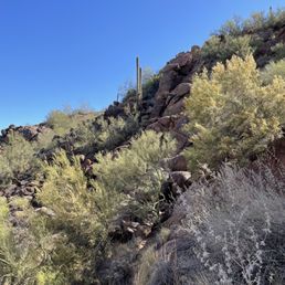

3 months ago
Love doing this hike! I always take my out of state visitors here if they want to hike. The hike is challenging but doable if you go a your own pace. It does get pretty crowded but I always like to go pretty early in the morning, especially to beat the heat. The view from the top is really great read more


6 months ago
This was a really cool experience to do while I was here in Scottsdale for a conference. THIS IS NOT FOR THE FAINT OF HEART. I went up the opposite side of the parking lot and wish there was a sign on the other side that gave a warning but this was a rock climb versus a regular hike. The trails are marked , clean, most trash is picked up. Hikers are friendly and the views are priceless. Once you get to the top it's a great achievement with a prize of a 360 degree view of Phoenix . Bring water and go slow ! read more


3 months ago
Camelback has my eternal love. What a solid mountain, always there to greet you at the summit. Cholla trail is it, with steady incline and slight scrambling. Bring water, be prepared to move your body. Hard work is always worth the view from the top! read more


9 months ago


10 months ago
My legs are like jello, but I'd do it again! If you have the energy and the desire to scramble over rocky Crags, GO DO IT. It's hard. But fun. And you don't have to do the whole thing! read more

Very cool trail minutes away from most of the hotels and restaurants in Scottsdale. Warning for beginners-- It's more steep at certain sections than I originally expected and probably not for beginners but manageable for average to expert hikers. I do have to say I was surprised at how they allowed such small children and novice hikers with sandals and flip-flops climb some of the sections. Just as I was taking a few pictures we heard someone yelling from above at the next difficult section for help. Someone had just fallen and they immediately closed the trail and sent everyone back down. We cleared the area quickly to give the rescue teams room to work and didn't stick around to see what happened but heard later that the individual was sent to a hospital with non-life threatening injuries. Parking is VERY limited and normally full from opening to close. Be prepared to wait awhile for a spot or to park further away and start your hike from the street below. Clean restrooms were available at the start of the trail and the trail itself is very well maintained with informative signs along the path. read more


2 years ago
My son loves to hike so after the 2025 AAE Arizona Cup we opted to hike the Camelback Trail. Allegedly my son thought it was a short trail and not that hard. I missed the sign clearly stating otherwise on the way up. The trail starts off decent and even has handrails and steps for the first 1/3 of the trail. Gets you committed. Then there is a short lull of easier trail and then the serious rocks appear. For an old fat fellow that is out of shape it was challenging but very achievable. I made the complete round trip in about 2.5 hours. Younger more flexible and in shape can do it much quicker. Quite an enjoyable climb and awesome that it is very convenient to be to. read more


2 years ago
Overall, I loved the trail experience, but admittedly it was a very confusion, different that noted trek, so be ready! The Echo & Cholla trailhead lots were closed or full, we found street parking about a mile away from Cholla entrance- walking along the sidewalk near the golf course Once we hit the trailhead, the signage said Cholla 1.5miles into Echo Canyon 1.2miles to Bobby Rock loop .18miles...definitely not accurate We walked 2.3miles along Cholla, mostly slow, rock scrambling incline to the lookout point. At the top we saw Echo was just another way up&down the mountain, not necessarily a next trail The trail was very tiring, but I loved the challenge. A lot of the path areas were quite narrow, causing traffic jams with other hikers, a decent portion we got stuck waiting for people coming the other way. The top view was worth it, I definitely recommend this hike, but it was very different experience than noted. In total, we hiked 4.26miles Cholla out & back read more


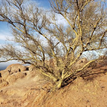

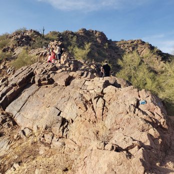


I nearly died on this mountain. RESEARCH before you go. Both the Echo Canyon Trail and Cholla Trails are extremely difficult. Bring lots of water and good hiking shoes and know that you will be CLIMBING ROCKS AND BOULDERS. Also, if you're doing a sunset hike, bring a headlamp just in case. But GREAT VIEWS. As a cautionary tale - I decided to start at the Echo Canyon Trail around 5pm to try and see the sunset. It was way harder than I ever imagined with having to climb hand-over-hand on rails and scramble up rocks. By the time I reached the summit, the sun was setting and I had planned to continue onto the cholla trail for the descent. The trail is almost impossible to see on the way down if you didn't come up that way. I was pretty confused and lost and then I saw the little reflector things pasted to random boulders to guide the way. About 10-15 minutes into my descent, it was completely dark and I still had a mile to go. Here are my recommendations: DO NOT DO THIS AT NIGHT. It's really steep so make sure you watch your footing and TAKE IT SLOW. I slipped a few times and fell once and I got super lucky that I wasn't more injured so be careful! Don't have any pride while you're on this mountain - stop and get your bearings if you need to. Also, don't take the cholla trail at down at night ...... no one else did so I was hiking by myself for over 45 minutes. They all turned around and went back through the Echo Canyon Trail. read more


2 years ago
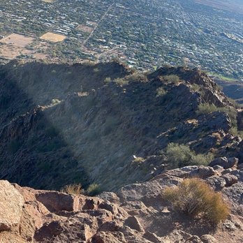
A must go when in the area! This hike is challenging but doable for those that are active. The view is amazing and so worth it. read more


3 years ago
Service was nothing short of amazing! Views were stunning! Food at our event was excellent to say the least. Highly recommend. read more


3 years ago
So wow, supa, Gohgeoussss views ya! :) Waking up to these views is worth the challenge. Centrally located and easily accessible. Wake up early to find a parking on the Echo Canyon side! read more


Very difficult and challenging mountain I have done both the echo canyon and cholla trails and reccomend both! The echo canyon is a bit longer and more gratifying (just more time to enjoy the climb), while the cholla trail is steep and quick (in terms of length). Parking will be a pain no matter which way you slice it. If you want to go all the way to the top, be prepared for some climbing as the rocks get steep and the trail requires more effort. But the views are worth it. Highly reccomend making it for Sunrise read more


3 years ago
Phenomenal place for a day hike. Great views all around. This trailhead is popular and parking is limited. Plan your hike early and bring snacks and hydration. Also I would recommend good hiking shoes. It is a double black diamond trail so it's steep at some places. We really enjoyed it and was not very far from our hotel in North Scottsdale. read more


2 years ago


Finally after 2 years of living in Phoenix my husband and I did this hike. We are pretty active people and hike maybe once every other month and I would say this is difficult. It's not too long miles wise, but the incline in some areas is pretty intense. There is also some bouldering involved. Add on the heat and that makes it more difficult. Make sure to bring a lot of water, I don't feel like the 2 bottles we brought were enough. In some areas you kind of need both hands to pull yourself up so a camelback or other similar water carrier would be best if you have one. However, the whole experience is fun and with it! And the views at the top are amazing! read more


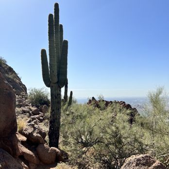


When you grow up in Phoenix, hiking Camelback is a rite of passage. For some reason (maybe it was the sweltering, never-ending heat) ... I just never got around to it when I was actually living there. However, my adventurous fiancé loves nothing more than a good hike, so I thought it might be fun to show him the difference between Midwest mountains and desert mountains. If you've at least driven past Camelback, you probably know how it gets its name. The rock formation literally looks like a sleeping camel. While it doesn't look too terribly high from the ground, let me echo the many that came before me in saying, it's a long way to the top. There's a sign at the start of the Echo Canyon trail that says "this hike is extremely challenging," and you should believe every word. Truthfully, this is more of a climb than a hike ... but I PROMISE it's worth it. We went on a Monday morning around 6 a.m., and the park was already packed. Still, we were able to find a parking spot pretty easily. We took our time going up to the top ... it was nice starting so early in the morning, because they sun hadn't fully risen yet, and we got the benefit of shade. There's no "easing in" to this hike ... you're trudging uphill almost right away. It took us about an hour and a half to get to the top ... and the view is absolutely worth every grueling step. Don't let this mountain fool you ... getting down is not much easier than getting up. It's a little faster-going, but you really have to watch your footing, and sometimes use your hands, and even your butt. I read a tip from AllTrails that this is a hike where you definitely want to have your hands free. Despite the intensity of this hike ... the trail is extremely well-marked and well-kept. We initially had the AllTrails app pulled up as a map, but we didn't end up even checking it once, because it was so easy to stay on the trail. My aunt accompanied me and my fiancé on the journey, with a literal baby strapped to her chest. She's a supermom if you ask me ... and I wouldn't recommend doing what she did if you don't think you could rock climb while not only holding a 20 pound weight ... but making sure that that "weight" doesn't touch any of the dozens of sharp rocks it might encounter. My final tips are this ... bring LOTS of water, especially if you're not starting in the early morning. The heat can be uncomfortable ... and even dangerous. Make sure you're wearing sunscreen ... and bring extra to reapply at the top. If you're not used to sun, I would recommend hiking this in the wintertime, because it's going to be so much more enjoyable when you don't have to worry about the weather. read more
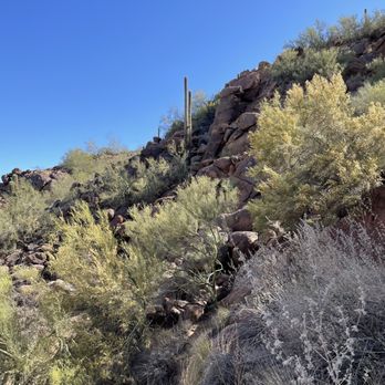


Loved my sunrise hike this AM!! It was beautiful! Suggestions: Water backpack of some sort- don't carry a water bottle- you need free hands for climbing multiple sections! Hiking shoes- I wore my Merrill trail running shoes, which worked well! I saw many people with rock climbing style shoes that had excellent grip!! Gloves- I did not take any- my hands wish I had lol! To grip rocks and the poles. Clothes you can get dirty and sweaty in. Comfortable- it was chilly in the early AM and very windy at the top- but I got warm during the hike- so it was nice to take off my lulu running jacket during most of the hike. Take a snack! There was a box of bananas someone left at the start of the hike, I had that and a protein bar that I enjoyed once I reached the top of the hike! Don't rush- slow is fast in this case- don't want to hurt yourself or twist an ankle etc trying to keep up with more experienced hikers. Enjoy the hike!! It'll push you but it's an excellent workout!! I pushed but also took short breaks to take in the scenery and get lots of pictures! Parking can be crazy!! The parking lot was not very full when I arrived... still many spaces- but by the time I got back from my hike about 7:30ish, it was packed and people were making loops to get a parking spot. There is restroom and information in the parking lot area before heading up! I suggest using the restroom before taking off- there isn't any spots to go on the hike. And read the info! If you go later in the day- def take water!!! I needed a decent amount once I reached the top and it was still chilly out... I can only imagine later in the AM or during the day as it heats up. :) Enjoy yourself!! I can't wait to go back!!! read more


Gets really packed!!! Almost over the top traffic especially, if you go during weekends after 10AM. It's best to go at dawn or before 9 honestly to avoid the traffic! I like this hike, however, there's one section that I refuse to go past, in which, I will turn around when reaching that area. One bad step and cough could send one over the edge.. no ty! I definitely love hiking the mini hikes more so. This is for professionals honestly! (My opinion) There's plenty of parking on the streets but you could end up parking blocks away if you're not early! Traffic dies down around 3pm and picks up again at around 5pm. Definitely recommend but it's not for us baby walkers that's for sure! read more


Kudos for kicking my bumbum! All the years of living here and I finally did this. I must admit, I thought it was an easy hill to conquer, but Miss Camelback quickly put me in my proper place (which was almost face-to-rock on more occasions than I'd like to admit). It's the perfect workout for hikers and is rated with a "hard" difficulty level on the All Trails app. I found that going up was easier than coming back down, for some reason. Anyone who knows me knows how OCD I've always been. Way before COVID, I was using gloves, sleeves, napkins to touch high-touch surfaces. Well let me tell you...coming down the mountain I bare-hand gripped that metal railing like it was nobody's business! I had to laugh at myself. Then immediately bathed in sanitizer once I reached my vehicle. You can get some nice valley and sunset views from the top and even from the halfway point. My tips: - Bring plenty of water, especially during the summer. If you see you're less than halfway through your water supply, turn around and head back. - Stay on the designated trails. - I would not recommend bringing our fur friends or small children on this adventure, unless you're only going to the plateau area, which I consider the halfway point. - Follow the park rules for hours of operation. You don't wanna met up with the mountain lions or snakes after sunset. And no, that is not an exaggeration. I love AZ, and places like Camelback Mountain have always made me love it even more. read more


Awesome hike but not for the feint of heart. It's a nice steady climb until the last quarter mile then it becomes boulder climbing. I saw lots of people in running shoes but I felt much better about having my hiking boots for traction. The views are amazing and worth the effort. Parking is on street only as there is construction so you may have to walk 1/2 mile before getting to trail. Lots of people so be prepared to move aside as people pass. Glad we gave it a go. read more


4 years ago
If you'd like excellent views of the valley with a challenging hike then look no further. Camelback is a hike that is popular for good reason. It's a super touristy thing to do, but it's also something that locals do regularly. These photos are from our recent hike on 4/5/23. It was a beautiful day for a sunset hike which turned into a gorgeous moon rise. Couldn't have asked for more. That being said- if you're new to hiking camelback come prepared with water, proper shoes, and if you need them hiking poles don't hurt for certain areas. It's deceptive because the hike really isn't that long however it's mostly just going upwards, fairly quickly. I have friends who hike camelback regularly and are in top shape, they don't report it being super challenging. However I'm a bit out of shape due to all my eating, drinking, & yelping ;) and I haven't been exercising as much as I used to. So I'd say I represent the average person and I found it a bit hard at times. Camelback became a Phoenix city park in 1968 and hiking it is one of the top 10 things to do in Phoenix according to Trip Advisor. The most common Flora on the Mountain are the Saguaro Cactus, Ocotillo, Palo Verde, Cholla, Barrel Cactus and the Creosote Bush. Rescues on the Mountain happen often so please proceed with CAUTION and know your limits. Again, know your limits. Don't get stuck or hurt up there and be someone who needs a rescue. It's a challenging hike. There are 2 hiking trails, Echo Canyon and Cholla. Both trails are difficult, while Echo Canyon is steeper and Cholla is longer. Echo canyon- This trail is an intense and difficult anaerobic hike the entire 1.23 miles to the summit. It ascends approximately 1,280 ft, from 1,424 ft above sea level to 2,704 ft. Cholla- gains about 1350 feet over 1.47 miles and may not be for you if your'e afraid of heights and look out for the loose gravel. The first mile or so is trail hiking. However, once you reach "the saddle" the hike becomes more intense and predominantly scrambling for the final stretch. Dogs are not allowed on the trail and please be respectful of the local residents and don't leave any trash behind. Restrooms are available at the trailheads. Please note: Camelback Mountain is closed from 11 a.m. to 5 p.m. on days with excessive heat warnings. read more


2 years ago
Awesome trail! Definitely technical at times and can really test you. I wouldn't say it's easy by any means but rather a fun challenge. Took about an hour up to the top and 35 minutes going down. By the time I made it back down my body was cooked! Wearing trail rated shoes is a much better option than tennis shoes like I did. You will be climbing, bouldering, gripping and balancing throughout. Find a cadence that works for you and stick to it. At one point you will feel like the top is just never going to come but when I did summit there was a little Christmas tree up there. Apparently Santa comes up there on the weekends during Christmas! read more


4 years ago
Hiked the Cholla trail while on vacation in Scottsdale. The sign at the beginning of the trail is accurate - this is an extremely difficult hike. Hiking shoes are a solid choice here to make sure you have traction, especially coming back down. The trail is difficult but there are plenty of areas to stop and rest. We stopped before the last ascent - the mountain basically goes vertical at the end. At marker 25 (I think), there's a nice place to stop and get pictures. Make sure you take enough water as there isn't anywhere along the way to get any! The entrance to the trail has bathrooms and a fountain to fill up at the beginning and end. read more
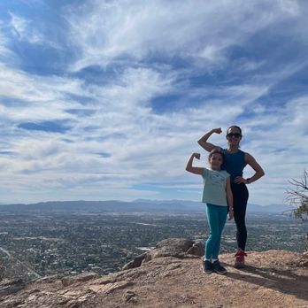


*WARNING* CUIDADO* I' AVERTISSEMENT* Out of town VISITORS and TRAVELERS should not attempt to hike to the peak. Unless you exercise frequently and are somewhat in shape, you should NOT try to hike to the summit. Even if you are fit, take plenty of water. I recommend 2 liters minimum. But DO NOT try to hike this mountain during the months of June through August. The heat is overwhelming. Even local residents fall victim to Camelback. There are people who die every year or sent to hospitals. People are frequently being rescued, air-lifted from the mountain by helicopter. DO NOT under-estimate the mountain. Many rescues come during the cooler months because hikers are careless or misjudge the effort required. There are local news reports all the time about foreigners experiencing tragedy. Don't be FOOLISH and end up getting rescued. I kinda care about people, but it is mostly about rescues costing us, tax-payers, so much money for the resources to save these half-wits. Using the tax money takes away from funds that could go toward our community. Schools and programs for our kids are being shorted because someone didn't heed warnings. Also, if the fire department crew has to rescue you, it will not exactly make their day, climbing up and carrying your weak butt down the rocks. Side notes: The ascent to the top can be steep, slippery and treacherous. You will have to climb up small boulders at various points using hands and legs to clasp the rocks. Going up can tend to be easier than coming down- account for that. Some areas offer shade depending the time of the day. Check temperatures and weather conditions that day. Bring a hat, sunglasses and sunscreen. DON'T LITER. Pick up your trash. You can see lizards and birds mostly for wildlife. And BUGS (did some of you just opt out?) I don't like this hike because the trail is too busy and parking lot can get too full. Busy trails are annoying and dangerous. It makes you second guess or rethink your steps to avoid oncoming or passing hikers which can be dangerous in split decisions. Or you are waiting for people in front of you if they are too slow. On the way up you have a butt in your face as you climb. On the way down you could slip trying to dodge the less sure-footed hikers. Weekdays tend to be less busy. read more


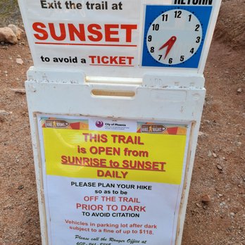
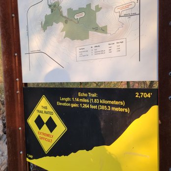


3 years ago
Great hike and amazing views I went January, it was quite chilly in the morning... but I would definitely go in the morning to catch the sunrise..absolutely gorgeous The hike takes about two hours total...overall nice and easy hike but if you're not the adventurous type there are parts near the top you need to scale the mountain. Have some good hiking boots and have fun read more


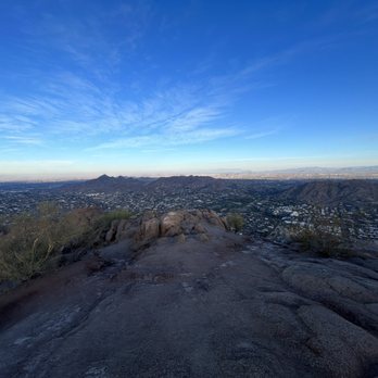


Magical! What else can I say? Had no idea we were visiting this spot but so happy we did. We stayed at the Embassy Suites just down the street and feel in love with Camelback at check in. It looks over the city of Scottsdale with such a majestic nature to it. It is most certainly a sight to behold. We went on the Echo Canyon trail and loved every second of it. We didn't go all the way but made it to a great spot with amazing 360 views of Scottsdale & Phoenix. This adventure was unplanned but most times, those are the best to be on. read more

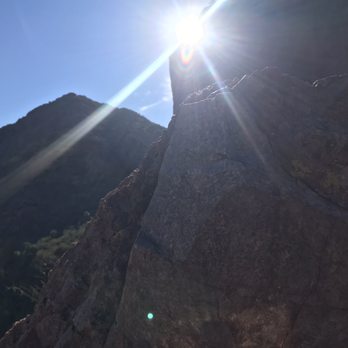


Go on a day when it isn't hot. There's four of them a year. Though 2706 ft above sea level, the hiking elevation is roughly 1300 ft. Open sunrise to sunset, the Echo Canyon (Echo Canyon) Trail at 4925 E. McDonald Drive is 1.14 miles and the Cholla Trail at 6131 E. Cholla Lane (closed for maintenance as of March 2020) have steep grades of dirt, gravel, and boulders. I was able to make it to the top once (and more than halfway three other times), though they are rated "Extremely Difficult"; subjecting hikers to steep elevation gains, uneven terrain (including loose rocks and large drops), 12" or greater obstacles, and a path that is unprotected from the elements. The average hike is 1.5 to 3 hours. It's mostly two forms of rock: the head of the camel is primarily sandstone so don't take it for granite. Animals: Dogs aren't allowed. Overdevelopment keeps large animals out of the area, though you may seen rabbits, lizards, squirrels, birds, and snakes, including rattlesnakes, ssssssssso be careful. Parking: Limited at trailheads, and not permitted along most nearby roads where you are subject to tickets and towing. Effective July 2021, the rangers will restrict climbing when the NWS issues an Excessive Heat Watch or when the NWA issues orders to cruise down the street in a 6-4, jockin the freaks clocking the dough. read more


3 years ago
Ranger Novak and Ranger Turner made my little hike a blessing. The sights are beautiful and the bees are plenty. Roadrunners are gorgeous. Go in the morning when the temperature is somewhat pleasant ( during the summer). Bring water. Bring WATER. BRING WATER. And enjoy yourself. read more


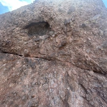


The cholla hike has been closed for several years so a Joel and I were excited to tackle it. The path has been under construction and it has benefited the hikers, the path is well groomed and marked all the way to the top. This hike is not for the faint of heart, the elevation is constant and as you ascend the last 1/3 of a mile, the terrain is so steep you must climb smooth rock that has a jagged top. The steep section has reflectors that indicate you are on the right train but beware of a narrow section in the last ascent that allows for one hiker at a time going up and down. I saw a lot of hikers in Nike type shoes...PLEASE ditch them and wear hiking boots. It will allow you a safer, more enjoyable hike. The views at the top are breath taking and reward your efforts! read more


4 years ago
One of my favorite hikes in Phoenix. Spectacular views all around! This trail is considered difficult and it's truly not an exaggeration. It's an incline elevation all the way up to the top with sections with a rail to aid in ascending/descending in some areas. If you have never hiked before, give yourself ample time and bring water as this will prove to be a challenge in cardio. So worth it! The parking is very limited and this is a popular trail. Be prepared. They have closing times at sunset and can give you a ticket if you're not out before then with your car. read more


Chris and I arrived here at 9:30 am to hike the mountain. Parking is very very limited and we waited 45 minutes for a space to open. The parking lot is one way directional and rude people were cutting in front of the organized waiting cars cutting the line and driving the wrong direction to steal open spots from those of waiting in the correct one way direction. It's important to arrive very early or wait until late afternoon. Ample clean bathrooms and chilled filtered water dispenser is available. The trail is well maintained with clear signage. The trail is challenging and ranges from moderate to very difficult. It's important to know your limits and to have plenty of water and food. A hat and sunscreen are a must. Plan on 3.5 hours round trip. This hike is not for the faint of heart or people that are out of shape. Chris and I only made it two thirds of the way up before giving up. The crowds were somewhat pushy and impatient with many places only wide enough for single file hiking. The views are incredible from the base as well as the midpoint areas. Arrive early and know your limits. We recommend this attraction for healthy and fit tourists!! read more


Desperate to end our trip with a spontaneous hike, my local friend recommended visiting camelback mountain since it was one of the closest spots in town. We had no hiking gear with us, so she recommended we use the Cholla Trailhead being less strenuous and still would provide us with the views we were looking for. This is where our story gets funny... I gave the Uber driver the trailhead address and we realized after driving 20 minutes from downtown Scottsdale that we were headed past the mountain. Our driver was sweet and new the main entrance where everyone goes to hike, so he turned around and took us there. Little did we know until arrival that the trailhead entrance he dropped us at was Echo trail, which my friend warned is a very intense hike that requires climbing boulders / rocks for a majority of the way up with a steep incline. Wearing my vans slip ons and carrying my purse, my husband looks at me and says well let's hike until we can't then we can turn back. As we ascended the mountain it started out with some gravel switchbacks that weren't too bad, but then we finally made it to the warning sign before we began the rock climbing and my husband, being the ambitious man that he is, said let's go for it. Thank goodness we were in great shape and had waters with us because the climb got intense. Took almost 2 hours to get to the top of the mountain due to us wanting to be careful with no grip shoes, and there is really nothing to catch you if you slip or fall besides the hikers behind you! Everyone was encouraging, supportive, and it was a fun experience that my legs are paying for today. You will get dirty, you will climb on your hands and knees, but the view at the top is breathtaking. The descend was as a little scary and you must take your time passing other hikers to ensure you don't slip on the way down or hurt yourself. Altogether the round trip was a little over three hours, but if you are a strong hiker you can make it round trip in 2. While my vans held up the whole hike, I recommend that you bring lots of water, proper hiking boots with sturdy ankles and grip, and then gloves for the rocks. Cut my hand coming down on some due to them being sharp. I would do this hike again in a heart beat ! Just come prepared and do some solid stretching beforehand read more


Page 1 of 20
More info about Camelback Mountain
4925 E McDonald Dr
Phoenix, AZ 85018
Directions
(602) 262-6011
Call Now
Visit Website
https://www.phoenix.gov/parks/trails/locations/camelback-mountain
Hours
Indoor Amenities
Outdoor Amenities
Ask the Community - Camelback Mountain
Review Highlights - Camelback Mountain
You might also consider
















Why does Yelp recommend reviews?
54 reviews that are not currently recommended
The reviews below are not factored into the business's overall star rating.

13 years ago

11 years ago

15 years ago

14 years ago

17 years ago

13 years ago

16 years ago

13 years ago

14 years ago
10 years ago

9 years ago

12 years ago

17 years ago

13 years ago

6 years ago

14 years ago

17 years ago

17 years ago

8 years ago

11 years ago


