
McDowell Sonoran Preserve Photos


You might also consider


More like McDowell Sonoran Preserve
Recommended Reviews - McDowell Sonoran Preserve
Start your review...


Reviews With Photos


This spot has gotten very popular over the last several years, but it's still a great place for some peaceful outdoor enjoyment. Plenty of trails & views to see. Bring appropriate footwear for rugged trails & don't forget your water. There's a water station near the parking lot for refilling. The park is dog friendly as long as you pack out their poop. Don't leave bagged poop on the ground. There is no poop fairy.


Excellent overall. Very well maintained trail with excellent views of the Sonoran Desert, Phoenix and Scottsdale. The loop takes you up the side of the mountain, around the back, and back in. The back of the range is one of the very few times in the entire Phoenix area you'll see just wilderness and serene beauty instead of urban sprawl and unending traffic. It really is a wonderfully disconnecting experience. Water is available only at the trailhead buildings. From there, several trails are marked with different expertise levels. If you're bringing a dog, numerous signs are posted about the dangers of heat stroke on dogs, so beware. One of thehighlights of our visit to Scottsdale.


Absolutely recommend this area for anything from easy trails can walk in tennis shoes to moderately difficult trails with hiking boots. We did both and the views are worth it. We did Gateway trail 4.6 miles and started left to get the harder incline trail 1st so can descend easier on other side. It was pretty rocky throughout and definitely needed water/ snacks. We couldn't help stopping for pics so it took a few hours . Went back the next day for horseshoe trail a easier 1.7 mile look with virtually no ascends and a few great places for views. Could easily run here with your furr babies or hike. Will be back when in Scottsdale.


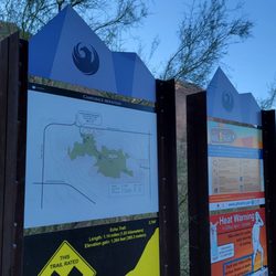
Impressive. I thought I had arrived at a gated community. At the trail head there are restrooms, maps and local guides there to share their trail knowledge and orient you. Gorgeous trails for miles.


As with just about every trail in the greater Phoenix area, they are all amazing. We come out from Ohio to visit one of our sons who relocated here almost six years ago now. We love the views, the plants and how well maintained all the parks are here. All the trail stations are well marked, paths are clear and easily followed. We just enjoy the views and wandering around parks that we've not been to.


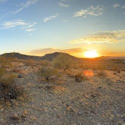
What a natural wonder! You would think looking at Cacti would get old, but they're all different it's amazing to see. We had a great end to our day hike here and got to take advantage of the beautiful sunset. There's many trails of varying difficulty , but my toddler was able to hike here with no problem (nature trail). There was lots of friendly smiling faces along with people walking dogs, exercising, etc. My girls loved looking at all the different rocks (kids love rocks) and also they enjoyed that tiny amphitheater area. Would love to visit here again when more prepared to do a longer hike. This was spur of the moment but so glad we did a small family hike.
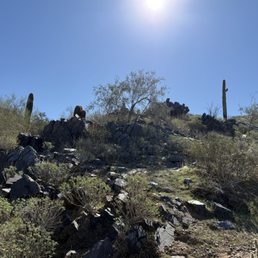

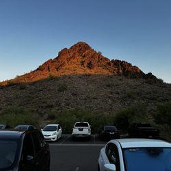
Great trails. Get there early if it is a hot day. Lots of parking. There are restrooms, water fountains, a water bottle fill station, maps and information after you park. Helpful guides, too.


I thought it was stunning, I never realized how many places or it should say levels of hiking that you want to anticipate, it's really up to you. I went to check it out one morning to see if it would be a good hiking place for me to bring my dog. She's under 6 pounds but boy is she a walker, I don't believe that she will have any problems doing this hike.I just need to remember to get up early so I could do the hike before gets way too hot. Make sure you bring plenty of water. Stunning! I would recommend this place, it was a perfect day.


I never know how we can actually "rate" nature. The trail was just what I needed this morning - to get out of my head and into my body. It was picturesque, easy enough, with just the right amount of ascent. Plenty of parking this Sunday morning.


Great spot and easily accessible. Highly recommend even if only a few minutes. It's a must if in the area,


The McDowell Sonoran Preserve is great way to spend your morning - emphasis on morning since you'll wanna get this done before it gets too hot. The routes are clearly mapped out and you can find something for every skill level. We took the moderate Gateway loop, a little over four miles and it was perfect for the active and not so active hikers in our group. The path is well marked but fair warning, it's really rocky so sturdy shoes with good tread are a must. You'll spend a good time looking at he ground for fear of falling over ass over tea kettle so try to remember and look up every one in awhile. You're in God's country!


There are plenty of hikes in the McDowells for skill levels of all kinds. You can hike a couple of miles or make it an all day excursion. You can climb a couple of hundred feet or several thousand feet in elevation. Depending upon the trail you're doing, you could find yourself in Scottsdale or Fountain Hills. There are numerous trailheads all over and I encourage you to find your favorite trail! Most of the trails at the McDowells are clean and well kept. The more popular ones (The Gateway Loop) are consistently packed with people, dogs and even strollers. Yes, I've seen strollers on the Gateway Loop. How in the hell you're managing to hike with your infant while their head is bobbing and weaving inside of a stroller is beyond me. You also need to watch out for landmines of dog shit that people neglect to pick up. Again, this is more apparent on the Gateway Loop. In addition to strollers and epic piles of dog shit, you'll find the soccer moms hell bent on hiking four abreast making it impossible to get around them and dammit, you'll go at their pace whether you like it or not. My recommendation is to ditch the Gateway Loop unless you really need to check it off your list. If you opt to hike some of the less popular trails in the McDowells, you'll find beautiful scenery, wildlife and a great local destination to clear your mind and hike your cares away. Pick up your trash. Don't trash the place. Be courteous to fellow hikers. Practice trail etiquette and don't be a douchebag.
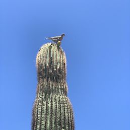

What a great park to explore! You can come to this park for a stroll, hike or a run. Although no biking is allowed through the trails. The park is very well marked with trail name, distance and direction. You can also download maps or use all trails to find your way about. Some trails even have signs with information about wildlife, plants, environment, etc. This is a heavily used park but as there are so many trails you can easily get lost in your own thoughts. Keep your eyes out for wildlife, including snakes. As for amenities: there are restrooms on site as well as places to fill up your water bottle . Plus free parking onsite. Make sure you wear a brimmed hat as no shade within the grounds. Don't forget to bring proper amount of water per your hiking distance. Happy Trails! read more
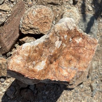



3 months ago
I loved it here. I loved the walking trails and scenery. I loved the park, the views and the ambiance. I loved walking here and hiking. I highly recommend this spot. read more

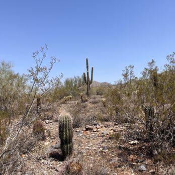


Beautiful Scenery for hiking and enjoying the outdoors - - - - - - - - February, 2026 Visit We visited Scottsdale / Phoenix and had a very memorable partial- and full-loop hike at McDowell Sonoran Conservancy. Before leaving home for Scottsdale, we explored hikes and parks near the hotel and McDowell is one we briefly looked at. Once we arrived, McDowell was on our short list and after a work day we got here just at sunset for a Hoo before it got dark - we enjoyed the short Saguaro hike and also the Interpretive Trail, on a nice night. The next day I did not work, but had a planned day off, so we had more time for the full hike...The Gateway Trail... 4.4 mile loop from the trailhead and another half mile or so to/from the car. This Trail rating is Moderate, and that seems right. There is a wide variety of rock on the trail, from sand to pebbles to rocks and built rocks. There is 650+ feet in elevation gain; the high point is about midway, at or near the Gateway saddle (thatMs just what it looks like!) and it's up one way and down the other; depending on whether you go left or right right. Someone else recommended following the trail clockwise, so we did... it's a bit shorter to the high point... about 2 miles "hiking to the left / to the northern side and about 2.5 miles on the right / southern side. Along the way we saw some birds, which looked like quail, at the 1.0-1.5 mile mark; fauna: the Arizona landscape is different from the California that we are more familiar with... many more types of cacti - tall Saguaro, shorter barrel, and buckhorn cholla and cholla; also, blue polo verde and more Do take a lot of water; even on a mostly cloudy day in the 70s, we drank two 32oz bottles apiece and had the last sips on the walk to the car; a sunny day would have had us likely feeling a bit dry from having finished our water earlier. The elevation change may provide a challenge on your thigh muscles and to your knees. As we we headed down, we met a lady who passed us going up, and then on her return down, some 30 minutes later, and she mentioned having not yet completed the full loop before, and being impressed that we were about to finish it; that was a good motivation for us - thanks!! Thank you all at the Conservancy who created and maintain this wonderful trail. read more




10 months ago
This spot has gotten very popular over the last several years, but it's still a great place for some peaceful outdoor enjoyment. Plenty of trails & views to see. Bring appropriate footwear for rugged trails & don't forget your water. There's a water station near the parking lot for refilling. The park is dog friendly as long as you pack out their poop. Don't leave bagged poop on the ground. There is no poop fairy. read more


Excellent overall. Very well maintained trail with excellent views of the Sonoran Desert, Phoenix and Scottsdale. The loop takes you up the side of the mountain, around the back, and back in. The back of the range is one of the very few times in the entire Phoenix area you'll see just wilderness and serene beauty instead of urban sprawl and unending traffic. It really is a wonderfully disconnecting experience. Water is available only at the trailhead buildings. From there, several trails are marked with different expertise levels. If you're bringing a dog, numerous signs are posted about the dangers of heat stroke on dogs, so beware. One of thehighlights of our visit to Scottsdale. read more


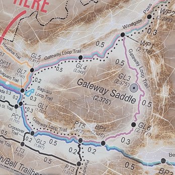
Absolutely recommend this area for anything from easy trails can walk in tennis shoes to moderately difficult trails with hiking boots. We did both and the views are worth it. We did Gateway trail 4.6 miles and started left to get the harder incline trail 1st so can descend easier on other side. It was pretty rocky throughout and definitely needed water/ snacks. We couldn't help stopping for pics so it took a few hours . Went back the next day for horseshoe trail a easier 1.7 mile look with virtually no ascends and a few great places for views. Could easily run here with your furr babies or hike. Will be back when in Scottsdale. read more




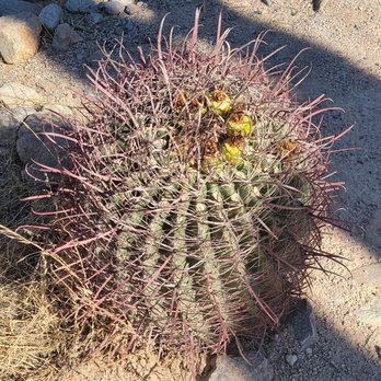


As with just about every trail in the greater Phoenix area, they are all amazing. We come out from Ohio to visit one of our sons who relocated here almost six years ago now. We love the views, the plants and how well maintained all the parks are here. All the trail stations are well marked, paths are clear and easily followed. We just enjoy the views and wandering around parks that we've not been to. read more


10 months ago

4 years ago
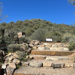
What a natural wonder! You would think looking at Cacti would get old, but they're all different it's amazing to see. We had a great end to our day hike here and got to take advantage of the beautiful sunset. There's many trails of varying difficulty , but my toddler was able to hike here with no problem (nature trail). There was lots of friendly smiling faces along with people walking dogs, exercising, etc. My girls loved looking at all the different rocks (kids love rocks) and also they enjoyed that tiny amphitheater area. Would love to visit here again when more prepared to do a longer hike. This was spur of the moment but so glad we did a small family hike. read more


2 years ago
Great trails. Get there early if it is a hot day. Lots of parking. There are restrooms, water fountains, a water bottle fill station, maps and information after you park. Helpful guides, too. read more


I thought it was stunning, I never realized how many places or it should say levels of hiking that you want to anticipate, it's really up to you. I went to check it out one morning to see if it would be a good hiking place for me to bring my dog. She's under 6 pounds but boy is she a walker, I don't believe that she will have any problems doing this hike.I just need to remember to get up early so I could do the hike before gets way too hot. Make sure you bring plenty of water. Stunning! I would recommend this place, it was a perfect day. read more


I never know how we can actually "rate" nature. The trail was just what I needed this morning - to get out of my head and into my body. It was picturesque, easy enough, with just the right amount of ascent. Plenty of parking this Sunday morning. read more


3 years ago
Great spot and easily accessible. Highly recommend even if only a few minutes. It's a must if in the area, read more


The McDowell Sonoran Preserve is great way to spend your morning - emphasis on morning since you'll wanna get this done before it gets too hot. The routes are clearly mapped out and you can find something for every skill level. We took the moderate Gateway loop, a little over four miles and it was perfect for the active and not so active hikers in our group. The path is well marked but fair warning, it's really rocky so sturdy shoes with good tread are a must. You'll spend a good time looking at he ground for fear of falling over ass over tea kettle so try to remember and look up every one in awhile. You're in God's country! read more


2 years ago

There are plenty of hikes in the McDowells for skill levels of all kinds. You can hike a couple of miles or make it an all day excursion. You can climb a couple of hundred feet or several thousand feet in elevation. Depending upon the trail you're doing, you could find yourself in Scottsdale or Fountain Hills. There are numerous trailheads all over and I encourage you to find your favorite trail! Most of the trails at the McDowells are clean and well kept. The more popular ones (The Gateway Loop) are consistently packed with people, dogs and even strollers. Yes, I've seen strollers on the Gateway Loop. How in the hell you're managing to hike with your infant while their head is bobbing and weaving inside of a stroller is beyond me. You also need to watch out for landmines of dog shit that people neglect to pick up. Again, this is more apparent on the Gateway Loop. In addition to strollers and epic piles of dog shit, you'll find the soccer moms hell bent on hiking four abreast making it impossible to get around them and dammit, you'll go at their pace whether you like it or not. My recommendation is to ditch the Gateway Loop unless you really need to check it off your list. If you opt to hike some of the less popular trails in the McDowells, you'll find beautiful scenery, wildlife and a great local destination to clear your mind and hike your cares away. Pick up your trash. Don't trash the place. Be courteous to fellow hikers. Practice trail etiquette and don't be a douchebag. read more


My husband and I spent a few hours hiking in the McDowell Sonoran Preserve. It is beautiful and a place that I would like to return to during a cooler month. The preserve has over 30,500 acres of desert. With over 200 miles of designated hiking trails. These trails are well maintained and laid out with markers and a map. On these trails you can bike, hike or ride a horse. We did not have to pay to park or to hike. There is a bathroom area near the parking lot that also offers water and shade. The trails range from as easy as a stroll to very advanced levels. The duration of each trail is different so you can also choose a trail by the amount of time that you have. read more
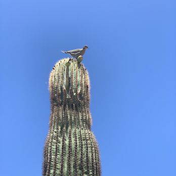


4 years ago
Great place for a nice walk. It gets pretty hot so don't forget to bring water. I didn't see any wildlife but maybe next time. read more


2 years ago

Beautiful place for a hike! The trails are very rocky so watch your step. We are from Ohio and are used to cleared flat walking paths We hiked for about an hour and half and enjoyed our time at the park. We got an Uber from our hotel near Kierland. Bring water and stay hydrated. read more


3 years ago

7 years ago
This place beckons you back!! Some trails difficult walking up & the decline can be treacherous without the right shoes. Plenty of teenie ledges to rest as you ascend but remember to Bring Water & consider going early &/or when it's in the 70s We love Tom's Thumb Trail (extremely diff) but only made it up to Raven Roost and turned around Next time!! Loved the moderate/moderately diff trails Get outdoors!!! read more


3 years ago

4 years ago
Beautiful trails and a great information center. The staff was helpful in tailoring the best route for us. read more


Review is for the Lost Dog Wash hiking loop trail. The trailhead has an enormous parking lot, decent bathrooms, and is about a 4.5-mile round trip hike that is mostly flat. Dogs are welcome on this trail, along with mountain bikers. My reason for just 3 stars are the following: * We were spoiled by the awesome hike from Pinnacle Peak Trail - better views, better signage, and better trails. * Lost Dog Wash is technically easier being a flatter trail, but I found the trail to be extremely rocky and uncomfortable for hiking long durations. You need really heavy hiking boots - old sneakers are not ideal. * The signage could be more frequent - there were several instances where trails forked or were unclear. read more


Wow, easy free parking, free hike trail maps, well marked and clean trails? Yes please. And the helpful and friendly seniors just waiting to point you in the right direction are the frosting on the (bundt) cake! The gateway loop trail was moderate to very rigorous going uphill, and moderate on the way down. Before you leave, grab some water and obviously sunglasses, hat, sunscreen. TIP: Don't just put the "McDowell Sonoran Reserve" into google maps....it takes you to a different address! If you want to hike the Gateway loop trail, the address is as per Yelp: 18333 N Thompson Peak Pkwy, Scottsdale, AZ 85255 Enjoy the view! read more


Wow oh wow, if your not used to hiking a bunch this is the place to start. Everyone goes to camelback to go fulfill their hiking goals but it's way too congested in my opinion, so just start here. Be aware there is loose rocks to the max so wear the right shoes. My dad comes here every day and he's 70 and in decent shape, so if your under that age it's no big deal. It is about 4 miles of scenic trail and you might encounter a gecko or two, I've never seen snakes but yea you might see some so be vigilant. If you go to the right its more of a short uphill stride but you can get up there in less than a breath and sip of water. Watch out because sometimes there is some people with dogs who are unaware of their surroundings. One thing I loved about the place is that most people say hello, say hello back, it's only cordial! They don't say hi on the trails where I'm from so it's a added bonus. Anyways, take a deep breath at the halfway point and watch your step! Happy trails! read more


Kudos to Scottsdale for this outstanding preserve that provides easy and free access the natural beauty of the Sonoran Desert. Different trails invite hikers, joggers, casual strollers, and people who want to take in the awe-inspiring vistas on their bikes or on horseback. There are trails of varying degrees of difficulty for hikers of different levels of fitness (and motivation). Examples of easy trails are the Lost Dog Wash Trail (round trip length, about 5 miles; maximum elevation difference, 380 ft.) and the Ringtail Trail (round trip length, about 4.5 miles; maximum elevation difference, 307 ft.) There are also moderate, difficult ... and very difficult trails, such as the Tom's Thumb Trail (round trip length, about 10 miles; maximum elevation difference, 1363 ft.) In this preserve you'll also find a well-planned and very informative nature trail, guided hikes for almost every interest and hiking level, two distinct regions for mountain bikers, and equestrian staging areas. There is a spacious parking area next to the visitor center where you can get abundant information about the preserve. There are other parking areas as well along the boundary of the preserve. You can use these if you want to hike certain trails such as the Lost Dog Wash Trail or the Sunrise Trail, but parking near the trailheads of these trails can be limited. The best way into the preserve is through the Gateway, which is at 18333 N. Thompson Peak Parkway (east side of Thompson Peak Parkway between Bell Road and Union Hills Drive). From the gate here, the road leads to the spacious parking lot and the visitor center, where you can get guide brochures and from which you can choose the trail for your hiking adventure, bike ride, or peaceful stroll while taking in the remarkable views. read more


6 years ago
Never been there before, but ended up going this Spring with a hiking friend. I totally forget the trail we did, but there's a few to choose from. Great views and if you have out of town visitors, there's easy hikes to do with them and pose with cacti. I would recommend to wear a good pair of tennis shoes or better yet, hiking boots as you will be doing some walking up hill. read more

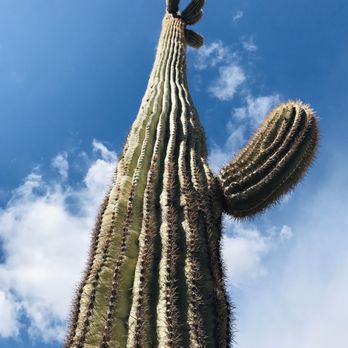


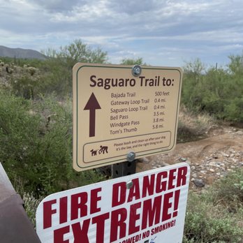
There are a number of trails available at the McDowell Sonoran Conservancy. The Bajada trail was ideal for our group which included 2 young children. The path is flat, well-defined and can easily accommodate a stroller. There were many places to stop and sit down, and plenty of signs with photos and detailed information about the area, plants and animals. Other favorable points: - Parking was plentiful - Before our walk we were greeted by a very friendly volunteer who gave my granddaughter a booklet about the desert. read more


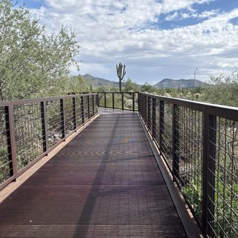
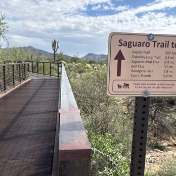
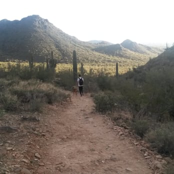
I've been here twice to hike the Gateway Loop trail with my dog. Parking has been easy both times. We enjoyed the hike even though it was a bit crowded. The only con about this place is that to get to the trails you have to walk over a bridge made of metal slats which my dog HATES. She refuses to walk over it which means I have to carry her and she's not a little dog so it's no easy feat. read more

5 years ago
We thought we were doing a 45-60 min hike...unfortunately we ended up 2 1/2 hours and almost 5 miles. We hiked the saddle trail. The view from the top was stunning but getting there was tough. The locals we talked to said if you go left at the start of the loop it's easier terrain and right was a little steep and rocky 1) If you are prone to rolling your ankle I would make sure you have your hiking boots laced high and tight or that you avoid this hike. It is incredibly rocky. 2) This is a given but a necessary comment... make sure you have lots of water! At least one decent sized bottle per person! Overall we did the trail with our two boys ages 8 and 6 and they did well! read more


Page 1 of 5
More info about McDowell Sonoran Preserve
Ask the Community - McDowell Sonoran Preserve
Are there any trails you can do in a wheelchair?
There's a couple trails that are paved. But they are mostly not wheelchair friendly. On all trails some of the "paved trails" are just sidewalks that take you from a trail to another.
Can you get a trespassing ticket for being in the preserve after hours?
Hi Van, It is in violation of the Preserve ordinance being in the Preserve after sunset. You can be trespassed. Additionally, cars left in the parking lot after sunset can…
Looking for easy hikes to start out. I'm 72 and out of shape but have been walking my dog about 1/2 mile a day?
There are a couple of flat short trails to begin and work you way to more challenging ones. Take your dog you’ll both enjoy.
Review Highlights - McDowell Sonoran Preserve
You might also consider

















Why does Yelp recommend reviews?
10 reviews that are not currently recommended
The reviews below are not factored into the business's overall star rating.

3 years ago
1 year ago

13 years ago

8 years ago

8 years ago
9 years ago
13 years ago

13 years ago

17 years ago

14 years ago


