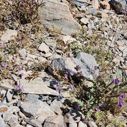
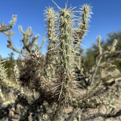
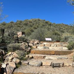
Cholla Trail Photos


You might also consider
More like Cholla Trail
Recommended Reviews - Cholla Trail
Start your review...

Reviews With Photos

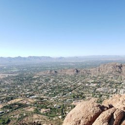
Super popular hike to do during the cooler weather seasons that gives you a great workout. Cholla Trail is one of two trails that takes you to the top of Camelback Mountain. Parking kinda sucks (Echo Canyon is worse). You can park up and down Invergordon Road and then walk to the trailhead. But overall, it's a fun challenging hike. I like doing it in December because someone brings up a Christmas tree and you can get your photo with Santa. You get great views of the Valley once you reach the top. The trail itself is around three miles out and back. But it gains 1350 feet in elevation. There are also some switchbacks at the beginning of the trail. Follow either the trail signs or spray painted blue dots once you pass the helipad. You will occasionally have to climb some slanted rocks - this is the challenging part of the trail. The summit is pretty spacious but can be a bit crowded. The views are amazing, especially at sunrise. Remember to bring lots of water and that dogs aren't allowed on the trail. This mountain is always in the news because people hike in the middle of hot days (without enough water) or they stray off the path. Mostly out-of-town folks who underestimate this mountain. During summer, try and go early in the morning. They recently built restrooms at the beginning of the trailhead and realigned it away from the residential areas. Just be respectful of those that live nearby and pick up your trash.

A really good Trail to do a hike in Scottsdale when it's not boiling hot. We came on a perfect Thursday morning, everyone was thinking the same... the trail was extremely packed. Like a line to go up, especially near the end with the scrambling. Lots of people including kids. Trail is 3.1 miles round trip, last 0.5 mile is scrambling. Everything else is easy. We didn't go to the top and stopped at marker 31. There's 36. We stopped because there was a long line and we didn't have the time and wanted to grab lunch. Come early if you can...to beat the rush!

I've done this trail once, and prefer Echo mainly due to the lack of shade here. Parking is on the street, "Invergordon". The hike starts out at an incline with some steps and switch backs. Then it starts to be a rocky sharp incline up. It eventually levels out and you get to walk along the side the mountain on a trail. Then it gets hard. You start going straight up the rocky spine of the mountain and you really have to watch for the blue traffic reflectors they have put on the rocks to mark the trail to make sure you are going the right way. I did get a little Sun burned despite going at 8 am as the trail is in the sun the entire way. In the future I think I would only go half way and skip the last 1/4 of rock scramble/climbing. 2.5 hr hike.

Let's start with the negatives. First, the parking is horrendous. It takes some effort to find parking, which is mainly on the side of the road. City of Scottsdale...you might want to think about adding the side street parking on the other side of the road. Otherwise, this is a pretty challenging trail. Be prepared to be on some small paths with very few flats. There are plenty of climbs and steps to start, but it gets rocky after the first 1/3 of the trail. Something I did notice that was awesome was the had trail markers numbered all throughout and up the mountain. Sadly, I didn't make it all the way to the top due to some annoying tightness in my hips and jacked up lower back, but nonetheless, still challenging and had me sweating like crazy! I will be back to conquer the full hike!

This trail reopened on September 30, 2022 after two years being closed. They moved the trailhead from Cholla Lane to Invergordon Road, the same road the parallel parking is located. Nice that we don't have to walk through a neighborhood anymore and bother the residents. They also added bathrooms, water fountain, and bike racks. At the start, it's a paved walkway and a good way to warmup, because once the trail begins with the steps, there's quite a bit of elevation. It's 1.42 miles up, classified as extremely difficult. I do appreciate the blue reflectors along the trail because that helped guide me on the hike, and there are about 37 markers as well. The top is the same as the Echo Canyon trail, and usually busy especially on a weekend. It's tough coming down because of the loose gravel and rocks, which is why I took off a star. Also because most of this trail is exposed to the sun, so there's no shade relief. Parking is all parallel on the street which is fine, just gotta do some extra walking if it's busy. Overall a good workout, just not my favorite hiking spot.

Beginning of the trail is kind of lame, just views of mansions and the Phoenician, but it is challenging and as you rise above the livable areas it becomes quite beautiful. Parking is near impossible so be prepared for a bit of a walk from the car. It is only open sunrise-sunset so plan accordingly. If you decide to go earlier (and hop the fence), don't go before dusk, the trail gets narrow and losing your footing will definitely result in injury and a steep fall. Views are fantastic and getting to the top is definitely an achievement!
The Cholla Trail's got some great views, so it's worth visiting, but it's not an easy thing to do! Tip: There's pretty much zero parking at the trailhead, so your choices are to either Uber here or to park a ways away along Invergordon Road and then walk about a mile to the trailhead. The trail is mostly gravel, so dress and equip yourself accordingly. Be sure to wear so good, solid hiking boots and to bring LOTS of water, as it can get pretty hot out here!

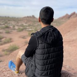
Cholla Trail Pros: right next to the Phoenician, this short but steep trail provides beautiful views. I'd recommend avoiding this trail in the summer, and bringing plenty of water! Pros: Scenery: beautiful views, clearly marked aside from a couple spots that overlap with an older trail. In the spring, the mountain is green and is really gorgeous. Length: the whole trail is a max 3 miles, up and down- maybe even a little shorter than that! Cons: Steep: big incline! There is also done scrambling at the top of the hike, over large rocks. Make sure you wear proper footwear No dogs: it makes sense that no dogs are allowed on this trail- it really is too steep and not suitable for them. Crowds: on nicer, cooler days, and especially on weekends, this can be a pretty crowded trail. Other: I went a little off trail and found a rattlesnake, so be aware that they are up there too!

Camel Back Mountain is pretty much THE hiking destination in Phoenix and Cholla Trail was the route we chose to tackle it. Used reviews here and info from AllTrails.com to plan ahead. Even going early in the morning (8AM) in December on a weekday, the trail was crowded. Trailhead is located in a residential area, highly recommend using rideshare or a friend for pickup and drop off, as parking is limited. The first half of the trail is quite manageable, which made me question the double black diamond "highly difficult" rating, but as we got halfway up the second peak, it was more climbing than hiking and I just couldn't hang. I'm not especially afraid of heights but started getting anxious and it just wasn't enjoyable heading into the home stretch- full disclosure, I tapped out. My guy made it all the way up and said the view was amazing. From the hikers we saw, it seemed more than half stopped at the saddle and turned back. Those who continued did include kids, but they're not really known for being aware of common danger. There are no animals (dogs) allowed on the trail, only one person seemed to overlook this rule and the dog did not look thrilled. At 3 miles round trip and ~1200 ft gain, there are great views throughout the hike. Take a backpack for your water bottles, you'll need your hands free to climb some sections.

Cholla Trail is rated "highly difficult" (double black diamond!!) and was apparently the easier one out of the two on Camelback Mountain! Although the trail is less than ~3 miles roundtrip + ~1,200 ft. climb, this was one of the most challenging hikes that I've ever completed due to my lack of hiking experience, the rock scrambles, and unpreparedness (I wore regular running sneakers instead of hiking shoes!). We managed to complete the hike in about ~2.5 hours. We came on a Saturday morning and it was very crowded. There are certain parts of the hike without any railing so I would proceed with caution as there were a few people that slipped. There are rock scrambles towards the top so you'll have to do some climbing, so you'll be dusty and potentially scraped up. The view is right in the middle of Phoenix so you have a gorgeous view of the suburbs and city once you reach the top. There are tons of photo ops throughout the trail and many friendly hikers who offer to take your photo for you. Don't forget to bring tons of water and stay hydrated! There's street parking on the side roads (parking on the main road leading to the trail is prohibited). Ubers will also drop you off on the main road as well.

Climbing Camelback Mountain is synonymous with being a Phoenician. Most everyone has at some point, but it's typically Echo Canyon trail that gets all the attention. Echo has handrails and numerous boulders to ascend on all fours for all you scramblers out there, with an approximately 1.3 mile trek with 1,200 ft climb to the 2,704 ft summit. The sister Cholla Trail, on the other side of the mountain, climbs the same elevation over about 1.5 miles. Both are moderately difficult, especially during the summer when some people get lost, dehydrated, and/or rescued, but you just have to play it smart. Bring plenty of water and know your limits. As with any hike with a decent elevation gain, you never underestimate it. Cholla Trail has more switch backs and is exposed but it's entertaining as you near the top. You're basically hiking the ridge of Camelback Mountain and it reminds me of trotting on the back of a stegosaurus' back as you eventually reach the same summit of Echo Canyon Trail. There is also some minimal scrambling but I feel it's a tad more friendly since it extends the climb over a longer distance on the switchbacks. I think it's more run-able than Echo on some parts, or you can just climb Cholla and run down Echo (or vise versa but then you'd have to run around the neighborhood to get back to your car). Either way, it's just really convenient and awesome to have such a beautiful pair of trails in the middle of the city!

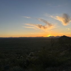
Now perhaps partial credit is due to my natural embrace of new terrain and adventure, but I absolutely loved my morning hike at sunrise up the Cholla Trail. Although is was no longer dark by the time we parked and began our hike, it was still early enough to make enough strides to actually see sun rising in the distance. It was absolutely beautiful. On the way up, I was surprised to see how many people were already on their way down. Maybe it's because I'm not an avid hiker, but even with a headlight, I'd probably feel a little uncomfortable with the number of grooves and loose rocks to navigate. In terms of difficulty, I found it to be perfect. I consider myself athletic, so while there may be times I'm in better shape, my muscle memory and drive can usually compensate for whatever physical ability I may lack. I'd say when I went on this hike, my workout schedule had been light to moderate, and I still found this hike very manageable but not at all boring. It was also nice to see how chipper so many of the hikers passing us were. Everyone was so courteous, smiling and wishing us good morning. I will say though that on our way down, we probably encountered a more steady volume of folks heading up, so I'd assume the earlier, the better to arrive. Overall, this hike was the perfect blend of inspirational, beautiful and invigorating and will remain a memory that I will cherish.

This is the 'easier' of the two trails to the top of Camelback Mountain. Easier is all relative, though. It is still rated extreme. It is 2.6 miles round trip, with an elevation gain of 1100+ feet to the top. There is no parking allowed on the street with the Cholla Trailhead. The mountain is in the middle of several very fancy residential neighborhoods, as well as having a schmancy looking hotel at the foot of the mountain. There is street parking up on the connecting street. The walk to and from the trailhead (ride sharing services are also not allowed to drop you off at the trailhead...but rather up at the corner of the street) will probably add another mile on to your total walk. The first, and therefore last, mile are actually relatively easy. Sure it is a climb, and your legs and knees will feel it. But the last .3 mile is STEEP. Be ready for some climbing! I did alright with most of it, and just needed some encouragement at the really steep parts. The whole thing took us just over two hours, I believe, which included a rest and snack stop at the top. It isn't the prettiest hike I have ever done, being in the middle of the the city. But it certainly is challenging. The only downside is the trail runners. The trail is pretty narrow for the most part, rocky, and highly traveled. So people running up and down the trail is slightly frustrating. But to each their own. A nice hike, a bit frustrating to get to, and you will feel like a star when you finish!

8 months ago
Let me start by saying that before, taking any hike, please take heed to every warning sign that is posted. I made the mistake of seeing extremely difficult and comparing it to a hike I did in New Mexico that was difficult thinking that this was just slightly higher than the one in New Mexico. I only looked at the distance and did not pay attention to the incline. This trail is 1.47 miles but has a gain of over 1300 feet. It is extremely steep and that is the part that will take you out! No pets are allowed on this trail, which is definitely a wise decision given how steep and narrow it is. Another hiker told us that there are a total of 36 markers along the trail, I made it to marker five, my husband made it to marker seven. By the time I hit marker five I was dizzy and nauseous. I was definitely not ready for how extremely difficult this hiking trail was. I feel like I looked at the warning signs, but didn't quite register what they were saying. It is a beautiful hike, but you definitely have to be accustomed to the incline and the altitude. The views were beautiful, but you absolutely must be careful, I would recommend a hiking stick to help keep your balance, especially on the way down. So my rating of five star is that they 100% accurately described the trail, it was absolutely beautiful, I just failed to register the warnings. read more


Quality/Quantity - 2-3 hour round trip hike (my guest does this hike in 4 hours, lol). We got here late, so we only did 1 hour as we did not want to get a $118 ticket for staying past sunset. So we only hiked to marker 8. A fairly steep rocky trail. No shade, but perfect weather for us on this winter afternoon. Beautiful views; see my pictures. Views of Scottsdale and Phoenix. Atmosphere - At the start of the trail there were restrooms, drinking fountain, bike rack, etc. Very limited parking, make sure you pay attention to the street signs. We got lucky and got a perfect space, probably because we got here an hour before closing and most people had already left. Summit - 2,704 feet. Animals - We saw loose dogs, rabbits, etc. Open from sunrise to sunset. Service - Self service. Price - Free. Owner Comment - Congrats on your success since 1960's since The Preservation of Camelback Mountain Foundation. read more


Great 3 mile trail in Scottsdale. AllTrails rates it hard which I agree. I think it should also be rated "scary". The last half mile up (and back down) there is a lot of scrambling and literally holding on to the side of the mountain while you look down steeply on one side or the other. Was happy I had my hiking boots and a backpack just so that my hands were free. Not very shaded so glad I got out there early, 8am in April. I wouldn't want to start any later. Beautiful views the whole way up and then 360 views from the top. read more


1 year ago
Super popular hike to do during the cooler weather seasons that gives you a great workout. Cholla Trail is one of two trails that takes you to the top of Camelback Mountain. Parking kinda sucks (Echo Canyon is worse). You can park up and down Invergordon Road and then walk to the trailhead. But overall, it's a fun challenging hike. I like doing it in December because someone brings up a Christmas tree and you can get your photo with Santa. You get great views of the Valley once you reach the top. The trail itself is around three miles out and back. But it gains 1350 feet in elevation. There are also some switchbacks at the beginning of the trail. Follow either the trail signs or spray painted blue dots once you pass the helipad. You will occasionally have to climb some slanted rocks - this is the challenging part of the trail. The summit is pretty spacious but can be a bit crowded. The views are amazing, especially at sunrise. Remember to bring lots of water and that dogs aren't allowed on the trail. This mountain is always in the news because people hike in the middle of hot days (without enough water) or they stray off the path. Mostly out-of-town folks who underestimate this mountain. During summer, try and go early in the morning. They recently built restrooms at the beginning of the trailhead and realigned it away from the residential areas. Just be respectful of those that live nearby and pick up your trash. read more


A really good Trail to do a hike in Scottsdale when it's not boiling hot. We came on a perfect Thursday morning, everyone was thinking the same... the trail was extremely packed. Like a line to go up, especially near the end with the scrambling. Lots of people including kids. Trail is 3.1 miles round trip, last 0.5 mile is scrambling. Everything else is easy. We didn't go to the top and stopped at marker 31. There's 36. We stopped because there was a long line and we didn't have the time and wanted to grab lunch. Come early if you can...to beat the rush! read more


2 years ago
I've done this trail once, and prefer Echo mainly due to the lack of shade here. Parking is on the street, "Invergordon". The hike starts out at an incline with some steps and switch backs. Then it starts to be a rocky sharp incline up. It eventually levels out and you get to walk along the side the mountain on a trail. Then it gets hard. You start going straight up the rocky spine of the mountain and you really have to watch for the blue traffic reflectors they have put on the rocks to mark the trail to make sure you are going the right way. I did get a little Sun burned despite going at 8 am as the trail is in the sun the entire way. In the future I think I would only go half way and skip the last 1/4 of rock scramble/climbing. 2.5 hr hike. read more


2 years ago
Let's start with the negatives. First, the parking is horrendous. It takes some effort to find parking, which is mainly on the side of the road. City of Scottsdale...you might want to think about adding the side street parking on the other side of the road. Otherwise, this is a pretty challenging trail. Be prepared to be on some small paths with very few flats. There are plenty of climbs and steps to start, but it gets rocky after the first 1/3 of the trail. Something I did notice that was awesome was the had trail markers numbered all throughout and up the mountain. Sadly, I didn't make it all the way to the top due to some annoying tightness in my hips and jacked up lower back, but nonetheless, still challenging and had me sweating like crazy! I will be back to conquer the full hike! read more


This trail reopened on September 30, 2022 after two years being closed. They moved the trailhead from Cholla Lane to Invergordon Road, the same road the parallel parking is located. Nice that we don't have to walk through a neighborhood anymore and bother the residents. They also added bathrooms, water fountain, and bike racks. At the start, it's a paved walkway and a good way to warmup, because once the trail begins with the steps, there's quite a bit of elevation. It's 1.42 miles up, classified as extremely difficult. I do appreciate the blue reflectors along the trail because that helped guide me on the hike, and there are about 37 markers as well. The top is the same as the Echo Canyon trail, and usually busy especially on a weekend. It's tough coming down because of the loose gravel and rocks, which is why I took off a star. Also because most of this trail is exposed to the sun, so there's no shade relief. Parking is all parallel on the street which is fine, just gotta do some extra walking if it's busy. Overall a good workout, just not my favorite hiking spot. read more


Beginning of the trail is kind of lame, just views of mansions and the Phoenician, but it is challenging and as you rise above the livable areas it becomes quite beautiful. Parking is near impossible so be prepared for a bit of a walk from the car. It is only open sunrise-sunset so plan accordingly. If you decide to go earlier (and hop the fence), don't go before dusk, the trail gets narrow and losing your footing will definitely result in injury and a steep fall. Views are fantastic and getting to the top is definitely an achievement! read more

3 years ago
The Cholla Trail's got some great views, so it's worth visiting, but it's not an easy thing to do! Tip: There's pretty much zero parking at the trailhead, so your choices are to either Uber here or to park a ways away along Invergordon Road and then walk about a mile to the trailhead. The trail is mostly gravel, so dress and equip yourself accordingly. Be sure to wear so good, solid hiking boots and to bring LOTS of water, as it can get pretty hot out here! read more


3 years ago
Cholla Trail Pros: right next to the Phoenician, this short but steep trail provides beautiful views. I'd recommend avoiding this trail in the summer, and bringing plenty of water! Pros: Scenery: beautiful views, clearly marked aside from a couple spots that overlap with an older trail. In the spring, the mountain is green and is really gorgeous. Length: the whole trail is a max 3 miles, up and down- maybe even a little shorter than that! Cons: Steep: big incline! There is also done scrambling at the top of the hike, over large rocks. Make sure you wear proper footwear No dogs: it makes sense that no dogs are allowed on this trail- it really is too steep and not suitable for them. Crowds: on nicer, cooler days, and especially on weekends, this can be a pretty crowded trail. Other: I went a little off trail and found a rattlesnake, so be aware that they are up there too! read more


7 years ago
Camel Back Mountain is pretty much THE hiking destination in Phoenix and Cholla Trail was the route we chose to tackle it. Used reviews here and info from AllTrails.com to plan ahead. Even going early in the morning (8AM) in December on a weekday, the trail was crowded. Trailhead is located in a residential area, highly recommend using rideshare or a friend for pickup and drop off, as parking is limited. The first half of the trail is quite manageable, which made me question the double black diamond "highly difficult" rating, but as we got halfway up the second peak, it was more climbing than hiking and I just couldn't hang. I'm not especially afraid of heights but started getting anxious and it just wasn't enjoyable heading into the home stretch- full disclosure, I tapped out. My guy made it all the way up and said the view was amazing. From the hikers we saw, it seemed more than half stopped at the saddle and turned back. Those who continued did include kids, but they're not really known for being aware of common danger. There are no animals (dogs) allowed on the trail, only one person seemed to overlook this rule and the dog did not look thrilled. At 3 miles round trip and ~1200 ft gain, there are great views throughout the hike. Take a backpack for your water bottles, you'll need your hands free to climb some sections. read more


Cholla Trail is rated "highly difficult" (double black diamond!!) and was apparently the easier one out of the two on Camelback Mountain! Although the trail is less than ~3 miles roundtrip + ~1,200 ft. climb, this was one of the most challenging hikes that I've ever completed due to my lack of hiking experience, the rock scrambles, and unpreparedness (I wore regular running sneakers instead of hiking shoes!). We managed to complete the hike in about ~2.5 hours. We came on a Saturday morning and it was very crowded. There are certain parts of the hike without any railing so I would proceed with caution as there were a few people that slipped. There are rock scrambles towards the top so you'll have to do some climbing, so you'll be dusty and potentially scraped up. The view is right in the middle of Phoenix so you have a gorgeous view of the suburbs and city once you reach the top. There are tons of photo ops throughout the trail and many friendly hikers who offer to take your photo for you. Don't forget to bring tons of water and stay hydrated! There's street parking on the side roads (parking on the main road leading to the trail is prohibited). Ubers will also drop you off on the main road as well. read more


8 years ago
Climbing Camelback Mountain is synonymous with being a Phoenician. Most everyone has at some point, but it's typically Echo Canyon trail that gets all the attention. Echo has handrails and numerous boulders to ascend on all fours for all you scramblers out there, with an approximately 1.3 mile trek with 1,200 ft climb to the 2,704 ft summit. The sister Cholla Trail, on the other side of the mountain, climbs the same elevation over about 1.5 miles. Both are moderately difficult, especially during the summer when some people get lost, dehydrated, and/or rescued, but you just have to play it smart. Bring plenty of water and know your limits. As with any hike with a decent elevation gain, you never underestimate it. Cholla Trail has more switch backs and is exposed but it's entertaining as you near the top. You're basically hiking the ridge of Camelback Mountain and it reminds me of trotting on the back of a stegosaurus' back as you eventually reach the same summit of Echo Canyon Trail. There is also some minimal scrambling but I feel it's a tad more friendly since it extends the climb over a longer distance on the switchbacks. I think it's more run-able than Echo on some parts, or you can just climb Cholla and run down Echo (or vise versa but then you'd have to run around the neighborhood to get back to your car). Either way, it's just really convenient and awesome to have such a beautiful pair of trails in the middle of the city! read more


Now perhaps partial credit is due to my natural embrace of new terrain and adventure, but I absolutely loved my morning hike at sunrise up the Cholla Trail. Although is was no longer dark by the time we parked and began our hike, it was still early enough to make enough strides to actually see sun rising in the distance. It was absolutely beautiful. On the way up, I was surprised to see how many people were already on their way down. Maybe it's because I'm not an avid hiker, but even with a headlight, I'd probably feel a little uncomfortable with the number of grooves and loose rocks to navigate. In terms of difficulty, I found it to be perfect. I consider myself athletic, so while there may be times I'm in better shape, my muscle memory and drive can usually compensate for whatever physical ability I may lack. I'd say when I went on this hike, my workout schedule had been light to moderate, and I still found this hike very manageable but not at all boring. It was also nice to see how chipper so many of the hikers passing us were. Everyone was so courteous, smiling and wishing us good morning. I will say though that on our way down, we probably encountered a more steady volume of folks heading up, so I'd assume the earlier, the better to arrive. Overall, this hike was the perfect blend of inspirational, beautiful and invigorating and will remain a memory that I will cherish. read more


This is the 'easier' of the two trails to the top of Camelback Mountain. Easier is all relative, though. It is still rated extreme. It is 2.6 miles round trip, with an elevation gain of 1100+ feet to the top. There is no parking allowed on the street with the Cholla Trailhead. The mountain is in the middle of several very fancy residential neighborhoods, as well as having a schmancy looking hotel at the foot of the mountain. There is street parking up on the connecting street. The walk to and from the trailhead (ride sharing services are also not allowed to drop you off at the trailhead...but rather up at the corner of the street) will probably add another mile on to your total walk. The first, and therefore last, mile are actually relatively easy. Sure it is a climb, and your legs and knees will feel it. But the last .3 mile is STEEP. Be ready for some climbing! I did alright with most of it, and just needed some encouragement at the really steep parts. The whole thing took us just over two hours, I believe, which included a rest and snack stop at the top. It isn't the prettiest hike I have ever done, being in the middle of the the city. But it certainly is challenging. The only downside is the trail runners. The trail is pretty narrow for the most part, rocky, and highly traveled. So people running up and down the trail is slightly frustrating. But to each their own. A nice hike, a bit frustrating to get to, and you will feel like a star when you finish! read more


Had no idea how awesome and challenging this trail would be. About 1.42 miles heading up to around 2,700 feet ranging from moderate to difficult along the way up. Beautiful views and picture opportunities along the way up. There's no parking or drop off at the trailhead so have to walk from the street to the trailhead. If you drive parking may be difficult. We ubered and the benefit was being able to take the Echo Canyon trail down which led us to a breathtaking cave view. In total it's just shy of 3 miles and can take 3-4 hours for average hikers. The parking at Echo Canyon has bathrooms. They have many signs explaining the level of difficulty and for hikers to make sure to have at least 1 liter of water, sunscreen, and fully charged cell phone. Stressing importance to stay on trails as well. We didn't encounter any rattlesnakes just saw a couple of the lizards and a few chipmunks. read more


Cholla Trail. This is one of the two trails up Camelback mountain. Driving up to the trailhead is weird because you're in a neighborhood... a rich neighborhood and there's no parking! You're technically not supposed to be dropped off but I plead tourist ignorance. Most people that we saw were parking elsewhere and walking up the road to the trailhead... WHOOPS. Most people that we spoke to along the trail said that this trail is the easiest of the two. Don't let the word 'easy' fool you. This trail is also 1.42 miles(2.84 round trip). Don't let that short distance fool you either. The first 0.9-1.1 mile up the trail, you start to wonder if this is a joke. It's desert. The elevation change is gradual and suitable for even the most novice hikers. Once you get a mile in, that changes! It changes quickly. The trail quickly switches from a hike to a mountain climb. If you're footing isn't the best and you're not good at navigating rocks... you might want to turn around instead of going all the way to the top. There are plenty of times where you're pulling yourself up over rocks. I loved this hike but it's not my favorite from the southwest. The combination of Camelback in Phoenix, Boynton Canyon in Sedona, and La Luz in Albuquerque... the southwest has won me over. The landscape is fantastic. I feel that Camelback and La Luz work together in a lot of ways. If you visit one, you have to visit the other. If you love Camelback, then La Luz is a must because it's leaps and bounds more beautiful than Camelback. Back to the climbing. This mountain hike is a great test of endurance. The trail is marked and there are times where it might seem intimidating to you. Once you reach the top, plan to bring lunch and stay a while. There was a drone that flew up and visited us while we were there. The surrounding views consist of many neighborhoods. You can also see South Mountain in the distance. When making your way down, you quickly realize there are multiple paths that you didn't see on the way up. The walk back down seems like it would be easier but be careful with all of the rocks. As I started to get tired, I rolled my ankle at least 3 different times. You should absolutely do this trail while in Phoenix. You should also take plenty of water. It's bizarre how many people you see with only a small bottle of water. There are also quite a few trail runners on this mountain. I'm used to seeing everything on trails but it seems CRAZY to me to run on this trail. I'm too clumsy for that. One wrong step and you're tumbling over the side of the mountain like Homer Simpson! This was one hike where I wish I would've had stronger shoes instead of lightweight hiking shoes. The next time I'm in Phoenix, I'll definitely go up the other side of the mountain. Other notes: -- Maybe if someone is asking you how you're holding up after 0.2 miles, you should stick to flatter grounds. -- This trail is crowded. The crowd starts to thin as you start to climb but I was surprised that we still saw quite a few people. -- It's easy to spot the locals. -- Double check your footing so that you don't go tumbling down the mountain. -- The trail can get strenuous but it's short enough to where you can still finish it in a couple of hours. Great workout. -- Bring binoculars. At the top, there's plenty to look at. -- Bring a snack to eat at the top. -- The most important thing? Don't forget to stop and check out the views every so often. read more


Looking for great view of the valley but don't want that intense climb of Echo Canyon? Cholla Trail is perfect for those. Easy stroll up to the summit. In fact, I didn't feel I got enough work out, I went for a quick 3.1 miles (5k) run after I got home. I enjoyed this nice hike at sunrise this morning. Cholla trail side offer interesting rock formation, I enjoyed playing with photo shooting. As you hike up at early morning, don't forget to turn around from time to time to enjoy beautiful sunrise. Good hiking shoes are highly recommended. I slipped once coming down today despite of my shoes. Parking to the trail entrance, I walked about 7 mins. I was surprised how many cars there at 5:30am. I had to use my headlamp to walk to the trail as it was still dark. read more

2 years ago
My partner and I had left it a little late in the afternoon to do a trail, but really wanted to do one since we were only in the area one more day, so we decided upon the Cholla trail, known as the slightly easier and quicker version of the Echo Canyon Trail. We had a few questions that we originally couldn't find here in reviews, so I'll answer them here, for anyone wanting to know. Firstly, parking. Cholla Ln, which is the road that the trail starts on is a residential dead end where parking is prohibited. That isn't to say that there isn't accessible parking. There is! Just before (or after) that road (depending on which direction you're coming from), you will see parking spaces off to the side of the road. It is free and you can park there until sunset. We went on a weekday, mid afternoon, and had no problem parking as there are people coming and going all the time. Secondly, restrooms. There are none. Make sure you use the bathroom before arriving, otherwise you'll have to hold it for a couple hours! Third, how much time to allow. You will need to park down Invergordon Rd and walk from the car down Cholla Ln before even reaching the trail entrance. This, along with the hike time itself and any stops you make for water and to soak in the views means that you should allow AT LEAST a couple of hours for this trail. My partner and I took 1/2 water stops and spent about 15 mins at the top. It took us 2hrs 45 min total - from the car, up the mountain and back to the car. For November, the sun set at about 5.30pm and we arrived just after 2.30pm. This is not a hike to do after dark and parking doesn't allow for it anyway, so I wouldn't arrive any later if you plan to go to the top. Fourth, pets. We left our dog at the hotel for this one as we found that DOGS ARE PROHIBITED from this hike as of 2016. When you get near the top of the hike, you totally understand why. I even read a review that said that a few pets had died of exhaustion and dehydration when they were allowed on it. This hikes a little too enduring for them. Finally, difficulty. Just because it's too enduring for your pet, doesn't mean you should be intimidated! Having said that, as someone who works out most days, has good cardio and is quite active, I would rate this as moderate to slightly strenuous. As such, anyone under 8 years old is prohibited also. The reason for this is mostly towards the end of the hike, when you reach the top. I wouldn't say you're 'rock climbing' like others suggest, however it is an unsteady path and there are some large rocks to work around. Because of this, you can spend some of your way on the decline, shifting down on your butt, so wear something you don't mind getting a little dusty and scraped up! As others say, wear comfy shoes as you'll be walking for a few hours and take water and a snack. Put them in your backpack as you'll need both hands for the steep inclines. The views are gorgeous and at the top, a 360' treat! Have fun and enjoy! read more


Absolutely loved this trail! We were looking for a somewhat easy hike close to the Hyatt for a sunrise hike, this seemed to fit the profile. My co worker and I snagged an Uber at about 6:40 in the morning and was there in 15 minutes, mind you, Uber is not supposed to drop you off or pick you up where the trail starts, as the residents do not want the traffic. You will have to walk a little bit to the trail where you get dropped off. We heard it was an easy trail, but saw the "extremely difficult" sign at the start. However, it's nothing like the other side of the mountain, therefore, this is an easy hike in comparison. You start at 1,400 and end at 2,700 in elevation. We made it to about 2,000 elevation in about 35 min, not bad. It's mostly uphill but nothing the average can't handle. Plenty of steps, rocks, dirt and sand so watch your grip and footing. Watching the sunrise at 2,000 was well worth it. The amount of awesome cacti and beautiful views was simply amazing. What a way to end my Scottsdale trip, best hike in the area. read more


2 years ago
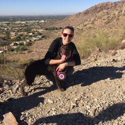
Came here with my hiking club for the first time this morning and had an amazing time! Parking can be a bit of a challenge but we were able to find a parallel park spot along the side of Invergordon. Please be aware of the no parking areas however as they are strictly enforced. While I'm on the topic of strict enforcement, it's insane the amount of rules this area has. There are literally signs ever few feet along Cholla Dr. advising "no stopping, no parking, no standing, no waiting." They're now even trying to ban dogs on the trail! I mean I understand wanting some peace and quiet in your neighborhood but I think things here are a bit comically extreme. Breaking the law by standing? Please. Anyways, back to the actual trail. The incline is fair for the first half of the way until you get to the flat bed followed by the rock scramble. If you don't like scrambling, I don't know what to tell you other than Camelback is not for you (the other trail up, Echo Canyon, also has scrambling). If you, like me, DO enjoy scrambling, prepare for some fun! It feels super rewarding to reach the summit and take some time to appreciate the 360 of beautiful AZ scenery. If you hike Camelback during the holiday season, you may be lucky enough to find a Christmas tree and Santa at the top! read more


As I was climbing up a second set of rocks in my flat Star Wars shoes, I had to ask again... "Did we really take the easier of the two trails?" Not saying that I'm a fantastic hiker, but I thought I could hold my own on a moderate trail. I guess this proved me wrong! The other side is supposed to be more strenuous and only for the more advanced climbers. We opted to go at sunrise as I wanted to catch of one of those gorgeous Arizona views during our walk. Located near a residential area, parking can be tricky, even when you arrive early on a weekday morning. As the day progresses, it's a full on process to find a spot to leave your car, so keep that in mind if you think you're going to just stroll on in without any trouble. Because it's not so far off the main road, taking an Uber may be a more convenient way to head out there. The trail is clearly marked and where you have to go is indicated with quite a few signs. There are a few points where it gets rocky (pun intended), but just follow the blue dots spray painted along the way to ensure you're taking the correct path. There are a lot of great lookout points at various points that give spectacular views of either side of the mountain. I didn't understand why people couldn't bring their dogs on this trail until we got about a quarter of the way up. Some of the trail becomes quite steep and narrow, so it's probably safest not to have your four-legged friend on this one. Be courteous along the way and let people pass if things get too tight! What you should bring: - Real hiking shoes + lots of water What you shouldn't bring: - Your favorite Star Wars slip-ons I'd love to come back and take it on again... with proper footwear that is! read more


10 years ago
I think Camelback Mountain is my Everest. I have tried to climb to the top twice and have turned around before reaching the summit because my cells no longer have the affinity to hold on to water, and I now dehydrate easily. So take heed visitors that are not used to desert climates! Bring more water than you think you may need because desert dehydration is real and this is the wrong place to test your cells proclivity to hold water. (Too many boulders, twigs, and loose gravel) This hike is great ~2.3 mile (up and back) hike along a shadeless trail with a steep ~1142 feet steady butt burn kind of climb. That doesn't include the .25 to 1 mile walk from Invergordon where you have to park. There will be boulders, rocks, cacti, and seemingly harmless gravel that you will slip on and then gain more respect for. I thought it was going well until about 2/3rds up. At that point I was relying on my haunches more than a woman of my fitness level should and when they started to fail, I clawed my way up using my hands (the scrambling portion around marker 25). You know your day has taken a turn when your hike turns into a literal climb! I was so close to the top but, I know my limits and when it's 95 degrees at 8 in the morning and the bottle of Arrowhead water I stuffed in my sports bra (because I needed my hands free to climb) was only half full....I knew it was time to turn around. I have to say that Phoenicians are quite a polite and supportive bunch. It's pretty easy to lose sight of the trail but people were happy to point me in the right direction. Also, most people make an effort to safely get out of your way and share the very narrow trail when passing. Lastly, I would like to extend a special thanks to the Park Ranger who, like a mirage, had a cooler filled with ice water and he allowed me to refill my tiny lil Arrowhead bottle! read more


 - Hiking Near Me - Paradise Valley, Arizona")


Camelback has always been on my Phoenix to do list. The Cholla Trail was a challenge, especially for the last quarter of the hike where there's some bouldering. But like any great climb, you're rewarded in the end with a great view. I don't think it can be reiterated enough to respect the heat and start before sunrise or close to sunset. There's no hiding from the sun once it's up in full force. Bring plenty of water and don't fear that you're bringing too much either. All 6 of our bottles of water between my wife and I were done by the time we got back to the car. Parking on Invergordon will add approximately another .5 mile each way to and from the Cholla trail head depending where your car is. And as of July 2016, no dogs are permitted. The first mile on the trail is a moderate incline and enough to get the heart rate ramped up, but the switchbacks take away some of the sting. I thought the last portion just past the helipad was challenging, but fun. The view at the top isn't as breathtaking as something like Angel's Landing in Zion, but you are definitely looking down on everything. With about a 20-30 minute break at the top, the 4 mile round trip hike took us around three and a half hours with just under 1300 feet in elevation gain total. The crowd wasn't too bad for starting just after sunrise, but I wished we would have started about 30 minutes earlier because we were feeling the heat and really had to push at the end. We'll take this learning experience next time to Echo Canyon. read more


8 years ago
Okay - so the only reason I can't give this trail a 5 Star is because was so busy!!! We went around 2:00- which maybe is peak traffic? Not sure. Short but challenging hike- I think about 3 miles total. Be ready to crawl on all 4s on the way up and down (mostly towards the top Of mountain). Don't carry your water- you will need your hands free. (But do remember to bring water!) read more


3 years ago
Disclaimer: I'm a midwesterner born and breed. My idea of "hiking" involves a flat pathway along a forest preserve. With that in mind... I had an amazingly outlandish idea that we were going to handle Echo Canyon. We drive 30-ish minutes only to see that it's closed 'til mid Jan '14. Perhaps the fates spared us as we took to Cholla Trail. We parked along Invergordon and made our way up. I'm ashamed to say that we arrived the same time as a father and his ten-ish year-old daughter... and they out-paced us. Cholla Trail was a moderately difficult hike with some narrow spots. I'm amazed at the folks who I saw running. Also saw a bunch of folks with some fresh cuts and scraps. Had breathtaking views of the sunset on our way back. Definitely recommend! read more

10 years ago
I've done a lot of hikes in a lot of places and didn't really believe everyone who said the hike was "challenging". Well it was... The first 2/3 is a solid hike with great views, and just when u think you must almost be done you get to "the saddle". If u are tired consider stopping here. The last portion of the hike is scrambling up rocks. So yes I got to the top , and it was gorgeous but what goes up must come down. Be really careful. I saw tons of people slip. After the hike I read a bunch of articles about people getting airlifted out including a former nfl player. It's a great workout and really beautiful but be safe, know your limits! The airlift rescue won't be a very cool Instagram pic Also, on my way down at marker 6/35 a fairly fit couple asked if they were almost to the top. Ummmm no. They turned around at that point. Don't give up that soon! read more


9 years ago
A humbling experience. I am an avid hiker, I can hike 2 hours in my sleep for sure, but this had a degree of difficulty I wasn't expecting. I had just watched a YouTube video of a Mom with a tot in a backpack carrier using a walking stick to climb to the top. This young lady did not have an athletic body type either. I thought, if she can make it...So can I. Well, it took me 80 minutes and some determination to get to the top. I almost turned back. The view is worth it. There is quite a party atmosphere at the top. The other hikers are totally friendly and helpful. They will take pics for you and share water with strangers who didn't bring enough. 45 minutes to get back down. It's tricky at times. Sheer and slippery in places. You must step lively and share the narrow trail. Bring 2 lites of water. Wear stretchy clothing. Wear a hat. I HATE wearing hats, but it really is necessary. Go before the high heat if the day. I left at 8:30am. It was getting too hot to touch the rocks by 10:30. There is some scrambling involved. A park ranger ensures you don't park or drop off on site. Park on 64th and walk in about 10 minutes to the trail head. There are zero bathrooms or facilities, so plan accordingly. I'm glad I did it, but I probably won't do it again. Today, I saw children as young as 7 climbing to the top. Many senior citizens and one visibly pregnant woman as well. There were also many adults turning back. It's free! read more


Page 1 of 3
More info about Cholla Trail
5150 N Invergordon Rd
Paradise Valley, AZ 85253
Directions
Visit Website
https://www.phoenix.gov/parks/trails/locations/camelback-mountain/trails
Hours
Indoor Amenities
Outdoor Amenities
Ask the Community - Cholla Trail
Review Highlights - Cholla Trail


Why does Yelp recommend reviews?
Cholla Trail - hiking - Updated June 2026
Best of Paradise Valley
People found Cholla Trail by searching for…
Hiking Trails With Waterfalls in Paradise Valley, Arizona
Easy Hikes in Paradise Valley, Arizona
Scenic Overlook in Paradise Valley, Arizona
Scenic Drive in Paradise Valley, Arizona
Paved Walking Trails in Paradise Valley, Arizona
Sunrise View in Paradise Valley, Arizona
Sunrise Hike in Paradise Valley, Arizona
Stairs Workout in Paradise Valley, Arizona
Scenic View in Paradise Valley, Arizona
Sunset View in Paradise Valley, Arizona
Watch Sunset in Paradise Valley, Arizona
Running Trails in Paradise Valley, Arizona
Parks in Paradise Valley, Arizona
Stargazing in Paradise Valley, Arizona
Secluded Spots in Paradise Valley, Arizona
Things to Do in Paradise Valley, Arizona
Caves in Paradise Valley, Arizona
Rock Climbing in Paradise Valley, Arizona
Beautiful Views in Paradise Valley, Arizona
Lookout Points in Paradise Valley, Arizona
Stair Climbing in Paradise Valley, Arizona
Swimming Lakes in Paradise Valley, Arizona
Trending Searches in Paradise Valley, AZ
Black Owned Nail Salons near Cholla Trail
Cliff Jumping near Cholla Trail
Dog Friendly Trails near Cholla Trail
Fishing Spots near Cholla Trail
Jet Ski Rental near Cholla Trail
Kayak Rental near Cholla Trail
Lakes & Ponds near Cholla Trail
Outdoor Activities near Cholla Trail
Places To Walk Around near Cholla Trail
Public Pools near Cholla Trail
Public Shower near Cholla Trail
River Swimming near Cholla Trail
Scenic Night View near Cholla Trail
Scenic Overlook near Cholla Trail
Secluded Spots near Cholla Trail
Soccer Store near Cholla Trail
Strawberry Picking near Cholla Trail
Sunrise View near Cholla Trail
Swimming Holes near Cholla Trail
Swimming Lakes near Cholla Trail
Browse Articles
Browse Nearby
BEST of Paradise Valley, Arizona Coffee near Cholla Trail
BEST of Paradise Valley, Arizona Restaurants near Cholla Trail
BEST of Paradise Valley, Arizona Things to Do near Cholla Trail
BEST of Paradise Valley, Arizona Breakfast near Cholla Trail
BEST of Paradise Valley, Arizona Walking Trails near Cholla Trail
BEST of Paradise Valley, Arizona Parks near Cholla Trail
BEST of Paradise Valley, Arizona Sightseeing near Cholla Trail
Browse Brands
Related Searches in Paradise Valley, AZ
Affordable Kayak Rental Services in Paradise Valley, Arizona
Best Fishing Locations and Guides in Paradise Valley, Arizona
Best Places for Horseback Riding in Paradise Valley, Arizona
Best Waterfalls and Swimming Holes in Paradise Valley, Arizona
Check Out Off Road Trails in Paradise Valley, Arizona
Discover Dog Friendly Trails to Explore in Paradise Valley, Arizona
Discover Scenic Hiking Trails in Paradise Valley, Arizona
Discover Scenic Mountain Bike Trails Near Paradise Valley, Arizona
Discover Scenic Waterfall Spots in Paradise Valley, Arizona
Discover Top Scenic Spots to Visit in Paradise Valley, Arizona
Discover the Best Night Hike Trails in Paradise Valley, Arizona
Dog-Friendly Hikes With Dogs in Paradise Valley, Arizona
Enjoy Camping Adventures Around Paradise Valley, Arizona
Enjoy Exciting Mountain Biking Adventures in Paradise Valley, Arizona
Enjoy Kayaking Adventures in Paradise Valley, Arizona
Enjoy River Tubing Adventures in Paradise Valley, Arizona
Enjoy Tent Camping Spots Around Paradise Valley, Arizona
Enjoy a Beautiful Waterfall Hike in Paradise Valley, Arizona
Enjoy the Best Walking Path in Paradise Valley, Arizona
Enjoy the Best Walking Trails in Paradise Valley, Arizona
Exciting Cliff Jumping Spots in Paradise Valley, Arizona
Experience Thrilling White Water Rafting in Paradise Valley, Arizona
Explore Beautiful Parks and Green Spaces in Paradise Valley, Arizona
Explore Easy Hikes Perfect for All in Paradise Valley, Arizona
Explore Fun Activities to Do in Paradise Valley, Arizona
Explore Popular Campgrounds Near Paradise Valley, Arizona
Explore Popular Scenic Overlook Points in Paradise Valley, Arizona
Explore the Best Beach Spots in Paradise Valley, Arizona
Explore the Best Boating Spots in Paradise Valley, Arizona
Explore the Best Trail Options in Paradise Valley, Arizona
Find Beautiful Views in Paradise Valley, Arizona
Find Cozy Camping Cabins in Paradise Valley, Arizona
Find Popular Ziplining Spots Around Paradise Valley, Arizona
Find the Best Parks for Picnics in Paradise Valley, Arizona
Find the Best Scenic View Locations in Paradise Valley, Arizona
Great Places to Walk in Paradise Valley, Arizona
Hiking Trails With Waterfalls in Paradise Valley, Arizona
Off Leash Dog Hiking Trails in Paradise Valley, Arizona
Plan a Scenic Drive Route Near Paradise Valley, Arizona
Popular Fishing Spots to Explore in Paradise Valley, Arizona
Popular Outdoor Activities to Try in Paradise Valley, Arizona
Popular Picnic Spots to Visit in Paradise Valley, Arizona
Safe River Swimming Areas in Paradise Valley, Arizona
Safe and Fun Parks for Kids in Paradise Valley, Arizona
Top Climbing Spots and Gyms in Paradise Valley, Arizona
Top Running Trails to Explore in Paradise Valley, Arizona
Top Swimming Lakes to Enjoy in Paradise Valley, Arizona
Top Swimming Spots and Pools in Paradise Valley, Arizona
Walk Dog Friendly Hiking Trails in Paradise Valley, Arizona
Walk the Best Paved Walking Trails in Paradise Valley, Arizona