1. Sky Valley Visitor Center

0

Sky Valley, GA

Cancel

Open app

Search

Sky Valley Visitor Center

5.0 (2 reviews)

SKY VALLEY VISITOR CENTER · YELP ASSISTANT

Ask Yelp Assistant

Sky Valley Visitor Center Photos

More like Sky Valley Visitor Center

Recommended Reviews - Sky Valley Visitor Center

Your trust is our priority, so businesses can't pay to alter or remove their reviews. Learn more about reviews.
Yelp app icon
Browse more easily on the app
Review Feed Illustration

2 years ago
Helpful 0
Thanks 0
Love this 0
Oh no 0

10 years ago

Helpful 22
Thanks 0
Love this 22
Oh no 0

Verify this business for free

People searched for Parks 200 times last month within 15 miles of this business.

Verify this business

Dick's Creek Falls - From the top of the falls

Dick's Creek Falls

4.3(3 reviews)
8.6 mi

These falls are gorgeous. But they you will need an suv to ford the river on sandy ford road to get…read moreto trailhead. Currently the bridge to dicks creek is out and you have to either walk on stopping stones, walk on a tree log across or get in the water. All options are worth it as you will love seeing these falls and sitting ththere for hours. So plan ahead and u won't be ddisappointed

There are two things about Georgia that make me scratch my head. One would be some of the old laws…read morethat are still on the books here, such as: 1) It is illegal to keep a donkey in a bathtub. 2) No one may carry an ice cream cone in their back pocket on a Sunday. 3) In Atlanta, it is against the law to tie a giraffe to a telephone pole or street lamp. WHAT'S IN A NAME? The other thing that makes me scratch my head is how notorious Georgia is for having several places with the same name. Metro Atlanta has over 200 streets with the name Peachtree. Also, if you are looking at a map leading to THIS waterfall, you will notice a town by the name of Pine Mountain in the upper right corner of the state. However, there is also a town by the same name one hour south of Atlanta. Similarly, there are two Dick's Creek (as if one weren't enough) and both have waterfalls bearing their name. The other is "smaller", located about 55 miles east of these falls and is a gorgeous 20-foot multi-tiered waterfall with a swimming hole at the base of the final drop. It is (in my opinion) one of the best-looking waterfalls in Georgia and no hiking required to reach it. You can practically park on the upper tier and find your way down to the swimming hole below. A small waterfall that proves its how you use it that counts. THE HIKE THIS Dick's Creek Falls (located in Rabun County) is much taller @ 60' and looks like a giant Slip n' Slide. To get to the waterfall you must travel Sandy Ford Road until it intersects with the Bartram Trail. Follow the trail north until you cross Dick's Creek. Turn right after crossing the first foot bridge and when you see a second foot bridge on your right, cross it also and continue to follow the trail straight. There will be a small opening on the right side of the trail that leads you to the top of the falls. The vantage point here will allow you to see upstream of the Chattooga River. Continue a few hundred feet down the trail to find an opening that leads you into the Chattooga River. I did not find a direct trail to the base of the falls, but from this opening expect to get your feet wet! You must get wet IF you want a great photo of the falls. But don't fret, the view downstream and upstream on the river is actually more beautiful than the waterfall itself. The river bends and cascades 100 yards from the base of the falls and creates a very unique photo opportunity. The Chattooga River was not deep or raging the day I visited, so the current was mild. It only came as high as my thigh as I crossed over the weirdly hairy stones and a sandy bottom, which I suppose is where Sandy Ford Road gets its name. Upstream I could see kayakers approaching and on the dry boulders near the rivers bend there were sunbathers. The most attractive thing about Dick's Creek Falls is the area surrounding the falls is simply one of the best looking of any of the waterfalls I've been to in the state. Picturesque is the only world that comes to mind. NOTES: While driving to the trailhead, if you stay on Sandy Ford Road past the trail entrance it will lead to a beach-like area off the Chattooga River. This area is downstream of the falls. Also, there are only three places a vehicle could park comfortably near the trailhead. [ DIRECTIONS ] From US-23 (Hwy 441) in Clayton, Georgia travel east on Rickman Road. In 1/2 a mile it will merge into Warwoman Road. 5.3 miles from here make a slight right onto Sandy Ford Road. Stay right and follow it down to the small concrete bridge over Warwoman Creek. Stay on this road approximately 3.2 miles to the Bartram Trailhead (you will see wooden signs). Follow the trailhead to the left of the road as you drove in. The trail to the right will take you back to Warwoman Dell and NOT towards the falls. Once on the trail, make a sharp right after you cross the first foot bridge then another right when you see a second footbridge and follow the sounds of rushing water. Overall trail is about 1.2 miles round trip and not very steep. FINAL THOUGHTS A beautiful waterfall and a even more beautiful natural area to bring the family on a hike (and play in the water). Just know there is no easy way to get a full and unobstructed photo of the falls without walking out into the Chattooga River. I did see what seemed to be an unsanctioned side trail to the base, but it was steep and didn't at all look safe. Another option would be to bring your own kayak and launch from further upstream. Here also is a link to the OTHER Dick's Creek Falls just in case you have a little more adventure in you after your visit: https://www.yelp.com/biz/dicks-creek-falls-cleveland?osq=Dick%27s+Creek+Falls 2018/56

Photos
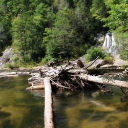
Dick's Creek Falls - Dick's Creek Falls from a distance (about 60' tall)

Dick's Creek Falls from a distance (about 60' tall)

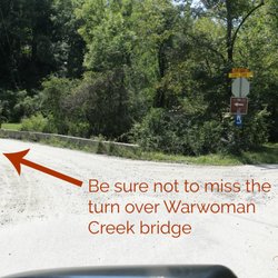
Dick's Creek Falls - Important turn you shouldn't miss

Important turn you shouldn't miss

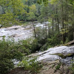
Dick's Creek Falls - Downstream at the bend in the Chattooga River

See all

Downstream at the bend in the Chattooga River

Martin Creek Falls - Base of Martin Creek Falls approximate height here is about 15 to 18 feet of the overall 30 feet height of the entire falls.

Martin Creek Falls

4.7(3 reviews)
6.9 mi

The fifth star is for the waterfall!…read more We hiked this trail via Becky Branch Falls. As I mentioned in my review for that trail, there is some road noise as you hike relatively parallel to Warwoman Dell Road for the first mile or so. Then the trail turns north and it fades away. I would call this trail pretty easy but maybe a little tricky in parts if you are terrified of heights and falling to your doom, like I am. The trail narrows here and there so a misstep will, in my irrational mind, send you careening down the side of the mountain. The waterfall at the end of the trail is gorgeous. We spent a few minutes taking it in before heading back the way we came. There is the option to continue on to Pinnacle Knob but as we had no cell service and hadn't looked up the trail, we decided against it. I would definitely come back and take on Pinnacle Knob on a future trip to Clayton!

Beautiful waterfalls and very easy to get to from warwoman dell parking lot. The trail is abt 2…read moremiles one way with an easy water crossing within 5 min. You can avoid it if you take the trail on the right of road crossing instead of going straight. The path is mostly gentle and downhill to falls but it felt ssteep and uphill on our way back from pinnacle knob at the end of 8 Miles. Always an awesome hike especially after rain or with fall colors

Photos
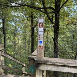
Martin Creek Falls - The bridge to the viewing deck

The bridge to the viewing deck

Martin Creek Falls - The viewing deck

The viewing deck

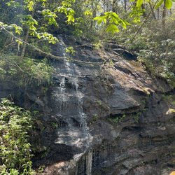
Martin Creek Falls - The cascading stream heading downhill.

See all

The cascading stream heading downhill.

Tallulah Gorge State Park

Tallulah Gorge State Park

4.5(211 reviews)
17.4 mi

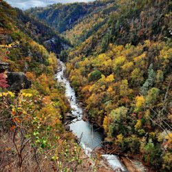
Nothing better on a crisp autumn morning than listening to rushing water over rocks, or the hike to…read moresee it! Well-maintained trails and industrial grade stairs (over 1,000 of them) lead you to a beautiful canyon in the Blue Ridge Mountains where you'll be reminded just how small you really are. And that is a very good thing. When the sun comes up, it looks like a totally different scene.

I came here on a very hot summer day with the plans to see some waterfalls. We got here around…read more8:30am which I believe is when the park opens. We took the South Rim (At least I think it was the South Rim) and went to all 5 viewing points which is a flat walk and a round trip of about 1.5 miles. Then we went down into the Gorge which includes 1,099 steps (actual staircase) to the bottom and of course that many steps back up. You can't go all the way to the Gorge floor without a permit but that just means you can only walk down 1,089 steps to a platform. There are plenty of places to stop including a very cool suspension bridge that overlooks Hurricane Falls. This was pretty tough for a 50-year-old fat boy like me but it's doable if you can simply climb stairs. The views are amazing and worth the quads burning for the next 3 days. The visitor's center is really nice. There is of course a gift shop. a huge display of taxidermy of all the local wildlife and a very nice museum that goes through the history of the region. The most important part is they have air conditioning. Suck it up, take the stairs and buy the t-shirt saying you did it when you are done.

Photos
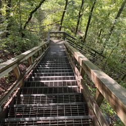
Tallulah Gorge State Park - Part of the 1,099 steps to bottom of Hurricane Falls

Part of the 1,099 steps to bottom of Hurricane Falls

Tallulah Gorge State Park

See all

Riley Moore Falls

Riley Moore Falls

5.0(4 reviews)
19.6 mi

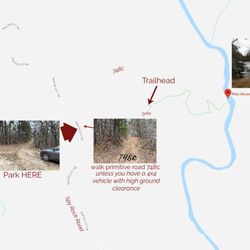
I just wanted to update my 3/15/20 review below to add I've now done this hike several times, but…read moreTHIS time I had the chance to hike it with a friend who is directly related to the namesake of the waterfall... Riley Moore. Sandie is a church friend of mine and Riley Moore was her Great Great Uncle (I believe that's right). He once upon a time operated a grist mill here at the top of the falls. She's been trying to get here to see the waterfall, but couldn't find it and wanted to join us (along with her family) since I knew the way. Upon further research I discovered there are actually still remnants of the mill including visible drill holes, spikes and bolts. Thought that was pretty cool info to share! [ [ [ PREVIOUS REVIEW ] ] ] Riley Moore Falls is small in height but HUGE in personality. It's located off State Road S37-748, which is a nicely maintained gravel road where cars and trucks alike can comfortably traverse. ~~~ DIRECTIONS From Westminster, SC - DO NOT turn onto Cobb Bridge Road from Long Creek Hwy (Hwy 76) where you will see the brown & white sign pointing you in the direction of Riley Moore Falls. Our GPS had us go this way, then left onto State Road S37-748, but the road was CLOSED during our visit! INSTEAD, turn onto PU-32 also known as Rocky Fork Road. Turn left onto a gravel road near Rocky Fork Baptist Church and follow that until it dead ends @ State Road S37-748 (also known as Spy Rock Road). Turn right and drive approx. 1.4 miles (4 minutes) to 748c (aka Riley Moore Shoals Road). Park at the intersection of State Road S37-748 and 748c. DO NOT ATTEMPT TO DRIVE 748c in a car or minivan. Low clearance vehicles will find the terrain on this road to be VERY difficult to navigate without bottoming out or getting stuck. I'd also recommend 4x4 capability on wet days! There can be several deep-pocketed muddy areas after heavy rains. ~~~ THE TRAIL Once you reach the intersection of Spy Rock Rd (S37-748) and 748c, park roadside on Spy Rock, secure your vehicle and begin your hike approx. 1/2 mile down the "primitive road." IF you have a high ground clearance SUV or truck, you can drive the primitive road another half mile or so to a second parking area near the trailhead. The primitive road is VERY BUMPY  and can be muddy in spots after heavy rains, so a 4x4 is best. After reaching the second parking area, follow the marked trail on the left!!! The trail is a little over a 1/2 mile to the falls from here. The trail is fairly straightforward and easy to follow. ~~~ THE FALLS Once you reach the Chauga River, you will notice a large sandy area with plenty of room for an entire horde of hikers!!! Riley Moore Falls is not very tall (only about 12 feet), but it is very wide and has a deep base pool. PRO TIP - Bring swimwear, towels and a picnic, but be sure to pack it in and pack it out. ~~~ THINGS TO KNOW Hiking Distance: 2 miles (round trip to falls from S37-748) Difficulty of hiking 748c: All downhill to trailhead (moderate return) Difficulty of hiking trail to falls: EASY Creek Crossings: NO Elevation Gain: 357 feet Waterfall Height: Approx 12 feet Access to top of falls: NO - not without getting wet Access to base of falls: YES Pool of water @ base of Falls: YES Sitting areas @ base: YES + sandy beach RESTROOMS: NO PARKING: YES (along road) + secondary parking area closer to trailhead for trucks and high ground clearance vehicles with room for about 6 cars. ~~~ [ FINAL THOUGHTS ] A lovely waterfall in any season, but also a great spot for a summer swim. While we had the waterfall practically to ourselves during our Mid-March expedition, be advised other trail website reviews say it gets trashy & crowded in summer months. What a shame if that is true because it truly is a treasure. ENJOY! 2022 / 74 #UPDATE 178

This is the best waterfall we got to visit in SC this far. After we left Reedy Branch Falls we…read moredrove here. Well, as close as we could get. I didn't realize that we couldn't drive all the way to the trailhead so we had a long hike in store due to me having to carry my toddler most of the time. I should have re-read the previous reviews before coming. My friend did help me carry her as well and for that I was very thankful. So definitely don't recommend this hike with a little one unless strapped in a carrier. Also, I don't recommend it for the elderly either. It's definitely a wilderness hike deal with roots and elevation change. In fact, it's mostly downhill on the way to the falls, but on the way back it's pretty much all uphill, which was not fun with aforementioned young child. It's about a half mile to the actual trailhead and then another 0.7 mile to the falls. That's about 2.4 miles round trip. The reason of course that my boys absolutely became enamored with this place is the large swimming hole. It is wonderful and has plenty of space. The waterfall itself is beautiful and although it's not as tall as others, its width is quite impressive. I was trying to get as close as I could and even noticed a hidden part of the falls inside of the rock structure. That was so cool!! The sand at the base and shore give it a beachy vibe. We definitely packed it in and out making sure not to leave anything behind as to preserve the area as best as possible. Needless to say we were wiped by the time we made it back to our vehicles, but we're still glad we decided to venture here. Coming back with my hubby and boys in the very near future. Happy yelping!

Photos
Riley Moore Falls
Riley Moore Falls - CREATED FROM GOOGLE MAPS

CREATED FROM GOOGLE MAPS

Riley Moore Falls

See all

Sky Valley Visitor Center - parks - Updated November 2026

Loading...
Loading...
Loading...