Mori Point Photos



You might also consider


More like Mori Point
Recommended Reviews - Mori Point
Start your review...


Reviews With Photos


Foggy start of the walk and clear when finished sorry to the beloved Chit Chat cafe at the pier that got demolished. A bit of road closer and construction. It's still a great easy walk. People fishing. Dogs.


Highly recommend this beautiful trail. Gorgeous views. Easy and try to go all the way to the top. Got lucky the day I came as it was beautiful sunny day. Some spots were a bit muddy from the recent rain but so worth it. It wasn't too busy but plenty of hikers runners and very pet friendly.


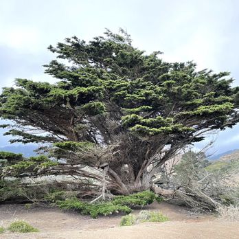
It was a pleasant and easy hike by the coast. It is not too crowded. However, the trail appears more eroded each time I go. The trees around are a spectacle and the coast is gorgeous. Can see beautiful, invasive weeds near the end of winter


Love hiking this scenic trail! There are so many paths you can take to tailor it to your own comfort level and goals, but I highly recommend going all the way to the top if you can- the views are incredible every time! Only thing is definitely wear hiking shoes with good grip because there's a decent amount of loose gravel which makes generic exercise shoes slip. If you're going after heavy rains the bottom creek could be flooded and challenging to cross.


This was a great place to take a long walk. We did the mostly flat, easy walk out to the ocean. We walked approx 45 minutes out & then back. Its clean, folks are friendly. Highly recommend!


Beautiful hike with gorgeous views. Lots of uphill and downhill,must wear proper shoes to not slide down. Somewhat child and dog friendly but for kids I would say 7 years old and up unless they are avid hikers. Lovely views. Came today around 1pm and hiked until almost 3pm and went down to the beach after the point by the steps. Weather was sunny with patches of clouds here and there and some wind but felt comfortable and warm with short sleeves.
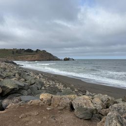

This stunning walking trail begins with numerous gorgeous memorial gardens. The gardens are beautifully maintained and house amazing tributes. The path goes up to (what I'm sure is) a spectacular ocean view. I opted for the easier route and did not go up the steep looking hill and was rewarded with all incredible ocean view as well. Plus we walked around some of the little town nearby. It was idyllic and the weather was perfect.
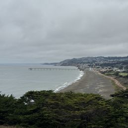

The most amazing part about Mori Point is that the entrance is tucked right inside a residential neighborhood. After parking, you're surrounded by quiet houses and local streets, and nothing really hints at what's coming. That contrast is what makes the experience so special. As you walk up the trail, the view slowly opens up. Before long, the entire Pacific Ocean comes into view. On a clear day, you can see layers of blue stretching all the way to the horizon. Turn around, and you get a full panoramic view of Pacifica--the city spreading across the hills, blending seamlessly with the coastline. Standing at the top, ocean on one side and city on the other, the perspective is truly unique. The trail itself is fairly easy, mostly a gentle incline. It's not a hardcore hike, but more of a relaxed walk where you naturally stop often just to take it all in. The ocean breeze can be strong, but it's refreshing rather than harsh. Walking near the cliffs and watching waves crash against the rocks has a calming effect that makes your mind slow down. What I personally love most is how open everything feels. There aren't many tall trees blocking the view, so the sky, ocean, and city are all laid out clearly in front of you. Every few steps feels photo-worthy, not because you're tired, but because the scenery keeps pulling you in. The only downside is parking. There's basically no real parking lot, so you'll need to rely on street parking in the surrounding neighborhood and walk a bit to the trail entrance. Weekends can be tight, but the short walk feels like a nice transition into the experience.


Fun place to explore in Pacifica! Great views from above the cliffs. Connects to walking path to the pier.


Beautiful trail in Pacifica! There is a small parking lot by the trailhead, but you also can park at the Rockaway Beach lot. We went around 11:30am on a Saturday in May and it was somewhat busy. Weather was a little overcast and windy but manageable. The hike itself is straightforward, more on the easy-moderate side. There is some incline at the start of the trail going up to the point, and then it gets easier after that. There were some trail markers but easy to get lost and we accidentally deviated from the trail at the start so I recommend following a map. The last portion of the hike is along highway 1. Hiking shoes not necessary but would recommend. We really liked how the hike takes you along the coast! It goes right by the ocean and the trail passes by a few beaches. There were still some pretty wildflowers along the path. I would definitely come back, especially when the flowers are blooming in spring time!


Had a lovely little stroll along the coast and got to see beautiful wildflower at Mori Point. The entire hike was relaxing and so pretty. There's a staircase that leads up to the highest vista point for a breathtaking view of the ocean and field of wildflowers. There are purple lupines and some yellow daisy like flowers which I wish I knew the name to. There are some orange poppies mixed in as well. Absolutely enjoyable walk with the sea breeze and little bit of sunshine. We lucked out and got a sunny day today but not hot at all.


One of my favorite easy hikes in the peninsula. It's so beautiful and there is a part that gets steeper and uphill but it's not difficult at all. Beautiful views once you get to the top


Was pleasantly surprised by the pink flowers that I spotted on this beautiful trail along the pacifica coast. This is a very doable trail with no technical difficulties in my opinion with most spectacular views of the ocean along your way!! This is going to be my goto trail as it is so close to my home:yay:


3 years ago
Gentle hike with panoramic views of the Pacific Ocean. Parking can be a challenge on a nice clear day. Good place to take kids or walk your dog. read more


Beautiful hillside and coastal trails here! If you want to getaway from the city life for a bit, then I recommend hiking Mori Point. It was easy to find parking and the trails here are easy to hike. Sometimes I get tired of woodsy hikes, so I'm glad there is a coastal trail here in the Bay Area! The views are stunning and I forgot I was in the Bay Area while I was here. I'll come back here to hike some of their other trails! read more


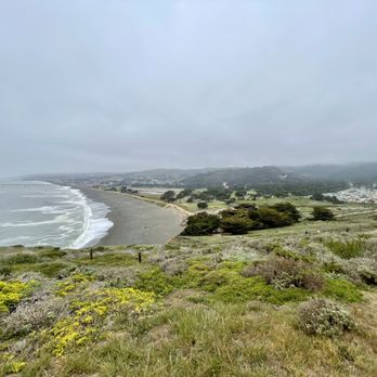

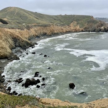


Parked on the street as the lot at Mori Point trailhead (on Google Map) was tiny. There was a public restroom right at the trailhead but there was trash everywhere and not flushed so pretty disgusting, but this was also after a holiday weekend. Brought our toddler w us who was able to hike most of it without being picked up. ~1.5 hours from Old Mori Trail to Bootlegger's Steps, Mori Headlands Trail to Coastal Trail to Lishuma Trail to Upper Mori Trail. There were colorful wildflowers. Most.of the trail is exposed except at the beginning. Came at 9am on a weekday and if was foggy, misty and a little chilly. I would've loved to walk along the sea wall and Mori peak trail. read more


My cousin and I wanted to go on a hike near the beach. This hike was very SHORT. Nothing wrong with a short hike but I was a little surprised by how short it really was. It seemed to be fairly sunny on the Peninsula. However, it was super foggy that day. The address provided on this page made it a little difficult to figure out where to park. My cousin ended up finding a side path near the golf course on the map and we parked near some residential area. Although it was super foggy and a tad windy, we both enjoyed the small hike up the stairs to the point. The waves were insane and must have been during high tide. The sounds of the waves crashing into the rocks was very relaxing. Considering it was Wednesday noontime, there was a fair amount of people walking/biking on the paths. I would definitely this place for people who would like to get away from all the city noise and needed to recenter. read more


Still dreaming about the time we visited Mori Point... it's a scenic wonderland lol. I loved Mori Point and I can't wait to go back. We had beautiful weather so the 20 minute car ride trip from the city went very quickly. Everything from the gorgeous ocean view to the stunning mountain-like trail took our breath away. I felt like I was at the end of the Earth (despite the Earth being round). I'm not sure how dog friendly Mori Point is, but I did see a few pups there. We are hesitant about taking our pup due to the steep ledges and cliffs. But I'm sure a dog would be okay if the owner deemed it appropriate! I can't wait to return :) read more


I remember bookmarking this place when I saw my former coworker posted on Instagram of her on a swing which I absolutely love because I'm a big fan of swings. So the last time that I hung out with my bestie, we came here to find this swing to take our own pictures. Unfortunately, the swing is stabilized with a tree stump that somebody placed underneath so it's not swingable anymore which kinda sucks. Maybe something happened so they had to do that, but it still pretty sucky. Oh well.. There were alot of people out and about at Mori Point that day since it was such a lovely day out. Parking was hard, but luckily, we found a family that was leaving so we nabbed their spot. Would I come back? Probably not. There are other beaches that I still need to go visit. I so want to visit the one in the Davenport area because supposedly there's a swing there still that operational. Lol read more


Nice easy walking trail. Went on a weekday and saw some folks but it wasn't overly crowded. First time to walk here...after previously living in Pacifica for many years. Glad we finally visited. Nice views of the ocean and along the coast of Pacifica. read more

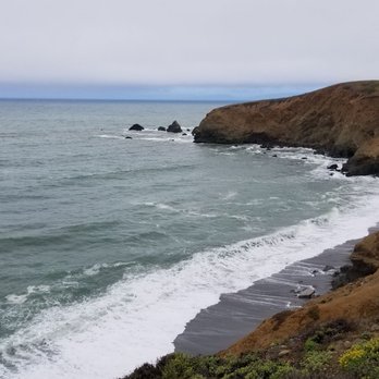


Mori Point is so beautiful around sunset. I went here over the weekend and was surprised how many people were hiking there. There's more than one path you can choose from to get to different areas of this hike or get different views. We chose the path that leads to the beach and saw a lot of people taking pictures with their professional cameras there. That is how beautiful it is during sunset. It wasn't too windy or cold here either so that was nice. Other hiking places near the ocean I've been to were very windy and this one wasn't. I'd recommend this place! It's very naturey and you can here a lot of frogs along one section of the path. There's also some signs to read for more info along this trail if you're into that stuff. Mori Point looks well maintained, is an easy hike, and great for photo ops too. read more




2 years ago
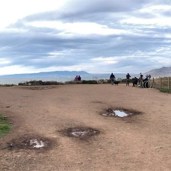
Great place to walk the dogs. The dirt trail is wide and flat. We followed the trail, which also runs next to the beach.it becomes paved near the pier. We stopped in Pacifica to get a coffee. If you're interested in California native plants,there is a wide variety along the trail. read more


You just have to come here. It's absolutely beautiful. We came here on Sunday July 5, 2020. The sun was out, no fog in sight, and it was glorious! So many whales breaching! Simply wonderful!! It's also COVID-19 times so nearly everyone we saw was wearing a mask or staying far away. There were lots of dogs too and every single dog was on a leash - even the solo picnicker had her dog on a leash. Please do note that there are lots of poison oak here. Some are right on the trail and some are not. Sometimes it's bright red like in my picture. But sometimes it's just green. Many people are allergic to poison oak so don't take any chances and stay away. Come with bottled water, binoculars and you'll have a great time. I didn't use the bathrooms at the trailhead but they're there. read more


4 years ago

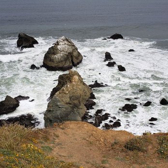
For Mother's day this year, my wish was to hike at Mori Point. After seeing a friend post she went hiking there I was amazed with the views. I told my daughter this is what I want for Mother's day. My first stop was at Mazettis bakery, when you drive to Pacifica it is a must to get Derby cake lol plus it is on the way! Anyways, driving along the 1 it is easy to miss the entrance sign of Mori Point. Thank goodness we arrived around 9ish because there is no parking. Literary residential area and there are signs no parking. Luckily a couple was leaving and I was able to take the spot. Upon entering beautiful wilderness surrounds the area with an open scenery. You can choose to to do hills or hike up to the point. My daughter wasn't feeling to be adventurous so we hiked around to the point and along the trail. I want to say I heart nature! The views were amazing!! Definitely worthy to come see. I've seen complaints it was not a 3 mile hike but it depends were you start and it you attempt to climb all the hills. Try starting from the pier and you'll get over 3 miles! Hope everyone had a great Mother's day. read more




4 years ago
One of my favorite places to watch the sunset in the Bay Area if the skies are clear! Hiking is one of my forms of self care and this place is a great spot for some fresh air. The area has numerous short trails than you can connect if you're in need of a longer walk or run. read more


Came for sunset to have a scenic view! Easy to navigate and found parking easily (probably as I'm coming in the evening). I like that there are signs and information about the plants and history. It's very clean and you get a nice view of both the beach and the land. A quick walk for days you want to get out for some nature but don't want to hike too much. There is a nice path for people to run/walk and bike along the beach if they like. read more


This is a gem of a park along the Pacific Coast Highway a few miles from Daly City. This is a 5+ star landmark without a doubt. Close to Daly City with free street parking. It's close quarters in the neighborhood but once you park, walk half a mile to the Mori Point Sea Wall and you will be moved by the ocean swells. I've been here on cold and warm days and the effect of the ocean is the same. You take a breath and reset your mind. The views from the Point are impressive. Recently we saw a whale blowing air in the distant ocean. A beautiful moment with my family. If you haven't been here yet - it's a must go for all Yelpers! Enjoy the pics! read more


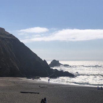


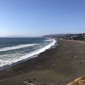

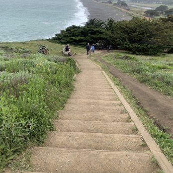


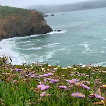
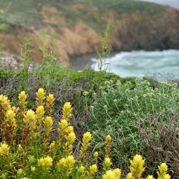

Beautiful simple and easy hiking trail. We arrived here Friday morning at by 9am and there were plenty of parking on the streets. When we left around 11am though, the streets were full and there seems to be barely any parking left. You have to park at the residential area since there are only a couple parking spots. Bathroom wasn't open, but there are porter potties. The start of the trail is about a 5-10 min walk that splits into left and right trails... right takes you along the boardwalk of the beach and left takes you to Mori Point. We took the left trail first and took the steep route to the top. It was a little steep so make sure you have enough grip on your shoes to handle the slippery parts. Once we got to the top the view was breathtaking! You'll see beautiful rocky beach and coastal views from almost any angle. All of this took about 20 minutes. Then we turned back around to go towards the beach. It was a pretty easy and short hike, perfect for our appetite. The weather at the time was slightly chilly but good weather for a hike; I like a breeze when I'm sweating and panting. Common courtesy is to wear a mask when you pass by others, but its super hard to breathe when you're hiking up a steep hill. I certainly took mines off during the steep hike since nobody else was around. 4 min away there's a beach where we stopped by for a picnic lunch. Would love to come back here! read more


Social distancing at its finest. We came here following the Mori point loop trail and we had a serene experience. The sites and sounds were beautiful, and on a bright day like today the ocean breeze was welcoming and cooling. You can watch the waves crash on the shore below and follow the dirt trail up onto the point, where you may see various blooming flowers during this season. It's easy to maintain a good distance from fellow hikers, especially if you travel up the steeper parts of the mountain! We can't wait to come back. Note: NO bathrooms on the trail we took, but other reviewers have said there are some nearby. read more


Nice hiking spot in the Pacifica area! Been here twice and both times I enjoyed the scenery as well as the trails! When I first visited Mori Point before the stay at home came into place, my friend and I parked near the entrance but this past weekend we had to park further out into the neighborhood. It's a great hiking trail and dog friendly! The trails here are a bit challenging if you're trying to go up the hills so be careful but you also do have a choice of just walking along the flat by the beach. ***FYI: There are signs in the neighborhood that says no parking unless you're a resident so be careful where you park during the Shelter in Place!*** read more


My family (myself, wife and two girls ages 7 & 9 + my wife's father) visited Mori Point and had a great time. First thing to be aware of is that the parking lot is very small (less than 10 spots) so unless you are extremely luck, you will likely be parking on the street in the neighborhood the leads to the entrance. When you follow the entrance path you will get to a point where you can go right and walk along the shoreline, or go right to begin the hike to the higher elevations. To get to the first plateau, you will be climbing stairs. At this level you will have some spectacular views. It was at this point, our girls wanted to go back down and play at the beach. Dad and I continued up to the next plateau. This was more strenuous and treacherous as the ground was loose and the incline was steep. What we did not know was there was an easier path. We should have gotten one of those maps we saw at the entrance but we are guys and we don't read instructions. The view from this plateau gave us even better views both north and south. There was one more hill to climb and we went for it. After arriving at the highest point and took in the view we contemplated getting back down. We started going in a few directions thinking that they were paths but they were way too steep. That map I mentioned previously would have come in handy at this point. So we ended up doubling back the way we came up. Then someone pointed out the easier path to go down and we were happy to take it as we were not looking forward to negotiating a steep decline. Overall I would consider the trip to the very top a strenuous hike and might be a challenge for beginners. The views of the coastline and the flowers were amazing. The pictures that we took just don't completely convey how beautiful it is. This park is a reminder of why it's so great to live here. If you have not been here you must go. read more

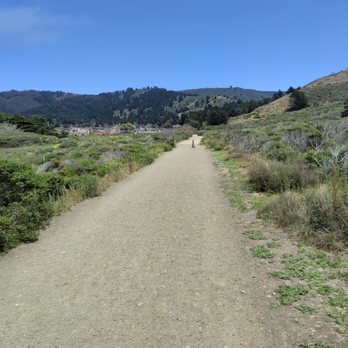


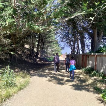


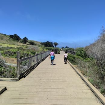


Just steal my heart, why don't you?! Mori Point is one of those places where you can spend your entire day. You've got the beach right at your feet, Pacifica Pier in the short distance, Sharp Park, and hikes that span as far away as Sweeney Ridge and further. Ugh. It's so perfect. There are so many great things to do here, but I just want to hone in on Mori Point for a second. This view is magical. Yes, it sounds cliche as ever... but it's true. Whether you're embarking on an intense hike to the point, or taking the short stroll up the Bootlegger's steps; you'll enjoy it all the same. Like... seriously numbing views y'all. Seriously. If you're a sucker for coastline views like I am, this place will make you fall in love. Been here twice so far; once via a killer 10 mile hike through Sweeney Ridge and another time through Sharp Park from the Pacifica Pier. Both experiences were wonderful. If you're looking for an intense hike to the point, I'd highly recommend the 10 mile loop from Sweeney Ridge to the point and back. But it's an INTENSE hike. Not for that faint of heart at ALL. A total of elevation gain of 2,000 feet and it's an all day hike. ALL day. For something more casual, you can connect from the Pacifica Pier and take a short one mile trail up the Bootlegger's Steps to the viewpoint. There are lots of other connector trails too, but these are the two that I took. You can go fishing in certain part of Sharp Park beach and there are picnic tables closer to Pacifica Pier. The stairs are also a good workout, and I found a few people who were running up and down them. I didn't think the beach was actually accessible, but some people were letting their kids get in there?? I'd probably double check first... Once you reach the point, you'll have marvelous views of the Pacifica Coastline. It gets really windy up there, so people don't really stay up there for too long. Bring a coat because it's super windy. At times it felt like even I was going to blow away, but it was still so beautiful to witness. Oh yeah, and the sunsets are pretty awesome if you can catch one. During the week it doesn't get too busy, but the weekends can turn into a zoo. There's limited parking at the Pier but there are a few parking lots near the entrance. This is also a great place to bring kids! There are wildflowers everywhere and the vegetation is extremely vibrant. The perfect place to picnic and relax. If you're planning on coming to Mori Point, you're in for a real treat. read more


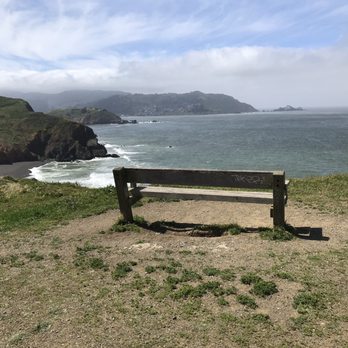


I was looking for somewhere easy to walk after brunch, and Mori Point/Pacifica Beach popped out on the search. We got there around 11am, parked on the street, and started the walk/hike along the coast. The view was amazing. It's hard to imagine that we have easy access to views like this. It was definitely very windy, but very hot after hiking up Mori Point. Make sure you dress in layers with comfortable shoes (and possibly with a hat/cap). Highly recommended if you are into easy hikes + ocean view :) read more


My second time at Mori Point . This time around the flowers were in full bloom. The hill tops are filled with tidy tips , blue eyes grass , lupines , ice plants , Indian paint brush , goldfields, etc. Thick fog on May 19, 2023. There's a new swing at the foot of the Bootleg Steps overlooking the ocean. We took the Old Mori Trail , Bootleg Steps and the Ridge Trail. There's a small parking and a restroom by the parking lot. read more


3 years ago
The Mori Point trail is accessible from Beach Blvd and is probably about 1/2 mile from the Pacifica Pier. There is a small parking lot between the pier and the start of the trail that you can park at, but can fill up fast, so you may need to park on the side streets. The walk from the start of the trail along the ocean and Sharp Park Golf Course to the stairs up to Mori Point is probably around 3/4 mile. The stairs up to Mori Point is probably around 1/4 mile or less, but it can be a steep climb if you have bad knees. The trail up to the the stairs from Beach Blvd is flat though. The stairs up to Mori Point can be a little intimidating if you are not the exercise type, but the views are worth it! We had parked on the parking lot on Beach Blvd and the round trip from the parking lot to the end of the Pacifica Pier, then back to the Mori Point Trail, then up to Mori Point and back down to our car was a little less than 3 miles. It's a beautiful walk on a nice day, but it's also nice with some light fog as well. read more





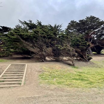


4 years ago
Found this place driving along the highway! It's a great scenic walk. I love California!!! read more


3 years ago
Beautiful place for a hike with the water view. It was an easy hike especially good for kids. Once you get to the specific location you can park your car on the street and follow the trail hike up to the pier. It was a short hike and easy, for 40 minutes you can completed the opposite side of the pier. On the opposite side of the pier it is sunny and warm. The flowers are gorgeous on top of the hill. The pier side is foggy and cold. There are no shops or any kind near the pier. Most people on the pier for fishing. The water was beautiful and blue. The sand is gray and black but are soft. You can have family gathering for BBQ on the pier side as there are couple of picnic table and BBQ pit. It is best to come on a sunny foggy clear day to enjoy on the pier otherwise it is dark and cold. It is funny that the opposite direction of the pier is completely different, sunny and warm! The place is usually busy on the weekend with kids but as for weekday, you can have the trail all to yourself. The trail was easy to managed if you are like me, not an expert on hiking. read more


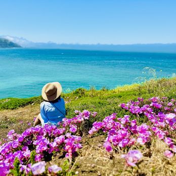


We parked in the neighborhood and walked the Old Mori Trail. Then we took the Bootlegger's Steps to get to "The Point," which is the main viewpoint. The wildflowers were not in bloom when we went at the end of May. It was very dry. It was a quick trip, as we were only there for about an hour. read more


* Parking: Ok, looking up Mori Point on Google maps was a bit confusing as we did not know where to park. Let me clarify for you - navigate to "775 Bradford Way, Pacifica, CA 94044". This will lead you to a little parking lot with a restroom. The little parking lot probably only holds about 5 cars. However, there is street parking in the residential area which is where we parked and then walked towards the restroom/old mori rd. * Experience: From Old Mori Rd to the Mori Point photo spot, it's probably only about 1 mile or less. But there is incline and stairs to get to the point. So plan accordingly! I saw a lady where high heels. Needless to say, she didn't hike up to the point while the rest of her family did. We came here mid-May and was able to catch a glimpse of the super bloom! It was definitely a pretty sight to see. I am totally in love with this low effort & high reward type hike. Honestly, it's more like a walk, I even wore jeans and was fine. Some ladies were there for the gram, so they were in long dresses. It's pretty windy up there, so I would refrain from wearing a short dress unless you want some Marilyn Monroe poses. I also saw some have picnics towards the edge of the point. It's definitely a great spot to watch the sunset and enjoy the views of the ocean in front of you and the rolling hills behind you. read more


Beautiful coastal views! Could easily spend 1-2 hours here going through several of the trails and large pathways. They all seem to be connected at various points. There were trail runners and pathways with steeper inclines if you like a challenge. Best time of year to come is during spring when you can see the wildflowers in bloom! Easy access point with a few parking spots, I was able to find parking on nearby streets. read more


It was drizzling and foggy when I came and I thought that would lead to less scenery to marvel at, but was I wrong. If anything, the overcast weather made it even more mysterious and beautiful. Mori Point allows you to see everything an outdoorsy person would want: trails, water, hills, and plants. I parked at the lot (people park alongside the road generally) and walked in until I hit the sea wall, then hiked a bit. Good social distancing and people generally wearing a mask. Trails are clearly listed with signs, and there is a great path to run alongside the beach. A beautiful spot to take a breather from chaotic schedules or when you just need a place to clear your head. Such breathtaking views! read more


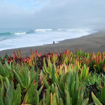

Located in Pacifica and accessible through the Pacifica Pier. It's very spacious and such a large area for people to come hike, walk, take their dogs and families out. It can get quite windy but such a beautiful view overlooking the water. There are steps in an area to go higher up and labyrinths within the trail. read more


6 years ago
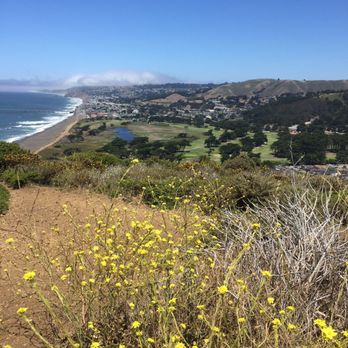
Mori Point is a small coastal area in the town of Pacifica. It is mostly made up 3-4 small hills and the valleys in between. Now when I say small, I only mean that it only takes 15 minutes or less to reach the peaks. It's not much compared to most other hills, but some of the ones here can climb to 600+ ft of elevation. And when the trail goes straight up versus a zig zag pattern, which most here do, it makes for a steeper climb. There are trails that go the circumference, which will give you stints on Highway 1 (or very near it) and the coastline on the other. In between there are trails that run through the innards of the park, so you can string a hike for as little or as much as you'd like. I can easily do 2-3 miles here one day, and do 5-7 miles the next out. I enjoy the versatility. For a more extensive hiking experience, many string this area with trails that go into Sweeney Ridge. Those are all-dayers and need a lot more planning. Many even extend the trails here and walk on a trail beach-side (the promenade) that will go north to the Pacifica Pier and beyond. For a quick 1.5 hour loop hike (almost 3 miles), I like to park at Rockaway Beach (more parking options there). I'll take this paved trail going in-land first because I like to finish with the final stretch along the glorious coastline. Why finish with the inland portion where the views aren't as grand. It's like accepting a bologna sandwich over a filet mignon, amirite?! But in this loop, I'll head east for a bit then to the north end of the park, near the golf course. Then it will loop back once you see the coast. Then it'll be a one mile trek through 2 hills straddling the Pacific Ocean. It is usually pretty breezy here as it is pretty exposed. But that fresh sea air along with the views will reward you in a big way. Trust Me. It looks barren but if you look close, there are lots of wild flowers in almost every color in different pockets all around. A robust bird presence is also nice to observe, that will vary from terrain to terrain. So over the many years, developers had always ogled this piece of land. Trying to plot plans on sprouting buildings and roads here, even a Coney Island of the West plan was in place at one point. Thank goodness preservation groups held their ground and now it is a part of the Golden Gate Recreation Area for all to enjoy in it's raw beauty. To that I am extremely grateful. Chalking this up as a team win for nature enthusiasts and more importantly future generations. read more

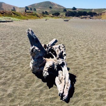


2 years ago

Beautiful trail with so many picturesque views. Great hike and many points to stop and take a break. We lucked out on a beautiful clear day and was able to admire the sweeping coastal views. Very kid friendly as well. We stopped and admired the makeshift "memorial." It was a very beautiful & touching tribute. I would def go again and hike further up and take on some of the other trails we didn't get to explore this time around. It does get crowded on the weekends and parking is scarce. read more
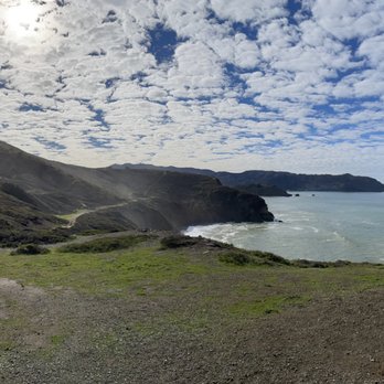




This spot is so beautiful! It's great because it is a short hike with great views. Great for families and it's dog friendly as well. There's cell signal everywhere so no need to worry about too much planning beforehand. Nice area and not too far from SF. The parking is free, the lot is a bit small but it seems like they do allow some street parking along the side near the parking lot (which is where I parked when I visited). I've been here a few times and even when it's foggy it's a good hike too. The views aren't as good compared to no fog or coming during sunset but it's still a fun and nice hike! If you're looking for a longer hike there's also Pedro Point near by too. read more





More info about Mori Point
775 Bradford Way
Pacifica, CA 94044
Directions
(415) 561-4323
Call Now
Visit Website
https://www.parksconservancy.org/parks/mori-point
Hours
Indoor Amenities
Outdoor Amenities
Ask the Community - Mori Point
Can you do a bonfire?
Fires are not allowed on National Park Service land at Mori Point.
Is this a strictly on leash hiking spot?
Park regulations require pets to be on leash on all trails within the boundaries of Golden Gate National Recreation Area at Mori Point.
Anyone know how far is it from the parking lot to the swing? Thank you!
I used google maps and started at Mori Point parking lot (limited spaces but there's some street parking). Follow the signs that say Old Mori Road and it'll be at the end of that trail (about a 10-15 min walk, less than half a mile).
Which trail leads to the beach?
Take the Old Mori Point trail. This trail more direct to the beach (Sea Wall). You can take the long stairs up to the Point.
Can the remote trails be hiked during shelter-in-place?
Yes if social distancing is practiced
What's parking like here? I'm meeting two other friends there for a hike and just wondering if there's ample parking
The official parking lot is very small, holds about 5-6 cars maybe. I've parked up around the corner or on the street in the neighborhood before arriving to the parking lot area.
Review Highlights - Mori Point
You might also consider





















Why does Yelp recommend reviews?
24 reviews that are not currently recommended
The reviews below are not factored into the business's overall star rating.

4 years ago

4 years ago

12 years ago

11 months ago


4 years ago

1 year ago

4 years ago

5 years ago
13 years ago
18 years ago

10 years ago

5 years ago
10 years ago
4 years ago

9 years ago

13 years ago
Mori Point - hiking - Updated September 2026
Best of Pacifica
People found Mori Point by searching for…
Crabbing Location in Pacifica, CA
Sea Shell Beaches in Pacifica, CA
Beautiful Views in Pacifica, CA
Dog Friendly Beaches in Pacifica, CA
Picnic Areas BBQ Pits in Pacifica, CA
Walking Trails in Pacifica, CA
Secluded Beaches in Pacifica, CA
Sea Glass Beach in Pacifica, CA
Dog Friendly Hiking Trails in Pacifica, CA
Trending Searches in Pacifica, CA
Apple Orchards near Mori Point
Consignment Shops near Mori Point
Dog Friendly Things To Do near Mori Point
Eyebrow Threading near Mori Point
Eyelash Extensions near Mori Point
Kids Birthday Party near Mori Point
Makeup Artists near Mori Point
Off Road Trails near Mori Point
Places To Take Pictures near Mori Point
Private Schools near Mori Point
Scenic Night View near Mori Point
Browse Articles
Browse Nearby
BEST of Pacifica, California Things to Do near Mori Point
BEST of Pacifica, California Coffee near Mori Point
BEST of Pacifica, California Walking Trails near Mori Point
BEST of Pacifica, California Restaurants near Mori Point
BEST of Pacifica, California Parks near Mori Point
BEST of Pacifica, California Breakfast near Mori Point
BEST of Pacifica, California Campgrounds near Mori Point
Browse Brands
Related Searches in Pacifica, CA
Affordable Kayak Rental Services in Pacifica, California
Best Dog Hiking Trails Around Pacifica, California
Best Fishing Locations and Guides in Pacifica, California
Best Nature Trails for Hiking in Pacifica, California
Best Places for Horseback Riding in Pacifica, California
Best Sightseeing Experiences Available in Pacifica, California
Check Out Off Road Trails in Pacifica, California
Discover Dog Friendly Trails to Explore in Pacifica, California
Discover Easy Hiking Trails Near Pacifica, California
Discover Kid Friendly Hiking Trails in Pacifica, California
Discover Popular Bike Trails in Pacifica, California
Discover Walking Parks in Pacifica, California Near You
Discover a Hiking Trail in Pacifica, California
Discover the Best Night Hike Trails in Pacifica, California
Dog-Friendly Hikes With Dogs in Pacifica, California
Enjoy Camping Adventures Around Pacifica, California
Enjoy Kayaking Adventures in Pacifica, California
Enjoy Off Leash Dog Hikes in Pacifica, California
Enjoy Scenic Places to Walk in Pacifica, California
Enjoy a Beautiful Waterfall Hike in Pacifica, California
Enjoy the Best Walking Path in Pacifica, California
Enjoy the Best Walking Trails in Pacifica, California
Explore Beautiful Parks and Green Spaces in Pacifica, California
Explore Easy Hikes Perfect for All in Pacifica, California
Explore Fun Activities to Do in Pacifica, California
Explore Popular Campgrounds Near Pacifica, California
Explore Popular Dog Walking Trails in Pacifica, California
Explore Top Dog Parks in Pacifica, California Near You
Explore the Best Beach Spots in Pacifica, California
Family Friendly Hiking With Kids in Pacifica, California
Find Beautiful Views in Pacifica, California
Find Cozy Camping Cabins in Pacifica, California
Find Top Dog Friendly Parks to Visit in Pacifica, California
Find Top-Rated Waterfalls in Pacifica, California Now
Find the Best Parks BBQ Grills in Pacifica, California
Find the Best Parks for Picnics in Pacifica, California
Hiking Trails With Waterfalls in Pacifica, California
Off Leash Dog Hiking Trails in Pacifica, California
Popular Outdoor Activities to Try in Pacifica, California
Popular Picnic Spots to Visit in Pacifica, California
Popular Waterfall Hiking Trails in Pacifica, California
Safe River Swimming Areas in Pacifica, California
Safe and Fun Parks for Kids in Pacifica, California
Top Hiking Trails to Explore in Pacifica, California
Top Playgrounds for Kids to Enjoy in Pacifica, California
Top Running Trails to Explore in Pacifica, California
Top Swimming Lakes to Enjoy in Pacifica, California
Top Swimming Spots and Pools in Pacifica, California


