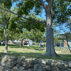
Sweeney Ridge Photos


You might also consider
More like Sweeney Ridge
Recommended Reviews - Sweeney Ridge
Start your review...

Reviews With Photos


We'd been wanting to check out the hiking trail for awhile. As we were coming from Pescadero our GPS directed us to the Sneath Lane Trailhead gate. There's a very small lot. Maybe 16 cars at most. We backed up and parked in the neighborhood. We decided we'll hike up to the San Francisco Bay Discovery monument marker. Round trip 3:85 miles. Took 1 hour 32 minutes. Bring water as it's a uphill climb. Spectacular views looking in every direction. We got to the summit. Elevation 1237 feet. At the top there are trail signs to Mori Ridge Trail, Baquiano Trail, and the Nike Missile Site. We walked over to the Discovery marker. It's covered up. I read later it was vandalized in 2020. Should we hike 0.5 miles to the Nike missile site. Wait. That's another mile RT. Next time. We turned around after using the restroom (enclosed outhouse). Going downhill went much faster. There were many hikers, some walking their dogs, bikers & joggers. The nice thing about the Sneath Lane Trail is that it's a paved trail.

I was on Milagra Ridge in Pacifica one windswept afternoon and said to myself with arms akimbo, "Well, what other mountains can I climb around here?" OK, I don't really ask myself such testosterone-driven questions, especially with the Pacific currents blowing headlong in my face. But I always need FitBit steps and flights, so I found myself a couple of weeks later on this even higher and more windswept ridge, which connects San Bruno and Pacifica. Taking the 280 south, I found it pretty easy to get to the trailhead at the end of Sneath Lane. It's deep in San Bruno's residential neighborhood. I just parked on the street since the trail's small lot seemed to me a ripe spot for break-ins given the paucity of walkers around here. The first 1-3/4 miles consisted of a curving hillside fire road, fully paved and lined with a variety of foliage with a gradual incline that afforded constantly better views with every turn of the road. I could see SFO, South San Francisco, and San Andreas Lake until I reached the key juncture where I was actually on the ridge line. There was a convenient restroom if you find the climb agitated your bladder. Make a left and you can walk up to the Spanish Discovery site where two monuments commemorate the first sighting of the bay. Make a right and you're on the Sweeney Ridge Trail where you pass by the remnants of a Nike missile site similar to the ones you see across the bay in Wildcat Canyon Park. We were certainly ready for those Russkies. Beyond the site, it became a dirt trail and changed direction as the Mori Ridge Trail. Views of the Pacific became more prominent as I made the steep descent into a quiet section of Pacifica where there would be nurseries to peruse if I was there when they were open for business. The walk back got me to my 15,000 step goal. I would've patted myself on the back if I kept up with my yoga. Gee, so what other mountains can I climb around here? RELATED - Up for a hike? Here's a collection of trails I've walked and reviewed: https://bit.ly/2OrC8nU

I haven't been back at this trail for a few years, and while the trail is the same, my experience with it has changed now that I've experienced more and better trails. I mapped to 3660 Sneath Lane and didn't bother driving into the small parking lot. There's ample street parking on the residential streets right outside the parking lot. It's a continuous uphill climb but is fairly gradual. The view is still great, but on a hot day, there is virtually no shade and isn't pleasant. It can also get very windy. My dog doesn't like walking on asphalt, so if your dog's paws are sensitive, beware, especially on a hot day. Now that I've been to to more trails, like the wider trails at Pulgas, the trail here seems very narrow, just about one car's width. If your dog is reactive, it's not a great idea to hike here because you can't really keep a good distance from other dogs. There are also a few irresponsible dog owners that don't keep their dogs on leash (even though I believe this trail does not allow off leash). Now if I came here without dog(s), this review would be far more positive. Parking is fairly easy, you can get a good walk in, the view is really nice. Just not the best trails for all types of dogs.

The conversation that I had with my friend about this place as we were looking at the All Trails app to pick a place to go hiking for the next day... Me: "Have you been to Sweeney Ridge? It's nearby in San Bruno." Him: "Oh it's trash. It's too easy." Me: "Have you gone to it yet?" Him: "No, but it looks like it would be." Me: "Well, it's nearby so why don't we just go there tomorrow to check it out." Then on the hike, my friend was struggling as he was a good 5-7 feet away behind me cussing and breathing hard. I laughed saying, "And you thought that this trail was going to be too easy? What do you think now?" Hahahahaha... We made it to the abandoned building with lots of graffiti on it, and took some pictures & videos while we're there. This place was a solid place to go for a hike with it's inclines, stairs, and great views. Plus, it was really neato to visit the graffiti building! The hike wasn't that long as we completed within almost 2 hours as we parked in a residential area and walked to the Sweeney Ridge sign near the orchids area. My friend didn't know that there was a parking lot there, but at least we know for future visit-- that we can just park in that lot instead.

kicking off the new year with a hike along this beautiful trail overlooking both the bay and the ocean! i came with a couple friends late-morning on new year's day, and it was a beautiful sunny winter day...no rain, and minimal wind! parking was a little challenging, since everyone else had the same idea, so we had to park a couple blocks away, but no big deal. we walked a couple minutes to the trailhead and began our ascent up the trail and paused a few times to take in the views of the bay, sfo, and the south san francisco signage. once we got to the top of the hill, approximately 1.7miles, there was a single vault restroom, toilet + toilet paper, but no running water, hand sanitizer or toilet seat covers...come prepared! a few steps away, we saw some information signs on the history of the area and the nike missile station. even met an older couple who had been here a few times and gave us a bit of their personal history, hiking this area. a few minutes later, we were on the other side of the ridge and could see the pacific ocean! mori point, pacifica and san francisco awaited us, on a sparkling blue skied day! in total, our group hiked 6.5mi roundtrip, but it is possible to walk longer, or shorter, depending on what you feel like. note that there are NO restrooms at the parking lot/trailhead, only the one restroom 1.7mi uphill from the trailhead. there are also no water fountains whatsoever, so bring water on a warm day. there's also no shade, so best to come in the winter/cooler months, or earlier in the day in the warmer months to avoid extreme heat.

Great area to take the doggy out! We had a blast going to the top and checking out the old Nike nuclear base. I didn't realize that it was entirely paved and loved the amount of people/dogs that we saw out there, coupled with the beautiful scenery! It was a bit windy, yet not cold enough to need to bear a sweater or coat for me thank goodness! :)


First Hike of 2021! Beautiful hike with beautiful views, with a little bit of work required. Hiked Sweeney Ridge this past weekend (came on a sunny, clear day) with my friend. We started our hike near the Mori Point parking lot, and walked to the Mori Ridge Trailhead (about a 150 feet elevation gain, all uphill). We didn't realize that the Mori Ridge Trailhead had a parking lot, but it did! If you want to save some time (and calories), you can park here. There are a few entrances to get to Sweeney Ridge. Mori Ridge Trailhead is one of the harder entrances due to its elevation gain required to ascend up top. Mori Ridge Trail is about 2 miles long with nonstop 1000 feet elevation gain (took us about 1 hour to hike up) to get to Sweeny Ridge. Definitely broke a sweat. Though, once you get to Sweeney Ridge up on top, you're rewarded with beautiful views of Pacifica (beach, ocean, trees, hills), as well as South City and the airport. Then, it's mostly flat from thereon out. A few interesting spots up on top are an army bunker and the Portola Expedition Site memorial - both of which are from a bygone era. After exploring up on top of Sweeney Ridge, my friend and I decided to make a loop back to our car, instead hiking down the Baquiano Trail. From there, it brought us to the Baquiano Trailhead. We walked down Fassler Ave to Rockaway Beach, and from there, hiked up the hills of Mori Point back to our car. Our total journey? 10 miles in roughly 5 hours with a few breaks in between to rest. My legs are definitely sore, but worth it for the experience, the views, and the exercise! Definitely would come back here, perhaps trying out coming from another trailhead for a lighter, less intense hike.

After dropping my family off at SFO, I decided to come hike this with my dog since it was nearby. I'm so glad I did! The hike I did was pretty much all paved. There's a couple spots for parking, otherwise, there's the street parking near the residential houses. It was a great view of the lake and surrounding San Bruno area. I was pleasantly surprised by the fog clouding above as we walked further up in elevation. There's also a lot of pampas grass on the trail so that added to the bohemian ambiance of the hike. After a couple winding long switchbacks, we got to the top overlooking San Bruno towards San Francisco. 4 mile roundtrip hike with less than 1,000 feet elevation gain.

I've hiked here a few times with Maxie when I lived in Pacifica and there's a few ways to get to the summit depending on your starting point. I've always chosen the Sneath Lane path as there's a few parking spaces on the side of the entrance sign. This trail is paved all the way to the top, which makes it a moderate hike. However, there are some steep parts as it winds up the ridge. You have an unobstructed view of San Andreas Reservoir, South City and the Bay as you take this route. If you're driving up 280 or even on San Mateo Bridge, this is the same ridge where the fog rolls in and cascades on the side like a waterfall flowing on the side of the mountain. To me, I'm still in awe whenever I see that sight of fog slowly drifting down like a puff of cloud instead of water. On a hot day, it can be a challenge hiking here since there are a few shaded areas to protect you from the sun until you almost reach the top where most of the trees are located. The weather could also quickly change as it could be sunny one minute then the fog would suddenly roll in. Once you hit the top, there are more trails that you can take as it splits in several directions. There's even a monument on top for the 'San Francisco Bay Spanish Discovery Site' where Capitan Juan Gaspar de Portola was the first European to see the entire San Francisco Bay from the top of this ridge with the aid of six of his men and ironically assisted by the local Aramai tribe of the original inhabitants from the Ohlone people. It was the beginning of the end for the natives as this was the turning point in their loss of lives, homes, land and traditional ways. If you stay on the paved path, it flattens out and leads you north towards an abandoned and dilapidated Nike Missile Site, which were strategically built along the coast of the bay to protect California from potential threats through the sky. From up there, it's about 1,669 elevation feet to the starting point below the entrance on the same path. It's a cool area to explore and similar to a lot of abandoned places, local artists have left their masterpieces on these walls. But the view from up here is an unobstructed 360 degree field of vision of the Bay. On a clear day, you can see all the bridges and you have a panoramic vista that Mark Zuckeberg would pay millions for. It's worth the hike just for the view alone and it doesn't cost you a thing. I do miss my hiking buddy though and we surely enjoyed exploring the area up here.

This is a popular hiking trail, especially on the weekends. There's plenty of parking on the edge of the San Bruno residential development--free of course. There are a few other trailheads, including one from the parking lot at Skyline College, and one quite close to the San Francisco jail. I used the jail trail on the way back to my car, but I hardly saw any inmates on the trail. I guess they're only allowed to use it on certain days. Much of the trail is paved, at least at first, and so it's good for hikers of all ability. There is no restroom at the trailhead, but there is one about two-thirds of the way to the Nike Site. I don't recall seeing any water, so be sure to bring plenty of water. Besides the old Nike Site, there is the Portola discovery plaque, which is worth seeing, at least once anyway. Quite a bit further on, towards Skyline College, there are ruins of an old Coast Guard Station. I thought that was pretty interesting. At the top of the ridge, there are great views of the bay. So overall, a very good hiking destination. It's a fairly mild hike, but I brought my trekking poles anyway.

Whew! What. A. Hike. Geezus! Did a strenuous 10 mile hike from Sweeney Ridge to Mori Point and back, and it totally kicked my arse. But, damn was it incredible! There are several different trails that you can take that range from fairly easy to strenuous. If a grueling 10 mile hike with an elevation gain of over 2,000 feet isn't your cup of tea, don't be worried. You can stick to the milder trails. I started on the Notch Trail in the Lot B parking lot of Skyline College in San Bruno. The Notch Trail starts off as a very narrow dirt path that meanders through a beautiful butterfly grove. Because the butterfly grove is considered a sensitive habitat, no dogs are allowed on this trail. The Notch Trail mildly inclines to the top of a hill where you'll find a gnarly old building painted in graffiti. From here, I connected to the Sweeney Ridge Trail which has a series of downhill and uphill staircases. There are so many pretty flowers along the Sweeney Ridge trail! I must have seen at least 6 or 7 different colors of petals during this stretch of my hike. Once you tackle the uphill staircase, you'll come to a flat paved trail. This is one of the areas where you'll be able to connect to a host of other trails. You'll also have a nice view of the old Nike Missile Control Site. I continued down Sweeney Ridge Road to the Baquiano Trail. This is where the trail starts to get strenuous. The inclines are steep and seem to be never ending. Most of the trails withing Sweeney Ridge are dry and exposed, so I'd definitely recommend lots of water and sunscreen. At the highest peak of the Baquiano Trail, you'll have some of the best views of the city as well as really lovely coastal views. Looking back at all of the rolling hills that I traversed was kind of fun too. I connected to the Farrallones View Trail next which starts back up on a gradual incline and then goes down a really steep hill. I should also note that parts of the Baquiano and Farrallones View aren't well maintained and that there are ticks here. One of my friends ended up getting a tick while hiking this trail. Wear long pants and sturdy hiking boots if you can, and just be cautious of your surroundings. When this trail ends, you'll have to cross the street to continue to Mori Point. Well, that's if you're looking to do this 10 mile long hike. Mori Point is pretty much the highlight of it all. The views of the beach and mountain top are amazing and totally worth the sore muscles. There's another entrance to Sweeney Ridge which is right across the street from Mort Point. You'll have to cross the street and walk or drive up a hill that will take you to the parking lot. I took this way back to Sweeney Ridge from Mori Point and it took me back to the Lot B parking lot of Skyline College. During the entire hike, I was surrounded by so much greenery and wildlife. I'm always so shocked to find that these kinds of generous trails exist practically right in my backyard. This was a grueling hike but the payoff of all of the amazing coastal views coupled with the enchanting flowers and lush greenery made it totally worth it.

1 year ago
This is a nice enough spot to go for a hike. It was easy to find my way to the Sneath Lane Trail Parking using google maps, a small lot within a residential neighborhood, that fits about 10-15 vehicles. It was foggy, cold, and incredibly windy during my visit last week, and of course, there's an incline as the trail wraps around the mountain. But it wasn't too bad, the actual climb up didn't feel as difficult as it looked from a distance, starting with the sneath lane trail then connecting to other trails higher up. In fact, there are many options for different trails to take. The Baquiano Trail had a dirt pathway while the Notch Trail toward the Nike Missile Control Site was paved. Near the SF Bay Discovery Site, there's a small restroom building (it was pretty clean for a park facility, on a Thursday afternoon). The gorgeous foliage lining the various paths was captivating, along with lovely views of the hills, lake (san andreas reservoir), and sunlit scenery in the distance. Too foggy to enjoy the views the higher you get though, just a giant cloud of fog everywhere. I barely made it three miles out before turning back. It was just far too windy and foggy to wanna be out there very long (I'm sure hot days would be even worse with zero shade to be found). Plus my legs definitely had a workout from the uphill trek. Luckily the jog back down was a breeze. And I did slow down to appreciate the vegetation and vast array of plant species, once again, before leaving. read more


 - Parks Near Me - San Bruno, California")


There are a few entrances, but I think the most popular one is on Sneath Lane. This trail is paved and pretty steady and not too difficult for about a mile but then gets a bit steeper for the next mile to the top. On the way up you can see views of the San Andreas Reservoir Lake. After the rain you can hear the water flowing and see some little streams and wild mushrooms. To the ridge is a little under 2 miles. I like the fact there is a small bathroom which I find quite rare on trails like this. To the left is the San Francisco Discovery Site which has a plaque with some information. Apparently, this was the place the Spanish settlers first saw the San Francisco Bay. To the right the trail goes along the ridge to the remains of the old Nike missile site. The views are stellar, and one can see for miles on end, Marin, the city, Pacifica Mount Diablo, etc. I love watching all the planes coming in and out from nearby SFO. From Sneath the hike is about 5 miles and 2 hrs. I've also gone the Mori Trail route which is nice because it's not paved but this trail is steeper. It's worth checking out the funky Shelldance Orchid Gardens which is located at the trailhead but they are only open on the weekends. read more


1 year ago
This is a great hiking trail in between the cities and waters and beaches.. it's pretty cool once you make your way up to the very top but it's hard work especially if you're out of shape or you have asthma.. The trail starts out super easy depending on where you start.. it's all paved and then gradually it gets steeper and steeper. It takes about 1.5 to 2 hours to get up to the top depending on what kind of shape you are in fitness-wise. My ankles and knees were hurting when we were hiking back down and it was night fall by the time we got down.. it took us longer to get down because we had to keep stopping since my knees and ankles were aching. The views are amazing at the top! read more


1 year ago
Great local trail, our first time here. Looking for something new and less windy/ stormy than our normal beach walks. Small parking lot, ~10 cars , but a few spaces open. Great trail up, views all around. Dogs on leash - owners and dogs are smiling . Nice place, good walk. read more

4 years ago
We'd been wanting to check out the hiking trail for awhile. As we were coming from Pescadero our GPS directed us to the Sneath Lane Trailhead gate. There's a very small lot. Maybe 16 cars at most. We backed up and parked in the neighborhood. We decided we'll hike up to the San Francisco Bay Discovery monument marker. Round trip 3:85 miles. Took 1 hour 32 minutes. Bring water as it's a uphill climb. Spectacular views looking in every direction. We got to the summit. Elevation 1237 feet. At the top there are trail signs to Mori Ridge Trail, Baquiano Trail, and the Nike Missile Site. We walked over to the Discovery marker. It's covered up. I read later it was vandalized in 2020. Should we hike 0.5 miles to the Nike missile site. Wait. That's another mile RT. Next time. We turned around after using the restroom (enclosed outhouse). Going downhill went much faster. There were many hikers, some walking their dogs, bikers & joggers. The nice thing about the Sneath Lane Trail is that it's a paved trail. read more


I was on Milagra Ridge in Pacifica one windswept afternoon and said to myself with arms akimbo, "Well, what other mountains can I climb around here?" OK, I don't really ask myself such testosterone-driven questions, especially with the Pacific currents blowing headlong in my face. But I always need FitBit steps and flights, so I found myself a couple of weeks later on this even higher and more windswept ridge, which connects San Bruno and Pacifica. Taking the 280 south, I found it pretty easy to get to the trailhead at the end of Sneath Lane. It's deep in San Bruno's residential neighborhood. I just parked on the street since the trail's small lot seemed to me a ripe spot for break-ins given the paucity of walkers around here. The first 1-3/4 miles consisted of a curving hillside fire road, fully paved and lined with a variety of foliage with a gradual incline that afforded constantly better views with every turn of the road. I could see SFO, South San Francisco, and San Andreas Lake until I reached the key juncture where I was actually on the ridge line. There was a convenient restroom if you find the climb agitated your bladder. Make a left and you can walk up to the Spanish Discovery site where two monuments commemorate the first sighting of the bay. Make a right and you're on the Sweeney Ridge Trail where you pass by the remnants of a Nike missile site similar to the ones you see across the bay in Wildcat Canyon Park. We were certainly ready for those Russkies. Beyond the site, it became a dirt trail and changed direction as the Mori Ridge Trail. Views of the Pacific became more prominent as I made the steep descent into a quiet section of Pacifica where there would be nurseries to peruse if I was there when they were open for business. The walk back got me to my 15,000 step goal. I would've patted myself on the back if I kept up with my yoga. Gee, so what other mountains can I climb around here? RELATED - Up for a hike? Here's a collection of trails I've walked and reviewed: https://bit.ly/2OrC8nU read more


3 years ago
I haven't been back at this trail for a few years, and while the trail is the same, my experience with it has changed now that I've experienced more and better trails. I mapped to 3660 Sneath Lane and didn't bother driving into the small parking lot. There's ample street parking on the residential streets right outside the parking lot. It's a continuous uphill climb but is fairly gradual. The view is still great, but on a hot day, there is virtually no shade and isn't pleasant. It can also get very windy. My dog doesn't like walking on asphalt, so if your dog's paws are sensitive, beware, especially on a hot day. Now that I've been to to more trails, like the wider trails at Pulgas, the trail here seems very narrow, just about one car's width. If your dog is reactive, it's not a great idea to hike here because you can't really keep a good distance from other dogs. There are also a few irresponsible dog owners that don't keep their dogs on leash (even though I believe this trail does not allow off leash). Now if I came here without dog(s), this review would be far more positive. Parking is fairly easy, you can get a good walk in, the view is really nice. Just not the best trails for all types of dogs. read more


The conversation that I had with my friend about this place as we were looking at the All Trails app to pick a place to go hiking for the next day... Me: "Have you been to Sweeney Ridge? It's nearby in San Bruno." Him: "Oh it's trash. It's too easy." Me: "Have you gone to it yet?" Him: "No, but it looks like it would be." Me: "Well, it's nearby so why don't we just go there tomorrow to check it out." Then on the hike, my friend was struggling as he was a good 5-7 feet away behind me cussing and breathing hard. I laughed saying, "And you thought that this trail was going to be too easy? What do you think now?" Hahahahaha... We made it to the abandoned building with lots of graffiti on it, and took some pictures & videos while we're there. This place was a solid place to go for a hike with it's inclines, stairs, and great views. Plus, it was really neato to visit the graffiti building! The hike wasn't that long as we completed within almost 2 hours as we parked in a residential area and walked to the Sweeney Ridge sign near the orchids area. My friend didn't know that there was a parking lot there, but at least we know for future visit-- that we can just park in that lot instead. read more

kicking off the new year with a hike along this beautiful trail overlooking both the bay and the ocean! i came with a couple friends late-morning on new year's day, and it was a beautiful sunny winter day...no rain, and minimal wind! parking was a little challenging, since everyone else had the same idea, so we had to park a couple blocks away, but no big deal. we walked a couple minutes to the trailhead and began our ascent up the trail and paused a few times to take in the views of the bay, sfo, and the south san francisco signage. once we got to the top of the hill, approximately 1.7miles, there was a single vault restroom, toilet + toilet paper, but no running water, hand sanitizer or toilet seat covers...come prepared! a few steps away, we saw some information signs on the history of the area and the nike missile station. even met an older couple who had been here a few times and gave us a bit of their personal history, hiking this area. a few minutes later, we were on the other side of the ridge and could see the pacific ocean! mori point, pacifica and san francisco awaited us, on a sparkling blue skied day! in total, our group hiked 6.5mi roundtrip, but it is possible to walk longer, or shorter, depending on what you feel like. note that there are NO restrooms at the parking lot/trailhead, only the one restroom 1.7mi uphill from the trailhead. there are also no water fountains whatsoever, so bring water on a warm day. there's also no shade, so best to come in the winter/cooler months, or earlier in the day in the warmer months to avoid extreme heat. read more


3 years ago
Great area to take the doggy out! We had a blast going to the top and checking out the old Nike nuclear base. I didn't realize that it was entirely paved and loved the amount of people/dogs that we saw out there, coupled with the beautiful scenery! It was a bit windy, yet not cold enough to need to bear a sweater or coat for me thank goodness! :) read more


5 years ago
First Hike of 2021! Beautiful hike with beautiful views, with a little bit of work required. Hiked Sweeney Ridge this past weekend (came on a sunny, clear day) with my friend. We started our hike near the Mori Point parking lot, and walked to the Mori Ridge Trailhead (about a 150 feet elevation gain, all uphill). We didn't realize that the Mori Ridge Trailhead had a parking lot, but it did! If you want to save some time (and calories), you can park here. There are a few entrances to get to Sweeney Ridge. Mori Ridge Trailhead is one of the harder entrances due to its elevation gain required to ascend up top. Mori Ridge Trail is about 2 miles long with nonstop 1000 feet elevation gain (took us about 1 hour to hike up) to get to Sweeny Ridge. Definitely broke a sweat. Though, once you get to Sweeney Ridge up on top, you're rewarded with beautiful views of Pacifica (beach, ocean, trees, hills), as well as South City and the airport. Then, it's mostly flat from thereon out. A few interesting spots up on top are an army bunker and the Portola Expedition Site memorial - both of which are from a bygone era. After exploring up on top of Sweeney Ridge, my friend and I decided to make a loop back to our car, instead hiking down the Baquiano Trail. From there, it brought us to the Baquiano Trailhead. We walked down Fassler Ave to Rockaway Beach, and from there, hiked up the hills of Mori Point back to our car. Our total journey? 10 miles in roughly 5 hours with a few breaks in between to rest. My legs are definitely sore, but worth it for the experience, the views, and the exercise! Definitely would come back here, perhaps trying out coming from another trailhead for a lighter, less intense hike. read more


After dropping my family off at SFO, I decided to come hike this with my dog since it was nearby. I'm so glad I did! The hike I did was pretty much all paved. There's a couple spots for parking, otherwise, there's the street parking near the residential houses. It was a great view of the lake and surrounding San Bruno area. I was pleasantly surprised by the fog clouding above as we walked further up in elevation. There's also a lot of pampas grass on the trail so that added to the bohemian ambiance of the hike. After a couple winding long switchbacks, we got to the top overlooking San Bruno towards San Francisco. 4 mile roundtrip hike with less than 1,000 feet elevation gain. read more


I've hiked here a few times with Maxie when I lived in Pacifica and there's a few ways to get to the summit depending on your starting point. I've always chosen the Sneath Lane path as there's a few parking spaces on the side of the entrance sign. This trail is paved all the way to the top, which makes it a moderate hike. However, there are some steep parts as it winds up the ridge. You have an unobstructed view of San Andreas Reservoir, South City and the Bay as you take this route. If you're driving up 280 or even on San Mateo Bridge, this is the same ridge where the fog rolls in and cascades on the side like a waterfall flowing on the side of the mountain. To me, I'm still in awe whenever I see that sight of fog slowly drifting down like a puff of cloud instead of water. On a hot day, it can be a challenge hiking here since there are a few shaded areas to protect you from the sun until you almost reach the top where most of the trees are located. The weather could also quickly change as it could be sunny one minute then the fog would suddenly roll in. Once you hit the top, there are more trails that you can take as it splits in several directions. There's even a monument on top for the 'San Francisco Bay Spanish Discovery Site' where Capitan Juan Gaspar de Portola was the first European to see the entire San Francisco Bay from the top of this ridge with the aid of six of his men and ironically assisted by the local Aramai tribe of the original inhabitants from the Ohlone people. It was the beginning of the end for the natives as this was the turning point in their loss of lives, homes, land and traditional ways. If you stay on the paved path, it flattens out and leads you north towards an abandoned and dilapidated Nike Missile Site, which were strategically built along the coast of the bay to protect California from potential threats through the sky. From up there, it's about 1,669 elevation feet to the starting point below the entrance on the same path. It's a cool area to explore and similar to a lot of abandoned places, local artists have left their masterpieces on these walls. But the view from up here is an unobstructed 360 degree field of vision of the Bay. On a clear day, you can see all the bridges and you have a panoramic vista that Mark Zuckeberg would pay millions for. It's worth the hike just for the view alone and it doesn't cost you a thing. I do miss my hiking buddy though and we surely enjoyed exploring the area up here. read more


This is a popular hiking trail, especially on the weekends. There's plenty of parking on the edge of the San Bruno residential development--free of course. There are a few other trailheads, including one from the parking lot at Skyline College, and one quite close to the San Francisco jail. I used the jail trail on the way back to my car, but I hardly saw any inmates on the trail. I guess they're only allowed to use it on certain days. Much of the trail is paved, at least at first, and so it's good for hikers of all ability. There is no restroom at the trailhead, but there is one about two-thirds of the way to the Nike Site. I don't recall seeing any water, so be sure to bring plenty of water. Besides the old Nike Site, there is the Portola discovery plaque, which is worth seeing, at least once anyway. Quite a bit further on, towards Skyline College, there are ruins of an old Coast Guard Station. I thought that was pretty interesting. At the top of the ridge, there are great views of the bay. So overall, a very good hiking destination. It's a fairly mild hike, but I brought my trekking poles anyway. read more


Whew! What. A. Hike. Geezus! Did a strenuous 10 mile hike from Sweeney Ridge to Mori Point and back, and it totally kicked my arse. But, damn was it incredible! There are several different trails that you can take that range from fairly easy to strenuous. If a grueling 10 mile hike with an elevation gain of over 2,000 feet isn't your cup of tea, don't be worried. You can stick to the milder trails. I started on the Notch Trail in the Lot B parking lot of Skyline College in San Bruno. The Notch Trail starts off as a very narrow dirt path that meanders through a beautiful butterfly grove. Because the butterfly grove is considered a sensitive habitat, no dogs are allowed on this trail. The Notch Trail mildly inclines to the top of a hill where you'll find a gnarly old building painted in graffiti. From here, I connected to the Sweeney Ridge Trail which has a series of downhill and uphill staircases. There are so many pretty flowers along the Sweeney Ridge trail! I must have seen at least 6 or 7 different colors of petals during this stretch of my hike. Once you tackle the uphill staircase, you'll come to a flat paved trail. This is one of the areas where you'll be able to connect to a host of other trails. You'll also have a nice view of the old Nike Missile Control Site. I continued down Sweeney Ridge Road to the Baquiano Trail. This is where the trail starts to get strenuous. The inclines are steep and seem to be never ending. Most of the trails withing Sweeney Ridge are dry and exposed, so I'd definitely recommend lots of water and sunscreen. At the highest peak of the Baquiano Trail, you'll have some of the best views of the city as well as really lovely coastal views. Looking back at all of the rolling hills that I traversed was kind of fun too. I connected to the Farrallones View Trail next which starts back up on a gradual incline and then goes down a really steep hill. I should also note that parts of the Baquiano and Farrallones View aren't well maintained and that there are ticks here. One of my friends ended up getting a tick while hiking this trail. Wear long pants and sturdy hiking boots if you can, and just be cautious of your surroundings. When this trail ends, you'll have to cross the street to continue to Mori Point. Well, that's if you're looking to do this 10 mile long hike. Mori Point is pretty much the highlight of it all. The views of the beach and mountain top are amazing and totally worth the sore muscles. There's another entrance to Sweeney Ridge which is right across the street from Mort Point. You'll have to cross the street and walk or drive up a hill that will take you to the parking lot. I took this way back to Sweeney Ridge from Mori Point and it took me back to the Lot B parking lot of Skyline College. During the entire hike, I was surrounded by so much greenery and wildlife. I'm always so shocked to find that these kinds of generous trails exist practically right in my backyard. This was a grueling hike but the payoff of all of the amazing coastal views coupled with the enchanting flowers and lush greenery made it totally worth it. read more


5 years ago
This trail was very dog-friendly and quite clean. The entire trail is pretty much paved until you get to the top, where you can choose to continue to the right on the paved trail or go left into pure gravel. The view was breathtaking as we were walking uphill, but once we got to the top - the view wasn't as stunning. We might've gone the wrong way or maybe not far enough; we even headed to Nike's point in order to find an overlook. There were some pockets of shade, while most of the incline was in the sun. The only sad part is that people leave their dogs' poop bags all over the sides of the trail, which is super annoying. I would recommend parking towards the neighborhood instead of the where the trail begins because the gravel spaces can be very tight. Lastly, you should use the bathroom before you arrive because the bathroom on top of the hill was disgusting. read more


6 years ago
Nice mild-moderate uphill hike. It's about 1.8 miles to the Historical Landmark. The entrance has a small parking area, but it's right next to a neighborhood so parking theoretically shouldn't be an issue. Your views will be very dependent on the weather given its location near Pacifica. On the day we went, there was a very dense fog that we really couldn't see anything even though views were fine around San Bruno. As a result, the temperature also dipped. Highly recommend bringing more clothes than you expect just in case. Updated review: Came during COVID on a sunnier day and the experience was completely different. You can view the Bay along the Sneath Trail and near the top the view transitions to the Pacific Ocean. Absolutely gorgeous! Would recommend bringing a windproof jacket as it can get windy. Don't forget the sunscreen on sunny days as there is minimal shade. read more


5 years ago
Came here on a lazy day seeing that this connects to Sawyer Camp. The trailhead is located in the back of San Bruno residency, passing Skyline college and San Bruno jail. The parking spots are limited and people double park making the path even more narrow. The trailhead has a fence and a narrow path to prevent people from brining their bikes, meant just for a walking trail. However, locals have just passed their bikes over the fences and often almost get hit by one of them speeding down the path. The path itself is a broken road. It has a lot of flies and graffiti and the only restroom is a mile in. read more


I'd noticed this area during a flight over it, and marked it to check out. I finally did that, or at least started by marking it to the top and a bit along the trail, although it keeps going. It's all paved, so it's not a trail hike, but it's a nice park walk with good elevation and steep incline so you feel like you did some legs. The views are really cool, as it goes right into the marine layer, which blows over the ridge. There are views down to the water and over SFO. There are a few trail options, but it's out and back, not a loop. There's a bathroom at the top of the trail up, where the road splits. There's an old Nike missile launch area with an interpretive sign, and a sign indicating when Europeans first got there, but otherwise no interpretation, which is in line with the fact that it's just a park. You just park at the space in the small lot. In short, it's nice for what it is, and worth doing. It's not what I would call a real hike. read more


This was a really nice hike! It's pretty exposed, but overall I enjoyed getting views of both the bay and the ocean, and watching the sunset over Mori Point. In the spring you'll also get to see a lot of greenery from the rains! STATS: 7.30 mi, 1,758 ft, 2h40m of moving time (5.5 hours total - we waited and watched the sunset! WEATHER: Mixed! Bring layers. We went in April 2017. We started at 2:30pm and it was HOT going uphill on the Mori Ridge Trail. By late afternoon, it was cold, and we were freezing watching the sunset. PARKING: Free residential parking available on Bradford Way. DOGS ALLOWED: Yes! On leash. TRAILHEAD: Restroom, no water. THE ROUTE: https://goo.gl/pDo6EZ - Head west on Mori Ridge Trail (1.8 mi) - South on Sweeney Ridge Trail (1.1 mi) - West on Baquiano Trail (1.6 mi) - West on unmaintained trail towards Rockaway Beach (~0.8 mi) - North through Mori Point; find a spot to watch the sunset (~1.1 mi) - East through Mori Point to head back to meeting location (~0.6 mi) ROUTE HIGHLIGHTS: - There is a pretty steep climb during the first part of our route heading west on Mori Ridge Trail. - The "unmaintained trail" got a little steep and bushwack-y. BONUS HISTORY: You get to see the the San Francisco Bay Discovery Site, where Spanish explorers first discovered the SF Bay! read more


6 years ago
This was a semi-intense walk. All uphill. Got a good 4.5 miles in round trip. Wear shoes you don't mind getting dirty. Mostly cement/paved roads. Bring water! Some benches along the way for breaks. Great views. There is a trail that can lead you to Mori Point in Pacifica- I didn't make it that far. read more


7 years ago
Had a couple of really good morning workouts here during late summer. Only did the Sweeney Ridge Trail, which is about a 3 mile gentle climb up a paved fire road, then another 3 miles back down the exact same way. There are other trails here that connect, but I've still yet to explore those. Parked in the residential streets where Sneath Lane ends. There's a small gravel parking lot closer to the trailhead, but it's limited to about 20 cars. The paved fire road is pretty smooth, so quite jog-able. Closed to car traffic, which made hiking on a paved road more attractive to me. Lots of wild plant life, tons of wild flowers, wild fennel and heavy brush. Brush that birds and these little brown bunnies love to inhabit. I must of seen over 30 bunnies in and out of the trail one morning. Really enforces the notion of "multiply like rabbits". Also on one cool morning, the breeze stirred the aromas of wild fennel/licorice and eucalyptus to delicious heights, very relaxing. When you get towards the top, you'll start to see evidence, also some signage on a Nike Missile site that used to guard this coast line. Very Cold War, and everything was dismantled by the early 70's I believe. But you can still see massive concrete structures that are now abandoned and that nature is once again reclaiming. Also both times I came here, it was completely engulfed in thick morning fog. Pretty much the par out here for the San Bruno/Pacifica stretch. Great for a workout because it is nice and cool and no direct sunlight beating on you. But both times, I reached the top, all the views were diminished. I couldn't see the coast, the reservoir and/or anything below the hill period. Actually at times it was hard to see past 50 feet. Oh well, that's just the way the fog rolls, and I'll take it just the way it is. read more


I used to love this hike for the views, the workout, and the fact that dogs were allowed so I could have my two best buddies with me. This hike is getting absolutely ruined by the yuppie scum that show up with total disregard to park rules. I was here today with with my husband and his friend, our 2 dogs and my infant daughter. Needless to say, our hands are kind of full and I've avoided Fort Funston and other off-leash dog parks for the most part when dealing with baby at the same time. This completely irresponsible group of 20-something tech yuppies met up in front of the entrance, with one girl who was handling an out-of-control large lab-ish dog. She had to be about 5'5" and was attempting to control a dog that might have been about her size on all 4s. Worst of all, she let that monstrosity off leash (note, this is all before we even got through the entrance) and her dog charged my two small dogs which were on leash and rightly terrified (one of my dogs started snarling and charging back in defense). Aside from this episode, dogs off leash coming at my dogs (who are largely well socialized and go to the dog sitters and dog park without any behavior issues) happened again twice. Once, it was an Alaskan Eskimo dog (not a small creature by any means) that came bounding up to my dogs with a leash on (but no owner in sight! he wasn't lost because I heard the owner call him from quite far away). THIS IRRITATES ME TO NO END. HAVE SOME RESPECT FOR PARK REGULATIONS AND IF YOU CAN'T EVEN DO THAT, CONTROL YOUR DOG BEFORE TAKING THEM ON ANY WALK. (Yes! That means you might have to spend some time and money on training them!) I would not feel safe about bringing small children, small dogs, or any unsocialized dog to this place due to the negligent behavior of the humans that use this trail. READ THE GODDAMN RULES FOR THIS PLACE: https://www.nps.gov/goga/planyourvisit/upload/sb-sweeney-2008.pdf (PAGE 2, "DOGS ON LEASH ARE ALLOWED"). AND STOP RUINING THIS FOR EVERYONE ELSE WHO HAS A DOG AND IS RUNNING OUT OF PLACES TO ENJOY THE BAY AREA WITH THEIR DOG. From what I know, Sweeney Ridge was one park in question by NPS about whether dogs would even still be allowed (see here: http://www.pacificatribune.com/news/new-rule-bans-dogs-off-leash/article_c4745406-e090-11e5-8536-af103cf2c8c4.html). San Mateo County has already kept them out of most parks with decent trails. I'd love to walk my dogs in Edgewood or Crystal Springs near my house instead of driving half an hour to this place for a workout that can handle a stroller and canines, but I can now see why we would just outright ban dogs and their irresponsible owners. Other notes: Dog shit on trail, and bags dumped on the side of the trail. Seriously people? Gross creatures. And again, just more ammo for local gov't and NPS to use against any dog owners who want to enjoy this trail respectfully. Parking is becoming a nightmare. We got there at 10 and it was already pretty packed. The gate at Sneath Lane is made for paper thin people (I'm a size 4 and I had trouble fitting through the zig/zag gate to the trail. We brought our jogging stroller for our daughter and had to lift it over the gate (thank goodness for tall friends over 6 feet tall who can lift over 40 pounds!). I don't know if there are other entrances for this train but if you are looking to do this hike as described at 3660 Sneath Lane (which is also where the parking is), don't expect access for strollers, wagons or anything aside from your skinny self. read more


5 years ago
We went up from the Notch trail by Skyline College. Awesome quick hike up to the graffiti barrack. We also tried to hike further but got tired with narrow trails. Pro tip: bring water bring a hat (no shade!) No bathrooms either. read more


This review is for all my plus size peeps :) We came up to Pacifica this weekend to get out of the heatwave and chose Sweeney Ridge to try and get in 5 miles or so before going to the beach for the remainder of the day. I have to say, I wasn't impressed with this hike. It was ok, but there are lots of others I would reccomend. One good thing about this trail is that it is paved for the first 1.75 miles (or the entire 3.5, if you turn around at the top like we did) and that means no climbing rocks or walking uneven surfaces. No worrying about a twisted ankle and if you wanted (and we saw plenty doing this) you could push a stroller or your furry friends if you wanted. Another (kinda) good thing about this trail is that it is dog friendly, however, it says dogs need to be leashed. Most of the dogs on this trail were leashed, with the exception of mine and a few others. I did leash my dog when I saw other dogs coming, but honestly if you have a well behaved dog it is annoying to keep them restrained. The views are ok. You can see a blue lake of water thats lovely and you get a fantastic view of SFO lol but even at the top, I found the views to be just "meh" and they don't change much throughout the hike which is a bummer. I prefer hikes with diverse views. Also, even in a cooler climate, shade is always nice and this trail have very little shade, so after 3 hours there yesterday I am a nice golden brown today. I really recommend a hat and sunscreen if you choose this hike. I wore a brand new pair of shoes thinking I would regret it, but because the hike is paved and I only ended up doing 3.5 miles, my tootsies are just fine today. Now, many reviews said that this was an easy hike and maybe if you hike every day it is, but for those of us with a little extra meat on our bones who only get out to hike once a week or so, let me tell you, this is not an easy hike. This is a moderate hike; easy in some places and difficult in others. And if you're thinking I am only saying that because I am fat, then tell me why I was passing up much thinner people stopping or trying to walk backwards to deal with some of the steeper sections. ~Here's the skinny~(no pun intended, well maybe) The first mile isn't too bad...your calves will definitely get warm and your booty too depending on how you walk. There are very few shaded places to stop and at 76 degrees, most of the people and the trail with is were breaking a sweat. Now, here is where it gets tough. just after the first mile, the incline gets steep. Take your time on the next 1/5 of a mile. It is difficult. There is a bench at 1.2 miles but some of the planks have been broken off. Don't worry; it held my 300 lbs plus a friends 170 on only two little planks so relax my friends! The incline is still moderate for the rest of the paved hike, but it is doable. At the top of the paved area there is a bathroom! It's pretty gross but its a bathroom. Straight ahead are views to the coast, to your right will be the Nike Missle area about 1/2 mile away and to the left there is a cute little dirt trail up over another hill. We opted to turn around as we were utterly unimpressed! I'm sure I will never do this hike again; its not worth the effort in my opinion. Still, if you have balance issues and want a good workout, the paved trail could be just what you need. If you do choose to try this one out, don't get discouraged and just keep going! Happy Hiking! read more


6 years ago
This trail is featured on the All Trails app. If you don't have All Trails, but you love outdoor hiking, you need this app. I've hiked here several times, but usually starting near Skyline College, parking at the residential area and just walking up at Notch Trailhead, off College Road bear the tennis courts. Right now, with COVID restrictions, Skyline track is closed. Sweeney Ridge splits off into several directions so you can choose whichever path you have the time and endurance for. Some hikes are moderate in incline but most trails are flat and easy. One thing to take note is the lack of bathrooms. There's one located in the middle of all the trails but it's disgusting. You're better off peeing in the bushes if you absolutely need to go. Weather is usually nice and sunny with some wind. read more

2 years ago
7 years ago
I wanted to try out Sweeney Ridge after reading all the reviews about getting a decent workout with sweet views and photo ops.. but little did I know the workout was pretty lame... and on top of that the cool old buildings were being torn down. So, 1) I did not get a workout in and 2) not much sights to see. This "trail" was sooo boring. There are so many better actual hiking trails around the Bay Area that I am just disappointed that I wasted my time doing that walk. read more


Don't even start drinking water until halfway through the hike. If you're a heavy water drinker, just stop. Stop while you can. I was drinking a cup of coffee and chugging water a few moments before we started the Sweeney Ridge hike. BAD MISTAKE. It's an uphill trail on pavement first and then it eventually goes into the mountains where you're walking on dirt and rocks, trailing up and down working that bootie. Think of it as a stair master, but so much better because you're getting a view, not staring at the back of someone's sweaty bald head. There was only one bathroom in sight, and that was unfortunately locked today. Just my luck. So do yourself a favor and just don't drink water until you need it. I had to pee in the bushes real fast; being tall (5'6) and whatnot, I was terrified someone would see me crouching in the bushes like a shameless lady, but my friends were on the lookout. Other than that, the trail was beautiful. We made the mistake of looking at the Nike missile sites. Cool history, but they're basically two broken down buildings covered in graffiti with who-knows-what, grungy ass debris and broken pieces. Just go on the hike towards the water--it's beautiful. The colors of the water remind me of Palos Verdes, various shades of blue and windy roads along the coast. We just sat on a nice patch of grass and enjoyed the view. Once you're done hiking, go enjoy some dimsum around the neighborhood at Koi Palace or Dim Sung King. Then happily skip your way to 99 ranch market, buy some cheap ass groceries, and go home to nap. Done. read more


7 years ago
Most of my Easter weekend was spent being a lazy sloth and eating so I decided to get off my ass and explore some of the local hikes to burn off the extra calorie intake. I live close to this trail and liked how parking was free in the residential area entrance at the end of Sneath Ln. Armed with my trusty sidekick and fur baby, Mochi, we battled the entire 1.7 mile uphill. The path is paved and I noticed how extremely well maintained it is. At first I cringed thinking of the entire thing being an uphill battle, but I got into a groove and it actually wasn't so bad. My Fitbit logged me as climbing 70 floors! - I do have short legs sooooooo don't quote me on accuracy lol! Tbh I think this hike is pretty easy for active people. The view got extremely more beautiful the higher we climbed and I stopped a few times to watch some airplanes taking off from SFO. The view overlooked the bay and the surrounding area around the SFO airport. I started the hike around 4:00pm on a Monday, and there were barely any people around. I felt so isolated that I was serenading Mochi, belting ballads, and dancing with every step of elevation until my Bluetooth headphones died haha! I also loved the random messages that people left as unofficial public art. After reaching the trailhead there was a restroom that I didn't dare check out - I'm sure it's just like any other outhouse restroom *gross*, so ladies and gentlemen bring your hand sani and wipes!!! LOL ... but the ocean view from there was gorgeous! I didn't even know I would end up seeing the ocean from one side and the bay from the other as I stood on the ridge. My only disappointment was that I didn't have more time to explore the Mori Point trail since I know that heads towards the ocean and cliffs. I can only image how breathtaking the sunset would look from up there! There are other trails from that point as well that are both paved and unpaved, so I'm excited and in anticipation for the next trail to discover the next time I visit! read more


10 years ago
My uncle, aunt, and I walked the Sneath Lane Trail in Sweeny Ridge Park today. My uncle and aunt had walked the Baquiano Trail on a previous occasion, but found the unpaved trail and the ups and downs arduous and discouraging. The Sneath Lane Trail was awesome and easier in comparison because it was paved, and never dipped--once you gained elevation you kept it. We arrived at just before 5pm. It was a gorgeous day in the 70sF, sunny skies, and a brisk wind that was pleasant and not chilly. We passed numerous walkers and the occasional cyclist. The steepest part of the trail is the last 1/4 and even then, you are rewarded by some amazing vistas. The final bit of the trail has some amazing flora. But do familiarize yourself with what poison oak looks like because there's tons of the shiny three lobed menaces about. We completed the 1.7 mile trail and went on to the Nike Nissile Site control site. Returning after a leisurely pace with numerous photo ops by about 7pm. Total about 4 miles. Will certainly do this again, but let me catch my breath first... read more


5 years ago
Great hike. A bit windy sometimes and some areas have little shade cover, but you get great views of the south city and the lake. read more

8 years ago
Page 1 of 5
More info about Sweeney Ridge
3660 Sneath Ln
San Bruno, CA 94044
Directions
(415) 561-4323
Call Now
Visit Website
http://www.parksconservancy.org
Hours
Indoor Amenities
Outdoor Amenities
Ask the Community - Sweeney Ridge
Is this trail stroller friendly?
It is stroller friendly just know that it's all up hill and once you're at the top you can either go left or right stick to the right the left is a dirt road not stroller friendly
Review Highlights - Sweeney Ridge
You might also consider


Why does Yelp recommend reviews?
10 reviews that are not currently recommended
The reviews below are not factored into the business's overall star rating.
4 years ago
4 years ago
1 year ago
4 years ago
15 years ago
2 years ago
15 years ago
11 years ago
9 years ago
13 years ago
Sweeney Ridge - parks - Updated July 2026
Best of San Bruno
People found Sweeney Ridge by searching for…
Things to Do in San Bruno, California
Beaches in San Bruno, California
Hiking Trails in San Bruno, California
Fireworks in San Bruno, California
Sunrise View in San Bruno, California
Abandoned Buildings in San Bruno, California
Photo Spots in San Bruno, California
Dog Parks in San Bruno, California
Beautiful Views in San Bruno, California
Scenic View in San Bruno, California
Walking Trails in San Bruno, California
Watch Sunset in San Bruno, California
Place to Watch Fireworks in San Bruno, California
Dog Friendly Hiking Trails in San Bruno, California
Public Rooftop Gardens in San Bruno, California
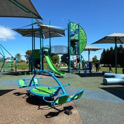
Playgrounds in San Bruno, California
Off Road Trails in San Bruno, California
Attractions in San Bruno, California
Waterfall Hike in San Bruno, California
Dog Friendly in San Bruno, California
Scenic Drive in San Bruno, California
Fishing Spots in San Bruno, California
Trending Searches in San Bruno, CA
Black Owned Nail Salons in San Bruno, CA
Cliff Jumping in San Bruno, CA
Dog Friendly Beaches in San Bruno, CA
Dog Friendly Trails in San Bruno, CA
Fishing Spots in San Bruno, CA
Jet Ski Rental in San Bruno, CA
Kids Activities Outdoor in San Bruno, CA
Lakes & Ponds in San Bruno, CA
Lookout Points in San Bruno, CA
Off Road Trails in San Bruno, CA
Outdoor Activities in San Bruno, CA
Outdoor Basketball Courts in San Bruno, CA
Places To Walk Around in San Bruno, CA
Pool Day Pass in San Bruno, CA
Public Beaches in San Bruno, CA
Public Shower in San Bruno, CA
River Swimming in San Bruno, CA
Scenic Night View in San Bruno, CA
Scenic Overlook in San Bruno, CA
Secluded Spots in San Bruno, CA
Strawberry Picking in San Bruno, CA
Swimming Holes in San Bruno, CA
Swimming Lakes in San Bruno, CA
Browse Nearby
BEST of San Bruno, California Coffee near Sweeney Ridge
BEST of San Bruno, California Restaurants near Sweeney Ridge
BEST of San Bruno, California Things to Do near Sweeney Ridge
BEST of San Bruno, California Breakfast near Sweeney Ridge
BEST of San Bruno, California Playgrounds near Sweeney Ridge
BEST of San Bruno, California Picnic Areas near Sweeney Ridge
BEST of San Bruno, California Campgrounds near Sweeney Ridge
BEST of San Bruno, California Sightseeing near Sweeney Ridge
Browse Brands
Related Searches in San Bruno, CA
Affordable Kayak Rental Services in San Bruno, California
Best Fishing Locations and Guides in San Bruno, California
Best Nature Trails for Hiking in San Bruno, California
Best Off Leash Dog Parks in San Bruno, California
Best Parks for Parties and Events in San Bruno, California
Best Places for Horseback Riding in San Bruno, California
Best Water Parks for Kids in San Bruno, California
Best Waterfalls and Swimming Holes in San Bruno, California
Check Out Great Playgrounds in San Bruno, California
Check Out Off Road Trails in San Bruno, California
Discover Baseball Fields Around San Bruno, California
Discover Beautiful Garden Spots in San Bruno, California
Discover Dog Friendly Trails to Explore in San Bruno, California
Discover Fun Toddler Parks in San Bruno, California for Your Little One
Discover Kid Friendly Hiking Trails in San Bruno, California
Discover Lakes & Ponds to Explore in San Bruno, California
Discover Popular Photo Spots in San Bruno, California
Discover Public Beaches to Visit in San Bruno, California
Discover Scenic Hiking Trails in San Bruno, California
Discover Scenic Mountain Bike Trails Near San Bruno, California
Discover Scenic Waterfall Spots in San Bruno, California
Discover Soccer Fields in San Bruno, California Near You
Discover Top State Parks to Visit in San Bruno, California
Discover Walking Parks in San Bruno, California Near You
Discover a Hiking Trail in San Bruno, California
Discover the Best Beaches in San Bruno, California
Discover the Best Kids Park Spots in San Bruno, California
Discover the Best Night Hike Trails in San Bruno, California
Discover the Best Running Track in San Bruno, California
Dog-Friendly Hikes With Dogs in San Bruno, California
Enjoy Camping Adventures Around San Bruno, California
Enjoy Kayaking Adventures in San Bruno, California
Enjoy Tent Camping Spots Around San Bruno, California
Enjoy a Beautiful Waterfall Hike in San Bruno, California
Enjoy the Best Picnic Spots and Ideas in San Bruno, California
Enjoy the Best Walking Path in San Bruno, California
Enjoy the Best Walking Trails in San Bruno, California
Explore Beautiful Botanical Gardens in San Bruno, California
Explore Beautiful Parks and Green Spaces in San Bruno, California
Explore Easy Hikes Perfect for All in San Bruno, California
Explore Family-Friendly Zoos and Wildlife in San Bruno, California
Explore Free Picnic Areas Around San Bruno, California
Explore Fun Activities to Do in San Bruno, California
Explore Parks With Pull Up Bars in San Bruno, California
Explore Popular Campgrounds Near San Bruno, California
Explore Popular Picnic Areas Around San Bruno, California
Explore Popular RV Parks Around San Bruno, California
Explore Popular Recreation Centers Around San Bruno, California