Bay Trail Photos


You might also consider


More like Bay Trail
Recommended Reviews - Bay Trail
Start your review...


Reviews With Photos


Great trail- it's paved and travels for several miles between the businesses and the bay. Not many walkers. I've been coming here for years. It has always been a safe trail, there is a mixture of dog walkers, bird lovers, bike riders and walkers. Never feels crowded. To find it: 1) Go to SSF Costco, there is even a plaque on the buildings wall 2) find the small parking lot between the Costco and the water Treatment Building Park. 3) Walk over the large pedestrian bridge - wood planks with brown Steel beams -enjoy the birds in the slow moving stream 4) Turn right at the end of the bridge onto the asphalt paved trail. There are rest areas, benches, and a few interpretive signs. Some sensitive areas are blocked off, stay on the path. Birds have nests in the brush and muddy shoreline . Lots to look at. The trail is marked with mileage signs. Bring a hat and water. Wear comfortable shoes. Bring a jacket, it can be windy. If you have a dog, use a leash.


Well, it isn't the most exciting stretch of the SF Bay Trail, but you probably could've figured that out for yourself. Stretching from the top of Sierra Point to the edge of SFO, the mostly paved trail snakes around bland business parks, mundane marinas, and poop-freckled pavement. Yet, it held a certain risk-averse appeal. It's over seven miles out and back, and if you manage it in one fell swoop, you're certainly a more motivated person than I am. It took me a couple of visits. I parked at Sierra Point and tackled the northern half on my first walk, and I just parked at Oyster Point to tackle the rest of the route. Truth be told, there wasn't that much difference in the terrain or the bay views between the two halves. It was pleasant enough if you don't mind a lot of wind whipping you around. The paved walkway works its way around the edges of the peninsulas with footbridges and plenty of benches along the way. It becomes a meandering path interrupted sometimes by bicyclists, joggers, and the occasional pack of Genentech colleagues holding walking meetings. Breaking up the monotony were several marshlands along the way with plenty of seabirds. Parking was a cinch at either Sierra Point or Oyster Point since there are public lots separate from the company-owned spaces. You'll definitely get your FitBit steps here, just not your flights. RELATED - Up for a hike? Here's a collection of trails I've walked and reviewed: http://bit.ly/2OrC8nU


Great little section of the San Francisco Bay Trail. Our preferred entry point is near the Airport Coscto. The parking area is small but we have never had an issue. The trail is mostly flat however, there are a few easy slopes to break up the monotony. There are killer views of the bay as well as you can watch a lot of flight operations at nearby San Francisco International. There are multiple train entry-points and the only services are the parks along the route so plan ahead. Also lots and lots of wind so dress accordingly


We started at Sierra Point in Brisbane and walked all the way to 5.5 mile end, which apparently takes you right up to the Costco Airport parking lot. The northern half of the trail is prettier with views but windy, while the southern end starting from oyster point onward has more wildlife. Keep your eyes alert while you're enjoying a brisk flat walk. The climate here is always sunny but sometimes super windy. I tend to dress in layers. Bathrooms are available at Oyster Point and at Sierra Point. I also tend to park at these two points. Spaces are always available. Lots of people also picnic on the grass nearby.


I Love walking this trail. It is mostly flat some little bumps in the road, I wouldn't even call them hills. You can walk, run, bike, roller blade, jog stroll whatevery you want to do! There is a lot business people walking during their lunch. It is beautiful on a nice day. But can get a little windy, it is in South San Francisco, do you expect anything different? This is one of the few trails that are dog friendly that I have found!


Great quiet pretty hidden and unknown spot to many including locals like me. I would have never know unless someone told me. What a peaceful place! Wide trail for walking or biking You can keep going and going however long you feel like walking before turning back to your car Free parking, plenty read more


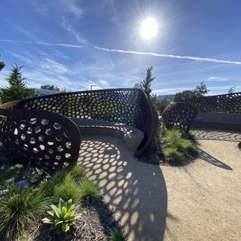


Good place to come for a walk. Newer trail and its very well taken care of. Planes overhead might ruin the Zen for you if your not a Jedi master. Might have to practice tuning things out like all the airplanes to and from SFO. Its seemingly a constant thing - and with all the jet fuel and pollution they put out I'm not sure if its the best thing to frequent this place or spend a lot of time here. I researched the pollution that comes off of jets and gas powered leaf blowers and its mind blowing when it compared to a modern car with a smog device. Trash can, benches, perfectly clean walking trails. If you are in the area don't hesitate to check it out. read more



2 years ago
Great trail- it's paved and travels for several miles between the businesses and the bay. Not many walkers. I've been coming here for years. It has always been a safe trail, there is a mixture of dog walkers, bird lovers, bike riders and walkers. Never feels crowded. To find it: 1) Go to SSF Costco, there is even a plaque on the buildings wall 2) find the small parking lot between the Costco and the water Treatment Building Park. 3) Walk over the large pedestrian bridge - wood planks with brown Steel beams -enjoy the birds in the slow moving stream 4) Turn right at the end of the bridge onto the asphalt paved trail. There are rest areas, benches, and a few interpretive signs. Some sensitive areas are blocked off, stay on the path. Birds have nests in the brush and muddy shoreline . Lots to look at. The trail is marked with mileage signs. Bring a hat and water. Wear comfortable shoes. Bring a jacket, it can be windy. If you have a dog, use a leash. read more


Well, it isn't the most exciting stretch of the SF Bay Trail, but you probably could've figured that out for yourself. Stretching from the top of Sierra Point to the edge of SFO, the mostly paved trail snakes around bland business parks, mundane marinas, and poop-freckled pavement. Yet, it held a certain risk-averse appeal. It's over seven miles out and back, and if you manage it in one fell swoop, you're certainly a more motivated person than I am. It took me a couple of visits. I parked at Sierra Point and tackled the northern half on my first walk, and I just parked at Oyster Point to tackle the rest of the route. Truth be told, there wasn't that much difference in the terrain or the bay views between the two halves. It was pleasant enough if you don't mind a lot of wind whipping you around. The paved walkway works its way around the edges of the peninsulas with footbridges and plenty of benches along the way. It becomes a meandering path interrupted sometimes by bicyclists, joggers, and the occasional pack of Genentech colleagues holding walking meetings. Breaking up the monotony were several marshlands along the way with plenty of seabirds. Parking was a cinch at either Sierra Point or Oyster Point since there are public lots separate from the company-owned spaces. You'll definitely get your FitBit steps here, just not your flights. RELATED - Up for a hike? Here's a collection of trails I've walked and reviewed: http://bit.ly/2OrC8nU read more


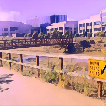



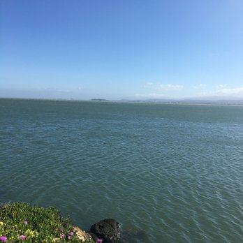
Great little section of the San Francisco Bay Trail. Our preferred entry point is near the Airport Coscto. The parking area is small but we have never had an issue. The trail is mostly flat however, there are a few easy slopes to break up the monotony. There are killer views of the bay as well as you can watch a lot of flight operations at nearby San Francisco International. There are multiple train entry-points and the only services are the parks along the route so plan ahead. Also lots and lots of wind so dress accordingly read more




6 years ago
We started at Sierra Point in Brisbane and walked all the way to 5.5 mile end, which apparently takes you right up to the Costco Airport parking lot. The northern half of the trail is prettier with views but windy, while the southern end starting from oyster point onward has more wildlife. Keep your eyes alert while you're enjoying a brisk flat walk. The climate here is always sunny but sometimes super windy. I tend to dress in layers. Bathrooms are available at Oyster Point and at Sierra Point. I also tend to park at these two points. Spaces are always available. Lots of people also picnic on the grass nearby. read more




9 years ago
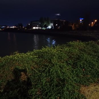
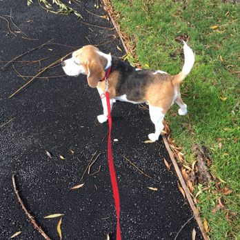
Great place to walk the dog and reflect on things. Not crowded and a killer view! Trash cans along the way on this well paved and lit path. Super quiet! read more



15 years ago
I Love walking this trail. It is mostly flat some little bumps in the road, I wouldn't even call them hills. You can walk, run, bike, roller blade, jog stroll whatevery you want to do! There is a lot business people walking during their lunch. It is beautiful on a nice day. But can get a little windy, it is in South San Francisco, do you expect anything different? This is one of the few trails that are dog friendly that I have found! read more


8 years ago
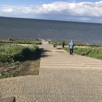
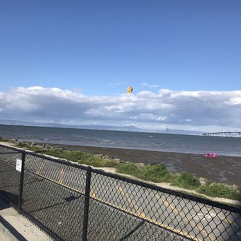
Beautiful paved walkway for outdoor exercising. The stairs were great for a workout up the hill. Great view on your run. Well maintained not a lot of trash or gang baby scribbles. Parking was good at the end. Would like to see more outdoor lighting for dusk jogging. read more


7 years ago

9 years ago
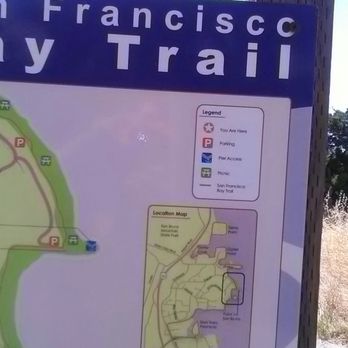
Today, was a great weather day to "Speed Walk" at The Bay Trail located conviently behind Genetech building. There is Free Public Access, and parking is ample just make sure to Secure personal belongings inside car before exercising. This entire walking trail is over 16 miles and on a BEAUTIFUL day with no heavy winds it's just Heavenly! No need for a stuffy gym..It's Free! read more


13 years ago

9 years ago
More info about Bay Trail
Oyster Point Genentech - Sierra Point
South San Francisco, CA 94080
Directions
Hours
Outdoor Amenities
Ask the Community - Bay Trail
Review Highlights - Bay Trail
You might also consider





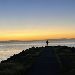


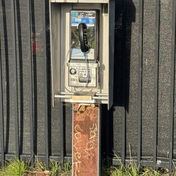


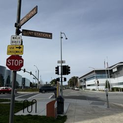
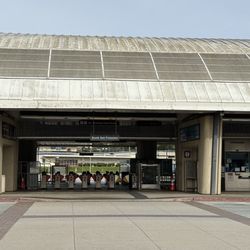









Bay Trail - hiking - Updated May 2026
Best of South San Francisco
People found Bay Trail by searching for…
Parks in South San Francisco, California
Hiking Trails in South San Francisco, California
Things to Do in South San Francisco, California
Walking Trails in South San Francisco, California
Great View Points at Night in South San Francisco, California
Beautiful Views in South San Francisco, California
Stairs Workout in South San Francisco, California
Dog Friendly Hiking Trails in South San Francisco, California
Running Trails in South San Francisco, California
Scenic View in South San Francisco, California
Trail in South San Francisco, California
Picnic Areas in South San Francisco, California
Off Road Trails in South San Francisco, California
View Points in South San Francisco, California
Views in South San Francisco, California
Parks for Kids in South San Francisco, California
Running Stairs in South San Francisco, California
Hikes With Dogs in South San Francisco, California
Places to Walk in South San Francisco, California
Easy Hikes in South San Francisco, California
Picnic Spots in South San Francisco, California
Hiking With Kids in South San Francisco, California
Trending Searches in South San Francisco, CA
Botanical Gardens near Bay Trail
Bounce House Rentals near Bay Trail
Dog Friendly Things To Do near Bay Trail
Nurseries & Gardening near Bay Trail
Outdoor Activities near Bay Trail
Outdoor Furniture Stores near Bay Trail
Party Equipment Rentals near Bay Trail
Pick Your Own Farms near Bay Trail
Places To Walk Around near Bay Trail
Rainy Day Activities near Bay Trail
Strawberry Picking near Bay Trail
Browse Articles
Browse Nearby
BEST of South San Francisco, California Coffee near Bay Trail
BEST of South San Francisco, California Restaurants near Bay Trail
BEST of South San Francisco, California Things to Do near Bay Trail
BEST of South San Francisco, California Walking Trails near Bay Trail
BEST of South San Francisco, California Breakfast near Bay Trail
BEST of South San Francisco, California Parks near Bay Trail
BEST of South San Francisco, California Campgrounds near Bay Trail
BEST of South San Francisco, California Hotels near Bay Trail
BEST of South San Francisco, California Sightseeing near Bay Trail
Browse Brands
Related Searches in South San Francisco, CA
Affordable Kayak Rental Services in South San Francisco, California
Best Fishing Locations and Guides in South San Francisco, California
Best Nature Trails for Hiking in South San Francisco, California
Best Places for Horseback Riding in South San Francisco, California
Best Waterfalls and Swimming Holes in South San Francisco, California
Check Out Off Road Trails in South San Francisco, California
Discover Dog Friendly Trails to Explore in South San Francisco, California
Discover Kid Friendly Hiking Trails in South San Francisco, California
Discover Scenic Hiking Trails in South San Francisco, California
Discover Scenic Mountain Bike Trails Near South San Francisco, California
Discover Scenic Waterfall Spots in South San Francisco, California
Discover Walking Parks in South San Francisco, California Near You
Discover a Hiking Trail in South San Francisco, California
Discover the Best Night Hike Trails in South San Francisco, California
Discover the Best Running Track in South San Francisco, California
Dog-Friendly Hikes With Dogs in South San Francisco, California
Enjoy Camping Adventures Around South San Francisco, California
Enjoy Kayaking Adventures in South San Francisco, California
Enjoy Tent Camping Spots Around South San Francisco, California
Enjoy a Beautiful Waterfall Hike in South San Francisco, California
Enjoy the Best Picnic Spots and Ideas in South San Francisco, California
Enjoy the Best Walking Path in South San Francisco, California
Enjoy the Best Walking Trails in South San Francisco, California
Explore Beautiful Parks and Green Spaces in South San Francisco, California
Explore Easy Hikes Perfect for All in South San Francisco, California
Explore Fun Activities to Do in South San Francisco, California
Explore Popular Campgrounds Near South San Francisco, California
Explore the Best Beach Spots in South San Francisco, California
Explore the Best Swimming Holes Around South San Francisco, California
Explore the Best Trail Options in South San Francisco, California
Family Friendly Hiking With Kids in South San Francisco, California
Find Beautiful Views in South San Francisco, California
Find the Best Parks for Picnics in South San Francisco, California
Find the Best Scenic View Locations in South San Francisco, California
Great Places to Walk in South San Francisco, California
Hike the Popular Waterfall Trail in South San Francisco, California
Hiking Trails With Waterfalls in South San Francisco, California
Off Leash Dog Hiking Trails in South San Francisco, California
Plan a Scenic Drive Route Near South San Francisco, California
Popular Outdoor Activities to Try in South San Francisco, California
Popular Picnic Spots to Visit in South San Francisco, California
Safe River Swimming Areas in South San Francisco, California
Safe and Fun Parks for Kids in South San Francisco, California
Top Climbing Spots and Gyms in South San Francisco, California
Top Paddleboarding Activities in South San Francisco, California
Top Running Trails to Explore in South San Francisco, California
Top Swimming Lakes to Enjoy in South San Francisco, California
Top Swimming Spots and Pools in South San Francisco, California
Walk Dog Friendly Hiking Trails in South San Francisco, California
Walk the Best Paved Walking Trails in South San Francisco, California
People who viewed Bay Trail also viewed

Milagra Ridge
70 reviews

Sweeney Ridge
190 reviews

San Pedro Valley Park
110 reviews

Mount Davidson Park
208 reviews
Sherwood Forest

Lake Merced
286 reviews
Lakeshore

Sign Hill Park
60 reviews

Crystal Springs Regional Trail
53 reviews

Edgehill Mountain Park
3 reviews
Forest Hill

Mount Sutro
113 reviews
Inner Sunset, Twin Peaks

San Bruno Mountain Watch
5 reviews