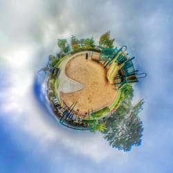
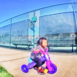
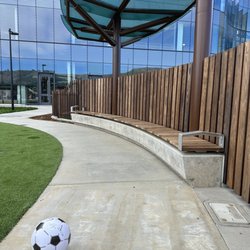
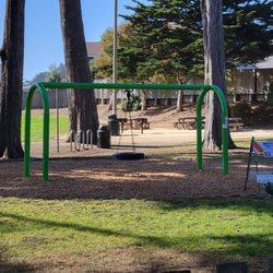
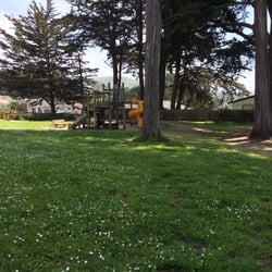
San Pedro Valley Park Photos


You might also consider
More like San Pedro Valley Park
Recommended Reviews - San Pedro Valley Park
Start your review...

Reviews With Photos

Love this hiking up and down for 6 miles with gorgeous view of the Pacifica valley and the coast. Sometimes, you will be under the tree tunnel but mostly be exposed under the sun. So, make sure wear protective sun clothing or wear sunscreen and hat. Watch out for poison oaks! Lots of it. Parking is limited and costs 6 dollars - ( exact cash only ) but there's also free parking near by. Enjoy!

I did a small 2.5 mile loop trail (Brooks fall loop) in this county park and it was really good. The trail was free of any wild growth and was easy to walk in. Also the views are amazing!. Here is the detailed loop information in case you picked up the trail map from the visitor center: 0.3 miles in Old Trout Farm trail + 0.7 miles in Brooks creek trail + 1.5 miles in Montara Mountain trail. Finally, parking is 6$ - make sure to bring cash to drop it in the envelope, if you come before 10AM as they don't have a machine to charge the fee.

Hiking today. Amazing trail. Very well maintained. Fantastic variety of geology. Several spots with some beautiful views. A great combination of open air and tree covered. Trailhead has plenty of safe parking with clean bathrooms and even a visitor center. It will definitely help to have a GPS tracker because there are a few forks in the road that could lead you wrong. Read up on the geology of this area before you come and your hike will be even better. Did I also mention, perfect combination of up and downhill.

I've hiked all over Pacifica throughout the years, and I have to say that San Pedro Valley Park has definitely been one of the most enjoyable and unique parks that I've hiked in this area. This is not your typical coastal hike. Now don't get me wrong; I adore coastal hikes! In fact, this was exactly what I was expecting when I hiked here. But instead, I was showered with beautiful lush groves, heart pumping inclines, and rampant wildlife. A far cry from a typical hike that you'd see on the coast side, but I loved every single second of it. San Pedro Valley Park is located a bit deeper in the cuts than many other parks in the area. Parking is $6 and there are actually quite a bit of parking spots. You can also park outside of the park if you want to avoid paying the fee, but it's a bit of jaunt through the residential neighborhood. I just paid. It's great to support the continuance of our local parks by paying these nominal fees. I hiked the 4.5 mile Hazelnut to Weiler Ranch loop trail and it was such a gorgeous hike! Came during the winter time and it was quite foggy in the morning, but the afternoon gave way to blue skies and lovely panoramic views. The start of this loop is immersed between large trees and lush green plants. It gradually inclines for the first half of the hike and then opens up to some magnificent views of the rolling green hillsides. The amount of wildlife that you'll see is just insane. I saw deer, birds, rabbits, and banana slugs! There were a few mountain lion warning signs, but luckily I didn't run into one. I can understand why this park has so much rampant wildlife. It's so incredibly peaceful here. For a moment, I almost forgot that I was in Pacifica. I only saw one other hiker on the trail which is so unbelievable. I think this might be one of the city's best kept secrets if you ask me. If you're coming during the colder seasons, you might run into some muddy spots. This is the perfect place for a summer hike though as most of the hike is shaded and stays cool. There's also a visitor's center but it was closed when I hiked here. There are restrooms on site and an abundance of picnic tables. So many different trails to choose from too. I would have definitely explored more of the trails if I had more time. But, now that means I need to make a return trip back here. And I will, because this park is truly stunning.

As you approach the gates, there may not be anyone at the booth. However, info can be found at the gate. Park your car first. Take a pic of your car reg and pick up an envelope at the gate. Write your car reg on the envelope and add $6 cash and post it in little box. Best to bring the exact amount of $, since there is no one there to give you change. Then display the torn out portion on your car dash. Restrooms are located at the trailhead as well as in the visitors center in front of the entrance. Maps can can also be picked up here too. Both restrooms are very clean, with seat covers and toilet paper. This was a lovely hike on the Montara Mountain trail, about 2.5 miles to the summit according to the map. This trail is about 50% shaded and takes you over different terrains. There will be hilly wooded and shrubby trails, open meadows and brief ocean views. Some areas are rocky with loose pebbles, so shoes with a good tread is advisable. The trail begins zig zagging and then as you get above the trees the views begin to appear. I did not see any animals but there were plenty of wildflowers and berries along the way. You might see a bench but with no views as the shrubs were too high. This trail seems popular with mountain cyclists and I noticed a few families too. Some paths are very tight and single file is best. Stay away from the edges, as some areas it was very steep over the edges and there were no safety guards. To end the hike, some people bought a picnic lunch as there were ample picnic tables. I visited the visitor center, where there were a few items for sale and a small museum of the animals found at the park. Definitely worth a visit.

Sat 5/22/21 hiked at San Pedro Valley Park, Pacifica. Parking fee $6, but if you want can parking in the residential area outside. There is parking on the left or the right side if you park inside. Separate bathrooms flushed toilets, sink. We did the Montara Mtn Trail, it's One-Way during COVID-19, then down Brooks Creek Trail. There is supposed to be a waterfall with a bench overlook, but it was Dry 5/22/21. We were suppose to take Trout Farm Trail but that's one-Way so just continued on Brooks Creek Trail. Lots of wildflowers still that was nice to see. Lots of picnic tables available.

I have been meaning to write a review about the hazelnut trail, it is one of the most beautiful hikes I think in the bay area! The valley is beautiful, I see a lot of little rabbits and tons of wildlife and beautiful flowers and then you go through this amazing forest of eucalyptus trees and then you can see the ocean as well. It is about 4 miles and it is not strenuous although you get a little bit of cardio.

It's almost always sunny and warm here. During COVID restrictions, there are two main loops and one-way designated paths marked. Parking on the residential street is the best way to access the trails free, although there are some people who prefer to pay the $6 parking fee in order to park in the lot. A lot of residents also park in the church parking lot and no one seems to mind. What I appreciate most about being here is the super clean bathroom near the Visitor's Center. If you decide to try the Hazelnut trail, be prepared for a climb, especially if it's a hot day. It's definitely the harder trail in comparison to what's available here.

This park has hiking trails that are great for beginners as well as advanced hikers. There are well well-designed maps that are available at the trailheads. I found these maps to be very helpful. Today I tried the Valley View Trail as well as the hazelnut Trail. However, I confess I could never find any hazelnut trees. There is a giant Grove of eucalyptus, but I'm pretty sure those aren't hazelnuts. There are also quite a few picnic and barbecue areas. Today, there are lots of people on the trail hiking a few bikers and lots of folks having picnics and barbecues. It's really a great place to bring your family. The small charge for parking as well worth the fee. However, if you are a cheapskate like me you could park out on the street and just walk in. There are lots of people who do that. After your hike, be sure to stop at The Visitor Center. Keep in mind however that's only open Saturday and Sunday.

Want to climb the peak of Montara Mountain but don't want to deal with the crowded parking and slow traffic on the Coast Hwy? Or maybe you just want to enjoy a relatively quiet hike in a small valley, tucked behind the town of Pacifica. San Pedro Valley Park can meet either need. Unlike many of the other parks and open spaces on the Peninsula, SPVP does have a parking fee ($6). But you do get what you pay for, with a nice visitor center (incl. a small museum and bookstore) and plenty of parking. The bathrooms are clean and the staff are friendly and helpful. Plus there are several picnic areas for daytime use. As for the the park itself, for me it feels like it has two main parts: 1) a set of lower elevation loop trails along the long valley formed by San Pedro creek; 2) and a set of longer climbing trails that parallel Brooks Creek before one ascends more smartly, eventually reaching the Montara trail (within McNee Ranch State Park). From there, it's only a few miles more to reach the Montara summit. (Total round trip 7 miles and 2000 ft of climbing). It's not a perfect park. Personally I find the trails along San Pedro Creek to be a little dull, and several hillsides are dominated by large groves of non-native Eucalyptus trees (a.k.a. America's largest weed). But I can think of worse places to spend on a beautiful day. And if I want to scale Montara, my preferred starting point has become SPVP, with views that are just as nice as the more popular byway. Hiking Spot Checklist: -- Parking: Yes; A large, paved lot. -- Bathrooms: Yes; at the visitor center and at trail-heads -- Potable water provided: Yes, at visitor center -- Maps provided: Yes -- Highlights: typically quiet and uncrowded My Peninsula Hike Collection is here: (https://www.yelp.com/collection/qBI6U6Lz9LJQjnGjFW6ubg)


I thought Pacific was just beaches but San Pedro Valley Park lies 2 miles inland away from all the beach action. I like it for its hiking trails. There are many different trails, the longest all-encompassing loop in the park is around 10 miles but you can go even further all the way up to Montara Mountain and beyond. I like the like Brooks Fall Loop (2.4 miles) and the Hazelnut and Weiler Ranch Loop (4.6 miles). Brooks Falls is fairly easy with a view of a waterfall in the distance. Keep in mind it only flows after a heavy rain and is rather far away looking through the canyon so you can't hear it flow. Someone with a nice camera lens might be able to get a good close up but otherwise in photos it looks very far away. For a waterfall hike where you can get up close, I'd go to Marin. Parking is $6 and it's cash in an envelope like it's year 2000. I don't understand why they don't have credit card machines because I've been to some other San Mateo parks that have them. The weekends there is a person where you can pay credit card. Lots of manzanita trees, iris, and yellow flower daisies. read more


5 months ago
Beautiful! And clean restrooms, too. I'll return asap. Good picnic place. Happy Valentine's Day! read more

Deer Factor ±1,050-acre park located in Pacifica's "Back of the Valley" neighborhood and is situated at the base of the area's impressive Montara Mountain, which peaks at ±1,900' above sea level. I can't believe I've never reviewed this place, as I used to visit at least several times a month when I lived here in P-Town. But, as they say, better late than never. ¯\_(ツ)_/¯ The Good: *Multiple restrooms *Paid parking lot (see The Ugly below) as well as free street parking outside the park along Oddstad Rd. *Visitor Center *Campsites for Youth Camps *Beach Volleyball court *Horses OK on marked trails *Always lots of deer and wild bunnies at this park, especially in the lower bowl area by the VC. *Approx nine-miles of trails, with options ranging from flat (Weiler Ranch Trail) to hilly (Montara Mountain Trail) and everything in-between, including some loops. *The uphill on the trails we did (±4.5-miles) weren't very steep but nice and gradual, including the Montara Mountain Trail. *Ocean views and the entire Pacifica area *You can take the Montara Mountain Trail into McNee State Park, but beware you're looking at an elevation gain of ±1,800' so be prepared. The Meh: *No dogs *Most of the trails were in pretty good shape, but a few of them were a little rough-and-ready--so wear good ankle supports! The Ugly: *There's a waterfall (Brooks Falls)along Brooks Creek Trail but unless it's rained recently, it won't even be a trickle. *Parking lot requires a paymentof $6, which is whatever I'm happy to contribute, but it's cash only in the envelope kinda deal. Not everyone carries cash these days and it's time to switch to a system that accepts CCs. Conclusion: read more


2 years ago
Love this hiking up and down for 6 miles with gorgeous view of the Pacifica valley and the coast. Sometimes, you will be under the tree tunnel but mostly be exposed under the sun. So, make sure wear protective sun clothing or wear sunscreen and hat. Watch out for poison oaks! Lots of it. Parking is limited and costs 6 dollars - ( exact cash only ) but there's also free parking near by. Enjoy! read more


2 years ago
I did a small 2.5 mile loop trail (Brooks fall loop) in this county park and it was really good. The trail was free of any wild growth and was easy to walk in. Also the views are amazing!. Here is the detailed loop information in case you picked up the trail map from the visitor center: 0.3 miles in Old Trout Farm trail + 0.7 miles in Brooks creek trail + 1.5 miles in Montara Mountain trail. Finally, parking is 6$ - make sure to bring cash to drop it in the envelope, if you come before 10AM as they don't have a machine to charge the fee. read more


5 months ago
Hiking today. Amazing trail. Very well maintained. Fantastic variety of geology. Several spots with some beautiful views. A great combination of open air and tree covered. Trailhead has plenty of safe parking with clean bathrooms and even a visitor center. It will definitely help to have a GPS tracker because there are a few forks in the road that could lead you wrong. Read up on the geology of this area before you come and your hike will be even better. Did I also mention, perfect combination of up and downhill. read more


I've hiked all over Pacifica throughout the years, and I have to say that San Pedro Valley Park has definitely been one of the most enjoyable and unique parks that I've hiked in this area. This is not your typical coastal hike. Now don't get me wrong; I adore coastal hikes! In fact, this was exactly what I was expecting when I hiked here. But instead, I was showered with beautiful lush groves, heart pumping inclines, and rampant wildlife. A far cry from a typical hike that you'd see on the coast side, but I loved every single second of it. San Pedro Valley Park is located a bit deeper in the cuts than many other parks in the area. Parking is $6 and there are actually quite a bit of parking spots. You can also park outside of the park if you want to avoid paying the fee, but it's a bit of jaunt through the residential neighborhood. I just paid. It's great to support the continuance of our local parks by paying these nominal fees. I hiked the 4.5 mile Hazelnut to Weiler Ranch loop trail and it was such a gorgeous hike! Came during the winter time and it was quite foggy in the morning, but the afternoon gave way to blue skies and lovely panoramic views. The start of this loop is immersed between large trees and lush green plants. It gradually inclines for the first half of the hike and then opens up to some magnificent views of the rolling green hillsides. The amount of wildlife that you'll see is just insane. I saw deer, birds, rabbits, and banana slugs! There were a few mountain lion warning signs, but luckily I didn't run into one. I can understand why this park has so much rampant wildlife. It's so incredibly peaceful here. For a moment, I almost forgot that I was in Pacifica. I only saw one other hiker on the trail which is so unbelievable. I think this might be one of the city's best kept secrets if you ask me. If you're coming during the colder seasons, you might run into some muddy spots. This is the perfect place for a summer hike though as most of the hike is shaded and stays cool. There's also a visitor's center but it was closed when I hiked here. There are restrooms on site and an abundance of picnic tables. So many different trails to choose from too. I would have definitely explored more of the trails if I had more time. But, now that means I need to make a return trip back here. And I will, because this park is truly stunning. read more


As you approach the gates, there may not be anyone at the booth. However, info can be found at the gate. Park your car first. Take a pic of your car reg and pick up an envelope at the gate. Write your car reg on the envelope and add $6 cash and post it in little box. Best to bring the exact amount of $, since there is no one there to give you change. Then display the torn out portion on your car dash. Restrooms are located at the trailhead as well as in the visitors center in front of the entrance. Maps can can also be picked up here too. Both restrooms are very clean, with seat covers and toilet paper. This was a lovely hike on the Montara Mountain trail, about 2.5 miles to the summit according to the map. This trail is about 50% shaded and takes you over different terrains. There will be hilly wooded and shrubby trails, open meadows and brief ocean views. Some areas are rocky with loose pebbles, so shoes with a good tread is advisable. The trail begins zig zagging and then as you get above the trees the views begin to appear. I did not see any animals but there were plenty of wildflowers and berries along the way. You might see a bench but with no views as the shrubs were too high. This trail seems popular with mountain cyclists and I noticed a few families too. Some paths are very tight and single file is best. Stay away from the edges, as some areas it was very steep over the edges and there were no safety guards. To end the hike, some people bought a picnic lunch as there were ample picnic tables. I visited the visitor center, where there were a few items for sale and a small museum of the animals found at the park. Definitely worth a visit. read more


Sat 5/22/21 hiked at San Pedro Valley Park, Pacifica. Parking fee $6, but if you want can parking in the residential area outside. There is parking on the left or the right side if you park inside. Separate bathrooms flushed toilets, sink. We did the Montara Mtn Trail, it's One-Way during COVID-19, then down Brooks Creek Trail. There is supposed to be a waterfall with a bench overlook, but it was Dry 5/22/21. We were suppose to take Trout Farm Trail but that's one-Way so just continued on Brooks Creek Trail. Lots of wildflowers still that was nice to see. Lots of picnic tables available. read more


I have been meaning to write a review about the hazelnut trail, it is one of the most beautiful hikes I think in the bay area! The valley is beautiful, I see a lot of little rabbits and tons of wildlife and beautiful flowers and then you go through this amazing forest of eucalyptus trees and then you can see the ocean as well. It is about 4 miles and it is not strenuous although you get a little bit of cardio. read more


6 years ago
It's almost always sunny and warm here. During COVID restrictions, there are two main loops and one-way designated paths marked. Parking on the residential street is the best way to access the trails free, although there are some people who prefer to pay the $6 parking fee in order to park in the lot. A lot of residents also park in the church parking lot and no one seems to mind. What I appreciate most about being here is the super clean bathroom near the Visitor's Center. If you decide to try the Hazelnut trail, be prepared for a climb, especially if it's a hot day. It's definitely the harder trail in comparison to what's available here. read more


2 years ago
This park has hiking trails that are great for beginners as well as advanced hikers. There are well well-designed maps that are available at the trailheads. I found these maps to be very helpful. Today I tried the Valley View Trail as well as the hazelnut Trail. However, I confess I could never find any hazelnut trees. There is a giant Grove of eucalyptus, but I'm pretty sure those aren't hazelnuts. There are also quite a few picnic and barbecue areas. Today, there are lots of people on the trail hiking a few bikers and lots of folks having picnics and barbecues. It's really a great place to bring your family. The small charge for parking as well worth the fee. However, if you are a cheapskate like me you could park out on the street and just walk in. There are lots of people who do that. After your hike, be sure to stop at The Visitor Center. Keep in mind however that's only open Saturday and Sunday. read more


3 years ago
Want to climb the peak of Montara Mountain but don't want to deal with the crowded parking and slow traffic on the Coast Hwy? Or maybe you just want to enjoy a relatively quiet hike in a small valley, tucked behind the town of Pacifica. San Pedro Valley Park can meet either need. Unlike many of the other parks and open spaces on the Peninsula, SPVP does have a parking fee ($6). But you do get what you pay for, with a nice visitor center (incl. a small museum and bookstore) and plenty of parking. The bathrooms are clean and the staff are friendly and helpful. Plus there are several picnic areas for daytime use. As for the the park itself, for me it feels like it has two main parts: 1) a set of lower elevation loop trails along the long valley formed by San Pedro creek; 2) and a set of longer climbing trails that parallel Brooks Creek before one ascends more smartly, eventually reaching the Montara trail (within McNee Ranch State Park). From there, it's only a few miles more to reach the Montara summit. (Total round trip 7 miles and 2000 ft of climbing). It's not a perfect park. Personally I find the trails along San Pedro Creek to be a little dull, and several hillsides are dominated by large groves of non-native Eucalyptus trees (a.k.a. America's largest weed). But I can think of worse places to spend on a beautiful day. And if I want to scale Montara, my preferred starting point has become SPVP, with views that are just as nice as the more popular byway. Hiking Spot Checklist: -- Parking: Yes; A large, paved lot. -- Bathrooms: Yes; at the visitor center and at trail-heads -- Potable water provided: Yes, at visitor center -- Maps provided: Yes -- Highlights: typically quiet and uncrowded My Peninsula Hike Collection is here: (https://www.yelp.com/collection/qBI6U6Lz9LJQjnGjFW6ubg) read more


4 years ago
Beautifil trails. Quiet. Peaceful. Looks like a good place to have a get together with family pr friends. Clean bathrooms. read more


I love san pedro park! I have been coming here as long as I can remember, so many childhood memories. Now I bring my children here to make thier own! They have made some updates over the years to the signage around the park, but it mostly remains the same which is always very comforting to me. We try to get here at least a couple times a month to walk the main trail, and if we are pressed for time but want to do a quick walk the nature trail combined with the old trout farm trail is also a good little route to take. Valley view and hazelnut are my favorite trails to walk, but i dont get to do them as much as I like. Thank you san mateo county parks for keeping san pedro beautiful! read more


2 years ago
17 years ago
For those who need a quick guide before leaving for here, here's a quick rundown before my review. ---------------------------------------------- NOTES AND RECOMMENDATIONS: -$5 Parking Fee, don't forget this! -For hiking don't wear short shorts. We once got TICKS and there's tons of poison oak (although it's off the trail, just cover up just in case) -Museum is open Saturday & Sunday 10AM to 4PM -No Pets Allowed -Park closes at 8:00PM -If you're having a picnic there, sign up or go EARLY in the morning to reserve a spot. ---------------------------------------------- San Pedro Park has always been one of my favorite family party spots since I was a little kid. This park has something for everyone. There are several picnic areas for eating, relaxing, playing football, baseball, and climbing trees (although you're actually not supposed to o_O) with bathrooms nearby. They also have a museum full of some awesome taxidermy which is cool for kids and adults alike to get an up close look at what the forest's animals look like. If you get creep ed out by that kind of stuff and it's not your scene, try hiking through the Brooks Trail or up the more rigorous Monetary trail for those who really want a good workout. The Monetary goes up for what seems like forever until you can see all of Pacific. I wouldn't bring any little kids on the Monetary unless they were REALLY full of spunk. All in all, this park is a great place for families and friends to enjoy the outdoors at however rigorous of a pace they'd like. read more


5 years ago
A beautiful and serene place in lovely Pacifica where you can take it easy and have a picnic or take a hike on one of the many gorgeous trails. read more


Gorgeous park, almost no people .... perfection! We ended up doing a really nice hike here. There seem to be several options depending on whether you want a quicker walk-style hike or a full-on "pack some snacks and water" hike. (We came here spur of the moment, so we did the former.) I normally hike on the ocean side of Pacifica, but this was a fun (and less windy) change. Will definitely be back! read more


 - Parks Near Me - Pacifica, California")


This is a really delayed review of hiking at San Pedro Valley Park. I went here in the fall, so it was a gorgeously sunny day and hot out (love to be hot sometimes!). San Pedro Valley Park has a number of trails that are different lengths and levels of difficulty. If you park in the lot near the visitor center, it is $5 or $6 for the daily rate. You can skip this and park on the street. The visitor center has maps of all the trails or you can look them up online here: http://parks.smcgov.org/san-pedro-valley-park-trails. Before I headed on my hike I grabbed a map from the visitor center and asked a ranger to point me in the right direction. Even these attempts to steer my direction didn't help my cause, though. I am not good at reading maps, so even though I had planned to take the Brooks Creek Trail and then connect to the Montara Mountain Trail for a quick 2 mile loop, that is not what I actually ended up doing! Whoops! I am geographically challenged, so it certainly would have been helpful if I could successfully navigate a paper map! Whoops again. I am clearly too reliant on my phone maps. Anyhow, I accidentally went on the Hazelnut Trail, which connects to the Weiler Ranch Trail, which was an approximately 5 mile hike! Since I thought I was going on a quick two mile hike, I didn't bring water or snacks - next time I won't leave those behind, just in case! Another whoops. The trail ascends for about three miles, so it is a good workout. There are benches along the way. There are also beautiful views of the valley and the ocean when the trail opens up to the vistas. I have to admit I was a bit nervous on this trail alone because there are mountain lions to watch out for - and apparently you should hike with at least one other person when you do hikes in mountain lion country. This is one of the reasons I only give San Pedro four stars. I was so nervous about mountain lions I couldn't really enjoy the trail as much as I would have liked. (Plus I knew I was on the wrong trail! phooey!) This was one time when I was glad not to catch a glimpse of wildlife! I do recommend going here. It is beautiful, has gorgeous views and interesting vegetation. Don't do what I did though, and make sure you get on the right trail or you'll might be saying whoops too :). read more

9 years ago
I am really starting to love San Pedro Valley Park. I have been here a few times already and I really enjoy everything it has to offer. There are various hiking trails from easy to more advanced. I have hiked up the Montara Mountain Trail (1175 feet elevation gain) a few times. This trail is approximately 2.25 miles. It is pretty much a steady slight incline the whole way up. When you reach the top, you can either go back down, or the more adventurous can go either go 2.5 more miles down to Montara State Beach or another 1 mile up to the top of Montara Mountain at North Peak. I have done all these options and enjoyed hiking up to North Peak the most. North Peak is actually in McNee Ranch State Park. There are signs letting you know when you enter a different park. The Montara Mountain Trail is defiantly more on the challenging side. Make sure you bring plenty of water and fuel if you plan on going up Montara Mountain. San Pedro Valley Park offers surreal views of the Pacific and the San Pedro Valley. Often times, it is misty and/or foggy, which in my opinion is perfect hiking weather. The trails I've been on offer great vista points perfect for selfies with great views. The park also offers both drop in and reserved picnic areas. The cost to get in is $6 per car. The bathrooms are pretty clean for county park standards. read more


9 years ago
An interesting and pretty beautiful hike. We took the Montara Mountain Trail from the parking lot and eventually got to the peak junction area where you could get a 360 view of the Ocean as well the inland area that stretched out to the bay. Most of the view on the way up is of Pacifica but I highly recommend taking the Grey Cove beach trail on the way down even though you'll end up in a different parking lot by the highway 1. Going down this way you see many flat greenlands where there's possibilities to picnic or just lay by crazy trees that are resting by the cliffs. read more


This is a great place to go if you live in the city, want a good hike, but don't want to drive too far. Head down to Pacifica on Route 1, hang a left at that big shopping center intersection, drive a couple of miles through a residential area, and there you are at the park ($5 parking fee). Our hike was about 7 miles and took us up to the Montara Mountain peak. It's about a 1900' climb, but much of it is a gradual climb with few really steep sections. There are some benches where you can stop and rest and take in the views. The top of the hike as you get closer to the peak is kind of exposed, but you get plenty of shade on the lower part of the trail. Much of the trail is narrow - wear long pants if you don't want to get your legs scratched up. The trails are rarely crowded, and seem to be popular with runners - I always see a few here every time I go. The peak itself is marred by the giant antenna right on it, but it still offers some pretty wonderful views (that is, when it's not fogged in). Part of the fun on today's hike was the view of the machinery that's going to be used to construct the tunnel that will take the place of Devil's Slide. Looks like they're finally getting around to building that thing. read more


10 years ago
18 years ago
Nice park for hiking. I loved that is was totally uncrowded; we only saw maybe 3-4 other hikers during our 3 hour hike. The trails are easy and well-maintained. I didn't think they were steep or strenuous at all and it's not like I consider myself to be an athlete or anything. However, I did think the trails got a little boring at times. Maybe I have no soul, but all the trees and valleys started looking the same to me. We did the Brooks Trail and most of the Montara trail. The views are great and there are several spots with benches and clearings where you can picnic. You can see out to the ocean and all of Pacifica. Overall, if you want to go hiking and don't want to deal with the crowds and Golden Gate Bridge on the way to/from Marin, San Pedro is a good choice. It's easy to get to and again, the best part is no crowds and easy parking. There are picnic tables near the parking lot and some small grassy fields for kids to run around in. The visitors center has clean bathrooms. Parking tip - there are tons of spaces in the residential area across the street from the park entrance. It's a five minute walk into the park from there and you can save yourself $5. read more


I ran my first trail marathon @this location. It was beautiful! It had been raining the night before, so the terrain was a bit muddy. No worries, nothing a good pair of Asic trail shoes can't handle. We signed up for the 5mile run and the first mile & a half was strictly uphill. It looped up and around the hill, then down, through wide terrains then more narrow ones. Be careful where you step and watch out for those running faster than you. I love switching between trail runs and regular runs. Nature & the picturesque scenery can be a lot more breathtaking. Breathing in cleaner air is a plus as well. I can't wait for the next trail marathon in July @Pacifica. Registration is only $30 and you get a cool shirt & some snacks after you complete your run! read more
 - Parks Near Me - Pacifica, California")
13 years ago
Page 1 of 3
More info about San Pedro Valley Park
600 Oddstad Blvd
Pacifica, CA 94044
Directions
(650) 355-8289
Call Now
Visit Website
http://parks.smcgov.org/san-pedro-valley-park
Hours
Indoor Amenities
Outdoor Amenities
Ask the Community - San Pedro Valley Park
What's the best route to the creek for people with mobility or balance issues? Where is the best parking for this/these trailheads? Thank you!
Review Highlights - San Pedro Valley Park
You might also consider


Why does Yelp recommend reviews?
4 reviews that are not currently recommended
The reviews below are not factored into the business's overall star rating.
2 years ago
10 years ago
14 years ago
15 years ago
San Pedro Valley Park - parks - Updated July 2026
Best of Pacifica
People found San Pedro Valley Park by searching for…
Hiking Trails With Waterfalls in Pacifica, California
Hiking in Pacifica, California
Campgrounds in Pacifica, California
Swimming Holes in Pacifica, California
Photo Spots in Pacifica, California
Things to Do in Pacifica, California
Redwood Trees in Pacifica, California
Picnic Spots in Pacifica, California
Beaches in Pacifica, California
Watch Sunset in Pacifica, California
Beautiful Views in Pacifica, California
Playgrounds in Pacifica, California
Scenic Drive in Pacifica, California
Playgrounds for Kids in Pacifica, California
Parks for Kids in Pacifica, California
Beach Bonfire in Pacifica, California
Free Beach Parking in Pacifica, California
Dog Friendly Hiking Trails in Pacifica, California
Walking Trails in Pacifica, California
Fall Foliage in Pacifica, California
Secret Spots in Pacifica, California
Picnic Areas BBQ Pits in Pacifica, California
Trending Searches in Pacifica, CA
Black Owned Nail Salons near San Pedro Valley Park
Boardwalk near San Pedro Valley Park
Boat Rental near San Pedro Valley Park
Cliff Jumping near San Pedro Valley Park
Day Trips near San Pedro Valley Park
Dog Friendly Beaches near San Pedro Valley Park
Dog Swimming near San Pedro Valley Park
Fishing Spots near San Pedro Valley Park
Jet Ski Rental near San Pedro Valley Park
Kayak Rental near San Pedro Valley Park
Kids Activities Outdoor near San Pedro Valley Park
Lakes near San Pedro Valley Park
Lookout Points near San Pedro Valley Park
Outdoor Basketball Courts near San Pedro Valley Park
Picnic Areas near San Pedro Valley Park
Places To Walk Around near San Pedro Valley Park
Pool Day Pass near San Pedro Valley Park
Public Beaches near San Pedro Valley Park
Public Pools near San Pedro Valley Park
River Swimming near San Pedro Valley Park
Scenic Overlook near San Pedro Valley Park
Soccer Store near San Pedro Valley Park
Splash Pad near San Pedro Valley Park
Strawberry Picking near San Pedro Valley Park
Swimming Holes near San Pedro Valley Park
Swimming Lakes near San Pedro Valley Park
Browse Articles
Browse Nearby
BEST of Pacifica, California Coffee near San Pedro Valley Park
BEST of Pacifica, California Restaurants near San Pedro Valley Park
BEST of Pacifica, California Things to Do near San Pedro Valley Park
BEST of Pacifica, California Breakfast near San Pedro Valley Park
BEST of Pacifica, California Playgrounds near San Pedro Valley Park
BEST of Pacifica, California Picnic Areas near San Pedro Valley Park
BEST of Pacifica, California Star Gazing near San Pedro Valley Park
BEST of Pacifica, California Campgrounds near San Pedro Valley Park
BEST of Pacifica, California Sightseeing near San Pedro Valley Park
Browse Brands
Related Searches in Pacifica, CA
Best Nature Trails for Hiking in Pacifica, California
Best Off Leash Dog Parks in Pacifica, California
Best Parks for Parties and Events in Pacifica, California
Best Water Parks for Kids in Pacifica, California
Check Out Great Playgrounds in Pacifica, California
Discover Baseball Fields Around Pacifica, California
Discover Beautiful Garden Spots in Pacifica, California
Discover Fun Toddler Parks in Pacifica, California for Your Little One
Discover Lakes & Ponds to Explore in Pacifica, California
Discover Popular Photo Spots in Pacifica, California
Discover Public Beaches to Visit in Pacifica, California
Discover Soccer Fields in Pacifica, California Near You
Discover Top State Parks to Visit in Pacifica, California
Discover Walking Parks in Pacifica, California Near You
Discover the Best Beaches in Pacifica, California
Discover the Best Kids Park Spots in Pacifica, California
Enjoy the Best Picnic Spots and Ideas in Pacifica, California
Enjoy the Best Walking Trails in Pacifica, California
Explore Beautiful Botanical Gardens in Pacifica, California
Explore Easy Hikes Perfect for All in Pacifica, California
Explore Family-Friendly Zoos and Wildlife in Pacifica, California
Explore Free Picnic Areas Around Pacifica, California
Explore Parks With Pull Up Bars in Pacifica, California
Explore Popular Campgrounds Near Pacifica, California
Explore Popular Picnic Areas Around Pacifica, California
Explore Popular RV Parks Around Pacifica, California
Explore Popular Recreation Centers Around Pacifica, California
Explore Scenic Lakes to Visit in Pacifica, California
Explore Top Dog Parks in Pacifica, California Near You
Explore Top Water Parks in Pacifica, California Today
Explore the Best Trail Options in Pacifica, California
Find Parks and Recreation Activities in Pacifica, California
Find Top Dog Friendly Parks to Visit in Pacifica, California
Find Top Skate Parks in Pacifica, California for All Skill Levels
Find a Park With BBQ Pits in Pacifica, California
Find the Best Parks BBQ Grills in Pacifica, California
Find the Best Parks for Picnics in Pacifica, California
Have Fun at a Splash Pad in Pacifica, California
Indoor Playgrounds to Explore in Pacifica, California
Locate Tennis Courts Around Pacifica, California
Parks With Basketball Courts for Games in Pacifica, California
Picnic Areas With BBQ Pits Available in Pacifica, California
Play at a Splash Pad Park in Pacifica, California
Popular Children Playgrounds to Visit in Pacifica, California
Popular Places to Take Pictures in Pacifica, California
Top Hiking Trails to Explore in Pacifica, California
Top Running Trails to Explore in Pacifica, California
Top Swimming Lakes to Enjoy in Pacifica, California