McNee Ranch State Park Photos


You might also consider
More like McNee Ranch State Park
Recommended Reviews - McNee Ranch State Park
Start your review...

Reviews With Photos


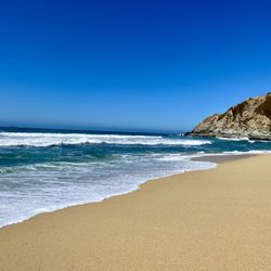
The Gray Whale Cove Trail could be my favorite of all the Pacific Coast trails I've recently discovered during my pandemic-driven adventures, so I'm amazed how I almost missed it. I was familiar with the crescent-shaped parking lot off Hwy One but thought it was just for the beach below. Given you have to risk life and limb crossing the high-speed highway, I was never that interested in stopping until I noticed there was a trail to explore. I just couldn't tell where it was, and truth be told, helpful signage was severely lacking. Out of pure ignorance, I had tried the North Trail at first, but it was so brief that I went back to the parking lot searching for another entry point and inadvertently found the Gray Whale Cove Trail, which takes you up the hill gradually and follows a flat mile-long dirt path around the hills that look over not only the Pacific but Hwy One. I found myself surrounded by lush vegetation and surprised by adorable jackrabbits looking for privacy. I just found the combination quite pleasing and the views were quite striking from almost any point on the path. On a subsequent visit, I dared to tackle the steep hillside that took me to the single tree on top of the adjacent hill. That was a difficult climb, but the payoff was an even more spectacular view and the fact that I got that much closer to the summit of Montara Mountain. The lengthier alternative was to take the Old Pedro Mountain Road which still has remnants of the pavement when it accommodated vehicular traffic in a bygone era. The mountain trail hugs the hills on the other side away from the ocean, and the benefit is that you get a lot more FitBit steps with that route. The North Peak Access Road provides another entry point further south on Hwy One closer to Montara Beach and offers a few parking spaces as well as another path to the summit next to a forest of cypress trees and an equestrian ranch. This network of trails was a true find for me and it doesn't depend on a beach to make it a must-stop. RELATED - Up for a hike? Here's a collection of trails I've walked and reviewed: https://bit.ly/2OrC8nU

Wow. Phenomenal hiking trail! Was definitely blown away by the views and scenery. The entire trail was full of luscious landscape and greenery. Felt great after completing the 2.4 mile loop which took me and my friend about one hour because we stopped several times to take pics! The terrain changes from flat to inclined depending which route you take. I loved this trail so much that I'll definitely be back more often!!

McNee is great for ocean views with their series of exposed trails right above the ocean and going up to Montara Mountain. Get there before 10am on a weekend, and if you're coming on a hot day, bring plenty of water because there is barely any shade! HIKES WE'VE DONE: North Peak Loop Trail (just the loop part): https://www.alltrails.com/explore/trail/us/california/montara-mountain-north-peak-loop-trail Note there benches close to the "2" marking (Pedro Mountain Road North Junction) and the "5" marking (Pedro Mountain Road Junction). I've also circled these spots in blue on my uploaded photo. Note that going clockwise on this loop, the first uphill section is very steep. Essential to have good hiking shoes with good grip, and/or hiking poles! However the downhill (the 2nd part of the loop, going clockwise), being a zigzag path, is much much more gradual. Grey Whale Cove Trail (plus an extra loop going up the mountain to the east - sorry, these trails aren't named! It's the highlighted red trails in my uploaded photo): https://www.alltrails.com/explore/trail/us/california/gray-whale-cove-trail EXPOSURE: Almost fully exposed! The zigzag path during the 2nd part of the loop on the North Peak Loop trail has more trees. PARKING: Empty at 4pm on a Friday. Just filling up at 10am on a weekend. However, note that there is a little road that goes uphill on the north end of the parking lot (right as you enter the lot, you'd turn left). This has pretty much endless overflow parking! See my uploaded photo, this road is circled in white. Note this is also where you would park to go to Gray Whale Cove Beach (probably another reason the lot fills up so quickly!). AMENITIES: None at the parking lot. No water, no restrooms. CROWDED: Yes, it gets busy here! And the trails can be narrow, so it's hard to socially distance. People are good about it and will step to the side to let you pass, though.

Always a great state park to hike at. We access McNee Ranch State Park from San Pedro Valley Park via the Montara Mountain Trail. The two parks connect on the Montara Mountain Trail and there is a sign on the trail letting you know you entered into McNee Ranch. We have hiked all the way up to the peak that has a giant antenna at the top. The elevation of the peak is around 1900 feet above sea level. It is a great hike with pretty much incline all the way up. It is around 3.5 miles up from the entrance of San Pedro Valley Park. There are great views from the top and it almost feels as if you are right next to the clouds with all the coastal fog. This park is not too crowded. Every time we come here, we only see a few hikers and bikers sporadically on the trail. Parking is $6 if you park at San Pedro, however I know there are a few lots on Highway 1 that offer free parking. Looking forward to more hikes here in the future.

This is one of my favorite hikes in the bay area! I went mid-june and not only did I get to see so many different wildflowers, but also got a beautiful view of the beach while hiking. You're hiking along the mountain right across from gray whale cove beach so you get a beautiful view. I came here during the shelter at home and didn't see too many people wearing masks on the hike. The trail itself can be narrow so I recommend bringing a mask (if you are particular about that). For logistics you can start the trail at gray whale cove parking lot. The lot is small and fills up quickly, but if you're willing to circle and wait you can definitely get a spot (we circled the lot for about 15 minutes before someone left). I saw some portable bathrooms at the parking lot, but they were very dirty. On the trail there are no bathrooms. The trail itself is open with little to no shade so I recommend bringing a hat, sunscreen and water. On the trail there were a lot of friendly pups and mountain bikers. The hike itself isn't too strenuous and is pretty well paved. There are some steep incline/decline so I recommend bringing a good pair of shoes that has grip as it can be easy to slip from the loose dirt. Overall I highly highly recommend this beautiful hike as you get a beautiful view of the ocean. Should you decide to hike to the top you are also greeted by the golden gate bridge and birds eye view of the peninsula. Would definitely hike this again.

Great hike for 2 hours. Seems to be a popular spot for dog walkers and mountain bikers. Parked at Gray Whale Cove Parking Lot, which had plenty of spots on Sunday morning. The Gray Whale Cove Trail to the Pedro Mountain Road Trail is easy/moderate (~1 mile). There is some initial incline and the trail is a bit uneven so not ideal for individuals with mobility issues. Unlike some trails that require you to get to the Vista point to get a view, the trail gives you beautiful views of the Pacific Ocean the entire way. We did part of the Pedro Mountain Road Trail and made a loop back to the Gray Whale Cove Parking Lot (essentially hugging left the entire time). The latter half is quite steep so make sure you have a good pair of shoes and might not be ideal if it just rained. Otherwise, a great hiking area and well worth the visit.

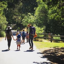
A very special place. I've been saving this place for my 700th review and it couldn't get here soon enough especially with our current political climate that's going on. No worries...I'm not gonna get political here and far from it. I wanted to get away from all the BS and this place will provide that sanctuary and then some. To say that I hike here a lot is an understatement. McNee Ranch is literally in my backyard and it's close enough to get off the grid for a few hours without having to drive great distances. I've hiked here with Maxie, Wifey and my kids, but I find the solitude with just Maxie and I more rewarding more than anything else. Don't get me wrong here since I do love my wife and kids, it's just that sometimes I need to get away and this place can afford me that luxury. Having said that, I have only hiked all the way to the top once and that was a few months after my third knee surgery as I just said the hell with it, took Maxie with me and went for it. Ignorance is truly bliss as I didn't know what I was in for as we made our way to top on a cold, windy and foggy day. The elevation to the top is 1,898 feet and due to the weather condition that day, most of the view was obstructed by the fog, but I wouldn't change a damn thing that day. There are some great views of Linda Mar along the way on the winding hike the felt like eternity. Prior to reaching the top, Maxie and I found a spot behind a rock to protect us from the howling winds and the elements and probably had the best lunch ever with her. We were in a bubble of calmness surrounded by chaos and it was a great feeling to have. We had a special connection that happened at that moment that is difficult to explain. I guess the best way to explain is that it was a happy moment saved in the memory vault similar to the movie Inside Out. I have yet to make a return trip to the top, and hope to go on a day where the fog bank just sits below the mountain as that would be awesome to take photos of that view. However, Maxie and I have have returned a bunch of times and depending on how she's feeling, we'll either take it easy or a little bit more challenging if she's up for it. That's what's great about this place is you can choose to hike it easy, moderate or difficult depending on what trail you take. There's two starting points from here and you can either start all the way from the bottom at North Peak Access Road where there are limited parking on the side of the road along Higway 1 or park across Gray Whale Cove at Montara State Beach where are plenty of parking spaces. We usually take Gray Whale Cove as our starting point and climb on the first incline towards the first tree on the side of the mountain. You'll have great views of the tunnel, the bunker and the beach. I love it when it's foggy and the layer just sits there, but you are on top of the fog bank literally just looking down at it. Keep it mind that there are no facilities here so you better pack for extra snacks, water and layer of clothing as the weather could change in an instant from sunny to foggy. But don't let that deter you since you will be rewarded with some gorgeous views from any angle and on a clear and crisp day, you can see as far south towards Pescadero and as far north as Drake's Bay. Also, there are plenty of rabbits running around here so better make sure your doggies don't chase after them or they can fall along the edge of the cliff onto Highway 1. Overall, it's a great place for humans, doggies and all kinds of wildlife even if your not the avid hiker as some of us. You'll get rewarded with plenty of moments that will be etched in the memory bank that you'll be glad you had.

Great hike for a weekend trip if you're in the bay area. The top was a little underwhelming given the locked fence for some unknown building, but the views were nice on the way up. The forested area was a change of scene that was particularly welcome because this place is quite exposed. You'll want to make sure you bring plenty of suntan lotion and water. Pro-tip is to bring a partner or friend and try to see who can name all the different flora you'll see on the way up! Finally, parking was super easy- plenty of spaces at the lot. The only annoying thing was actually getting to the trailhead which involved crossing the highway - so be careful!

Montara Mountain & the marine layer get to choose. I don't. My few visits to McNee Ranch State Park have all centered around summiting Montara Mountain & those experiences have proven binary. It's either all about the view from the top or it's all about the mad scramble to get there. The difference maker is the coastal fog & low cloud deck. Trail running all the way to the top of Montara Mountain, non-stop, without ever breaking stride or slowing to a walking pace, is no easy feat. At this point, it's not something I can do on a clear, sunny day. It gets too warm & I can't carry enough fluids to keep from overheating & dehydrating. On those days, it's a mix of hiking & running while lugging lots of fluids. But the payoff is 1 of the most magnificent views anywhere around the SF Bay. The Mt Tam Observatory, Devil's Slide Tunnels, Sutro Tower, SF, Daly City, SFO, SF Bay, San Mateo Bridge, Half Moon Bay & the big blue of the Pacific Ocean all the way out to the curvature of the Earth are all clearly visible. But when the marine layer makes it push inland & the cold gray mist clings close to the ground, you're getting none of that. Instead, it's time to run like Hell. With the fog completely blocking the direct heat of the Sun & persistent cool damp air all the way up, I can run light (maybe 40oz. fluids total). I'll still sweat like a waterfall, but won't ever actually feel hot. The payoff, in this case, is the accomplishment. It ain't easy, try it sometime. So, what's it going to be next time? I don't know. Montara Mountain & the marine layer will know. I just need to bring lots of fluids & 3 different pairs of shoes to be prepared for whatever I get.

CLEAN UP AFTER YOURSELVES! This is a beautiful hike that I take my pup on. Today my dad joined us and we went all the way to the top and he got a sharp pain. We checked his shoe and there was nothing. He kept going and the pain continued. Later we found the piece of glass that went sideways into his shoe and was stabbing him. We all like to have a good time but please clean your stuff up and pack it out (it's even lighter than when you carried it full) So sad, this is a beautiful hike with amazing views that I highly recommend. Just wanted to give a heads up to fellow hikers.

When I first saw pictures of the stunning, panoramic view from the top of Montara Peak in McNee State Park, I knew I was way overdue for a hiking excursion of extraordinary magnitude! The day I set out to ascent Montara Peak, it was a crisp, sunny day. The air was crystal clear, and the cloudless sky was blue with just enough wind to keep things interesting. Starting off slowly on a fire road, then following a dirt trail through McNee Ranch, the path to the top goes by a couple of short trails which lead down to bluff-colored sandy beaches with crashing surf and the tang of salt hanging in the air. Passing by the bluffs above the Pacific Coast Highway, the rate of ascent picks up as both the elevation increases and the terrain gets tougher. Topping out after an ascent of almost 2000 feet, the climb to the top of Montara Peak is definitely not for the faint of heart, but the payoff is totally worth it! Tips: 1) With minimal stops for water and pictures, an out-and-back hike from the trailhead to the peak and back was around 8.5 miles; it took us just under five hours. 2) With climate requirements not unlike Mission Peak, scaling Montara Peak is best done outside of the summer months; extreme heat can cause the sometimes cardio-intensive ascent to become a Sisyphean slog. Given due consideration to temperature, this hike is a beautiful, invigorating, five star experience which I heartily recommend to anyone who thinks they're up to the challenge!

Amazing view, epic experience and poor signage pretty much sums up my experience of hiking to Montara Mountain Summit via McNee Ranch State Park. We got there on a semi windy, started from the McNee parking lot in an overcast weather- hiked through semi shady and sunny part of the trail and ended up in foggy and windy summit. Even though the elevation of our hike was around 1800 but since it was steady it didn't feel like a hard trail. (tip: Start your hike on the narrow entrance of the right side of the parking toward Gray Whale Cove- there is a sign- Bring a lot of water- some snacks for mini stops along the way- cap and sunscreen) our total loop was around 9 miles- took us around 4 hours- we improvised a little! The chance of getting lost is pretty slim because you have to go back towards the ocean! There is no sign on how to get to summit- so intuitively just hike up! We passed 3 large electrical pole and we reached a big electrical station where there was no other route behind it. You will reach a flat area that should be the summit.

Such a beautiful trail! Not too challenging, pet friendly, and has awesome views! We came mid day and the sky was killer (see photos). There are so many trails and plenty of benches to sit and bring lunch. Highly recommend! Bathrooms at the trail head, parking is so easy! read more


Arrived at 10am, $6 reg parking, toilet at trailhead. We hiked to North Peak Summit in 2 hours. This first 1/2 mile was shaded by the Eucalyptus forest, then about an hour of red Manzanita trees, then we were hiking in the fog layer. Today was not a clear day, but we were able to spot Mt Tam peeking above the clouds. Pretty cool. We passes by 3 crews of volunteer clearing the trail (very thankful for their services) It was an easy hike with no crowds. Great times spent with friends. read more


2 years ago
Beautiful hike near the coast Fog had rolled in Didn't deter folks from hiking all the way up to Pacifica peak read more


I love this place! The Old Colma Road loop is my favorite coastside hiking trail. Beautiful views of the ocean, mountains, Pacifica, Montara, you name it. Uncrowded area despite all the people who fo to Gray Whale Beach. Use the same parking lot but go inland instead of to the ocean. read more


The Gray Whale Cove Trail could be my favorite of all the Pacific Coast trails I've recently discovered during my pandemic-driven adventures, so I'm amazed how I almost missed it. I was familiar with the crescent-shaped parking lot off Hwy One but thought it was just for the beach below. Given you have to risk life and limb crossing the high-speed highway, I was never that interested in stopping until I noticed there was a trail to explore. I just couldn't tell where it was, and truth be told, helpful signage was severely lacking. Out of pure ignorance, I had tried the North Trail at first, but it was so brief that I went back to the parking lot searching for another entry point and inadvertently found the Gray Whale Cove Trail, which takes you up the hill gradually and follows a flat mile-long dirt path around the hills that look over not only the Pacific but Hwy One. I found myself surrounded by lush vegetation and surprised by adorable jackrabbits looking for privacy. I just found the combination quite pleasing and the views were quite striking from almost any point on the path. On a subsequent visit, I dared to tackle the steep hillside that took me to the single tree on top of the adjacent hill. That was a difficult climb, but the payoff was an even more spectacular view and the fact that I got that much closer to the summit of Montara Mountain. The lengthier alternative was to take the Old Pedro Mountain Road which still has remnants of the pavement when it accommodated vehicular traffic in a bygone era. The mountain trail hugs the hills on the other side away from the ocean, and the benefit is that you get a lot more FitBit steps with that route. The North Peak Access Road provides another entry point further south on Hwy One closer to Montara Beach and offers a few parking spaces as well as another path to the summit next to a forest of cypress trees and an equestrian ranch. This network of trails was a true find for me and it doesn't depend on a beach to make it a must-stop. RELATED - Up for a hike? Here's a collection of trails I've walked and reviewed: https://bit.ly/2OrC8nU read more


Wow. Phenomenal hiking trail! Was definitely blown away by the views and scenery. The entire trail was full of luscious landscape and greenery. Felt great after completing the 2.4 mile loop which took me and my friend about one hour because we stopped several times to take pics! The terrain changes from flat to inclined depending which route you take. I loved this trail so much that I'll definitely be back more often!! read more


McNee is great for ocean views with their series of exposed trails right above the ocean and going up to Montara Mountain. Get there before 10am on a weekend, and if you're coming on a hot day, bring plenty of water because there is barely any shade! HIKES WE'VE DONE: North Peak Loop Trail (just the loop part): https://www.alltrails.com/explore/trail/us/california/montara-mountain-north-peak-loop-trail Note there benches close to the "2" marking (Pedro Mountain Road North Junction) and the "5" marking (Pedro Mountain Road Junction). I've also circled these spots in blue on my uploaded photo. Note that going clockwise on this loop, the first uphill section is very steep. Essential to have good hiking shoes with good grip, and/or hiking poles! However the downhill (the 2nd part of the loop, going clockwise), being a zigzag path, is much much more gradual. Grey Whale Cove Trail (plus an extra loop going up the mountain to the east - sorry, these trails aren't named! It's the highlighted red trails in my uploaded photo): https://www.alltrails.com/explore/trail/us/california/gray-whale-cove-trail EXPOSURE: Almost fully exposed! The zigzag path during the 2nd part of the loop on the North Peak Loop trail has more trees. PARKING: Empty at 4pm on a Friday. Just filling up at 10am on a weekend. However, note that there is a little road that goes uphill on the north end of the parking lot (right as you enter the lot, you'd turn left). This has pretty much endless overflow parking! See my uploaded photo, this road is circled in white. Note this is also where you would park to go to Gray Whale Cove Beach (probably another reason the lot fills up so quickly!). AMENITIES: None at the parking lot. No water, no restrooms. CROWDED: Yes, it gets busy here! And the trails can be narrow, so it's hard to socially distance. People are good about it and will step to the side to let you pass, though. read more


Always a great state park to hike at. We access McNee Ranch State Park from San Pedro Valley Park via the Montara Mountain Trail. The two parks connect on the Montara Mountain Trail and there is a sign on the trail letting you know you entered into McNee Ranch. We have hiked all the way up to the peak that has a giant antenna at the top. The elevation of the peak is around 1900 feet above sea level. It is a great hike with pretty much incline all the way up. It is around 3.5 miles up from the entrance of San Pedro Valley Park. There are great views from the top and it almost feels as if you are right next to the clouds with all the coastal fog. This park is not too crowded. Every time we come here, we only see a few hikers and bikers sporadically on the trail. Parking is $6 if you park at San Pedro, however I know there are a few lots on Highway 1 that offer free parking. Looking forward to more hikes here in the future. read more


This is one of my favorite hikes in the bay area! I went mid-june and not only did I get to see so many different wildflowers, but also got a beautiful view of the beach while hiking. You're hiking along the mountain right across from gray whale cove beach so you get a beautiful view. I came here during the shelter at home and didn't see too many people wearing masks on the hike. The trail itself can be narrow so I recommend bringing a mask (if you are particular about that). For logistics you can start the trail at gray whale cove parking lot. The lot is small and fills up quickly, but if you're willing to circle and wait you can definitely get a spot (we circled the lot for about 15 minutes before someone left). I saw some portable bathrooms at the parking lot, but they were very dirty. On the trail there are no bathrooms. The trail itself is open with little to no shade so I recommend bringing a hat, sunscreen and water. On the trail there were a lot of friendly pups and mountain bikers. The hike itself isn't too strenuous and is pretty well paved. There are some steep incline/decline so I recommend bringing a good pair of shoes that has grip as it can be easy to slip from the loose dirt. Overall I highly highly recommend this beautiful hike as you get a beautiful view of the ocean. Should you decide to hike to the top you are also greeted by the golden gate bridge and birds eye view of the peninsula. Would definitely hike this again. read more

 - Parks Near Me")


6 years ago
Great hike for 2 hours. Seems to be a popular spot for dog walkers and mountain bikers. Parked at Gray Whale Cove Parking Lot, which had plenty of spots on Sunday morning. The Gray Whale Cove Trail to the Pedro Mountain Road Trail is easy/moderate (~1 mile). There is some initial incline and the trail is a bit uneven so not ideal for individuals with mobility issues. Unlike some trails that require you to get to the Vista point to get a view, the trail gives you beautiful views of the Pacific Ocean the entire way. We did part of the Pedro Mountain Road Trail and made a loop back to the Gray Whale Cove Parking Lot (essentially hugging left the entire time). The latter half is quite steep so make sure you have a good pair of shoes and might not be ideal if it just rained. Otherwise, a great hiking area and well worth the visit. read more


A very special place. I've been saving this place for my 700th review and it couldn't get here soon enough especially with our current political climate that's going on. No worries...I'm not gonna get political here and far from it. I wanted to get away from all the BS and this place will provide that sanctuary and then some. To say that I hike here a lot is an understatement. McNee Ranch is literally in my backyard and it's close enough to get off the grid for a few hours without having to drive great distances. I've hiked here with Maxie, Wifey and my kids, but I find the solitude with just Maxie and I more rewarding more than anything else. Don't get me wrong here since I do love my wife and kids, it's just that sometimes I need to get away and this place can afford me that luxury. Having said that, I have only hiked all the way to the top once and that was a few months after my third knee surgery as I just said the hell with it, took Maxie with me and went for it. Ignorance is truly bliss as I didn't know what I was in for as we made our way to top on a cold, windy and foggy day. The elevation to the top is 1,898 feet and due to the weather condition that day, most of the view was obstructed by the fog, but I wouldn't change a damn thing that day. There are some great views of Linda Mar along the way on the winding hike the felt like eternity. Prior to reaching the top, Maxie and I found a spot behind a rock to protect us from the howling winds and the elements and probably had the best lunch ever with her. We were in a bubble of calmness surrounded by chaos and it was a great feeling to have. We had a special connection that happened at that moment that is difficult to explain. I guess the best way to explain is that it was a happy moment saved in the memory vault similar to the movie Inside Out. I have yet to make a return trip to the top, and hope to go on a day where the fog bank just sits below the mountain as that would be awesome to take photos of that view. However, Maxie and I have have returned a bunch of times and depending on how she's feeling, we'll either take it easy or a little bit more challenging if she's up for it. That's what's great about this place is you can choose to hike it easy, moderate or difficult depending on what trail you take. There's two starting points from here and you can either start all the way from the bottom at North Peak Access Road where there are limited parking on the side of the road along Higway 1 or park across Gray Whale Cove at Montara State Beach where are plenty of parking spaces. We usually take Gray Whale Cove as our starting point and climb on the first incline towards the first tree on the side of the mountain. You'll have great views of the tunnel, the bunker and the beach. I love it when it's foggy and the layer just sits there, but you are on top of the fog bank literally just looking down at it. Keep it mind that there are no facilities here so you better pack for extra snacks, water and layer of clothing as the weather could change in an instant from sunny to foggy. But don't let that deter you since you will be rewarded with some gorgeous views from any angle and on a clear and crisp day, you can see as far south towards Pescadero and as far north as Drake's Bay. Also, there are plenty of rabbits running around here so better make sure your doggies don't chase after them or they can fall along the edge of the cliff onto Highway 1. Overall, it's a great place for humans, doggies and all kinds of wildlife even if your not the avid hiker as some of us. You'll get rewarded with plenty of moments that will be etched in the memory bank that you'll be glad you had. read more


Great hike for a weekend trip if you're in the bay area. The top was a little underwhelming given the locked fence for some unknown building, but the views were nice on the way up. The forested area was a change of scene that was particularly welcome because this place is quite exposed. You'll want to make sure you bring plenty of suntan lotion and water. Pro-tip is to bring a partner or friend and try to see who can name all the different flora you'll see on the way up! Finally, parking was super easy- plenty of spaces at the lot. The only annoying thing was actually getting to the trailhead which involved crossing the highway - so be careful! read more


Montara Mountain & the marine layer get to choose. I don't. My few visits to McNee Ranch State Park have all centered around summiting Montara Mountain & those experiences have proven binary. It's either all about the view from the top or it's all about the mad scramble to get there. The difference maker is the coastal fog & low cloud deck. Trail running all the way to the top of Montara Mountain, non-stop, without ever breaking stride or slowing to a walking pace, is no easy feat. At this point, it's not something I can do on a clear, sunny day. It gets too warm & I can't carry enough fluids to keep from overheating & dehydrating. On those days, it's a mix of hiking & running while lugging lots of fluids. But the payoff is 1 of the most magnificent views anywhere around the SF Bay. The Mt Tam Observatory, Devil's Slide Tunnels, Sutro Tower, SF, Daly City, SFO, SF Bay, San Mateo Bridge, Half Moon Bay & the big blue of the Pacific Ocean all the way out to the curvature of the Earth are all clearly visible. But when the marine layer makes it push inland & the cold gray mist clings close to the ground, you're getting none of that. Instead, it's time to run like Hell. With the fog completely blocking the direct heat of the Sun & persistent cool damp air all the way up, I can run light (maybe 40oz. fluids total). I'll still sweat like a waterfall, but won't ever actually feel hot. The payoff, in this case, is the accomplishment. It ain't easy, try it sometime. So, what's it going to be next time? I don't know. Montara Mountain & the marine layer will know. I just need to bring lots of fluids & 3 different pairs of shoes to be prepared for whatever I get. read more


9 years ago
CLEAN UP AFTER YOURSELVES! This is a beautiful hike that I take my pup on. Today my dad joined us and we went all the way to the top and he got a sharp pain. We checked his shoe and there was nothing. He kept going and the pain continued. Later we found the piece of glass that went sideways into his shoe and was stabbing him. We all like to have a good time but please clean your stuff up and pack it out (it's even lighter than when you carried it full) So sad, this is a beautiful hike with amazing views that I highly recommend. Just wanted to give a heads up to fellow hikers. read more

9 years ago
When I first saw pictures of the stunning, panoramic view from the top of Montara Peak in McNee State Park, I knew I was way overdue for a hiking excursion of extraordinary magnitude! The day I set out to ascent Montara Peak, it was a crisp, sunny day. The air was crystal clear, and the cloudless sky was blue with just enough wind to keep things interesting. Starting off slowly on a fire road, then following a dirt trail through McNee Ranch, the path to the top goes by a couple of short trails which lead down to bluff-colored sandy beaches with crashing surf and the tang of salt hanging in the air. Passing by the bluffs above the Pacific Coast Highway, the rate of ascent picks up as both the elevation increases and the terrain gets tougher. Topping out after an ascent of almost 2000 feet, the climb to the top of Montara Peak is definitely not for the faint of heart, but the payoff is totally worth it! Tips: 1) With minimal stops for water and pictures, an out-and-back hike from the trailhead to the peak and back was around 8.5 miles; it took us just under five hours. 2) With climate requirements not unlike Mission Peak, scaling Montara Peak is best done outside of the summer months; extreme heat can cause the sometimes cardio-intensive ascent to become a Sisyphean slog. Given due consideration to temperature, this hike is a beautiful, invigorating, five star experience which I heartily recommend to anyone who thinks they're up to the challenge! read more


Amazing view, epic experience and poor signage pretty much sums up my experience of hiking to Montara Mountain Summit via McNee Ranch State Park. We got there on a semi windy, started from the McNee parking lot in an overcast weather- hiked through semi shady and sunny part of the trail and ended up in foggy and windy summit. Even though the elevation of our hike was around 1800 but since it was steady it didn't feel like a hard trail. (tip: Start your hike on the narrow entrance of the right side of the parking toward Gray Whale Cove- there is a sign- Bring a lot of water- some snacks for mini stops along the way- cap and sunscreen) our total loop was around 9 miles- took us around 4 hours- we improvised a little! The chance of getting lost is pretty slim because you have to go back towards the ocean! There is no sign on how to get to summit- so intuitively just hike up! We passed 3 large electrical pole and we reached a big electrical station where there was no other route behind it. You will reach a flat area that should be the summit. read more


Mcnee Ranch offers a challenging yet very beautiful hike along the gorgeous pacific coast of highway 1 and Montara State Beach. There are few different trails along the park; one of the most popular being the North Peak Access Road Trail that will lead you to the top of Montara Mountain. The North Peak Access Road Trail measures about 10 miles roundtrip and has about a 1,900 foot elevation gain. This trail is not for the faintest of heart! Beginning hikers will really be put to the test on this hike, but the views are so spectacular! The trail has a mix of paved, dirt, and rocky paths along the way and there are still spots of extreme muddiness due to the recent rainstorms. The first 3 miles of the North Peak Access trail are pretty easy and ascends at a gradual and steady incline. The following two miles are filled with steep inclines and offers very little shade. The inclines are very mountain peakish and can be strenuous, but will lead you straight to the top of the mountain. I would highly recommend bringing plenty of water and using the restroom before you start as there aren't any restrooms available on the trail itself. As you ascend up the trail, you will have many opportunities to view the fallen trees, avid greenery, and the beautiful beach down below. This is a great place to take pictures of the gorgeous surrounding scenery. Unfortunately, the wild life is pretty sparse on this trail. However, the peak of Montara Mountain offers an amazing view of the city of Pacifica and beyond! Going back down the trail is fairly easy aside from descending down the steep hills. When I hiked this trail with my group, we actually cut through to the Grey Wave Cove Trail going back down and it cut down one mile for us coming back. This can serve as a mini short cut if you don't want to do the full 10 miles. I will warn that the Grey Wave Cove Trail is very narrow and can be dangerous going down as the trail is very uneven and unpaved. A couple of us almost slipped going down and had to crawl down the trail on parts to make it back down safely. It's not too bad, but it's not a trail that you can rush through. There is a parking lot available off of highway 1 on the left side about a mile after you pass through Devil's Slide tunnel if you are driving from San Francisco. This parking lot will take you straight up to the trail. Our group got there at 8 am and there was plenty of parking available, the lot fills up quickly because people also use this parking lot to get to the beach. I would recommend getting there early and carpooling to secure a parking space. There are also restrooms available near this parking lot, but they were absolutely atrocious! Not sure if they just hadn't been cleaned in a while, but it was really gross. Overall, this was such an enjoyable and heart pumping hike and you just can't beat the amazing views! I can't wait to go back to tackle the trail again, and I would recommend it to hikers looking for a scenic and challenging hike! read more


6 years ago
Beautiful hike with views of the ocean, cliffs, highway 1 and full of lush trees. Good trail for hiking, running and hiking. It's a gradual incline and easy to get at least 4-5 miles in. Very dog friendly, and you may even see the occasional horse or tops of dolphins swimming from up above. read more


15 years ago
Montara Mountain is perhaps not the best place to find solitude, but damn if the views are not special. "Scenic" does not do this spot justice. 1900 vertical feet in about 3.9 miles to the top. Not much more to be said. Pick a cool day, wait for clear skies, and just do it. The steep ascent to the summit is quite simply magnificent, and who cares if other people know it, too? Look around: it's hard not to be impressed: http://www.yelp.com/biz_photos/Ct46Z7uBgtr8AWp-sPiaGA?select=FBdCQ99LZoFt8-GwMwPrNQ At the top, when you gaze down like an Olympian goddess at Pacifica and San Francisco, with the peaks and valleys spread out at your feet, you can't help but feel your pulse quicken: http://www.yelp.com/biz_photos/Ct46Z7uBgtr8AWp-sPiaGA?select=sZWwkcXp7slwh36vSXSoew And the death-defying Devil's Slide on Highway One never looked as awesome as seen from high above, with the sound of waves crashing on rocks far below: http://www.yelp.com/biz_photos/Ct46Z7uBgtr8AWp-sPiaGA?select=7UFrfevfwmRBdu3siqFCsg Look to the south for amazing views of Montara beach, the Pillar Point radar station, Half Moon Bay, and the Santa Cruz mountain ridgelines. if you look carefully (or have binoculars), you can even see the mega waves of Mavericks breaking offshore: http://www.yelp.com/biz_photos/Ct46Z7uBgtr8AWp-sPiaGA?select=2GiSJa_aR08rIu2OvudDHQ Whether you hike, bike, jog, meander, or just lose yourself in the vastness of open space and fragrant splendor of the chaparral-covered hillsides, this is definitely a place to reconnect with all that makes coastal California so unforgettably great: http://www.yelp.com/biz_photos/Ct46Z7uBgtr8AWp-sPiaGA?select=PJv5Y5O1pInL9p1zjl535w read more


If you mention McNee Ranch Park to most Bay Area residents they will usually draw a blank; but if you mention Montara Mountain, they will probably nod knowingly, either having previously scaled the summit, or they've placed it on their to-do list. But the peak itself lays within the boundaries of this impressively large (690-acre) park. And the park is (weirdly) part of the Montara State Beach system, even though it roams pretty far inland from the crashing surf. Your destination, if you choose to accept it: the North Peak of Montara Mountain. At 1898 feet, it has nearly unobstructed views of much of the Bay Area. On very clear days you can see (from left to right): The Pacific Ocean, Point Reyes, the town of Pacifica below, Mount Tamalpais, The Golden Gate bridge (partial); the upper hills of San Francisco, pieces of Oakland, Mt. Diablo (in the East Bay), The SF airport (partial), the Bay itself, The San Mateo Bridge, and even some sections of towns dotting the Peninsula and East Bay. I think of it as one of the 'Big Four' Bay Area mountaintop views (the other three being Mount Umunhum in the south bay, and the aforementioned Mount Tam and Mount Diablo). The best time to go: on a winter's day after a high pressure system rolls in. The rest of the year many of the landmarks mentioned may be partially obscured by fog...or you might be standing in fog. (Basically just check the weather in Pacifica before you go). There are several starting points to access the peak, but 90% of the people attempt to start at Gray Whale Cove Beach on Rte 1. Consequently, on any weekend day with nice weather the parking lot can be a complete clusterF; and so is best avoided unless you can arrive early. Alternate parking locations are from nearby Montara Beach or even from San Pedro Valley Park on the east side. (Yelp favorites can msg me for a secret, uncrowded west-side entrance). For a longer hike, there are even some trail-heads starting in the town of Pacifica. It's not what I'd call an "easy" hike, but it's not too long either: 7 miles and 1800 feet ascent from Gray Whale Cove. (slightly longer mileage from Montara Beach). If you're in reasonable shape and take it slow and steady, you'll be fine. The views are worth it. Hiking Spot Checklist for McNee Ranch SP: -- Parking: Dirt lot off Rte 1 at Gray Whale Cove; or roadside parking on Rte 1 at Montara Beach -- Bathrooms: At the beach of Gray Whale Cove (other side of Rte 1 from parking) -- Potable water: No -- Maps provided: No -- Highlights: Open terrain+steep drops = Nice views My Peninsula Hike Collection is here: (https://www.yelp.com/collection/qBI6U6Lz9LJQjnGjFW6ubg) read more


13 years ago
My husband and I went for a hike yesterday and brought our dog. (Dogs must be on a leash) It was very cloudy and foggy but we have been planning to go all week. Overall prepare for some steep inclines however generally an easy hike. We decided to not go all the way to the top but take the trail towards Pacifica. It seemed to be flatter and more scenic. The closer we got to Pacifica the more the fog rolled in so we decided to turn around. The trail is not a loop so remember you will have to walk back the sane way you came. The ocean views are great. Hopefully you pick a clear day to enjoy it. We will definitely be back! read more


Drove here today for a hike and it was beautiful. Parking was easy on the lot by the hike entrance and also across from the beach access. The hike has some steep areas if you want to make it all the way to the top. The views at top are worth it. Bring water and good hiking shoes. After a hike you can head down to the beach or drive along HW1 to grab lunch around Half Moon Bay or Pacifica. read more

10 years ago
12 years ago
Awesome workout! This hike is tough if you choose to do the North Peak Trail - all steep hills up to 2000 ft elevation for 8+ miles! Took us about 3 hours. (If you're having trouble finding the trailhead, start from the dirt trail at the parking lot and you'll see signs for N. Peak Trail at the top of the first hill). There's also the Gray Whale Cove Trail, which is easier/shorter. The views of Pacifica are gorgeous on both! I loved the trail too - we saw some really beautiful and unique plants and even a couple of bunnies. Unfortunately it was super foggy when we went, but it was pretty cool to see the fog roll through. At one point, we reached a clearing over all the clouds. That was awesome, but I wish it wasn't as foggy because we missed out on some other amazing views. I guess it's probably not best to go during summer? I'd definitely come back though! But maybe on a clear summer day or a different season next time. read more


17 years ago
Not crowded on a cloudy Sat, warning no bathrooms or garbage cans. Make a bathroom stop at the Linda Mar shopping center or the Taco Bell in Pacifica. Great view, we just went up to the first peak, it is not a difficult hike, but those with knee or leg problems may find it challenging. Going down is a bit steep, wear shoes with traction. There is also horse poop scattered about the trail. Now why do dog owners have to pick up poop and horse owners do not? Allow 1-2 hrs for a slow paced hike, bring a water bottle or 2 if you have a dog. The trails are doable with mountain bikes, but the incline is a bit harsh. You can also stop in across the highway to see the nude beach, in the summer there are a lot of roasting wieners about and not the good kind. read more


Oof. This hike kicked my butt. In a good way. But definitely some ouchiness goin on. Most of the ascent wasn't quite as bad as I thought it would be after reading the reviews. MOST of it. That 7% or so that doesn't fall into the most category though...daaaaang it gave me some booty muscles. Beautiful views along the hike itself, but I was somewhat disappointed by the "panoramic view" at the top. Something about a ginormous communications tower being smack in the middle of my gaze struck me as ever so slightly...undesirable. Most of the good picnic areas (if you're a sucker for ocean views like I am) are in the middle third of the hike. The views on the way down though were fantastic. I took the Blue Whale Cove path for the very last portion and am super stoked about that decision. It's much less of a dust bowl (I was seriously sliding down the main dirt + pebble trail) AND I hit the jackpot and got a birds-eye view of a half dozen or so whales just chillin in the water. There's also an amazing rock to picnic/recuperate on just when the path breaks off from the main trail. I'd go back, but I'm not so sure I'd hike all the way to the top again. And I'd certainly bring more food...a few dried cherries and and orange definitely don't cut it. read more


11 years ago
Came here during the much needed labor day weekend. The trip here was almost unbearable.The entire drive took us almost 3 hours from what I recall and I was venturing in from Fremont.( I may be exaggerating as I was about to implode mentally). This place is off Highway 1 between Pacifica and Halfmoon Bay. Great scenic views driving and the stop we decided to get off at the Montara State Beach Parking Lot as it had ample parking for 4 wheelers. Maybe it wasn't an official parking spot. But I parked there. We stumbled upon a nice trail with the dog and trips like these really makes me appreciate discovering new spots because the views on this hike were amazing! The trail starts narrow but it does open up so make sure you stick to it in order to get rewarded! Pros: - great views of the ocean & beaches Cons: - Parking could be a challenge? - Accessing location through the highway 1 can be difficult on busy weekends. Expect traffic read more


11 years ago
Stellar hike and gorgeous views. It was our first time hiking this trail - surprisingly, since we are at Montara State Beach all the time. We took our dog off leash for this trail and he did great. Props to those who climb the mountain! We only did the 3 mile or so walk/hike along with views of the coast. Still beautiful but can't wait to make it to the top! Busy trail and lots of dogs which is the only downside. But it is expected on a clear, warm Saturday. read more

7 years ago
During the week it's pretty empty which is really nice. Be careful if you're bringing your dog because there are a lot of ticks. Dogs must stay on leash. Beautiful views of the ocean and highway 1 read more


15 years ago
Great place to hike. A good mix of flat scrubby trails and steeper terrain. You can hike hard then kinda cruise. I also like that for almost all of the hike you can see the oceanviews. As you first start the trail you are hiking along the ocean and above Hwy 1. Then you come to a nice "vista point" here you can turn left and start to hike up to the mountain. Good places for a sitdown picnic too. Dog friendly too. Park on the side of the Hwy. We went to HMB afterwards and ate at Flying Fish Grill. read more

12 years ago
This is another one of my favorite places to hike. It's not too far from home, and the views of Pacific Ocean on a beautiful day, are absolutely breathtaking. There aren't many trails to choose from, and none of the trails are extremely strenuous. So if you're looking to go on a hike, but nothing too serious- I highly recommend checking out the trails around McNee Ranch. Also, I believe there was a trail that went fairly far, but it wasn't a steep or extremely strenuous hike. Definitely, nothing compared to Mission Peak in Fremont! I'll be back again, when the sun is out shining and the water is glistening! read more


A similar landscape to Sweeney Ridge but more strenuous hike (greater elevation change, longer). I started at the parking lot (free parking) off Highway 1. The first part of the trail is easy with lovely views of the ocean and a narrow, well-worn dirt path. Parts of the path are overgrown so you'll have to brush by the plants to get through (but this doesn't last for long). In one spot early on, there are two benches that face the ocean. Next, you'll reach the most strenuous part of the hike, a series of about five short climbs over rough terrain. I wouldn't attempt to climb up this way if the ground is muddy. This takes you to the North Peak Access Road, a wider road - part of it is asphalt but most of it is dirt. There are some signs that point to the top of Montara Mountain. You're still going uphill but at a more gradual incline and also, because of the curves, you can't tell where the trail ends. The weather at the top (sunny) was much different than at the coast (foggy). It's about 8 miles roundtrip and I finished it in 2 hours. Since so much climbing is involved, it's definitely a moderate/intermediate level hike. There are other trails in that area that take you to the top of the mountain - one is a windy paved road that looks long but the ascent is more gradual. I didn't see any deer or rabbits, but I saw lizards and birds. The terrain is covered by shrubs. It's more popular than Sweeney Ridge and the parking lot can probably accommodate 70 cars. I saw a couple of rusted car wrecks - rather odd. I wonder how they got there. The best part of the experience is the feel of the ocean breeze during your descent. read more


Page 1 of 3
More info about McNee Ranch State Park
Montara, CA 94044
Directions
(650) 726-8819
Call Now
Visit Website
http://www.parks.ca.gov/?page_id=532
Hours
Indoor Amenities
Outdoor Amenities
Ask the Community - McNee Ranch State Park
Review Highlights - McNee Ranch State Park
You might also consider


Why does Yelp recommend reviews?
2 reviews that are not currently recommended
The reviews below are not factored into the business's overall star rating.
16 years ago
13 years ago
McNee Ranch State Park - parks - Updated July 2026
Best of Montara
People found McNee Ranch State Park by searching for…
Hiking Trails With Waterfalls in Montara, California
Beaches in Montara, California
Dog Friendly Beaches in Montara, California
Fishing Spots in Montara, California
Things to Do in Montara, California
Picnic Spots in Montara, California
Playgrounds in Montara, California
Dog Friendly Hiking Trails in Montara, California
Free Beach Parking in Montara, California
Watch Sunset in Montara, California
Dog Parks in Montara, California
Sunset Views in Montara, California
Fishing in Montara, California
View Points in Montara, California
Picnic Areas BBQ Pits in Montara, California
Crabbing Location in Montara, California
Fireworks in Montara, California
Tai Chi in Montara, California
Secret Spots in Montara, California
Beach Bonfire in Montara, California
Redwood Trees in Montara, California
Community Pool in Montara, California
Trending Searches in Montara, CA
Black Owned Nail Salons near McNee Ranch State Park
Boardwalk near McNee Ranch State Park
Boat Rental near McNee Ranch State Park
Cliff Jumping near McNee Ranch State Park
Day Trips near McNee Ranch State Park
Dog Friendly Beaches near McNee Ranch State Park
Dog Friendly Trails near McNee Ranch State Park
Dog Swimming near McNee Ranch State Park
Fishing Spots near McNee Ranch State Park
Jet Ski Rental near McNee Ranch State Park
Kayak Rental near McNee Ranch State Park
Kids Activities Outdoor near McNee Ranch State Park
Lakes near McNee Ranch State Park
Lakes & Ponds near McNee Ranch State Park
Lookout Points near McNee Ranch State Park
Off Road Trails near McNee Ranch State Park
Outdoor Activities near McNee Ranch State Park
Outdoor Basketball Courts near McNee Ranch State Park
Picnic Areas near McNee Ranch State Park
Places To Walk Around near McNee Ranch State Park
Pool Day Pass near McNee Ranch State Park
Public Beaches near McNee Ranch State Park
Public Pools near McNee Ranch State Park
Public Shower near McNee Ranch State Park
River Swimming near McNee Ranch State Park
Rock Quarry near McNee Ranch State Park
Scenic Night View near McNee Ranch State Park
Scenic Overlook near McNee Ranch State Park
Secluded Spots near McNee Ranch State Park
Soccer Store near McNee Ranch State Park
Splash Pad near McNee Ranch State Park
Strawberry Picking near McNee Ranch State Park
Sunrise View near McNee Ranch State Park
Swimming Holes near McNee Ranch State Park
Swimming Lakes near McNee Ranch State Park
Watch Sunset near McNee Ranch State Park
Water Parks near McNee Ranch State Park
Browse Nearby
BEST of Montara, California Things to Do near McNee Ranch State Park
BEST of Montara, California Restaurants near McNee Ranch State Park
BEST of Montara, California Coffee near McNee Ranch State Park
BEST of Montara, California Playgrounds near McNee Ranch State Park
BEST of Montara, California Picnic Areas near McNee Ranch State Park
BEST of Montara, California Breakfast near McNee Ranch State Park
BEST of Montara, California Campgrounds near McNee Ranch State Park
BEST of Montara, California Lodging near McNee Ranch State Park
BEST of Montara, California Motel near McNee Ranch State Park
Browse Brands
Related Searches in Montara, CA
Affordable Kayak Rental Services in Montara, California
Best Fishing Locations and Guides in Montara, California
Best Off Leash Dog Parks in Montara, California
Best Parks for Parties and Events in Montara, California
Best Places for Horseback Riding in Montara, California
Best Water Parks for Kids in Montara, California
Best Waterfalls and Swimming Holes in Montara, California
Check Out Great Playgrounds in Montara, California
Check Out Off Road Trails in Montara, California
Discover Baseball Fields Around Montara, California
Discover Beautiful Garden Spots in Montara, California
Discover Dog Friendly Trails to Explore in Montara, California
Discover Free Parking Options in Montara, California
Discover Fun Toddler Parks in Montara, California for Your Little One
Discover Lakes & Ponds to Explore in Montara, California
Discover Popular Photo Spots in Montara, California
Discover Scenic Hiking Trails in Montara, California
Discover Scenic Mountain Bike Trails Near Montara, California
Discover Scenic Waterfall Spots in Montara, California
Discover Soccer Fields in Montara, California Near You
Discover Top Nature Parks to Visit in Montara, California
Discover Walking Parks in Montara, California Near You
Discover a Hiking Trail in Montara, California
Discover the Best Beaches in Montara, California
Discover the Best Kids Park Spots in Montara, California
Discover the Best Night Hike Trails in Montara, California
Discover the Best Running Track in Montara, California
Dog-Friendly Hikes With Dogs in Montara, California
Enjoy Camping Adventures Around Montara, California
Enjoy Kayaking Adventures in Montara, California
Enjoy Tent Camping Spots Around Montara, California
Enjoy a Beautiful Waterfall Hike in Montara, California
Enjoy the Best Picnic Spots and Ideas in Montara, California
Enjoy the Best Walking Path in Montara, California
Enjoy the Best Walking Trails in Montara, California
Exciting Cliff Jumping Spots in Montara, California
Explore Beautiful Botanical Gardens in Montara, California
Explore Beautiful Parks and Green Spaces in Montara, California
Explore Easy Hikes Perfect for All in Montara, California
Explore Family-Friendly Zoos and Wildlife in Montara, California
Explore Free Picnic Areas Around Montara, California
Explore Fun Activities to Do in Montara, California
Explore Parks With Pull Up Bars in Montara, California
Explore Popular Campgrounds Near Montara, California
Explore Popular Picnic Areas Around Montara, California
Explore Popular RV Parks Around Montara, California
Explore Popular Recreation Centers Around Montara, California
Explore Scenic Lakes to Visit in Montara, California
Browse Articles
People who viewed McNee Ranch State Park also viewed
Pedro Point Headlands
27 reviews
Milagra Ridge
70 reviews
Purisima Creek Trail
61 reviews
Half Moon Bay Coastal Trail
62 reviews
Seal Cove Cypress Tree Tunnel
26 reviews
Thornton State Beach
52 reviews
Pillar Point Bluff
29 reviews
Sign Hill Park
60 reviews
Philosopher's Way Trail
4 reviews
Visitacion Valley
Burleigh H Murray Ranch
8 reviews