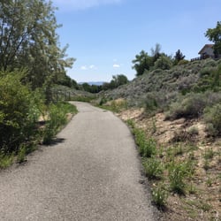
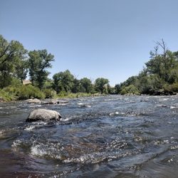
Huffaker Park and Mountain Trail Photos


You might also consider


More like Huffaker Park and Mountain Trail
Recommended Reviews - Huffaker Park and Mountain Trail
Start your review...


Reviews With Photos


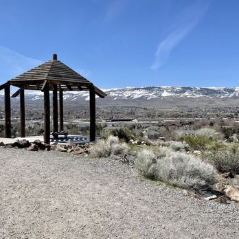
01/06/2025 The Huffaker Loop is approximately 1.4 miles. It's an easy hike with great views and a Gazebo at the top, where you can sit and enjoy the views before continuing on with your hike. We started on the Southeast entrance and was a little disappointed with the amount of poop along the trail. Really sad, especially when poop bag stations are well stocked. Fortunately, it was only at the beginning of our hike. Today was windy and overcast, but perfect weather for this easily accessible city hike.


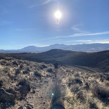
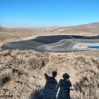
This is for a different access point on Alexander Lake road off South McCarran just east of Longly. A bit hard to find, but definitely worth checking out. It is also the access point for climbing to the the top of Rattlesnake Mountain. There is a small parking area with a few picnic tables but no other amenities. I was here for a the first Trail Challenge Event with Truckee Meadows Parks Foundation. it was definitely a winter hike! The views over are magnificent! To the east you can see bits of hidden valley with Steamboat Creek running through it. To the northwest, Downtown, Sparks and South Reno are all laid out at your feet. The Best views are to the West where there are spectacular views of Mt. Rose, Slide Mountain, and the other peaks along the western edge of our valley. The best overlook is a small peak to the southwest. The trail is a bit rocky and very steep in some places. Hiking boots would be recommended over lighter athletic shoes. There is no cover vegetation so this would not be an ideal hiking spot mid-day in the summer. Other than the ice and snow, it was a great place to hike on a winter day. Dogs are allowed on a leash.


Great easy 1.8 mile hike with Flat dry walking trails with some incline. Great for walking and mountain biking. It takes about 45 minutes to complete. Offering Beautiful panoramic views of Reno. They have some benches to sit along the path to stop and enjoy the views. Dogs are also welcome. Also plenty of street parking.


Nice hiking trail within the city. Easy to access on the south side of town, with a smallish parking lot and a couple trails to pick from. Zero shade so this is hike is better done during the cooler or spring/fall months. Once away from the trail head we didn't see to much signage but it's not a big deal because every thing is so open, you can easily gauge what direction to go. Fun to watch the airplanes head toward the airport and would be a nice spot to catch the sunset.


I always see the pagoda lookout while driving and have failed in past attempts to hike it. Today, I found out I was looking at the wrong entrances. Enter through the back of Huffaker park and "whoops there it is"! So close and doable. It was hot today, though. So it's a steep but quick dirt hike up to the pavillion. There is a bunch of trails around the mountain. Will return and do them when it gets cooler. Bucket/curiosity list,.... Check!


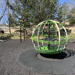
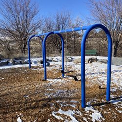
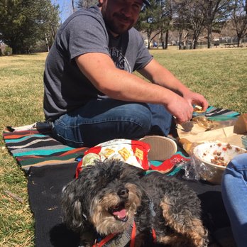
Really nice park for a picnic! Walking trails right nearby, playground for the kids, and tons of grass and open space. Being the time of year it is, shade was a bit hard to come by (no leaves!) but there are lots of trees lining the edges of the park. Not too busy on a weekend, plenty of parking and little to no street noise either--yay! This park is Buddy the Dog approved...I mean look at that face!!


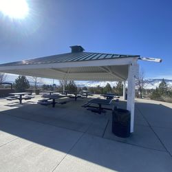
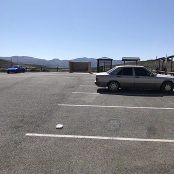
Trying to discover new area trails. Take Alexander Road off Longley on a well paved road. Not quite a mile you'll find a nice blacktop parking. It holds about 15 cars. Around the edge are a half dozen picnic tables with awnings for shade. This area and the entire trails have absolutely no shade. So early morning or spring and fall hikes are the best. Trailhead was well marked. Also the app AllTrails shows several loops in the area. Plus Rattlesnake Mountain trail is across the road. The trail is mostly dirt, loose rocks. In a few areas large rough rocks, so have good shoes and watch your footing. Hike towards to west and gradually head uphill and you'll reach a small peak. Here is a fabulous view of all is Reno and the snow covered Mt Rose. This spring morning had lots of wildflowers blooming. Dogs are allowed but must be in a leash. And please pick up after them ! Easy hike. Take a couple of hours and do all the area trails. Pack a lunch and enjoy the Sierra beauty.


Lovely hike! Great uninterrupted views of mount rose as well as the eastern hills (BLM). Super easy climb and urban hike. You can hear the cars on the nearby highway (I-80), kids playing at the local daycare, abs people working/ heading out from nearby manufacturing and logistics facilities. You get to be in nature, far but close to it all!


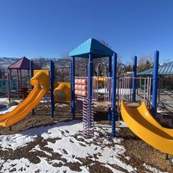
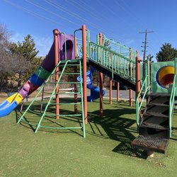
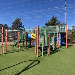
The Huffaker Park is a nice little neighborhood park. It seemed well maintained, there were the groundskeeper guys there while I was there. Lots of natural shade with trees around the park with a little baseball field, basketball and tennis court, playground, and grassy area for the little ones to go running around. No parking lot but seems like lots of street parking. The hike offers some really nice views of Reno. There's no one spot where you could spin around and see the whole valley but it was pretty close. You'd have to walk along the trail which loops around and through. It's a pretty easy hike with 3 looping trails North .74 miles, South 1.07 miles, or the whole loop around 1.4 miles. Saw a few people running and walking the trail. Some slopes here and there. There's benches at certain spots, a gazebo, and a amphitheater. Not to much shade on the trail but nice easy trail.


Sunday, 7/24/2022 - Huffaker park overlook of Reno, NV. Our short hike to see Reno, NV. We were at that arrow looking at Reno. This was an easy hike and two cute little clean parks right next to it. We liked this hike.


If you're new to Reno and looking for a new fairly easy hike with great views... here you go. I was pleasantly surprised I'd be climbing up so high above and garnering amazing, panoramic views of Reno valley. Ignore the hum of fwy traffic below because the views are worth it. A few spots to sit at picnic tables ( very old and worn) but still, nice to take a break. If it's a windy day, hold on to your hat! There is a public restroom at street level where you enter the trail. FYI.


Huffaker park, located in South Reno, is a park that has it all. What you will find: -a short and sweet looped trail (1.4 miles) with a bit of a challenging upward slope at the beginning (once you start feeling a little burn, it will be over and you will be rewarded with nice views of Reno). From there on out, the trail is easy and enjoyable -a gazebo at the top of the hill -basketball court -two playgrounds with big trees nearby -a huge covered pavilion right next to one of the play structures and a BBQ grill -restrooms -baseball field -tennis court -exercise area with lots of bars -wide open areas of grass ideal for sports and running around with your dog -water fountain and restroom -amphitheater at the top of the trail -beautiful tall trees around the park area (lots of shade) -path ideal for jogging and mountain biking -a small creek that runs through the park -a few interpretive signs about nature -flowers in spring - lots of people walking their dogs -dirt/rocky path on the trail -benches laid out around the trail and park. You can have a picnic up on the mountain. -view of mt. Rose I was so glad when I found this sweet park, nicely tucked away in a nice neighborhood. My kids enjoy the structures/running on the grass and the trail is the perfect distance for my dog to get the right amount of exercise. Plenty of street parking is available and the trail is completely exposed so don't forget to protect yourself against the elements. I plan on throwing a party here in the future and know that it will not disappoint.


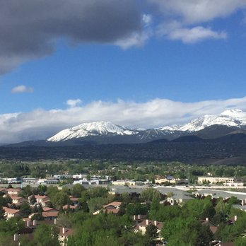
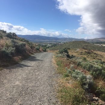
This trail has huge bang for the buck! For the small price of a 2 mile round trip hike you get views all the way from downtown to Mt. Rose! Incredible! I parked at the main trailhead but during my journey around noticed at least 3 more access points I could chose in the future if I'd like to. The main trailhead starts with the only major incline of the entire journey. I'd say 45 degrees with a few switchbacks. That only last 1/2 of a mile or so. After that, rolling hills and beautiful views. The wind was whipping and the clouds were flying by when I went so it made for beautiful views. It also made for perfect weather for the hike. The hills roll back and forth so much that you are never overwhelmed by the terrain. So far, the trails are not overgrown at all and in great shape. Pro tip - the terrain is not just dirt - it's mostly rocks / pebbles. If you are not sure footed I would opt for hiking boots instead of sneakers. Once you've explored the terrain you may opt for sneakers on the second trip! Even if you don't like to hike, consider it a elevated walk and check out the views. It's breathtaking. Also, if you like to watch airplanes think of Gary Allen and his lyrics to "Watching Airplanes:" I'm just sitting out here watching airplanes Take off and fly Trying to figure out which one you might be on And why you don't love me anymore Right now I'm sitting out here watching airplanes Grab a seat on the benches available everywhere and just simply watch some airplanes.


3 months ago

Neighborhood spot only if you're in the area and you just really must walk because you ate a big lunch or really want some exercise. I would not go out of the way to go hiking here. it's very quiet. the trail I took started out marked but then kind of disappeared once I got pretty far in and I did not know if I was lost anymore or if I was on track or what was going on. confusing. perhaps there's a better trail that I was not aware of. barely any shade plenty of parking few picnic tables which is lovely for sitting out and eating read more




2 years ago
01/06/2025 The Huffaker Loop is approximately 1.4 miles. It's an easy hike with great views and a Gazebo at the top, where you can sit and enjoy the views before continuing on with your hike. We started on the Southeast entrance and was a little disappointed with the amount of poop along the trail. Really sad, especially when poop bag stations are well stocked. Fortunately, it was only at the beginning of our hike. Today was windy and overcast, but perfect weather for this easily accessible city hike. read more


This is for a different access point on Alexander Lake road off South McCarran just east of Longly. A bit hard to find, but definitely worth checking out. It is also the access point for climbing to the the top of Rattlesnake Mountain. There is a small parking area with a few picnic tables but no other amenities. I was here for a the first Trail Challenge Event with Truckee Meadows Parks Foundation. it was definitely a winter hike! The views over are magnificent! To the east you can see bits of hidden valley with Steamboat Creek running through it. To the northwest, Downtown, Sparks and South Reno are all laid out at your feet. The Best views are to the West where there are spectacular views of Mt. Rose, Slide Mountain, and the other peaks along the western edge of our valley. The best overlook is a small peak to the southwest. The trail is a bit rocky and very steep in some places. Hiking boots would be recommended over lighter athletic shoes. There is no cover vegetation so this would not be an ideal hiking spot mid-day in the summer. Other than the ice and snow, it was a great place to hike on a winter day. Dogs are allowed on a leash. read more
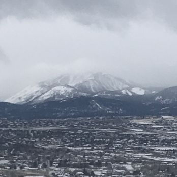

Great easy 1.8 mile hike with Flat dry walking trails with some incline. Great for walking and mountain biking. It takes about 45 minutes to complete. Offering Beautiful panoramic views of Reno. They have some benches to sit along the path to stop and enjoy the views. Dogs are also welcome. Also plenty of street parking. read more
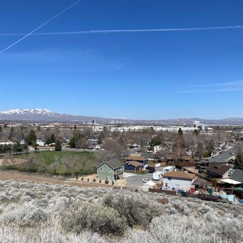
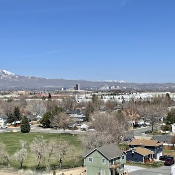


Nice hiking trail within the city. Easy to access on the south side of town, with a smallish parking lot and a couple trails to pick from. Zero shade so this is hike is better done during the cooler or spring/fall months. Once away from the trail head we didn't see to much signage but it's not a big deal because every thing is so open, you can easily gauge what direction to go. Fun to watch the airplanes head toward the airport and would be a nice spot to catch the sunset. read more
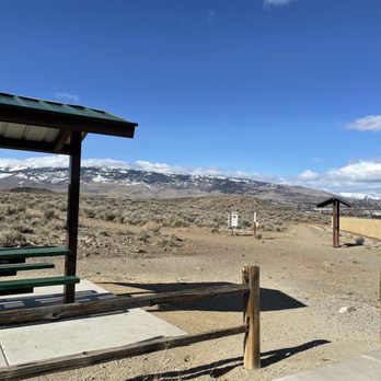
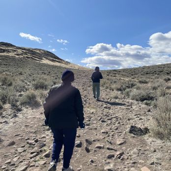
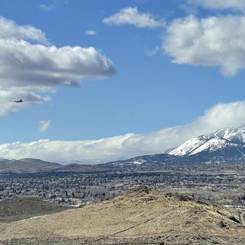
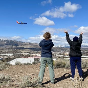

I always see the pagoda lookout while driving and have failed in past attempts to hike it. Today, I found out I was looking at the wrong entrances. Enter through the back of Huffaker park and "whoops there it is"! So close and doable. It was hot today, though. So it's a steep but quick dirt hike up to the pavillion. There is a bunch of trails around the mountain. Will return and do them when it gets cooler. Bucket/curiosity list,.... Check! read more
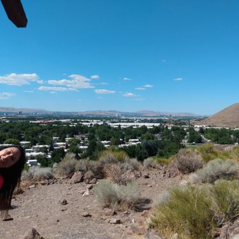

Really nice park for a picnic! Walking trails right nearby, playground for the kids, and tons of grass and open space. Being the time of year it is, shade was a bit hard to come by (no leaves!) but there are lots of trees lining the edges of the park. Not too busy on a weekend, plenty of parking and little to no street noise either--yay! This park is Buddy the Dog approved...I mean look at that face!! read more


Trying to discover new area trails. Take Alexander Road off Longley on a well paved road. Not quite a mile you'll find a nice blacktop parking. It holds about 15 cars. Around the edge are a half dozen picnic tables with awnings for shade. This area and the entire trails have absolutely no shade. So early morning or spring and fall hikes are the best. Trailhead was well marked. Also the app AllTrails shows several loops in the area. Plus Rattlesnake Mountain trail is across the road. The trail is mostly dirt, loose rocks. In a few areas large rough rocks, so have good shoes and watch your footing. Hike towards to west and gradually head uphill and you'll reach a small peak. Here is a fabulous view of all is Reno and the snow covered Mt Rose. This spring morning had lots of wildflowers blooming. Dogs are allowed but must be in a leash. And please pick up after them ! Easy hike. Take a couple of hours and do all the area trails. Pack a lunch and enjoy the Sierra beauty. read more
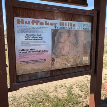
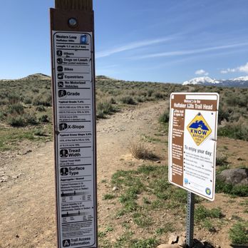


Lovely hike! Great uninterrupted views of mount rose as well as the eastern hills (BLM). Super easy climb and urban hike. You can hear the cars on the nearby highway (I-80), kids playing at the local daycare, abs people working/ heading out from nearby manufacturing and logistics facilities. You get to be in nature, far but close to it all! read more
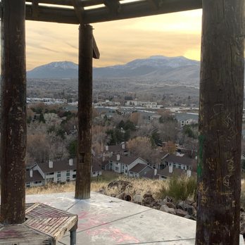
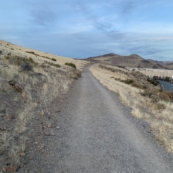

The Huffaker Park is a nice little neighborhood park. It seemed well maintained, there were the groundskeeper guys there while I was there. Lots of natural shade with trees around the park with a little baseball field, basketball and tennis court, playground, and grassy area for the little ones to go running around. No parking lot but seems like lots of street parking. The hike offers some really nice views of Reno. There's no one spot where you could spin around and see the whole valley but it was pretty close. You'd have to walk along the trail which loops around and through. It's a pretty easy hike with 3 looping trails North .74 miles, South 1.07 miles, or the whole loop around 1.4 miles. Saw a few people running and walking the trail. Some slopes here and there. There's benches at certain spots, a gazebo, and a amphitheater. Not to much shade on the trail but nice easy trail. read more


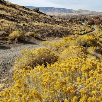


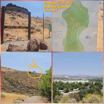
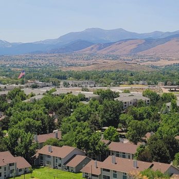

5 years ago
If you're new to Reno and looking for a new fairly easy hike with great views... here you go. I was pleasantly surprised I'd be climbing up so high above and garnering amazing, panoramic views of Reno valley. Ignore the hum of fwy traffic below because the views are worth it. A few spots to sit at picnic tables ( very old and worn) but still, nice to take a break. If it's a windy day, hold on to your hat! There is a public restroom at street level where you enter the trail. FYI. read more


7 years ago
Huffaker park, located in South Reno, is a park that has it all. What you will find: -a short and sweet looped trail (1.4 miles) with a bit of a challenging upward slope at the beginning (once you start feeling a little burn, it will be over and you will be rewarded with nice views of Reno). From there on out, the trail is easy and enjoyable -a gazebo at the top of the hill -basketball court -two playgrounds with big trees nearby -a huge covered pavilion right next to one of the play structures and a BBQ grill -restrooms -baseball field -tennis court -exercise area with lots of bars -wide open areas of grass ideal for sports and running around with your dog -water fountain and restroom -amphitheater at the top of the trail -beautiful tall trees around the park area (lots of shade) -path ideal for jogging and mountain biking -a small creek that runs through the park -a few interpretive signs about nature -flowers in spring - lots of people walking their dogs -dirt/rocky path on the trail -benches laid out around the trail and park. You can have a picnic up on the mountain. -view of mt. Rose I was so glad when I found this sweet park, nicely tucked away in a nice neighborhood. My kids enjoy the structures/running on the grass and the trail is the perfect distance for my dog to get the right amount of exercise. Plenty of street parking is available and the trail is completely exposed so don't forget to protect yourself against the elements. I plan on throwing a party here in the future and know that it will not disappoint. read more


9 years ago
This trail has huge bang for the buck! For the small price of a 2 mile round trip hike you get views all the way from downtown to Mt. Rose! Incredible! I parked at the main trailhead but during my journey around noticed at least 3 more access points I could chose in the future if I'd like to. The main trailhead starts with the only major incline of the entire journey. I'd say 45 degrees with a few switchbacks. That only last 1/2 of a mile or so. After that, rolling hills and beautiful views. The wind was whipping and the clouds were flying by when I went so it made for beautiful views. It also made for perfect weather for the hike. The hills roll back and forth so much that you are never overwhelmed by the terrain. So far, the trails are not overgrown at all and in great shape. Pro tip - the terrain is not just dirt - it's mostly rocks / pebbles. If you are not sure footed I would opt for hiking boots instead of sneakers. Once you've explored the terrain you may opt for sneakers on the second trip! Even if you don't like to hike, consider it a elevated walk and check out the views. It's breathtaking. Also, if you like to watch airplanes think of Gary Allen and his lyrics to "Watching Airplanes:" I'm just sitting out here watching airplanes Take off and fly Trying to figure out which one you might be on And why you don't love me anymore Right now I'm sitting out here watching airplanes Grab a seat on the benches available everywhere and just simply watch some airplanes. read more




10 years ago
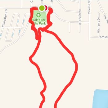
I love this trail. I love how conveniently located it is for so many South Reno residents. I love that the street parking near the park is ample. I love the views from the trail. There are so many good things about it! This is a great place to take out-of-town visitors to showcase just how beautiful Reno is. Just make sure that you and your visitors have closed toed shoes and not flip flops: the uphill and downhill portions of this trail are no joke. Also, remember to give any sea-level visiting folks time to rest on the uphill portions! If you're hiking in the winter, bring an extra layer: the wind exposure can be brutal. I remember seeing the gazebo from the highway and wondering how the heck to get to it. Now I know: from the trail at this park! The outdoor amphitheater (not visible from the highway) a little ways down the trail is also very cool. As Michael T. notes, it is unclear who built it and how! My fair-skinned, red-headed (vampire) boyfriend likes that the "backside" of the trail (the part by IGT) is in shade in the afternoon. Thus we can hike that portion and see the sunset without him needing to wear sunscreen. read more


12 years ago
Ever notice that little gazebo on the hill just off the S. Virginia Street exit of 395? Well I had many times, and I'd often wonder what it was doing up there. Is it part of someone's backyard? Is it one of those random structures left in the Nevada backcountry for weary travelers? Did someone get married up there and just leave it? I wanted to know but I'd never really tried that hard to find out. But then, as fortune would have it, I moved into a new neighborhood and I discovered a really nice park, some short hiking trails, and great views of South Reno and benches to enjoy them from! The gazebo itself is actually pretty cool and a picnic underneath it on a nice day is a great idea! I guess it wasn't as mysterious as I'd once thought. It's just a gazebo on a hill for people to enjoy, and that's enough purpose I suppose. But In my quest to find the gazebo, I discovered an "amphitheater" that looks to have been there for years. It's a number of concrete slabs arranged symmetrically in a v-shape pattern, resting high up on the hill. I have no idea how it got there, or what force of nature might have created it, but my guess is aliens! How else could something that big and heavy get up there? On each of my walks now I look for clues on the hillside. Someday I'll crack the case. Someday... read more


This hike has a view of the city at the top. The trails have an incline and no shade. Bring a hat. I wouldn't do this hike under the blazing summer sun though. The distance isn't long, but the incline will give your lungs a little huff depending on your pace and physical shape. The dog also enjoyed the hike. Make sure you bring water for the furry one. There are no dog bags on the trail. Bring your own. A lot of people let their dogs off leash, which is probably why the humans miss poop patrol. It wasn't too bad during my hike. I noticed a lot of lizards, and one surprised my pup! Lot opportunity to take great pictures. I didn't use trekking poles but could be useful on some parts. Sneakers were ok on this hike. Besides the view at the top, I wouldn't consider this a scenic hike. I'd consider this a good workout, where you can improve on speed to get to the top. read more


7 years ago

First timer! We only hiked the Western Loop, but it was a nice and exercising trail. We started on the far right path which descended and wrapped around some slopes. The path itself was rocky so watch your step; you wouldn't want to roll your ankle! We reached a point where the path forked so we chose the right side knowing it would be a dead end but would overlook the city. The climb wasn't bad, but it was a steeper uphill making it great exercise. After enjoying the view we turned around and walked uphill on the left path. Again it was a slight uphill and we walked through a field to which it ended back to complete the loop! The weather wasn't hot but not too chilly either making it perfect for this hike. Hope to come back to complete the other trails! read more


6 years ago
This is a great easy hike. It's becoming a weekly routine as it is conveniently located close to where I live. read more


Huffaker Park and Mountain Trail...is the Peanut Butter to my JAM....trying to jam up that hill. I love this trail because it enough to get the heart rate going, but not too much where you can't feel your legs you are crying inside and never want to return. It easy enough to where I can bring my 4, 9, and 10 year old, and they are not complaining the whole time. My favorite time to walk the trails is during the spring and summer months about 5am, there typically is no one on the trail....Shhhhhhhhhhhh, that's my secret. Once you reach the top of the hill and you think your about to die, there is a gazebo where you can sit and enjoy the view! I'm lucky enough to live a block or so from the park, so I visit it often. I take my kids to burn some energy on the play grounds, and basketball courts, there is tennis courts too. My dogs love to run around the park too, but other dog owners please pick up your phooo. The park is always clean and well maintained. I feel that this park is pretty safe; we have all been to that one park out of a horror movie with weirdo's lurking around...don't be mad, facts of life. I love this park, my kids love this park, my escape artist dogs love this park, I know when they turn up missing just to go to the park and there they are, with smiling faces! read more


10 years ago
Nice trail. Convenient parking, awesome view. Clean and quiet location. Great for walking and sights seeing. Definitely going back! read more


8 years ago


This park, nestled amid the suburban sprawl and industrial parks of Southeast Reno, is a great place for active folks. The park, located in the middle of a residential neighborhood, seems to be split into two sections--the front section, a large playing field with a good-sized playground; and the back section, which includes a picnic shelter, tennis courts, basketball courts, exercise/stretching equipment, horseshoes, and another playground. The front section is frankly a bit scary and probably prevents a lot of people from enjoying the rest of the park. The playground here is not well maintained--the climbing gyms are covered in graffiti, and the sand is sprinkled liberally with trash and cigarette butts. The back section of the park (off of Offenhauser) is a real gem, though. Lovely shade trees and a running stream make this a very relaxing place, and the playground and other equipment here is in much better repair. There is a rentable shelter here with several tables and a large grill. My recommendation if you visit here is to park your car on Offenhauser Street and totally skip the front section of the park on E. Huffaker. Starting off the rear section of the park is the Huffaker Desert Preserve Lookout Point Loop Trail. This trail is great for a short hike--it took us less than an hour to walk the whole loop. It is easy and flat for a majority of the loop, with a few short steep sections to get your heart going. Again, poor maintenance is apparent here, with the interpretive signs in great need of repair. Also, despite the fact that there are plenty of signs telling dog walkers to pick up after their pets, you will need to beware the many canine land mines. Because apparently those signs only apply to SOME dog owners and not to those other, SPECIAL people who don't have to follow the posted rules or the dictates of common courtesy. Other than that unfortunate downside, this is a great trail with lots of nice views. read more


15 years ago

11 years ago
Really cool trail that you can walk around with your dogs. It was a little windy because storm was rolling in but dogs didn't mind. Pretty views from the top too! read more


8 years ago


11 years ago

10 years ago
This is probable my favorite place to go hiking. It's not that far from my house, in fact, I live extremely close to it. It is a perfect distance of you decide to go around it. read more


10 years ago

10 years ago
Page 1 of 2
More info about Huffaker Park and Mountain Trail
1160 E Huffaker Ln
Reno, NV 89511
South Reno
Directions
Hours
Indoor Amenities
Outdoor Amenities