Devil's Slide Coastal Trail Photos


You might also consider


More like Devil's Slide Coastal Trail
Recommended Reviews - Devil's Slide Coastal Trail
Start your review...


Reviews With Photos


One of the most enjoyable hikes and trails I've been on. It runs along the coast on the old highway. Very scenic the whole way, paved walking path, some moderate inclines nothing too crazy pretty much anybody should be able to do the hike. There are restrooms on each side of the hike at the start and trip back around to the finish. Basically a step up from a porta potty, there is hand sanitizer in there they were pretty clean could be a lot worse than what it was, kind of nice to find one there if you need it. The hike was extremely enjoyable. I highly recommend.


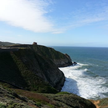
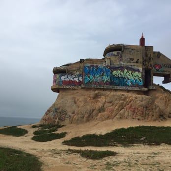
Nice easy stroll on a paved path. The views are spectacular and we even saw a humpback whale breaching out near one of the rocks that attract lots of birds. Make sure you bring warmer clothes because while it was 75 in the Peninsula, this walk dropped to 60° with a nice cool breeze. Definitely worth checking out this hike. Also, go check out the old WW2 observation bunker (can't miss it) near the beginning of the walk near the parking area. Really cool views.


Fantastic place for a hike with amazing views. The trail is easy on the legs but still a real visual treat. Parking is limited--there's a small lot right after the tunnel. It's great for everyone: little kids can run around, older people can enjoy a relaxed hike, and there are benches where you can sit and take in the beautiful scenery.


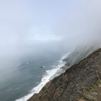
I drove over from Pacifica State Beach to explore this trail over the weekend, the south parking lot is on your right side, directly after you drive through the tunnel. Once you park, if facing the water, the Devil's Slide bunker is to your left, up a small hill, and the trail is to your right, as well as a restroom at the start of the concrete pathway. The trail has slight elevation and clear bike lanes and pedestrian lanes. What keeps it interesting is being immersed in the magnificent landscape and walking (or running) alongside the curves of the mountain. There are informational boards to learn about the surrounding nature and wildlife and history of the trail, and a few benches and viewpoints along the way. The place wasn't crowded on a Saturday afternoon, it was quite peaceful actually, a nice hike/jog, even on a foggy day.


I love this historic trail with a good display of granite and sedimentary rock. Additionally, we were able to see a baby red-tailed hawk, ravens, snakes, whales, and multiple types of flora. As you travel down the coastal trail, the flora type changes with the amount of shade that is provided and I think that is so cool. Be warned that parking here is a bit of a nightmare with only 10-12 spots in one lot and around 15 in the other. The trail itself coming from south up to north was a bit more difficult than north up to south. It's not too strenuous but will get some heavy breathing. However, there are many rest stops and benched areas to catch your breath. It took about an hour to walk the trail and back Additionally, the bathrooms on either end are nicely maintained and even have a hand sanitizing station within. Overall, it's a great trail that I could recommend to most people to explore California.


The hike is about 2.5 miles down and back. It's nice because it's not too long or too short and goes along the ocean the majority of the way. There is a slight grade uphill going south to north so it gives you some workout but nothing too strenuous. The only problem is that it's a paved surface because it used to be the old freeway before they closed it due to numerous landslides. I prefer a dirt path but the views of the ocean are worth it and being paved makes it very easy for bikers. There are a couple of lookout points and at the southern parking lot end is the Devil's Slide bunker which is worth checkout out.
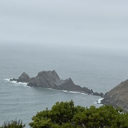

Nice loop for hike with ocean vibes and bird..always feel cool and mindfulness when hiking walking or biking around..
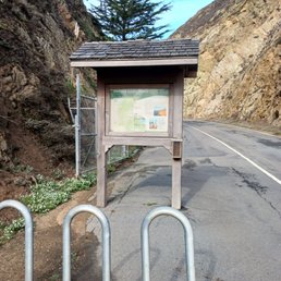

Took me a very long time making it out here. So glad we did. Park on the Half Moon Bay side, they have a larger car lot. Granted it's still not ideal for the amount of people that would like to walk here. You can chance waking up early and find a space, or ride your bike. The trail isn't long at 1.3 miles. What is so magical is the opportunity to walk along where I used to drive such a scary drive. Now saved by the most state of the art tunnel under the mountain you can drive after your hike. The trail allows anyone to take their time, look at the plants, wildlife and the ocean! It's truly amazing. There are two pit toilets on both sides, one drinking fountain with a bottle refill feature, and bike racks. This was well thought out. Along the trail there are a couple of areas you can sit down and relax. Tips: Bring layers, you never know what the weather will be like. Bring your camera. Dogs are allowed on a leash. Enjoy!


At first, I thought this trail was all coastal with paved roads that have been closed down for vehicles, so easy pavement walking at an incline. But as you get into the trail, it almost requires some gloves, helmet, and a safety carabiner line for scaling the initial climb. Just kidding, you can really do it without all of thar gear but it is steep after the pavement strolling. Great views all around, plenty of greenery, plants, and tighter trails.


A fairly easy hike with inclines and declines. You are basically walking on pavement where cars use to drive on years ago. There's a small parking lot so best to get there early especially on weekends. There are restrooms by the entrance and it was the only one that we came across to so use it before you start on your hike. There's a great view of the ocean with some benches. If you bike, there's a bike tire station by the restrooms. It can get very windy up there so dress accordingly.


It took a long time for us to get here for whatever reason or reasons. Considering it was a highway it seems pretty wild! Big native plants. Some dampness from the coastal overcast dripping at places. Steep cliffs of course. Great views. Amenities-pit WCs clean and not stinky at least on this morning. Parking-not enough...good thing we arrived early.


Love this place. As you may already know this used to be Hwy 1 and they built a tunnel and made this road open for hikers/bikers. Road is 1.3 mile long one way and we have parking on both ends called North parking lot where parking spots are less and South parking lot where parking lots are better compared to North and have restrooms at both ends. There is a separate lane for Bikers and the hike itself is calm n peaceful with not many people. Recommend during the Day before Noon where u wont have issues with parking and if its hot day prepare with water and cap as there is no shade and there r some spots where it might get windy so just FYI. I parked at North and hiked to south and came back and there are some steep road but its manageable so just go have some fun with nature Be sure to check out the tunnel too and explore pacifica as it is amazing


One of my favorite hikes in the Bay Area! We started all the way at the Taco Bell Cantina, so the hike was about 6.7 miles, out and back. Not only are the views stunning, but you really get a little bit of everything here - woods that look like a jungle, a dirt path overlooking a horse ranch, incredible wild flowers, and of course the beautiful coast. Once you get inside the state park, you get a paved road and clean bathrooms. The hike itself isn't very challenging, as it's mostly flat with maybe one or two hills. It's dog friendly and there's a separate lane for bikers, as well. The best views are all the way at the end, by the Devil's Slide Gun Turret, but honestly the whole hike was impressively scenic. Highly recommend!


5 years ago
Nice and easy 3 mile round trip hike. I came here with my mom on a Sunday around 11pm. The entire path is paved since it used to be part of highway 1. The views are amazing and the bunker on the south end of the hike is pretty cool too! I also enjoyed this hike because I was able to bring my dog :) read more


One of my dreams came true. I've been wanting to walk this stretch of road waay before it was turned into what it is now. When it was still still a source of problem for locals and admirers of the view. It's by no means a difficult trail. It's 1.5 miles one way and there's about three areas where you can stop, sit and admire the fabulous vista. My guesstimate is it's about 500 feet in between those three spots. They resurrected the road. It's clean. Pothole free and there's a bike lane that indicates 15 mph. With new road paint to boot. It's such a comfortable walk with a parking lot on both ends. I noticed the parking lot from the south is a lot bigger than the one from the north side. The south side lot is closer to the mouth of the new tunnel and can be admired up close. Anywhere you look the coastal view is ridiculously beautiful! No bad views! Charge your cameras/ phone and click away! Best time is before 10 am. Less people. Easy parking. But bundle up. There are areas of the walk that would feel like you're in a wind tunnel. Freezing wind. Porta Potty on both ends of the trail. Super convenient. Btw the whole length of the trail is fenced in for safety. So no way to climb anything if you're thinking of visiting a couple of the tall structures that's been there. read more


THE GOOD * You can now walk/hike/bike/horseback the old Highway 1 route known as Devil's Slide. * On this trail there's a lot more space dedicated to hikers/walkers than there is on the Bay Bridge Trail. Bicyclists and pedestrians don't compete for space or feel cramped or get in the way of one another. * Leashed dogs are allowed. * Immaculate restrooms have been installed at both the north and south ends of the trail. * Many seats along the trail for those who wish to or need to sit. * Two small, free parking lots at each end of the trail. A couple of spaces for disabled access are also available on each end. * Beautiful coastal views. THE NOT SO GOOD * Some have mentioned the limited parking (about 20 spaces on each end of the trail) and the jockeying for available spaces. The earlier you come the greater the likelihood that you'll get a space without having to wait for one. On a Saturday at 11:30 a.m. I got a place on the south end without having to wait. * The trail is a repaved road with the cliffs and ocean immediately to the west and dramatic cliffs to the east. You're definitely in nature but there's not dirt beneath your feet. * There's small areas where your dog can slip in and sniff a bush or a weed but mostly the trail is bound along its length to keep you and your pet from getting "into" nature. * Aside from climate change nothing can be done about the weather. It's mostly dramatically cool, sometimes foggy and windy. This is the NorCal coast; bring a jacket. ACCESS * The trail is 1.3 miles long with the steepest part being closest to the north end of the trail. For quickest access to cliff views and water views park and enter at the south end of the trail where the views are immediate and the grade is most gradual. * If you have mobility issues, the south end is also the optimal end to enter from. You can see what the trail has to offer without having to go far at all. * To park at the south end if coming from the north, bypass the northern entrance to the parking lot and proceed south through the new tunnel. Awesome. MISCELLANY * This is a small but significant segment of the California Coastal Trail which will eventually extend 1,200 miles (from Oregon to Mexico). * The trail includes one section with a 9% grade which is fairly significant. This is likely a result of the old Devil's Slide road failing (and falling into the ocean) as it did regularly when the road was open exclusively to cars. Experts predict that this will continue to happen and those in charge have gone on record saying that they might not attempt to fix it when it does. At that point, this trail will likely become two separate lookout points rather than a single trail. See it now before the rains come and threaten to make it so. read more


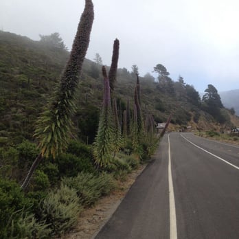


Wish they had more parking here but this place is great. It's the old hwy 1 that is now a trail due to the landslides that happen often. You can reference one of my photos and see that the hill side has a steep down hill slide like path right into the ocean. I hadn't heard about this place until the pandemic. I've been finding lots of spots nearby home to visit and it's been great. Parking is a beezy here as it took 3 weekends to finally get parking. Yes, you can keep circling and circling, but there are many other great spots near by like grey whale cove, half moon bay, Pacifica, rock away beach to name a few. The walk up and back on the trail provides great exercise. There's a part with a 9 percent great. Be ready for those butttttox and calves working. Either side you park provides great views. You don't even need to walk the entire thing, but it is a good workout and great views! read more


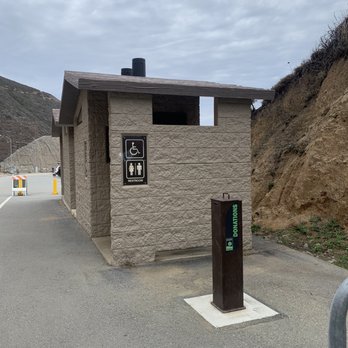


To say I've been here a lot is an understatement. Most of all, I can't believe I haven't written a review about this place yet. I'm going to assume that most of you know the history of this section of Devil's Slide. Countless of closures due to landslides and accidents eventually forced the locals to realize that it was a good idea to bore a tunnel through this area. The result has been two beautiful tunnels, better flow of traffic, safer to drive thru and a whole new area to explore on foot whether it's the two-legged or four-legged kind. Driving thru this section before was scary, nerve-wracking but beautiful and breath-taking at the same time. It was like a roller coaster ride; only in this ride it could cost you your life if you made a mistake. And I was always curious about that old WWII bunker perched on the edge of the cliff as I've always wanted to inspect it up close and personal. With the creation of the Devil's Slide Coastal Trail, it made it possible for anyone to safely explore the area on foot. There are two parking locations on both ends, and if you decided to walk the entire length of this section, remember that you have to return and walk back to where you parked. In my opinion, it is better to park on the south end of the trail as there is a traffic light to guide you in either direction. That is not possible on the north end, and you might end up waiting for a clearance before you can get on the road. Walking this section on foot really gives you a sense of how precarious this area is in terms of geological sense. Eventually, all of these will end up in the Pacific Ocean one day, but we still have several more years to enjoy it before it returns to the water. You can also see the layers of sediments and rock formation that is created by the powerful force of tectonic plates colliding with one another and the result is like a wave of rocks that is frozen in time. Mother Nature is beautiful and dangerous at the same time. You must remember this and respect her at all times or you'll end up like another statistic if you are not careful. Enjoy her, but never take her for granted. NOTE: Dogs are allowed, but they must be on a leash. There is a doggie bag receptacle on the south side by the gate entrance. There are two sets of restrooms on the south parking lot and one restroom on the north parking lot. Watch out for falling rocks. read more
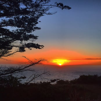


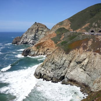
I haven't gone south of Pacifica for years. Although, back when we had a doggie, I took her to Mori Point, and then drove south. Caltrans was building the tunnels then, so I got a picture of these two holes in the hill, and somehow the dog stayed in the car. A little further was the notorious Devil's Slide, and it's always been a problem child in the highway system. Somehow, money was scraped together to bypass Devil's Slide with these tunnels. So, what to do with the old road? Pull into the parking lot, and you can get up close and find out for yourself. When you think "Scenic Highway 1", you think "spectacular mountain dropping into the ocean", and that's exactly what you get here. (Literally; the road closed so often because parts of the mountain were dropping into the ocean, taking the road with it.) The jagged gray rock stands above the pounding waves a hundred feet below you. Vegetation clings to the soil for dear life. Wind whips through your hair. And not an apartment building in sight. And so accessible, too! The road is paved, perfect for joggers, bikers, wheelchair users, or strollers. It's slightly uphill on the north end, flat on the south end, so those out of shape will still be able to get an awesome view by walking a short distance. There is a 9% grade uphill going north. The trail was kept the same width that Highway 1 was, so there's enough room for everyone. Small parking lots keep the crowds small. If you're a tourist looking for an "only in California" experience, then drive a little south of San Francisco to the Devil's Slide Coastal Trail. read more




7 years ago
This is a beautiful scenic trail along the old Devil's Slide highway. The road is paved and there are many viewpoints which are incredible to watch the sun set at. The trail is well kept and literally gorgeous. This is a great place for a run, walk or family friendly hike. read more
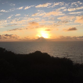


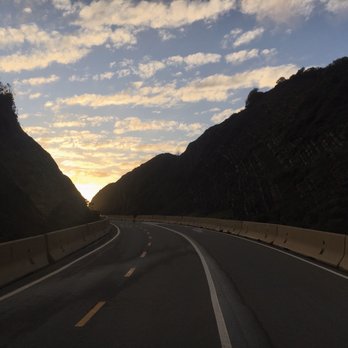


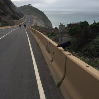
I had been curious about the new trail since it opened in late March, but I also knew getting there would be a major pain in the toochis. Yes, almost every Yelp review about this spot mentions the severely limited parking available here, and they are absolutely correct. That's why I had the brilliant idea of coming here on Good Friday and sure enough, when I arrived at 10AM, only two of the spaces in the southern lot were taken. In fact, the trail was eerily desolate except for a roving band of blue hair walkers in velour jogging suits. It was like Mad Max: Beyond Thunderdome meets The Golden Girls. Actually with the rolling fog and empty highways that looked like they went nowhere, it was the perfect setting for a classic Hitchcockian thriller (photo: http://bit.ly/1lfP5tn). All I needed were a few thousand crows, a hideous mint-green suit, a blonde upsweep, and a couple of lovebirds in a cage. Just south of Pacifica, the whole trail is only 1.3 miles and takes about a half-hour to walk back and forth since even the steepest slopes are quite manageable due to the smooth pavement (photo: http://bit.ly/1ghfds9). There are interpretative panels to educate yourself on the local flora and fauna, a dozen benches in case you want to sit a spell to enjoy the coastal view, and yes, restrooms at both ends of the trail. Dog owners and baby strollers started to converge on the trail so I left to find at least a half-dozen cars waiting for a space in the lot. And this is my quandary with the trail. As striking as the setting is, I'm not sure it's worth waiting in my car for a parking spot. How far is it to Big Sur again? read more


Returning to Devil's Slide in it's current incarnation was like re-connecting with an old friend. An old friend who was always a lot of fun but also a bit too unhinged, maybe had a rap sheet &/or did a stint or 2 in rehab, & yet somehow made it to the other side mellower, older, wiser & no worse for the wear. Devil's Slide, when it was still part of Highway 1, was 1 of my favorite stretches of road anywhere for sheer hair-raising, adrenaline-junkie driving. The curves. The inclines/ declines. No margin for error, tires screeching & slipping, the Pacific Ocean only a quick drop off a cliff away. Good times, good times. But I've emerged from my death-wish driving years with a new appreciation for a place like Devil's Slide Coastal Trail. It's all about running & bicycling now. While it's less than 1.5 miles end to end, views are spectacular every foot of the way. & the 9% grade is nice too. I've really gotten into trail running hills & a few laps out here is good hill work. Also nice are the restrooms & water fountains at both ends. Parking is limited though with just 17 total spaces (2 handicap) at the South end & 15 total spaces (1 handicap) at the North end. My advice, get in early. That's what I did & parking was a breeze, even on a Saturday. It didn't take me long to run the short circuit, but it was all along that stunning California Pacific Coast that people come from all around the World to see. So while my old friend may not be as crazy exciting as before, that old friend sure is looking good. read more


12 years ago
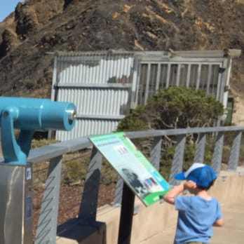
I had only driven this section of Highway 1, along Devils's Slide twice in the 12 years I've been in the Bay Area. While extremely glorious and awe inspiring, it was too anxiety inducing as both a driver and passenger. With the new tunnel making travel much smoother, I find myself much more often on the stretch of coast between Pacifica and Half Moon Bay. Now, walking the Devils's Slide Coastal trail-ah well that is a different story-no anxiety or worries here-just a lovely and peaceful walk. A perfect way to end a day of mini hikes at Mori Point and Fitzgerald Marine Preserve, was catching the sunset along Devils's Slide. Arriving just after 5 on a winter Saturday, the lot on the south side was completely full but we waited a few minutes and got lucky when someone left. The paved trail is great for kids, bikes and pets. I saw young and old and everyone in between enjoying a sunset walk along the coast. The cliffs, crashing waves below and endless ocean views are just amazing (and much more serene while being able to walk along a well paved pedestrian path than a drive of this section ever could be.) There are informational plaquards along the way, pay-telescopes for more far reaching views and clean facilities at the start of the trail. I didn't get to walk the whole trail, since it was getting dark, but made it about halfway and enjoyed every second of it. Can't wait to come back but would be concerned about finding parking, especially if it were prime time daylight hours. The trail is perfect for a low key short walk and very well done, with the exception of the parking situation. read more


This little gem is truly a hidden escape from civilization! (Well, sorta). I wish I had known about this place earlier! The views of the water are spectacular! Upon visiting here, you almost forget that the hustle and bustle of SF is only a couple miles away! That's how SERENE and CALM this little trail is. My favorite part about this trail (aside from the stunning views of the glacier colored waters) is the fact that it's so CLEAN! Not a piece of trash in sight! And even more promising, this place allows dogs!! I don't have one (sad face) but if I did I would totally take it skipping here. Beware though, there aren't many trash bins along the trail so you'd have to carry your best friend's poop. The trail isn't taxing in any way. It's a paved trail with a wee bit of incline that leads you along the coastal path. There are some bikers that had a difficult time pushing their bikes, so I would only bring your bikes here if you're willing to tire yourself out pushing uphill. I find that this trail is better for strolling than biking. On one side you get glistening views of the water and waves crashing, and on the other side you see cliffs of exposed rock, whose gradient mimics that of wood grain! There are plenty of species of plants to marvel at, if you're into that sort of thing! As far as I know, there are two parking lots near the tunnel entrance. After your little hike, be sure to visit the little graffiti'd lookout fortress type structure near the parking lots! Definitely pay this trail a visit if you'e looking for a leisure activity, one which requires minimal energy expense! Soak in the views and time seems to stop. read more





4 years ago

6 years ago
I enjoyed my walk on this short little paved trail of what used to be a busy highway. I parked on the North side parking lot which fills quick due to its limited space. There is a restroom, and a cool little bike station with tools and an air pump at the start of the trail. The trail start with a long gradual ascent to the top where there is a vista point of nice coastal views, and then desends to the South parking lot where there is an interesting old bunker perched up on a rock to behold. Then it's just a backtrack to the car. The trail is split with markings on the ground. A side for bikes and a side for hikers. I saw cyclists, hikers, dog walkers and even a few people on kick scooters out enjoying the day just as I was. read more


Interesting if short coastal/cliff trail that offers open ocean vistas and easy access. There are two small lots both at the southern and northern end of the trail. Walking/biking alongside the road to get here-for example along the highway from pacifica-can be risky. Traffic travels fast and for major sections there is no safe bike lane. On the off chance there is no parking go somewhere for coffee and come back in an hour. This is a shorter trail less then a mile and a half (just under two kilometers if that's your thing). It's fully paved which helps 'cause it can be alittle steep at times. There's benches with overlooks here and there, along with signage that tells you how this trail came to be along with some birds and bees factoids. There's cleaner restrooms as well which is very handy. The views both of the hills behind you and the ocean itself are pretty epic if a bit distant-you're up several hundred feet from the ocean and no there is no ocean side access from this trail. It's all about the views, which is fine 'cause from this trail you can see dang near into infinity. Bonus awesome points for the sunrise/sunsets. For those times you'll want a camera even though pictures don't really do it justice. Off trail exploring is more then usually dangerous-both the hills and cliffs are made of unstable shale and the drops are straight down. While I don't consider this a must do-believe it or not there are a lot of pacific coast highway epic epic ness down the road a bit some of which is arguably even more epic-y then this trail-it is a very mellow spot for a light hike. read more


6 years ago
Agree with the below reviews that this trail is perfect for social distancing. It's wide and it's very easy to maintain distance but I would recommend bringing a mask just in case. Beautiful views! read more


I enjoyed this walk on what used to be Highway 1. The trail is completely paved and has some really great pacific ocean views. There are a few steep parts but anyone without any walking issues should be able to enjoy the walk. Since this was formerly the highway, lots of space to socially distance while you are enjoying views. There were a few informational/educational signs that were useful. read more


6 years ago
Wow! Such an amazing trail. Parking is a hassle so if you go get there early they open the gates at 8 am but you may want to get there a little early. We went early in the afternoon on a Sunday and it was packed, I drove around and waited for about 20 minutes to get a parking spot. The trail is clean, expansive views of the ocean and family friendly. The trail is paved and I would say it's easy to maneuver. There is a hill so if you're out of shape like me, LORDT! I walked the entire trail and back again and I enjoyed every bit of it. This is definitely a great trail to walk and I will be back. read more


5 years ago
I met this beautiful place it is a beautiful place that I recommend you to know is a walk along the Bay of the sea between pacific and halmon Bay all in paved you find benches to sit and rest and it is a 100% family place it is very fun. read more


I was a little bit confused on which end to start from, but we ended up parking at the parking lot once we went through the tunnel. I went on a Saturday morning around 10:00, and it happened to be a foggy day. At the beginning, I was able to see a little bit of the ocean. As we starting walking, the fog started to roll in. However, by the time we reached the end, it was sunny again! You never know what time weather will be like, so I recommend bringing a jacket. I didn't see any bikers when I was there, but there were lots of dogs. Dog owners are really nice and their dogs would do no harm to you. This trail is nice because there aren't any cars and you can hear the ocean. It's peaceful. There are benches along the trail. So on sunny days, I bet you will see a nice view! This is a very short trail. It's a good place to walk your dog and getting your body warmed up. However, if you're looking for a challenge, this is not the place to go. read more


6 years ago
After years of driving this road for years. I was sad it had to close. But now to be able to walk it is truly a unique special thing. Thanks to all that made this happen. Love there vision read more


It was a great idea to turn this old stretch of Hwy 1 into a trail. I rememeber when I used to drive it and I wished there was a place to stop to soak up the views. Now I can take my time and walk this spectacular coastline while the weather constantly changes the scenery. Definitely worth a stop if you are travelling between Pacifica and Half Moom Bay, or as a destination unto itself. Great spot! After you visit there are plenty of restaurants to grab a bite to eat in Pacifica, Montara, Moss Beach, Half Moon Bay and beyond. read more


This patch of Highway 1 was closed to motor traffic after the tunnel was built. As a result, people can now take a nice walk on the road and along the water. Beware, there are very few parking spaces in the parking lots at each side of the road (15 spots each give or take). I would recommend getting there earlier in the day. My family managed to get a spot in the afternoon, but we were pretty lucky. We originally thought there was only one parking space lot, but there is actually a parking lot on each side of the road/trail read more


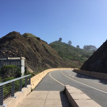
Wow, Can you imagine that such an amazing hiking trail like Devil's Slide is only a short drive away from the city? Recently, my girlfriend and I were looking up places to hike along the peninsula and a group of trails in Pacifica appeared on our radar. We had never been to this area of the Bay Area before - only driven through it to San Francisco - and so we decided to give the area a look. Pacific has a few hiking trails to explore for those interested: Devil's Slide, Mori Point, and Pedro's Point. The beauty of it is that all of them are clustered together, and so you don't actually have to keep driving and finding parking; walking to the trailhead is just another hike! And so this review will be for the Devil's Slide Coastal Trail. First off, there are two parking lots, both relatively the same size. One is on the North, and the other on the South end. We parked on the North end. This parking lot is divided into two smaller ones, and luckily we were able to find a spot. Both parking lots are open at 8 am everyday, and I suggest coming then. And because you are near the water (LITERALLY NEXT TO IT), you may want to bring a jacket. To summary, Devil's Slide Coastal Trail is a quick 1 hour or so hike along the coast, between the North and South end. It's around 1 mile each way, with minimal changes in elevation. The beauty of this hike is that you will always be immediately next to the water. You get a GORGEOUS view of the coast as you are walking along the trail. This is also a great place for someone who wants to run, bring their dogs, or even bike. I was surprised that the trail was not too busy when we came on a Sunday. One of the coolest parts of the hike is when you are at the end/beginning at the South parking lot, you can see the famous, abandoned WW2 bunker nearby. I think you are able to take a picture there, but sometimes it may be closed for officer training. Overall, I had an amazing experience at the Devil's Slide Coastal trail. This is a perfect place for someone to enjoy a stroll alongside Bay Area's famous coast. The route is beautiful and easy, and the weather is nice. The only knock I'd give this trail is that I wouldn't really call Devil's Slide a "trail." It's more like a road, as you can see in pictures. You won't be fighting through brush, but you'll be strolling along concrete and asphalt. Still, I'd give this trail an "Omg, I'd travel 2 hours for this." Have fun and prosper! read more




6 years ago
The trail itself and the views are spectacular but parking sucks. Wish there were more spots. read more


9 years ago
Perfect 3.6m loop trail We parked at the northern entrance and walked to southern end and back Parking is very limited You can optionally park at places 1-1.6m away but need samtrans 17 route bus which travels every 2 hrs on weekend and every hour on weekday Perfect for kids and family read more


9 years ago
This trail is so beautiful! Parking can be a pain, but if you arrive early enough you will be fine. Since it was part of highway 1, it's provides enough space for a lot of people and the views are breathtaking. (You're allowed to take your dogs as long as they are on a leash). We were lucky enough to see whales! read more


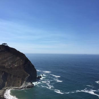
It's a SHORT (1.3mi, 1-way), EASY, very wide, PAVED road with magnificent views of the ocean and cliffs along the coastline - great for all ages! It's wonderful for walking, biking, AND exercising your pets while taking in the spectacular coastal views! Go Enjoy! Be sure to charge up your smart phone, because you'll want to take lots of pics. So, if you are driving along Cal Route-1 near Pacifica, be sure to make a stop at one of the scenic parking lots at either end of the Lantos Tunnel for a wonderful view. You can do yourself a favor and take a scenic STROLL on this short, paved trail. No hiking gear needed, just bring water, a hat, sun screen. It's also a great place to walk your dogs. One can start from either parking lot, right OFF the entrance/exit of the tunnel. From the South Lot, you will be going UPHILL to the north lot. From there you can either take the return downhill trek, or have your folks pick you up there. LONGER VERSION Devil's Slide is located in Pacifica on Cal State Route-1, bookended by the scenic parking lots at the entrances/exits of the Lantos Tunnel. There are toilet facilities by the lot. This trail was the ORIGINAL section of Route-1 with the DANGEROUS frequent rock slides! This section was renovated as the present day popular trail, after the new Lantos Tunnel was constructed to replace it. Off the South lot, you can see a strange contraption on the hill above the cliff, which is an OLD military defense installation of historical significance! The SOUTH LOT is also much easier to exit than the NORTH lot, thanks to its TRAFFIC LIGHT at the SOUTH lot. IN CASE YOU THINK THE TRAIL IS TOO SHORT - DON'T WORRY.... IF you think Devils Slide Trail is TOO SHORT to make a special day trip hike for it, don't worry, there are also several challenging hiking trails on top of the hills nearby the parking lots. Furthermore, heading SOUTH along Route-1 there are many other wonderful places to visit, such as the Montara State Beach, Pier Point Harbor and the scenic coastal trails on top of the hill, the Half Moon Bay...! In Pacifica, there are many restaurants, hotels, shops, and parking lots with water access. Sept 2015 read more




7 years ago
Needing a place to breathe in and out that calming, relaxing, ocean breeze fresh air? Devil's Slide should be the go-to for all your workout combined with meditative solace. Don't forget to stop and be in awe of the millions of years rock scrapings, the wild flowers that surround the trail, the protected species as well as perhaps, a sighting of a shy red fox and bugs on the ground. It's my little place of heaven and being in the "now". read more


3 years ago


11 years ago
Love it here! Came here yesterday with my bf and dog for a morning walk. I love that the trail is dog friendly, easy to walk on with paved roads, free parking, lots of benches and trash cans. The view is beautiful! If you live in the area and have a dog I recommend bringing your dog here for a walk. I'll be back. read more


I still remember driving this road and thinking WHOA, thats a drop! I remember when it slid for the last time and they finally closed it. I have been wanting to walk it forever. Well we did. It is hard to park but luckily someone left right as we pulled in. There are restrooms at the start (much apprciated) and they were super clean. The walk itself was beautiful. In the middle is a 9% grade, up or down depending which side you start at. Also a viewing area on top with benches. While we were there the government peeps were there tracking wildlife, what a cool job that would be! Views the whole entire way! Paved clean, some dude was walking barefoot! LOL. Almost 3 miles round trip. An absolutely perfect use of this old road! read more
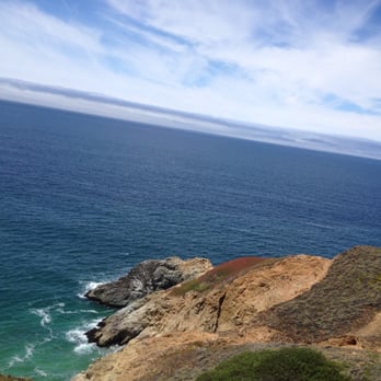

Despite what the yelp address reads, Devil's Slide is in Pacifica not Half Moon Bay. Just FYI for people who are unfamiliar with the area. Like the other reviewers have noted, there is very limited free parking on each end of the trail. Be prepared to wait for a spot to open up. When friend tried looking for parking in the first lot, we had no luck. We drove through the tunnel to get to the second lot. Luckily, a car was just pulling out so we scored a parking spot right away. The Devil's Slide Coastal Trail is 1.3 miles each way. Since it's the old stretch of the highway, it's all paved. Only pedestrians and bikes are allowed through. I would say that it's an easy stroll with a small incline towards the middle portion. We saw very few bikes on the weekend afternoon, but lots of pedestrians. Many people came out with their dogs as well. The views are what you come here for. The scenery of the coast reminds me of how much I love living in the Bay Area. From the trail, you can look out into the deep blue ocean and also down on the surrounding beaches. We even spotted a grey whale in the distance. Along the trail are also beautiful native plants. There are eco-sensitive sections that are fenced off with signs. Although this trail is quite new, I imagine that it will continue to be well maintained. The trail is open from 8am to 8pm. There are a few places along the trail with park benches including a look out point. At each of the trail ends are restrooms. They do not have running water just as most restrooms at regional parks. On a nice and sunny day, there wasn't too much of a wind factor. I expected it to be very windy considering it always being so in that area. I would suggest wearing layers just to be prepared. Towards the end of our leisurely walk, the fog did start rolling in a bit. I would recommend checking out Devil's Slide. If you've driven on it in the past, you'll enjoy walking or biking it much more. read more


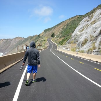


12 years ago
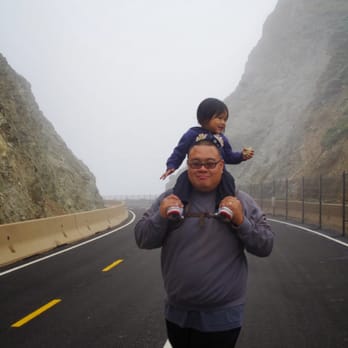
I was introduced to this place by Janet O. who organized a great UYE here Memorial Day Weekend 2014. I was so glad I dragged my family to come so early in the morning. It was a great stroll accompanied with great people and in the end, like me, they had a great time. It's an out and back kind of stroll. You start on one end, stroll to the other side, and stroll back where you started. There are two parking lots, one on our side and one at the end of the stroll, which also included bathrooms. Despite the fog and being cold, I still really enjoyed the walk. I love how the path is paved and has plenty of space for big groups. One side of the path are for those talking a stroll and the other are for bikers. In my kids case, their scooter and long board. Along the path, their are also a few benches to sit, relax, and enjoy the beautiful view. read more




12 years ago
Just a tip, wear your walking shoes, not your hiking shoes. I thought it was a hiking trail so I was wearing my trail hiking shoes, turns out it was a mile of pavements for bikes and walking. The pavement is new and there are bathrooms at both entrances, all of them are very clean and well maintained. The view is fantastic read more

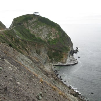

I love this walking trail! Was fortunate to visit this place on a surprisingly warm day. (76 degrees!) After passing the horrible traffic on Hwy 1 (from people all going to the Pacifica beach) getting here was so easy! Right after going thru the new tunnel, there's a quick turn about on your right and you'll find two small parking lots. The first one we turned into was full so we went back to the other one and were lucky since someone was leaving. The trail itself is beautiful. Lovely blue ocean views! And the road is paved, mostly flat. (Except for a couple parts that had steep grades.) Both my kids managed to do it with no problems. It's perfect for an easy stroll. There are benches along the trail for your photo ops and places to sit if you need to rest. read more


More info about Devil's Slide Coastal Trail
5981 California Coastal Trl
Pacifica, CA 94044
Directions
(650) 355-8289
Call Now
Visit Website
https://parks.smcgov.org/devils-slide-trail
Hours
Indoor Amenities
Outdoor Amenities
Devil's Slide Coastal Trail Reviews in Other Languages
Ask the Community - Devil's Slide Coastal Trail
Review Highlights - Devil's Slide Coastal Trail
You might also consider





















Why does Yelp recommend reviews?
4 reviews that are not currently recommended
The reviews below are not factored into the business's overall star rating.

11 years ago

6 years ago

12 years ago

11 years ago
Devil's Slide Coastal Trail - hiking - Updated September 2026
Best of Pacifica
People found Devil's Slide Coastal Trail by searching for…
Trending Searches in Pacifica, CA
Apple Orchards near Devil's Slide Coastal Trail
Apple Picking near Devil's Slide Coastal Trail
Archery near Devil's Slide Coastal Trail
Barbershop near Devil's Slide Coastal Trail
Blow Dry Bar near Devil's Slide Coastal Trail
Caves near Devil's Slide Coastal Trail
Cliff Jumping near Devil's Slide Coastal Trail
Consignment Shops near Devil's Slide Coastal Trail
Corn Maze near Devil's Slide Coastal Trail
Dog Friendly Things To Do near Devil's Slide Coastal Trail
Dog Swimming near Devil's Slide Coastal Trail
Eyebrow Threading near Devil's Slide Coastal Trail
Eyelash Extensions near Devil's Slide Coastal Trail
Hiking near Devil's Slide Coastal Trail
Kids Birthday Party near Devil's Slide Coastal Trail
Makeup Artists near Devil's Slide Coastal Trail
Mens Suits near Devil's Slide Coastal Trail
Off Road Trails near Devil's Slide Coastal Trail
Parks near Devil's Slide Coastal Trail
Photo Spots near Devil's Slide Coastal Trail
Picnic Areas near Devil's Slide Coastal Trail
Places To Take Pictures near Devil's Slide Coastal Trail
Private Schools near Devil's Slide Coastal Trail
Public Shower near Devil's Slide Coastal Trail
Rock Quarry near Devil's Slide Coastal Trail
Scenic Night View near Devil's Slide Coastal Trail
Scenic Overlook near Devil's Slide Coastal Trail
Browse Articles
Browse Nearby
BEST of Pacifica, California Coffee near Devil's Slide Coastal Trail
BEST of Pacifica, California Restaurants near Devil's Slide Coastal Trail
BEST of Pacifica, California Things to Do near Devil's Slide Coastal Trail
BEST of Pacifica, California Breakfast near Devil's Slide Coastal Trail
BEST of Pacifica, California Walking Trails near Devil's Slide Coastal Trail
BEST of Pacifica, California Parks near Devil's Slide Coastal Trail
BEST of Pacifica, California Campgrounds near Devil's Slide Coastal Trail
BEST of Pacifica, California Sightseeing near Devil's Slide Coastal Trail
BEST of Pacifica, California Day Trips near Devil's Slide Coastal Trail
Browse Brands
Related Searches in Pacifica, CA
Affordable Kayak Rental Services in Pacifica, California
Best Dog Hiking Trails Around Pacifica, California
Best Fishing Locations and Guides in Pacifica, California
Best Nature Trails for Hiking in Pacifica, California
Best Places for Horseback Riding in Pacifica, California
Best Sightseeing Experiences Available in Pacifica, California
Check Out Off Road Trails in Pacifica, California
Discover Dog Friendly Trails to Explore in Pacifica, California
Discover Easy Hiking Trails Near Pacifica, California
Discover Kid Friendly Hiking Trails in Pacifica, California
Discover Popular Bike Trails in Pacifica, California
Discover Walking Parks in Pacifica, California Near You
Discover a Hiking Trail in Pacifica, California
Discover the Best Night Hike Trails in Pacifica, California
Dog-Friendly Hikes With Dogs in Pacifica, California
Enjoy Camping Adventures Around Pacifica, California
Enjoy Kayaking Adventures in Pacifica, California
Enjoy Off Leash Dog Hikes in Pacifica, California
Enjoy Scenic Places to Walk in Pacifica, California
Enjoy a Beautiful Waterfall Hike in Pacifica, California
Enjoy the Best Walking Path in Pacifica, California
Enjoy the Best Walking Trails in Pacifica, California
Explore Beautiful Parks and Green Spaces in Pacifica, California
Explore Easy Hikes Perfect for All in Pacifica, California
Explore Fun Activities to Do in Pacifica, California
Explore Popular Campgrounds Near Pacifica, California
Explore Popular Dog Walking Trails in Pacifica, California
Explore Top Dog Parks in Pacifica, California Near You
Explore the Best Beach Spots in Pacifica, California
Family Friendly Hiking With Kids in Pacifica, California
Find Beautiful Views in Pacifica, California
Find Cozy Camping Cabins in Pacifica, California
Find Top Dog Friendly Parks to Visit in Pacifica, California
Find Top-Rated Waterfalls in Pacifica, California Now
Find the Best Parks BBQ Grills in Pacifica, California
Find the Best Parks for Picnics in Pacifica, California
Hiking Trails With Waterfalls in Pacifica, California
Off Leash Dog Hiking Trails in Pacifica, California
Popular Outdoor Activities to Try in Pacifica, California
Popular Picnic Spots to Visit in Pacifica, California
Popular Waterfall Hiking Trails in Pacifica, California
Safe River Swimming Areas in Pacifica, California
Safe and Fun Parks for Kids in Pacifica, California
Top Hiking Trails to Explore in Pacifica, California
Top Playgrounds for Kids to Enjoy in Pacifica, California
Top Running Trails to Explore in Pacifica, California
Top Swimming Lakes to Enjoy in Pacifica, California
Top Swimming Spots and Pools in Pacifica, California


