Franklin Falls Trailhead Photos


You might also consider


More like Franklin Falls Trailhead
Recommended Reviews - Franklin Falls Trailhead
Start your review...


Reviews With Photos


On a nicely manicured trail, down a shady road, up near snoqualmie pass, lies this delightful waterfall! We've been driving over Snoqualmie pass for darn near 40 years, and I had no idea this was here. From the waterfall, you're able to see the westbound lanes as you're descending the west side of Snoqualmie pass. The trail is well marked, and more manicure than we are generally used to. While it was a really nice hike, it honestly took a little bit away from it. That said, it's one we would do again. We don't hike on the side of the mountains very often, so we've forgotten how busy it would be on a Saturday. We were lucky to find a place to park, but do be ready to spend a little bit of time circling. They were probably 1000 people that we saw on the trail, and a few hundred down near the waterfall, including the number of groups that were swimming underneath it. It still remains very picturesque, and is the sort of place. It's nice to hike with friends, especiallyif you have younger kids. It's not a particularly difficult trail, and other than a slight descent to the waterfall, it's not much different than walking through a park.


Simply breathtaking, any time of year. It's a bite-sized creekside "hike" / nature walk to a wonderful waterfall at the end. Discovery NW Pass required. If you are going to do this hike, please be respectful of nature ^___^ Keeping our trails trash free preserved the beauty for us all (critters included!) I just love the PNW.


A friend had posted photos of waterfall and I just knew I had to come here. On a few different trail and hiking ops, it rated this as an easy trail. 1 mile there, 1 mile back and about an hour for the hike. But what I feel no one mentioned is that the hike there is ALL UPHILL. All of it. According to my watch it was almost a 400ft elevation gain. There are areas where there are stairs that made on the pathway but some of the stairs have a tall height. But the trail and path is wide enough in 99% of the areas so that it's easy to pass other hikers. There are a few sections where you can easily rest on the way up on the trail without blocking anyone walking on the trail so that is a very nice benefit. When you get close to the waterfall, the path ends and you have to navigate on rocks to get to the waterfall. As someone who doesn't always balance so well, I did need some assistance. The water from the waterfall is so clear and beautiful. There is something so soothing about being in nature like that. Surrounded by greenery, water sounds and fresh air. Going back down the trail is much faster since you are going down but for someone with bad knees the height of the stairs sometimes made it an issue when going down. It was better for me to walk on the outside of the stair instead. Overall highly recommend. It's beautiful and a great hike.


Went on a short hike today to see the big Waterfall. Parking was kind of difficult to find since there were a lot of people there. Luckily, we found one space in the main Visitor Parking lot when someone had pulled out. Just some cars were parked very close to each other. Some people can be very inconsiderate of others. We also witnessed several people driving down the wrong way and entering in where it clearly shows a DO NOT ENTER sign!!! Stupid people... The short walk up to the Waterfall was great! Enjoyed the nice weather, good trail and took a whole lot of pictures. Very scenic for the most part.


The falls are ok, but the trail is the highlight. We parked in the large lot up the hill past the first trailhead we spotted. We hopped on the trail here and completed the Wagon Road to Franklin Falls trail loop...through the gorgeous forest...down the slippery steps for a brief viewing of the falls...along the beautiful Snoqualmie River...past the adorable cabins...and back around to the opposite end of the parking lot. Sure the falls are pretty, but I enjoyed the hike more...beautiful place!


We have been to Franklin fall in the summer many times. This is our first time snowshoeing to the fall on a very merry white Christmas Day. Instead of going from the trail head parking lot. We came down from the Summit at snoqualmie all the way down to the fall. The walk was super beautiful and the kids get to play in the snow and even grab a few popsicles (icicles) to eat and play with. This is an amazing winter wonderland and the perfect day to hang outdoors with the family.
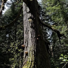

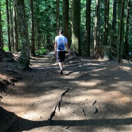

We hike here a fair bit, despite it being 40min drive from home. Love the hike, it's beautiful. Waterfall is beautiful. The creek is serene and clean. You can see the bottom of the creek. It's just an amazing site/sight :) The bathrooms however - DISGUSTING. People need to treat public facilities better. Recommend the hike, avoid the convenience.
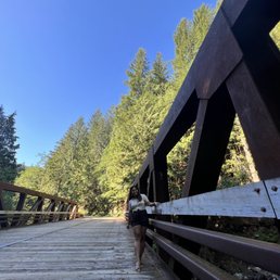

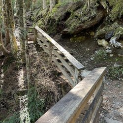
So easy to get to, yet so pretty! My uncle decided to take my family and I here after seven years. I recall that the last time we went, it was rainy and a bit slippery, but this time around, it was perfectly sunny. The wooden bridge to get to the trailhead was nice to take photos on, and the trail to get to the fall itself was nicely maintained. And boy, were the falls beautiful! You can walk pretty close to it on the rocks- def nice for photo ops. Def coming on out again if I want an easy, yet pretty getaway.


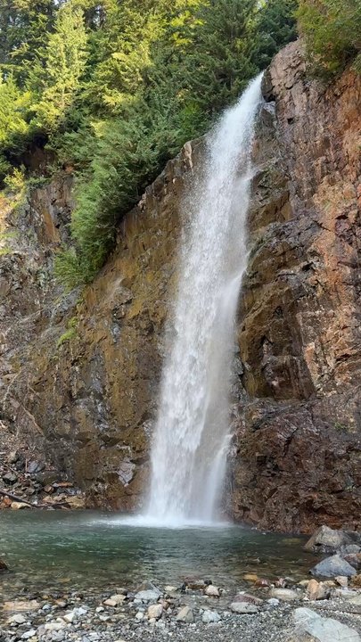
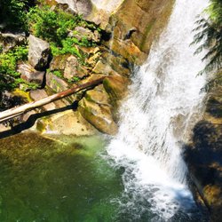
We found this to be a beautiful and leisurely hike with a rewarding end. It's a pretty popular hike even though it's a decent drive from the city, so plan to arrive early or give it a visit on a weekday. The parking lot is right at the trailhead and takes the NW Forest Pass. It's a pretty mild hike with only 2 miles roundtrip and a 400 ft elevation gain. The trail is pretty smooth and well maintained. There are two vista points, one directly on the trail and the second you can climb the rocks to go right up to the base of the waterfall. The trail is shaded the whole way so you don't have to worry too much about the sunscreen. The falls themselves are beautiful at 135 ft of total waterfall and an icy cold pool of water at its base. The trees and natural PNW forest are an incredible backdrop making these falls a breathtaking sight. There's lots of places to sit on rocks and just enjoy the water, that is if there aren't too many people around. We took the Wagon Road Trail back to the parking lot which completes a nice loop and was less trafficked than the in and out Franklin Falls Trail. It's a well worthy hike and perfect for a quick outdoor experience.


Off I-90 Exit 47. Go 3 miles to the parking lot. Easy short little kid-friendly hike up a gradual incline & many steps for 1 miles and be rewarded along the way with views of Denny Creek and then the beautiful the 70' Franklin Falls waterfall at the end. Saw big volumes of water when visiting at the end of July. Great return on hiking effort! 5* Fee paid $5 pass per car online at www.discovernw.org, printed out the pass OR write the confirmation number and leave it on the dashboard Parking parking lot is ~3miles from the exit 47 ramp but will see cars lined up along the side of the road as well. Was able to find parking at 1:30pm on a Thursday in the lot. Trail mostly shaded incline with overall 370' elevation. Mostly cleared trail & steps except the last short portion just before the fall which is a bit narrow, slippery when wet slope and rocky area so need to hold little children's hands for safety. Timing About 45/50 minutes from Seattle to the parking lot. Forgot to time it but was about 35-40 minutes there going leisurely but steady and about 25 minutes on the return. Fallen Trees there was a controlled avalanche on February 24, 2021 and now there are many fallen trees in the area by Franklin Falls. Bathroom About 100' east of the Franklin Falls Trailhead or across the road 500' SW of the parking lot Dogs on lease allowed


Mesmerizing, serene, beautiful, heavenly, spectacular. I am falling short of words. Our first hike in 2017 and i am so glad it was ! We went on a Sunday at around noon. It had snowed just the day before so roads towards the trail were pretty slow and slippery. Mostly all the cars were taking u turns. We ended up parking about 2 miles away from the trailhead. Hence the total distance for the hike was about 3.5 -4 miles. Hike was pretty much flat with small inclinations in the last 1 mile, None of it was strenuous. The view of the frozen falls in the end is so worth every step you take towards it. Loved it!! I would highly recommend getting crampons before going there in winter. Parts on the roads and the last quarter mile were quite slippery and I could complete it only because of my crampons. read more


7 years ago
Super pretty winter hike. Only wore my hiking boots and didn't have spikes, but I lived. Just be careful because it can get slippery. Cold, but worth. Just took a while to get there because the road there was blocked so we had to find an alternate route. read more


Franklin Falls is an amazing, easy day hike. It's so great for beginners, families, etc. This was my third time going, and it was great to actually go when the place isn't frozen completely over (that's how it was the last time I was here). The trail is very clean, fairly easy, but it does get packed on these summer weekends for sure. The water is FREEZING. My sister and I did our best to try and get in, but we couldn't make it past our waist! So many people were swimming full on, and I commend them for that. Impressive, to say the least. Along the way, you get to see some pretty awesome views of the creek down below that provide a lot of cool picture stops. Word of advice: get here early, because I parked about a half a mile away due to how many people were there and how small the parking lot is. read more


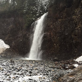
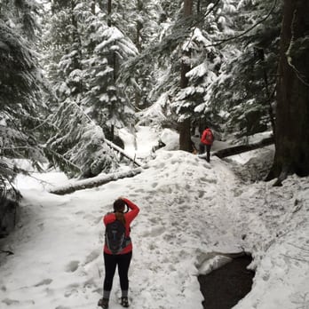
Hiked Sunday 3/13/2016 Miles hiked: 3.48 miles out and back Directions: I used the directions off the WTA site "From Seattle, head east on I-90 to exit 47 Denny Creek/Tinkham Road. At the top of the exit ramp turn left and cross over the freeway. Go .2 miles and turn right at the stop sign onto Forest Road 58. The road crosses under the freeway and after .2 miles turn left. Continue ahead for 2.4 miles and take a left just after Denny Creek Campground and arrive at the Franklin Falls trailhead" But we were not able to drive to the trail head. On that 2.4 mile stretch, there was road blockage by huge snow/ice chunks. We ended up parking our car on the side of the road and hiking in from there. We parked 0.74 miles away from the trail head. Trail: since there was so much snow, we missed the trail head, but the road and the trail eventually meet up, so we found the trail a bit further down. What is nice about the area is I had phone service the entire time so I could look at google maps and see where we were. Franklin Falls Trail comes up on google maps. Hike itself was short, but it was beautiful! Definitely an adventure cuz of all the snow. The waterfalls wasn't frozen, but it was still plenty cold. Only downer about this hike, is right above the waterfall is the highway. The day we went, hiking out we didn't see much people. Hiking back we passed large teenage crowds. Glad we went early! Parking pass needed. read more




5 years ago
BEAUTIFUL!!! Went today the weather was perfect. Trail to Franklin Falls is clean and well maintained. The trail is not far at all with steps throughout that help the incline. As your walking up there are so many beautiful spots to stop along the way and look at the beautiful scenery. Over the winter they had a controlled avalanche so there is a lot of debris currently at the bottom but still very very beautiful!! Lots of spots you can walk down to the river before you get to the actual falls. You need to pay for parking / have a permit. Your able to park in the lot or along one side of the road once you get near the trail. This location has a few different trails you can choose from, can't wait to try the others. read more



6 years ago
Very short and easy day hike. Super kid or dog friendly, just practice caution once you get to the actual fall point, that's where the trail turns into climbing rocks to get down. Usually pretty crowded, but people are conscious & kind to give space and/or let each other take turns at taking pictures next to the fall The fall itself is magical... Parking lot will have an open space if you are patient enough to wait when it's full. They do not accept Discovery pass, pay only $5 to park, so it's worth it. Pack a lunch and if you prefer a more secluded vibe, go down to the water at the beginning of that trail read more


6 years ago
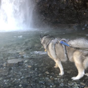
Fairly simple hike, took my two huskies during a weekday and it wasn't too busy. Mostly flat path with steps which increases intensity closer to the waterfall. The end before the waterfall bottom is a little steep rock area so make sure to have good grip shoes. Luckily they didn't drag me down! It was helpful to have them pull me upwards though! Great hike! read more


4 years ago
This hike was a lot of fun! The weather was in the 80s and perfect for this hike, it was only 2 miles round trip so it wasn't too difficult. The waterfall was absolutely beautiful and there was a nice breeze when standing near it which felt amazing after sweating a little on the hike. We took our shoes off and dipped our toes in the cold water and that was pretty refreshing. Next time I will pack water shoes so the rocks don't hurt my feet when walking in the pool at the bottom of the waterfall. Packing a lunch and blanket to sit on and stay for a while would be so much fun also! It's peaceful there and I would have loved to stay longer. There is a bathroom at the beginning of the trail but it's not the cleanest and there was no toilet paper so I would definitely bring some with you or have some extra napkins just in case. You do need to have a Northwest Forrest Pass or a Sno-Parks Permit to park there. If you don't have one, there is a QR code at the beginning of the trail that will take you to the website and you can pay for a day pass there (it was only $5) You just have to write down your pass number and display it in your front window. Also don't follow the directions on Yelp! It took us to a neighborhood and that was 7 miles away from where we were supposed to be. We went to the Washington trail association website and got the correct directions from there. read more


6 years ago
Franklin falls has been a family hiking place for my family. We've been here twice and it never disappoint us. The waterfall view at the end is worth the hike. The hike towards the waterfall too is a good workout. Going down towards the waterfall is a scary narrow hike so make sure you have a good balance and some comfy shoes. read more


4 years ago

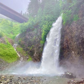
Beautiful and easy hike for all (including families and puppies)! It's a gorgeous 3 mile loop with a small elevation gain of 400 feet. This was one of the most packed hikes I've been on, and I even went on a rainy day, so I'd recommend arriving early in the day. It took us about 90 minutes round trip to complete. We took the wagon trail up. It connects to the falls and is less traveled, while also a bit shorter. It goes through the forest rather than along the river. When you arrive at the falls, it is very rocky and wet because of the mist. Where solid grip shoes and prepared to get wet. It can also be a bit narrow and is one way at one point. The falls are beautiful. You can walk in the water or stay on the rocks. Lastly, there is a restroom at the start of the trails. The trails can be a bit tricky to find the start. If you find the Franklin Falls parking lot, head backwards from the way you entered and right next to the bridge is the start of the trail. I highly recommend! read more


4 years ago
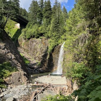
I saw this on TikTok and I thought I should give it a try (I am glad I did) it is a very moderate hike that even the little ones and the furry friends can enjoy. read more




9 years ago
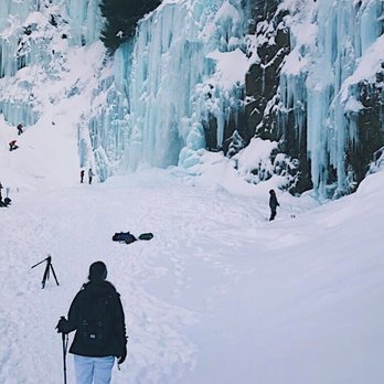
Franklin Falls is amazing! If you're doing this hike in the summer it's so easy! You can take exit 47 or 52 and drive all the way down to the trailhead. From there it's only 2 miles round trip. You don't need to be in shape or be prepared in anyway other than wearing shoes (which you might not NEED). I think it's also $5 for fee or if you have some pass but not Discover pass. If you're doing this in the winter, oh be prepared.. We went on Wednesday 1/11/17. I wish I read the reviews on WTA before heading out because it was a journey just getting there. We left at 7am to arrive early but of course forgot about work traffic on the 405. Google maps took us to exit 52 which you don't really want to do since there is no parking and a giant wall of snow blocking the road to the trailhead (although it technically would be closer to go this way if you can park somewhere). So we read some reviews and drove back to exit 47. Yes, TAKE EXIT 47. There's a sign that points to the right for Franklin Falls. From there park under the overpass. It was probably 10am-ish when we finally got to the right spot. From the freeway to the overpass (literally not even a quarter mile) we got stuck in the snow. I have a WRX with summer tires (go ahead and laugh).. Heh.. But these two kind people in a white subaru helped push my car out. If you two ever read this THANK YOU SO MUCH! There were only 5 or 6 other cars parked so we got a spot pretty easily. From there you just walk through the road closure sign, follow the road, walk over or around the wall of snow roadblock (not as bad as the previous one I mentioned), keep walking, over the bridge, you will eventually pass a restroom and if you keep going, there's a board that says Franklin Falls and a little wooden bridge. That's where the trailhead begins. It was about 2.5 miles from where we parked to the beginning of the trail. Pee before you leave the house if you're a woman. That bathroom is not serviced during the winter and it is DISGUSTING. I mean, frozen pee everywhere and number two on the toilet seats. The trail itself isn't bad, it's just exhausting. Once you're about to reach the falls someone was amazing and put up a little rope by the rocky area which is so helpful since it's covered in snow/ice. The view is absolutely amazing! 7 miles round trip but it is so worth it! If you're reading reviews contemplating doing it, you have to. This place should be on the cover of NatGeo. You won't regret it. Coming back around 1pm and there was absolutely no parking anywhere on the street. It was crazy how many people came in those few hours. There's only room for 1 car to drive out at a time and if someone is coming in, you're out of luck. If you're too lazy to read this novel I'm writing, IN A NUTSHELL: - Take exit 47 & Come early for parking - Waterproof hiking boots are a must! - Hiking sticks recommended but snow shoes aren't really necessary - Snow pants only if you plan to make snow angels - Pack some tissues for your cold runny nose - Pack some tea or hot cocoa in an insulated thermos so when you get to the falls you can stand there for a while and enjoy your warm beverage. :) Happy Hiking! read more




6 years ago

7 years ago

6 years ago
This was a super beautiful hike but if you're thinking of doing it soon, just know that the road you're supposed to take is literally snowed shut, and you have to walk like 1.5 miles to get to the trail! It also very slick in some places so if you're not from Alaska like me, you may want to consider ski poles or snow shoes! All and all it was very beautiful and it ended up being almost 6 miles and took about 3 hours, (but I'm also extremely out of shape) wouldn't advise bringing small kids or doggies cuz the snow is so deep on some spots read more


6 years ago
This is beautiful. Im surprised it doesnt have more reviews. Coming from LA we see nothing like this. The tall trees, the dew and the amazing waterfall. If your looking for an easy hike to a beautiful waterfall this is perfect. The trail was paved well and there wasn't much elevation. You could easily take your kids or small pets. Compared to Snoqualmie where its mainly just site seeing this hike was better. Less crowded and you get up close in nature. Snoqualmie was closed off to hike down so I didn't get to get in but Franklin falls is perfect. It was such a nice rewarding finish to the hike with the waterfall. Definitely recommend this hike to others. read more
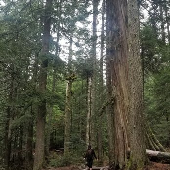


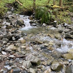
According to the Washington Trails Organization they say this is a kid friendly/beginners hike. I'm going to call BS because getting to the falls at the end is no easy task and it maybe a little challenging for the little ones, your 5ft tall or less girlfriend/wife or vertically challenged boyfriend/hubby, the elderly, and ya'll nasty-ass smokers! Let's start with getting to Franklin Falls from I-90 in Snoqualmie. After getting off I-90 your going to take a paved road that is going to be extremely narrow. I highly recommend that you take this very slowly because of on-coming traffic and blind turns. The person is who is responsible behind the wheels is going to face on-coming traffic and will have to drive as close as possible to the side of the road to prevent side swiping the on-coming vehicle. Just don't get to close to the edge coming back up from hiking later. There are drop offs! So just take it nice and slow! Kinda wish ya'll people with "short people syndrome" and your "sky-high" lifted trucks wished you had taken your Prius instead huh? If you see the camp site on your right side and or you come to a reddish brown wooden/steel bridge you've passed the starting point of the trail or the parking area. Turn around and you'll see the sign. There are no signs posted directing you when coming down the narrow paved roads. Parking is very limited and it's a single narrow off road area with a lot of pot holes so go slow with your Prius. I guess you should have brought the truck instead? You just can't win! A Discovery Pass is required. It's $30 for a year pass or $11.50 for a Day Pass. You can get a pass at most location that sells the Discovery Pass. I get mine at my local Fred Meyers. The Washington State Rangers and wardens are highly active in this particular location due to it's popularity, the current improvements made to the hiking trail, and the lurkers/car break-ins. Just be sure not to leave any valuables in plain site when parking your vehicle. Secure everything inside your car trunk or out of sight after leaving your vehicle. Don't be leaving your IPOD in plain site you numb-nuts! The hike is almost 80% incline so your little person (small children or your vertically challenged girlfriend who is below 5ft with her little short legs) is going to have to deal with the high steps that is created by the WTA. Some of these steps are no joke! There are some off great locations off the trail to take a break and get some great pics of the riverbeds and flowing water at the starting of the trail. There is a great spot off the trail with the flowing river bed! You'll see it! Also as you get more up in the trail there is a large rock great for a quick selfie! Can't miss the big rock! It's the size of your mother-in-law! As you make your way towards the falls it starts to get real! The incline hike isn't bad but you may have to start hauling your little ones. If you want to know how it feels get yourself a 40lb bag of rice and carry it around or just lift up your 5ft tall GF and walk around the house. She might get offended if you start to huff and puff after a few minutes because she'll think your saying to yourself that she's a fatty. She probably is but it's not my problem. Maybe you should stick with the bag of rice and stop smoking. As you make your way to the end of the hike getting to the falls the last part of the hike is going to be challenging for some especially for young children and people with balancing issues. The last part of the hike involves getting close to a stone rock wall with jagged edges. The walk way is extremely narrow and uneven. It can be intimating. So take it easy and you'll get thru it! Go slow! Keep close to the wall. Watch your steps! Who knows... your 5ft GF with her little legs may show you what's up! At the end of the hike you are rewarded with a great view of Franklin Falls! Overall, about 2.2 miles round trip but your going to get a workout trying to get to the other end with the increasing incline. Coming back it's all down hill and you are rewarded at the end of the trip with split shines. Yay! Recommendations: Arrive early for the best parking spots! When passing other hikers stay to your right and allow faster moving hikers to pass you by stopping and moving to your right to allow them to pass. Dogs are allowed. Don't be bringing your pet iguana aiight? Leave your weird stuff at home! Bring plastic baggies to store your trash. Don't be that one guy who litters and messes it up for the rest of us. Don't forget your Discovery Pass! Pros: Great experience! Great views! Easy hike for those who are experienced. Cons: Death like narrow roads getting to the trail! Bad parking! Limited signs. Somewhat of a challenge for the little ones, your short legged GF or vertically challenged BF. Not recommended for ya'll people with balancing issues or the elderly because you might bust yo hip trying to get up the steps or fall over the edge. read more


9 years ago
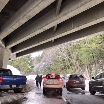
I love the photos - didn't make the hike as parking was an issue ... also son wore rain boots ... snow shoes are highly recommended... bundle up its cold... read more


10 years ago
Required to have a pass ($5). It was a nice, beautiful, easy, breathtaking hike! So, we passed the Exit we were suppose to take. Lesson learned for this hike.. DONT follow what google maps tells you, it took us to the skiing resort. We asked some friendly people that we saw on the parking lot and they told us we missed it. So, that helped us alot. Lol. We came back and it was EXIT 47. Google maps told us to turn left, but we saw a sign it says "Franklin Falls" so we turned right instead. We passed a little bridge. Turned left and went all the way to the back. There were fallen trees all over the place. DRIVE SAFE. Youre going to pass a camping area, then youre going to turn left. WAAALLLLAAA. Lol. Youre there. Ot was freezing cold when we got out of the car. There was still snow and watch out and be careful cause there are trees that were covering the trail. Youll see some cabins there. ENJOY! Hope this was helpful. Alohas read more


Franklin Falls is absolutely beautiful. Directions: I couldn't find the exact address for Franklin Falls so I used Google Map on my phone. It told me to take exit 52 but I decided to double check the website. The website told me take exit 47 and I went with the website and was able to easily find the place. Here is the driving directions from its website, http://www.wta.org/go-hiking/hikes/franklin-falls "From Seattle drive east on I-90 to exit 47 (Asahel Curtis/Denny Creek). Turn left over the overpass and proceed to a T. Turn right and travel 0.25 mile to Denny Creek Road (Forest Road 58). Turn left and drive 3 miles, passing the Denny Creek Campground. Just past the camp-ground, turn left onto FR 5830 and park before crossing the bridge." Parking: $5 for day pass or $30 for annual pass. I had a difficult time finding parking. All parking spots near the trail entrance was taken. I decided to grab a fee envelope with me first and then kept on looking for parking. I had to drive up the paved road for awhile before finding a questionable spot. I say it is questionable because I was not sure if I could even park there but I did anyway. It is a spot along the paved road and a lot of cars parked there. The road is curved so the car behind was sticking out a little bit on the road. But it was fine. I filled out the information on the envelope and put $5 in there. I detached the ticket part and put it up on the rear-view mirror inside the car. Then I detached the matching ticket stub and took it with me and put the envelope in its envelope box. Trail: It was not a difficult trail at all. The hike towards the falls just felt really long for some reason. The website is correct, the last 100 yards was pretty dangerous, "The path reaches Franklin Falls at 1 mile, with the last 100 yards climbing steeply on rocky trail to the base of the falls. The tall falls pounds down a sheer rock face, providing a refreshing spray to cool hot hikers. Don't venture out into the falls water, however. It's coming down hard and frequently carries loose rocks down with the tumbling water." The rocks towards the end get pretty slippery so just make sure you hold on to the edges or something. When I was there, there was one guy trying to walk across the falls water to the other side, he had proper equipment anything and had a friend with him. While the falls water was shallow if you stay afar, it was clear that the falls water get deep really quickly. This guy went a little further in the falls water and pretty much ran back out because the water got way too deep for him. So I would listen to the website advice and not venture out into the falls water. Round trip is only 2 miles. When I was there, I heard some thunders and decided to head back early. It started drizzling on my way back and it started pouring when I drove out. So definitely bring a rain-jacket with you. read more


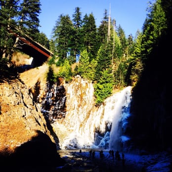
Came here on a late November afternoon for a short hike. The road getting here was so icy we almost died at least twice. We thought about turning around but I'm so glad we made it! (Shoutout to the nice driver behind us who helped push our car and explained to us newbie Californians how to deal with ice on the road!) This 2-mile roundtrip trail runs alongside a creek with gorgeous colors in the water when the sunlight hits it just right. It is a fairly easy and dog-friendly hike. However, the trail is mostly covered and it was about 27 degrees out when we went, so there were definitely some icy patches on the stairs (be careful)! But the formations of the frozen patches of the water, the icicles along the side of the trail, and the rushing water of the falls at the end were so worth it! Definitely recommend! read more

11 years ago
Easy two miles roundtrip! Great for kids, as well. Along the Snoqualmie region and NW Forest Pass is required. Perfect hiking trail for any hiker looking for something easy and breathtaking! Coming from Denny Creek Campground, it should be on the left side of the area. You will see an entrance, and it's to the right heading up. (No sign of Franklin Falls) The falls itself is so beautiful--there's a log where you just sit and just watch and listen to the falls. You can take a dip but the water was freezing cold! There's a parking lot that can hold up to 15 cars, so come early to ensure a parking spot! Coordinates: 47.4130,-121.4416 read more


10 years ago
I/we are from the Seattle area, however today was my/our first trip to Franklin Falls! It was awesome! I am a novice hiker and will turn 60 this year. It was pretty much a piece of cake! It was my 33 yr old daughter, 15 yr old daughter, 12 yr old g'daughter and 4 yr old g'son. We all loved it. My g'son who is very tiny loved it! He never complained once (and neither did I...LOL). We did not follow the driving directions given by google as I read the reviews on here and just took Exit 47 off of I-90 and the rest was very easy. We were lucky and did find parking in the little lot which hold about 15 cars. We were not prepared for all the snow, ice and rain, but it didn't stop us at all. The trail was full of snow/ice as well as it was beginning to rain off and on. We didn't let it hold us back. We made it all the way to the waterfall and then right when we turned around to come back it started to rain rather hard. There were definitely some very slippery spots, as well as many trees which had fallen down recently across the path/trail, however I was already prepared to take a tumble or two! (LOL) I think everyone of us were shocked I did NOT fall. We are already talking about our next trip to Franklin Falls. We hope the next time we go (in 3-4 weeks), the snow will be gone and it won't be raining. I would most definitely recommend this hike/trail to any/everyone! It's beautiful! It's also the perfect hike/trail for everyone whether you are a beginner or experienced hiker. It's gorgeous and breathtaking! p.s. I noticed other's on here mentioned needing to pay/buy a $5 day pass. We did NOT! There was a sign right before the entrance which said, "Closed for the Winter...Enjoy your hike!" read more


Me and my boyfriend left Seattle at 6:30am today (Sunday, January 14, 2018) and got to the trailhead around 7:30am. We took exit 47, made a left off the exit, and then a right following signs to Franklin Falls. We drove about 1 minute till we reached the gate(closed) which takes you to Denny Creek Campground. We made a U turn and parked right next to the gate with the head of the car facing the way we came in(recommended!). This is because we knew there would be ALOT of people when we came back, so we wanted an easier getaway. 3 cars were already there when we arrived and 3 more cars showed up as we were getting ready to hit the trail. From the gate, you walk about 2 miles on a paved road to the trailhead of Franklin Falls. The 2 miles is pretty easy since the road is paved and there is little to no incline. You will pass a few cabins along the way, hear cars go by on the I-90W to your left, and see the South Fork Snoqualmie River on your right. However, the road is icy so around 1 mile in (where the bridge is at) we put on our traction cleats (Yaktrax Walk Traction Cleats for Walking on Snow and Ice. https://www.amazon.com/dp/B0094GO9DA?ref=yo_pop_ma_swf). Once you hit the campground, you have the option to go strait or left. Take a left and you will pass a bathroom and the trail's parking lot covered in snow. The trail is to the right of the parking lot ( you will see a sign that points you in the direction of Franklin Falls 1 mile away). The trail itself is well maintained (with rails at dangerous parts) and heavily trafficked, as there is only 1 path that you really follow. It is pretty packed down from all the hikers as the snow is brown. Endure a bit of cold and elevation and you will be greeted with an amazing winter wonderland view. To get to the Falls at the last bit of the hike, you have to go down a short (single file line here!) icy slope. Traction really helped here as I saw people without them struggle, even with trekking poles. We quickly snapped some pictures and made our way back as my fingers started to freeze. We saw SO MANY people on our way back that we just knew there had to be a lines at the falls forming. By the time we were back at our car around 10:30, the entire road was filled with cars and people were fighting for spots. You can just tell it was no bueno. Tips: 1. Go early.. honestly 7:30am was perfect, and park facing the exit for a quick escape :) 2. Traction cleats are not a must, but they help a great deal. Can't imagine how much I would struggle without them. read more


A really nice place that a number of assclowns took some effort to ruin. Bags of animal fecal manner on the trail. Toilet paper on the trail covered in flies. Kid's snack wrappers all over the place.. crowing this was a full baby diaper at the bottom of the falls. I don't think this was one party.. It's a number of inconsiderate people doing the same thing.. It's just too short and easy of a hike such that the average person can access the location. The falls are pretty, albeit right under I-90 so there is also a considerable amount of road noise.. in the rain, I would assume there would be splash from vehicles as well. Not going back unless someone forces me. read more


8 years ago
Did the "hike" to Franklin Falls and I'd definitely call it more of a casual walk than hike. So easy that it's age appropriate for everyone. It was beautiful and peaceful with a well maintained path. Highly suggest coming on a weekday so you can get more private time on the trail and at the waterfall. Water level was really low today but hopefully will fill up a bit once this week of rain comes. Recommend this short trail for hiking beginners and families with young kids. read more
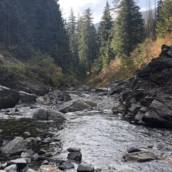
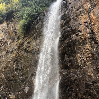

I'm from California, currently living in TX. We came to Seattle for the weekend and I wanted to see a waterfall. I yelped a few and this one came up as one of the closest one to where we were staying. I wanted an easier hike since the other person coming with me is not very adventurous.. I absolutely LOVED this hike, there was a bit of snow on the hike but the weather was perfect. The waterfall was so pretty. I'll definitely come back to this waterfall again. LOVED it. read more


10 years ago
Pros- Perfect for beginners. I would say this is my 4th hike in my life (snoqualmie falls, diamond head in Oahu, HI, and rattle snake ridge) A trail that leads to a waterfall that you can be very up close and personal. If you take a leisure stroll, it may take you 45 minutes each way. It took us longer because we had a 20 min lunch by the waterfall to enjoy the view. I was anticipating to be sore the next day and I wasn't. Next time I will definitely bring my 7 year-old child. We'll see how she does. Con- parking can be difficult if you come on a busy day. We got there at 10:30am, found parking right next to the trail. If we had come late or come on a warm Sunday day, we would have to park further then walk quite a ways to reach the trail. read more


11 years ago
The 2.4 mile path to the trailhead after exiting I-90 had a thin layer of compacted snow and is a bit narrow. Though I was able to safely arrive at the trailhead in a Honda Accord (front wheel drive), I would highly recommend chains, snow-tires or an AWL vehicle. We started our hike around 11am, and were on of the first visitors or the trail so by the time we finished and headed back, the dozens of cars after us managed to turn the snow into slosh so we felt much more comfortable leaving. If you are planning an afternoon hike, you'll probably be able to get away with a front wheel drive vehicle. The path itself was gorgeous. We encountered a few icy patches along the way and I even slipped twice and fell flat on my bum -__-. But have no fear, it was 90% my clumsiness. The iciest and scariest part was the slight downgrade to the waterfall. It's a pretty narrow path alongside the rocks and one slip could land you 6 ft below on the ice. I had trouble with this part, but later I saw an little girl...maybe 8 years old run down the path. It was about 26 degrees at the trailhead, but clothed in my nike dri-fit tights, with a pair of thermal running pants over and a Northface snowboarding jacket, I managed to stay warn. I'd recommend hiking boots, something with a larger footprint but I also saw hikers in Nike frees that made it. So to each their own I suppose. Overall, absolutely gorgeous hike. What should have taken about an hour, took my boyfriend and I close to two because of the countless pictures we took. read more
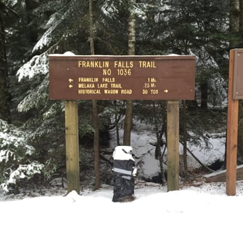


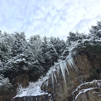

10 years ago
[Hiked on 01/14/16] This hiking trail was my first snow hike as well as my first snow experience. I moved to WA recently from Hawaii so I wanted to try something different. First off, let me say that if you're gonna come here during the winter, definitely use a car that can drive through snow or at least have chain for your tires. Of course the idiot island girl would drive her front-wheel drive car in the snow. LOL. Long story short, I got stuck in the snow but people hiking the trail was kind enough to help me push my car out the snow. Now I know... Anyways, this hike was fairly short. Since there was snow, we actually had to hike to the trail head. About a mile to the trail head and a mile to the falls. All-in-all, this hike is fairly easy. I was unprepared to hike in the snow (I wore jeans and knock-off Timberlands haha). I honestly thought there wasn't going to be much snow b/c I left home on a really sunny day probably at mid-50 degrees so I didn't think much of suiting up for the snow. I've never been to Snoqualmie area either so of course I didn't think much of it. Boy was I wrong. I'm glad that there was a guy (the one who helped me push my car out the snow) actually had extra spikes for my boots so it made hiking in snow sooo much easier. He recommended REI for my hiking needs especially when it comes to hiking in snow. The trail was beautiful. I felt like I was in a winter wonderland. There were cottages along the trail buried in snow; it was perfect for photo ops. The falls are beautiful! There were huge icicles that surrounded the falls. I can't imagine how that place would look during the summer time. If you're looking for a short & easy hike but with a big reward, this hike is for you! read more


10 years ago
So, we finally went there last Sunday. Do not follow the direction you have if you search for Franklin Falls from you google map. Take the direction from their website. Maybe because it is still early spring and we had a lot of snow over the winter, the path was still covered with snow when we went. But no worries, they are melting. Meanwhile, if you are not careful with your steps, you could really slip or stomp onto some of the really big holes since the snow is melting. Anyhow, the hike is east with not too much elevation at all. Very family friendly, take your kids with you definitely! read more


What a fun summer hike! I'll be the first to admit I'm out of shape and I've just gotten back into the hiking game after having a spinal surgery and a foot surgery. Ugh! But I was able to complete this hike with no issues and it was gorgeous along the way! It's 1.2 miles each way and there's only about 400 feet elevation gain, so it's great for beginners or those with pets or children. I saw a lot of both on the trail. **Be cautious for sharp, uneven rocks on some parts. The falls at the end are absolutely gorgeous and we happened to be there when the water was really low, so there's a ton of rocks you can sit on and enjoy a picnic lunch. Most of the trail is shaded so it's cool even on a hot day. Even though it's not a long, steep trail, I still think it's a gorgeous place that almost anyone would enjoy! read more


9 years ago

Great PNW day trip. I would recommend for all ages. Please keep in mind this is a hike and dress accordingly. Once you reach the falls the rocks are slippery and if you plan on getting close to the falls for a great shot you my get your feet wet. I plan on returning again with other family members and it friends. Absolutely stunning natural landscape, easy access and easy hike. Some inclines and a few fallen tree you will need to go over, under or around but not with much difficulty. Some areas have a steep open drop overlooks. So keep kids and animals close. read more

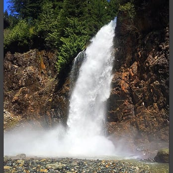


More info about Franklin Falls Trailhead
Denny Creek Campground
North Bend, WA 98045
Directions
(206) 625-1367
Call Now
Visit Website
http://www.wta.org/go-hiking/hikes/franklin-falls
Hours
Indoor Amenities
Outdoor Amenities
Other Amenities
Ask the Community - Franklin Falls Trailhead
Do they require parking pass or something if you're just going to pull over on the road?
Can I bring a baby?
Yes. There are some steep hills and cliffs but most of them have railings.
Review Highlights - Franklin Falls Trailhead
You might also consider














Why does Yelp recommend reviews?
1 review that is not currently recommended
The reviews below are not factored into the business's overall star rating.
12 years ago
Franklin Falls Trailhead - hiking - Updated May 2026
Best of North Bend
People found Franklin Falls Trailhead by searching for…
Sledding in North Bend, Washington
Hiking Trails With Waterfalls in North Bend, Washington
Lakes in North Bend, Washington
Things to Do in North Bend, Washington
Swimming Holes in North Bend, Washington
Cliff Jumping in North Bend, Washington
Parks in North Bend, Washington
Long Term Rv Parking in North Bend, Washington
Places to Take Pictures in North Bend, Washington
Snow Play in North Bend, Washington
Swimming Lakes in North Bend, Washington
River Swimming in North Bend, Washington
Scenic View in North Bend, Washington
Scenic Drive in North Bend, Washington
Picnic Areas in North Bend, Washington
Photo Spots in North Bend, Washington
Stairs Workout in North Bend, Washington
Easy Hikes in North Bend, Washington
Scenic Spots in North Bend, Washington
Dog Friendly Things to Do in North Bend, Washington
Rv Campgrounds in North Bend, Washington
Breakfast in North Bend, Washington
Trending Searches in North Bend, WA
Boat Rental near Franklin Falls Trailhead
Botanical Gardens near Franklin Falls Trailhead
Bounce House Rentals near Franklin Falls Trailhead
Cabins near Franklin Falls Trailhead
Campgrounds near Franklin Falls Trailhead
Cherry Picking near Franklin Falls Trailhead
Cliff Jumping near Franklin Falls Trailhead
Communal Shower near Franklin Falls Trailhead
Crabbing Location near Franklin Falls Trailhead
Dog Friendly Things To Do near Franklin Falls Trailhead
Flower Fields near Franklin Falls Trailhead
Flower Shop near Franklin Falls Trailhead
Garage Sales near Franklin Falls Trailhead
Hair near Franklin Falls Trailhead
Lakes near Franklin Falls Trailhead
Long Term Rv Parking near Franklin Falls Trailhead
Nurseries & Gardening near Franklin Falls Trailhead
Outdoor Activities near Franklin Falls Trailhead
Outdoor Furniture Stores near Franklin Falls Trailhead
Party Equipment Rentals near Franklin Falls Trailhead
Pedicure near Franklin Falls Trailhead
Pick Your Own Farms near Franklin Falls Trailhead
Picnic Areas near Franklin Falls Trailhead
Places To Walk Around near Franklin Falls Trailhead
Rainy Day Activities near Franklin Falls Trailhead
River Tubing near Franklin Falls Trailhead
Rock Quarry near Franklin Falls Trailhead
Running Trails near Franklin Falls Trailhead
Rv Dump Station near Franklin Falls Trailhead
Scenic Drive near Franklin Falls Trailhead
Secret Spots near Franklin Falls Trailhead
State Parks near Franklin Falls Trailhead
Strawberry Picking near Franklin Falls Trailhead
Sunrise View near Franklin Falls Trailhead
Swimming Holes near Franklin Falls Trailhead
Trail near Franklin Falls Trailhead
Browse Nearby
BEST of North Bend, Washington Coffee near Franklin Falls Trailhead
BEST of North Bend, Washington Restaurants near Franklin Falls Trailhead
BEST of North Bend, Washington Breakfast near Franklin Falls Trailhead
BEST of North Bend, Washington Campgrounds near Franklin Falls Trailhead
BEST of North Bend, Washington Hotels near Franklin Falls Trailhead
Browse Brands
Related Cost Guides
Related Searches in North Bend, WA
Affordable Kayak Rental Services in North Bend, Washington
Affordable Long Term RV Parking in North Bend, Washington
Best Day Camps for Children in North Bend, Washington
Best Fishing Locations and Guides in North Bend, Washington
Best Nature Trails for Hiking in North Bend, Washington
Best Places for Horseback Riding in North Bend, Washington
Best Summer Camps for Kids Located in North Bend, Washington
Browse Charming Cabins in North Bend, Washington
Browse Top Hotels in North Bend, Washington for Your Stay
Browse Vacation Rentals to Book in North Bend, Washington
Check Out Off Road Trails in North Bend, Washington
Discover Dog Friendly Trails to Explore in North Bend, Washington
Discover Free Campgrounds in North Bend, Washington Area
Discover Scenic Beach Camping Sites in North Bend, Washington
Discover Scenic Mountain Bike Trails Near North Bend, Washington
Discover Scenic Waterfall Spots in North Bend, Washington
Discover Top Nature Parks to Visit in North Bend, Washington
Discover Top State Parks to Visit in North Bend, Washington
Discover Walking Parks in North Bend, Washington Near You
Discover a Hiking Trail in North Bend, Washington
Discover the Best Beaches in North Bend, Washington
Discover the Best Night Hike Trails in North Bend, Washington
Dog-Friendly Hikes With Dogs in North Bend, Washington
Enjoy Camping Adventures Around North Bend, Washington
Enjoy Exciting Mountain Biking Adventures in North Bend, Washington
Enjoy Hiking Adventures in North Bend, Washington
Enjoy Kayaking Adventures in North Bend, Washington
Enjoy RV Camping Adventures in North Bend, Washington
Enjoy Tent Camping Spots Around North Bend, Washington
Enjoy a Beautiful Waterfall Hike in North Bend, Washington
Enjoy the Best Picnic Spots and Ideas in North Bend, Washington
Enjoy the Best Walking Path in North Bend, Washington
Enjoy the Best Walking Trails in North Bend, Washington
Experience Thrilling White Water Rafting in North Bend, Washington
Explore Beautiful Parks and Green Spaces in North Bend, Washington
Explore Easy Hikes Perfect for All in North Bend, Washington
Explore Fun Activities to Do in North Bend, Washington
Explore Mobile Home Parks in North Bend, Washington Now
Explore Popular Campgrounds Near North Bend, Washington
Explore Popular Picnic Areas Around North Bend, Washington
Explore Scenic Lakes to Visit in North Bend, Washington
Explore Summer Camps for All Ages in North Bend, Washington
Explore Top Dog Parks in North Bend, Washington Near You
Explore Top Tent Campgrounds Near North Bend, Washington
Explore Top Water Parks in North Bend, Washington Today
Explore the Best Beach Spots in North Bend, Washington
Explore the Best Swimming Holes Around North Bend, Washington
Explore the Best Trail Options in North Bend, Washington


