Brown's Ranch Trailhead Photos


More like Brown's Ranch Trailhead
Recommended Reviews - Brown's Ranch Trailhead
Start your review...

Reviews With Photos

Mountain biking fast flow, furious fun, fly free like a bird FFFFFFLAB! Trails really rolly- poly, nice packed DG. Seems like I'm always accelerating because you blast a short decent and fly with a little pedal power up and down, short ascent - makes complete sense. This is one of the best places to MTB. Ride on challenging Snake Eyes and Scorpion, black diamond trails. Weave your way through large boulder fields, roll clip and plop over, up and down - steep rock slabs, vertical drops, narrow slots and protruding rocks. Pick the right line, you'll be fine. If not crash and burn. Trails for all levels. Lots of hiking too

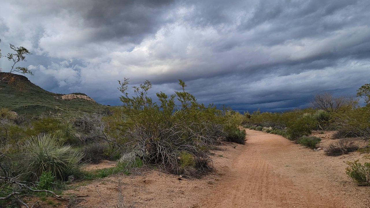
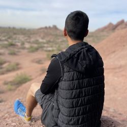
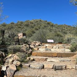
Exploring a new to me trail in the valley, we headed out to the McDowell Sonoran Preserve and headed out on Brown's Ranch Trailhead to go up Brown's Mountain. There is plenty of signage letting you know what trail you are on, or where to go if traversing onto a different trail. For this we took Brown's Ranch Trailhead to the sign that said Brown Mountain Trial, then we turned left and started our way. Once your on Brown Mountain Trail you will start climbing up, you gain anywhere between 500 to 650ft elevation gain. When your more than 1/2 way up, there is a little bit of a clearances, you can take in the views, rest for a minute. You also will see the sign pointing to the summit, this is where you will have the most incline. For me this trail was moderate. After we climbed down, we continued along Brown's Ranch Trailhead to finish the loop. Love that the McDowell Sonoran Preserve has so much to explore!


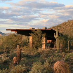
Love walking here! It's dog and horse friendly! Be aware they change the park hours to reflect sunrise and sunset. It's located in North Scottsdale. Crossroads are Alma School and Dynamite. Bathroom and water Fountains available at the trailhead. Lots of car and horse trailer parking. Mountain biking can also be done here. Check out the trail map at trailhead for unlimited possibilities.


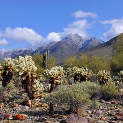
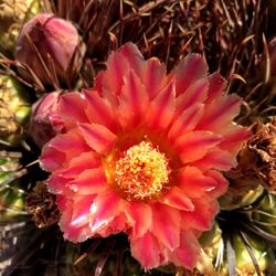
I consider this a family friendly hike. Most of the trail is a "sandy" texture. I suggest bringing BUG spray (especially if hiking in the evening) we had a swarm of gnats/random bugs surrounding us. Nature at its finest: Bunnies Quail Little snakes Wildflowers Saguaros This trail is also good for mountain bikes & trail running. Approx 3 miles out & back. (Brown's Summit)

This is the perfect desert landscape with plenty of saguaros and desert flora and fauna however most of the time you're either hiking along or looking at powerlines so be prepared that it does seem like you're in the middle of nowhere (once you pass through the neighborhood) but you're constantly reminded of the city. Also there are nonstop bikers on the path and though there are signs telling them to slow down and be cautious of hikers they zoom right by you. If you do hike with your dog this is definitely something to be aware of.


3 months ago
Easy to park and easy to navigate to multiple trailheads. The building is well maintained. We took a couple of different trails and they were all marked clearly and had no issues. Take lots of water, minimal shade. read more


Mountain biking fast flow, furious fun, fly free like a bird FFFFFFLAB! Trails really rolly- poly, nice packed DG. Seems like I'm always accelerating because you blast a short decent and fly with a little pedal power up and down, short ascent - makes complete sense. This is one of the best places to MTB. Ride on challenging Snake Eyes and Scorpion, black diamond trails. Weave your way through large boulder fields, roll clip and plop over, up and down - steep rock slabs, vertical drops, narrow slots and protruding rocks. Pick the right line, you'll be fine. If not crash and burn. Trails for all levels. Lots of hiking too read more


Exploring a new to me trail in the valley, we headed out to the McDowell Sonoran Preserve and headed out on Brown's Ranch Trailhead to go up Brown's Mountain. There is plenty of signage letting you know what trail you are on, or where to go if traversing onto a different trail. For this we took Brown's Ranch Trailhead to the sign that said Brown Mountain Trial, then we turned left and started our way. Once your on Brown Mountain Trail you will start climbing up, you gain anywhere between 500 to 650ft elevation gain. When your more than 1/2 way up, there is a little bit of a clearances, you can take in the views, rest for a minute. You also will see the sign pointing to the summit, this is where you will have the most incline. For me this trail was moderate. After we climbed down, we continued along Brown's Ranch Trailhead to finish the loop. Love that the McDowell Sonoran Preserve has so much to explore! read more


6 months ago
2 years ago
Great flowy fun gravel for a mountain bikers and mountain hikers it has vistas and wildlife, closes at sunset! Enjoy this treasure! read more


Love walking here! It's dog and horse friendly! Be aware they change the park hours to reflect sunrise and sunset. It's located in North Scottsdale. Crossroads are Alma School and Dynamite. Bathroom and water Fountains available at the trailhead. Lots of car and horse trailer parking. Mountain biking can also be done here. Check out the trail map at trailhead for unlimited possibilities. read more


I consider this a family friendly hike. Most of the trail is a "sandy" texture. I suggest bringing BUG spray (especially if hiking in the evening) we had a swarm of gnats/random bugs surrounding us. Nature at its finest: Bunnies Quail Little snakes Wildflowers Saguaros This trail is also good for mountain bikes & trail running. Approx 3 miles out & back. (Brown's Summit) read more


2 years ago
4 years ago
Business owner information
Kelly C.
Beautiful photo, Katherine -- thanks for sharing!
2 years ago
This is the perfect desert landscape with plenty of saguaros and desert flora and fauna however most of the time you're either hiking along or looking at powerlines so be prepared that it does seem like you're in the middle of nowhere (once you pass through the neighborhood) but you're constantly reminded of the city. Also there are nonstop bikers on the path and though there are signs telling them to slow down and be cautious of hikers they zoom right by you. If you do hike with your dog this is definitely something to be aware of. read more


3 years ago
Love this place! Super clean and peaceful the staff of volunteers is friendly and helpful. It is a great place for people of all skill levels. read more


6 years ago
First hike there on Monday and wow, it's now my favorite! Even the drive there was beautiful let alone the hike. Awesome sahuaro, rock formations, and endless trail options. And the trailhead is the nicest I've seen with quality bathrooms. Can't wait to go back! read more


Rented mountain bikes for my birthday weekend and were recommended this trails here as a beginner friendly. Sure enough, we had an amazing time. Starting with the Upper Ranch Trail and cutting through Brown's Ranch Road, we crossed the Corral Trail and ventured over to Cathedral Rock. On our way back to the trailhead, I heard the hissing of a snake in one of the bushes as we rode by on a narrow trail off of Maverick Trail. Well, that scared me silly but fortunately we were towards the end of the ride. Overall beautiful views and well maintained trails. Hope to return soon. read more


3 years ago
We have visited this trailhead several times now, both to hike, ride our mountain bikes, and walk our two labrador retrievers. This is a beautiful park with plenty of trail options, from mild to fast n' wild. We have also been blown away with the wildlife here...coyotes, rattlesnakes, and even a lone Gila Monster have all been spotted here. The plentiful Saguaro (pronounced sew-wahr-oh) cacti act as natural sentinels, guarding creatures large and small. For great trail info when biking here, visit either the Trailforks or MTBproject apps on your PC or smartphone. The main trailhead access is off of Alma School road, and winds through affluent neighborhoods before t-ing off at the parking lot. Plenty of parking awaits you, especially during the busy months in fall/winter/and spring seasons. Bring plenty of water, and be careful of your pups paw pads...all trails here are full exposure. Pack sunscreen as well. Best time to come is when a Monsoon has just passed, cooling temps by 10 degrees and tacking up the trial surface. Great for hooking up those knobby tires. Remember if your biking to walk your bike through the main trailhead structure. Cyclists yield to all here, as equestrians and hikers are abundant on weekends. Pack a bear bell for the ultimate in consideration to your fellow park users. The main kiosk features clean bathrooms and plenty of shade for a post hike/run stretch. Lots of trash cans too, so remember to pack out those gel packs you used and drop them here before you leave. Well maintained and centrally located, this is an excellent spot to get your sweat on with dusty feet, handlebars, or leashes. We will be back.. read more


5 years ago
4 years ago
One of my favorite places I took my horse to ride in Arizona!!! Plenty of horse trailer parking - m read more

8 years ago
4 years ago
Found this place by accident when attempting to go to Pinnacle Peak. There are many different trails to choose from, from a quick easy stroll to several miles. It's fantastic for mountain bikers and hikers alike, some even bring their horses. It's far less congested than Pinnacle Peak, and there's plenty of good parking. It's very picturesque, so take your time here and enjoy the beautiful surroundings. read more


4 years ago
11 years ago
7 years ago
Amazing view from up top. Trails are well laid out, junctions are clearly labeled. The trail is actually good for both hiking or running if you skip the spur to the summit. I had a great hike: would definitely visit again. read more


11 years ago
My son & I loved this trail! Friendly volunteers who showed us different trails that they recommend. Ample parking & 5 star bathrooms. Great for mountain biking too. We will bring our bikes in the future. There are plenty of trails to choose from with varying degrees of flat to hilly so not a tough but good workout. Bonus is the beautiful scenery! Enjoy your hike this is a true gem! read more


4 years ago
11 years ago
10 years ago
What I love about this place is that if you want a short or a long hike, grueling or just enjoying the scenery, this the place to go. Doesn't hurt that it is 3/4 mile from my house. They always have guide volunteers on hand to direct you to the right trail and maps to go along with the hike. Beauty all around. Give it a try. read more


Pretty desert scenery! Free ample parking and the trails are very well marked. The trailhead has a lot of information about the area and there are bathrooms. Trails have varying degrees of difficulty. We hiked around the cone mountain trail, which circles around cone mountain so it is fairly flat, about 4 miles round trip. Bring water! The sun gets hot if you are out there after 10am. read more

Page 1 of 2
More info about Brown's Ranch Trailhead
30301 N Alma School Pkwy
Scottsdale, AZ 85262
Directions
(617) 724-3466
Call Now
Visit Website
http://www.mcdowellsonoran.org
Hours
Indoor Amenities
Outdoor Amenities
Ask the Community - Brown's Ranch Trailhead
Review Highlights - Brown's Ranch Trailhead


Why does Yelp recommend reviews?
1 review that is not currently recommended
The reviews below are not factored into the business's overall star rating.
1 year ago
Brown's Ranch Trailhead - hiking - Updated May 2026
Best of Scottsdale
People found Brown's Ranch Trailhead by searching for…
Horseback Riding in Scottsdale, AZ
Scenic Drive in Scottsdale, AZ
Sunrise View in Scottsdale, AZ
Scenic Overlook in Scottsdale, AZ
Sunrise Hike in Scottsdale, AZ
Hiking Trails in Scottsdale, AZ
Dog Friendly Parks in Scottsdale, AZ
Flower Fields in Scottsdale, AZ
Paved Walking Trails in Scottsdale, AZ
Lookout Points in Scottsdale, AZ
Hiking With Kids in Scottsdale, AZ
Off Road Trails in Scottsdale, AZ
Dog Friendly Hiking Trails in Scottsdale, AZ
Dog Friendly Things to Do in Scottsdale, AZ
Things to Do in Scottsdale, AZ
Visitor Centers in Scottsdale, AZ
Waterfall Hike in Scottsdale, AZ
Trending Searches in Scottsdale, AZ
Boat Rental near Brown's Ranch Trailhead
Botanical Gardens near Brown's Ranch Trailhead
Bounce House Rentals near Brown's Ranch Trailhead
Campgrounds near Brown's Ranch Trailhead
Cheap Plants near Brown's Ranch Trailhead
Cherry Picking near Brown's Ranch Trailhead
Cliff Jumping near Brown's Ranch Trailhead
Dog Friendly Trails near Brown's Ranch Trailhead
Flower Fields near Brown's Ranch Trailhead
Flower Shop near Brown's Ranch Trailhead
Free Picnic Areas near Brown's Ranch Trailhead
Garage Sales near Brown's Ranch Trailhead
Garden Center near Brown's Ranch Trailhead
Hiking near Brown's Ranch Trailhead
Lakes & Ponds near Brown's Ranch Trailhead
Lookout Points near Brown's Ranch Trailhead
Nurseries & Gardening near Brown's Ranch Trailhead
Outdoor Activities near Brown's Ranch Trailhead
Outdoor Furniture Stores near Brown's Ranch Trailhead
Parks near Brown's Ranch Trailhead
Party Equipment Rentals near Brown's Ranch Trailhead
Pedicure near Brown's Ranch Trailhead
Photo Spots near Brown's Ranch Trailhead
Picnic Areas near Brown's Ranch Trailhead
Places To Take Pictures near Brown's Ranch Trailhead
Rock Quarry near Brown's Ranch Trailhead
Running Trails near Brown's Ranch Trailhead
Rv Rental near Brown's Ranch Trailhead
Scenic Drive near Brown's Ranch Trailhead
Scenic Night View near Brown's Ranch Trailhead
Secluded Spots near Brown's Ranch Trailhead
Star Gazing near Brown's Ranch Trailhead
Sunrise View near Brown's Ranch Trailhead
Swimming Holes near Brown's Ranch Trailhead
Table And Chair Rentals near Brown's Ranch Trailhead
Walking Trails near Brown's Ranch Trailhead
Browse Nearby
BEST of Scottsdale, Arizona Restaurants near Brown's Ranch Trailhead
BEST of Scottsdale, Arizona Coffee near Brown's Ranch Trailhead
BEST of Scottsdale, Arizona Things to Do near Brown's Ranch Trailhead
BEST of Scottsdale, Arizona Breakfast near Brown's Ranch Trailhead
BEST of Scottsdale, Arizona Gyms near Brown's Ranch Trailhead
BEST of Scottsdale, Arizona Hotels near Brown's Ranch Trailhead
Browse Brands
Related Searches in Scottsdale, AZ
Affordable Bike Repair Services in Scottsdale, Arizona
Affordable Bike Tune Up Services in Scottsdale, Arizona
Affordable Kayak Rental Services in Scottsdale, Arizona
Affordable Mobile Bike Repair in Scottsdale, Arizona
Best Dog Hiking Trails Around Scottsdale, Arizona
Best Electric Bike Rental Services in Scottsdale, Arizona
Best Fishing Locations and Guides in Scottsdale, Arizona
Best Nature Trails for Hiking in Scottsdale, Arizona
Best Places for Horseback Riding in Scottsdale, Arizona
Best Places to Sell Used Bike in Scottsdale, Arizona
Best Used Bikes for Sale Near Scottsdale, Arizona
Best Waterfalls and Swimming Holes in Scottsdale, Arizona
Check Out Off Road Trails in Scottsdale, Arizona
Discover Dog Friendly Trails to Explore in Scottsdale, Arizona
Discover Popular Bike Tours in Scottsdale, Arizona
Discover Popular Bike Trails in Scottsdale, Arizona
Discover Scenic Bike Paths in Scottsdale, Arizona
Discover Scenic Mountain Bike Trails Near Scottsdale, Arizona
Discover Scenic Walking Paths in Scottsdale, Arizona
Discover Scenic Waterfall Spots in Scottsdale, Arizona
Discover Top Nature Parks to Visit in Scottsdale, Arizona
Discover Walking Parks in Scottsdale, Arizona Near You
Discover the Best Night Hike Trails in Scottsdale, Arizona
Discover the Best Running Track in Scottsdale, Arizona
Enjoy Camping Adventures Around Scottsdale, Arizona
Enjoy Exciting Mountain Biking Adventures in Scottsdale, Arizona
Enjoy Hiking Adventures in Scottsdale, Arizona
Enjoy Kayaking Adventures in Scottsdale, Arizona
Enjoy River Tubing Adventures in Scottsdale, Arizona
Enjoy Tent Camping Spots Around Scottsdale, Arizona
Enjoy a Beautiful Waterfall Hike in Scottsdale, Arizona
Enjoy a Scenic Walk in Scottsdale, Arizona
Enjoy the Best Tubing Experiences in Scottsdale, Arizona
Enjoy the Best Walking Trails in Scottsdale, Arizona
Exciting Cliff Jumping Spots in Scottsdale, Arizona
Experience Thrilling White Water Rafting in Scottsdale, Arizona
Experience the Thrill of Road Bike Rental in Scottsdale, Arizona
Explore BMX Bike Shops Near Scottsdale, Arizona
Explore Beautiful Parks and Green Spaces in Scottsdale, Arizona
Explore Bike Rentals Throughout Scottsdale, Arizona
Explore Easy Hikes Perfect for All in Scottsdale, Arizona
Explore Electric Bikes Available in Scottsdale, Arizona
Explore Fun Activities to Do in Scottsdale, Arizona
Explore Popular Campgrounds Near Scottsdale, Arizona
Explore Popular Scenic Overlook Points in Scottsdale, Arizona
Explore Scenic Lakes to Visit in Scottsdale, Arizona
Explore Secret Spots Worth Visiting in Scottsdale, Arizona
Explore the Best Beach Spots in Scottsdale, Arizona
Browse Articles
People who viewed Brown's Ranch Trailhead also viewed
Adero Canyon Trailhead
6 reviews
Lost Dog Wash Trail
93 reviews
Spur Cross Ranch Conservation Area
51 reviews
Reach 11 Recreation Area
19 reviews
Black Mountain Summit Trail
31 reviews
Needle Rock Rec Site
2 reviews
Granite Mountain Trailhead
11 reviews
DC Desert Parks Ranch
3 reviews
Desert Hills Trailhead
4 reviews
Arizona Horse Lovers Park
5 reviews