Veterans Park Trail Photos


You might also consider
More like Veterans Park Trail
Recommended Reviews - Veterans Park Trail
Start your review...

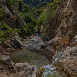
Such a great hiking trail! There's different trails to take depending if you want to climb the mountain or walk up the pavement. Definitely recommend everyone trying it at least once! It is a tricky/ harder trail than just a regular hiking trail, but very fun to say you did it! read more

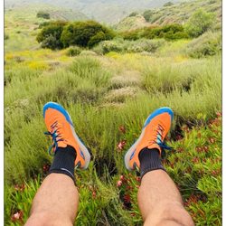
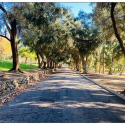
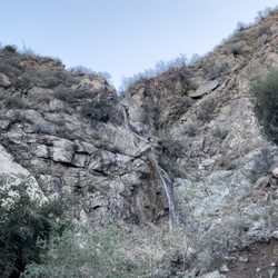
May Canyon Truck Trail is a popular 7.4-mile ridge loop hiking trail adjacent to the Veterans Regional Park in Sylmar, CA. There are two sections getting into the summit highest peak: (1) the paved truck road trail, and (2) taking the dirt trail with extremely steep. This trail is generally considered a challenging route, but very doable. Trail is dog friendly. The top of the ridge has an elevation of 2,280 ft and people generally take 3 1/2 hours to complete. As an experienced hiker, I took the challenging route trail which has extremely steep incline. My leg core, stamina, cardio endurance and balance were challenged. However, it was worth it especially once you reached the top b/c the view was breathtaking. Moreover, there is little to no tree shade on these trails. And if the weather is warm bring plenty of water, sunscreen, hat and long sleeves. It can easily get hot even if the weather high forecast is 74 F degree. I completed the loop trail and it took me close to 3 hrs with a few rest stops along the way. As for parking, you can park on the street or at the Veterans Regional Park lot. Overall, I enjoyed this trail. I recommend it. read more
More info about Veterans Park Trail
May Canyon TKTR
Newhall, CA 91321
Directions
Hours
Outdoor Amenities
You might also consider


Veterans Park Trail - hiking - Updated July 2026
Best of Newhall
People found Veterans Park Trail by searching for…
Fun Things to Do in Newhall, CA
Empty Parking Lot in Newhall, CA
Free Things to Do in Newhall, CA
Beautiful Views in Newhall, CA
Parks With Shade in Newhall, CA
Public Golf Courses in Newhall, CA
Dog Friendly Hiking Trails in Newhall, CA
Places to Take Pictures in Newhall, CA
Browse Nearby
BEST of Newhall, California Things to Do near Veterans Park Trail
BEST of Newhall, California Restaurants near Veterans Park Trail
BEST of Newhall, California Coffee near Veterans Park Trail
BEST of Newhall, California Parks near Veterans Park Trail
BEST of Newhall, California Breakfast near Veterans Park Trail
BEST of Newhall, California Campgrounds near Veterans Park Trail
BEST of Newhall, California Horseback Riding near Veterans Park Trail


