Little Tujunga Canyon Photos


You might also consider
More like Little Tujunga Canyon
Recommended Reviews - Little Tujunga Canyon
Start your review...

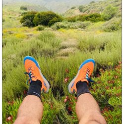
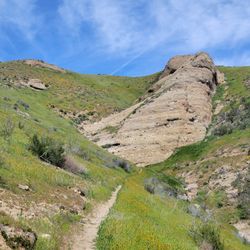
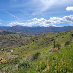
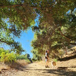
Little Tujunga Canyon is a wonderful place to hike or just relax. Part of the Angeles National Forest, make sure that you have an Adventure Pass before parking. Also make sure you check the weather forecast as this area is prone to flash flooding. read more


 - Hiking Near Me - Sunland, California")


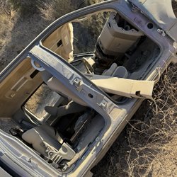
One of the filthiest parks i have seen EVER. trash everyone. People just do not care here. I can tell people just dump their car trash out the window and on the trails. Shotgun shells everywhere bullet holes on any metal you see just about. Jesus What the hell is going on here. I walked and rode my bike for 13 miles and this trash and bullet holes was consistent everywhere. I was not happy. read more


10 years ago
9 years ago
More info about Little Tujunga Canyon
8054 Le Berthon St
Sunland, CA 91040
Directions
(818) 352-9970
Call Now
Hours
Outdoor Amenities
You might also consider


Little Tujunga Canyon - hiking - Updated May 2026
Best of Sunland
People found Little Tujunga Canyon by searching for…
Beautiful Views in Sunland, California
Things to Do in Sunland, California
Hiking Trails in Sunland, California
Photo Spots in Sunland, California
Sunrise View in Sunland, California
Fishing Spots in Sunland, California
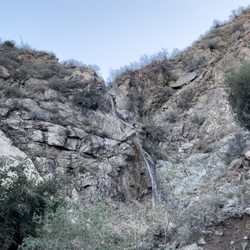
Waterfall Hike in Sunland, California
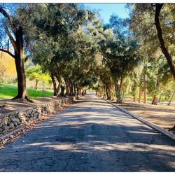
Walking Trails in Sunland, California
Night Hiking in Sunland, California
Fall Foliage in Sunland, California
Hiking Trails Kid Friendly in Sunland, California
Night View in Sunland, California
Places to Walk in Sunland, California
Places to Walk at Night in Sunland, California
Fall Colors in Sunland, California
Sunrise Hike in Sunland, California
Places to Run in Sunland, California
Browse Nearby
BEST of Sunland, California Restaurants near Little Tujunga Canyon
BEST of Sunland, California Coffee near Little Tujunga Canyon
BEST of Sunland, California Things to Do near Little Tujunga Canyon
BEST of Sunland, California Lakes near Little Tujunga Canyon
BEST of Sunland, California Parks near Little Tujunga Canyon
BEST of Sunland, California Breakfast near Little Tujunga Canyon
BEST of Sunland, California Campgrounds near Little Tujunga Canyon
BEST of Sunland, California Hotels near Little Tujunga Canyon
Browse Brands
Browse Articles
People who viewed Little Tujunga Canyon also viewed
Hansen Dam Park
62 reviews
Veterans Memorial Park
102 reviews
La Tuna Canyon Park
91 reviews
Tujunga
Aliso Canyon Park
80 reviews
Granada Hills
Plum Canyon Fire Road
4 reviews
Deukmejian Wilderness Park
99 reviews
East Walker Ranch
5 reviews
Whiting Woods Motorway
3 reviews
Veterans Park Trail
1 review
Newhall Pass Open Space
4 reviews