Lopez Canyon Park Photos


You might also consider
More like Lopez Canyon Park
Recommended Reviews - Lopez Canyon Park
Start your review...

Lopez Canyon Park lies high above Sylmar offering miles of well-maintained trails for hiking and public use. It's one of the most pristine hiking experiences near Los Angeles with fantastic views. I saw no graffiti, no trash and after just a few minutes of hiking truly felt that I was in the wild. Until.....I heard the bang! bang! bang! from the shooting range nearby. Nevertheless, it was a wonderful hiking experience and highly recommended if you're in the San Fernando Valley Area. The trail itself rises straight up but isn't too steep. After your efforts, you'll be rewarded with an all downhill experience as you return to the parking lot. Speaking of the parking lot, it is beautifully maintained and features an actual working water fountain. Open from 30 minutes after sunrise to 30 minutes before sunrise, it's maintained by the Mountains Recreation and Conservation Authority who have preserved these 125 acres of wilderness for hiking, mountain biking and equestrian use. Free. And free parking. The best things in life are free, it's true. read more


2 years ago
5 years ago
Beautiful gem tucked away in the foothills. My partner and I walked up midway on an old road that makes a great trail. There was the persistent sound of gunfire from a nearby shooting range but it sort of gives the whole spot a Wild West feeling. There were no other people on the path. Delightful! read more

5 years ago
The road up from the valley to the park is surprisingly full of large piles of rubbish, but it's worth it. The park itself is pristine, and provides a rugged landscape of dry scrub, native plants and a geology that surely tells an interesting story. It's pretty exposed to inland "Valley" heat, so wear a hat, bring water and maybe go when the highs are in the low 80s at most. We were the only hikers, but cell service was great (if we were to unexpectedly need civilization). Only complaints (beside the trash-strewn highway to the park) was that there's a gun range nearby. Not offensive or loud, but without it, there are spots where only the path itself is evidence of humans. We saw a juvenile deer, two hawks (or some kind of kite--too far away to make out features) and sounds of birds and insects, all only about 15 minutes drive from Pacoima. read more


 - Hiking Near Me - Sylmar, California")

More info about Lopez Canyon Park
You might also consider


Lopez Canyon Park - hiking - Updated May 2026
Best of Sylmar
People found Lopez Canyon Park by searching for…
Beautiful Views in Sylmar, California
Hiking Trails in Sylmar, California
Scenic Drive in Sylmar, California
Sunrise View in Sylmar, California
Walking Trails in Sylmar, California
Easy Hikes in Sylmar, California
Hidden Picnic Spots in Sylmar, California
Pump Track in Sylmar, California
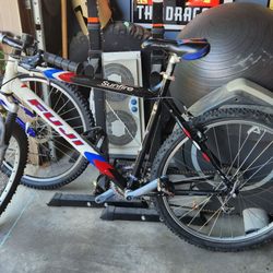
Bike Paths in Sylmar, California
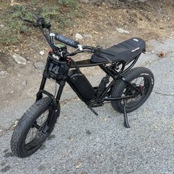
Electric Bikes in Sylmar, California
River Swimming in Sylmar, California
Running Tracks Open to the Public in Sylmar, California
Kite Flying in Sylmar, California
Bird Sanctuary in Sylmar, California
Off Road Trails in Sylmar, California
Free Parking in Sylmar, California
Scenic Night View in Sylmar, California
Picnic Areas in Sylmar, California
Places to Take Pictures in Sylmar, California
Canyoneering in Sylmar, California
Places to Walk in Sylmar, California
Browse Nearby
BEST of Sylmar, California Restaurants near Lopez Canyon Park
BEST of Sylmar, California Coffee near Lopez Canyon Park
BEST of Sylmar, California Things to Do near Lopez Canyon Park
BEST of Sylmar, California Lakes near Lopez Canyon Park
BEST of Sylmar, California Parks near Lopez Canyon Park
BEST of Sylmar, California Breakfast near Lopez Canyon Park
BEST of Sylmar, California Campgrounds near Lopez Canyon Park
Browse Brands
Browse Articles
People who viewed Lopez Canyon Park also viewed
Mario DeCampos Trail
46 reviews
Granada Hills
Bee Canyon Park
6 reviews
Granada Hills
Wilson Canyon Park
25 reviews
Sylmar
Palisades Park
9 reviews
Porter Ranch
Little Tujunga Canyon
4 reviews
Devonshire Arleta Park
8 reviews
Arleta
OAK SPRINGS
2 reviews
Sylmar
Veterans Park Trail
1 review
Colby Canyon Trail
3 reviews
Santa Susana Pass State Historic Park
28 reviews
Chatsworth