
Deukmejian Wilderness Park Photos


You might also consider


More like Deukmejian Wilderness Park
Recommended Reviews - Deukmejian Wilderness Park
Start your review...


Reviews With Photos


Great place for a hike, picnic, or just to lay on the grass. It's well maintained and fairly clean. There are restrooms and picnic tables. Only downside was I came for an event and couldn't find any parking so I had to park by the entrance and then walk up hill. On the road that leads up to the park it says No Parking yet people do it anyway.


Convenient, close by, easy/accessible parking. Wilderness trails are easy, moderate, kind of tough, etc. Not much shade on trails, so consider that during summer months. Restrooms are clean, area is well maintained, no graffiti; bring a lunch and sit at the picnic tables!


As a lifelong San Gabriel Valley resident and something of an outdoorsman, I've spent plenty of time exploring the mountains that bear the same name-- hiking, backpacking, trail-running, camping, fishing, rock-climbing, hunting, wilderness survival... you name it, I've probably done it. But then, days turn to decades, and the subtle changes of life synergize to shift our course again and again. With three kids, a bride of nearly 17 years, a mortgage, and a real job... my solo mountaineering days are postponed for a while. Instead, we spent a family Valentine's day hiking around this spot, scouting for new territory-- now, even more important that the Bobcat fire has closed most of my entry points above the SGV until at least 2022. Arriving on a beautiful Sunday after 10 AM, I figured the parking lot would be full... and I was right. Still, we did a quick loop to scope the place out, then found a parking spot on the street near the main entrance. A 0.2 mile walk up the paved road was potentially one of the steepest parts of our hike with kids today. We did a quick three mile hike through the chaparral-- enjoying the new growth of mule sage, wild buckwheat, sugar bush, oak trees, laurel trees, and a few early wildflowers. We took the Mummy Rock loop (never found the rock as far as I know,) and ended up back heading up the canyon to what seemed to be the end of that particular trail, terminating under a large oak tree near the dry creek bed. A little bench created the perfect platform for a snack and water break for the kids. The trail is a mix of hard-packed clay, decomposed granite, and quite a few loose rocks, so best to wear sturdy shoes. Not a lot of shade, either... today was cool and breezy, but I can see that this would require a nice big hydroflask or Camelback on a hot day. There also appear to be plenty of other trails to explore, with the surrounding mountains covered with switchbacks in those typical "zig-zag" patterns through the scrub. On our way out, I saw a trailhead sign for Mount Lukens... which is the mountain wayyy up there with all the radio towers on top. A hike for another day, as my youngest wasn't feeling another uphill after our short but quick climb. After your hike there are a few grassy park areas with tables and benches to enjoy a picnic, or to just relax. Plenty of folks with dogs, but not overly crowded today. Compared to places like Eaton Canyon, Millard Canyon, the Mt. Wilson trail, or Sam Merrill/Echo Mountain... this place was really not crowded. I will have to head back this way to explore more. You should too.
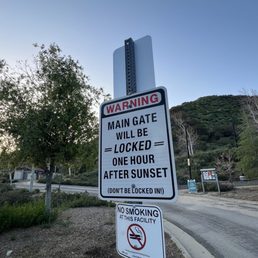

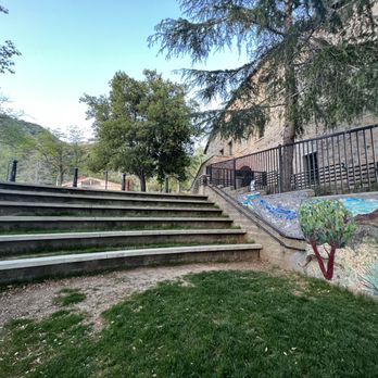
Park underwent huge renovations in recent years. We still have yet to explore the nature center but will next time. Picnicking here is peaceful and fun, there aren't any play grounds so you won't see loads of kids. The new tile mural is really cute and restroom facilities are nice. Have done several hikes here in the past year or so and not much is shaded so bring proper sun protection.


Free, nice people, good parking, grassy picnic area and nature center. Gets super hot in the summer. Variety of hikes to take. Today we brought the pooch to enjoy the creek after the big rains this year. Make sure your pooch is on its leash and please people- pick up the poop.


Great location; various levels of trails to hike; trails can be a bit rocky so wear appropriate shoes; clean restrooms; free parking lot; great views. Not a lot of shade on trail so if a sunny day a hat would be a good choice to wear. On site nature center.


I've visited this park a few times for a comfortable hike and yesterday was one of those perfect fall days where the weather was crisp and the sun was shining on you at the same time. Though not the most tamed or clear park, Deukmejian Wilderness Park provides a nice escape for people, friends and family to take a nice hike, see the valleys from a distance, watch a gorgeous sunset and have some socially distant picnics and lunches at the benches by the adjacent park. PARKING A few lots available for free


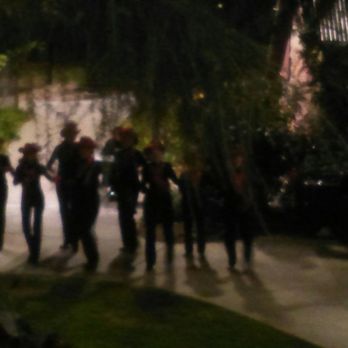
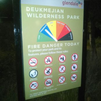
Winter Holiday Festivities at the mini amphitheatre next to the Le Mesnager "Barn" at Deukmejian Wilderness Park after 6pm on December 15, 2018. This event took place at the cold, cold 2300 foot above sea level elevation in the San Gabriel Mountains. Wonderful improvisational choir singing winter holiday traditional, folk, country, contemporary songs in tribute to Saturnalia, Bodhi Day, Xmas, Chanukkah, etc. Tap Chicks, Tap Dancing Team in Dorothy of Oz scarlet, red sequined western hats. Also wore garrison caps and khaki uniforms to do "Boogie Woogie Bugle Boy from Company B" to honor our veterans. YMCA & In the Navy by the Village People also made their list. Mostly senior citizens, but the youngest is 39 yo. Great "All American" act that goes through many costume changes to evoke different moods. For a concise history of Le Mesnager "Barn" refer to Z.Z.'s Yelp review September 2018, and why the present name for this wilderness may not be the most appropriate. For more detailed information: https://www.cvhistory.org/winemaking.htm Nice park that has a series of nature trails of varying difficulty. Be careful since much of this area has easily friable decomposed granite made worse by the heat of the huge Station Fire in 2010. Le Mesnager "Barn" was the place meant to crush wine grapes and store them in barrels to age. Grape vines also grew near by. In tribute to the wine production during the late 19th & early 20th century, grape vines are still grown here. You can participate in the harvesting of grapes in early fall where you can learn a lot about enology. https://m.facebook.com/stonebarnvineyard/


I live in Rosemead but saw the low snow levels with this last storm and wanted to get in on the action. Thankfully, we didn't have to drive very far for the powdery white stuff! It was pure and fresh like an all white Mercedes, bro! We tried going up Angeles Crest, but it was blocked by CHP due to needing chains. The next best thing was to drive up a few exits where we found this gem of a park just up Pennsylvania Ave. The police blocked the public again at the base of the entrance to the park, so you had to hike up. It was a nice little hike with plenty of places to play in the snow. There were so many Angelenos there, kids on sleds, dogs on sleds, people in shorts, even saw a Lamborghini Urus. Typical LA behavior! All in all, it was a fun time. We will definitely be back to check out the rest of the park, most likely without snow. Thank you, Global Warming!!!!


This is an amazing hidden gem of a park! Plenty of parking and awesome grassy shady areas to hang out in. The views up here are great with trailheads leading higher up the mountain.


I'm always amazed on how many trails are in our local mountains. This was my first time to this trail and it was an enjoyable hike. This is an easy trail for beginners and is well marked and very popular on the weekend. We hiked on a cloudy day but if it was sunny we would've cooked under the sun because there aren't many trees shading the trails. They have begun to add tree seedlings along most of trails which is a great plus for our future hikers. There's plenty of free parking with few parking restriction signs.


I went on a hike early morning on a cloudy day. Light rain but that was okay because there was so much green and flourishing plants. There was a lot of trails not alot of people.


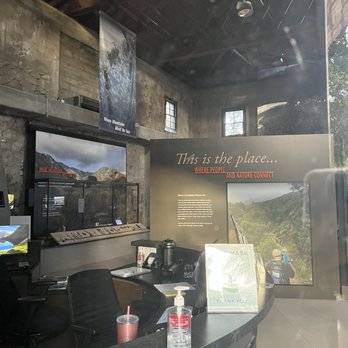
Hidden secret in our own backyard. Bests of all this is free until 10pm daily. Breath taking views of LA and my fav is the view of a former winery house that is a nature center (museum like with ac). Free parking for about 40 cars. Elevation is over 2700 feet. Able to park near homes but prepared to walk steep uphill. Clean bathrooms. Hiking here is the most popular so can get busy. Trails of all types for beginners, moderate and super hikers level. About 10 miles of hiking available. I love the scenic views of the city/LA. It can get really hot because there is very little shade. Plenty of picnic tables to rent. The ones closest to house is not rentable. Half of the tables are not in the shade. Small amphitheater is there too. Very safe if you visit alone. There are bears, snakes, coyote and small critters. Wilderness park named in honor of George Deukmejian, the 35th Governor of California. Has so much history. Former vineyard and winery. 1885-1890s: French immigrant and winemaker George Le Mesnager purchased acreage in Dunsmore canyon to plant extensive vineyards. The vineyard has 81 grapevines which have been planted since 2004 and are maintained by the Stone Barn Vineyard conservancy which is a part of the historical society of the Crescenta Valley. You can still purchase Stone Barn wine bottles of Chardonnay, cabernet sauvignon, and white zin for $10-$20. City of Glendale purchased land to preserve it from developers. 2009 a severe wildfire swept through the terrain, though resilient landmarks like a historic 200-year-old oak tree survived. 2022 historic stone barn reopened to the public as the Stone Barn Nature Center. You can still see the gorgeous vineyards. read more


2 months ago
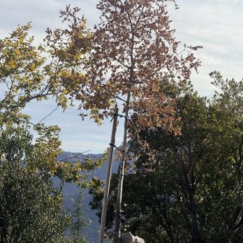
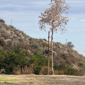
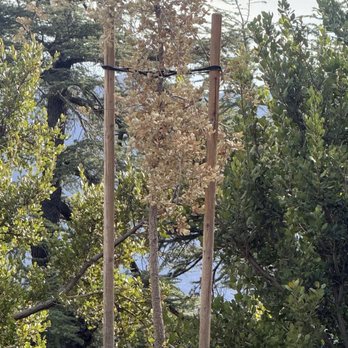
Beautiful park n trails ! Clean restrooms ! BUT, they need tree health care . The oaks tree planted are dying . 7of them. Sad to see that . It's next to the flat area where the large pepper tree is located . HELP THEM LIVE. Thanks plenty of parking . Park open till 9pm . Trees need - water bladders and mulch at least to help them survive read more

It's time to explore the unseen. Without further ado let's begin the adventure. Deukmejian Wilderness Park is a public park which occupies a rugged 709-acre site in the foothills of the San Gabriel Mts at the northernmost extremity of the City of Glendale. There are 10 trails throughout the park which varies in length, elevation and level of difficulty. They are as follows: Le Mesnager loop, Rim of the Valley, Dunsmore Canyon, Vineyard, Mummy Rock, Crescenta View, Cooks Canyon, Haines Canyon, Mt Lukens and Pickens Spur. Moreover, trails on the site provide spectacular views of the Crescenta Valley and the Los Angeles basin. I arrived early morning and decided to do the easy Dunsmore Canyon (elev gain 600 ft) is a mile long with extremely rocky trail; this canyon intersects with Crescenta View, Le Mesnager Loop, Mummy Rock and Vinyard trails. The view was amazing! Dogs are allowed as long as they're on a leash. Public bathroom is available. Parking lot is free albeit limited. Overall, it's a great park to go on a hiking adventure. I highly recommend you visit. read more


4 months ago

2 years ago

1 year ago
7 months ago

3 years ago

Great place for a hike, picnic, or just to lay on the grass. It's well maintained and fairly clean. There are restrooms and picnic tables. Only downside was I came for an event and couldn't find any parking so I had to park by the entrance and then walk up hill. On the road that leads up to the park it says No Parking yet people do it anyway. read more


2 years ago
Convenient, close by, easy/accessible parking. Wilderness trails are easy, moderate, kind of tough, etc. Not much shade on trails, so consider that during summer months. Restrooms are clean, area is well maintained, no graffiti; bring a lunch and sit at the picnic tables! read more


As a lifelong San Gabriel Valley resident and something of an outdoorsman, I've spent plenty of time exploring the mountains that bear the same name-- hiking, backpacking, trail-running, camping, fishing, rock-climbing, hunting, wilderness survival... you name it, I've probably done it. But then, days turn to decades, and the subtle changes of life synergize to shift our course again and again. With three kids, a bride of nearly 17 years, a mortgage, and a real job... my solo mountaineering days are postponed for a while. Instead, we spent a family Valentine's day hiking around this spot, scouting for new territory-- now, even more important that the Bobcat fire has closed most of my entry points above the SGV until at least 2022. Arriving on a beautiful Sunday after 10 AM, I figured the parking lot would be full... and I was right. Still, we did a quick loop to scope the place out, then found a parking spot on the street near the main entrance. A 0.2 mile walk up the paved road was potentially one of the steepest parts of our hike with kids today. We did a quick three mile hike through the chaparral-- enjoying the new growth of mule sage, wild buckwheat, sugar bush, oak trees, laurel trees, and a few early wildflowers. We took the Mummy Rock loop (never found the rock as far as I know,) and ended up back heading up the canyon to what seemed to be the end of that particular trail, terminating under a large oak tree near the dry creek bed. A little bench created the perfect platform for a snack and water break for the kids. The trail is a mix of hard-packed clay, decomposed granite, and quite a few loose rocks, so best to wear sturdy shoes. Not a lot of shade, either... today was cool and breezy, but I can see that this would require a nice big hydroflask or Camelback on a hot day. There also appear to be plenty of other trails to explore, with the surrounding mountains covered with switchbacks in those typical "zig-zag" patterns through the scrub. On our way out, I saw a trailhead sign for Mount Lukens... which is the mountain wayyy up there with all the radio towers on top. A hike for another day, as my youngest wasn't feeling another uphill after our short but quick climb. After your hike there are a few grassy park areas with tables and benches to enjoy a picnic, or to just relax. Plenty of folks with dogs, but not overly crowded today. Compared to places like Eaton Canyon, Millard Canyon, the Mt. Wilson trail, or Sam Merrill/Echo Mountain... this place was really not crowded. I will have to head back this way to explore more. You should too. read more


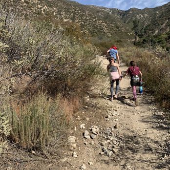


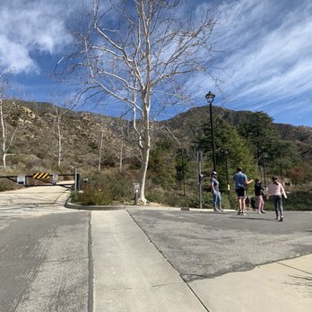

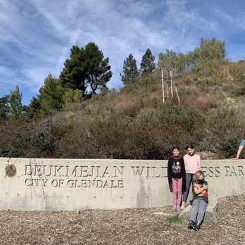

Park underwent huge renovations in recent years. We still have yet to explore the nature center but will next time. Picnicking here is peaceful and fun, there aren't any play grounds so you won't see loads of kids. The new tile mural is really cute and restroom facilities are nice. Have done several hikes here in the past year or so and not much is shaded so bring proper sun protection. read more




1 year ago

2 years ago

4 years ago
Free, nice people, good parking, grassy picnic area and nature center. Gets super hot in the summer. Variety of hikes to take. Today we brought the pooch to enjoy the creek after the big rains this year. Make sure your pooch is on its leash and please people- pick up the poop. read more


Great location; various levels of trails to hike; trails can be a bit rocky so wear appropriate shoes; clean restrooms; free parking lot; great views. Not a lot of shade on trail so if a sunny day a hat would be a good choice to wear. On site nature center. read more


I've visited this park a few times for a comfortable hike and yesterday was one of those perfect fall days where the weather was crisp and the sun was shining on you at the same time. Though not the most tamed or clear park, Deukmejian Wilderness Park provides a nice escape for people, friends and family to take a nice hike, see the valleys from a distance, watch a gorgeous sunset and have some socially distant picnics and lunches at the benches by the adjacent park. PARKING A few lots available for free read more


Winter Holiday Festivities at the mini amphitheatre next to the Le Mesnager "Barn" at Deukmejian Wilderness Park after 6pm on December 15, 2018. This event took place at the cold, cold 2300 foot above sea level elevation in the San Gabriel Mountains. Wonderful improvisational choir singing winter holiday traditional, folk, country, contemporary songs in tribute to Saturnalia, Bodhi Day, Xmas, Chanukkah, etc. Tap Chicks, Tap Dancing Team in Dorothy of Oz scarlet, red sequined western hats. Also wore garrison caps and khaki uniforms to do "Boogie Woogie Bugle Boy from Company B" to honor our veterans. YMCA & In the Navy by the Village People also made their list. Mostly senior citizens, but the youngest is 39 yo. Great "All American" act that goes through many costume changes to evoke different moods. For a concise history of Le Mesnager "Barn" refer to Z.Z.'s Yelp review September 2018, and why the present name for this wilderness may not be the most appropriate. For more detailed information: https://www.cvhistory.org/winemaking.htm Nice park that has a series of nature trails of varying difficulty. Be careful since much of this area has easily friable decomposed granite made worse by the heat of the huge Station Fire in 2010. Le Mesnager "Barn" was the place meant to crush wine grapes and store them in barrels to age. Grape vines also grew near by. In tribute to the wine production during the late 19th & early 20th century, grape vines are still grown here. You can participate in the harvesting of grapes in early fall where you can learn a lot about enology. https://m.facebook.com/stonebarnvineyard/ read more




4 years ago
I live in Rosemead but saw the low snow levels with this last storm and wanted to get in on the action. Thankfully, we didn't have to drive very far for the powdery white stuff! It was pure and fresh like an all white Mercedes, bro! We tried going up Angeles Crest, but it was blocked by CHP due to needing chains. The next best thing was to drive up a few exits where we found this gem of a park just up Pennsylvania Ave. The police blocked the public again at the base of the entrance to the park, so you had to hike up. It was a nice little hike with plenty of places to play in the snow. There were so many Angelenos there, kids on sleds, dogs on sleds, people in shorts, even saw a Lamborghini Urus. Typical LA behavior! All in all, it was a fun time. We will definitely be back to check out the rest of the park, most likely without snow. Thank you, Global Warming!!!! read more


6 years ago
I'm always amazed on how many trails are in our local mountains. This was my first time to this trail and it was an enjoyable hike. This is an easy trail for beginners and is well marked and very popular on the weekend. We hiked on a cloudy day but if it was sunny we would've cooked under the sun because there aren't many trees shading the trails. They have begun to add tree seedlings along most of trails which is a great plus for our future hikers. There's plenty of free parking with few parking restriction signs. read more


4 years ago
I went on a hike early morning on a cloudy day. Light rain but that was okay because there was so much green and flourishing plants. There was a lot of trails not alot of people. read more

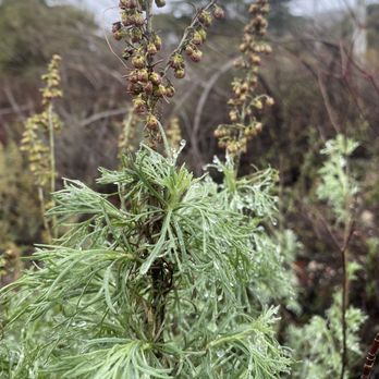

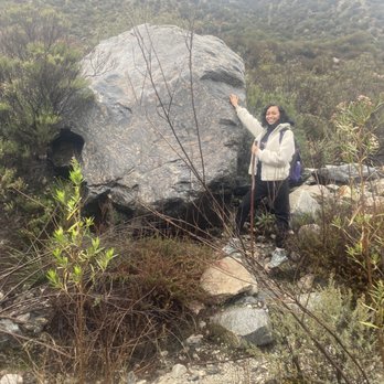

Lovely park w hiking trails. There is a parking lot with several spots before the trail. There are bathroom and picnic tables before the trails start. The trails are not that difficult and have gradual inclines due to the zig zag nature of the trails. Kind of rocky at some points so my dog started choosing his steps carefully to avoid the tougher terrain. There is a LOT of vegetation and we had to squeeze through a good many bushes and whatnot to continue on w the trail. We went for about 2 hours and called it a day. :) lovely views! read more


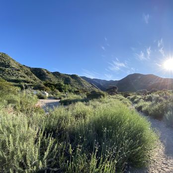


9 years ago
I was having a really tough day when my brother and I decided to hike at Deukmejian. It was my first time here and made my entire day. What a great local park! We arrived around 5P to an empty parking lot. As soon as we hopped out of the car, we spotted several deer. The trails were serene and peaceful. We hiked around for a couple of miles and enjoyed the sunshine and fresh breeze. He then showed me the vineyard, restrooms, picnic area and main parking lot. This place is really nice. I can't wait to return early one morning and explore further out on some of the trails. He mentioned hiking and packing a picnic (what him and his gf use to often do) which sounds like an excellent idea. The trails are all extremely well marked, slightly overgrown in some areas (I'm sure due in fact to our very wet So Cal Winter). I'm very much looking forward to returning. If you're a local, you have got to get out on these trails - you won't regret it. I'd say they are good for all athletic abilities, nothing to strenuous. So happy to have been introduced to this park. read more


Absolutely loved this place. Went for a picnic here and had a great time. It was a very friendly and peaceful little area. Definitely plan on going back here. Everyone was also very nice. Tons of people brought their dogs with them so I got to play with a bunch of puppies too. I definitely plan on going back here for a relaxing picnic. :) read more


Yelp 100 Challenge 22 The views from this park are amazing! The park itself is elevated and the various trails afford hiking for different abilities. If hiking isn't your thing, then bring a picnic basket and enjoy the scenery. I did notice that there weren't many shade trees, so I would suggest going earlier in the day. If you bring your dog, bring plenty of water for both of you. Most people were respectful of the leash law and others, although I'm told once on the trails people do let their dogs roam free. I'd be careful, this is the hills and wild life roam these areas. Bathrooms are located in the parking lot and were clean and stocked. And I must add, appreciated. Parking is plentiful although when we visited, there were several events going on in the park and the lots were full. The two lane road leading into the park seemed to get tighter when cars are parking in both directions. Go slowly and be prepared to yield or wait for traffic coming up before proceeding. The park is a great resource to enjoy the outdoors, remember to bring your hat and wear your sunscreen. read more


4 years ago

5 years ago
I just moved to the area and my awesome neighbor recommended this place for hikes after catching my husband and I on a walk in the neighborhood. We came and visited the stone barn and got informed about the wilderness area. It was great. We did a quick and easy loop to get a feel and will absolutely be back for harder trails in the future. read more


Just a fantastic outdoor area with excellent facilities. I've lived in the area for years and have summited Mt. Lukens via another trailhead, but I'd never been to this park and even as I was driving in I was impressed by the quality of the park and facilities. The trails are well kept and it's just a beautiful area for both family outings as well as serious hikers. read more


13 years ago
One word to describe this park - BEAUTIFUL. Talk about working up a sweat. For Summer hikers, I highly suggest getting here as the sun is starting to rise or you will be dripping sweat and dying on the hike up. We hiked the trail (don't know the name) to the right and straight up (about a mile long). Everything about this park and it's trails is INCLINE mania - your calves and glutes will be thanking you the following day. They also have a picnic & resting area, but if there is an event you will have to find somewhere else to relax. This park area can also be utilized for weddings and such - there is a vineyard and event area attached which is breathtaking. Clean bathrooms & parking included! I don't know why it took me so long to find this park, it's truly a gem in the Glendale hills. I will make the 10 mile drive from Sherman Oaks to hike here since it's not as crazy packed as Runyon/Griffith - a definite fresh of breath of fresh air from all the hustle and bustle. I can't wait to come back and try the other trails when I wake up earlier. Great place to bring your dogs as well - just make sure to pack enough water and snacks for you and them (don't forget your doggy bags). Every once in a while you will pass a volunteer planting a tree or two - love! read more


2 years ago

6 years ago
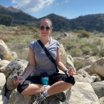
I went on this hike with a friend last Saturday. We didn't get to do much hiking but we saw Mummy Rocks, a small collection of boulders you can climb. I also like the gorgeous picnic areas, the free parking and the bathrooms available. read more




7 years ago
Very nice place to walk Clear marked, nice viewpoints Water available at the start point Diferent paths for diferent time lenghts and fitness levels Suitable to go with dogs Quite busy in weekend mornings but still nice read more


9 years ago
This was a good place if you want to hike to Mount Lukens. Deukmejian Wilderness Park is nice, and no fee to park here so that's the best part:) It's about 10 miles round trip. I don't recall if there were much posted signs on the trail, so plan ahead since it's a lengthy distance. I printed a trail map since there are connecting trails that i did not want to get lost. Not much shade, so pack accordingly to the weather. Other good hikes nearby, check out Wildwood Canyon or Brand Park for hikes less than 8 miles RT. read more


7 years ago
Nice peaceful park to enjoy fresh air, also has two hiking trails one is longer than the other so you can choose to go for a long or short hike. read more


The third time at Deukmejian is the charm. The first time I hiked the west side of the park my acrophobia kicked in on part of the Rim of the Valley Trail. Kris A. and I tried to tackle the east side on the Crescenta View Trail on our second attempt to get to the top. That trail really is very scary. We ended up turning around because I wasn't wearing hiking shoes and I was starting to feel a little light headed. Yesterday, it was very foggy and I had just had a lovely morning with my teenager. I forgot to dry his jeans and he was forced to wear a pair that didn't look good enough for his standards so he was in a bad mood. Then, I drove him to school at 6:20 a.m., drop him off, get back home and I received a text that his zero period got cancelled. He asked me to come back and pick him up so I drove over there for the second time and he isn't waiting at the curb. I have to park my car, walk to his class and pop my head in and his teacher said he could stay, so I left him there. Meanwhile, my hiking partner is supposed to arrive at my house to go hiking at 7:00 a.m.. My nerves were seriously frazzled by the time we hit the road to go over to Deukmejian Park. It was really foggy, so I thought that would help me with my acrophobia. I figured if I could just see the trail that would be great. I wouldn't have to see the bottom of the canyon off the edge of the trail. When we pulled into the lot it was sunny and the whole park was above the clouds. I told myself I wasn't going to freak out and I could do this. Hundreds of hikers have made their way successfully along those trails and I've never heard of any deaths or accidents there. We decided to hike the Rim of the Valley Trail on the west side of the park again because it wasn't as scary as the east side. It was a great hike and I think we could have made it to the top of Mt. Lukens, but we were starting to get tired after hiking uphill for two hours and we didn't bring lunch with us. We had some snacks and enough water, but both of us didn't want to over exert ourselves and regret it the next day. After looking at the map I think we were about a mile away from the summit. Our total mileage covered was about 7 miles round trip, so add on an additional 3.4 miles according to another hiker who mapped it on the following link: http://www.everytrail.com/view_trip.php?trip_id=2173137 Hopefully, the next time we hike at Deukmejian Wildnerness Park we'll hike all the way to the top and back down. read more


15 years ago
I came for a short hike on a beautiful sunny afternoon thinking I'd skip the gym and try something more organic for a change! As strange as this sounds, I spent the first 10 minutes just trying to hear sounds. A sound. Any sound! After an eternally long period of deafening silence, I regained my hearing. A sudden gush of wind rustling the leaves. The birds chirping. An owl. A crow. A swallow. I soon realized, however, that these sounds had been there the whole time but it was as if my ears had been trained to tune them out! Everyday we're bombarded with so many sensory inputs that sometimes our bodies and minds need exposure to serene and peaceful environments just to decompress! George Deukmejian Park and Hiking Trail is a great place for local residents to go and be at one with nature. Next time I'll definitely save the trip to Runyon and come here instead! read more


Page 1 of 3
More info about Deukmejian Wilderness Park
3429 Markridge Rd
Glendale, CA 91214
Directions
(818) 548-2000
Call Now
Visit Website
https://www.glendaleca.gov
Hours
Indoor Amenities
Outdoor Amenities
Ask the Community - Deukmejian Wilderness Park
So im new to hiking and want to go hike all the way to mt lukens. Any advice on the trails and how not to get lost. Also dont want to spend thousands in a gps watch or a satalilte emergency phone. Help a brudda out here thx?
If you are new to hiking this is not the place for you unless you go with a group of experienced hikers. There are some really challenging sections and little to no shade. Find a hiking group like Pasadena Hiking Pacers to join.
Are these trails good for the casual trail runner or are they too steep?
I hiked a little bit today and I saw a dude running with his dog, so it seems like it would be perfect.
Review Highlights - Deukmejian Wilderness Park
You might also consider











Why does Yelp recommend reviews?
5 reviews that are not currently recommended
The reviews below are not factored into the business's overall star rating.

5 years ago

11 years ago

2 years ago

17 years ago

15 years ago


