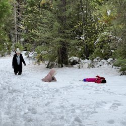
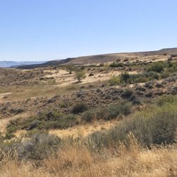
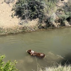
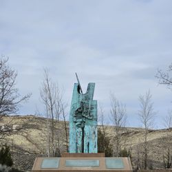
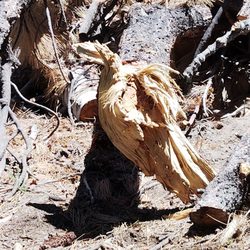
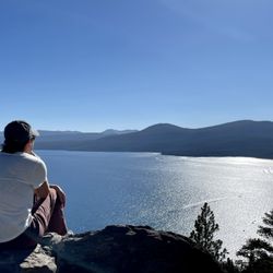
Verdi East Trail Photos

You might also consider
More like Verdi East Trail
Recommended Reviews - Verdi East Trail


More info about Verdi East Trail
Verdi, NV 89439
Directions
Visit Website
http://www.renotrails.com/ve/ve.htm
Hours
Outdoor Amenities
You might also consider


Verdi East Trail - hiking - Updated May 2026
Best of Verdi
People found Verdi East Trail by searching for…
Trending Searches in Verdi, NV
Boat Rental near Verdi East Trail
Botanical Gardens near Verdi East Trail
Bounce House Rentals near Verdi East Trail
Campgrounds near Verdi East Trail
Cherry Picking near Verdi East Trail
Cliff Jumping near Verdi East Trail
Dog Friendly Things To Do near Verdi East Trail
Flower Fields near Verdi East Trail
Flower Shop near Verdi East Trail
Garage Sales near Verdi East Trail
Lakes & Ponds near Verdi East Trail
Nurseries & Gardening near Verdi East Trail
Outdoor Activities near Verdi East Trail
Outdoor Furniture Stores near Verdi East Trail
Party Equipment Rentals near Verdi East Trail
Pedicure near Verdi East Trail
Pick Your Own Farms near Verdi East Trail
Picnic Areas near Verdi East Trail
Places To Take Pictures near Verdi East Trail
Plant Nursery near Verdi East Trail
Rock Quarry near Verdi East Trail
Running Trails near Verdi East Trail
Scenic Drive near Verdi East Trail
Secret Spots near Verdi East Trail
Strawberry Picking near Verdi East Trail
Sunrise View near Verdi East Trail
Swimming Holes near Verdi East Trail
Browse Articles
Browse Nearby
BEST of Verdi, Nevada Coffee near Verdi East Trail
BEST of Verdi, Nevada Things to Do near Verdi East Trail
BEST of Verdi, Nevada Breakfast near Verdi East Trail
BEST of Verdi, Nevada Parks near Verdi East Trail
BEST of Verdi, Nevada Restaurants near Verdi East Trail
Browse Brands
Related Searches in Verdi, NV
Affordable Kayak Rental Services in Verdi, Nevada
Best Fishing Locations and Guides in Verdi, Nevada
Best Places for Horseback Riding in Verdi, Nevada
Best Sledding Spots and Fun in Verdi, Nevada
Check Out Off Road Trails in Verdi, Nevada
Discover Dog Friendly Trails to Explore in Verdi, Nevada
Discover Scenic Mountain Bike Trails Near Verdi, Nevada
Discover a Hiking Trail in Verdi, Nevada
Discover the Best Night Hike Trails in Verdi, Nevada
Dog-Friendly Hikes With Dogs in Verdi, Nevada
Enjoy Camping Adventures Around Verdi, Nevada
Enjoy Exciting Mountain Biking Adventures in Verdi, Nevada
Enjoy Kayaking Adventures in Verdi, Nevada
Enjoy Tent Camping Spots Around Verdi, Nevada
Enjoy a Beautiful Waterfall Hike in Verdi, Nevada
Enjoy the Best Picnic Spots and Ideas in Verdi, Nevada
Enjoy the Best Tubing Experiences in Verdi, Nevada
Enjoy the Best Walking Path in Verdi, Nevada
Enjoy the Best Walking Trails in Verdi, Nevada
Exciting Cliff Jumping Spots in Verdi, Nevada
Experience Thrilling White Water Rafting in Verdi, Nevada
Explore Beautiful Parks and Green Spaces in Verdi, Nevada
Explore Easy Hikes Perfect for All in Verdi, Nevada
Explore Fun Activities to Do in Verdi, Nevada
Explore Popular Campgrounds Near Verdi, Nevada
Explore the Best Beach Spots in Verdi, Nevada
Explore the Best Boating Spots in Verdi, Nevada
Explore the Best Swimming Holes Around Verdi, Nevada
Explore the Best Trail Options in Verdi, Nevada
Family Friendly Hiking With Kids in Verdi, Nevada
Find Beautiful Views in Verdi, Nevada
Find Popular Ziplining Spots Around Verdi, Nevada
Find the Best Playgrounds to Visit in Verdi, Nevada
Find the Best Scenic View Locations in Verdi, Nevada
Hiking Trails With Waterfalls in Verdi, Nevada
Off Leash Dog Hiking Trails in Verdi, Nevada
Plan a Scenic Drive Route Near Verdi, Nevada
Popular Fishing Spots to Explore in Verdi, Nevada
Popular Outdoor Activities to Try in Verdi, Nevada
Popular Picnic Spots to Visit in Verdi, Nevada
Safe River Swimming Areas in Verdi, Nevada
Safe and Fun Parks for Kids in Verdi, Nevada
Top Climbing Spots and Gyms in Verdi, Nevada
Top Places for Snorkeling in Verdi, Nevada
Top Playgrounds for Kids to Enjoy in Verdi, Nevada
Top Running Trails to Explore in Verdi, Nevada
Top Swimming Lakes to Enjoy in Verdi, Nevada
Top Swimming Spots and Pools in Verdi, Nevada
People who viewed Verdi East Trail also viewed
Lower Galena Creek Trail - Jones-Whites Loop - Church's Pond
19 reviews
Cross Peak Hiking Trail
16 reviews
Michael D Thompson Trailhead
27 reviews
Upper Thomas Creek - Whites Creek - Dry Pond Trail
7 reviews
Evans Creek Trailhead
22 reviews
Tahoe Pyramid Bikeway Verdi Upstream Section
2 reviews
Tom Cooke Trail
3 reviews
Northwest Reno
Ophir Creek Trail
4 reviews
Halo Trail
1 review
Swan Lake Nauture Study Area
5 reviews
North Valleys