1. Monkey Rock Trailhead

0

,

Cancel

Open app

Search

Monkey Rock Trailhead

4.8 (8 reviews)

Monkey Rock Trailhead Photos

You might also consider

Recommended Reviews - Monkey Rock Trailhead

Your trust is our priority, so businesses can't pay to alter or remove their reviews. Learn more about reviews.
Yelp app icon
Browse more easily on the app
Review Feed Illustration

Reviews With Photos

Ginger D.

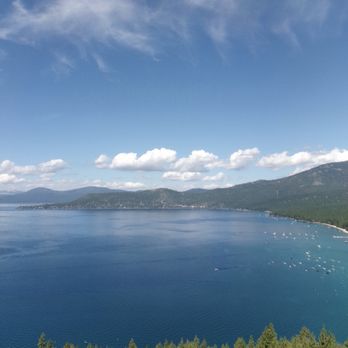
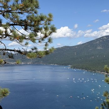
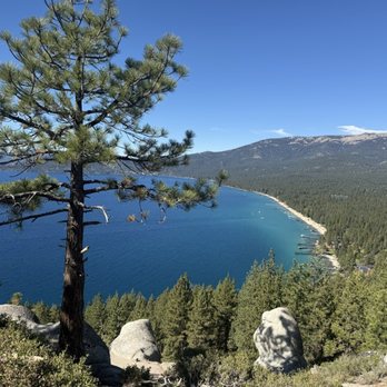
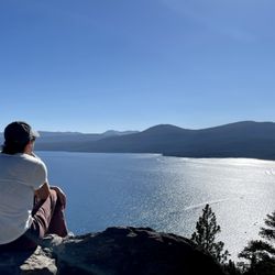
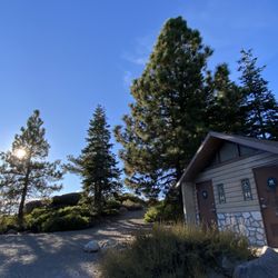
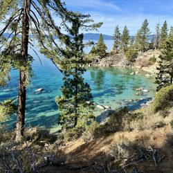
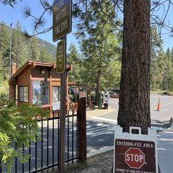
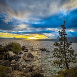
Monkey rock trailhead... located in North Lake Tahoe! I've done this hike 4 times now and it's beautiful everytime! Parking is tricky.. not a lot of spots. Be prepared to either park and walk a ways or get dropped off if that's an option! A lot of the kings beach hotels are right by this trailhead! If you made it to the Tunnel Creek Cafe you are in the right spot! This is a pretty easy hike I believe it's like 2.5 miles. Monkey rock is simply gorgeous and it's a great beginner hike! Please take care of Tahoe and pack in whatever you bring and pick up any trash you see!

Debbie N.

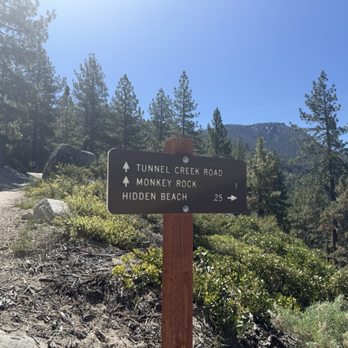
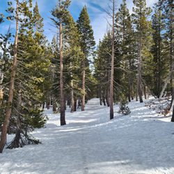
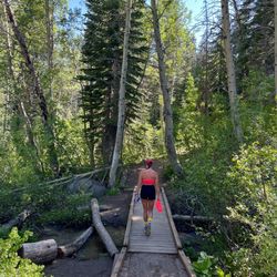
A gorgeous hike on a dirt path. Some areas had us huffing and puffing up the hills but totally worth it. There are signs to guide you to monkey rock.

Christina S.

Must do if visiting the lake. I've done this trail 2 times. Once I was in my first trimester of pregnancy and the other time with a 3 year old that wanted to be carried. It's not very easy to find the actual monkey rock. The path splits and if you go straight up the rock will be on your left once the 2 paths connect. You have to go around the large rocks and then the monkey will appear out of nowhere. There are always nice kickers that randomly appear and are really helpful and motivating while you are trying to find it. The sand is very slippery are you walk the path even with hiking shoes. So be careful and take in the views.

Monkey rock
Nicole R.

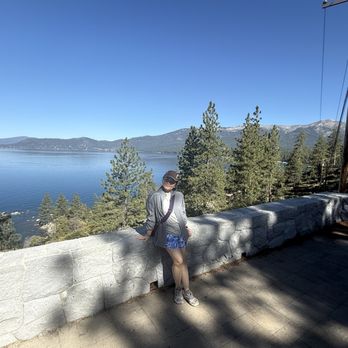
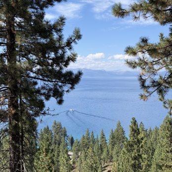
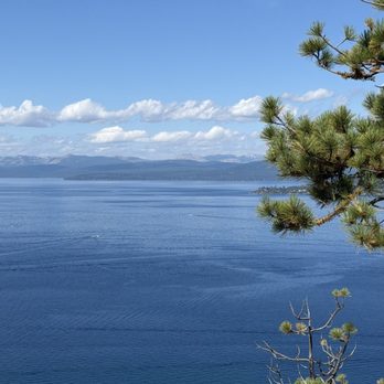
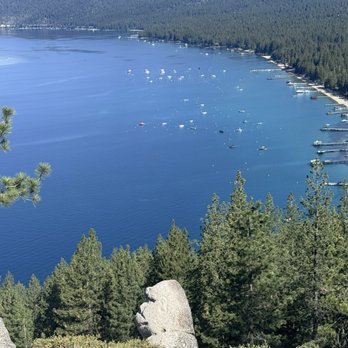
This is a beautiful, short but steep trail with great views of Lake Tahoe and it does indeed have a rock that looks just like a monkey! Apparently someone carved the rock to make it look so realistic. Parking is limited and requires a fee.

See all

5 months ago

Helpful 0
Thanks 0
Love this 0
Oh no 0

2 months ago

Helpful 1
Thanks 0
Love this 2
Oh no 0

4 months ago

Helpful 0
Thanks 0
Love this 0
Oh no 0

1 year ago

Helpful 2
Thanks 0
Love this 1
Oh no 0

11 months ago

Helpful 1
Thanks 1
Love this 2
Oh no 0

1 year ago

Helpful 1
Thanks 0
Love this 0
Oh no 0

1 year ago

Helpful 2
Thanks 1
Love this 2
Oh no 0

2 years ago

Helpful 0
Thanks 0
Love this 0
Oh no 0

Ask the Community - Monkey Rock Trailhead

You might also consider

Verify this business for free

People searched for Hiking 621 times last month within 15 miles of this business.
Verify this business

Mt Rose Hike - Galena Waterfall

Mt Rose Hike

4.6(26 reviews)
4.1 km

Looking for an epic hike that isn't too far from Reno? Look no further than Mount Rose! To find the…read moretrailhead, head up the Mount Rose Highway and once you reach near the top, you'll notice a decent sized parking lot off to the side of the Highway. The trailhead begins behind the bathrooms. This hike is slightly deceptive because for the first half (2.5 or so miles), it's relatively flat. I mean, you're definitely going upwards but you barely notice it (at least I didn't). Once you reach the waterfall (the unofficial halfway point), that's where things begin to get a bit more interesting. The scenery gets better and better, but the incline in the trail will get far more noticeable not just due to steepness, but due to the elevation as well. Many people were turning around as my friend and I continued going. In no way is this a difficult hike, however, it's definitely not easy either. If you're out of shape or have any medical problems, this may not be the hike for you. There's plenty of other gorgeous hikes in the area that would be more suitable. But if you think you can tackle the 10,778 foot Mountain, by all means give it a go. The hike is just shy of 11 miles round trip. Once at the summit, you'll have an amazing 360 view with Lake Tahoe on one side and Reno on the other. It makes for some amazing pano shots.

Okay, I am going to probably get a lot of hate from giving this hike 3 stars instead of 4 or 5…read morestars which seems to be the norm in terms of reviews. When I go on hikes, I prefer it to be flat, scenic and with pretty meadows. I was not expecting it to be quite scary actually as my husband reassured me that this hike was easy and flat; he was wrong trust me. The beginning of the hike was a steep uphill climb that was full of sand and dirt. Combined with the intense heat and the uneven rocks, I was already getting a shortness of breath when we climbed the uphill. My skin also got a burning sensation even though I slaughtered on sunscreen before the hike. I looked up the UV index on my phone and it was at level 11; wow, no wonder why I felt like I was burning! Thankfully, I brought some sunscreen with me so I started applying it to my face and skin again. The heat was also so intense that my hair started sticking to the back of my neck. Anyways, we continued our climb and when we reached the top, my heart started racing as I noticed we were a good 9000 feet up in the air and the trail was so thin and narrow that my husband and I had to make a single file line just to walk on it. I remember throughout the entire hike, I had to look down because the rocks were so uneven (trust me, they were everywhere) because I didn't want to fall and hurt myself. Another thing about being so high up, we encountered wind storms that constantly blew up dirt and sand on our faces; talk about feeling super dirty and gross! The sand and dirt got all over my clothes, skin and hair. Needless to say, I was not enjoying myself and I kept wishing we were lying on the beach instead listening to quiet waves and sunbathing. After a good 2 and a half mile hike, we finally reached the waterfall and relaxed. The waterfall was gorgeous and there were cute chipmunks too; this is why I gave my review three stars; this was the one good thing about our hike. When we got home that night, I scrubbed my face clean and washed my hair twice too. For avid hikers like my husband, this hike will be enjoyable as for me however, I will take a pass for next time.

Photos
Mt Rose Hike - Mt Rose hiking trail

Mt Rose hiking trail

Mt Rose Hike - Mt Rose Hike

Mt Rose Hike

Mt Rose Hike - A short break on Mt Rose hiking trail

See all

A short break on Mt Rose hiking trail

Hidden Beach - 9/9/25 FYI. Another beautiful day.

Hidden Beach

4.5(34 reviews)
1.5 km

I hesitated to put out this review as I love this beach so much and want to keep it to myself. My…read morelittle secret so to say. Well here goes... Quiet, peaceful, secluded with a small sandy beach area with some rocks and boulders but not so big that would draw a crowd. The water was cool and refreshing without being too cold in late August. We were there right before Labor Day but after kids are back in school so we felt like we have the whole place to ourselves. You do have to walk a short 20 mins distance until you see a small bend that leads to an under pass that connects to the other side. Safe and no need to cross the road. There's some wooden steps that leads down to the water. Clean scenic path revealing the treasures ahead. I highly recommend water shoes and a blanket to lounge on. Bring refreshments and snacks and clean up after yourself please. Don't forget the sunscreen and sunglasses. It is a dog friendly area which is why we chose this spot. We did have to park near a restaurant and pay for parking. After 5pm it's $1 per hour otherwise it's $5-$6 per hour. We had trouble with paying at the kiosk and it ran out of paper. Text message options did not work either :/ nonetheless we paid and took a screen shot as proof. The walking path is paved with a bit of incline/decline but it was easy. I don't recommend high heels but easy with sandals. I can't wait until we are back!

Quality/Quantity - Not so hidden, lol. The first beach…read morewalking towards Sand Harbor from Incline. Very small, but we were here off season (just the way I like it) and other than one other family, it is just us "two" here. So a private beach, lol. We are hosting our friends today. Showed them our free local parking spot. Gave them a quick tour of this area and all of Incline. A short 1.5 walk on the beautiful and easy Tahoe East Shore Trail. Just be careful of all the ebikes that do NOT have full control of their bikes or themselves. It would be nice if there was a separate bike path, or only allow manual bikes on the walking paths...? Atmosphere - Again, a very small, NOT so hidden beach. A nice stop/break from the 3 mile walk. Approximately the half way mark from Incline to Sand Harbor. Restrooms nearby, but I can NOT recommend them. More like outhouses with NO sink to wash your hands. Easy walk or bike ride. Fairly easy, very short walk/hike to each path. Service - Self service. Price - Free. Owner Comment - N/A.

Photos
Hidden Beach
Hidden Beach - 9/9/25 FYI. Another beautiful day.

9/9/25 FYI. Another beautiful day.

Hidden Beach - Underpass to the other side of the street

See all

Underpass to the other side of the street

Spooner Lake - spooner lake sledding area free endless fun

Spooner Lake

4.4(18 reviews)
0.8 km

Spooner Lake State Park is easily accessible off NV 28 (on the way to Incline Village), but does…read morecharge for parking. I had previously purchased an annual pass through Nevada Parks for $30 (Senior Rate). The parking area, visitor's center, picnic areas, and large greenbelt are all well maintained, pretty, and with a great view of the Lake. I was most recently here for a well-executed and family/dog friendly Day 2 Rosh Hashana service led by Temple Bat Yam (Stateline). That included a interactive and leafy 2.1 walk around the lake on a almost perfect day. Spirituality experienced outside is a special thing, and meeting a few new friends along the way was a welcome bonus. Note: Yelp also has a Spooner Lake Trailhead listing, which overlaps with this one.

Mom and I got lucky when we visited Spooner Lake on a Tuesday in August. Hardly anyone there so…read morekeeping our distance was easy. We only passed 1 couple on the trail. I wasn't really sure where the trail for Spooner Lake loop was so I parked and we wandered a bit til we saw the map and a little sign. Followed it down to the water... and then from there the trail was clear. We did the lake loop trail... I think it's about 2.5 miles... with all our walking around we did 3. It's a great trail! Lots of shade with a little bit of elevation change.... not too much tho. There was 1 big hill but that's it. So, a really nice easy trail around the lake. If I lived in the area, I would get an annual pass and come here regularly to do this loop and explore the other trails that connect to this one. It's a state park so $10 fee... we wanted to buy an Annual Pass good for all state parks but they were sold out.

Photos
Spooner Lake
Spooner Lake - Restrooms

Restrooms

Spooner Lake - I love fall - October 2026

See all

I love fall - October 2026

Tahoe Meadows - 1/31/26 FYI. So many cars, mainly for the tubing on the other side. Not many people hiking, snowshoeing or cross country

Tahoe Meadows

4.7(57 reviews)
7.7 km

Quality/Quantity - Something for everyone! For both locals and tourists; well the tourists I feel…read moreout number us.... Views of Lake Tahoe, Sierras, Washoe Lake (yes quite a ways of a hike), Incline Lake (I have not been yet), etc. Winter - Sledding, cross country, snow shoeing, hiking, snow mobile, etc. Summer - Hiking, biking, etc. The path is 1.4 miles with only a 78ft elevation. It should take you no more than an hour. Only certain parts of the trail are ADA friendly. And of course, feeding the chickadees; bird seeds only please!! Do NOT give them "human" food. They will literally eat out of your hands. A great experience for all ages. Overall, very easy trails. But if you want to keep going, there are more challenging ones that you can connect to. We do not come here often enough... Ambiance - Beautiful and user friendly! Road parking, be safe. And please do NOT run across 431, wait for NO traffic before crossing! A place to drop off your snow mobiles, etc. Oh, and now I am starting to see food trucks?!?! NO restrooms or services. If available, you can drive a mile to Mt Rose Summit to see if the public restrooms are open. Service - Self service. Price - Free. Owner Comment - Thank you to the team at Tahoe Rim Trail Association, a 501(c)(3) nonprofit for maintaining this beautiful area.

Good place for hiking, or playing around in the snow. Nice place to snowshoe, cross-country ski,…read moreetc. great fun for the whole family, ample parking. Make sure you bring your sunglasses cause the snow can be very bright on your eyes. Highly recommend this place! It's a lot of fun! And the surroundings are beautiful!!

Photos
Tahoe Meadows
Tahoe Meadows - Nevada Nordic Trail System Map.

Nevada Nordic Trail System Map.

Tahoe Meadows - Tahoe Rim Trail at Tahoe Meadows.

See all

Tahoe Rim Trail at Tahoe Meadows.

Sand Harbor Beach - Sunset at the sandy harbor beach

Sand Harbor Beach

4.3(522 reviews)
4.1 km

The hype is real, Sand Harbor certainly delivers on being one of the most if not most beautiful…read morebeaches in Lake Tahoe. Recommend booking a reservation as you will be taking a chance trying to time the 10:30AM opening for parking. We came on a Wednesday and the best part about reservations is the beach never felt too crowded once we were inside. There are three distinct areas, the boat launch, the picturesque cove with all the boulders you see on instagram, and the longer more open beach area. We picked the picturesque area and got lucky to find a small section we could carve out of the beach after arriving around 10 am. I'm sure on weekends this cove fills up even sooner so get there early as everyone mentions. Great area for paddle boarding, climbing rocks and relaxing on the beach. Definitely plan to come back again next summer, but will not be on a weekend. Seeing the lines for the parking lot midweek was enough to convince me. All in all if you have an opportunity to go do it! Just make sure you have a plan before you do to maximize your time and fun.

After all my years living in this area, my first visit to Sand Harbor. My daughter had been before…read moreand knew all the needed ins and outs. Most important, do make your parking reservation, $15. Opens at 8:30am, we arrived very early ensuring a great parking spot and a choice of position on the beach. Bringing your own shade is a must, umbrellas are the least popular, we had an Easy Up, perfect! The limited parking also limits the number of people so always comfortable and doesn't feel too crowded. Many bring their paddle boards, floats and canoes. People watching is top notch Fun day being surrounded by people just relaxing, chilling and enjoying the moment. Restrooms are near by, an easy walk and across the parking lot is their restaurant. Nice menu choices and prices quite okay. Later on in the year there are no reservations needed but to have the best experience, check to be sure if you need one before planning your visit. I shall return and that is the best thing you can say about a first time visit!

Photos
Sand Harbor Beach - Sunset

Sunset

Sand Harbor Beach - Sand Point 10.5.25

Sand Point 10.5.25

Sand Harbor Beach - Sandy harbor beach rock

See all

Sandy harbor beach rock

Monkey Rock Trailhead - hiking - Updated October 2026

Loading...
Loading...
Loading...