Ballardini Ranch Trailhead Photos


You might also consider
More like Ballardini Ranch Trailhead
Recommended Reviews - Ballardini Ranch Trailhead
Start your review...

Reviews With Photos

Beautiful hike my Malamute loves! We go early before the sun comes up and watch the sun rise as we go. There's no one out there then and he loves trotting around Remember to pick up your poop and throw it away when on the trail! There's clearly lots who don't so don't be part of the problem!

Took a trail challenge with my wife at Ballardini Ranch. Not bad. For the challenge, you do need to be in fair shape. To do the trail without a group, you can do it at your own pace. Study the trails as some branch off and you can end up in Galena! Here's a link to the trail: https://www.alltrails.com/trail/us/nevada/ballardini-ranch-trail?_branch_match_id=519932165660136315 As with all trails anywhere. Pick up after yourself! It's simple and easy. If you bring a pet, pick up after the pet! If you're new to hiking up in the hills here. Bring water and/or a Camelbak type of device Wear sunscreen Bring a hat Watch for rattlers during the warmer months Leave nature natural This trail is good for newbies. It's not too hard, good views of the city and gives you the impression that you're miles away from civilization. ---------------- Bottom Line I wouldn't mind coming back here and taking some of the tertiary trails to Galena.

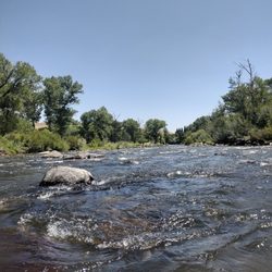
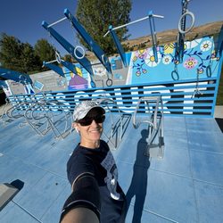
Reno's newest trailhead is really lovely, which one would hope, seeing as the land was dedicated in 2008, and it only just opened a few months ago. Apparently it takes the county six years to construct a trail and parking lot. Still, though, it IS lovely. This trailhead and the land behind it was part of a very, very long battle between the city and Ballardini Ranch developers. I really don't know all the details, but suffice to say lots of people were very angry, and much time was spent in court, and many millions of dollars wasted. With that in mind, I guess I was expecting a more extensive project than what is here, and, as is so often the case, expectations lead to disappointment. The trailhead consists of about 20 parking spots, a covered picnic area, and a bathroom with two pit toilets. No water is provided on site, nor did I see a doggie-doo station. A creek runs through the trailhead, providing trees and shade. It is overall just a nice little spot. The trail consists of two loops--a "lower" loop, which is only .5 miles (why even bother?!) and an "upper" loop that adds another 1.7 miles. If you do them both together, you'll log about a two-mile hike. Like I said, not terribly impressive, especially considering how much the trail loops back on itself, fooling you into thinking you are covering more terrain than you actually are. You WILL get some very nice scenery, though. There are better views to be had of the city on other trails; the real pleasure here is the view back into the BLM land behind the development area. I managed to find a few small side trails that led to convenient gaps in the barbed wire, should you decide to take off into all that beautiful open space. Just sayin'. The best thing about this trail is it's newness. Everything is fresh and clean, with no trash, no gardens of dog turds, and no broken glass. The toilets don't even smell bad yet. Let's hope it can stay this way for a little while, at least! Overall, this trail is great for a short hike or very short trail run, but not really extensive enough for serious hiking. It's perfect for kids--you could probably even do it with a stroller--and my dog loved it. Eventually, there will be a diversion trail that connects this small loop to the greater Rim to Reno system, and then it will really be awesome, but until then it's just a nice way to spend an hour.

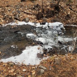
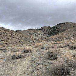
I took the family out for a late-spring hike and was pleasantly surprised by the trails and property. In mid-May (after a good wet, spring), the wildflowers were still blooming (calochortus lilies, penstemons, etc.) and the cheatgrass was tall but not yet a threat to everyone's socks. Bird life in the middle of the day was pretty quite (as expected), but there were still meadowlarks singing here and there. The trails look like they were made with a bobcat, but still nicely contoured for hiking with a 5 year old. The bench near the "summit" was a nice treat and the views to the west make you forget all the sprawl of south Reno to west (which has a certain appeal when seen from a distance). We ran into a rattlesnake on the descent to the creek (from the 'summit'), always exciting. The wiggly trail goes in and out of some gullies, passing by some cottonwoods where we saw flicker and kestrel nests. Overall, the lack of shade would make this a challenging place to enjoy fully in the middle of a summer day, and the weeds (esp. cheatgrass) could be really annoying if you weren't careful. For a cool-weather day (or early summer morning), however, it's a great choice.

1 year ago
This is a very nice hiking trail that is easy to access and with plenty of parking. The bathrooms were clean and well maintained. The trail itself has 3 trails for a total of 4.6 miles. There is pretty much no shade, so this is a great hike for the colder months. read more


5 years ago
Beautiful hike my Malamute loves! We go early before the sun comes up and watch the sun rise as we go. There's no one out there then and he loves trotting around Remember to pick up your poop and throw it away when on the trail! There's clearly lots who don't so don't be part of the problem! read more


Took a trail challenge with my wife at Ballardini Ranch. Not bad. For the challenge, you do need to be in fair shape. To do the trail without a group, you can do it at your own pace. Study the trails as some branch off and you can end up in Galena! Here's a link to the trail: https://www.alltrails.com/trail/us/nevada/ballardini-ranch-trail?_branch_match_id=519932165660136315 As with all trails anywhere. Pick up after yourself! It's simple and easy. If you bring a pet, pick up after the pet! If you're new to hiking up in the hills here. Bring water and/or a Camelbak type of device Wear sunscreen Bring a hat Watch for rattlers during the warmer months Leave nature natural This trail is good for newbies. It's not too hard, good views of the city and gives you the impression that you're miles away from civilization. ---------------- Bottom Line I wouldn't mind coming back here and taking some of the tertiary trails to Galena. read more

Reno's newest trailhead is really lovely, which one would hope, seeing as the land was dedicated in 2008, and it only just opened a few months ago. Apparently it takes the county six years to construct a trail and parking lot. Still, though, it IS lovely. This trailhead and the land behind it was part of a very, very long battle between the city and Ballardini Ranch developers. I really don't know all the details, but suffice to say lots of people were very angry, and much time was spent in court, and many millions of dollars wasted. With that in mind, I guess I was expecting a more extensive project than what is here, and, as is so often the case, expectations lead to disappointment. The trailhead consists of about 20 parking spots, a covered picnic area, and a bathroom with two pit toilets. No water is provided on site, nor did I see a doggie-doo station. A creek runs through the trailhead, providing trees and shade. It is overall just a nice little spot. The trail consists of two loops--a "lower" loop, which is only .5 miles (why even bother?!) and an "upper" loop that adds another 1.7 miles. If you do them both together, you'll log about a two-mile hike. Like I said, not terribly impressive, especially considering how much the trail loops back on itself, fooling you into thinking you are covering more terrain than you actually are. You WILL get some very nice scenery, though. There are better views to be had of the city on other trails; the real pleasure here is the view back into the BLM land behind the development area. I managed to find a few small side trails that led to convenient gaps in the barbed wire, should you decide to take off into all that beautiful open space. Just sayin'. The best thing about this trail is it's newness. Everything is fresh and clean, with no trash, no gardens of dog turds, and no broken glass. The toilets don't even smell bad yet. Let's hope it can stay this way for a little while, at least! Overall, this trail is great for a short hike or very short trail run, but not really extensive enough for serious hiking. It's perfect for kids--you could probably even do it with a stroller--and my dog loved it. Eventually, there will be a diversion trail that connects this small loop to the greater Rim to Reno system, and then it will really be awesome, but until then it's just a nice way to spend an hour. read more


 - Hiking Near Me - Reno, Nevada")


10 years ago
I took the family out for a late-spring hike and was pleasantly surprised by the trails and property. In mid-May (after a good wet, spring), the wildflowers were still blooming (calochortus lilies, penstemons, etc.) and the cheatgrass was tall but not yet a threat to everyone's socks. Bird life in the middle of the day was pretty quite (as expected), but there were still meadowlarks singing here and there. The trails look like they were made with a bobcat, but still nicely contoured for hiking with a 5 year old. The bench near the "summit" was a nice treat and the views to the west make you forget all the sprawl of south Reno to west (which has a certain appeal when seen from a distance). We ran into a rattlesnake on the descent to the creek (from the 'summit'), always exciting. The wiggly trail goes in and out of some gullies, passing by some cottonwoods where we saw flicker and kestrel nests. Overall, the lack of shade would make this a challenging place to enjoy fully in the middle of a summer day, and the weeds (esp. cheatgrass) could be really annoying if you weren't careful. For a cool-weather day (or early summer morning), however, it's a great choice. read more


8 years ago
This is a great place to get out in nature and you don't even need to leave Reno! You get some nice moderate elevation gain and loss, so it makes a good trail run. The terrain is rocky and uneven, though, so wear good shoes for it. There are pit toilets, trash cans, dog waste bags, and picnic tables at the trailhead, next to a nice paved parking lot. You get great views of Reno; however, there is no shade on the trail, so plan accordingly if hiking in warmer weather. read more


7 years ago
10 years ago
10 years ago
More info about Ballardini Ranch Trailhead
4100 Gaspari Rd
Reno, NV 89511
Directions
Hours
Outdoor Amenities
Ask the Community - Ballardini Ranch Trailhead
Review Highlights - Ballardini Ranch Trailhead
You might also consider


Ballardini Ranch Trailhead - hiking - Updated July 2026
Best of Reno
People found Ballardini Ranch Trailhead by searching for…
Swimming Holes in Reno, Nevada
Scenic Overlook in Reno, Nevada
Beautiful Views in Reno, Nevada
River Swimming in Reno, Nevada
Walking Trails in Reno, Nevada
Swimming Lakes in Reno, Nevada
Off Road Trails in Reno, Nevada
Off Leash Dog Hiking Trails in Reno, Nevada
Secluded Spots in Reno, Nevada
Running Trails in Reno, Nevada
Hiking With Kids in Reno, Nevada
Trending Searches in Reno, NV
Browse Articles
Browse Nearby
BEST of Reno, Nevada Restaurants near Ballardini Ranch Trailhead
BEST of Reno, Nevada Things to Do near Ballardini Ranch Trailhead
BEST of Reno, Nevada Coffee near Ballardini Ranch Trailhead
BEST of Reno, Nevada Breakfast near Ballardini Ranch Trailhead
BEST of Reno, Nevada Horseback Riding near Ballardini Ranch Trailhead
BEST of Reno, Nevada Wineries near Ballardini Ranch Trailhead
Browse Brands
Related Searches in Reno, NV
Affordable Kayak Rental Services in Reno, Nevada
Best Fishing Locations and Guides in Reno, Nevada
Best Places for Horseback Riding in Reno, Nevada
Best Sledding Spots and Fun in Reno, Nevada
Check Out Off Road Trails in Reno, Nevada
Discover Dog Friendly Trails to Explore in Reno, Nevada
Discover Scenic Bike Paths in Reno, Nevada
Discover Scenic Mountain Bike Trails Near Reno, Nevada
Discover Scenic Waterfall Spots in Reno, Nevada
Discover a Hiking Trail in Reno, Nevada
Discover the Best Night Hike Trails in Reno, Nevada
Dog-Friendly Hikes With Dogs in Reno, Nevada
Enjoy Camping Adventures Around Reno, Nevada
Enjoy Exciting Mountain Biking Adventures in Reno, Nevada
Enjoy Kayaking Adventures in Reno, Nevada
Enjoy Tent Camping Spots Around Reno, Nevada
Enjoy a Beautiful Waterfall Hike in Reno, Nevada
Enjoy the Best Picnic Spots and Ideas in Reno, Nevada
Enjoy the Best Tubing Experiences in Reno, Nevada
Enjoy the Best Walking Path in Reno, Nevada
Enjoy the Best Walking Trails in Reno, Nevada
Exciting Cliff Jumping Spots in Reno, Nevada
Experience Thrilling White Water Rafting in Reno, Nevada
Explore Beautiful Parks and Green Spaces in Reno, Nevada
Explore Easy Hikes Perfect for All in Reno, Nevada
Explore Fun Activities to Do in Reno, Nevada
Explore Popular Campgrounds Near Reno, Nevada
Explore the Best Beach Spots in Reno, Nevada
Explore the Best Boating Spots in Reno, Nevada
Explore the Best Swimming Holes Around Reno, Nevada
Explore the Best Trail Options in Reno, Nevada
Family Friendly Hiking With Kids in Reno, Nevada
Find Beautiful Views in Reno, Nevada
Find Popular Ziplining Spots Around Reno, Nevada
Find the Best Parks for Picnics in Reno, Nevada
Find the Best Scenic View Locations in Reno, Nevada
Great Places to Walk in Reno, Nevada
Hiking Trails With Waterfalls in Reno, Nevada
Off Leash Dog Hiking Trails in Reno, Nevada
Plan a Scenic Drive Route Near Reno, Nevada
Popular Outdoor Activities to Try in Reno, Nevada
Popular Picnic Spots to Visit in Reno, Nevada
Safe River Swimming Areas in Reno, Nevada
Safe and Fun Parks for Kids in Reno, Nevada
Top Running Trails to Explore in Reno, Nevada
Top Swimming Lakes to Enjoy in Reno, Nevada
Top Swimming Spots and Pools in Reno, Nevada
Top Things to Do With Kids in Reno, Nevada
People who viewed Ballardini Ranch Trailhead also viewed
Hunter Creek Waterfall Trail
74 reviews
Downtown
Huffaker Park and Mountain Trail
45 reviews
South Reno
East Keystone Canyon
10 reviews
Erica Greif Memorial Bike Trail
3 reviews
South Reno
Pah Rah Interpretive Trail
3 reviews
Ophir Creek Trail
4 reviews
Halo Trail
1 review
Mayberry Park
57 reviews
Northwest Reno
Verdi East Trail
4 reviews
Huffaker Hills Trailhead
2 reviews