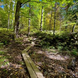
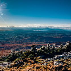
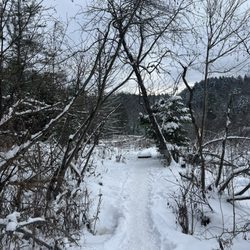
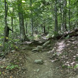
Underhill State Park Photos


More like Underhill State Park
Recommended Reviews - Underhill State Park
Start your review...

8 years ago
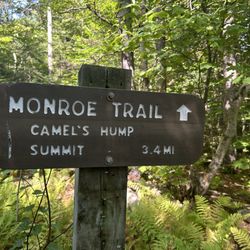
Decent amount of parking, restrooms, normally a ranger there, access to hiking for the Mount Mansfield summit. read more


10 years ago
8 years ago
More info about Underhill State Park
352 Mountain Rd
Underhill, VT 05490
Directions
(802) 899-3022
Call Now
Visit Website
http://www.vtstateparks.com/htm/underhill.htm
Hours
Outdoor Amenities
Other Amenities


Underhill State Park - hiking - Updated May 2026
Best of Underhill
People found Underhill State Park by searching for…
Hiking Trails in Underhill, Vermont
Walking Trails in Underhill, Vermont
Easy Hikes in Underhill, Vermont
Parks for Kids in Underhill, Vermont
Off Road Trails in Underhill, Vermont
Off Leash Dog Hikes in Underhill, Vermont
Things to Do in Underhill, Vermont
Hiking With Kids in Underhill, Vermont
Hiking Trails Kid Friendly in Underhill, Vermont
Running Trails in Underhill, Vermont
Tent Camping in Underhill, Vermont
Camping Sites in Underhill, Vermont
Public Shower in Underhill, Vermont
Communal Shower in Underhill, Vermont
Watch Sunset in Underhill, Vermont
Night Hike in Underhill, Vermont
Free Campgrounds in Underhill, Vermont
Luggage Storage in Underhill, Vermont
Public Swimming Pools in Underhill, Vermont
Browse Nearby
Browse Brands
Related Cost Guides
Browse Articles
People who viewed Underhill State Park also viewed
Little River State Park
10 reviews
Gold Brook Campground
14 reviews
Champlain Campgrounds
8 reviews
Five Tree Hill Country Park
2 reviews
Maple Grove Campground
7 reviews
Stowe Pinnacle
10 reviews
Lake Champlain Camping
1 review
Centennial Rotary Park
1 review
Waterbury Center State Park
3 reviews
Williston Northbound Information Center
4 reviews