Cancel

Open app

Search

Snake Mountain

4.7 (3 reviews)

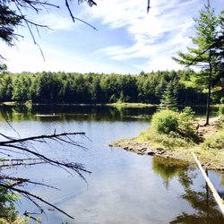
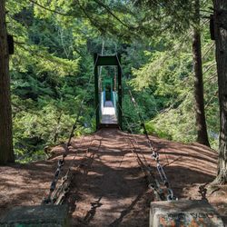
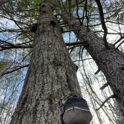
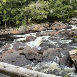
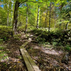
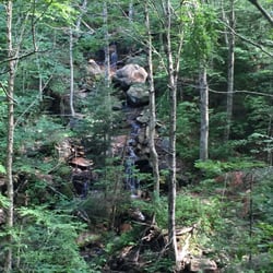
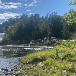
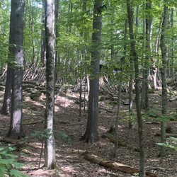
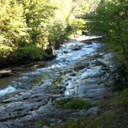
Snake Mountain Photos

Recommended Reviews - Snake Mountain

Your trust is our priority, so businesses can't pay to alter or remove their reviews. Learn more about reviews.
Yelp app icon
Browse more easily on the app
Review Feed Illustration
Photo of DeeDee O.
0
114
79

6 years ago

Helpful 0
Thanks 0
Love this 0
Oh no 0

7 years ago

Helpful 0
Thanks 0
Love this 1
Oh no 0

5 years ago

Helpful 0
Thanks 0
Love this 0
Oh no 0

Verify this business for free

Get access to customer & competitor insights.

Verify this business

Sleeping Beauty Mountain - Mid October, Sleeping Beauty Summit.

Sleeping Beauty Mountain

(5 reviews)

A great hike of moderate difficulty. The summit is lovely, with beautiful views of Lake George and…read morethe surrounding mountains. Some areas of the trail are fairly eroded, but there were crews there working to protect the trail and divert water. Even with a full parking lot, the hike was long enough that we didn't see people very often along the way. We saw some families with little ones, but none near the top, so I'm not sure how far they made it. This wouldn't be an easy hike carrying kids, and I don't think most kids under 10 would stick it through to the end. A few portions are pretty steep, so it'd be tough on little legs. The one downside is that apparently Dacy Clearing Road isn't always fully open to vehicles, so rather than parking closer to the trailhead, you may have a few extra miles to walk on a gravel road. This takes your roundtrip from approximately 5 miles to roughly 8.

One of the most beautiful places I've hiked in. The view from the summit is spectacular on a sunny…read moresummer day, and probably even better in the fall. The hike to the top can be long or short, depending on your skill level, and how you want it to be. If you choose to do a longer hike, you can park at the Hogtown parking lot at the bottom. If you choose the shorter path ( 1.8 mi) to the summit, you must drive further down a dirt path (if the gate to go further is open) for another mile or so and park at the Dacy clearing. The hike itself is not bad. It can be a little rocky and steep, but if you're in average shape, you should be okay. It is for the average to moderate hikers. There were a lot of families with smaller children and dogs when I went. It's definitely something a family can enjoy. If you go on a nice day, I would recommend bringing lunch or snacks with you. It was really nice to eat with a view of the Adirondacks, and Lake George.

Buttermilk Falls

Buttermilk Falls

(12 reviews)

Wow ! What a hidden gem ! We were visiting Ludlow VT and saw this fall . Kids wanted to enjoy…read morewater and this was a perfect choice for us . The water was colddddddddddd though. Ufff . Very cold . The first dip was tough ! Later once you get use of it , it felt a bit better . Pathway was a bit crazy , in some places .it is about a 2 mile walk but we just went not too far : .. the lower and middle falls is also accessible from car parking lots outside . Parking is outside and sometimes you have to park 5-8 mins away from the falls . Not much of restrooms around . Lots of dogs in the water :) It was an amazing tint though ! Loved it . 5 stars !

As we were staying near Ludlow, I had put this on our schedule as a "check it out whenever time…read morepermits" item. We drove back after visiting some places to the north, and were passing this around 4 p.m. so we checked it out. This was in early October and the sun was just starting to go down. Though it was pre-dusk, it would be better to visit this site in full sunlight. There are 3 separate falls (the creatively named upper, middle, and lower). You access them from the main highway via a side road that starts as paved but soon becomes (good) dirt/gravel. The total length is less than 2 miles. You first get to a wide spot / parking area from which you can access the middle and lower falls. A trail leads down a hill where you must choose which falls to visit. The middle falls is impressive. It is probably the easiest one to access. The area from which you have the best view is a bit rocky, but navigable. It makes for nice photos. The lower falls appeared accessible from a side trail that descended a bit more steeply. You can also see it from above (somewhat) without descending. It appeared smaller and less photogenic than the middle falls. We then drove another 1/4 mile up the road (to its end) to check out the upper falls. There is a sharp short descent from the road to the top of the falls. It appeared to have a fairly large pool at the bottom and a flat dirt/sand area where some people had laid out a blanket for a picnic. The light was fading more so we skipped walking down the relatively gentle slope to check it out further. If you are in the area and have time, this is a nice spot to visit. It is within 3 miles of Ludlow. I cannot comment on what the swimming is like, but I saw references to that online (during summers, I guess).

Bucklin Trail - Waterfall

Bucklin Trail

(1 review)

If you are looking to hike and summit Mount Killington, Bucklin Trail is a wonderful option. Much…read moremore of a traditional hike (as opposed to climbing the ski trails on the resort), the path is well-marked and well-maintained. It is approximately 7.5 miles round trip to the summit and back. It is marked with blue blazes that are easy to follow. To find the trailhead, you must turn down Wheelerville Road off Route 4... keep in mind that this is an unpaved road. After approximately 4 miles, you will reach a sharp turn in the road. There is a turnoff to the left with a decent sized area for parking. The trail begins here and remains relatively flat for almost 2 miles. It follows Brewers Brook for some time, with a couple of bridge crosses over its rocky waters. After the initial 2 miles, the trail begins to climb more steeply until it joins the Appalachian and Long Trail (follow the white blazes for this section). Along this section is Cooper Lodge, a refuge for backpackers... built in 1939, it is the highest shelter on the Long Trail. Unfortunately it was covered in graffiti (I mean really... who brings spray paint 4,000 feet up a mountain?). To end the hike you scramble up the last and steepest part of the climb, emerging from the treeline to a panoramic view of the surrounding Green Mountains. It took about 3.5-4 hours of actual trekking to complete the hike. I am not a fast hiker by any means and took several breaks along the way (especially as it got steep!). Beware of the black flies that swarm in the spring/early summer. Overall, I was very pleased with this hike. Waterfalls, rivers, bridges, panoramic views. Doesn't get better than that!

Cascade Mountain

Cascade Mountain

(17 reviews)

One of my favorite hikes in the high peak region -- it's a great starter one to those interested in…read moredoing a high peak. You combine it with Porter to get two mountains off your list, for the "physical price" of doing one! This is a gentle mountain, but still should not be taken lightly as it is a high peak and it will challenge you, no matter how fit you might be. I've climbed this in the summer 2-3 times and at least 2-3 times in the winter. I prefer doing it in the winter personally for less crowds and beautiful ice covered pine sights and an Arctic wonderland, but either one is gorgeous. Parking is free, but limited...come early to try to snag a spot. Doing both mountains will only add an hour or so to your total hike time, so don't be afraid to tackle both even if you might be tired after hitting Cascade. I think Cascade is good to hit first and then head over to Porter, but honestly either one will work well. Plan 3-8hours round trip, depending on your level of physical ability. Come prepared and know the conditions, talk to the rangers or other hikers so you know what to expect.

One of the 46 high peaks and known to be the easiest and quickest round trip hike! This means that…read moreyou should expect it to be the busiest as well! Early birds will get the parking spots, but during the warmer season, early may mean arriving before 6:30am for optimal parking! A phenomenal panoramic view that gives a great view from anywhere you decide to post up on the top for a quick snack. You can also hike this to mount porter which is another high peak of the 46er club! For avid hikers/trail runners, you could really round trip in under 2 hours. For new mountain hikers, best to expect a 4-5 hour trek for those who aren't use to the 2000 feet of elevation gain.

Otter Creek Gorge Trail - View Of Creek

Otter Creek Gorge Trail

(1 review)

Hiked Otter Creek Gorge Trail on Friday afternoon. After a long drive up to Vermont, decided to…read morestretch our legs at this dull trail, which was quick and uneventful. Quality: Otter Creek Gorge Trail is a short trail that starts near a dam on Otter Creek. It is a piece of a larger trail that circles all of Middlebury. The trail is short and pretty boring. Other than the fun bridges at the entrance and a small waterfall, which isn't actually visible from the trail itself, there is not much to see. It also has quite a few bugs that were very irritating. Okay for a quick stroll, but not worth a visit unless you live in the area. Quantity: There were a few different trail options in the Middlebury Area Land Trust, but we decided to stick with the shorter Otter Creek Gorge Trail, which was just under two miles. Value: No cost to park or hike this trail. Ambiance: Otter Creek Gorge Trail is located a little north of Middlebury, Vermont. It is a short trail that follows along the creek in a forested area before opening up to a large field. The trail is very easy with minimal elevation, but also very few viewpoints. There are two unique bridges that you traverse over the dam, which are the most exciting part of the short journey. Crowd: We saw cars in the lot, but no people on the relatively short trail. Service: Signage was not the best on the trail, but it is still easy to follow. The trail itself was well-maintained and the recent heavy rains did not impact the quality. Parking: Small dirt parking lot at the trailhead, not well marked.

Snake Mountain - hiking - Updated May 2026

Loading...
Loading...
Loading...