Spring Hill Park Photos


More like Spring Hill Park
Recommended Reviews - Spring Hill Park
Start your review...

2 years ago
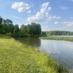
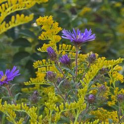
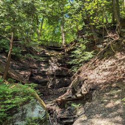
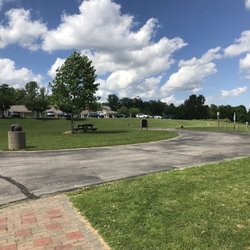
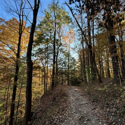
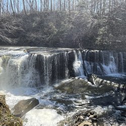
Cute little park with gravel parking, a few benches, nice size pond, and prairie/woods walking trails. About 1 mile of nicely mowed prairie with lots of native grasses and flowers. Best wear tall boots or long pants to avoid bugs and grass. read more


More info about Spring Hill Park
1113 E Pioneer Trl
Aurora, OH 44202
Directions
Hours
Outdoor Amenities


Spring Hill Park - parks - Updated June 2026
Best of Aurora
People found Spring Hill Park by searching for…
Trending Searches in Aurora, OH
Baseball Fields near Spring Hill Park
Black Owned Nail Salons near Spring Hill Park
Boat Rental near Spring Hill Park
Cliff Jumping near Spring Hill Park
Day Trips near Spring Hill Park
Dog Friendly Beaches near Spring Hill Park
Fishing Spots near Spring Hill Park
Free Picnic Areas near Spring Hill Park
Jet Ski Rental near Spring Hill Park
Kayak Rental near Spring Hill Park
Kids Activities Outdoor near Spring Hill Park
Outdoor Basketball Courts near Spring Hill Park
Paddle Boat Rentals near Spring Hill Park
Public Pools near Spring Hill Park
River Swimming near Spring Hill Park
Soccer Store near Spring Hill Park
Splash Pad near Spring Hill Park
Strawberry Picking near Spring Hill Park
Sunbathing near Spring Hill Park
Swimming Holes near Spring Hill Park
Swimming Lakes near Spring Hill Park
U Pick Farms near Spring Hill Park
Browse Articles
Browse Nearby
Browse Brands
Related Searches in Aurora, OH
Best Off Leash Dog Parks in Aurora, Ohio
Best Parks for Parties and Events in Aurora, Ohio
Best Water Parks for Kids in Aurora, Ohio
Check Out Great Playgrounds in Aurora, Ohio
Discover Baseball Fields Around Aurora, Ohio
Discover Beautiful Garden Spots in Aurora, Ohio
Discover Free Parking Options in Aurora, Ohio
Discover Lakes & Ponds to Explore in Aurora, Ohio
Discover Popular Photo Spots in Aurora, Ohio
Discover Soccer Fields in Aurora, Ohio Near You
Discover Top Nature Parks to Visit in Aurora, Ohio
Discover the Best Beaches in Aurora, Ohio
Enjoy the Best Picnic Spots and Ideas in Aurora, Ohio
Enjoy the Best Walking Trails in Aurora, Ohio
Explore Beautiful Botanical Gardens in Aurora, Ohio
Explore Family-Friendly Zoos and Wildlife in Aurora, Ohio
Explore Free Picnic Areas Around Aurora, Ohio
Explore Fun Activities to Do in Aurora, Ohio
Explore Parks With Pull Up Bars in Aurora, Ohio
Explore Popular Campgrounds Near Aurora, Ohio
Explore Popular Picnic Areas Around Aurora, Ohio
Explore Popular RV Parks Around Aurora, Ohio
Explore Popular Recreation Centers Around Aurora, Ohio
Explore Popular Scenic Views Near Aurora, Ohio
Explore Scenic Lakes to Visit in Aurora, Ohio
Explore Top Dog Parks in Aurora, Ohio Near You
Explore Top Gyms in Aurora, Ohio Now
Explore Top Water Parks in Aurora, Ohio Today
Explore the Best Swimming Holes Around Aurora, Ohio
Find Beautiful Views in Aurora, Ohio
Find Parks and Recreation Activities in Aurora, Ohio
Find Top Dog Friendly Parks to Visit in Aurora, Ohio
Find Top Skate Parks in Aurora, Ohio for All Skill Levels
Find Top Skating Rinks in Aurora, Ohio for All Ages
Find the Best Parks for Picnics in Aurora, Ohio
Find the Best Swimming Pools in Aurora, Ohio Today
Have Fun at a Splash Pad in Aurora, Ohio
Indoor Playgrounds to Explore in Aurora, Ohio
Locate Tennis Courts Around Aurora, Ohio
Parks With Basketball Courts for Games in Aurora, Ohio
Picnic Areas With BBQ Pits Available in Aurora, Ohio
Popular Fishing Spots to Explore in Aurora, Ohio
Popular Places to Take Pictures in Aurora, Ohio
Top Hiking Trails to Explore in Aurora, Ohio
Top Running Trails to Explore in Aurora, Ohio
Top Swimming Lakes to Enjoy in Aurora, Ohio
Top-Rated Basketball Courts to Play at in Aurora, Ohio
Top-Rated Hikes in Aurora, Ohio to Explore
People who viewed Spring Hill Park also viewed
Summit Metro Parks
12 reviews
Brust Park-Munroe Falls Parks & Recreation
4 reviews
Hampton Hills Metro Park
3 reviews
O'Neil Woods Metro Park
3 reviews
The Ledges Shelter House & Trail
24 reviews
Cleveland Metroparks
4 reviews
Austin Badger Park
2 reviews
Hinckley Reservation
22 reviews
Blue Hen Falls
29 reviews
West Creek Reservation
20 reviews