Old Mission Dam Trail Photos


You might also consider


More like Old Mission Dam Trail
Recommended Reviews - Old Mission Dam Trail
Start your review...


Reviews With Photos


Old Mission Dam is location in the Mission Trails section of the Mission Trails Regional Park system ( Fortuna and Cowles being the other two). The easiest way to get here in from Santee via the 52 freeway. We came in and parked in the first parking lot and hiked to the Old Mission Dam ( Less than a mile hike, but up a large hill). You can try and park in the Old Mission Dam parking lot ( small ), or along the street. Just know that if you come here on the weekend parking is going to be tight. I don't believe there is an "Old Mission Dam Trail" but there is the old Mission Dam. The dam and the immediate area is family friendly and handicapped friendly too. The one thing that I took away from this visit was that you can actually walk along the dam wall and around the San Diego river. There are chem-cans, a drinking fountain, and picnic tables. There is a also a road for handicapped people to go around this area. For the hiker, there is a bounty of trails that connect from this Dam. Oak Canyon South, and Kwaay Paay Peak trail. I HIGHLY recommend taking one or both of these hikes while you're at this Dam. Each hike is under a few miles. - This is the staging area for many large REI group hikes.. - Snakes!


Very easy trail for all hikers. You can even walk, bike, walk your dog, wheelchair, etc. from the interpretative center to the Mission Dam... but if you really don't want to walk, you can drive there, but parking is limited. The Old Mission Dam is very beautiful and there are some fun facts behind the Natives who built the dam under the Spaniards' watch. The dam itself isn't suitable for swimming for fishing. It's sad how people use the dam to put their trash in it. To get to the other side of the dam, you have to go around, there's no "bridge" built over the main dam. The dam stretches far into the other trails. Just a heads up to apply insect repellent, wear light colored clothing, avoid dawn & dusk hours, because mosquitoes love the calm waters of the dam, especially during the summer.
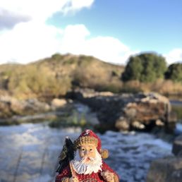

Old Mission Dam Trail (Mission Trails Regional Park) There are a ton of hikes and trails inside Mission Trails Regional Park. The Old Mission Dam Trail is one of them. The reviews for this trail are all over the place. Some people say it's easy. Some people say it's hard. That's the beauty of Mission Trails Regional Park. The difficulty of this trail really depends on the person, how long they're willing to hike, and which of the connecting trails they choose to follow. In my opinion, this trail is mainly flat and easy. The trail leads to multiple other trails, including Oak Canyon Trail and both South & North Fortuna Trail Loop. The dam and San Diego River are conveniently located at the trailhead, which is perfect if you just want to take few photos and enjoy the scenery without putting in any real effort. I hiked a total of 2 miles before deciding to head back and check out the other trails that Mission Trails Regional Park had to offer. The Old Mission Dam Trail is very easy to follow and great for leisure hike.
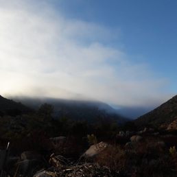

This is a great beginners day-hike for the whole family! Not too far from the hubbub of the San Diego city, perfect for a jaunt out in the morning Old Mission Dam Trail is a refreshing way to treat yourself to nature. This trail leads of into many other trails where you can explore the hillside all day. Be sure to bring lots of water. It's mostly a flat walk with slight inclines, therefore if you were in a motorized wheelchair you could enjoy mother nature too. The walk to the old dam is gentle, and the dam itself is a fantastic find. It's part of San Diego history! I especially enjoyed stumbling across old military signs from the cold war era exclaiming that there are missiles in the area and new signs telling you where you should not go. Just like all other southern California hikes and trails, it is always busy on the weekends... no matter how early you arrive. REASONS TO VISIT: 1. Off the road parking 2. Maintained trails 3. Beginners level 4. Great for bikers 5. Old Dam 6. Several trails


There are several trails that pass through the dam but it seems like the dam is the most popular spot to stop! The trails around the dam are nice and easy not too rocky or much of an incline. There is lots of scenery and plenty of photo ops. When the park is open you can park down by the dam but they usually close the gates by sunset so it's better to park just outside the gates if you go in the late afternoon. I looks like they added mulch to some of the grassland loop trail as well which I found to be awesome... easier on the joints for sure! This trail is definitely family friendly and pet friendly. There are no restrooms at this location but they have portable one if you must go. Remember to carry plenty of water and stay hydrated.... enjoy the trails!
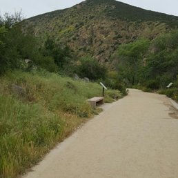

So far every hiking trail in town has not let me down. I underestimated this trail thinking it was an easy dirt trail but it is not. There are some fairly steep hills to climb and a lot of rocky terrain around the watery area of the trail. Signs are easy to find to point you where to go. This is a good woodsy trail to hit up if you prefer the greenery scene over the beach trails in town. Its also a good alternative to Cowles which is in the same regional park as this trail. Estimated a loop to be just over 3 miles. If I recall this trail connected with the Oak Creek Trail and Fortuna trail during the hike.


We went to explore the old mission dam trail today the drive up wasn't bad at all we found our spot and got over to the dam , I think the water levels are a little low today just because I have seen some other pictures and there seemed to be more water flowing . Although that is ok I wanted to take my family to a place that was a new site to see as well as educational and someplace to explore the dam is very cool , great place to get cool pictures and walk around get some hiking in as well we had fun at the end of the day


This trail is relatively easy. Paved road all the way through with little to no incline. The dam was absolutely gorgeous Wish I had been here earlier in the fall season when the leaves started changing colors. Would definitely do it again for a nice stroll/ leisure exercise read more


3 years ago
This is one of my favorite places to hike in San Diego because, I truly enjoy seeing and hearing water . It has such a relaxed feel about it . Different level of trails here from easy family friendly to more challenging with incline . It's a great place to view nature with an easy nature stroll if you want to take it easy . Some benches are set up for taking a rest near the dam or down the paved path. Bicyclist , runners, walkers and hikers can come out to play and go home happy . I did notice also a few picnic benches setting near the damn parking lot as well a water fountain is available . Porta potty's available there as well . The visitor center has regular bathrooms and maps for the trails . read more


We decided to take a little hike today to the Dam. Good amount of people on the trail and even a ranger which was nice to see. Dogs, kids, bikers were all sharing the path. I like this trail coz it's good if you are a beginner. It's a good starter trail. The trail from the road is clearly marked and you ascend down a little grade then you cross over the San Diego river. As you begin to incline the little bridge turns to a steel plate then uneven dirt and rocks. At the top it opens up to a nice wide open spot and from here you come to a cross roads. You can choose other trails with more difficulty or bank left to the Old Mission Dam overlook and trail. I say that coz the overlook is a nice little bench to overlook the dam. We stopped here with the ranger. It was getting pretty hot and there were bugs. I forgot to bring the bug spray. It's a nice little hike to get you back on your wellness game and being healthy again. I recommend you bring sunscreen, a hat, water, wear sunnies, proper attire and shoes. Be aware of your surroundings. There are wildlife around. Use bug spray and stay on the trail to keep safe. Cheers mate happy hiking. Mel M Yelp 20:17 read more


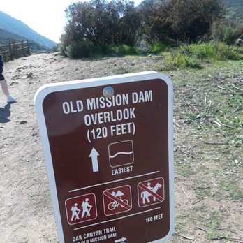


Old Mission Dam is location in the Mission Trails section of the Mission Trails Regional Park system ( Fortuna and Cowles being the other two). The easiest way to get here in from Santee via the 52 freeway. We came in and parked in the first parking lot and hiked to the Old Mission Dam ( Less than a mile hike, but up a large hill). You can try and park in the Old Mission Dam parking lot ( small ), or along the street. Just know that if you come here on the weekend parking is going to be tight. I don't believe there is an "Old Mission Dam Trail" but there is the old Mission Dam. The dam and the immediate area is family friendly and handicapped friendly too. The one thing that I took away from this visit was that you can actually walk along the dam wall and around the San Diego river. There are chem-cans, a drinking fountain, and picnic tables. There is a also a road for handicapped people to go around this area. For the hiker, there is a bounty of trails that connect from this Dam. Oak Canyon South, and Kwaay Paay Peak trail. I HIGHLY recommend taking one or both of these hikes while you're at this Dam. Each hike is under a few miles. - This is the staging area for many large REI group hikes.. - Snakes! read more


8 years ago
Very easy trail for all hikers. You can even walk, bike, walk your dog, wheelchair, etc. from the interpretative center to the Mission Dam... but if you really don't want to walk, you can drive there, but parking is limited. The Old Mission Dam is very beautiful and there are some fun facts behind the Natives who built the dam under the Spaniards' watch. The dam itself isn't suitable for swimming for fishing. It's sad how people use the dam to put their trash in it. To get to the other side of the dam, you have to go around, there's no "bridge" built over the main dam. The dam stretches far into the other trails. Just a heads up to apply insect repellent, wear light colored clothing, avoid dawn & dusk hours, because mosquitoes love the calm waters of the dam, especially during the summer. read more


Old Mission Dam Trail (Mission Trails Regional Park) There are a ton of hikes and trails inside Mission Trails Regional Park. The Old Mission Dam Trail is one of them. The reviews for this trail are all over the place. Some people say it's easy. Some people say it's hard. That's the beauty of Mission Trails Regional Park. The difficulty of this trail really depends on the person, how long they're willing to hike, and which of the connecting trails they choose to follow. In my opinion, this trail is mainly flat and easy. The trail leads to multiple other trails, including Oak Canyon Trail and both South & North Fortuna Trail Loop. The dam and San Diego River are conveniently located at the trailhead, which is perfect if you just want to take few photos and enjoy the scenery without putting in any real effort. I hiked a total of 2 miles before deciding to head back and check out the other trails that Mission Trails Regional Park had to offer. The Old Mission Dam Trail is very easy to follow and great for leisure hike. read more
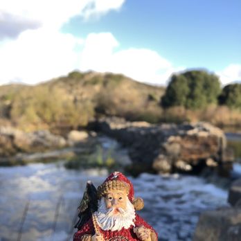


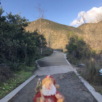


This is a great beginners day-hike for the whole family! Not too far from the hubbub of the San Diego city, perfect for a jaunt out in the morning Old Mission Dam Trail is a refreshing way to treat yourself to nature. This trail leads of into many other trails where you can explore the hillside all day. Be sure to bring lots of water. It's mostly a flat walk with slight inclines, therefore if you were in a motorized wheelchair you could enjoy mother nature too. The walk to the old dam is gentle, and the dam itself is a fantastic find. It's part of San Diego history! I especially enjoyed stumbling across old military signs from the cold war era exclaiming that there are missiles in the area and new signs telling you where you should not go. Just like all other southern California hikes and trails, it is always busy on the weekends... no matter how early you arrive. REASONS TO VISIT: 1. Off the road parking 2. Maintained trails 3. Beginners level 4. Great for bikers 5. Old Dam 6. Several trails read more


There are several trails that pass through the dam but it seems like the dam is the most popular spot to stop! The trails around the dam are nice and easy not too rocky or much of an incline. There is lots of scenery and plenty of photo ops. When the park is open you can park down by the dam but they usually close the gates by sunset so it's better to park just outside the gates if you go in the late afternoon. I looks like they added mulch to some of the grassland loop trail as well which I found to be awesome... easier on the joints for sure! This trail is definitely family friendly and pet friendly. There are no restrooms at this location but they have portable one if you must go. Remember to carry plenty of water and stay hydrated.... enjoy the trails! read more


So far every hiking trail in town has not let me down. I underestimated this trail thinking it was an easy dirt trail but it is not. There are some fairly steep hills to climb and a lot of rocky terrain around the watery area of the trail. Signs are easy to find to point you where to go. This is a good woodsy trail to hit up if you prefer the greenery scene over the beach trails in town. Its also a good alternative to Cowles which is in the same regional park as this trail. Estimated a loop to be just over 3 miles. If I recall this trail connected with the Oak Creek Trail and Fortuna trail during the hike. read more
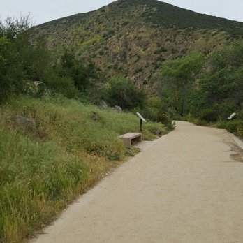

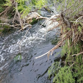


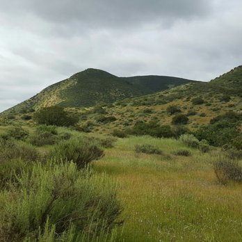
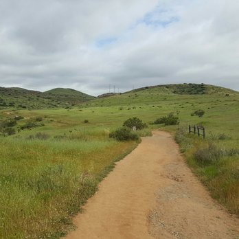


7 years ago
We went to explore the old mission dam trail today the drive up wasn't bad at all we found our spot and got over to the dam , I think the water levels are a little low today just because I have seen some other pictures and there seemed to be more water flowing . Although that is ok I wanted to take my family to a place that was a new site to see as well as educational and someplace to explore the dam is very cool , great place to get cool pictures and walk around get some hiking in as well we had fun at the end of the day read more


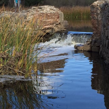
This trail is a great place to go for a short nature walk or to just find a shady spot to think. The loop is less than two miles. It starts at the old Mission dam then loops out towards the Oak Canyon trail. The dam is always a great photo spot and the whole area attracts lots of birds. There are a number of short stairs to climb but overall this is a very easy and enjoyable hike. read more




9 years ago
7 years ago
More info about Old Mission Dam Trail
8300-9996 Father Junipero Serra Trl
Santee, CA 92071
Directions
Hours
Outdoor Amenities
Ask the Community - Old Mission Dam Trail
Review Highlights - Old Mission Dam Trail
You might also consider

















Why does Yelp recommend reviews?
1 review that is not currently recommended
The reviews below are not factored into the business's overall star rating.
9 years ago
Old Mission Dam Trail - hiking - Updated September 2026
Best of Santee
People found Old Mission Dam Trail by searching for…
Trending Searches in Santee, CA
Apple Orchards near Old Mission Dam Trail
Apple Picking near Old Mission Dam Trail
Archery near Old Mission Dam Trail
Barbershop near Old Mission Dam Trail
Baseball Fields near Old Mission Dam Trail
Beautiful Views near Old Mission Dam Trail
Bird Sanctuary near Old Mission Dam Trail
Blow Dry Bar near Old Mission Dam Trail
Consignment Shops near Old Mission Dam Trail
Corn Maze near Old Mission Dam Trail
Dog Friendly Things To Do near Old Mission Dam Trail
Dog Parks near Old Mission Dam Trail
Dog Swimming near Old Mission Dam Trail
Eyelash Extensions near Old Mission Dam Trail
Formal Wear near Old Mission Dam Trail
Hiking Trails near Old Mission Dam Trail
Kids Birthday Party near Old Mission Dam Trail
Makeup Artists near Old Mission Dam Trail
Mens Suits near Old Mission Dam Trail
Off Road Trails near Old Mission Dam Trail
Parks near Old Mission Dam Trail
Photo Spots near Old Mission Dam Trail
Picnic Areas near Old Mission Dam Trail
Places To Take Pictures near Old Mission Dam Trail
Playgrounds near Old Mission Dam Trail
Private Schools near Old Mission Dam Trail
Public Running Track near Old Mission Dam Trail
Public Shower near Old Mission Dam Trail
Pumpkin Patches near Old Mission Dam Trail
River Swimming near Old Mission Dam Trail
Rock Quarry near Old Mission Dam Trail
Scenic Night View near Old Mission Dam Trail
Scenic Overlook near Old Mission Dam Trail
Sunrise View near Old Mission Dam Trail
Browse Nearby
BEST of Santee, California Coffee near Old Mission Dam Trail
BEST of Santee, California Restaurants near Old Mission Dam Trail
BEST of Santee, California Things to Do near Old Mission Dam Trail
BEST of Santee, California Breakfast near Old Mission Dam Trail
BEST of Santee, California Parks near Old Mission Dam Trail
BEST of Santee, California Horseback Riding near Old Mission Dam Trail
BEST of Santee, California Campgrounds near Old Mission Dam Trail
Browse Brands
Related Searches in Santee, CA
Affordable Kayak Rental Services in Santee, California
Best Dog Hiking Trails Around Santee, California
Best Fishing Locations and Guides in Santee, California
Best Nature Trails for Hiking in Santee, California
Best Off Leash Dog Parks in Santee, California
Best Parks for Parties and Events in Santee, California
Best Places for Horseback Riding in Santee, California
Best Sightseeing Experiences Available in Santee, California
Best Water Parks for Kids in Santee, California
Check Out Great Playgrounds in Santee, California
Check Out Off Road Trails in Santee, California
Discover Baseball Fields Around Santee, California
Discover Dog Friendly Trails to Explore in Santee, California
Discover Easy Hiking Trails Near Santee, California
Discover Fun Toddler Parks in Santee, California for Your Little One
Discover Kid Friendly Hiking Trails in Santee, California
Discover Lakes & Ponds to Explore in Santee, California
Discover Popular Bike Trails in Santee, California
Discover Soccer Fields in Santee, California Near You
Discover Top Nature Parks to Visit in Santee, California
Discover Top State Parks to Visit in Santee, California
Discover Walking Parks in Santee, California Near You
Discover a Hiking Trail in Santee, California
Discover the Best Beaches in Santee, California
Discover the Best Kids Park Spots in Santee, California
Discover the Best Night Hike Trails in Santee, California
Dog-Friendly Hikes With Dogs in Santee, California
Enjoy Camping Adventures Around Santee, California
Enjoy Kayaking Adventures in Santee, California
Enjoy Off Leash Dog Hikes in Santee, California
Enjoy Scenic Places to Walk in Santee, California
Enjoy Tent Camping Spots Around Santee, California
Enjoy a Beautiful Waterfall Hike in Santee, California
Enjoy the Best Picnic Spots and Ideas in Santee, California
Enjoy the Best Walking Path in Santee, California
Enjoy the Best Walking Trails in Santee, California
Explore Beautiful Parks and Green Spaces in Santee, California
Explore Easy Hikes Perfect for All in Santee, California
Explore Free Picnic Areas Around Santee, California
Explore Fun Activities to Do in Santee, California
Explore Parks With Pull Up Bars in Santee, California
Explore Picnic Parks Near Santee, California
Explore Popular Campgrounds Near Santee, California
Explore Popular Kids Parks Throughout Santee, California
Explore Popular Picnic Areas Around Santee, California
Explore Popular RV Parks Around Santee, California
Explore Scenic Lakes to Visit in Santee, California


