
Mount Lawlor Via Red Box Photos


You might also consider


More like Mount Lawlor Via Red Box
Recommended Reviews - Mount Lawlor Via Red Box
Start your review...



6 years ago
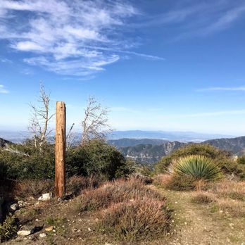
This hike going up the firebreak ridge to Lawlor, then to Strawberry Peak saddle and back is about 4.8 miles round trip. The hike starts at the same trailhead as Strawberry peak. You will continue on for about 1 mile, then see the steep ridge ahead that will take you directly to the peak. The climb is a little less than 1000 feet elevation in 0.6 miles. This ascent is very steep, and there will be some rock scrambling/climbing and loose gravel and scree to contend with. At times it may be difficult to get a foot hold. Take your time. At the top, the mountain starts to flatten and you will follow the trail to the right to Mount Lawlor peak (marked with a partial telephone pole). I would recommend to take the firebreak trail to Strawberry Peak saddle (about 0.7 miles) to descend, as it will be much safer. The trail is overgrown in parts and there is some rock scrambling down as well, but the trail is mostly visible and easy to follow. At the saddle, take a hard left and follow the single file trail back to the trailhead. This part of the trail is quite easy. If you are looking for a challenging alternative to Strawberry Peak, this hike fits the bill. parking - adventure pass required if you park in the designated parking lot (which is closed at this time due to covid-19 restrictions). Alternate parking is available across the street read more


6 years ago
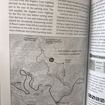
Great hike but get ready for a tough ascent and a tougher descent. The first couple of miles are fairly easy, the trail is straight forward and clear until you reach your U turn to head up to the summit (this is where it splits for strawberry peak) That trek up is tough, lots of climbing over rocks and spiky bushes. At times it feels like you've lost the trail but just keep heading up. I did not see anyone on my way up to the summit or down and I started around 10:30am. So this is definitely the path less traveled which I appreciate when I'm hiking. The way down is fairly straight forward, again it doesn't look much like a trail and there was LOTS of challenges- spiky bushes, loose dirt, it's a kicker for sure. If you're confused where to go basically continue on the trail south and it's a straight shot down. Very literally straight down. There's some cables to hold on to so keep an eye for those they're very helpful! I checked my GPS a couple times to make sure I was heading in the right direction but again it's really just down. A couple of things: WEAR PANTS!!! The spiky bushes are real and even with capris my legs are all cut up. Definitely wear hiking boots to protect your ankles on the way down. I'm writing this review during Covid 19 shelter in place, so the main parking lot is closed but there is a small parking lot just past the paved one where you can park and walk up. This trailhead as of when I'm writing this review is open and you're able to hike it still! read more


7 years ago
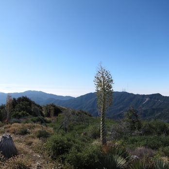
This hike starts at the strawberry peak trail head. You will park at the redbox picnic area. Remember to display your adventure pass. There is a restroom at the parking lot, I suggest bring your own wipes if needed. You will find the start of the trail across the Angeles Crest Highway. You will see a sign stating strawberry. The trail is well maintained in this portion. You do see poodle dog bush near the trail area, so try to avoid touching if you can. I wore long pants. You will arrive at a faint split in the trail. If you want to take a challenge, you can go right and up to Mount Lawlor, but I could not make out the trail and it's steep with a lot of overgrown plants and Spanish Bayonet which hurts to get stabbed by them. So I opted to go left to Lawlor Saddle and hike up from there. Once you reach Lawlor Saddle, you will see another split in the trail. I think if you go right, that takes you to Strawberry Meadows, and there is a sign for strawberry peak to go left and up. But for Mount Lawlor, make a right U turn to a small trail going up. This is where the trail is thinned out and a lot of overgrown bush, spanish bayonet, and poodle dog bush. If you want a bit of an adventure and scrambling thru rocks, this would be it. You probably won't see much hikers on this trail. Everyone prefer the popular Strawberry Peak hike. So if you want to get away from the crowd, you can't go wrong with this one. As you summit Mount Lawlor, the view is good, but not great. Because it doesn't seem to be maintained very well, the view is blocked by all the overgrown bush. I did find a spot near the end with some great views, but it could be much better if it was cleaned up. From here, I tried to locate the steep trail to head back down to complete the loop. But I could not find it and I do not want to get stabbed by those Spanish Bayonet plants. So I hiked out the same way I hiked up. It was still a fun challenging hike, but might be better during the winter time as bugs galore near top. I ended up hiking about 6 miles round trip which is not bad:). As always pack accordingly to the weather and have fun. read more




7 years ago

10 years ago
Great hike. But man oh man did we potentially get lost more on that later. So as of now, the best way to access this trail is via the split between the sign heading towards Strawberry Peak (about 1.5 miles in). To access the trail in general (which is now the Strawberry Trail alt route) walk across the street from the Redbox camp to a sandy area. You'll see a post for the sign that used to be there. Once you get to the fork 1.5 miles in (after you follow the narrow trails around the mountain edges) if you look to your right (you'll see some metal scrap on the ground) you'll see the ridge line Mt Lawlor. Yes. You're going to hike that shit. It was fun but the terrain can be difficult since the trail isn't groomed anymore and some of the rock faces are kind of sharp. Long pants would be super helpful as our legs were cut up by the time we circled around. It was hard to find the path at times because it's not groomed so you'll have to do a bit of footprint tracking. Not too hard though. So you get to the top and it's amazing! Definitely worth it. However, don't follow the posts that continue going east as we found out, it takes you to Barley Flats. If you have the time, go for it! Unfortunately for us, we got five peaks over at around 6pm so we had to turn back. It's beautiful and fun because you can see everything though following the ridge line. If you start the hike in the morning, you'll have plenty of time to do it all. Again, only unfortunate thing is that it is ungroomed so the trails are covered with bushes and Spanish Yucca plants which are really sharp. Just FYI, it's considered closed by the park. You can still do it, but just keep it in mind when hiking. read more


More info about Mount Lawlor Via Red Box
Angeles National Forrest
Arcadia, CA 91006
Directions
Hours
Outdoor Amenities
You might also consider








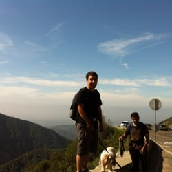





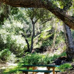
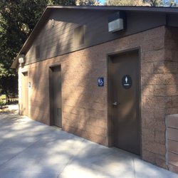



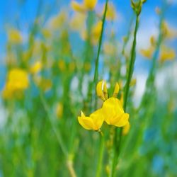

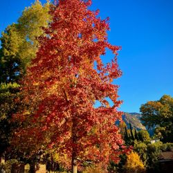


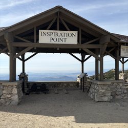

Mount Lawlor Via Red Box - hiking - Updated October 2026
Best of Arcadia
People found Mount Lawlor Via Red Box by searching for…
Trending Searches in Arcadia, CA
Apple Orchards near Mount Lawlor Via Red Box
Apple Picking near Mount Lawlor Via Red Box
Attraction Farms near Mount Lawlor Via Red Box
Bird Sanctuary near Mount Lawlor Via Red Box
Corn Maze near Mount Lawlor Via Red Box
Costume Store near Mount Lawlor Via Red Box
Cpr Classes near Mount Lawlor Via Red Box
Dog Friendly Trails near Mount Lawlor Via Red Box
Fall Foliage near Mount Lawlor Via Red Box
Halloween Events near Mount Lawlor Via Red Box
Haunted Houses near Mount Lawlor Via Red Box
Hiking Trails near Mount Lawlor Via Red Box
Indoor Activities near Mount Lawlor Via Red Box
Jewellery near Mount Lawlor Via Red Box
Kids Birthday Party near Mount Lawlor Via Red Box
Lookout Points near Mount Lawlor Via Red Box
Off Road Trails near Mount Lawlor Via Red Box
Photo Spots near Mount Lawlor Via Red Box
Pick Your Own Farms near Mount Lawlor Via Red Box
Places To Take Pictures near Mount Lawlor Via Red Box
Places To Walk At Night near Mount Lawlor Via Red Box
Pumpkin Patches near Mount Lawlor Via Red Box
Rock Quarry near Mount Lawlor Via Red Box
Scenic Night View near Mount Lawlor Via Red Box
Scenic Overlook near Mount Lawlor Via Red Box
State Parks near Mount Lawlor Via Red Box
Browse Articles
Browse Nearby
Browse Brands
Related Searches in Arcadia, CA
Best Dog Hiking Trails Around Arcadia, California
Best Fishing Locations and Guides in Arcadia, California
Best Nature Trails for Hiking in Arcadia, California
Best Places for Horseback Riding in Arcadia, California
Check Out Off Road Trails in Arcadia, California
Discover Dog Friendly Trails to Explore in Arcadia, California
Discover Easy Hiking Trails Near Arcadia, California
Discover Kid Friendly Hiking Trails in Arcadia, California
Discover Popular Bike Trails in Arcadia, California
Discover Scenic Mountain Bike Trails Near Arcadia, California
Discover Walking Parks in Arcadia, California Near You
Discover a Hiking Trail in Arcadia, California
Discover the Best Night Hike Trails in Arcadia, California
Dog-Friendly Hikes With Dogs in Arcadia, California
Enjoy Camping Adventures Around Arcadia, California
Enjoy Kayaking Adventures in Arcadia, California
Enjoy Off Leash Dog Hikes in Arcadia, California
Enjoy Scenic Places to Walk in Arcadia, California
Enjoy Tent Camping Spots Around Arcadia, California
Enjoy a Beautiful Waterfall Hike in Arcadia, California
Enjoy the Best Walking Path in Arcadia, California
Enjoy the Best Walking Trails in Arcadia, California
Explore Beautiful Parks and Green Spaces in Arcadia, California
Explore Easy Hikes Perfect for All in Arcadia, California
Explore Fun Activities to Do in Arcadia, California
Explore Popular Campgrounds Near Arcadia, California
Explore Popular Dog Walking Trails in Arcadia, California
Explore Top Dog Parks in Arcadia, California Near You
Explore the Best Beach Spots in Arcadia, California
Family Friendly Hiking With Kids in Arcadia, California
Find Beautiful Views in Arcadia, California
Find Parks and Recreation Activities in Arcadia, California
Find Top Dog Friendly Parks to Visit in Arcadia, California
Find Top-Rated Waterfalls in Arcadia, California Now
Find the Best Parks for Picnics in Arcadia, California
Hiking Trails With Waterfalls in Arcadia, California
Off Leash Dog Hiking Trails in Arcadia, California
Popular Outdoor Activities to Try in Arcadia, California
Popular Picnic Spots to Visit in Arcadia, California
Popular Waterfall Hiking Trails in Arcadia, California
Safe River Swimming Areas in Arcadia, California
Safe and Fun Parks for Kids in Arcadia, California
Top Hiking Trails to Explore in Arcadia, California
Top Playgrounds for Kids to Enjoy in Arcadia, California
Top Running Trails to Explore in Arcadia, California
Top Swimming Lakes to Enjoy in Arcadia, California
Top Swimming Spots and Pools in Arcadia, California
Top-Rated Camping Sites in Arcadia, California


