Mt Baldy via Register Ridge Photos



You might also consider


More like Mt Baldy via Register Ridge
Recommended Reviews - Mt Baldy via Register Ridge
Start your review...


Reviews With Photos


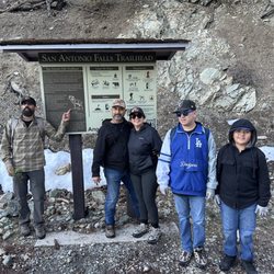
The trailhead for this hike begins at the intersection of Mt Baldy Rd and Falls Rd in Manker Flat. Mt. Baldy Rd splits into two just before you get to the intersection and you can park anywhere in between, and preferably as close as possible to Falls Rd. Hike up Falls Rd to San Antonio Falls. Continue about 0.3 miles on Falls Rd to the beginning of the Baldy Bowl Trail, also known as the Ski Hut Trail. The Baldy Bowl Trail will be on your left, heading steeply up the mountain, and is not marked, so pay attention. I've attached a pic to give you an idea of what to look for. Shortly after you get on the Baldy Bowl Trail, you will pass a rust red register box on the right side of the trail. Continue for about 50 yards and you will come across a use trail that goes up the mountain on your right. The use trail is not marked, but is quite visible if you are paying attention. I've attached a pic for this too. Take this use trail up Register Ridge all the way up where it intersects the Devils Backbone Trail near Mt Hardwood. This route is steeper than most of the other standard routes up Mt. Baldy. You gain about 2600 ft of elevation over about 1.7 miles. There is also an optional short Class 3 rock climb that you can do or just hike around near the end of the use trail. The use trail sort of fades away just before you get to the Devils Backbone Trail, so just continue up the ridge towards Mt. Hardwood. Once you're on the Devils Backbone Trail, you can head straight towards the Mt. Baldy peak, or you can take a short detour and tag Mt. Hardwood along the way. I decided to climb Mt. Hardwood too since is was right there. I didn't see a trail up, but you can just scramble up the rocky slope. You can continue along the top of Mt. Hardwood towards Mt. Baldy peak to a ridge that takes you back to Devils Backbone Trail. Make the final climb to the top of Mt. Baldy and enjoy the view. To descend, I'd recommend taking the Baldy Bowl Trail. It's less steep than the way you came up, so it's much easier on the legs. Along the way you pass by the Baldy Bowl and the Sierra Club Ski Hut, which is why the Baldy Bowl Trail is often referred to as the Ski Hut Trail. A stream runs by the Ski Hut, at least when there is still melting snow on the mountain, so you can fill up on water here if you have a means of purification. Not sure if the stream runs during late summer and fall. Continue down the Baldy Bowl Trail until you reach Falls road, which you can take back to Manker Flat. Trip totals: 8.4 miles / 4000 ft. elevation gain There was still some snow high on the mountain as of May 3. Most of the route was clear of snow except for short portions of the Baldy Bowl Trail.


I can't add much to Winston C.'s thorough review, but here's my attempt. Less than 50 feet past the register box at the start of the Ski Hut/Baldy Bowl trail, the register ridge trail begins faintly on your right. It starts off as a steep climb up loose dirt, so make sure you have a stick or hiking pole. All you need to do is to go up; most of the way, there isn't a set use trail, but it seems impossible to get lost going up on the ridge. If you need to do some route finding, the best bet is to stick to the left/northwest direction. After a bit, the steepness plateaus and you can rest under the trees. Continuing on, the path will resume its steepness. As you near the end of the ridge, you'll be scrambling across scree/talus and pine needles, though the scree can be avoided if you ascend further west. Once you see a tall wall of rocks, keep to the left. You may notice a use trail heading leftwards. Follow it, and you'll eventually top out on the well worn Devil's Backbone trail at the base of Mt. Harwood. Continue left (west) to reach Mt. Baldy, which is about 1.5 miles away. Register ridge is a great option if you feel like avoiding the Mt. Baldy crowds. Nary a soul was seen on the entire ridge. It's also the most direct way to Mt. Baldy from Manker Flats, but that also means it's the steepest. For those visiting Mt. Baldy for the first time, it may be advisable to first ascend via the Ski Hut or Devil's Backbone trails, saving a register ridge ascent for a later trip in the future because, really, why not save the best for last? Going down register ridge may be a pain, considering how slippery the loose dirt can be; if you're set on heading down, make sure you descend the correct ridge. (Note: Don't ask me about the AJEC trail; it exists only for three other people.)


What a pleasure! So steep that it helps one develop that special tenacity hikers cherish so! It was very easy to find...100 steps past the register on the Baldy Bowl Trail. Easy to follow to the Devils Backbone and seldom traveled. It feels twice as steep as the Bear Ridge and Baldy Bowl trails. It is not quite but is a very direct way to gain 2000'.


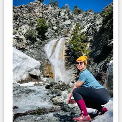
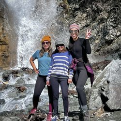
Nice hike to where you can view a waterfall - have to climb through rocks to get to the base of it but other than that it's a wide paved road. You can even bring a stroller. Great place for a hike, remember pay for parking. read more


11 years ago
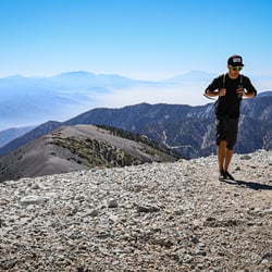
This is a pretty difficult hike of about 11 miles up and back and 4,100' elevation gain. The start of the hike is San Antonio Falls trail at Manker Flats. About 1/2 mile in, you will see the very steep turn off to the right to start your Register Ridge climb. The incline is very steep from the get-go and it continues on a pretty steady uphill incline throughout. There are parts that are pretty tough. The trail is single file with loose rocks under foot. You will also have to maneuver over and around some big rocks on occasion. It can be difficult to get your footing, so hiking poles would be helpful. Once you reach Devil's Backbone, you have the opportunity to add a bit of elevation and mileage by summitting Harwood Peak before reaching Baldy, which is right off of Devil's Backbone. The 360 degree views are pretty spectacular on Mt Baldy. It can be very windy and cool on top at any given time of year, so bring a jacket/windbreaker. There are several trail options to take for the return trip, inluding Devil's Backbone or the Ski Hut Trail. Both have steep areas of descent, but the Ski Hut Trail is shorter. parking - lot located at the start of the trail that requires an adventure pass read more


7 years ago

17 years ago
The trailhead for this hike begins at the intersection of Mt Baldy Rd and Falls Rd in Manker Flat. Mt. Baldy Rd splits into two just before you get to the intersection and you can park anywhere in between, and preferably as close as possible to Falls Rd. Hike up Falls Rd to San Antonio Falls. Continue about 0.3 miles on Falls Rd to the beginning of the Baldy Bowl Trail, also known as the Ski Hut Trail. The Baldy Bowl Trail will be on your left, heading steeply up the mountain, and is not marked, so pay attention. I've attached a pic to give you an idea of what to look for. Shortly after you get on the Baldy Bowl Trail, you will pass a rust red register box on the right side of the trail. Continue for about 50 yards and you will come across a use trail that goes up the mountain on your right. The use trail is not marked, but is quite visible if you are paying attention. I've attached a pic for this too. Take this use trail up Register Ridge all the way up where it intersects the Devils Backbone Trail near Mt Hardwood. This route is steeper than most of the other standard routes up Mt. Baldy. You gain about 2600 ft of elevation over about 1.7 miles. There is also an optional short Class 3 rock climb that you can do or just hike around near the end of the use trail. The use trail sort of fades away just before you get to the Devils Backbone Trail, so just continue up the ridge towards Mt. Hardwood. Once you're on the Devils Backbone Trail, you can head straight towards the Mt. Baldy peak, or you can take a short detour and tag Mt. Hardwood along the way. I decided to climb Mt. Hardwood too since is was right there. I didn't see a trail up, but you can just scramble up the rocky slope. You can continue along the top of Mt. Hardwood towards Mt. Baldy peak to a ridge that takes you back to Devils Backbone Trail. Make the final climb to the top of Mt. Baldy and enjoy the view. To descend, I'd recommend taking the Baldy Bowl Trail. It's less steep than the way you came up, so it's much easier on the legs. Along the way you pass by the Baldy Bowl and the Sierra Club Ski Hut, which is why the Baldy Bowl Trail is often referred to as the Ski Hut Trail. A stream runs by the Ski Hut, at least when there is still melting snow on the mountain, so you can fill up on water here if you have a means of purification. Not sure if the stream runs during late summer and fall. Continue down the Baldy Bowl Trail until you reach Falls road, which you can take back to Manker Flat. Trip totals: 8.4 miles / 4000 ft. elevation gain There was still some snow high on the mountain as of May 3. Most of the route was clear of snow except for short portions of the Baldy Bowl Trail. read more


16 years ago
I can't add much to Winston C.'s thorough review, but here's my attempt. Less than 50 feet past the register box at the start of the Ski Hut/Baldy Bowl trail, the register ridge trail begins faintly on your right. It starts off as a steep climb up loose dirt, so make sure you have a stick or hiking pole. All you need to do is to go up; most of the way, there isn't a set use trail, but it seems impossible to get lost going up on the ridge. If you need to do some route finding, the best bet is to stick to the left/northwest direction. After a bit, the steepness plateaus and you can rest under the trees. Continuing on, the path will resume its steepness. As you near the end of the ridge, you'll be scrambling across scree/talus and pine needles, though the scree can be avoided if you ascend further west. Once you see a tall wall of rocks, keep to the left. You may notice a use trail heading leftwards. Follow it, and you'll eventually top out on the well worn Devil's Backbone trail at the base of Mt. Harwood. Continue left (west) to reach Mt. Baldy, which is about 1.5 miles away. Register ridge is a great option if you feel like avoiding the Mt. Baldy crowds. Nary a soul was seen on the entire ridge. It's also the most direct way to Mt. Baldy from Manker Flats, but that also means it's the steepest. For those visiting Mt. Baldy for the first time, it may be advisable to first ascend via the Ski Hut or Devil's Backbone trails, saving a register ridge ascent for a later trip in the future because, really, why not save the best for last? Going down register ridge may be a pain, considering how slippery the loose dirt can be; if you're set on heading down, make sure you descend the correct ridge. (Note: Don't ask me about the AJEC trail; it exists only for three other people.) read more


8 years ago
What a pleasure! So steep that it helps one develop that special tenacity hikers cherish so! It was very easy to find...100 steps past the register on the Baldy Bowl Trail. Easy to follow to the Devils Backbone and seldom traveled. It feels twice as steep as the Bear Ridge and Baldy Bowl trails. It is not quite but is a very direct way to gain 2000'. read more


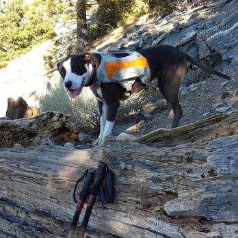
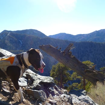
Short and STEEP! I could stop here and that would describe this trail. Register Ridge Trail takes you up 2,638 feet of elevation gain in just 1.4 miles! After hiking the Baldy Bowl Trail many times and passing by the Register Ridge Trailhead each time, my pooch Sammy insisted we step up and finally take the challenge... and so we did. You can park at Manker Flats, exactly 4 miles from the Mt Baldy Visitor Center, and start at the San Antonio Falls Trailhead. Walk 0.6 miles up the asphalt road to the falls, continue up the dirt road for another 0.2 miles and then take the easy to miss steep Baldy Bowl Trail to the left. You will quickly reach the metal register box which you can sign. From there, I counted 100 steps, or a good 50 yards, to reach the Register Ridge Trailhead that takes off to the right up the STEEP loose dirt trail. There is no sign for this trail, so you will have to look for it. At 1.1 miles from the SA Falls Trailhead, look up to the left for the small green roof of the Ski Hut. I also found cell phone coverage here to sign into Yelp. The trail is easy to follow about 90 percent of the time. One hard spot is when you reach 1.34 miles at the large rocky section where the big pine cones and needles cover the trail. When in doubt, stay to the left or northwest side of the narrow ridge. When you come a huge fallen split tree that seems to lead you to the left, climb over it and take a hard right up the trail. http://www.yelp.com/biz_photos/mt-baldy-via-register-ridge-mount-baldy?select=q7uMZMeynyWY0hvvLTss3Q#A0bBfGqg4X3yT9zaXAvzVw Don't miss the great photo prop rock at 1.75 miles on the left side of the trail. Awesome view! http://www.yelp.com/biz_photos/mt-baldy-via-register-ridge-mount-baldy?select=q7uMZMeynyWY0hvvLTss3Q#QqtGw1er72DzDGaLwh0BYQ You probably won't see anyone on this trail so you might need to use a tripod like I did. I bought a Tamrac 404 Zipshot Mini tripod at REI. It's great; it only weighs 9 ounces and reaches 28" high. You can even bend up one of the legs for when you are on the slanted hillside. At 1.84 miles you can climb up the 50 foot boulder wall or just go around. Just past that, the Manzanita bushes start and you are less than a half of a mile from the Devil's Backbone Trail at 2.23 miles from the SA Falls Trailhead. The Register Ridge Trail runs perpendicular into the Devil's Backbone Trail, 1 mile east of the D.BBone Trail sign at the top of Mt. Baldy. Coming from the Register Ridge Trail you can go to the right and head down the D.BBone to the ski lodge then back to Manker Flats. I chose to go left, to the west up the hardest part of the D.BBone Trail to summit Mt. Baldy at 10,064 feet. From there, I hiked down the Baldy Bowl Trail past the Ski Hut and back down to Manker Flats. This was a challenging loop covering 7 miles with an elevation gain of 4,238 feet. It is a shorter route, but it was STEEP going up the Register Ridge Trail and STEEP going down the Baldy Bowl Trail. My legs don't usually get sore after these hikes... but they did on this loop! Even Sammy slept a little longer that night. read more




16 years ago

8 years ago

11 years ago
More info about Mt Baldy via Register Ridge
Mt Baldy Rd & Falls Rd
Mount Baldy, CA 91759
Directions
Hours
Outdoor Amenities
Ask the Community - Mt Baldy via Register Ridge
Review Highlights - Mt Baldy via Register Ridge
You might also consider












Mt Baldy via Register Ridge - hiking - Updated May 2026
Best of Mount Baldy
People found Mt Baldy via Register Ridge by searching for…
Sunrise View in Mount Baldy, CA
Rock Climbing in Mount Baldy, CA
Waterfall Hike in Mount Baldy, CA
Tourist Attractions in Mount Baldy, CA
Visitor Centers in Mount Baldy, CA
Scenic Overlook in Mount Baldy, CA
Sunrise Hike in Mount Baldy, CA
Parks for Parties in Mount Baldy, CA
Hiking Trails in Mount Baldy, CA
Free Things to Do in Mount Baldy, CA
Stairs Workout in Mount Baldy, CA
Walking Trails in Mount Baldy, CA
Places to Walk at Night in Mount Baldy, CA
Scenic View in Mount Baldy, CA
Hiking Club in Mount Baldy, CA
Scenic Spots in Mount Baldy, CA
View Points in Mount Baldy, CA
Off Road Trails in Mount Baldy, CA
Running Trails in Mount Baldy, CA
Browse Nearby
BEST of Mount Baldy, California Restaurants near Mt Baldy via Register Ridge
BEST of Mount Baldy, California Coffee near Mt Baldy via Register Ridge
BEST of Mount Baldy, California Things to Do near Mt Baldy via Register Ridge
BEST of Mount Baldy, California Breakfast near Mt Baldy via Register Ridge
BEST of Mount Baldy, California Fishing near Mt Baldy via Register Ridge
BEST of Mount Baldy, California Shopping near Mt Baldy via Register Ridge
BEST of Mount Baldy, California Campgrounds near Mt Baldy via Register Ridge
BEST of Mount Baldy, California Snow Tubing near Mt Baldy via Register Ridge
Browse Brands
Browse Articles
People who viewed Mt Baldy via Register Ridge also viewed

Mount Baden-Powell Trail
65 reviews

Old Mt. Baldy Trail
29 reviews

Iron Mountain Via Heaton Flats
24 reviews

Mount Lowe Road To Inspiration Point
7 reviews

Mormon Rocks Interpretive Trail
8 reviews

Shoemaker Canyon Road Hiking Trail
6 reviews

Baldy Bowl Trail
4 reviews

Rattlesnake Peak Trail
7 reviews

Ben Overturff Trail
24 reviews

Sunset Peak Hike
21 reviews