
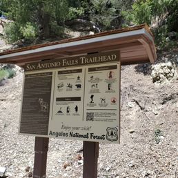
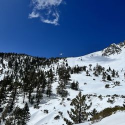
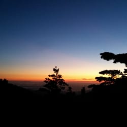
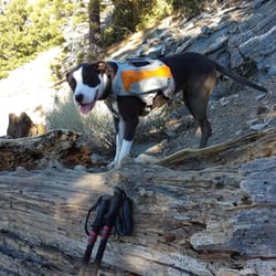
San Antonio Falls Photos


You might also consider
More like San Antonio Falls
Recommended Reviews - San Antonio Falls
Start your review...

Reviews With Photos

Short & easy hike on a mostly paved path. You can hike down a short dirt path to the waterfall (looks sketchy at first but the first part is the steepest it'll get, so don't be discouraged). It's awesome hanging out at the base of the waterfall and feeling the mist if you're hiking on a warm day. Plenty of parking when I went mid day in the middle of the week.

Took my 5 year olds to do this hike. Would recommend! Parking can be a bit confusing as it's just kind of off to the side of the road. But the home itself was great. I would suggest very grippy shoes especially for the little ones as the path is only paved for sometime and as you get closer to the waterfall it's much looser dirt/gravel

My boyfriend and I are trying to get out and do more hikes. He wanted to go to Mt. Baldy, but we decided to do this trail first. It's off the main road with plenty of parking and is a nice hike! The destination is really great because the waterfall is really nice and you can get pretty close if you want to! I usually try to avoid hikes in the summer because of the chances of heat exhaustion but this would be an okay one to do because it's not very far and the reward of the waterfall at the end if well worth it! Would definitely do it again!

Hiked on 1/22/22 Clean and 85% of the trail is paved! This is an easy and short hike. The falls at the end were rewarding. There was ample parking. While there were others on the trail, it definitely wasn't congested. We were a little underprepared for the weather. My car said it was in the 30s. It was definitely chilly. At the beginning of the trailhead, there was a bit of ice. The water was low enough to maneuver without getting your shoes wet to get close to the falls. The left side of the falls had some snow. We kept to the right side (no snow). There was only one point that was a bit steep to descend just before getting to the falls. It was a beautiful clear and sunny day and can easily be done in 2hrs RT including rest at falls and pics at falls.


Short hike slight incline paved quarter of the way to the fall. Except getting closer to the falls , need to venture towards the narrow dirt path . Once there at the water fall it's all rocks , can walk right under the fall and get yourself wet ( if you don't mind the icy water ) I notice the water ran down the rocky creek from the fall, I saw some people hiked down that direction away from the fall. ( will do that next time ) As for taking the young kids to hike on the narrow dirt path to get closer to the fall , I honestly don't recommend it. For us adults women we kinda felt nervous trekking on the narrow slopes, we mentioned carrying a small child while trying to keep your balance with nothing sturdy to grab on to , is not advisable. I wonder if there is another path to hike to with kids to get closer to the fall?


This is such an awesome, quick hike not too far from LA! I saw plenty of families coming here, so it's friendly for most people, although the minor difficulty comes into play with the tiny bouldering section right before getting into the waterfall section that most people should be able to get through with caution. Getting here: If you want to drive as close as possible to the entrance, enter in Mt. Baldy Trailhead to Google Maps. We came in January while there was still lots of snow on the mountains. No chains were needed, although it would've come in handy for parking by the side of the road where there was still a lot of snow and ice. Parking: Once you arrive, find parking right outside the gate, or park out at the side of the road if it's packed. Closer to the entrance, there weren't any signs of enforcement besides a faded sign mentioning the adventure pass helping to maintain the area. Once you enter the Angeles Forest, technically the adventure pass is mandatory if you park within sites like these, so bring one with you which can be bought at stores like Big 5 and REI (one day costs $5, full year costs $30, and all to support keeping these great trails maintained)! The hike: You'll notice the start of the trail where there's a little bathroom outhouse and a closed gate. Walk past the gate and continue up the asphalt road. At the fork where the asphalt road starts to end, make sure to keep to the left when going to the falls and keep to the right when returning (following the asphalt road). It probably only took us about an hour at most round-trip, including a quick break at the falls to enjoy the scenery. Low difficulty in terms of steepness / elevation gain, with the only the tougher part coming into play with the small bouldering close to the falls. Highly recommend coming during winter while there's still snow, as the waterfall seems to have more water then. Also right outside the parking, you'll notice families enjoying some sledding with all the snow available.

Waterfall meets snow in this perfect little 3-tier, family-friendly, waterfall hike. The distance to the falls is 1.4 miles out and back. Park at Mt Baldy Rd and Falls Rd intersection and the proceed up the paved road. After 0.6-miles you'll continue along a dirt path. The waterfall will be visible from a distance. There's a small uphill rocky section that's a little tricky. The day I visited the water was flowing nicely. The water is snowmelt from Mt St Antonio, AKA Mt Baldy; the highest peak in the San Gabriel mountains. There was just enough snow at the base of the falls for a snowball fight. What's nice about this hike is that there are more activities to do after you're done. You can take a very short drive up the hill and take a scenic 20 min ski lift ride to Mt Baldy. There you can enjoy some hot coco at the Top of the Notch restaurant and appreciate the views. The waterfall is best appreciated in late winter or early spring. There's a bathroom outhouse at the parking area.
Location - Far drive up the mountain. Would recommend having other stuff lined up. Parking - Lots of parking available along the road. Trail - They pretty much have 2 trails to get to the main waterfall. One is pretty easy, short, but its a incline. The other is more rugged and not kid friendly, it will allow you to actually walk to the actual fall. Overall my experience was okay because I was with my younger kids and couldn't enjoy the actual hike to the waterfall.

Great outdoor activity! The waterfall itself, is really easy to access. Distance wise its short. However, the hike itself is slightly inclined the entire way up to the vantage point. So if your not used to steep pavements. This will be a tad bit difficult. Wear some non slippery shoes with good gripping, if you continue down towards the waterfalls base. Stay on the right hand side of the dirt pathway towards the waterfall for the easiest most secure way down. **THE WATER IS COLD AND REFRESHING, it's worth going down there, but please be careful. *Parking is on mount baldy BEFORE your GPS suggests to go up (turn left onto) "Falls road" ***Park and hike up "Falls Road" to get to the waterfall

This hike to San Antonio Falls is super easy breezy. The hardest and toughest part is the drive getting here as you must drive from the base of Mount Baldy where you'll find yourself looping around and around the ramp of the mountain. Just make sure your vehicle is well maintained as I have witnessed some cars overheating and pulled to the side track. Follow the road past the visitor center (Mount Baldy Village) and follow up past the Manker Flats Campground to the bottom of Falls road on the left. You can park along the Mount Baldy Road. Remember to purchase an adventure pass for the day ($5) or annual ($30) since this is mandatory to visit Mt. Baldy. Dogs are welcomed and you'll love how beautiful this multi-tier waterfall is in person. Again, this is a super easy hike that's only about 1.4 miles round trip with barely any elevation gain. #OptOutside

Got in on Saturday, early afternoon. Parking was easy enough. The trail was super easy and actually quite short. There is some incline but not difficult. No shade but the mountainside is pretty. Mason, our GSD, really enjoyed his time running in the small stream. We walked a few yards down from the San Antonio Falls away from the crowd and let him off his leash. We would love to return for an all day hike to the summit one day!

4 months ago
Great place to hike and enjoy nature. Been here many times and never get enough. There's tons of snow on the ground and by the water fall at the moment. read more


1 year ago
3 years ago
You'll need to get the Adventure pass. Once you get up to Mt Baldy. You'll need to hang a left and not into the ice house parking lot. It'll be another 2 miles up the mountain and you find the trail head . Should be plenty of parking. Hike itself is fairly short about 1.5 out and back. Majority of the hike is paved and if you want a challenge probably park little further down. You'll get to the out look to see the falls, but you can walk towards the falls by heading down in a dirt path. read more


Short & easy hike on a mostly paved path. You can hike down a short dirt path to the waterfall (looks sketchy at first but the first part is the steepest it'll get, so don't be discouraged). It's awesome hanging out at the base of the waterfall and feeling the mist if you're hiking on a warm day. Plenty of parking when I went mid day in the middle of the week. read more


1 year ago
Took my 5 year olds to do this hike. Would recommend! Parking can be a bit confusing as it's just kind of off to the side of the road. But the home itself was great. I would suggest very grippy shoes especially for the little ones as the path is only paved for sometime and as you get closer to the waterfall it's much looser dirt/gravel read more

My boyfriend and I are trying to get out and do more hikes. He wanted to go to Mt. Baldy, but we decided to do this trail first. It's off the main road with plenty of parking and is a nice hike! The destination is really great because the waterfall is really nice and you can get pretty close if you want to! I usually try to avoid hikes in the summer because of the chances of heat exhaustion but this would be an okay one to do because it's not very far and the reward of the waterfall at the end if well worth it! Would definitely do it again! read more


4 years ago
Hiked on 1/22/22 Clean and 85% of the trail is paved! This is an easy and short hike. The falls at the end were rewarding. There was ample parking. While there were others on the trail, it definitely wasn't congested. We were a little underprepared for the weather. My car said it was in the 30s. It was definitely chilly. At the beginning of the trailhead, there was a bit of ice. The water was low enough to maneuver without getting your shoes wet to get close to the falls. The left side of the falls had some snow. We kept to the right side (no snow). There was only one point that was a bit steep to descend just before getting to the falls. It was a beautiful clear and sunny day and can easily be done in 2hrs RT including rest at falls and pics at falls. read more

2 years ago
Nature's calling! Short hike, close to home. Not so crowded if you start early. The recent rain brought this waterfalls to life! Will definitely hike again soon! (It's kids friendly but make sure you bring the right shoes unlike me ) read more


Short hike slight incline paved quarter of the way to the fall. Except getting closer to the falls , need to venture towards the narrow dirt path . Once there at the water fall it's all rocks , can walk right under the fall and get yourself wet ( if you don't mind the icy water ) I notice the water ran down the rocky creek from the fall, I saw some people hiked down that direction away from the fall. ( will do that next time ) As for taking the young kids to hike on the narrow dirt path to get closer to the fall , I honestly don't recommend it. For us adults women we kinda felt nervous trekking on the narrow slopes, we mentioned carrying a small child while trying to keep your balance with nothing sturdy to grab on to , is not advisable. I wonder if there is another path to hike to with kids to get closer to the fall? read more


This is such an awesome, quick hike not too far from LA! I saw plenty of families coming here, so it's friendly for most people, although the minor difficulty comes into play with the tiny bouldering section right before getting into the waterfall section that most people should be able to get through with caution. Getting here: If you want to drive as close as possible to the entrance, enter in Mt. Baldy Trailhead to Google Maps. We came in January while there was still lots of snow on the mountains. No chains were needed, although it would've come in handy for parking by the side of the road where there was still a lot of snow and ice. Parking: Once you arrive, find parking right outside the gate, or park out at the side of the road if it's packed. Closer to the entrance, there weren't any signs of enforcement besides a faded sign mentioning the adventure pass helping to maintain the area. Once you enter the Angeles Forest, technically the adventure pass is mandatory if you park within sites like these, so bring one with you which can be bought at stores like Big 5 and REI (one day costs $5, full year costs $30, and all to support keeping these great trails maintained)! The hike: You'll notice the start of the trail where there's a little bathroom outhouse and a closed gate. Walk past the gate and continue up the asphalt road. At the fork where the asphalt road starts to end, make sure to keep to the left when going to the falls and keep to the right when returning (following the asphalt road). It probably only took us about an hour at most round-trip, including a quick break at the falls to enjoy the scenery. Low difficulty in terms of steepness / elevation gain, with the only the tougher part coming into play with the small bouldering close to the falls. Highly recommend coming during winter while there's still snow, as the waterfall seems to have more water then. Also right outside the parking, you'll notice families enjoying some sledding with all the snow available. read more


3 years ago
Waterfall meets snow in this perfect little 3-tier, family-friendly, waterfall hike. The distance to the falls is 1.4 miles out and back. Park at Mt Baldy Rd and Falls Rd intersection and the proceed up the paved road. After 0.6-miles you'll continue along a dirt path. The waterfall will be visible from a distance. There's a small uphill rocky section that's a little tricky. The day I visited the water was flowing nicely. The water is snowmelt from Mt St Antonio, AKA Mt Baldy; the highest peak in the San Gabriel mountains. There was just enough snow at the base of the falls for a snowball fight. What's nice about this hike is that there are more activities to do after you're done. You can take a very short drive up the hill and take a scenic 20 min ski lift ride to Mt Baldy. There you can enjoy some hot coco at the Top of the Notch restaurant and appreciate the views. The waterfall is best appreciated in late winter or early spring. There's a bathroom outhouse at the parking area. read more


Location - Far drive up the mountain. Would recommend having other stuff lined up. Parking - Lots of parking available along the road. Trail - They pretty much have 2 trails to get to the main waterfall. One is pretty easy, short, but its a incline. The other is more rugged and not kid friendly, it will allow you to actually walk to the actual fall. Overall my experience was okay because I was with my younger kids and couldn't enjoy the actual hike to the waterfall. read more


6 years ago
Great outdoor activity! The waterfall itself, is really easy to access. Distance wise its short. However, the hike itself is slightly inclined the entire way up to the vantage point. So if your not used to steep pavements. This will be a tad bit difficult. Wear some non slippery shoes with good gripping, if you continue down towards the waterfalls base. Stay on the right hand side of the dirt pathway towards the waterfall for the easiest most secure way down. **THE WATER IS COLD AND REFRESHING, it's worth going down there, but please be careful. *Parking is on mount baldy BEFORE your GPS suggests to go up (turn left onto) "Falls road" ***Park and hike up "Falls Road" to get to the waterfall read more


This hike to San Antonio Falls is super easy breezy. The hardest and toughest part is the drive getting here as you must drive from the base of Mount Baldy where you'll find yourself looping around and around the ramp of the mountain. Just make sure your vehicle is well maintained as I have witnessed some cars overheating and pulled to the side track. Follow the road past the visitor center (Mount Baldy Village) and follow up past the Manker Flats Campground to the bottom of Falls road on the left. You can park along the Mount Baldy Road. Remember to purchase an adventure pass for the day ($5) or annual ($30) since this is mandatory to visit Mt. Baldy. Dogs are welcomed and you'll love how beautiful this multi-tier waterfall is in person. Again, this is a super easy hike that's only about 1.4 miles round trip with barely any elevation gain. #OptOutside read more


 - Hiking Near Me - Mount Baldy, California")
5 years ago
Got in on Saturday, early afternoon. Parking was easy enough. The trail was super easy and actually quite short. There is some incline but not difficult. No shade but the mountainside is pretty. Mason, our GSD, really enjoyed his time running in the small stream. We walked a few yards down from the San Antonio Falls away from the crowd and let him off his leash. We would love to return for an all day hike to the summit one day! read more


3 years ago
5 years ago
This trail is right before you get to the mountain baldy lift. You will see cars parked on the right hand side. This is a small pavement trail. This will take you about 40 minutes to the end of trail and back. The waterfall is very small and you can't get up close because if you try to walk down I don't feel the rocks are stable. Doesn't look safe. Walking up to the end of trail you will see some cabins and pretty trees. We did enjoy the view to the end of the trail and back to our car. If your looking to go for a nice walk with your kids, love one or dog, this is a easy trail. Family friendly! If you do this trail do go and do the lift up mountain baldy or take a hike up mountain baldy. You will definitely get a work out and enjoy the view. Don't forget to get an adventure pass. You can get one at any Big 5. read more


It took my 7 year old granddaughter to get me to visit this waterfall, and I'm greatful she did! Turned out to be a great outing to a 3 tier waterfall. Many times I passed by this landmark without stopping, heading up the Baldy Bowl Trail on my way to the Mt Baldy summit. From the Manker Flat parking area, go around the locked gate, walk 0.6 miles up the asphalt road to the hairpin turn where you will see the falls to your left. There are a couple of houses on the way, so don't take their driveways. Just after you exit the asphalt road at the hairpin turn you will reach a trail junction that takes you uphill to the right or downhill to the left. The shortest and easiest route to the falls is to the right, although you have get past a very small washed out section. We took the more adventurous route to the left, down the steep ravine and then bouldered upstream a little to the falls. The entire waterfall hike was only 1.6 miles, but it was the perfect hike for my granddaughter that included a steep downhill and some small bouldering. Plus a chance to play in the water at the base of a waterfall! read more


9 years ago
The walk up is short, but steep! I do have to add that the elevation made it harder to breathe for me, so we took about 4 breaks (FYI: I'm overweight). It's a beautiful stroll, with a stunning view! After a few twists and turns, you can then see the falls on your left, from a distance. To get closer, you would have to go "off-road" (which is not hard to do). We took fruits up there and enjoyed them under the falls. It was absolutely beautiful, and worth the drive+walk. Also, be prepared to drive through a winding road, no phone service and porta-potties... read more


6 years ago
Beautiful Waterfall! The hike trail to the waterfall is only 1/2 mile , it doesn't have shade, once you get to the entrance of the waterfall, you have two options to get to waterfall, to the left , the long way, you may walk by the creek, and to the right , short way, it's a bit steep , kid friendly, dog friendly , no reservation needed . read more

9 years ago
Had Bookmarked this hike a few months back, today finally decided to check it out. I figured with all the rain the waterfall should be flowing pretty good, but did not expect Snow also. Drive up was not too bad my car did not need chains and I guess it snowed about a day ago. Once you find somewhere to park the hike itself was only about 1 mile very easy hike my 9 year old was also with Me. This waterfall was well worth the drive. First time for everything hiking in the snow. read more


At just 0.6mi (1.2mi round trip) from the Manker Flats/San Antonio Falls parking area to the waterfall, this is a short easy hike (on a paved road) that just about anyone can do. If you're coming all the way out here to see the waterfall, it will be somewhat disappointing though because not only is the hike too short, this waterfall isn't (IMO) as beautiful as Sturtevant Falls or even Eaton Canyon Falls. For many, this waterfall is just a landmark you pass on the way to some of the longer hikes that the Mt. Baldy area has to offer. For one, you can stay on Falls Rd. and hike towards where the ski lifts take off or stay on the trail and go all the way up to Baldy Notch where the lift drops you off by the Top of the Notch Restaurant. That is about a 3.6mi one way hike going uphill. But for those who want to summit Old Baldy, you have to pass the waterfall in order to find the Baldy Bowl (aka Ski Hut) Trail, which takes you to the peak passing the Sierra Club San Antonio Ski Hut on the way. Either way, San Antonio Falls is worth checking out at least once! read more


4 years ago
This is a nice way to spend the morning. Drive up the hill and on the way to the falls. The path is paved and at a incline until you arrive to the falls. It's about 1-1 1/2 mile to the falls but the scenery is great. read more


11 years ago
Depending if you start the trail from the beginning or backwards, the San Antonio Falls will be one of the first or last landmarks you see. This is a very easy hike, with some steep parts, but nothing impossible to climb. This waterfall is not as stupendous as the other waterfalls in the San Gabriel Mountains (Sturtevant Falls, Hermit Falls, etc.), but is still nice to see inland. I would not recommend coming to Mt. Baldy just for the San Antonio Falls. Since you're here already, do the trail as much as you can! :) read more

5 years ago
5 years ago
2 years ago
8 years ago
This hike was not planned, but super glad I completed it. I have mild asthma but that didn't stop me! Pretty easy trail, but it does have some incline on the road. The end results are amazinggggg!!! The waterfall was beautiful and since there is no shade the water was not ice cold! We went around 1pm and we had the waterfall for about an hour all to ourselves. read more


8 years ago
Lovely hike with gorgeous falls. Fairly easy to get to. Just tread carefully as you pick your way along the creek bed to the falls themselves once the trail leaves the road. read more


9 years ago
7 years ago
6 years ago
8 years ago
Nice short hike with a slight incline, great for beginners. All ages and Pet friendly too! read more


8 years ago
This hike was so easy!!! Loved climbing on the big snow mound to actually touch the waterfall!! Absolutely an amazing experience! read more


15 years ago
16 years ago
Beautiful falls, just a quick walk from Manker Flats, at the beginning of the Mt. Baldy trail. Loved the easy access! If you're not afraid to walk across a few wet rocks, you can even get right under it. The view is breathtaking. If there was a bit more greenery, and a deep pool of water to swim in, this spot would have been magnificent. Definitely worth checking out, so do check it out sometime. read more


Page 1 of 2
More info about San Antonio Falls
Mt Baldy Rd
Mount Baldy, CA 91759
Directions
Hours
Outdoor Amenities
Ask the Community - San Antonio Falls
Review Highlights - San Antonio Falls
You might also consider


Why does Yelp recommend reviews?
1 review that is not currently recommended
The reviews below are not factored into the business's overall star rating.
10 years ago
San Antonio Falls - hiking - Updated July 2026
Best of Mount Baldy
People found San Antonio Falls by searching for…
Hiking Trails With Waterfalls in Mount Baldy, CA
Free Snow Play in Mount Baldy, CA
River Swimming in Mount Baldy, CA
Waterfalls and Swimming Holes in Mount Baldy, CA
Places to Take Pictures in Mount Baldy, CA
Beautiful Views in Mount Baldy, CA
Campgrounds in Mount Baldy, CA
Scenic Drive in Mount Baldy, CA
Tourist Attractions in Mount Baldy, CA
Photo Spots in Mount Baldy, CA
Picnic Areas in Mount Baldy, CA
Fishing Spots in Mount Baldy, CA
Dog Friendly Things to Do in Mount Baldy, CA
Off Road Trails in Mount Baldy, CA
Running Trails in Mount Baldy, CA
Swimming Lakes in Mount Baldy, CA
Hiking Trails Kid Friendly in Mount Baldy, CA
Parks for Kids in Mount Baldy, CA
Secret Spots in Mount Baldy, CA
Scenic View in Mount Baldy, CA
Browse Nearby
BEST of Mount Baldy, California Restaurants near San Antonio Falls
BEST of Mount Baldy, California Coffee near San Antonio Falls
BEST of Mount Baldy, California Things to Do near San Antonio Falls
BEST of Mount Baldy, California Breakfast near San Antonio Falls
BEST of Mount Baldy, California Fishing near San Antonio Falls
BEST of Mount Baldy, California Shopping near San Antonio Falls
BEST of Mount Baldy, California Campgrounds near San Antonio Falls
BEST of Mount Baldy, California Snow Tubing near San Antonio Falls