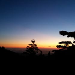
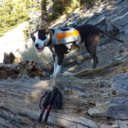
Mount Baldy Photos


You might also consider
More like Mount Baldy
Recommended Reviews - Mount Baldy
Start your review...

Reviews With Photos

I've done this hike two times now. Once in mid May and another in early June. Do your research before going on this hike! I would classify this hike as a difficult and for an experienced hiker. That is, if you plan on going all the way to the top (10,064 ft) - otherwise there are shorter trails you can take throughout the park. The first time I did this hike I went up devils backbone, made it to the top and went down via the ski hut. The second time doing this, last week, I went the opposite way. Although this way has a steeper incline, it's shorter and I preferred it. Check reviews first though and see which way sounds easier for you - everyone is different. Took me about 7-7.5 hrs RT with stops at the top. The hike up to the top can feel never ending, but just don't give up! It is worth it once you make it and can see the breathtaking views. KNOW the weather for this area before hiking ie if it's snowing make sure you have the correct shoes. Otherwise you will slip and fall. There have been many deaths on this trail, especially earlier this year. Bring enough water, snacks, lunch, etc. Worst thing you can do is go on a hike with this altitude and distance and not be prepared. Start early and give yourself enough time to go and up and down while their is still sunlight. If you make it to Mt. Baldy Notch you can relax and have a drink or grab some food. To cut some time you can take the ski lift down to your car (pending operational hours).


I've never been backpacking before so I decided to try it out here! The trail was so pretty and the views were absolutely gorgeous. I forgot which trail I took but it was around 2.8 miles going up (6 miles total). It took around 3 hours to go up (with breaks) and 1 hour to go down. I set up tent near the helicopter pad - no issues with finding a place to set it up. I recommend going on a weekday because I heard there's less space during weekends. We ventured out a bit and saw a gorgeous view. However, there were a crazy ton of mosquitos and insects so bring bug repellent!

This is my first winter trip to Mount Baldy, I had a great time up there during summer. I called the help desk to point out their ticketing had wording issue which says 65 year and under, but no mention of senior. The person was very informative about the weather condition which is stormy and icy and that it is still safe for elderly to visit. There used to be three price ranges, and that changed to a single price and forgot to remove the age range. It was a cloudy day so I had decided to drive up first to see condition before going further up. As repeatedly warned, buy your tickets before going up, given if you think you won't have cell phone coverage high up in the mountain. This place isn't worth the ticket price for winter, it's basically a below freezing to just freezing 20 min each way riding experience, round trip for $40, a bit outrageous, there is only the cozy dining area at the top in the winter. Parking attendant happily took my cash for the half empty lot. I had to think about how people make you throw money at problem, this has to be one of them, snowing up in the mountain and no cell reception. The disgusted part was employee told me his WiFI is down but he can still charge the higher price when I told him I spoke with his colleague with their online issue. Upon my return to the station, nope, Guest WiFi worked just fine, the guy lied in order to get higher revenue. I don't blame him but yah I didn't enjoyed been take advantage of high up in the mountain for group of 3 and met a not so good person.

Good old Mount Baldy, always comes through when you need some time outdoors and a little bit of a challenge. My plans were canceled this weekend when my boyfriend decided last week he wasn't ever my boyfriend and we were just dating and he didn't love me when he told me he did. He blessed me with this info from one day to the next. So with this new truth from him and my new found understanding of "definitions" of things people say to me, I was a little embarrassed to tell my coworkers I was no longer taking Monday as a vacation day. I decided to still take my planned day off, cancel the plans I thought we'd planned and take myself outdoors locally to enjoy some time to myself. If you've read any reviews of mine and I mentioned a boyfriend, no you didn't. Anyhow Mount Baldy always comes through. I needed to feel that feeling of driving out of town, winding through the mountain, windows down, hair blowing in the fresh air and make Monday (my favorite day of the week!) still feel like my favorite day of the week. I've never hiked Baldy solo, and I was feeling a bit brave- probably powered by adrenaline. I knew the trail would be far less trafficked on a Monday. I've done this hike a few times now and I felt confident in myself to make it without an issue. I parked at the trailhead and started up Manker Flats at 1115A. I haven't been to the gym since Feb 2020 so I wasn't sure just how prepared I'd be with missing out on all my Stairmaster action but I'm still a pretty avid hiker, I run and indoor bike a bunch so my time didn't change much from the last time I summited in 2hrs25min. I was to to ski hut by 1225A where I stop and have a little bit of a bar, and to the Summit by 140P. I only saw a handful of people all day long which was extremely peaceful in itself. I continue to hike this the same way each time I come which seems to work for me. I ascend from Manker Flats and descend down the Devils backbone trail. I made it down and to the Lodge by about 315p, no beer or snacks for me as they were Closed. I followed the path that descends under the ski lift down until a smallish off shoot that cuts left and down into the top parking lot below the bottom of the ski lift area, then switchback through the 3 large paved parking lots until reaching the dead end road and following this back down to the trail head parking area. I was back at the car by 405P. All in all, this is a nice little summit that provides you with a small sense of accomplishment. I wouldn't typically recommend these types of hikes as solo hikes but yesterday proved, it's totally fine so long as you are safe. I tossed on a hat, my hiking boots, packed my 2L pack and only drank 1L (the weather was very pleasant), a bottle of sunscreen and a couple bars in it and was on my way. 4hr50min round trip loop, with a couple of stops here and there to take in the views etc. There are some patches of snow still, but nothing on the trail that would make it not safe. I forgot to wear and pack layers which was no problem at all, but I'd say it's probably always smart to have an additional layer in your pack for this hike - I hit a strong breeze here and there in some areas where I was a bit chilly but nothing too bad. Can't wait to come back when the lodge is open, the beer up top may be one of my favorite parts. I think I ended up with about 31k steps, although mileage wise my Fitbit was at about 13 miles (maybe my small little steps make it add up to more). Nice hike for a little outdoor adventure.

This was my first time hiking to Mt. Baldy. It's a nice trail, but gets difficult towards the summit. Came during an extreme heat warning day, but was perfect weather at the top. We followed another hiker's advice and used the trail on the left when heading to Devil's Backbone - it's much less steep! The trail is well travelled, we passed lots of people on the way up and down, including trail runners - I was amazed they could run this trail! Got to opportunity to watch a man paraglide from the summit, which was really amazing! He said he was trying to head to Lancaster but I guess ended up back at Baldy since I saw him in the parking lot on our way out. Recommend using the ski lift to go up and down from Baldy Notch if this is your first time (I did!) and order tix online in advance to save money (I paid $25 R/T). Ticket's purchased that day at the restaurant to go down is $20. Parking at the ski lift lot is now $10 although they said there was no parking fee the day we were there.

SoCal six pack of peaks #4 Difficulty: Hard Mileage: ~10 miles (many different trails up) Pets: Dog friendly View: LA county, ocean, SoCal What to bring: 3 liters of water, snacks, hat, bug spray, sunblock, trekking poles Parking: Free Street parking on Manker Flats or adventure pass for Mt Baldy Resort parking lot Fee: free Time: ~5-7 hours We went up by ski hut trail, which was pretty steep (counter clockwise). Started at 6:15am and it was packed! We got shade going up that way in the morning. Half way point is the Ski Hut. Very busy and had a ton of bugs. Got bitten several times by mosquitos. Nicely maintained, no fresh spring water. The summit is super busy! Everyone and their moms were there. I didn't like how Baldy looked at the summit, by far one of the ugliest summit. It was "bald" at the peak. Hence the name. Views are amazing though! Initially we wanted to descend devils backbone... but we descended and made the terrible mistake of coming down on Register Ridge. DO NOT DESCEND ON REGISTER RIDGE!! It's the worst sh-t ever!!! It's only about 1.5 mile (versus 6 miles) but it's literally going down 2000 feet. It was suuuper steep, I fell on my ass 2x! Trekking poles needed. It'll take as long as the 6 miles bc it was sooo steep going down. Your shoes will be torn. I repeat, do not go down register ridge, take Devils Backbone! We also saw a black BEAR on Register Ridge trail!! It was not fully grown- maybe an adolescent and it saw us. Then it ran right across the trail like 25 feet above us. Scary!!! We tore our legs going down. It looks shorter on map but not worth it. Do the longer Devils Backbone. I can't stress this enough. BRING ENOUGH WATER! Especially on a hot LA day. You don't have to be fit to do this hike, it just endurance or you just need to try. Also I saw a guy going up in his effing rainbow sandals. I laughed my ass off. Lots of IG Hoes at the top too. Good for training for Gorgonio.

There's are 2 different trails you can take to the summit if you're starting from Manker Flats. The steep 4 mile route that goes through Baldy Bowl, or the 6 plus mile trail up Baldy Rd that will lead you to Devils Backbone. Personally I prefer going the 6 mile trail since the elevation gains aren't as steep as Baldy Bowl. You views going the 4 mile trail are a lot better, but you can probably save on time going up the 6 mile trail. I'd recommend bringing hiking poles for this one just in case, coming back down baldy bowl there are parts of the trail where the ground has loose dirt and rocks so it can be easy to slip & fall in some spots, plus the decline can be pretty steep too so your knees & legs in general can get pretty tired/sore coming back down.

So I tried to check in but once you get there all cell service is pretty much non existent. Though it says they have wifi I wasn't even thinking of it while I was there. It was good to be off the grid though. First it is beautiful up there. The views are awesome. Though the sun was out there was snow. Hard snow, so you can just say ice. I was only able to go tubing. It was exhilarating but walking back up the hill with a mask on at that altitude was killin me so I didn't do it much as I wanted to. There was some skiing and snowboarding but I wasn't prepared for it so I didn't go. It was a good time, the lift was scary and I fell on the snow and I can still feel it. I would definitely go again.im probably going to have to since I spent money on snow pants.

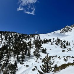
This hike always challenges but I love it - and some of the group hates it but never misses it. I've never gone up this late in the season and it was a different experience. All the crowds and noise of the summer are gone. It was peaceful with lots of snow from a storm about 10 days ago. We hiked up the Ski Hut trail and down the Backbone, stopping at the lodge for a beer and then down the fire road because my friends knees were hurting and he was worried about the steepness of the lower trail to the parking lot. The road added about a mile and a half from taking the trail. We were glad to have our spikes on after the Ski Hut all the way back down to the lodge. It was perfect, sunny and 30ish at the top with some wind. We felt pretty safe with spikes and polls but there was one part at the start of the Backbone that was washed out and it had some people pretty sketched out, taking a lot of time to get by. Understandable because it was a long way down! I enjoyed the winter experience but it definitely adds some more risk; you should do your research and know what you're in for.

Ok so this was tough! I am talking about one of the toughest things I have done so far. I figure if we are going to hike Mt. Whitney next year might as well practice. Our group of hiking friends are always looking for an adventure. Last year a big group decided to do this hike I did not join. This year they decided to hike it again and summit it but guess what only two from the previous year decided to summit. I should have known what I was getting into lol. Parking: We arrived before 5 a.m. and parked at Manker flats. We did not need a day permit so we parked off the road close to the entrance. Plenty of parking at that time. Restrooms: There is one at the beginning of the trail but it was super stinky and had mosquitos super yuck. I had to hold my breath. Necessities: Bring lots of water. I filled my water pack with powerade. SHOES-You need some very sturdy anti slip shoes due to some parts that are very slippery due to loose rocks. A hat to shield the sun away and sun glasses. Maybe a small jacket as it gets really windy at the top at the most difficult point YIKES! Trekking poles I did see some people without them but let me tell you they did help me get out of some dicey areas. They also helped alot when coming down some very steep areas. Hike: We started at Maker Flats and took the wider trail. The first three miles of the trail are pretty tame and you start ascending but nothing too serious. You just take the views of the valley and a water fall at the beginning and you are all good. After we passed the Mount Baldy ski lift it got super serious. We started ascending and it got pretty steep. I thought I was in shape lol I had to take some breaks especially because of the high altitude. We got to Devils backbone after about a mile of that steepness and woooo chilld. If you are scared of heights this is not for you. The views are AMAZING though. I mean there are 360 views of LA to the Mojave. At this point I was like oh yeah this is not an easy hike. I looked down at my feet cause when I looked on either side you saw those steep drops on both sides. After passing Devils back bone the tail got dicey as the trail had a huge drop on one side and plenty of loose small rocks. I used my poles there. After that for about two miles everything was pretty cool not too bad. We ran it for a while. That last mile and half was very tough. The climb was super steep and it was full of rocks. I had to take two breaks as the altitude at this point really started to get to me. Once we got to the summit the weather was super cold and windy. I am glad I had brought a jacket. The weather at the top was very different than the bottom. Restaurant: There is a restaurant at the ski lift with drinks, beers and sodas. They also have food such as sandwiches, hot dogs and chips. Hiking Time: It took us about 3 hours to summit and a distance of 6 miles. It is a really tough hike but every time you look in the distance at the tallest snow capped mountain (10,064) in LA county you can say you hiked that. Will I do it again? maybe. I decided to run from the ski lift and meet my friends at the bottom and total round trip was about 12 miles and about 5 hours.

Such a great mountain and trail, but there are SOOOOOOO many people that come, so I only hit it every few years. The trail is in excellent condition and the mountain is always beautiful and rugged and if you get lucky, you may see some bigger animals like a bear of long-horned sheep. Parking is plentiful if you're an early riser (no later than 7am), but you'll need an adventure pass. The ski lodge parking was open at 5am today and already come down the lifts, so I just parked up there and didn't pay. You can take ski lifts down from the notch, but they torch you for $20 nowadays for a 1-way ticket.

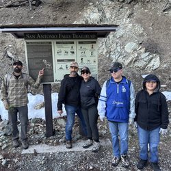
BADA$$ Trail! I'm training to trek Mount Whitney in September and this was on my list of hikes to summit. I've been reluctant to hike this trail, due to the fact I am deathly afraid of heights, but I managed to control my fear! It's not for the faint of hearts. There are sections on this trail that has sheer drops on either side, but the trail is wide enough where you could muscle through, take your time, and don't look down. Start early! We started at 6am (7/31) and decided to take the loop trail starting at Manker Flats campground, up San Antonio Falls, towards Sierra ski hut (clockwise loop) and back down through Devil's Backbone and towards Mount Blady Resort. Moving time 5:30:34, in 10.37 miles with an elevation gain of 3755ft, and a total loss of -3803ft. This is considered a difficult trail; altitude change, elevation gain, loose gravel, heat from the sun, winds/weather...but it is very doable. Pace yourself. Hydration and food are important on this trail. I felt a little dizzy (from altitude change around 7600ft), but was able to quickly recover by hydrating. Drink plenty of water, snack as much as you can, take deep breaths, and most importantly listen to your body. The morning was awesome, there was cloud coverage protecting us from the sun which kept our ascent very pleasant. We ran into a few fellow hikers that informed us there was a falsh flood warning issued for the area. Luckily, we arrived at the summit before we experienced any rain. As we descended, the sun was out full force, it was hot and muggy. My pack consisted of: 2l bladder, 1.5l of liquid IV, tons of snacks, sunblock, a jacket (for the summit), and Tylenol.

When Baldy opened back up, we took advantage and hiked it multiple times. It is spectacular. If you hike up Ski Hut, it's an amazing booty builder hike. Bring poles. Restroom at trailhead. Restaurant at top of ski lift and I usually grab a chicken sandwich. Easy parking at trailhead. I put my adventure pass on the dash in case it's needed. Please come and create your own adventure. read more


The trailhead is before you've reach the Mt Baldy Resort at Falls Rd. I prefer to start my hikes early so I never have trouble finding parking, but there should be adequate amount of parking. I've always found the hiking trails here to be well-maintained. However, if your goal is to go up to the summit, please know that the trail does get pretty technical during sections on the Devil's Backbone. There's the Top of the Notch restaurant about halfway up, but make sure you carry enough water with you if you plan to do this hike during the summer months or whenever the weather is warm. read more


7 months ago
Went up on December 8th 2025, had an absolute blast here. Huge shoutout to Jason at the rental spot, he was an absolute legend, helped me and all my friends get fitted and showed us some dope spots! Everyone was super cool and immensely helpful! Also Shoutout to Cindy who let us move our reservation for another day when we got here late, absolutely will be back read more

I've done this hike two times now. Once in mid May and another in early June. Do your research before going on this hike! I would classify this hike as a difficult and for an experienced hiker. That is, if you plan on going all the way to the top (10,064 ft) - otherwise there are shorter trails you can take throughout the park. The first time I did this hike I went up devils backbone, made it to the top and went down via the ski hut. The second time doing this, last week, I went the opposite way. Although this way has a steeper incline, it's shorter and I preferred it. Check reviews first though and see which way sounds easier for you - everyone is different. Took me about 7-7.5 hrs RT with stops at the top. The hike up to the top can feel never ending, but just don't give up! It is worth it once you make it and can see the breathtaking views. KNOW the weather for this area before hiking ie if it's snowing make sure you have the correct shoes. Otherwise you will slip and fall. There have been many deaths on this trail, especially earlier this year. Bring enough water, snacks, lunch, etc. Worst thing you can do is go on a hike with this altitude and distance and not be prepared. Start early and give yourself enough time to go and up and down while their is still sunlight. If you make it to Mt. Baldy Notch you can relax and have a drink or grab some food. To cut some time you can take the ski lift down to your car (pending operational hours). read more


9 months ago
An amazing trail ....total of 16 miles to get to cucamonga peak....love it. I highly recommend it read more

11 months ago
I've never been backpacking before so I decided to try it out here! The trail was so pretty and the views were absolutely gorgeous. I forgot which trail I took but it was around 2.8 miles going up (6 miles total). It took around 3 hours to go up (with breaks) and 1 hour to go down. I set up tent near the helicopter pad - no issues with finding a place to set it up. I recommend going on a weekday because I heard there's less space during weekends. We ventured out a bit and saw a gorgeous view. However, there were a crazy ton of mosquitos and insects so bring bug repellent! read more


This is my first winter trip to Mount Baldy, I had a great time up there during summer. I called the help desk to point out their ticketing had wording issue which says 65 year and under, but no mention of senior. The person was very informative about the weather condition which is stormy and icy and that it is still safe for elderly to visit. There used to be three price ranges, and that changed to a single price and forgot to remove the age range. It was a cloudy day so I had decided to drive up first to see condition before going further up. As repeatedly warned, buy your tickets before going up, given if you think you won't have cell phone coverage high up in the mountain. This place isn't worth the ticket price for winter, it's basically a below freezing to just freezing 20 min each way riding experience, round trip for $40, a bit outrageous, there is only the cozy dining area at the top in the winter. Parking attendant happily took my cash for the half empty lot. I had to think about how people make you throw money at problem, this has to be one of them, snowing up in the mountain and no cell reception. The disgusted part was employee told me his WiFI is down but he can still charge the higher price when I told him I spoke with his colleague with their online issue. Upon my return to the station, nope, Guest WiFi worked just fine, the guy lied in order to get higher revenue. I don't blame him but yah I didn't enjoyed been take advantage of high up in the mountain for group of 3 and met a not so good person. read more


5 years ago
Good old Mount Baldy, always comes through when you need some time outdoors and a little bit of a challenge. My plans were canceled this weekend when my boyfriend decided last week he wasn't ever my boyfriend and we were just dating and he didn't love me when he told me he did. He blessed me with this info from one day to the next. So with this new truth from him and my new found understanding of "definitions" of things people say to me, I was a little embarrassed to tell my coworkers I was no longer taking Monday as a vacation day. I decided to still take my planned day off, cancel the plans I thought we'd planned and take myself outdoors locally to enjoy some time to myself. If you've read any reviews of mine and I mentioned a boyfriend, no you didn't. Anyhow Mount Baldy always comes through. I needed to feel that feeling of driving out of town, winding through the mountain, windows down, hair blowing in the fresh air and make Monday (my favorite day of the week!) still feel like my favorite day of the week. I've never hiked Baldy solo, and I was feeling a bit brave- probably powered by adrenaline. I knew the trail would be far less trafficked on a Monday. I've done this hike a few times now and I felt confident in myself to make it without an issue. I parked at the trailhead and started up Manker Flats at 1115A. I haven't been to the gym since Feb 2020 so I wasn't sure just how prepared I'd be with missing out on all my Stairmaster action but I'm still a pretty avid hiker, I run and indoor bike a bunch so my time didn't change much from the last time I summited in 2hrs25min. I was to to ski hut by 1225A where I stop and have a little bit of a bar, and to the Summit by 140P. I only saw a handful of people all day long which was extremely peaceful in itself. I continue to hike this the same way each time I come which seems to work for me. I ascend from Manker Flats and descend down the Devils backbone trail. I made it down and to the Lodge by about 315p, no beer or snacks for me as they were Closed. I followed the path that descends under the ski lift down until a smallish off shoot that cuts left and down into the top parking lot below the bottom of the ski lift area, then switchback through the 3 large paved parking lots until reaching the dead end road and following this back down to the trail head parking area. I was back at the car by 405P. All in all, this is a nice little summit that provides you with a small sense of accomplishment. I wouldn't typically recommend these types of hikes as solo hikes but yesterday proved, it's totally fine so long as you are safe. I tossed on a hat, my hiking boots, packed my 2L pack and only drank 1L (the weather was very pleasant), a bottle of sunscreen and a couple bars in it and was on my way. 4hr50min round trip loop, with a couple of stops here and there to take in the views etc. There are some patches of snow still, but nothing on the trail that would make it not safe. I forgot to wear and pack layers which was no problem at all, but I'd say it's probably always smart to have an additional layer in your pack for this hike - I hit a strong breeze here and there in some areas where I was a bit chilly but nothing too bad. Can't wait to come back when the lodge is open, the beer up top may be one of my favorite parts. I think I ended up with about 31k steps, although mileage wise my Fitbit was at about 13 miles (maybe my small little steps make it add up to more). Nice hike for a little outdoor adventure. read more


This was my first time hiking to Mt. Baldy. It's a nice trail, but gets difficult towards the summit. Came during an extreme heat warning day, but was perfect weather at the top. We followed another hiker's advice and used the trail on the left when heading to Devil's Backbone - it's much less steep! The trail is well travelled, we passed lots of people on the way up and down, including trail runners - I was amazed they could run this trail! Got to opportunity to watch a man paraglide from the summit, which was really amazing! He said he was trying to head to Lancaster but I guess ended up back at Baldy since I saw him in the parking lot on our way out. Recommend using the ski lift to go up and down from Baldy Notch if this is your first time (I did!) and order tix online in advance to save money (I paid $25 R/T). Ticket's purchased that day at the restaurant to go down is $20. Parking at the ski lift lot is now $10 although they said there was no parking fee the day we were there. read more


SoCal six pack of peaks #4 Difficulty: Hard Mileage: ~10 miles (many different trails up) Pets: Dog friendly View: LA county, ocean, SoCal What to bring: 3 liters of water, snacks, hat, bug spray, sunblock, trekking poles Parking: Free Street parking on Manker Flats or adventure pass for Mt Baldy Resort parking lot Fee: free Time: ~5-7 hours We went up by ski hut trail, which was pretty steep (counter clockwise). Started at 6:15am and it was packed! We got shade going up that way in the morning. Half way point is the Ski Hut. Very busy and had a ton of bugs. Got bitten several times by mosquitos. Nicely maintained, no fresh spring water. The summit is super busy! Everyone and their moms were there. I didn't like how Baldy looked at the summit, by far one of the ugliest summit. It was "bald" at the peak. Hence the name. Views are amazing though! Initially we wanted to descend devils backbone... but we descended and made the terrible mistake of coming down on Register Ridge. DO NOT DESCEND ON REGISTER RIDGE!! It's the worst sh-t ever!!! It's only about 1.5 mile (versus 6 miles) but it's literally going down 2000 feet. It was suuuper steep, I fell on my ass 2x! Trekking poles needed. It'll take as long as the 6 miles bc it was sooo steep going down. Your shoes will be torn. I repeat, do not go down register ridge, take Devils Backbone! We also saw a black BEAR on Register Ridge trail!! It was not fully grown- maybe an adolescent and it saw us. Then it ran right across the trail like 25 feet above us. Scary!!! We tore our legs going down. It looks shorter on map but not worth it. Do the longer Devils Backbone. I can't stress this enough. BRING ENOUGH WATER! Especially on a hot LA day. You don't have to be fit to do this hike, it just endurance or you just need to try. Also I saw a guy going up in his effing rainbow sandals. I laughed my ass off. Lots of IG Hoes at the top too. Good for training for Gorgonio. read more


There's are 2 different trails you can take to the summit if you're starting from Manker Flats. The steep 4 mile route that goes through Baldy Bowl, or the 6 plus mile trail up Baldy Rd that will lead you to Devils Backbone. Personally I prefer going the 6 mile trail since the elevation gains aren't as steep as Baldy Bowl. You views going the 4 mile trail are a lot better, but you can probably save on time going up the 6 mile trail. I'd recommend bringing hiking poles for this one just in case, coming back down baldy bowl there are parts of the trail where the ground has loose dirt and rocks so it can be easy to slip & fall in some spots, plus the decline can be pretty steep too so your knees & legs in general can get pretty tired/sore coming back down. read more


So I tried to check in but once you get there all cell service is pretty much non existent. Though it says they have wifi I wasn't even thinking of it while I was there. It was good to be off the grid though. First it is beautiful up there. The views are awesome. Though the sun was out there was snow. Hard snow, so you can just say ice. I was only able to go tubing. It was exhilarating but walking back up the hill with a mask on at that altitude was killin me so I didn't do it much as I wanted to. There was some skiing and snowboarding but I wasn't prepared for it so I didn't go. It was a good time, the lift was scary and I fell on the snow and I can still feel it. I would definitely go again.im probably going to have to since I spent money on snow pants. read more


4 years ago
This hike always challenges but I love it - and some of the group hates it but never misses it. I've never gone up this late in the season and it was a different experience. All the crowds and noise of the summer are gone. It was peaceful with lots of snow from a storm about 10 days ago. We hiked up the Ski Hut trail and down the Backbone, stopping at the lodge for a beer and then down the fire road because my friends knees were hurting and he was worried about the steepness of the lower trail to the parking lot. The road added about a mile and a half from taking the trail. We were glad to have our spikes on after the Ski Hut all the way back down to the lodge. It was perfect, sunny and 30ish at the top with some wind. We felt pretty safe with spikes and polls but there was one part at the start of the Backbone that was washed out and it had some people pretty sketched out, taking a lot of time to get by. Understandable because it was a long way down! I enjoyed the winter experience but it definitely adds some more risk; you should do your research and know what you're in for. read more

Ok so this was tough! I am talking about one of the toughest things I have done so far. I figure if we are going to hike Mt. Whitney next year might as well practice. Our group of hiking friends are always looking for an adventure. Last year a big group decided to do this hike I did not join. This year they decided to hike it again and summit it but guess what only two from the previous year decided to summit. I should have known what I was getting into lol. Parking: We arrived before 5 a.m. and parked at Manker flats. We did not need a day permit so we parked off the road close to the entrance. Plenty of parking at that time. Restrooms: There is one at the beginning of the trail but it was super stinky and had mosquitos super yuck. I had to hold my breath. Necessities: Bring lots of water. I filled my water pack with powerade. SHOES-You need some very sturdy anti slip shoes due to some parts that are very slippery due to loose rocks. A hat to shield the sun away and sun glasses. Maybe a small jacket as it gets really windy at the top at the most difficult point YIKES! Trekking poles I did see some people without them but let me tell you they did help me get out of some dicey areas. They also helped alot when coming down some very steep areas. Hike: We started at Maker Flats and took the wider trail. The first three miles of the trail are pretty tame and you start ascending but nothing too serious. You just take the views of the valley and a water fall at the beginning and you are all good. After we passed the Mount Baldy ski lift it got super serious. We started ascending and it got pretty steep. I thought I was in shape lol I had to take some breaks especially because of the high altitude. We got to Devils backbone after about a mile of that steepness and woooo chilld. If you are scared of heights this is not for you. The views are AMAZING though. I mean there are 360 views of LA to the Mojave. At this point I was like oh yeah this is not an easy hike. I looked down at my feet cause when I looked on either side you saw those steep drops on both sides. After passing Devils back bone the tail got dicey as the trail had a huge drop on one side and plenty of loose small rocks. I used my poles there. After that for about two miles everything was pretty cool not too bad. We ran it for a while. That last mile and half was very tough. The climb was super steep and it was full of rocks. I had to take two breaks as the altitude at this point really started to get to me. Once we got to the summit the weather was super cold and windy. I am glad I had brought a jacket. The weather at the top was very different than the bottom. Restaurant: There is a restaurant at the ski lift with drinks, beers and sodas. They also have food such as sandwiches, hot dogs and chips. Hiking Time: It took us about 3 hours to summit and a distance of 6 miles. It is a really tough hike but every time you look in the distance at the tallest snow capped mountain (10,064) in LA county you can say you hiked that. Will I do it again? maybe. I decided to run from the ski lift and meet my friends at the bottom and total round trip was about 12 miles and about 5 hours. read more


Such a great mountain and trail, but there are SOOOOOOO many people that come, so I only hit it every few years. The trail is in excellent condition and the mountain is always beautiful and rugged and if you get lucky, you may see some bigger animals like a bear of long-horned sheep. Parking is plentiful if you're an early riser (no later than 7am), but you'll need an adventure pass. The ski lodge parking was open at 5am today and already come down the lifts, so I just parked up there and didn't pay. You can take ski lifts down from the notch, but they torch you for $20 nowadays for a 1-way ticket. read more


4 years ago
BADA$$ Trail! I'm training to trek Mount Whitney in September and this was on my list of hikes to summit. I've been reluctant to hike this trail, due to the fact I am deathly afraid of heights, but I managed to control my fear! It's not for the faint of hearts. There are sections on this trail that has sheer drops on either side, but the trail is wide enough where you could muscle through, take your time, and don't look down. Start early! We started at 6am (7/31) and decided to take the loop trail starting at Manker Flats campground, up San Antonio Falls, towards Sierra ski hut (clockwise loop) and back down through Devil's Backbone and towards Mount Blady Resort. Moving time 5:30:34, in 10.37 miles with an elevation gain of 3755ft, and a total loss of -3803ft. This is considered a difficult trail; altitude change, elevation gain, loose gravel, heat from the sun, winds/weather...but it is very doable. Pace yourself. Hydration and food are important on this trail. I felt a little dizzy (from altitude change around 7600ft), but was able to quickly recover by hydrating. Drink plenty of water, snack as much as you can, take deep breaths, and most importantly listen to your body. The morning was awesome, there was cloud coverage protecting us from the sun which kept our ascent very pleasant. We ran into a few fellow hikers that informed us there was a falsh flood warning issued for the area. Luckily, we arrived at the summit before we experienced any rain. As we descended, the sun was out full force, it was hot and muggy. My pack consisted of: 2l bladder, 1.5l of liquid IV, tons of snacks, sunblock, a jacket (for the summit), and Tylenol. read more

3 years ago
Nice mountains one of favorite places to go to during the holidays season great for photos and much more read more

This hike is intense but Mount Baldy is the highest point in LA County so it's soooo worth it! Altogether, the hike roundtrip was 13 miles so come equipped with good hiking shoes, a jacket as it gets cold and windy up top (there was still some snow when I went two weeks ago on 5/31/2020), camelbak for plenty of water, snacks for days and sunscreen. We were able to refill on cold, filtered water at the lodge and they also have clean restrooms.... score! One of my friends could not make it past the narrow pass on devil's backbone as it is pretty daunting. People die on this hike so take it seriously. If you are careful and watching your step, and not too afraid of heights, you'll be fine. The hike in total took me about 7 hours. Enjoy!!! read more


2nd time hiking this trail and I LOVE it! We followed "Mount San Antonio and Mount Baldy Notch Trail" which is a loop, and clocked in my watch at 11.2 miles. There's street parking at the trailhead, and we were informed you no longer need an adventure pass for parking. First mile or so is pavement, and then you veer to the left and start heading straight UP. It was about 5 1/2 miles to the top, and then another 3 to the ski lodge where you can stop and have a beer, and then another 3 down on an easy road (or you can pay $20 to take the ski lift down). It's a tough trail, but a bit easier than some of the other 6 packs of peaks (I would say easier than San Jacinto, and definitely easier than Gorgonio). Bring a lot of water, we drank almost our full 3 liters of water (Although you can also fill up at the ski lodge. And there are some running streams on the way up as well). Bring lots of snacks and food, lots of nice shady spots to hang and eat. read more


2 years ago
I was searching for a ski/snow mountain for the kids. I stumbled upon Mount Baldy online. I was so excited for the kiddos only to be disappointed. I booked the tickets on their website for the morning snow play, 9:30am - 12:30pm. The ski lift looks so dangerous and scary. So rusty and rickety like it hadn't been maintained since the Beatles broke up. Going up was very steady and slow. Going back down was when we ran into trouble. Half way back down the mountain, the ski - lift got stuck. It grinded to a halt for what seemed like an eternity, but was still a good 20 mins. Luckily, I'm very calm and levelheaded. I had four children sitting in chairs ahead of me so I had to keep calm and reassure them that the engineers are working on the problem. When we finally got to the bottom, I asked the crew member what happened and he said it was a problem at the top. It sure does give a whole new meaning to the term; forest bathing. Apart from that mishap, the kids had fun tubing and sledding. It wasn't busy at all, no crowds or lines to wait in. Just go at your own risk! read more


4 years ago
2 years ago
3 years ago
9 years ago
Baldy is what it is nothing more nothing less than the awesomeness a Southern California Forest should be in every way shape or form! Pretty much I really can't remember the last time I ventured up to Baldy it must be that we have really been lacking any type of winter weather over the past decade or so it's kept me away and down the mountain as it really has to be a cold storm for this area to get any type of decent snowfall! One thing that is definitely super awesome about this whole area is that it's a total dead zone for phones so there will be no checking-in or yelping whatsoever until you get back down to the bottom of the mountain I say this in a good way because when your up here just leave the technology alone and enjoy all the awesomeness that nature has to offer because I feel it's getting overlooked now a days as some just want to be focused on their screens! The road to get up to Baldy is a small two lane road that goes along steep jagged cliffs and through some tunnels snaking it's way up the mountain where it stops once you reach The Ski Lifts if you can even make it that far on a day like the day we visited last! Pretty much if this area just got some fresh snow you can expect the masses to be here enjoying the snow too so come early morning status and get up the mountain so your not sitting in traffic all the way up because by the looks of it as we were leaving in the afternoon you will be sitting there for a great wile even longer if an accident occurred! When we felt like we didn't need to drive any higher up the mountain we stopped and just parked along side the road kinda blocking the second lane as this is what the people in front of us were doing because there was just soo many cars and no where to leave them! Even with all the cars this didn't bother me as there was more than enough snow filled areas for all to enjoy all the way up to The Ski Lifts! Pretty much we came to just hangout on and around the snow for the day as you can't ever go wrong with that as it provides lots of fun and chilly activities in a area that is just too beautiful not to be totally stoked about where you are and what surroundings you get to enjoy wile being here! If this will be your first visit up to Baldy keep in mind that there really isn't much here so fill the car up with gas down the mountain before you come up and make sure you bring enough food and water for everyone your traveling with because you definitely will be needing all that good stuff wile enjoying everything Baldy has to offer! Overall it's the mountains you can't ever go wrong with a visit here summer winter all seasons as it's just totally awesome every time with that said next time I'll be bringing my ski's and hitting the slopes of Mt. Baldy as I haven't skied it since at least 2004! See you again soon Mt. Baldy stay bald and full of snow! read more


 - Hiking Near Me - Mt Baldy, California")


SPOILER If you've seen my previous hike reviews as much as I am for adventures and the art of getting lost, sometimes I am on a time constraint. As much as I enjoyed the experienced and time wandering in the wild, I REALLY needed to get where I needed to be. Directions: This is in Los Angeles Forest. This direction is going towards Sturtevant Falls trails (Chantry Flats). See other reviews for different directions. Hiking Difficulty: Medium/Hard This was a tough one. The milage may seem short from the other Six Peak challenges but the elevation and heat was strong. There were some shaded areas and some beautiful photo ops. Not much water but there are a few good pitstops here and there. The scenery is beautiful as you do see nice parts of nature and parts of Los Angeles City. Advice: * Bring food, bug spray/net, sun block, hiking shoes, and water, * 1 of the Six Pack of Peaks Challenge * This is no hidden gem. Come around 7am or earlier for parking and to beat the heat. * Adventure Pass applies for legit parking spaces and not on the hill. * Food and souvenirs can be found near the "Devil's Backbone" * If you're too exhausted to hike down the Devil's Backbone direction, take the ski lift read more


I moved back to Los Angeles at the end of this past July and had been hiking regularly. When I started reading about Mount Baldy being a rite of passage for Southern California hikers, I knew I had to do it. Having a random Wednesday off in mid-October, I set off from my Playa del Rey apartment around 6:00am and reached the Manker Flat trail head around 7:30ish. I thought the drive to the trail head was beautiful but I was in for another surprise when I saw the vast beauty surrounding me throughout the duration of the hike. From Manker Flats I passed by San Antonio Falls and continued up the fire road for about three miles. I guess I didn't realize that Devil's Backbone didn't technically start until after the ski lodge/restaurant at the top of the hill... Onward and upward I went. The scariness of Devil's Backbone got my adrenaline pumping and kept me going even though I was petrified. I'm not sure if this was a positive or a negative but since it was a random weekday in October, there was virtually no one else on the trail. Scary, yes, but I suppose I'm thankful I didn't have to move over to let people pass by -- seriously, that trail is NARROW! Once off Devil's Backbone was the real challenge - so close, yet so far - to get up to the summit. Once at the summit, I was so excited. I couldn't believe I had climbed Mount Baldy, let alone doing it by myself too! 10,068 feet - the highest point in Los Angeles county. I took some pictures at the summit, basked in all my proud glory, devoured my peanut butter and jelly, took in the views, and began the descent back down. It was a long way down and my legs were pretty sore by the end of the hike. Luckily I brought another pair of shoes to change into once at the car. This might have been my first time climbing Baldy but I know it won't be my last. I look forward to returning back to Manker Flats again and reaching the summit again by tackling the Ski Hut Trail. Highly recommend this hike for those wanting a good challenge while also being surrounded by beautiful views. read more
 - Hiking Near Me - Mt Baldy, California")


We drove 2 hours from San Diego for Mt San Antonio -- more appropriately termed Mount Baldy, for its lack of trees -- and it did not disappoint! If you type "Manker Campground" into your GPS, it takes you right to the trailhead. There is one restroom, but there was no toilet paper or sink, so I'd highly advise using beforehand! No facilities available throughout the hike so plan accordingly. Remember to purchase a daily pass for $5 or run the risk of getting ticketed! There are a few trails to reach the summit, but the loop we chose started at Devil's Backbone and descended Baldy Bowl/Ski Hut Trail back to Manker Flats. Roughly a 10 mile loop, it took us 6 hours to complete, and that included the 45 minutes we spent at the top, and on the way there: multiple breaks, photo ops, playing in the snow, and staring into the vastness of the beauty around us. San Antonio Falls is visible at the first switchback (and was still falling 06/06/19), but we opted to stay on the main trail. I recommend screen shotting a guide on your phone to use, as the trail can be confusing with the various splits and intersections. The hike immediately before Devil's Backbone was so steep and rocky, I was almost tempted to say never mind and turn back. Glad I didn't! There was snow along the trail, and more towards the top; we missed the snow by a few weeks, good for us since I was not dressed for it anyways! Not only was Devil's Backbone quite narrow (single file was just enough space) but the wind pounds you from either side, taunting you to take a plunge over the edge. Not today, Satan! Once you can see Mount Baldy, it seems like it takes forever to reach it. At the top, there are rock formations you can hang out in that will protect you from the wind. Don't forget to snap a pic with the elevation sign! Descending down Ski Hut Trail is the shortest of your three options. I was actually hoping to take the ski lift down (small fee), but I heard in the summer months, they only run it on weekends. Because it was a Thursday and my little legs were not going to be saved, we opted for the easiest hike down - Ski Hut Trail. Although it was steep and there were some creek crossings/rock hoppings, the descent back on Ski Hut Trail was nothing compared to Devil's Backbone. Beautiful hike and a perfect location to train for Mt. Whitney! Despite the blisters on my feet, I wish I lived closer, because I would be here every weekend. If you're really looking for a challenge, try ascending Ski Hut and hiking Devil's Backbone back! 5/summersteepventures read more


6 years ago
AWESOME! Everything about it, I started skiing here1957-58 season. All for the love of it & I ended up living in Aspen and still skiing Mtn Baldy to this day. SKI YA LATER read more


What an amazing hike! As the trail continues, the scenery changes. It's absolutely breathtaking, and one giant A-hole going up. The roundtrip trail up Old Baldy (Baldy Bowl Trail) & down Devil's backbone is an all day affair. It's best to start before sunrise, and with breaks/lunch/photo ops it took us 7 hours to complete. You can finish the trail faster depending on breaks and level of fitness. Mt. Baldy is 11 miles of hell/bliss. It's not about how fast you are; it's about the journey. We took the Old Baldy trail up (bc it's a more challenging trail), and Devils backbone down. However, both trails are challenging. I enjoyed going down Devils backbone the most. What a sight! It's such a beautiful trail, and going down relaxed made it easy capturing photos on my phone. Bring water, water, and more water. The earlier you go, the easier it will be. You don't want to battle the heat. Bring lunch, proper hiking shoes, snacks, frozen fruit, jerky, nuts, and a jacket. It's gets cold once you arrive at the summit. Be mindful of how heavy your pack is. You're going up, and the incline is immediate. I was carrying an extra 10 lbs in my pack. It felt so good when my pack lightened up from all the water I drank and snacks I had. There's a camp (Manker Flats Campground) mid way to stop, sit, and eat on the Old Baldy trail. Coming down Devils Backbone there's a ski lift for $20-30 going down. It cuts about 3 miles of your trail. Do it. You deserve it. I didn't and took the fire road down to complete 11 miles and my feet hated me. I honestly didn't find the last 3 miles down on a fire road worth capturing on film. I'll probably take the ski lift next time! read more


One of the more challenging and gorgeous hikes in the San Gabriel Mountains, Mount San Antonio aka Mt. Baldy is the highest point in LA County that offers wild ridgelines and amazing views from 10,064 feet. Parking is plentiful near the main base of the hike. The best (opinion) route up is the hike up the path along the Ski Hut and then take Devils Backbone to the Ski Lodge. Easier on the knees and you get the option of taking the ski lift down and having a beer before you do so. The hike was about 7-8 miles based on our route. Hiking sticks are a major key, but doable without it. The views are amazing. When we went, we saw a sea of clouds beneath us among the mountains. Also spotted some deer along the hike. At the ski lodge, there's food and beer. And every month or so, there's a battle of the brews (two breweries show up and people vote). Definitely a hike worth doing. read more

OMG.. i would never think I would ever complete this hike or even attempt it! But this past weekend, it has happened! This is a hike that should be part of everyone's bucket list of to-do's! After 11.5 miles of crazy strenuous hiking full of inclines, it's all worth it! Little tid bits about the hike! -We went through Devil's Backbone to get there first and went through Manker Flats to get back to the lot, both ways regardless are crazy intense. Mainly going through Devil's Backbone is harder because of the last 1 mile of HELL (aka intense incline).. Your feet/body will feel it after the hike for the next 2 days! I'm still sore -__- -Beware that since the incline and decline are pretty dramatic, there are pretty high chances of getting altitude sickness, I really started to feel it as we were going down in the 8,000 ft elevation.. so bring Advil or something incase! -It gets pretty windy when your on your way to the top so be very careful! Especially when your taking the Devil's Backbone path! There has been people who have died from that. -Bring LOTS of water! Believe what everyone is saying in the posts because you may think you brought enough, it really isn't enough! Also bring plenty of snacks and food! Also sunscreen!! -You can drink some of that mountain water from the waterfall, I've seen a bunch of the regulars just taking a cup of that and drinking it! So my fiance did the same haha.. -Don't forget your camera! Soooooo many picture opportunities! But of course they don't do much justice as being there in person is soooo much better, TRUST me! -I'd recommend using actual hiking boots for this hike cuz your feet won't be as sore as if you're wearing just regular running shoes or those 5 fingers. Also comfy hiking socks! -Don't forget to get an Adventure Pass! Either the $5 day pass or the $30 pass! You can get those from REI or some reseller that sells them like some 7-elevens. Some of my upcoming hardcore hikes will definitely be Mt. Whitney (one day!), Half Dome, and Mt. Wilson! read more


My girlfriend and I were driving around the area and saw the signs for Mount Baldy and decided to go up the hill. It's a nice drive with a few switchbacks when you get near the top. We drove up in the Spring and there was still a little bit of dirty snow on the ground near the summit. The roads were clear and we didn't need chains. We got near the top around sunset and I took some nice pictures. It was fun to see the scenic views and go for a relatively easy drive. read more


Always wanted to check out this place when I used to snowboard many years ago. Ended up checking it out because I saw a good groupon deal - which was something like 3 round trip chair lift tix and 3 lunches for $50. I bought the deal but forgot to activate it before I got there and it took another 5 min or so because there's no service in area. The guy has to add wi-fi to your phone first, then process everything :/ Once we had the lift passes we headed to the top. It happened to be in the middle of April, and the weather was slightly warmer than usual. So, I was dressed in shorts and a short sleeve shirt thinking I would be comfortable... Wrong!! As we inched up the mountain in the chair lift, the wind picked up and it was COLD! I was freezing all the way to the top! I actually ended up buying a hoodie for $40 at the gift shop just to keep warm!! It was a nice, beautiful ride up the mountain with amazing views along the way. Our deal included a lunch for 3 people ($10 food voucher) at the lodge restaurant. We were already hungry so we ate there before doing a little hiking on the surrounding trails. The food was real good! Daughter and friend had burgers and I had the tri-tip sandwich. Very tasty! There's also a bar inside that serves beer/ wine and cocktails. We probably hiked about 2-3 miles at the most, but it was enough to admire the natural beauty of the forest. The summit here is over 10,000 feet! Amazing 360 degree views when at the top! It is a good 2 to 2 and a half hours drive from home for me, but I will definitely go back again! A majestic place for sure. read more


Labor Day weekend - we had a $29 Groupon for 2 round-trip lift tickets to Mt. Baldy and 2 $10 meal vouchers at the Top of the Notch restaurant inside the lodge. So despite our hiking inexperience, and paying $5 to park, off we went! The trip up the mountain via the ski lift was amazing. It was very quiet and peaceful during our trip... even though I tried not to look down during the ride, due to my fear of heights. Once we arrived at the top, be prepared to see some stunning views from the mountain; that feeling of tranquility and peace won't leave you anytime soon. Seeing how we were inexperienced hikers (though we did bring extra water and my walking stick), we did the trail to Thunder Mountain - not too steep going up, and views and feeling of accomplishment as we reached the summit at about 8000 feet was worth it. Going down, on the other hand - well, that was a whole separate adventure seeing how we got lost going down the mountain. I retained enough composure to lead Kathy and myself up to the ski lift towers leading down Thunder Mountain (and back to the lodge), but... yeah, we were both losing it at one point. I'm still wondering about how we got turned around going down the mountain and off the trail. Safe journeys heading up to Mt. Baldy - and I ain't talking just about the hike, either - the drive up the mountain is crazy! No way in hell am I driving up there in the winter! Oh yeah - don't forget to ring the bell after your hike! read more


9 years ago
This is one of the tougher hikes in the Greater Los Angeles County. So if you are a novice at hiking, this is not the place to start. For my fellow fitness freaks, this hike is most definitely worth the drive! The trail head starts at Baldy Village, a place that embodies small-town Americana. The walk into the trail will take you past several privately owned homes sitting under the canopy of the tall trees. The ascent begins from there, and continues steeply up the mountains. In my opinion, the trail isn't bad at all. Before coming here, people told me that this trail narrowed significantly. But I found it to be easy to navigate. I recommend bringing an SLR camera here, as the views are spectacular. Bring plenty of trail mix and water as well, as this hike will take several hours to complete. I got some good shots of this place as we made our way up, but my phone battery ran out of juice about an hour from the summit. Meaning, I will be back to get my shots from the peak. Stay tuned. read more


Page 1 of 6
More info about Mount Baldy
8401 Mt Baldy Rd
Mt Baldy, CA 91759
Directions
Hours
Indoor Amenities
Outdoor Amenities
Ask the Community - Mount Baldy
Is there any snow up there now?
Only a little since it's been warm last few days
Is there a waterfall there ? someone told me there was a waterfall as you were hiking up.
There are 2 that I know of. The first waterfall, is much Smaller. Just before you get to Mt Baldy Village, you turn off to the right at a small parking turnout which leads to a dirt road. When you go down to the stream, (not far from Mt. Baldy Rd,… Read more
Any snakes up here and if so what kind?
Not sure of how many kinds of snakes but there are but I have seen rattlesnakes up there!
Review Highlights - Mount Baldy
You might also consider


Why does Yelp recommend reviews?
13 reviews that are not currently recommended
The reviews below are not factored into the business's overall star rating.
13 years ago
9 years ago
3 years ago
1 year ago
13 years ago
8 years ago
11 years ago
11 years ago
5 years ago
13 years ago
9 years ago
8 years ago
13 years ago
Mount Baldy - hiking - Updated June 2026
Best of Mt Baldy
People found Mount Baldy by searching for…
Snow Play in Mt Baldy, California
Beaches in Mt Baldy, California
Things to Do in Mt Baldy, California
Hiking Trails With Waterfalls in Mt Baldy, California
Scenic Night View in Mt Baldy, California
Photo Spots in Mt Baldy, California
Beautiful Views in Mt Baldy, California
Scenic Drive in Mt Baldy, California
Gold Panning in Mt Baldy, California
Swimming Lakes in Mt Baldy, California
Campgrounds in Mt Baldy, California
Stairs Workout in Mt Baldy, California
Fishing in Mt Baldy, California
Waterfalls and Swimming Holes in Mt Baldy, California
Day Trips in Mt Baldy, California
Picnic Spots in Mt Baldy, California
Lakes & Ponds in Mt Baldy, California
Scenic Overlook in Mt Baldy, California
Tent Camping in Mt Baldy, California
Bungee Jump in Mt Baldy, California
Places to Take Pictures in Mt Baldy, California
Browse Nearby
BEST of Mt Baldy, California Restaurants near Mount Baldy
BEST of Mt Baldy, California Coffee near Mount Baldy
BEST of Mt Baldy, California Things to Do near Mount Baldy
BEST of Mt Baldy, California Breakfast near Mount Baldy
BEST of Mt Baldy, California Fishing near Mount Baldy
BEST of Mt Baldy, California Shopping near Mount Baldy