
Mount Baldy Photos


You might also consider


More like Mount Baldy
Recommended Reviews - Mount Baldy
Start your review...


Reviews With Photos


I've done this hike two times now. Once in mid May and another in early June. Do your research before going on this hike! I would classify this hike as a difficult and for an experienced hiker. That is, if you plan on going all the way to the top (10,064 ft) - otherwise there are shorter trails you can take throughout the park. The first time I did this hike I went up devils backbone, made it to the top and went down via the ski hut. The second time doing this, last week, I went the opposite way. Although this way has a steeper incline, it's shorter and I preferred it. Check reviews first though and see which way sounds easier for you - everyone is different. Took me about 7-7.5 hrs RT with stops at the top. The hike up to the top can feel never ending, but just don't give up! It is worth it once you make it and can see the breathtaking views. KNOW the weather for this area before hiking ie if it's snowing make sure you have the correct shoes. Otherwise you will slip and fall. There have been many deaths on this trail, especially earlier this year. Bring enough water, snacks, lunch, etc. Worst thing you can do is go on a hike with this altitude and distance and not be prepared. Start early and give yourself enough time to go and up and down while their is still sunlight. If you make it to Mt. Baldy Notch you can relax and have a drink or grab some food. To cut some time you can take the ski lift down to your car (pending operational hours).


I've never been backpacking before so I decided to try it out here! The trail was so pretty and the views were absolutely gorgeous. I forgot which trail I took but it was around 2.8 miles going up (6 miles total). It took around 3 hours to go up (with breaks) and 1 hour to go down. I set up tent near the helicopter pad - no issues with finding a place to set it up. I recommend going on a weekday because I heard there's less space during weekends. We ventured out a bit and saw a gorgeous view. However, there were a crazy ton of mosquitos and insects so bring bug repellent!
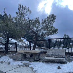

This is my first winter trip to Mount Baldy, I had a great time up there during summer. I called the help desk to point out their ticketing had wording issue which says 65 year and under, but no mention of senior. The person was very informative about the weather condition which is stormy and icy and that it is still safe for elderly to visit. There used to be three price ranges, and that changed to a single price and forgot to remove the age range. It was a cloudy day so I had decided to drive up first to see condition before going further up. As repeatedly warned, buy your tickets before going up, given if you think you won't have cell phone coverage high up in the mountain. This place isn't worth the ticket price for winter, it's basically a below freezing to just freezing 20 min each way riding experience, round trip for $40, a bit outrageous, there is only the cozy dining area at the top in the winter. Parking attendant happily took my cash for the half empty lot. I had to think about how people make you throw money at problem, this has to be one of them, snowing up in the mountain and no cell reception. The disgusted part was employee told me his WiFI is down but he can still charge the higher price when I told him I spoke with his colleague with their online issue. Upon my return to the station, nope, Guest WiFi worked just fine, the guy lied in order to get higher revenue. I don't blame him but yah I didn't enjoyed been take advantage of high up in the mountain for group of 3 and met a not so good person.
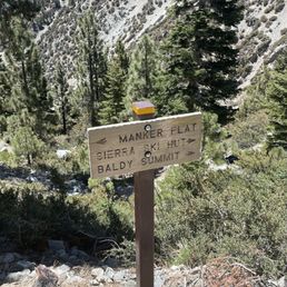

Good old Mount Baldy, always comes through when you need some time outdoors and a little bit of a challenge. My plans were canceled this weekend when my boyfriend decided last week he wasn't ever my boyfriend and we were just dating and he didn't love me when he told me he did. He blessed me with this info from one day to the next. So with this new truth from him and my new found understanding of "definitions" of things people say to me, I was a little embarrassed to tell my coworkers I was no longer taking Monday as a vacation day. I decided to still take my planned day off, cancel the plans I thought we'd planned and take myself outdoors locally to enjoy some time to myself. If you've read any reviews of mine and I mentioned a boyfriend, no you didn't. Anyhow Mount Baldy always comes through. I needed to feel that feeling of driving out of town, winding through the mountain, windows down, hair blowing in the fresh air and make Monday (my favorite day of the week!) still feel like my favorite day of the week. I've never hiked Baldy solo, and I was feeling a bit brave- probably powered by adrenaline. I knew the trail would be far less trafficked on a Monday. I've done this hike a few times now and I felt confident in myself to make it without an issue. I parked at the trailhead and started up Manker Flats at 1115A. I haven't been to the gym since Feb 2020 so I wasn't sure just how prepared I'd be with missing out on all my Stairmaster action but I'm still a pretty avid hiker, I run and indoor bike a bunch so my time didn't change much from the last time I summited in 2hrs25min. I was to to ski hut by 1225A where I stop and have a little bit of a bar, and to the Summit by 140P. I only saw a handful of people all day long which was extremely peaceful in itself. I continue to hike this the same way each time I come which seems to work for me. I ascend from Manker Flats and descend down the Devils backbone trail. I made it down and to the Lodge by about 315p, no beer or snacks for me as they were Closed. I followed the path that descends under the ski lift down until a smallish off shoot that cuts left and down into the top parking lot below the bottom of the ski lift area, then switchback through the 3 large paved parking lots until reaching the dead end road and following this back down to the trail head parking area. I was back at the car by 405P. All in all, this is a nice little summit that provides you with a small sense of accomplishment. I wouldn't typically recommend these types of hikes as solo hikes but yesterday proved, it's totally fine so long as you are safe. I tossed on a hat, my hiking boots, packed my 2L pack and only drank 1L (the weather was very pleasant), a bottle of sunscreen and a couple bars in it and was on my way. 4hr50min round trip loop, with a couple of stops here and there to take in the views etc. There are some patches of snow still, but nothing on the trail that would make it not safe. I forgot to wear and pack layers which was no problem at all, but I'd say it's probably always smart to have an additional layer in your pack for this hike - I hit a strong breeze here and there in some areas where I was a bit chilly but nothing too bad. Can't wait to come back when the lodge is open, the beer up top may be one of my favorite parts. I think I ended up with about 31k steps, although mileage wise my Fitbit was at about 13 miles (maybe my small little steps make it add up to more). Nice hike for a little outdoor adventure.


This was my first time hiking to Mt. Baldy. It's a nice trail, but gets difficult towards the summit. Came during an extreme heat warning day, but was perfect weather at the top. We followed another hiker's advice and used the trail on the left when heading to Devil's Backbone - it's much less steep! The trail is well travelled, we passed lots of people on the way up and down, including trail runners - I was amazed they could run this trail! Got to opportunity to watch a man paraglide from the summit, which was really amazing! He said he was trying to head to Lancaster but I guess ended up back at Baldy since I saw him in the parking lot on our way out. Recommend using the ski lift to go up and down from Baldy Notch if this is your first time (I did!) and order tix online in advance to save money (I paid $25 R/T). Ticket's purchased that day at the restaurant to go down is $20. Parking at the ski lift lot is now $10 although they said there was no parking fee the day we were there.


SoCal six pack of peaks #4 Difficulty: Hard Mileage: ~10 miles (many different trails up) Pets: Dog friendly View: LA county, ocean, SoCal What to bring: 3 liters of water, snacks, hat, bug spray, sunblock, trekking poles Parking: Free Street parking on Manker Flats or adventure pass for Mt Baldy Resort parking lot Fee: free Time: ~5-7 hours We went up by ski hut trail, which was pretty steep (counter clockwise). Started at 6:15am and it was packed! We got shade going up that way in the morning. Half way point is the Ski Hut. Very busy and had a ton of bugs. Got bitten several times by mosquitos. Nicely maintained, no fresh spring water. The summit is super busy! Everyone and their moms were there. I didn't like how Baldy looked at the summit, by far one of the ugliest summit. It was "bald" at the peak. Hence the name. Views are amazing though! Initially we wanted to descend devils backbone... but we descended and made the terrible mistake of coming down on Register Ridge. DO NOT DESCEND ON REGISTER RIDGE!! It's the worst sh-t ever!!! It's only about 1.5 mile (versus 6 miles) but it's literally going down 2000 feet. It was suuuper steep, I fell on my ass 2x! Trekking poles needed. It'll take as long as the 6 miles bc it was sooo steep going down. Your shoes will be torn. I repeat, do not go down register ridge, take Devils Backbone! We also saw a black BEAR on Register Ridge trail!! It was not fully grown- maybe an adolescent and it saw us. Then it ran right across the trail like 25 feet above us. Scary!!! We tore our legs going down. It looks shorter on map but not worth it. Do the longer Devils Backbone. I can't stress this enough. BRING ENOUGH WATER! Especially on a hot LA day. You don't have to be fit to do this hike, it just endurance or you just need to try. Also I saw a guy going up in his effing rainbow sandals. I laughed my ass off. Lots of IG Hoes at the top too. Good for training for Gorgonio.


There's are 2 different trails you can take to the summit if you're starting from Manker Flats. The steep 4 mile route that goes through Baldy Bowl, or the 6 plus mile trail up Baldy Rd that will lead you to Devils Backbone. Personally I prefer going the 6 mile trail since the elevation gains aren't as steep as Baldy Bowl. You views going the 4 mile trail are a lot better, but you can probably save on time going up the 6 mile trail. I'd recommend bringing hiking poles for this one just in case, coming back down baldy bowl there are parts of the trail where the ground has loose dirt and rocks so it can be easy to slip & fall in some spots, plus the decline can be pretty steep too so your knees & legs in general can get pretty tired/sore coming back down.


So I tried to check in but once you get there all cell service is pretty much non existent. Though it says they have wifi I wasn't even thinking of it while I was there. It was good to be off the grid though. First it is beautiful up there. The views are awesome. Though the sun was out there was snow. Hard snow, so you can just say ice. I was only able to go tubing. It was exhilarating but walking back up the hill with a mask on at that altitude was killin me so I didn't do it much as I wanted to. There was some skiing and snowboarding but I wasn't prepared for it so I didn't go. It was a good time, the lift was scary and I fell on the snow and I can still feel it. I would definitely go again.im probably going to have to since I spent money on snow pants.
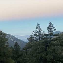

Ok so this was tough! I am talking about one of the toughest things I have done so far. I figure if we are going to hike Mt. Whitney next year might as well practice. Our group of hiking friends are always looking for an adventure. Last year a big group decided to do this hike I did not join. This year they decided to hike it again and summit it but guess what only two from the previous year decided to summit. I should have known what I was getting into lol. Parking: We arrived before 5 a.m. and parked at Manker flats. We did not need a day permit so we parked off the road close to the entrance. Plenty of parking at that time. Restrooms: There is one at the beginning of the trail but it was super stinky and had mosquitos super yuck. I had to hold my breath. Necessities: Bring lots of water. I filled my water pack with powerade. SHOES-You need some very sturdy anti slip shoes due to some parts that are very slippery due to loose rocks. A hat to shield the sun away and sun glasses. Maybe a small jacket as it gets really windy at the top at the most difficult point YIKES! Trekking poles I did see some people without them but let me tell you they did help me get out of some dicey areas. They also helped alot when coming down some very steep areas. Hike: We started at Maker Flats and took the wider trail. The first three miles of the trail are pretty tame and you start ascending but nothing too serious. You just take the views of the valley and a water fall at the beginning and you are all good. After we passed the Mount Baldy ski lift it got super serious. We started ascending and it got pretty steep. I thought I was in shape lol I had to take some breaks especially because of the high altitude. We got to Devils backbone after about a mile of that steepness and woooo chilld. If you are scared of heights this is not for you. The views are AMAZING though. I mean there are 360 views of LA to the Mojave. At this point I was like oh yeah this is not an easy hike. I looked down at my feet cause when I looked on either side you saw those steep drops on both sides. After passing Devils back bone the tail got dicey as the trail had a huge drop on one side and plenty of loose small rocks. I used my poles there. After that for about two miles everything was pretty cool not too bad. We ran it for a while. That last mile and half was very tough. The climb was super steep and it was full of rocks. I had to take two breaks as the altitude at this point really started to get to me. Once we got to the summit the weather was super cold and windy. I am glad I had brought a jacket. The weather at the top was very different than the bottom. Restaurant: There is a restaurant at the ski lift with drinks, beers and sodas. They also have food such as sandwiches, hot dogs and chips. Hiking Time: It took us about 3 hours to summit and a distance of 6 miles. It is a really tough hike but every time you look in the distance at the tallest snow capped mountain (10,064) in LA county you can say you hiked that. Will I do it again? maybe. I decided to run from the ski lift and meet my friends at the bottom and total round trip was about 12 miles and about 5 hours.


This hike always challenges but I love it - and some of the group hates it but never misses it. I've never gone up this late in the season and it was a different experience. All the crowds and noise of the summer are gone. It was peaceful with lots of snow from a storm about 10 days ago. We hiked up the Ski Hut trail and down the Backbone, stopping at the lodge for a beer and then down the fire road because my friends knees were hurting and he was worried about the steepness of the lower trail to the parking lot. The road added about a mile and a half from taking the trail. We were glad to have our spikes on after the Ski Hut all the way back down to the lodge. It was perfect, sunny and 30ish at the top with some wind. We felt pretty safe with spikes and polls but there was one part at the start of the Backbone that was washed out and it had some people pretty sketched out, taking a lot of time to get by. Understandable because it was a long way down! I enjoyed the winter experience but it definitely adds some more risk; you should do your research and know what you're in for.


Such a great mountain and trail, but there are SOOOOOOO many people that come, so I only hit it every few years. The trail is in excellent condition and the mountain is always beautiful and rugged and if you get lucky, you may see some bigger animals like a bear of long-horned sheep. Parking is plentiful if you're an early riser (no later than 7am), but you'll need an adventure pass. The ski lodge parking was open at 5am today and already come down the lifts, so I just parked up there and didn't pay. You can take ski lifts down from the notch, but they torch you for $20 nowadays for a 1-way ticket.


BADA$$ Trail! I'm training to trek Mount Whitney in September and this was on my list of hikes to summit. I've been reluctant to hike this trail, due to the fact I am deathly afraid of heights, but I managed to control my fear! It's not for the faint of hearts. There are sections on this trail that has sheer drops on either side, but the trail is wide enough where you could muscle through, take your time, and don't look down. Start early! We started at 6am (7/31) and decided to take the loop trail starting at Manker Flats campground, up San Antonio Falls, towards Sierra ski hut (clockwise loop) and back down through Devil's Backbone and towards Mount Blady Resort. Moving time 5:30:34, in 10.37 miles with an elevation gain of 3755ft, and a total loss of -3803ft. This is considered a difficult trail; altitude change, elevation gain, loose gravel, heat from the sun, winds/weather...but it is very doable. Pace yourself. Hydration and food are important on this trail. I felt a little dizzy (from altitude change around 7600ft), but was able to quickly recover by hydrating. Drink plenty of water, snack as much as you can, take deep breaths, and most importantly listen to your body. The morning was awesome, there was cloud coverage protecting us from the sun which kept our ascent very pleasant. We ran into a few fellow hikers that informed us there was a falsh flood warning issued for the area. Luckily, we arrived at the summit before we experienced any rain. As we descended, the sun was out full force, it was hot and muggy. My pack consisted of: 2l bladder, 1.5l of liquid IV, tons of snacks, sunblock, a jacket (for the summit), and Tylenol.


9 years ago
This is one of the tougher hikes in the Greater Los Angeles County. So if you are a novice at hiking, this is not the place to start. For my fellow fitness freaks, this hike is most definitely worth the drive! The trail head starts at Baldy Village, a place that embodies small-town Americana. The walk into the trail will take you past several privately owned homes sitting under the canopy of the tall trees. The ascent begins from there, and continues steeply up the mountains. In my opinion, the trail isn't bad at all. Before coming here, people told me that this trail narrowed significantly. But I found it to be easy to navigate. I recommend bringing an SLR camera here, as the views are spectacular. Bring plenty of trail mix and water as well, as this hike will take several hours to complete. I got some good shots of this place as we made our way up, but my phone battery ran out of juice about an hour from the summit. Meaning, I will be back to get my shots from the peak. Stay tuned. read more


6 years ago

6 years ago

9 years ago
Hiked Devils Backbone Trail to Ski Hut/Bowl loop This is a strenuous hike, though marked as 11.3, we clocked it around 12 miles round trip. It took us just over 5.5 hours round trip. The hard parts of this hike are the consistent uphill treks you face. The inclines along with the elevation can make the climb up very challenging. I personally had a very hard time with the elevation gain. As with every hike coming down is way easier, though watch your footing as there are a lot of lose rocks and ground. I highly recommend coming up the backbone trail though it has many inclines, looking at people coming up the bowl/ski hut trail, that looked even more challenging and steep. Technically the bowl/ski hut trail is shorter but with all those hills I don't know if it's any faster on the way up. We left east LA around 5am and got there a little after 6. This is the way to go! It was cool on our way up, very little foot traffic, and parking was easy. As we were coming down we saw the crowds coming up and it did not look fun to be in those lines. If you have bad knees I wouldn't not recommend this hike. My sister and I did this is sneakers, but hiking boots would have been helpful for the ankle support though not 100% necessary. Overall this hike has beautiful views almost the whole time and it is vey fun and challenging. Highly recommend!! read more


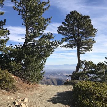

8 years ago
We hiked on memorial day weekend. So it might of been more crowded than normal. The parking area is past the Manker campground. The trail starts near a restroom. Remember to display your adventure pass. You will see a gate. Here is where you will start. Continue up the road area. You will pass san Antonio falls but we opted to bypass it. In a bit you will see a split. It's a loop so either way will work. We opted to stay on the dirt road going straight instead of going up left towards the ski hut. Continuing straight this trail will take you to baldy notch. Once at baldy notch, the trail continues straight ahead. But you can take a break, there is a restaurant, restroom and a gift shop. Some people might want to save time and take the ski lift to baldy notch, then continue the hike to baldy. Continuing the hike we pass by some summer tents, you will see an intersection, it will be the immediate left going up. If you're going down or right. It's the wrong way. The hike up was steep but wasn't too bad, pace yourself and you'll be fine. Before you know it, you will arrive at devil's backbone. Originally I didn't even know I was on it. I had to circle back to take pictures. If you're afraid of heights, you might want to start this way heading up instead of coming back down on this portion of the trail. As I guess looking down could be much scarier, but going up I didn't even notice the narrow trail so much. But winter time I can see the danger. From there you keep hiking up, there is another split before you start the final summit, stay left to baldy, if you go right going up, you will hike to Mount Harding. Which is not a bad thing, but will add to your distance. The final summit hike there is a somewhat define trail but everyone seems to be hiking up in their own path but all end up to the same destination. Once you make it to the top. You will see trail sign from a far. That is where you'll find Mount Baldy summit sign. You can relax, eat, take pictures. Once all done you can hike back down the way you came up or finish the loop. We did the loop, so we headed towards Sierra Club Ski Hut/Manker Campground trail. Hiking back down was steep, this is where you might want to use your hiking poles. Even with the poles we still slipped a few times. It felt like this side of the trail was steeper with a lot of loose rocks, but no major drop offs. Right before you arrive to the ski hut, you will see a trail going right. Unless you want to checkout the hut, turn right and continue on. Near the end you can see the road where you parked. Then you will be hiking down to the split on the dirt road. Go right and your headed back to where you started. As always pack accordingly to the weather. Even though it was sunny, it can be windy up top. I carried camelbak 3 liter with an extra bottled water, hiking poles, snacks and extra layer of clothing just in case. One thing I might of also brought is gaiters. Those pesky rocks can get in your boots and make it uncomfortable. This is a must do hike, but due to the crowd on the weekend, I can knock this off my list and can probably revisit years later:) or during the week day I would definitely do this again. read more


9 years ago
It has been a while since I experienced such a wonderful nature hike, with the rewards of seeing the beauty of the Angeles National Forest. If you are an avid hiker and want to explore your backyard here in Socal, this is the place to see. I believe that anyone can do this hike, but you must be prepared, do your homework, and enjoy the journey. The drive up is amazing, parking near the Manker Flats campground was a snap (make sure you get your adventure pass before you go up for 5 bucks) and start your trek! Started on a chilly Friday morning 9am in the middle of October, make sure to layer up. The sunny blue sky shortly after made things definitely more bearable. Bring at least 6 hours worth of water, more for hotter days. Snacks, food, electrolytes, sunscreen, hat, you name it. Trekking poles would help, especially on the declines. As you get past the ski lift, the altitude can get you a bit dizzy and lightheaded. Take a break but keep pushing. I feel that Mt. Baldy is a mental game. If you are afraid of heights, prepare to harden your resolve. The devil's backbone is a narrow trail and when the wind blows hard, man get that courage in your system. Start steady, go slow. You will eventually reach the top at 10064 feet. Enjoy the horizon, take a rest. The way down of course is easier on the legs, but there are lots of loose rocks. Pace accordingly. You can take the ski lift down and save your legs at the second half of hike (11 bucks). Exhilarating views, being one with nature and self is something that everyone should try out. I felt like I was in a REI ad. Challenge yourself, get out there. read more

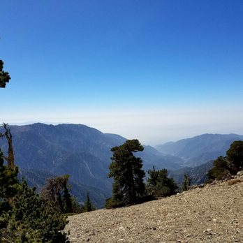


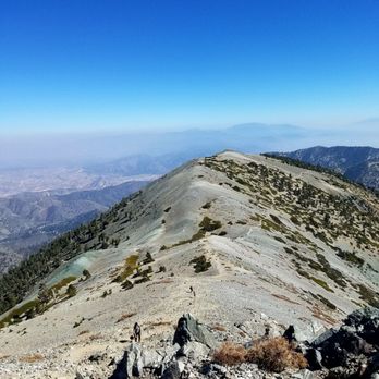

6 years ago
An ARSE KICKER & 1/2!!! 4000 feet gain & 7 1/2 hours of moving time; this is the most difficult hike I've experienced yet. The trail to the BaldY summit is rated as difficult, which is an understatement! We did the hike after the first snow and the trail was completely covered in ice and snow & requires micro spikes or crampons. It took 4 1/2 hours to the top and 3 hours down. The trek after the ski hut was difficult to navigate in the snow, but there were a few trail posts far between. I suggest using gps and recording your trail. Below 0 windchill @ the top and blowing gusts of snow that actually pushed you. The views were SPECTACULAR & BREATHETAKING. Lucky for us it was a perfect day with the sun out. We had clear views of Catalina and So CaL. So Freakin AWESOME & so GRATEFUL for the ability to experience what others can only see in pics. read more

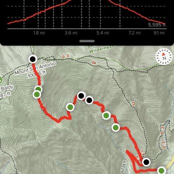


Distance: about 10.5 miles Elevation Gain: about 3,700 ft (start at 6,300 and reach about 10,000ft.) Duration: 7 hrs including pictures, eating, resting, etc... Difficulty: Strenuous *we did this last Sunday (5/21/17) as part of a charity hike for The Heroes Project Climb for Heroes event...also as part of the 52 Hike Challenge and the 6 Pack of Peaks Challenge This was my first time doing this hike and the weather was perfect...it was a sunny, clear day! We started from the ski lift parking lot with the first half mile being an incredibly steep trail with a stream to the left. We then took a right and the trail was wider and not as steep for the next 1.5 miles while hugging the mountain side until we reached The Notch. This is where the ski lifts come up to and there are other connecting trails that meet here along with a restaurant. The hike gets progressively harder from this point on for mile 3, 4, and 5. The entire hike contains elevation gain of between 500 to 800 feet but this is the section that contains The Devil's Backbone which consists of a narrow stretch with steep drop-offs on both sides and winds that really start to whip around. The final 2 miles are completed at altitudes of over 8k feet and people (including myself) start to feel the effects of the thinner air making it harder to catch one's breath. The last mile or so you could see the summit on the rather treeless lunar-looking landscape with patches of snow present. This final part of the trail consisted of many loose rocks that made it hard to gain traction. It was rewarding to reach the top and the positive vibe of all the people celebrating in their accomplishment and enjoying being a part of such a great cause. The hiking community is filled with an amazing amount of positive, encouraging individuals. The views were pretty spectacular but after about an hour and eating a little bit we decided to head back down. The trek down was harder than you would expect downhill to be and many people opted to avoid the final 2 miles by taking the ski lift back to the parking lot, but we didn't. * I would recommend starting this hike early since it will take so long, wearing hiking shoes/boots, using hiking poles, wearing layers of clothing for the temperature fluctuations, and bringing sufficient food and water in your backpack read more


This review is for the Ski Hut Trail, not the more popular Devil's Backbone. Keep in mind there are four different paths to get up to Baldy Summit. Stuff in my pack: 1.5L of water (it was about 75F the day I went, adjust for water/weather accordingly) food and snacks, jacket (it's windy and cold when you're resting, especially in the shade), sunblock Hiking shoes - yes Trekking poles - helpful, but not mandatory This is an unbelievably difficult hike. We started off at Manker Flats at 7:30 and did not return until 3:30 that afternoon, including all the breaks. In my defense, I had just donated blood a few days prior. I believe most people take Devil's Backbone to the peak, but my group decided to hike through via the Ski Hut trail. It's a shorter trail, but I can only imagine the hike is steeper because you're making the same elevation gain. The majority of the hike is relatively shaded as well. The official length is 9 miles round-trip I believe, but my FitBit clocked 11 miles round-trip. My dad's Apple Watch clocked in at 12 miles. I'm not sure I would recommend this trail for everyone, because the path isn't always very clear. It's not difficult to get confused. On our descent, we actually met a group just hanging out waiting for other parties because they didn't know how to get back down. It's easy to miss the trailhead because it's a narrow trail that diverges to the left from the fire access trail about a mile in. You'll see a metal table thing soon after once you've left the fire road. With that said, this trail is broken up into two parts. Part 1 is the hike to Ski Hut, which is a cabin managed by the Sierra Club. It's usually open on the weekends for a little while, and there is a water source inside, but DO NOT count on it. It is LOCKED if there is not a Sierra Club member there, with no access to said water source. This section of the hike is hard, but not as hard as the second half. It's also very clearly marked. Part 2 is from the Ski Hut up to the summit. It is also where you make the most elevation gain, and it is hell-ish. My group stopped so often in part because of the altitude. The air is so thin. The trail is also not very clearly marked in this section. There are some painted arrows on rocks and standalone poles to guide you, but you do want to have good directional senses. Identify areas that are clear to see from far away that you can use to guide you (EG. we rested at this super flat open spot on the way up and we used that as a beacon to guide us on the way back down), Just know that when you're about to give up.. you're probably still not close yet. LOL sorry, but those are just the facts. Regardless, do not give up because the view from above is unparalleled. Plus, you need that picture for Instagram. read more



7 years ago

11 years ago
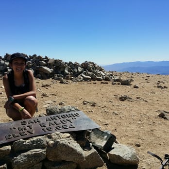
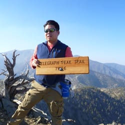
IT WAS SUPPOSED TO BE A ONE AND DONE! BACKGROUND: Mount San Antonio, also known as Old Baldy or Mount Baldy, at 10,068 ft., is the highest peak in the San Gabriel Mountains, and the highest point in Los Angeles County. The peak, which marks a boundary between San Bernardino County and Los Angeles County is called Baldy because of the absence of trees around the summit. STATS: Trailhead: Mankers Flats Trail: Ski Hut Trail Distance: 10 miles Elevation Gain: ~4,000 ft. Max elevation: 10,064 ft. Rating: Moderate Trail: Looped some pavement, fire roads, but mostly single track and rocky trails ESSENTIALS: At least 3 liters of water Sunglasses and sunscreen Extra clothing Headlamp/flashlight First-aid supplies Food Trekking poles Camera OUR ROUTE: Although my first time hiking to the top of Mt. Baldy was several years I remember it as if it was yesterday. Talk about preparing for the worst, hope for the best... I packed and dressed for a snow storm. Dressed with multiple layers of thermals, jackets, hats, and more inside my backpack. I was ready for whatever weather came my way. The Crew typically does this hike as part of their Mt. Whitney training series. I had no intention of hiking to the top of Mt. Whitney... EVER!!! But I did want to see what it was like to be at 10k ft., where altitude sickness begins. Starting from Mankers Flats, me and The Crew took the Ski Hut trail and Baldy Bowl to the summit. The trail to the saddle is fairly simple to follow and there are always people coming and going. The likelihood of veering off trial is minimal. The Ski Hut visible and not too far off the trail, not only offers spectacular views of civilization sitting below and beyond the treetops, it's a place to rest, snack, and use the port-a-potty. Be warned, the potty doesn't get cleaned very often, I typically put my bandana over my mouth, like a bandit, to avoid puking from the smell. The Ski Hut is used typically by Boy Scouts, but others have rented it. There is a full working antiquated kitchen, some bunks, warmth, and sometimes adult beverages... bring cash or bring a donation. While the Ski Hut is about halfway to the summit, it's 1 mile to the saddle and the last mile from the saddle to the summit is the most challenging. It is about 1 mile, with 1k ft. elevation gain. If the elevation gain isn't enough, the trail disappears.The trail is rocky and slippery at times, the trees are no more at this elevation, and the only greenery is the sparse shrubs. You will know you are at the top when you see people napping, eating, socializing, and striking poses around the marker. Take it all in and set your backpack down, and turn in circles, you'll get a view that goes as far as the eye can see. After summiting the rest of the hike will be a breeze. Me and The Crew hit Mount Harwood and then took the devil's backbone trail over to the baldy notch where we stopped inside for some brew and grub. There is a marker on the summit of Mount Baldy at the start of the eastbound Devil's Backbone Trail. Descend 0.7 miles to the saddle between Baldy and Mount Harwood. Watch your step. The gravel may be slippery underfoot. From the saddle, follow the trail along the south side of Harwood and on to the Devil's Backbone. Cross the spine of the steep ridge to the top of the ski resort. Take the dirt road that passes to the left of a non-operational ski lift down to Baldy Notch. The Baldy notch is a great place to relax. Tables, chairs, full bar, tasty food, flushing toilets, not to mention spectacular views. For about $20 take the ski lift down and continue to enjoy the views. IN A STEP: As I always say, I'm not a trail followin', elevation huffin', peak bagger, summiting Mt. Baldy was not on my wish list, and once I summited it once, it became a one and done. If it weren't for friends that twisted my arm, The Crew, and National Trail Day, I would not have hiked it six more times. Oy!!! There are four popular routes to the summit. All are considered moderate hikes of 8.5 to 13 miles round trip and anywhere from 3,600 feet to 6,000 feet of elevation gain. Know your limits. Be mindful of what's going on with your body. Be informed, Google altitude sickness. DISCLAIMER: Hiking is not something that can be taken lightly. It can be life-threatening as you see and hear on the news, people die or get lost all time. Please, if you are going to hike, never go alone and prepare for the worst, hope for the best. Remember when going for a hike, no matter how short you think it may be, always be prepared. Carry at least two liters of water for every five miles (more if the weather is warm), protein bar, nuts, and electrolytes. Wear sturdy lug sole shoes and protective clothing. Some areas the weather can change quicker than a fireman can put on his gear. It is also very important, always always always let a family member or friend know where you are going and when you expect to be back. Lastly, have fun when you hike it up. read more




Total ass-kicker. This hike is one for which you have to be VERY CAREFUL about what you pack and what you wear. Given the elevation gain, the climate change from the trail head to the summit can be drastic. Here is the skinny: - approximately 12-15 mi total depending on which way you head down - 3000 ft. elevation gain - beautiful views on the way up and at the summit - dangerous and can realistically be perilous if one is not careful - start no later than 10am (summer) or no later than 8am (spring/fall) to ensure you have enough daylight to complete the hike What to bring: - a hiking partner (hiking this alone seems precarious) - Adventure Pass - water (AT LEAST 3 liters, but 4-6 liters to be safe) - full lunch (sandwich, Starbucks protein pack was nice) - snacks & energy bars (my favorite are Clif bars, "Ginsting" honey packs from REI) - small towel or washcloth - extra sweater or wind/water-resistant jacket (depending on weather) - good shoes (Vibram treksport worked fine for me) - sunscreen - first aid kit - compass - flashlight - clock/phone Start at the trail head up the road from the Snow Creek Lodge through a paved road towards San Antonio Falls. Less than a mile in, you can visit a small waterfall before you start the steady climb to the summit. Once at the waterfall, the trail continues up the hill to a marked offshoot. Difficulty starts here. Sign the log, and be on your way. It will be necessary to take small breaks to catch your breath, but the ski hut is your first full rest stop. Have lunch here, take a breather, and take some pictures. I'm careful not to rest too long here, because it gets difficult to get back into workmode. If you thought the trail was difficult getting to this point, it gets harder. After the ski hut, you will take the trail upwards again towards a pile of large rocks. Once past the rocks, you will start a steady climb up a dirt trail. At the top, there is another clearing with a few stumps and logs. This is your second rest stop. It is flat here for a few hundred feet, so you can give your body some time to recover before heading upwards again. The trail will continue upwards, and there are really no other "nice" rest stop areas. The last half-mile is no joke, and the combination of thinner air at high altitude (probably around 9000 ft. elevation at this point) and a steep climb will have you panting and resting every few feet. Look up and when you can't see your fellow hikers anymore, you're near the summit. The summit! This is a lovely flat area with sectioned off rock piles for camping. Do a 360 of the Los Angeles view. Take another food break, take some pictures. I've also seen some people nap, but 1) daylight is precious and 2) hard to get back to speed. From the summit, there are two ways to head down - the way you came up, or via the Devil's Backbone. I recommend trying both. The way you came up is harder on the knees since it is steep the whole way, and in much shorter distance, and the Devil's Backbone is a steadier route. Both ways are still scary and dangerous if you are not careful! The Devil's Backbone way is extremely dangerous and steep heading down from the summit. There is no real marked trail, and is full of rocks and gravel. Once at the bottom, the trail levels off for approximately 5 miles. The Devil's Backbone is a few hundred feet stretch that basically drops off on both sides, with the trail no wider than 5 feet. Be careful, but enjoy the spectacular views from the canyon. At the end of this, there is a lodge with a restaurant called "Top of the Notch" where you can hang out before heading down. There is also a ski lift here, so if your feet can't take it anymore, you can take it down to a lower parking area, which will loop you back to the trail head from where you started. If you don't take the ski lift, I imagine the rest of the hike is 3-5mi down. I completed this hike once in July and once in October. I was frying during July and the weather was perfect. There was a lot of sun, so slathering on sunscreen was a must. During October, the weather was less predictable, and the temperature was in the low 50s when we started. With wind chill, the temperature likely was in the high 30s to low 40s, so I brought extra sweaters to keep warm. There were also thick clouds, so we had to take the ski lift down due to low visibility and cold temperatures. Always check the weather in the area and know what you are getting yourself into. TL;DR: One of the best hikes in the LA area, and a testament to your fitness level. EDIT: 3000 ft. elevation gain read more




7 years ago

Took us around 7 1/2 hours to complete. I was wearing my Merrells and my friend her Palladium boots & both our feet were about to fall off on our hike back :( lol. It's a beautiful and challenging hike. When we got to devils back bone it was a bit scary but the views made it totally worth it. At the top there were a lot of people! Don't under estimate this hike! There is no reception so make sure to take screen shots of directions / pictures just in case. I took screen shots of the trail from modernhiker.com better to be prepared :) read more


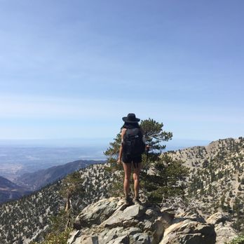

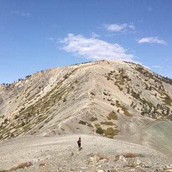
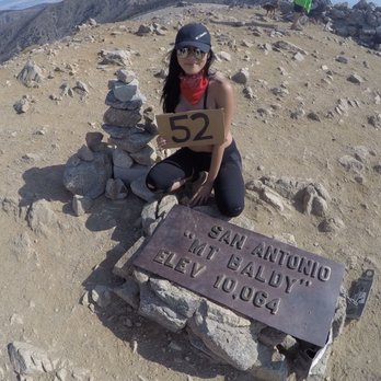


There is so much to do in the local mountains. Mount Baldy has waterfalls, challenging trails, skiing, coffee and food. If you go the back way down from the Baldy Village you end up in Glendora and Azusa Canyon. There you can pan for gold or bungee jump from the Bridge of No Return. On this day I woke up early to take advantage of the 'Golden Hour.' The golden hour is the hour surrounding sunrise and sunset. It is an ideal time for photographers because the land is flushed with natural diffused light. The diffused light reduces shadows and allows you to get greater detail in your photographs. I enjoy the Baldy Lodge where you can sit on the back patio and enjoy the sounds of nature while you eat. It is also moderately priced for American standard food. If you plan on taking one of the side trails be sure to stop in at the RANGER STATION and get a parking pass. They cost around $5 for the day and will save you from a $100 ticket. Bring a dog-doo bag if you bring your animal. I often find myself picking up trash that people leave behind. I hope you will join me in my effort to keep our parks clean. read more


12 years ago
This is a challenging hike to the top of Mt. Baldy. Definitely do NOT recommend for beginners as you'll be hiking upwards of 4 steep miles for an increased elevation from 6,000 to 10,000 feet. There are 2 main ways to get to the summit. I'll explain both ways below... Start your hike at the gate by following the service road toward San Antonio Falls. At the first switchback enjoy the views of the waterfall, then continue on the service road for about another 0.3 miles. At this point you will have a fork in the road (easy to miss as there are not signs!!!) where you can take sharp left incline for "hard" path OR continue straight for "easy" path. Both paths will reach the same summit. I'll explain both paths now: Taking the "hard" path on the left, you will proceed upward on Baldy Bowl/Ski Hut trail to Sierra Sky Hut (elevation 8200 ft). Take a quick break at the Sierra Ski Hut to regroup before continuing upward on the Baldy Bowl to a ridge south of the Summit. From there it will be a push for another 1 miles to reach the summit. Alternatively, you can take the "easy" path by continuing straight (or make it even easier on yourself by taking the "ski lift" that's located about a 1/4 of a mile from where you parked). Anyway, whether you took the ski lift or hiked this distance, you will reach the same "top of the notch" spot where there is a little hut with food and snacks you can buy. From there, hike up the "Devil's Backbone trail" all the way to the summit. For more experienced hikers, I highly recommend taking the "hard" path to the top, then descend down using the "easy" path. Basically, you'll be making a loop and returning to the same parking lot. Some things to keep in mind: - bring 2-3 Liters of water and snacks - hat, sunglasses, and sunscreen as there are lots of open areas to get sunburned - several layers of clothing as it gets pretty windy/chilly at the very top. - start your hike EARLY around 7am to escape most of the heat. Plan for about 10-11 miles of hiking (there and back). - hiking poles (useful for descent) - camera and positive attitude. It's beautiful over there! Directions to Mt. Baldy parking lot: From 210 Freeway, exit Baseline Road. Head west on Baseline. Turn right on Pandua Road and drive 2 miles to Mt Badly Road. Continue on Badly Road until you reach the village. Continue up Mount Baldy Road for 7 miles to Mount Baldy Village (where there is a visitor center) and drive another 4 miles up the road to the Manker Flat campground. Park along the road. As of 6/1/14, you do NOT need an Adventure Pass to park near the gate. Having said that, keep an eye out for the latest news as that might change. read more


7 years ago

3 years ago

11 years ago
I've done this hike two times and the first time kicked my ass. I came with my little brother and his group of friends who are non-seasoned hikers. Two of them didn't bring water, but it was fine because we had water for them in our family car. Note: in order to park at Mount Baldy you must have an adventure pass, obtainable at the Baldy Village at the Mt. Baldy Visitor Center. It's $5.00 for the day or $30.00 for a year (which gains you access to hikes such as Mt. Wilson Observatory, Bridge to No Where, and etc. within the Angeles Mountains). As a seasoned hiker I bought along with me 3 liters of water in my bladder (Camelback brand) which was personally enough for me. The hike is 10.33m round trip with about 4,000 ft elevation gain that summits at 10,064 ft. We started the hike kind of late because we decided to go to this hike at 11:pm. By the time our group of 6 arrived we had started the hike around 11:30am. It was searing hot. Luckily we came on a Wednesday and there was hardly anyone, but that was almost our downfall. More on that in a bit. The hike to the top took us a very long time. Near the ski lodge, you'll meet one of the first few challenges that will test your ability or your inability to climb high slopes in high elevation. And that nearly did my little brother in. He was cramping (probably from dehydration and lack of sleep) and he had to stop very frequently. By the time we reached the top it was perhaps 4:30pm or so. We encountered an old couple who we asked directions for how to do the loop once we got to the top. They gave us very clear instructions to NOT FOLLOW THE TRAIL WITH THE POST SIGN. Once again that is, DO NOT FOLLOW THE TRAIL WITH THE POST SIGN. If you are at the metal plaque that says you have made it to the top of Mt. Baldy, look directly south to find yourself a "low-key" trail. When we did summit Mt. Baldy we encountered another lovely young couple who was decked out with hiking poles, hiking packs, and all these outdoor gears. So I asked them which way they were going. They said they knew the way back and they headed towards the TRAIL WITH THE POST SIGN. We ended up spending about an hour at the top recuperating (mainly my little brother and his friends). On our way down we started to try and find that "low-key" trail only to give up while "scouting" to follow the TRAIL WITH THE POST SIGN. Note: there was also a group of 3 guys who summitted with us. They were still chilling at the top. Perhaps an hour into our descent we encountered the young coupled decked out in outdoor gear coming back, coming backwards with another couple who was severely dehydrated and out of water. They have ventured 3 hours down that path to discover that it was not the path at all. So this is when my group (Buddha bless us) gave them and shared with them our water. Mind you this was on a Wednesday and besides the people I had mentioned to you there is no one else on that "Buddha"-forsaken mountain. So we summitted again to find the 3 guys on top coming down our way. We turned them around and we with a party of 13 (6 of my party + 2x2 couples + 3 guys) started scouting for that Southern trail. We found it. Long story short we ran out of water because we shared with them, when we arrived at the bottom it was 9:30pm and it was dark. We were starving and a bit dehydrated-for city folks. My second time I went with MY group of hiking buddies, and we did it easy. Though we did get lost 20 minutes accidentally going off trail. I just had a massive hangover from blacking out the night before, so I ended up puking like 3 times to clear all the stomach acid out of my system. But other than that, the hike was fabulous. =] read more
![Mount Baldy - My hiking buddies and I :] - Hiking Near Me - Mt Baldy, California](https://s3-media0.fl.yelpcdn.com/bphoto/NlhatrGeshbSCYnsiQqZ-Q/348s.jpg "Mount Baldy - My hiking buddies and I :] - Hiking Near Me - Mt Baldy, California")


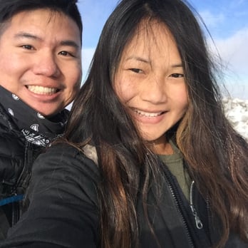

This is an update for people that want to hike this in the winter. You can read my previous review for more details about the trail itself. I hiked Mt. Baldy for the second time today and it was absolutely freezing and windy. Thankfully I had my trekking poles this time or I don't think I would have survived. I anticipated that it would be cold today but not windy. And high winds to be exact. There were patches of ice throughout the trail and they were mostly hard, packed ice that you can easily slip on. My friends and I would either walk around it if we can or go on a different route or if it was a small patch, we would slowly step across it. This trail is still doable now but I know this week there will be rain and snow so I'm not sure how accessible this trail will be in the coming weeks. I would check the weather before coming here. The wind speed was ridiculous today and made it feel like it was 10x colder than it was. It was about 20-30 degrees Fahrenheit. My fingers and my whole body was numb. I highly recommend wearing insulated gloves, a warm jacket, a ski mask and using trekking poles in the winter. Regarding the ski lift, since it's in season now, tickets are more expensive. You can check them out on groupon or the link I provided in my last review. We didn't take the ski lift this time since we didn't want to pay for. That added a good 1.5-2 hrs to our time so this time with the snow/ice, walking back down the trail, resting and chilling at the summit, it took us 10 hours to complete it. I'm sure it can completed faster than that. read more


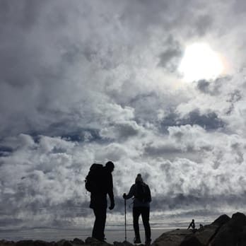


12 years ago
Mount Baldy is definitely one of the more strenuous hikes in SoCal, but a must-do for all adventurers and hikers out there. I would say the trail is as comparable as to the Half Dome at Yosemite (but scenic-wise, Half Dome wins). My friends and I started at 6000 ft elevation and it took us ~7-8 hours to finish including water/food breaks, photo ops and beer stop at the restaurant towards the end. We took the more challenging of the two routes, which killed our thighs but worth the trip. Tips: -It was almost impossible to tell where the 2 routes split, but they should split within the first 0.5 mile (I included a picture for your reference). There's a notebook you can sign when you reach a resting point (then you know you're on the right track). -Hiking poles are recommended since the more challenging trail has very steep inclines. Also, when going down the Devil's Backbone trail, there's a lot of loose gravels so either have good hiking boots, bring hiking poles, or take smaller strides. -2L of water is sufficient. And a bottle of Gatorade or Powerade is recommended to replenish your electrolytes. I packed 2 sandwiches and it lasted me the whole way. Overall, I would definitely do the hike again. It was fun, nice overview of the city, and a great workout. I did it in the middle of summer (6/28/14) and there was enough shade most of the way, but always remember to wear sunblock and share the trail (it can be very crowded)! read more


I had written off Mt Baldy as "Ho-Hum" hike years ago. I figured it was a quick hike for local LA folk to get a quick workout in. I was wrong A friend text me and asked if I was up for the hike. Having already summited some of the highest peaks in California I was up for the hike. After doing more research on "Baldy" I was surprised to read that this was going to be a bit of a challenge. How strenuous could it be? At 11+ miles and 4000 ft of elevation gain this was not going to be a walk in the park. There are shorter trails to the top and the option to take the ski lift. Our group wanted to "man up" and take the long way. The moment you leave Mankers flat campground it's an incline all the way up. No occasional flat spots to catch your breath if you do the whole loop. Once you leave the access road the scenery gets much better with views of LA in the background. I recommend this hike to anyone that is in decent shape, good cardio, stamina or an intermediate hiker. Trust me....It will be a much more enjoyable hike. Be prepared. Bring plenty of water (not just a small bottle), some food, energy bar, sunscreen, layers of clothing because weather changes in a matter of minutes, and of course good pair of hiking shoes/boots. At minimum some good trail shoes. Try to map out your hike before hand because their are no signs to tell you were to go. Have fun and be safe! read more


12 years ago
Yesterday, Saturday, April 11, 2015 at around 8pm my brother me and my German Shepherd were making our way back down the devil's backbone trail, we were about 20 minutes walking distance from the ski cabin. It was pitch black and all three of us had headlamps on yes including my dog! I fortunately brought my flashlight with me and used it to point light at the hills just east of the trail. As we advanced I flashed my light on the hill my brother spotted to reflective eyes looking at us. We pointed all the lights we had right on it and saw it was a large mountain lion standing just 30 yards above us just in the direction we were heading. We stopped and slowly kept eyes on it as we slowly kept moving forward. My dog did not grow concern over it. Just moments after the encounter 2 unsuspecting night hikers were walking toward us and we told them that there is a mountain lion above us. That was enough for them to turn around and walk back down with a purpose lol. After closer review of pictures we took just minutes earlier we could see reflective eyes on one of the pictures that were obviously not my dog's. So people do not go hiking alone at night, take a weapon, light and a friend. Do not provoke the predator animals, yes this mountain lion was stalking us but we lived because we did everything carefully and were aware of our surroundings. Before the encounter we saw a lady hiking alone going up the devils back bone, understanding that these creatures do not hunt and kill humans everyday however; you may be that one that gets mauled when you decide to go alone at night with nothing to defend yourself with. Mountain Lions are out and about. This is their land and home you are only a visitor! So be-careful and have fun. read more


12 years ago
On New Year's Eve, my former roommate and dear friend suggested we go on a day-time adventure to celebrate the last day of the year. She specifically wanted to find snow, and suggested Mount Baldy. I was more than down. We cruised down the 101 to find a winding mountain road (a mere hour or so of driving from the deep end of the San Fernando Valley - not bad at all). Mount Baldy itself is a kitschy mountain town, like something out of an old school Rankin Bass movie, especially on the heels of Christmas time. There's a few lodges and motels, a restaurant, a trout fishing pond, a ski/snowboarding area at the top (with a restaurant aptly titled Top of the Notch), and of course - sweeping mountain views, covered in snow! We went on a great, refreshing hike. We made snow angels. We built a tiny snowman. It was truly awesome. Lots of families were nearby with the kids for a day of bob sledding. We didn't venture up to the top half via ski lifts since neither of us snowboard or ski, but I'll be sure to change that next season. After our refreshing day in clean winter air, we grabbed hot chocolate at the Mount Baldy Lodge (the owners were awesome - they let us warm up by the fire and introduced us to their friendly resident cat, Hemingway). Then we went back down the windy road to the freeway. It was such a great quick little getaway. We even went back a few days ago (the snow was all gone, unfortunately) but it was still gorgeous - great for a hike at some serious altitude (The Devil's Backbone is the name of the trail). Overall, Mount Baldy is fantastic, especially in the winter season. I highly recommend it for a nice day trip! read more


STRENUOUS AND GREAT!! About 2 years ago, my friend and I came here to hike this trail, yet he had a cold and couldn't finish it. This year, I decided to come back with a different set of friends, and I was determined to finish what I started. First off, don't forget your ADVENTURE PASS. We embarked on our journey around 5 am, so the only open place that sells these passes is the 7/11 in Azusa. The drive up there had a lot of turns, and uphill driving. We parked under some trees on the side of the road. You'll know it when you see it. You can also park near the ice house father up the road you're on, but I preferred this. We started the hike, and the first part is always easiest. The ending is harder, by the last stretch up Mt. Baldy we were having a difficult time because it was nothing but an incline. We've gone through soooooo many inclines already, and the last one is the worst of it. My 3 friends got left behind, and I ended up finishing it first. I went down to find them, and we went up again to see the plaque. Some people were up there, and they congratulated us on a job well done. We came, we saw, and we conquered! Here are a few tips: -this hike is NOT for beginners. I am fairly experienced, and I had a difficult time hiking up. -Mt. Baldy is NOT meant for everyone to finish. It kills you, before you kill it. -My friend did not bring enough water. I recommend 2 liters for small body, and even MORE for body builders, and other body types. -Brings fruits, snacks, and a camera! -lots of sunscreen. I am horribly burned right now. -Shoes need to be in good condition; there are very slippery and narrow paths here. - if you are not in great health, just don't come. -Don't make plans for the later part in the day, because you will regret it after this trip to hell. read more


5 years ago
DO NOT COME. They didn't open the ski lift due to a delay. We waited an hour. We then made our way to get something to drink and then to pick up ski lift rentals. It took from 12:30-3pm standing in line to get our rentals . The last lift to go back down at 4:45 making it extremely frustrating not to be able to enjoy skiing. I asked for a refund and I was told they are not liable ( see pictures) we understand the weather but selling tickets when you are understaffed is ridiculous. Even to get hot chocolate the wait was 20-30min. The women bathroom was flooded and dirty. Not worth coming here. Also we were told to get snow chains and we were asked to put them on even though it was just gravel many cars were slipping and it became dangerous. The safety for the resort didn't even have snow chains. Terrible experience save your money go else where. read more


11 years ago

12 years ago
We did this hike for the first time. It's certainly not for the faint at heart or for beginners. We started at Manker Flats and took the Ski Hut trail. The start of the hike is San Antonio Falls trail at Manker Flats. Round trip to Baldy summit is about 8 1/2 miles and there is a 3,900 foot elevation gain. The hike to the ski hut is a pretty steady uphill incline and parts are pretty tough, but the real work comes AFTER reaching the ski hut. From here it's another 2 miles to get to the summit - it starts out having to maneuver over and around some big boulders and rocks. Then the path consists of more loose rocks and gravel under foot and the incline becomes insanely steep, especially the last mile or so. It can be difficult to get your footing, so hiking poles would be helpful. The 360 degree views are pretty spectacular on Mt Baldy, but not as impressive as Half Dome. It is windy and cool on top in August, so bring a jacket/windbreaker. There are several trail options to take for the return trip. tip - there are 2 places to use restrooms on the way up - one at San Antonio Falls and one at the ski hut. There are also restrooms at the Baldy Notch ski lift if you go down Devil's Backbone read more


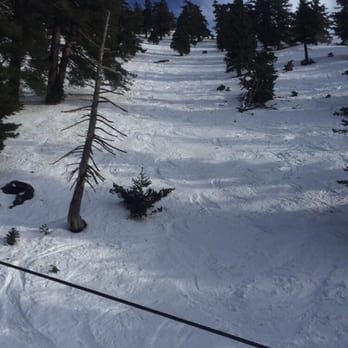
I am so in love with this beautiful place! The views on this mountain are absolutely amazing and breathtaking and I couldn't be happier with the experience. I had been telling my boyfriend since last year how much I have wanted to visit this place and with all of the fresh snow that fell last week I knew it would be the best time to experience it. Luckily we only live about 45mins away so the drive wasn't too bad getting there. However I must say the weekend is not the best time to make a trip in the middle of the afternoon it was super packed! It literally took us an hour to make it to the very top where the ski lifts were but it was well worth it when we finally parked. I was a little upset with the ticket guy because when we got there around 3pm he was telling everyone that the wait at the restaurant would be super long as well as the loft ride back down. He was trying to help but we had already sat in a hour of traffic to get there! Anyway my boyfriend and I still went up and I am glad we did because there was no wait at the restaurant and the wait to get back down was minimal. I guess he thought he was helping us lol All in all I had an amazing g experience and this place is a must visit!!!! read more



We hiked to the Mt. Baldy summit via Ski Hut and Devil's Backbone. General Tips: Trip time was about 7.5 hours (took plenty of breaks on the way up) I drank about 2.5 liters of water and Gatorade for a hi-70's / low-80's day Hiking poles and boots recommended (not essential) Bring a meal for the summit in case you're not in a rush to head down Dress to sweat Ski Hut Trail: "Please God, not more switchbacks!" Those words were running through my head while trekking up. The trail was pretty brutal going up to the actual Ski Hut and only got even harder from the Ski Hut to the summit. But on the flip side the trail and scenery are heads and heels above any other hikes I've done in LA. Breathing the clean(er) air here was also super refreshing! The Summit: Everyone will want a picture of the sign at the top! I definitely felt super accomplished making it and quickly claimed a space of rocks for our group (it's pretty crowded on the weekend)! This place rocks for spending the afternoon with a 360 view of the wilderness. There is no covering at the top so remember to keep your hats on and reapply your sunscreen. Devil's Backbone: This was a good trail to take down since it is no where as steep as the Ski Hut trail which was better for my knees. There is a lot of winding along steep drop offs so we had to watch out for people coming up for slower hikers. The worst parts were getting down to the ski lodge where there is a $10 charge if you want to skim off the last three miles of fire road via the chair lift. The last fire road from the lodge isn't bad as there are shaded portions and I did not use my poles for the descent. I definitely look forward to doing this hike again - highly recommended as a LA must-do! read more




12 years ago
Just an fyi. This address takes to to the adventure lodge area where you can buy your adventure pass for $5. You can also buy an adventure pass from big 5 and sports chalet if you prefer to purchase one from a sporting goods store. We went in the month of January. 4 miles up took us up to an area where there was plenty of parking. From there we hiked up and used our boogie board in the snow. It actually work better than the plastic sleds that will crack by the end of the day. On the way back we stopped by Buck Horn Lodge and had some good hot cocoa with marshmallows and whipped cream. They also have all natural black angus beef jerky. Sooo good. read more


Mount Baldy Stats from Hikespeak Distance: 11.3 miles loop (from Manker Flats Campground) Elevation: 10,064 feet Elevation Gain (from trailhead): 3900 feet Hiking Time: Approx. 7 hours Mount Baldy has been on my list of hikes to complete for a very long time. I had this hike bookmarked since late 2012. Almost 6 years later, I finally got my chance to hike this beast. I completed this hike with my partner-in-climb (aka my wife), a very close family friend, and a handful of cool California hikers that I met for the first time. Based on the hike's stats, I knew this hike would be challenging. I was properly armed with hike boots, comfortable dry-fit clothing, trekking poles, 3 liters of water, a turkey sandwich, and a ton of bacon. We parked off the side of the road about a 1/4 mile from Manker Flats Campground and headed towards the peak via the Ski Hut Trail. The hike up was beautiful, some parts shaded, and we even got to witness some bighorn sheep doing what bighorn sheep do. The first 2.5-3 miles was fairly easy, and the climb wasn't too steep. During this stretch, we passed a small waterfall and reached the Ski Hut where we sat for a bit, got some rest, nibbled on a few snacks, and mentally prepared ourselves for what was coming next. The rest of the hike was tough and all uphill. Even the switchbacks were tough. Keep in mind that the elevation gain is almost 4,000 feet from the trailhead. Most of this elevation gain was the last mile or so to the peak. We got to the peak, admired the view, took our pictures, and headed back down via the Devil's Backbone trail. The hike down from the peak to the base of the Devil's Backbone was treacherous. It was very steep and tough on my already injured knee. At one point, my knee gave out and I ate some dirt. The Devil's Backbone wasn't too difficult, but very dangerous since it's a long way down and the trail is very thin. The rest of the hike is downhill and very steep as you get closer to the Mt. Baldy Ski Resort. On the way down, we spotted a bobcat chillin' in the shade and doing what bobcats do. He was one cool cat. We eventually got to the ski resort, rested, and rehydrated. We were pressed for time and took the ski lift from the resort to the parking lot, which shaved 2+ miles of hiking. In total, we hiked 8 miles. The hike was challenging, but well worth it. Mount Baldy Peak is one of the Six-Pack of Peaks of Southern California. One down, five more to go. TIP: Southern California Adventure Pass needed. We purchased ours at Big 5 located in La Verne for $5 read more


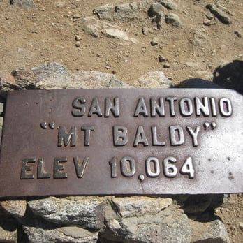
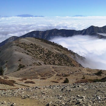
After hiking Half Dome at Yosemite, I began to look for another challenging hike and that's when I came upon Mount Baldy. I will never forget my hike here because it was the first time I got lost. Thanks to some amazing hikers, they found me and I have a story to tell. During the summer of 2010, I decided to explore the San Gabriel Mountains. What's better way to explore these mountains than hiking the tallest one right off the start, right? And that was exactly what I did. Since I didn't want to walk the same trail twice, I decided to go up through the Devil's Back Bone trail and came back through the Baldy Bowl Trail. I drove here for an hour more and started the hike around 7:30am at the Manker Flats. Following the trail, I soon reach the San Antonio Fall. I am guessing the beauty of the fall probably depended on the time of the year. For the next few miles, I just hiked directly under the ski lift until I reach the ski shack. Once there, keep walking to the left and there would be two trails before you. Either way is actually fine but I chose the right one with the steeper slope. As I hiked up here, the view was just beautiful on my right side with layers of mountains can be seen. View at my right side: http://www.yelp.com/biz_photos/mount-baldy-mount-baldy?select=qv-w0-1z2OR7pi7IwEVDnQ#l237L_AQ8ev4kidh5aRpnQ The rest of the way to the top was very straight forward. I got up to the top at around 11-12pm and the view was so amazing! It was basically a 360 degree of mountains view. View at the top: http://www.yelp.com/biz_photos/mount-baldy-mount-baldy?select=qv-w0-1z2OR7pi7IwEVDnQ#yoZqC6nOW4883bWezfKdDg Seeing the sign that I reached up at 10,064 definitely gave me a big sense of accomplishment as well. The sign at the top: http://www.yelp.com/biz_photos/mount-baldy-mount-baldy?select=qv-w0-1z2OR7pi7IwEVDnQ#5FPYseIs36Fzcr5yQmDubQ After taking enough pictures, I hiked back along another trail, the Baldy Bowl Trail. The view was even more amazing than the one at Devil's Back Bone. I can tell the slope was much steeper for this trail so I was glad I was hiking down instead of up here. At a certain point, the sand trail became the rock trail here. Rock trail: http://www.yelp.com/biz_photos/mount-baldy-mount-baldy?select=qv-w0-1z2OR7pi7IwEVDnQ#V0z6QcUqiKXBrNHokZzQpQ I must have been enjoying the scenery a bit too much and got lost while hiking through this part. I knew something wasn't right when I could no longer find my trail and what I saw in front of my me were just wild plants (they were very pretty though): Wild plants: http://www.yelp.com/biz_photos/mount-baldy-mount-baldy?select=qv-w0-1z2OR7pi7IwEVDnQ#qv-w0-1z2OR7pi7IwEVDnQ Good thing someone found me and they were able to guide me back to the main trail. For the rest of the trail, I struggled a bit in pain since I was hurting from all the scratches. By the end, I got sunburn everywhere, my legs were all scratched up and my hands covered with dirt. It was not how I imagine this hike would turn out. But still, I enjoy this hike a lot. I do hope to come back to hike someday soon and without getting lost along the way. Tips for this hike: -Bring sunscreens and reapply every hour or so since there are not a lot of shades -Wear sunglasses and hat -Bring at least 3 liters of water and energy bar or banana -Bring a mask because it is very windy up at the last part of the trail to avoid breathing the sand -Be careful hiking at the rocks at the Baldy Bowl Trail so you won't get lost like I did. -Hiking sticks are recommended -If you want to shorten the hike, you can pay extra and ride the ski lift to reach the shack to save a few miles and some energy -Get an adventure pass beforehand or at the Mount Baldy visitor center for $5 read more


Useful tips: -The address here leads to the adventure lodge where you buy your adventure pass for $5. -Parking is abundant - I hiked it on 10/19/14 and weather was fantastic! Hike in fall! - Most popular trail is 12 miles and strenuous - Bring 2 liters of water, snacks, sunblock, long pants because its chilly near the top, a hat, comfortable shoes, and a camera for the scenery My experience: I loved this hike! I came here with a good friend of mine and the hike was strenuous, scenic, and a lot of fun. We arrived around 8:30 and the first thing we did was buy the adventure pass for $5. We drove up a bit more down the road passing the camp sites and parked at the beginning of the trail, which was a little before the main parking lot where the ski lifts were. The start of the trail was pretty easy to find since there were plenty of other hikers starting at the same time. It starts right where the 4 blue porto-potties are. As you start the hike, you see a few cottages and then very soon after, a bunch of wooden stumps on the left side which signifies the water fall on the left. There are a few trails and we went on the most popular one which was a 12 mile loop going up to the summit through the ski hut trail and then down the Devil's backbone trail. Hiking up to the ski hut took about 4 hours. The second half from the green ski hut to the top was more difficult than from the base to the ski hut so I recommend PACING yourself. There were a few benches where you could sit and have a nice picnic. As you go from the ski hut to the summit, the trails are narrow and there are quite a few little trails winding to the top and its kind of easy to lose a trail but luckily there are hikers coming up and down that can lead you to the right place kind of like how ants navigate. BRING HIKING STICKS because it makes the ascent so much easier. It alleviates all the weight on your legs and disperses some of it to your arms. I had a hiking stick and my legs are still sore the day after. Anyway, after going up, the view is gorgeous and worth the effort. On the way down, if you go along Devil's backbone, you will hit the ski lodge and you can take the ski lift down if you like. You can also refuel with some food and drinks at the restaurant. The only WARNING i would have is to be careful when you're looking for the trail up to the ski hut because its not well marked. There's really no sign except for this small collection of stacked rocks no more than 2 feet tall that shows the narrow trail up. Its 2 left turns from the water fall and can be easily missed. If you don't hit it, then you'll be taking the road up to the restaurant. It doesn't matter that much because it eventually leads to the top. read more



11 years ago
I had a hard time with this hike. They say that the first 20 minutes of the hike is the hardest, it's actually not. Hiking the last uphill before the summit seemed like a never ending mountain that just kept going. A few people have died doing this hike, make sure you research the weather conditions before going. I actually recommend doing it with The Heroes Project, or Climb for Heroes. Time: Started the hike around 8am, got to the summit after 3.5hrs. Finished around 4p and that's with picture taking and some relaxation time, left the summit around 1p. I went with a friend who hikes a lot and I guess you could say that I'm more of a runner than a hiker. I was surprised that I found the hike somewhat challenging because it got my heart rate racing and had to stop at one point before reaching the summit to catch my breath. Most of it though consisted of moderate amount of flat ground, some narrow areas steep climbs, and snow, loose rocks , where you can easily slip and fall. This hike is about 11.3 miles round trip. Weather: It was pretty cold, felt like 40 degrees, I wore gloves, sleeveless shirt, thermal, workout jacket/sweater, and a windbreaker. If I could do it over again, I'd bring a winter jacket, beanie, waterproof pants, and hiking poles, elevation is pretty crazy. Hydration: I downed 2 bottles of Gatorade, 1 pack of stinger gummies, snacks and 1 L of bottled water. Make sure you eat breakfast! The heroes project did a great job organizing this event. Would I do it again? For a good cause? Yes. But for pleasure and just because? Maybe not. read more


14 years ago
This place offers multiple hikes with the same destination. You can do the strenuous or the not as strenuous depending on your ability. I found it easier to get the the green lodge (I so wish it was black!) and stash my backpack and bring a bottle of water the rest of the trail. It lightens the load at least 10-15 pounds off your back. Plus the hike down from Baldy is kinda steep so you might slide. And with the extra weight it might drag you down a few more times. The hike down is fantastic. I was booming it! People were actually running. It's a great hike! Hints: Eat a nice breakfast. Bring a decent amount of water. I went in November and only used about 2 liters, but I brought a gallon and felt happy I did just in case. The lodge has running water- ask if you can fill up if you need to. There's a subway around the area- not exactly near. It's at a Chevron. I highly recommend you bring a sandwich. People were staring at me will I ate because they were jealous. I think the six inch works well- you don't want to over do it. I brought some beer as well. Glad I did! They say beer has more electro-whatever than water and Gatorade. Camera and extra batteries. And bring an extra tee shirt when you make it back to your car. Glad I did. read more




7 years ago
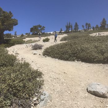
Decided to take the ski hut trail up to the summit ,this tail is 2000 elevation gain,and it also cuts the trail by 4 miles ,it's a bit rocky after reaching the ski hut but not for long.On the photos you will have to start on Baldy trail you will see the waterfall on left side ,Baldy trail swerves to the right go about 40 ft and you will come across this sign ,it will lead u to ski hut trail read more


10 years ago
More info about Mount Baldy
8401 Mt Baldy Rd
Mt Baldy, CA 91759
Directions
Hours
Indoor Amenities
Outdoor Amenities
Ask the Community - Mount Baldy
Is there any snow up there now?
Only a little since it's been warm last few days
Is there a waterfall there ? someone told me there was a waterfall as you were hiking up.
There are 2 that I know of. The first waterfall, is much Smaller. Just before you get to Mt Baldy Village, you turn off to the right at a small parking turnout which leads to a dirt road. When you go down to the stream, (not far from Mt. Baldy Rd,…
Any snakes up here and if so what kind?
Not sure of how many kinds of snakes but there are but I have seen rattlesnakes up there!
Review Highlights - Mount Baldy
You might also consider













Why does Yelp recommend reviews?
13 reviews that are not currently recommended
The reviews below are not factored into the business's overall star rating.

14 years ago

9 years ago
4 years ago
2 years ago

13 years ago

8 years ago

11 years ago

12 years ago

6 years ago

14 years ago
9 years ago
8 years ago

13 years ago


