
Monrovia Canyon Park Photos


You might also consider


More like Monrovia Canyon Park
Recommended Reviews - Monrovia Canyon Park
Start your review...


Reviews With Photos


Thanks to Google for the most accurate directions. This was our first time at this park. Nice even paved roads all the way up to the entrance and to all 3 of their parking lots. We parked at the first parking lot right by the ranger booth. Parking was $6 on Sunday. I would consider this an easy to moderate hike to the falls. There are some parts that are pretty flat but there are also some parts that are uphill with more narrow paths. Proper footwear is very important. Also, don't forget your water bottle. It took us about 2 and 1/2 hours to go up up to the falls and back. They have bathrooms at each of their parking lots. They also have drinking fountains where you can refill your water bottle. I'm glad to see the people are respectful of the park. As I did not see one piece of trash along the trail. There is also a nature center that is a must visit when you're here. This will definitely be one of our hikes on rotation


One of my hiking buddies mentioned years ago that this park was his all-time favorite. Between the closure and time passing, I very nearly forgot to check out this place, until by chance an article informed me of its recent reopening. It was Thanksgiving morning, and before spending the evening eating, I figured I ought to go out and touch grass. The hill going up before the trailhead entrance had a decent number of street parking. Perhaps because it was a holiday, but the gates were locked so street parking was the only option. If you were to continue up the hill pass the gate entrance, street parking suddenly becomes permit only. The bridge over the river went through to a clearing with many tall trees which felt tranquil and calming. I took the paved road all the way up, although there were several paths other hikers were taking which led up to picnic areas and waterfalls. The road eventually leads to dead end in front of a closed gate for Sawpit Dam. There is a nature center where events are held, a little free library for book exchanges, and a clean water fountain. There's so much to explore, and I'm very much looking forward to a coming back.


The trail to the falls has finally reopened!*Reservations needed on the weekends, done via the city website* The trails are beautiful and they've done an incredible job restoring everything from the Bobcat Fire! The new trails to the falls are pretty narrow in most places with loose dirt and fine gravel - they're well maintained but I highly recommend hiking shoes with decent tread. People in regular running shoes were slipping and almost falls on the steeper sections. I'd even go so far as to say use poles if you're prone to slipping. From the new ranger station, it's 1.5 miles to the falls (one way). From the middle trailhead it's about a mile to the falls (one way), and from the upper trailhead by the nature center it's 3/4 mile to the falls (one way) and there's a decent amount of elevation gain - 450 feet gain from the middle trailhead. At the upper trailhead there are bbq grills, picnic tables, and benches under the giant oaks. There are also more benches and picnic tables scattered throughout the park. The recovery from the Bobcat Fire is truly remarkable- so much regrowth has occurred! They have paved parking available in several lots spread throughout this the park. It's normally $5 on weekdays and $6 on weekends. But at the moment it's free for a little bit bc of the grand reopening. There's also free street parking outside the entrance but be sure to watch the signs bc some is permit only and some is regulated for street sweeping on certain days and they will ticket you. It's also a residential area so please be respectful. The city has done a beautiful job on the restoration and it's so fantastic to be back on this beloved local trail!
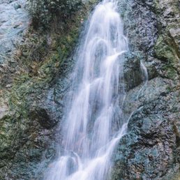

So overjoyed that Monrovia Canyon Park is open again! I haven't hiked here since 2019 and have been itching to come back since they had to close it due the fires. The park itself is well maintained, with diverging paths that lead to the beautiful waterfall up at the top. Well worth the hike and it definitely won't be my last time coming back here.


The long waited Canyon had opened a few months ago open to the public. This park has been closed for 5 years due to the fires & floods. Now that it's opened to the public, they have made significant improvements for the public to enjoy. This park is isn't far from downtown Monrovia. But when you're at the park, it feels like you're far away from the busy city life which I enjoy. No bears & deers that I saw today, but I'm sure they're nearby somewhere. Whenever you're visiting the park, please pick up after yourself & throw it away in the trash or take it with you. Leave nothing behind.


Great park for all ages. Multiple trails, all of which will add up to around 5 to 6 miles. One trail leads to the overlook - steep and switchback characteristics- around 1.5 to 2 mile total round-trip. Bill cull is a winding and fun trail, around 1.5 miles or more of twists and turns, narrow edges and scenic views. The waterfall trail is the most popular, from the ranger station to the falls, around 1.5 miles or slightly more. A few creek crossings and a.consisttent path upwards- once there the waterfall is inspiring, nice to bath in and just experience. Please mind your time, as people wait to get photos and time by themselves. Trails are moderate to more in skill. The continuous rise in elevation can wind some. There are warnings of animals please heed. Fawns and deer are visible - be respectful and clean after yourself. 3 major parking lots and picnic tables- clean water fountains and bathrooms. Overall, - clean and welcoming. Parking is about 5 to 8 bucks... but worth it. People show up early, by 8am trails had many people on them. You can park outside and do an extra 1.5 miles of uphill workouts . The scenery is great... the trails are fun. A strong 4.5 to 4.75 - even great water creek that run through the parking lot.. very cool. And lastly, if they had a small children's playground..would have been a definite 5.0... oh pets allowed on leashes...


Pandemic review: modifications in place include making reservations online, trails are marked to support walking in a clockwise direction, masks and social distancing are required, and some trails (including the waterfall trail) are closed as of July 2020. Maps are available when you check in and there is a $5 parking fee paid to the city. A walk in Monrovia Canyon Park is definitely worth the price of admission and the hassle of making a reservation. It's lushly green, relaxing, full of trees and running water, and would be a perfect hike during a heat wave. The topography is mountainous, so wear walking shoes and be prepared for some steep terrain. Luckily, it's pretty much uphill out and downhill back, my favorite type of hike. To make a reservation, go to cityofmonrovia.org/CPreservation and click on Canyon Park. And don't forget to bring your own water. Enjoy.
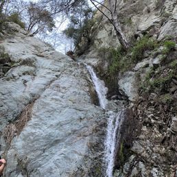

Really easy hiking trail!! Not as busy as Eaton Canyon but still super close to the main cities. It's very serene and peaceful to be among trees and nature. I did not see any bears although there were bear warning signs, but we did see a few squirrels. It is about 2 mile round trip but very little incline. The trail is dirt with some areas with rocks, but nothing to be intimidated of. Very family and dog friendly trail! You only cross the water stream twice but it's not wider than 3 feet so it's not a big deal to step on some rocks. The trail is pretty much parallel to the water stream. There's a nice large log a little more than halfway in for cool pictures but climb on the tree log with precaution! The waterfall isn't that big, but it's very clear and cold! No adventure pass needed, but parking is $5 on weekdays and $6 on weekends. You could also park on the residential streets and walk up, but I didn't do that. There are 2 parking lots. The first one you see requires a half mile walk to the trail entrance while the parking lot further in is next to the entrance. No trash cans within the trail so have your dog poop before the trail or hold their poop bags!


My first time here. I didn't really know which way to start on the trail so it was more just exploring today. During this Covid-19 time you must make a reservation in order to access the trail. Just go on the city website and it's simple. I decided to use the parking lot since it was my first time here and paid the $5. Beautiful place to hike and get away and very easy hike. On my way down the road back to my car I saw a bear!!! Thank God there was people who spotted it first and I walked down with them. You can make it into a good workout if you park in the residential area and jog all the way up to the 2nd parking lot. It will be about 1 mile and all uphill. Then jump on the trail and walk the rest back as the trail is a bit narrow and just enjoy the scenery. I'd say round trip it would be like 3 miles of a hike/run. I will try this the next time I go but definitely not by myself since the bear sighting was a little out of the ordinary!!


Took my puppy for her first hike here and she LOOVED it. Their parking lot was closed so that sucked for us because we had to park further away and walk more but the reason why we went on the go hike was to exercise so I guess it worked out. The trail was very clean and it was nice to see the greenery and the water. I have yet to come across any signs of other wild life but I hope this place stays as it is!

Reviews are largely positive. Hikers enjoy the beautiful scenery, well-maintained trails, and clean facilities.
Read the full review summary in the app

6 months ago
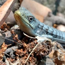
Loved this 1.8 miles hike. Lots of trees for shade, distinct trails to walk. The Waterfalls was small but beautiful. We saw deer, squirrels , lizards , snake and butterflies. Recommended hiking shoes and sticks . It wasn't rocky but there were areas steep and slippery. It was a very good experience. read more


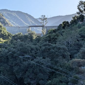
I visited Monrovia Canyon Park for the first time with a friend and had a great experience. We parked at the first lot ($5) and started our hike from there. We made it to the waterfall, continued to the Nature Center, and then looped back to the parking area about 3.3 miles total, which took us around 2 hours. The hike has a steady uphill on the way in, but nothing too difficult just be ready for the incline. There isn't much shade along the trail, but the waterfall at the end is definitely worth it. We were told by other hikers that it's even more beautiful after it rains, so I'd love to come back and see it then. A ranger also mentioned that the trail can extend up to 7 miles if you want a longer hike. There are restrooms at the entrance parking lot and at the Nature Center, and both were very clean, which is always a plus. Overall, a great spot for a moderate hike with a rewarding view at the end! read more



7 months ago
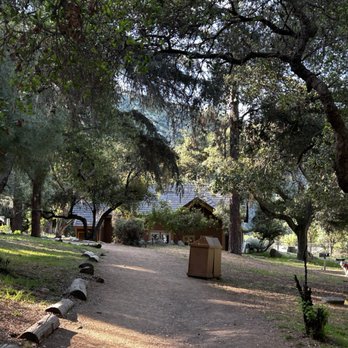
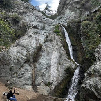
Monrovia Canyon has finally reopened after being closed for 5 years due to fire and flooding -- huge thanks to the volunteers who made this possible! I started at the ranger station for a longer hike. First, I did the Cunningham Overlook Trail, then continued on the Waterfall Trail, which leads to a beautiful waterfall. The trail is family-friendly, about 3 miles out and back, and easy to navigate -- no chance of getting lost. If you want less of a workout, you can park closer to the Nature Center for shorter trails. I really enjoyed the walk and even spotted a deer on my way out! Perfect for a morning hike, nature lovers, or families. read more




8 months ago
Thanks to Google for the most accurate directions. This was our first time at this park. Nice even paved roads all the way up to the entrance and to all 3 of their parking lots. We parked at the first parking lot right by the ranger booth. Parking was $6 on Sunday. I would consider this an easy to moderate hike to the falls. There are some parts that are pretty flat but there are also some parts that are uphill with more narrow paths. Proper footwear is very important. Also, don't forget your water bottle. It took us about 2 and 1/2 hours to go up up to the falls and back. They have bathrooms at each of their parking lots. They also have drinking fountains where you can refill your water bottle. I'm glad to see the people are respectful of the park. As I did not see one piece of trash along the trail. There is also a nature center that is a must visit when you're here. This will definitely be one of our hikes on rotation read more


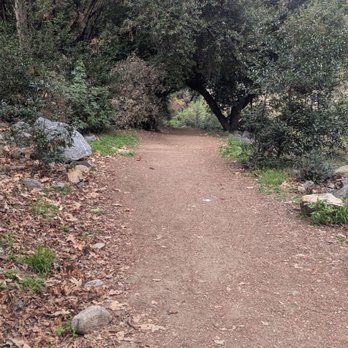
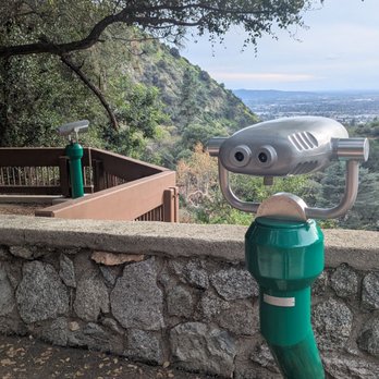


One of my hiking buddies mentioned years ago that this park was his all-time favorite. Between the closure and time passing, I very nearly forgot to check out this place, until by chance an article informed me of its recent reopening. It was Thanksgiving morning, and before spending the evening eating, I figured I ought to go out and touch grass. The hill going up before the trailhead entrance had a decent number of street parking. Perhaps because it was a holiday, but the gates were locked so street parking was the only option. If you were to continue up the hill pass the gate entrance, street parking suddenly becomes permit only. The bridge over the river went through to a clearing with many tall trees which felt tranquil and calming. I took the paved road all the way up, although there were several paths other hikers were taking which led up to picnic areas and waterfalls. The road eventually leads to dead end in front of a closed gate for Sawpit Dam. There is a nature center where events are held, a little free library for book exchanges, and a clean water fountain. There's so much to explore, and I'm very much looking forward to a coming back. read more


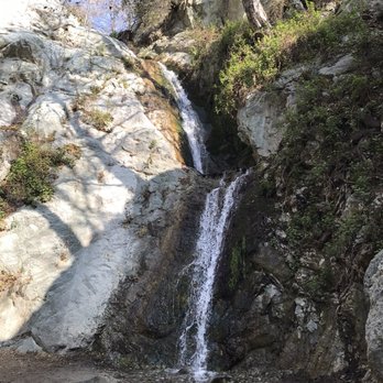
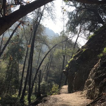
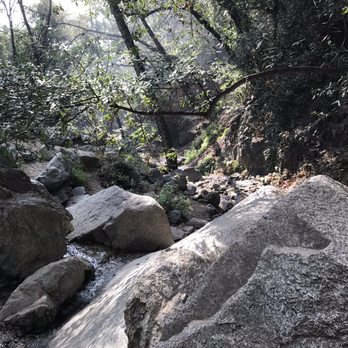
The trail to the falls has finally reopened!*Reservations needed on the weekends, done via the city website* The trails are beautiful and they've done an incredible job restoring everything from the Bobcat Fire! The new trails to the falls are pretty narrow in most places with loose dirt and fine gravel - they're well maintained but I highly recommend hiking shoes with decent tread. People in regular running shoes were slipping and almost falls on the steeper sections. I'd even go so far as to say use poles if you're prone to slipping. From the new ranger station, it's 1.5 miles to the falls (one way). From the middle trailhead it's about a mile to the falls (one way), and from the upper trailhead by the nature center it's 3/4 mile to the falls (one way) and there's a decent amount of elevation gain - 450 feet gain from the middle trailhead. At the upper trailhead there are bbq grills, picnic tables, and benches under the giant oaks. There are also more benches and picnic tables scattered throughout the park. The recovery from the Bobcat Fire is truly remarkable- so much regrowth has occurred! They have paved parking available in several lots spread throughout this the park. It's normally $5 on weekdays and $6 on weekends. But at the moment it's free for a little bit bc of the grand reopening. There's also free street parking outside the entrance but be sure to watch the signs bc some is permit only and some is regulated for street sweeping on certain days and they will ticket you. It's also a residential area so please be respectful. The city has done a beautiful job on the restoration and it's so fantastic to be back on this beloved local trail! read more







6 months ago

1 year ago
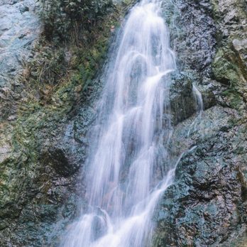
So overjoyed that Monrovia Canyon Park is open again! I haven't hiked here since 2019 and have been itching to come back since they had to close it due the fires. The park itself is well maintained, with diverging paths that lead to the beautiful waterfall up at the top. Well worth the hike and it definitely won't be my last time coming back here. read more


1 year ago
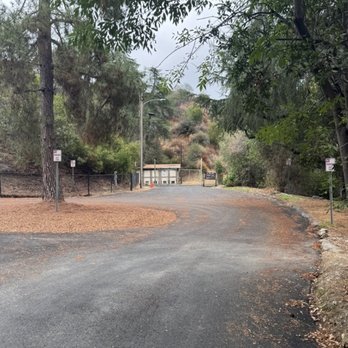
The long waited Canyon had opened a few months ago open to the public. This park has been closed for 5 years due to the fires & floods. Now that it's opened to the public, they have made significant improvements for the public to enjoy. This park is isn't far from downtown Monrovia. But when you're at the park, it feels like you're far away from the busy city life which I enjoy. No bears & deers that I saw today, but I'm sure they're nearby somewhere. Whenever you're visiting the park, please pick up after yourself & throw it away in the trash or take it with you. Leave nothing behind. read more






5 months ago
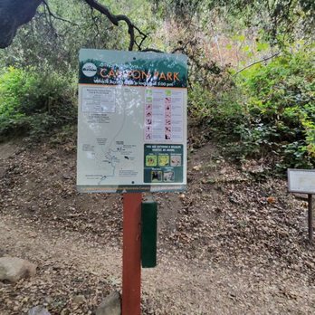
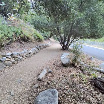
Great park for all ages. Multiple trails, all of which will add up to around 5 to 6 miles. One trail leads to the overlook - steep and switchback characteristics- around 1.5 to 2 mile total round-trip. Bill cull is a winding and fun trail, around 1.5 miles or more of twists and turns, narrow edges and scenic views. The waterfall trail is the most popular, from the ranger station to the falls, around 1.5 miles or slightly more. A few creek crossings and a.consisttent path upwards- once there the waterfall is inspiring, nice to bath in and just experience. Please mind your time, as people wait to get photos and time by themselves. Trails are moderate to more in skill. The continuous rise in elevation can wind some. There are warnings of animals please heed. Fawns and deer are visible - be respectful and clean after yourself. 3 major parking lots and picnic tables- clean water fountains and bathrooms. Overall, - clean and welcoming. Parking is about 5 to 8 bucks... but worth it. People show up early, by 8am trails had many people on them. You can park outside and do an extra 1.5 miles of uphill workouts . The scenery is great... the trails are fun. A strong 4.5 to 4.75 - even great water creek that run through the parking lot.. very cool. And lastly, if they had a small children's playground..would have been a definite 5.0... oh pets allowed on leashes... read more






1 year ago
A nice and relaxing hike, super beginner friendly for anyone who wants to bring their kids/doggies! Pictures were taking during September 14, 2025. I wish it was a bigger waterfall, but still a pleasant payoff. Round trip took under an hour. Depending on where you park it may take longer to finish. read more


11 months ago

1 year ago

3 years ago

Pandemic review: modifications in place include making reservations online, trails are marked to support walking in a clockwise direction, masks and social distancing are required, and some trails (including the waterfall trail) are closed as of July 2020. Maps are available when you check in and there is a $5 parking fee paid to the city. A walk in Monrovia Canyon Park is definitely worth the price of admission and the hassle of making a reservation. It's lushly green, relaxing, full of trees and running water, and would be a perfect hike during a heat wave. The topography is mountainous, so wear walking shoes and be prepared for some steep terrain. Luckily, it's pretty much uphill out and downhill back, my favorite type of hike. To make a reservation, go to cityofmonrovia.org/CPreservation and click on Canyon Park. And don't forget to bring your own water. Enjoy. read more


Really easy hiking trail!! Not as busy as Eaton Canyon but still super close to the main cities. It's very serene and peaceful to be among trees and nature. I did not see any bears although there were bear warning signs, but we did see a few squirrels. It is about 2 mile round trip but very little incline. The trail is dirt with some areas with rocks, but nothing to be intimidated of. Very family and dog friendly trail! You only cross the water stream twice but it's not wider than 3 feet so it's not a big deal to step on some rocks. The trail is pretty much parallel to the water stream. There's a nice large log a little more than halfway in for cool pictures but climb on the tree log with precaution! The waterfall isn't that big, but it's very clear and cold! No adventure pass needed, but parking is $5 on weekdays and $6 on weekends. You could also park on the residential streets and walk up, but I didn't do that. There are 2 parking lots. The first one you see requires a half mile walk to the trail entrance while the parking lot further in is next to the entrance. No trash cans within the trail so have your dog poop before the trail or hold their poop bags! read more


6 years ago
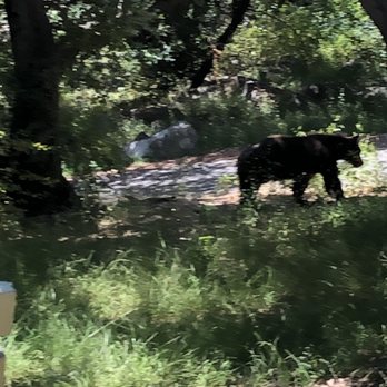
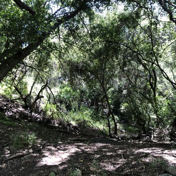
My first time here. I didn't really know which way to start on the trail so it was more just exploring today. During this Covid-19 time you must make a reservation in order to access the trail. Just go on the city website and it's simple. I decided to use the parking lot since it was my first time here and paid the $5. Beautiful place to hike and get away and very easy hike. On my way down the road back to my car I saw a bear!!! Thank God there was people who spotted it first and I walked down with them. You can make it into a good workout if you park in the residential area and jog all the way up to the 2nd parking lot. It will be about 1 mile and all uphill. Then jump on the trail and walk the rest back as the trail is a bit narrow and just enjoy the scenery. I'd say round trip it would be like 3 miles of a hike/run. I will try this the next time I go but definitely not by myself since the bear sighting was a little out of the ordinary!! read more


7 years ago
Took my puppy for her first hike here and she LOOVED it. Their parking lot was closed so that sucked for us because we had to park further away and walk more but the reason why we went on the go hike was to exercise so I guess it worked out. The trail was very clean and it was nice to see the greenery and the water. I have yet to come across any signs of other wild life but I hope this place stays as it is! read more


Canyon park is a large well developed park with parking and a lot of family areas including camping, cabin rental picnic areas.. There is a charge for parking in the park. Alternatively you can park in the residential streets outside of the park and walk in. There are a number of hikes that start inside the park or you can just walk around the roads in the park and enjoy the scenery. There is a trail that leads to a waterfall. The Ben Overturff trail starts well inside the park. Oddly, even though there are signs everywhere give directions, the direction to the Ben Overturff trail is not well identified. To get to the trailhead, walk inside the park and follow the signs for the Boy Scout Trask camp. The trailhead starts the entrance to the camp. There it splits into a three way fork. One to the Boy Scout camp, one to the trail, and one to a road that almost parallels the Ben Overturff trail. This road meets up with the trail at its end. You can hike up either the road or the trail and come back the same way or you can hike the loop. The trail is very easy to follow and is well marked. Towards the end you can do s short spur and visit the Deer Park cabin ruins. We hike the trail and came back down the road. Towards the end of the trail where Deer Park cabin spur starts there is also a fork that says it goes to the restroom, if you are going to go back down the road instead of the trail take that fork and the restroom is where the trail meets the road. It is a dirt road but is well developed and large enough for vehicles to travel on. When going on the road beware of bicyclists, especially going downhill, they go very fast. Take the road you will end up at the 3 way fork where you started. Then just follow the road downhill till you get back to the park. Next time? I am going to check out the waterfall read more


5 years ago

4 years ago

The waterfall is very pretty and it's a relatively easy and short hike from the Nature Center. I got together with a couple friends on September 19th, 2013 and we decided to hike the "Waterfall Trail" because it wasn't very difficult and it has a lot of shade in the canyon. We parked by the Nature Center, hiked up to the waterfall and then back down to the cabin by the Emerson Flat Picnic Area. This is an easy hike and "Map My Hike" showed we hiked about 2 1/2 miles with an elevation gain of about 1,000 feet. Next time, I would like to hike up past Camp Trask to the Ben Overturff Trail, but I will definitely come with a few people because a friend of a friend was almost attacked by a Mountain Lion up here on September 14, 2013. See my "Warning" below. I did not know this until after I got home. Tips: - You are not permitted to drive on the Sawpit Fire Road up to Camp Trask unless you are dropping your scout off for merit badge courses or camp outs. You can walk up windy and steep one lane road to the trailhead. - Bring $5.00 to park anywhere past the Ranger Station and entrance gate. - This is Black Bear & Mountain Lion country so keep that in mind. My friend's son works up at Camp Trask he sees Black Bears all the time. - Monrovia Canyon Park opens at 8:00 a.m. and closes at 5:00 p.m. You'll get locked in unless you are going up to Camp Trask to drop a scout off. - I know there is very little AT&T cell coverage up by Camp Trask. Not sure about other carriers. - Do not hike or ride alone. Mountain Lions are out looking for food early in the morning which is my favorite time to hike. Misc. Boy Scout Related Info: The San Gabriel Valley Boy Scout Council will give you codes to the gates when you sign your son up for a merit badge course. The road is pretty much one way at a time. When a course is about to start or end they'll have a scout on either end with a radio directing traffic. Warning: This is Black Bear & Mountain Lion Country!!! A mother cougar and her cubs were spotted by a friend of a friend on Saturday, September 14, 2013 while she was riding her mountain bike. She had to put her mountain bike between her and the protective cat who would not back down or go away. The rider had to slowly back away to get out of there. If you see a Black Bear or Mountain Lion do not try to run or ride away quickly. They will think you are its prey and run after you. Cougars can run up to 45 miles an hour. Can you run or ride faster than that? Maybe riding downhill would be O.K. until you hit a rock or big rut and go flying. Stand up tall, make noise, eye contact and back away. Don't hike or ride alone. I saw a few lone hikers yesterday, but there were other people around. The website for California Department of Fish & Game has tips for dealing with wild animals at: www.dfg.ca.gov/keepmewild/ read more


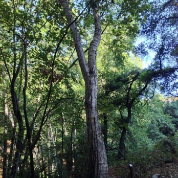


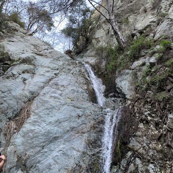
This is probably one of my all time favorite hikes. It's a 3 mile round trip trail, to an all year round 2 tier waterfall. Majority of the trail is shaded. There's a good incline halfway through but its perfect for beginners as well as families. On weekends parking is $6. You can park a mile down towards residential homes, and add an additional 2 miles to your workout. You'd be going up the road towards the trail with no shade if you decide to park residentially. Keep that in mind, for those sensitive to the sun and heat. It's a clean trail, and perfect for those looking for a short sweet hike in the shade under the trees. There have been a few bear sightings, but they keep away from the main trail. My phone died due to excessive snaps, that I missed capturing my bear cub sighting. Monrovia Canyon is beautiful, well kept, and always an option year round! read more
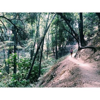

Lets make this simple and to the point! If you want to do a quick, scenic and not mentally or physically draining.... Monrovia Canyon Falls Hike is your one stop hike for all your needs! The hike is about two miles and at the end you are awarded with a waterfal. The waterfall ain't grand scale like the eaton's, the chantry flats, or the hermit falls... but it'll do. Wam bam thank you maam! I'm outie! read more


This is a pretty easy hiking spot. I've seen young children and dogs along the trail. There are several different trails; I've only tried the ones leading to the waterfall. I've been lucky every time I come here because the water is still running. I've heard sometimes there is no water, so there's not much to look forward to at the end. You hike up and then come down the same way; the trail is not a loop. There's a restroom available at the parking lot and another one further up the street (closer to the cabin rentals). They lock it up after 4:30 pm though. The road leading to the entrance of the park is in the middle of a residential area. When you see a bunch of cars lined up against either side of Canyon Blvd, that's when you know when to park for free. You can pay $5 on weekdays to park inside or $6 on weekends. I would say this trail is quite popular and therefore can get crowded, especially by the waterfall. Parts of the trail are narrow and can only fit maybe two people. Young children can slip and fall, so they need to be watched at all times. I usually see some squirrels and birds here and there. The trail will take 1 - 1.5 hours going up and back. I added the extra 30 minutes for photos and random exploring off the trails. read more


10 years ago
A family friendly, relaxing, and enjoyable hike perfect for a weekend morning. Parking is $5 in the park and there is a lower and upper lot (expect upper lot to be full later in the day). Many others including myself opted for free street parking in the residential neighborhood about 1 miles out where Oakglades Dr. and Canyon Dr. splits. Given how short the hike is, the extra mile really doesn't hurt. And if you parked in the upper lot, there is barely any hiking left to do at that point. If you walk in from the residential neighborhood, don't be turned off by the barrenness of the Sawpit Debris Basin. Once you get inside the park, the trail has plenty of shades and is very pleasant. It can get pretty crowded. We were surrounded by other hikers and their dogs throughout the entire trip. Like many other waterfalls in the area affected by the California drought, the waterfall at the end of the Monrovia Canyon hike was quite modest... It can get quite crowded around the water fall, I mean water puddle, as that's most people's destination point. I believe there are several trails but we didn't really branch out to the other paths. We attempted to look for the Nature Center at one point but accidentally walked out onto the paved road. The ranger told us that we had to take a different turn, but by that time, we were ready to go home. We walked back down via the paved road for the car which snakes around the hiking trail. Monrovia Canyon Park is a great free way to spend a Saturday morning breathing in God's beautiful creation and get some exercise in! read more


4 years ago

My friend and I ended up going to the waterfall this past Saturday. We both parked in the residential area to avoid paying $5.00 for parking. Plus, the extra walking we did as we headed up the trail got us warmed up for this adventure. Hehe. Basically, there is a dirt path that you take to the fall, which is a bit past the ranger station when you walk through the park gate and lower lot of the park. The first part has barely any trees covering the path and you can see a dam in the distance (but you can't go there...legally that is). You will eventually get to a fork in the path that has a trail marker that indicates the waterfall is to the left (planning to check out what is to the right on our next trip there). You will start seeing numbered markers on poles that have indents of leaves, plants, etc. When you find #14, it let's you know that you can go straight past it to the fall or backtrack a bit to go to the nature center. We went to the fall first and ran into a couple of groups along the way. It is a busy hiking trail in comparison to the ones my friend and I went to, but not crowded in a sense that we would be slowed down. When we got to the waterfall, it was a lot smaller than we anticipated, but glad that there was still water coming down considering how the weather has been. :) After taking some pictures, we backedtracked to the #14 trail marker and went up to check out the nature center. There is a picnic and camping area by the nature center as well as an upper lot for those who plan to use the area or I guess start hiking from this point. The nature center has some displays of wildlife, a model of the park that indicate the various trails there and nearby, furs of animals you can touch, and replicas of animal bones that you can examine. They even have some snakes, frogs, and spiders that you can view that have been donated for visitors to see. It was a very enjoyable walk with all the trees, scenery, and the quietness of the place. Plus, it was fairly easy to complete and many paths to take in the park depending on how long you want to hike or walk for. read more


I really enjoyed this little mountain/canyon hiking trail! True true, as the one recent Yelper reviewed it stated, it's a very short hike. The waterfall isn't as abundant as the one in Azusa (Bridge to Nowhere) or definitely no Eaton Canyon Falls, however it is one that is still worthy to go on, close by to travel too (if you live in the SGV area) and is so idyllic! Highly recommended to the newbie hiker. It's short one that can be approached with ease. Nice little narrow steep inclines, nice mini streams to jump over (or not) and well shaded in most areas. Very woodsy. The people that go there are so friendly! I saw all kinds of people, from families, to couples, to older mature couples that appeared to be still so much into ea other and one in particular singing a joyful praiseful noise! Even saw some monks hiking through, it was just an amazing sight (I don't like to use amazing in description, but only for few great situations....I must!) It's $5.00 to park or you can park in residential area (make sure to check for signs otherwise) and have a nice little extended walk to it. Park opens at 7am, but did see people on foot walking through. Employees were really informative, friendly and helpful. You will see and hear wildlife! We saw a mama deer and her baby and heard a woodpecker. I also recommend to families w/little ones - it's a good one that might tire them out, or not but they can definitely handle, will enjoy and a nice little family outing to add to a nice mellow Sunday agenda. I'm thankful my friend took me there, as she has a good eye for a variety of hiking trails to explore :) read more



Ben Overturff trail review!! there are a limited number of trails at Monrovia Canyon Park. I've been to the falls so this time we decided to take the more challenging and extended Ben Overturff Trail (which was pretty empty except 2 other groups along the way) for Ben Overturff i would suggest asking the park ranger for a map since the trail head is up the paved road past the scout campground (take the fireroad down if you wanna make a loop) the reason i didn't love this hike is that a big portion of it was on paved road, there were TONS OF GNATS, and the cabin at the top was nothing but ruins so there was no "AHA" view at the top NOTE: parking inside is not free & closes at 5pm so park in the neighborhood before the parking and walk in if you want to save money or you want to stay later read more


7 years ago
This is a beautiful little hike! Save a photo of the trail maps to your phone so you won't need internet to access it. The nature center didn't have any more copies of the map when we arrived. The road to get here is narrow and full of pedestrians, please do not take this road in a rush. Parking is $5 on week days and $6 on weekends. Bring cash for this. There is lots of dirt, rocks, plants, and water. Best of all, there is lots of SHADE! Bring and already be wearing bug repellant. The journey to the falls is uphill. Parts of the path become narrow, share the path and be patient taking turns sharing the path with travelers going the opposite directions. BEARS: Black bears live here. This is their home. That being said, please do not feed the bears. I posted video and photo of the bears we saw. The water is beautifully clear! Cell service is spotty so best to stay together as a group. read more



11 years ago
This is a really easy hike, perfect for beginners! You can park inside the park for $6 or park outside in the residential areas. If you park outside, you will be walking about half a mile before reaching the trail. My hiking buddies and I felt like we cheated parking inside because the hike was so short! Next time we will probably park outside just so we can hike a bit more. SHADE SHADE SHADE. This hike was so shady and cool. There was so much natural shade from the trees which kept us cool from the sun. The hike was very forest-like with some incline and a few stream crossings. At the end of the hike is a small waterfall. Apparently it used to be bigger, but of course, we are in a drought now. No bear sightings but we did see this very large gray squirrel causing ruckus in the trees above the trail. Largest squirrel I've ever seen! This hike was a bit too short for us but still an exciting adventure for those who like to hike! Are you trying to convince some friends to hike with you but they complain about the sun? Bring them here! read more


Short, easy, scenic hike. I hiked it for the first time today. It is pretty easy to get to since it is not too far from the 210. Parking- $5 weekdays, $6 weekends, free on the residential streets I parked on Canyon/Ridgeside and it added about 1.5 miles to the total hike Trailhead- I accessed the trail on the left side after passing the ranger station; the trails are pretty narrow for the most part, shady, with a not too steep incline to the waterfall Waterfall- about 1.25 miles from the trailhead; it was flowing pretty well today but it is on the smaller scale; some large rocks to rest on and view the waterfall before heading back down read more



13 years ago
I really like this park. I come here to run for a bit of a challenge. The hike to the waterfall so beautifully wooded, I can come in the middle of the day and not worry about the sun beating down on me. It's a pretty easy hike, people take toddlers and strollers on the hike to the falls, so its good for a slow pace, seniors and people with small children. I run the hike as much as I can. It costs $5 to park, and its a city park so adventure passes don't work. What I usually do is park on the street outside of the park gates and run down into the park; it's about 0.6 mi each way. The park is open 6 days a week, closes at 5pm. It is also closed on Tuesdays. The weekends can get crowded, so I much prefer the weekday where the park is almost empty. read more


LA County and it's mountains are graced by enchanting canyons and falls. Monrovia Canyon is no exception, complete with a 30-foot waterfall and trails with elevation up to 600 feet. The trails were flat with minor elevation and filled with streams, creeks, dams and lush grove of alders. I like the sound and smell of nature. I love hiking in SoCal but don't get me wrong I still love my home state (NY). Anyway, we're neither here or there, there is a parking fee at the canyon park and it cost $5 bucks on weekdays and $6 bucks on weekends. I know it's absurd. Don't worry ample of street parking on the surrounding neighborhood. The Monrovia Canyon Park trail was an easy trail which is perfect for beginners or novice hikers. The trail to the falls presents a gradual 1.5 miles round trip with a hike of 350 ft of elevation gain. You'll see upstream to the waterfall. Rocks can be slippery so be careful or you'll get your feet and butt wet. Did the Boss fell? Not quite. Haha. Overall this was a good hiking trail and a good get away for a bit on our busy life. I will definitely return. read more


2 years ago
Page 1 of 9
More info about Monrovia Canyon Park
Monrovia Canyon Park Reviews in Other Languages
Ask the Community - Monrovia Canyon Park
Still close or not?
Reopened as of June 27th with a reservation system for the weekends. https://www.monroviaca.gov/your-government/parks/canyon-park#ad-image-1
Does anyone Know when Monrovia Canyon park will be open to the public again? I miss the hiking experience. Esther
Reopened as of June 27, 2025. Reservation system on the weekends. https://www.monroviaca.gov/your-government/parks/canyon-park#ad-image-1
Still closed as of November 2023?
Yeah still closed - I just walked by there this morning. According to the city, no date to open as of yet :(
Is the park open?
Not yet - they've closed indefinitely due to mudslides from all that rain and now these winds too.
Is there an area where I can fill up bottles of natural spring water for free?
No, the spring is somewhere way up in the mountains.
Can we hike there after the fires?
Not yet - it’s closed down “indefinitely” according to the city website. I live in the neighborhood and walk to the entrance several times a week and it’s still blocked off. But the Hillside Wilderness Preserve that takes you up to Clamshell is…
Is this hiking trail open currently?
Not yet - it’s closed down “indefinitely” according to the city website. I live in the neighborhood and walk to the entrance several times a week and it’s still blocked off. But the Hillside Wilderness Preserve that takes you up to Clamshell is open.
Is this place good for kids 4-6 years old?
Yes! Lots of kids there, we started w 1 yr old in carrier. Kids will be fascinated by water, hike is easy. Visitor Center is good for themtoo tho check on hours
Do you have to drive up the mountain to get to trail?
No, you can park in the lot or the residential streets and walk up to the start of the trail.
Is it open thanksgiving day?
The park functions on normal holiday hours, so I don't think it is.
Since the park closes at 5pm, does that mean that the hiking trail is also closed/unaccessible?
Yes I believe so. Access to the trail starts after you go through gates and the gates are closed when the park closes.
Review Highlights - Monrovia Canyon Park
You might also consider



















Why does Yelp recommend reviews?
19 reviews that are not currently recommended
The reviews below are not factored into the business's overall star rating.

14 years ago

6 years ago

9 years ago

9 years ago


7 years ago

6 years ago
10 years ago

13 years ago

13 years ago
2 years ago

13 years ago

11 years ago

12 years ago

13 years ago

14 years ago
13 years ago

13 years ago

15 years ago


