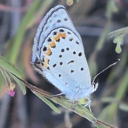
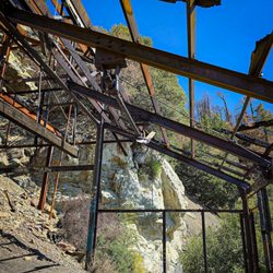
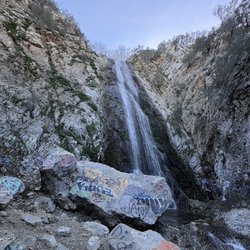
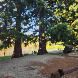
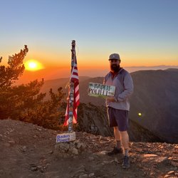
Inspiration Point, Wrightwood Photos


You might also consider
More like Inspiration Point, Wrightwood
Recommended Reviews - Inspiration Point, Wrightwood
Start your review...

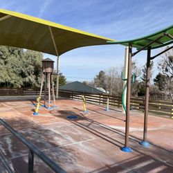
A great place to get away from the hustle of bustle of city life and for "inspiration". From this point, you can see from Wrightwood, CA, through Los Angeles, all the way to Catalina Island (on a clear day). The views from this lookout are amazing and there are hiking trails to enjoy nearby if you care to venture. Overall, a great place to take a moment to pause, reflect, and admire the beauty that nature has to offer. There's a bench located at the stop for visitors to utilize as well :) Link for more info: http://www.wrightwoodca.com/wrightwood-mountains/mountain.php?view&mountain=10 read more


2 years ago
More info about Inspiration Point, Wrightwood
Wrightwood, CA 92397
Directions
Hours
Outdoor Amenities
You might also consider


Inspiration Point, Wrightwood - hiking - Updated June 2026
Best of Wrightwood
People found Inspiration Point, Wrightwood by searching for…
Snow Play in Wrightwood, California
Hiking Trails in Wrightwood, California
Things to Do in Wrightwood, California
Lookout Points in Wrightwood, California
Waterfall Hike in Wrightwood, California
Beautiful Views in Wrightwood, California
Scenic View in Wrightwood, California
Running Trails in Wrightwood, California
Photo Spots in Wrightwood, California
View Points in Wrightwood, California
Places to Take Pictures in Wrightwood, California
Trails in Wrightwood, California
Walking Trails in Wrightwood, California
Scenic Overlook in Wrightwood, California
Tourist Attractions in Wrightwood, California
Sunrise View in Wrightwood, California
Picnic Areas in Wrightwood, California
Hiking Trails Kid Friendly in Wrightwood, California
Lakes & Ponds in Wrightwood, California
Easy Hikes in Wrightwood, California
Watch Sunset in Wrightwood, California
Attractions in Wrightwood, California
Trending Searches in Wrightwood, CA
Black Owned Nail Salons near Inspiration Point, Wrightwood
Boat Rental near Inspiration Point, Wrightwood
Cliff Jumping near Inspiration Point, Wrightwood
Day Trips near Inspiration Point, Wrightwood
Fishing Spots near Inspiration Point, Wrightwood
Jet Ski Rental near Inspiration Point, Wrightwood
Kayak Rental near Inspiration Point, Wrightwood
Lakes & Ponds near Inspiration Point, Wrightwood
Off Road Trails near Inspiration Point, Wrightwood
Outdoor Activities near Inspiration Point, Wrightwood
Places To Walk Around near Inspiration Point, Wrightwood
Public Shower near Inspiration Point, Wrightwood
River Swimming near Inspiration Point, Wrightwood
Rock Quarry near Inspiration Point, Wrightwood
Running Trails near Inspiration Point, Wrightwood
Scenic Night View near Inspiration Point, Wrightwood
Scenic Overlook near Inspiration Point, Wrightwood
Secluded Spots near Inspiration Point, Wrightwood
Soccer Store near Inspiration Point, Wrightwood
Splash Pad near Inspiration Point, Wrightwood
Strawberry Picking near Inspiration Point, Wrightwood
Sunrise View near Inspiration Point, Wrightwood
Swimming Holes near Inspiration Point, Wrightwood
Swimming Lakes near Inspiration Point, Wrightwood
U Pick Farms near Inspiration Point, Wrightwood
Watch Sunset near Inspiration Point, Wrightwood
Browse Articles
Browse Nearby
BEST of Wrightwood, California Things to Do near Inspiration Point, Wrightwood
BEST of Wrightwood, California Restaurants near Inspiration Point, Wrightwood
BEST of Wrightwood, California Breakfast near Inspiration Point, Wrightwood
BEST of Wrightwood, California Coffee near Inspiration Point, Wrightwood
BEST of Wrightwood, California Shopping near Inspiration Point, Wrightwood
BEST of Wrightwood, California Campgrounds near Inspiration Point, Wrightwood
BEST of Wrightwood, California Snow Tubing near Inspiration Point, Wrightwood
BEST of Wrightwood, California Ski Resorts near Inspiration Point, Wrightwood
Browse Brands
Related Searches in Wrightwood, CA
Best Fishing Locations and Guides in Wrightwood, California
Best Nature Trails for Hiking in Wrightwood, California
Best Places for Horseback Riding in Wrightwood, California
Best Sledding Spots and Fun in Wrightwood, California
Check Out Off Road Trails in Wrightwood, California
Discover Dog Friendly Trails to Explore in Wrightwood, California
Discover Scenic Bike Paths in Wrightwood, California
Discover Scenic Mountain Bike Trails Near Wrightwood, California
Discover Top Nature Parks to Visit in Wrightwood, California
Discover a Hiking Trail in Wrightwood, California
Discover the Best Night Hike Trails in Wrightwood, California
Discover the Best Running Track in Wrightwood, California
Dog-Friendly Hikes With Dogs in Wrightwood, California
Effective Stairs Workout Spots in Wrightwood, California
Enjoy Camping Adventures Around Wrightwood, California
Enjoy Exciting Mountain Biking Adventures in Wrightwood, California
Enjoy Tent Camping Spots Around Wrightwood, California
Enjoy a Beautiful Waterfall Hike in Wrightwood, California
Enjoy the Best Tubing Experiences in Wrightwood, California
Enjoy the Best Walking Path in Wrightwood, California
Enjoy the Best Walking Trails in Wrightwood, California
Exciting Cliff Jumping Spots in Wrightwood, California
Explore Beautiful Parks and Green Spaces in Wrightwood, California
Explore Easy Hikes Perfect for All in Wrightwood, California
Explore Fun Activities to Do in Wrightwood, California
Explore Popular Campgrounds Near Wrightwood, California
Explore Scenic Lakes to Visit in Wrightwood, California
Explore Top Dog Parks in Wrightwood, California Near You
Explore the Best Swimming Holes Around Wrightwood, California
Explore the Best Trail Options in Wrightwood, California
Find Beautiful Views in Wrightwood, California
Find Cozy Camping Cabins in Wrightwood, California
Find Popular Ziplining Spots Around Wrightwood, California
Find the Best Parks for Picnics in Wrightwood, California
Find the Best Playgrounds to Visit in Wrightwood, California
Find the Best Scenic View Locations in Wrightwood, California
Hiking Trails With Waterfalls in Wrightwood, California
Off Leash Dog Hiking Trails in Wrightwood, California
Plan a Scenic Drive Route Near Wrightwood, California
Popular Fishing Spots to Explore in Wrightwood, California
Popular Picnic Spots to Visit in Wrightwood, California
Safe River Swimming Areas in Wrightwood, California
Safe and Fun Parks for Kids in Wrightwood, California
Top Climbing Spots and Gyms in Wrightwood, California
Top Paddleboarding Activities in Wrightwood, California
Top Running Trails to Explore in Wrightwood, California
Top Swimming Lakes to Enjoy in Wrightwood, California
Top Swimming Spots and Pools in Wrightwood, California