1. Rainbow Bridge Via Pacific Crest Trail

0

Hesperia, CA

Cancel

Open app

Search

Rainbow Bridge Via Pacific Crest Trail

4.8 (4 reviews)

Rainbow Bridge Via Pacific Crest Trail Photos

You might also consider

More like Rainbow Bridge Via Pacific Crest Trail

Recommended Reviews - Rainbow Bridge Via Pacific Crest Trail

Your trust is our priority, so businesses can't pay to alter or remove their reviews. Learn more about reviews.
Yelp app icon
Browse more easily on the app
Review Feed Illustration

7 months ago

Helpful 0
Thanks 0
Love this 0
Oh no 0

2 years ago

Helpful 5
Thanks 1
Love this 0
Oh no 0
Photo of Ed T.
102
363
2888

4 years ago

Helpful 13
Thanks 5
Love this 4
Oh no 0
Photo of Joe F.
0
10
0

3 years ago

Great bridge cross the Niagara River from Canada to United States all the time we always walk never drove

Helpful 1
Thanks 0
Love this 0
Oh no 4

You might also consider

Verify this business for free

People searched for Hiking 792 times last month within 15 miles of this business.

Verify this business

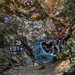
Heart Rock - Creek

Heart Rock

4.5(203 reviews)
12.2 mi

This is a great local spot. Parking is pretty spacious. It's about a mile and a half. It has narrow…read moresections and inclines. I would say it's a moderate hike for beginners. The heart is so cute. Perfect for families and dates. You can swim at the bottom. Takes about an hour.

This is was my first time going on this hike and it was good. The only mistake was going while it…read morewas over 100 degrees outside, but it was actually about 88 in this location, so probably a good day to go to the mountains. I've been hiking for a few years now and would say this was a pretty good starter hike, not bad at all. I even saw some kids at the end of the hike. It has some rocky trails and even more squirrels, so keep a look out for both. It took about 45 minutes to get to the heart rock and felt like it was quicker to get back. I do want to mention, that since it was my first time at this location, I did take a wrong trail for about an hour and was nowhere near the rock, so make sure to either download a map or have someone with you that knows where to go. Overall, a cool area to check out and alot of shade. I felt over prepared when I brought my camelback with waters and a knife, which I always bring. You could probably just bring a water bottle and make this whole hike in 60-90 minutes. The most animals I saw were birds, squirrels, and couples. Parking: There is a dirt spot right before Camp Seeley where you can park for FREE What to bring: Water, athletic shoes, bug spray, and someone who knows where the trail is. What to expect: Rocks, squirrels, birds, lizards, maybe some confusion on where the rock is.

Photos
Heart Rock - Trees

Trees

Heart Rock - Arrows pointing to heart shaped rock

Arrows pointing to heart shaped rock

Heart Rock

See all

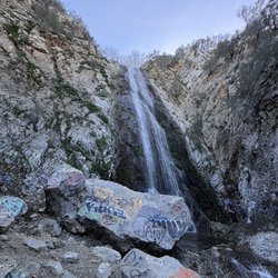
Bonita Falls - bonita falls grafiti

Bonita Falls

4.1(166 reviews)
16.4 mi

I'll give this place a strong 3.75 to 4.0 stars. And when compared to all other locations in the…read morearea, this would be easiest location for most people to discover, hike walk or jog and Enjoy. You must arrive early. As people are already taken up slots in the parking lot as early as 630am. Now, super easy to park on the side of the road, as there are many signs against it and many areas that are welcomed. By 8am, the streets were getting filled, as there are many outlets that lead to the river and many places where on can just the views, without the hike. So please get your 5 dollar windows taken for parking- the local 76 station is a place where you are able to. The hike is self explanatory, follow the people, which you will see many many hikers. And contrary to what people say, it is not an easy hike. You will need to be prepared for a 1.5 mile walk up and 1.5 miles back. It is a super rocky trail. Lots of loose rocks , once on the upper trail, boulders get bigger, the small cascades of water can make the area slippery. You will need to extend your limbs to reach up and pull yourself up. Not for small children and not for the elderly. The only thing here that I had a distaste for was the littering and the graffiti. Just the stupidity of humans not picking up their trash or painting moronic signs on rocks. Made it less intriguing... made it comical that people can be such idiots. The downhill trail becomes dangerous, as people can slip or fall and amid some cliffs that surround the area, being careful is at the most important danger. The area is accessible by various routes. The fantastic point here would be the river, which is wide, always tuburlant but not deep. Some area as 1ft ...other areas can reach 3 feet. The picnic area and the small rest stop are great stop points. The water is crystal clear, cold and just majestic. Bring appropriate foot wear, bring water and snacks and make sure you are physically fit. The waterfall is high...over 100ft. Standing under the falls can be refreshing, the cold waters offering an unexpected cold shiver, the light mist and the gaze of the falls can be spectacular. The river extends past the small pits top bonita falls bathroom and parking...next down the road is the picnic area...which is basically one or two tables for a get together, best to just visit the river and enjoy the stream... and finally the large parking lot..from here you can saddle the edge of the river, enjoy it, have a get together and from there, the Rover twist and turns to another southerner point where long lines of cars gather and can be accessed by the public and by foot. Gentle streams and relaxing moments. Over all, a good small hike with options for picnics and stream wading. Please, no graffiti and pick after yourself- let's keep nature clean!

We went for a hike yesterday and Bonita Falls was 22 minutes drive. The location was in Lytle Creek…read morein San Bernardino National Forest. The weather was great. We parked in the designated area. It was around 2.8 miles round trip . Make sure bring water, sunscreen, good hiking shoes and hiking stick. The trail was very rocky and steep going to the waterfalls. The running stream was amazing. Water was cold but soothing to listen to the sound of the water. The waterfall was high , great to take pictures and can get to the waterfalls area. There were people doing rock climbing too. Great adventure.

Photos
Bonita Falls
Bonita Falls
Bonita Falls - The falls

See all

The falls

Mojave Narrows Regional Park - Hotdog plant

Mojave Narrows Regional Park

3.2(83 reviews)
6.6 mi

I've visited this park for years and it continues to improve. It's such a gem to have in the area…read more There's space for children to play, and open space for throwing frisbees, or having a picnic, or reading a book. Plenty of space to walk your dog. There's at least two lakes that I've seen and numerous hiking trails several of which I've enjoyed. Some people like to fish, I'm not sure which type of fish are in the waters. There's also horse trails and bike trails. Most of the trails are accessible whether you have a motorized scooter, cane, or wheelchair, you can enjoy the nature trails. There's a variety of different wildlife and birds. A great place to bird watch. There's cows nearby. I love cows! There's clean restrooms, but they never have soap. There's overnight camping available and space to keep horses, not sure if it's for overnight horse lodging. I'm grateful for the Regional Park card they offer to veterans. That's a huge benefit and I appreciate it. I recently discovered the Celeste De Blasis Memorial Garden which was so beautiful it made me emotional. It's nice to see things like that in this area. This is a beautiful park and one of my favorite parks to visit. It's open daily from 7:30 am to 7pm.

Beautiful park in the high desert offering many recreational activities for the whole family. Great…read morefor hiking, relaxing, camping, picnicking, wildlife watching, photography and fishing. There is a fee per day/per car ($15 as of this writing), so plan accordingly. While I didn't camp, I did see some stunning campsites right next to the water and in beautiful condition. Lots of great hiking spots, lots of folks fishing and overall a wonderful atmosphere. There's even a Frisbee golf course. Very clean and well-maintained. Parking is included in the entrance fee. Always check the website https://parks.sbcounty.gov/park/mojave-narrows-regional-park/ for current regulations and fees. Enjoy!
Photos
Mojave Narrows Regional Park - Lake

Lake

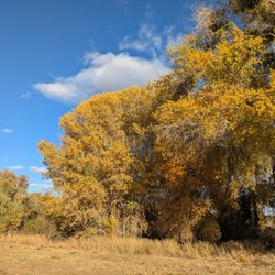
Mojave Narrows Regional Park - Beautiful foliage changing color; golden-green trees

Beautiful foliage changing color; golden-green trees

Mojave Narrows Regional Park - Beautiful day to explore nature

See all

Beautiful day to explore nature

Indian Rock Camp

Indian Rock Camp

4.8(4 reviews)
11.8 mi

Great little hike with some shade for the family. Park by the Metate Trailhead sign and cross the…read moreroad to where trail begins. According to AllTrails the hike is called Metate Trail and is approximately 2 miles of fairly flat trails. There are many different trails that links to this so you can extend your hike and go a totally different way. The Indian Rock Camp is only about 1/4 mile into the trail if you take the entrance on the left that says "interpretative." Once you get to the sign you will need to explore the hill for the Rock Camp. Our kids had a blast exploring and looking for acorns to play with. There is also a small hut for the kids to explore. Further down the trail is a small creek and lots more trail to explore. We saw signs of a large herd of deer so if you are quiet you maybe in for a surprise.

Starting at the Rock Camp Forest Service Station a very short trail (maybe a mile) winds through a…read morebeautiful grove of ponderosa pines and soon you will see a sign for the centuries (and maybe millennium) old Serrano Indian rocks that were used to grind acorns into meal for use as food. I love this place because it brings everyone back to reality, letting us know that we were not the first ones here, and we will not be the last. Its a really neat little piece of history in a secluded patch of woods. The trail head is located at 34.287955, -117.212582, just walk east and you'll run into it. I'm pretty sure there is a map and sign there as well.
Photos
Indian Rock Camp
Indian Rock Camp
Indian Rock Camp

See all

Will Abell Memorial Trail at Arrowhead Ridge

Will Abell Memorial Trail at Arrowhead Ridge

4.5(18 reviews)
13.6 mi

Great short hike, about 2 miles round trip, easy to moderate trail, beautiful trees, serene views,…read morepeaceful, and not busy. Stayed at an Airbnb close by and my kids wanted to explore the outdoors. Found this trail and it was prefect for what we were looking for. My 8 year olds enjoyed the view from the top, saw squirrels and birds, and only got tired towards the end. There is a dirt path and signs posted making it easy to follow. There were lots of trees providing shade and a cool feel. There were a few areas (stumps/down trees/rocks) to sit and rest at and some inclines, but nothing too strenuous or steep. It was very quiet and peaceful, and it felt like we were the only ones out there. Although we ran into 3 couples during our hike, we had the trail pretty much to ourselves. There is limited parking, but we were able to park along the curb and didn't have an issue. Worth checking out if you're in the area.

We came here on a Saturday and it wasn't very busy. The temperature was roughly 70 degrees, perfect…read morefor a hike. When we arrived, there was limited parking and no restrooms from when I seen so be sure to handle your business before you come. We weren't exactly sure where the trail began so we walked up the steep paved road and took a right at the top of the road and began the hike. This trail is full of incline areas so if you are expecting a nice stroll around the woods, you'll be sadly mistaken. I'd say this hike is closer to medium difficulty but it's a great time and very rewarding once you reach the top. Sadly you only get a "peek a boo" view of the lake due to the trees being in the way but hey that's nature for ya! This trail took a little over an hour for myself and my wife to complete and that's with peaks and taking in the scenery. I highly recommend this trail, the views, fresh air etc. is amazing!

Photos
Will Abell Memorial Trail at Arrowhead Ridge - Taken 6/30/2023

Taken 6/30/2023

Will Abell Memorial Trail at Arrowhead Ridge - View point

View point

Will Abell Memorial Trail at Arrowhead Ridge - View of the lake from the peak

See all

View of the lake from the peak

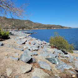
Silverwood Lake State Recreation Area - Rocky shoreline.

Silverwood Lake State Recreation Area

3.4(296 reviews)
9.8 mi

First of all, I'm honestly amused by some of the 1-star reviews complaining that it's crowded,…read morethere are flies and bugs, and people are playing loud music. LOL. Come on, people! This is a recreational area where people come to have a good time, BBQ, listen to music, and enjoy the outdoors with friends and family. Of course it's going to get crowded on weekends and holidays. And if you're cooking BBQ outdoors in nature, guess what? There are going to be flies and bugs! That's just common sense. Okay, now for my actual review. I give Silverwood Lake 4 stars. It's a relaxing place to BBQ, enjoy nature, and spend time with family and friends. Could it be cleaner? Absolutely. But I don't think that's completely the park's fault. Everyone needs to do their part. Pick up your trash, clean up after yourself, and help keep the public restrooms clean. If everyone respected the area, it would be a much nicer place for everyone. One important tip: If you're coming with a group, have someone arrive early when the park opens if you want to grab a good spot with picnic benches or a BBQ grill. It's first come, first served, and the good spots can go quickly, especially on busy weekends and holidays. Overall, it's a great place to BBQ, relax, enjoy the lake and nature, and have some fun. Stop worrying so much about a few bugs or the $20 parking fee. Pack your food, bring your family and friends, clean up after yourselves, and enjoy the day!

$20 dollars for entry in San Bernardino is wild…read more.. I was disappointed lots of trash everywhere! Even floating in the lake. Much algae as well and bees! Trash on tables. Have to get there early to get a good spot as the area is overcrowded.

Photos
Silverwood Lake State Recreation Area - First time on the PCT...I cried...so happy. Thank you God

First time on the PCT...I cried...so happy. Thank you God

Silverwood Lake State Recreation Area

See all

Rainbow Bridge Via Pacific Crest Trail - hiking - Updated October 2026

Loading...
Loading...
Loading...