Cancel

    Open app

    Search

    Halawa Ridge Trail

    3.0 (1 review)

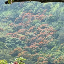
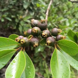
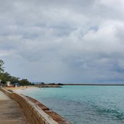
    Halawa Ridge Trail Photos

    You might also consider

    Recommended Reviews - Halawa Ridge Trail

    Your trust is our priority, so businesses can't pay to alter or remove their reviews. Learn more about reviews.
    Yelp app icon
    Browse more easily on the app
    Review Feed Illustration
    Photo of Kristin T.
    46
    11
    135

    7 years ago

    Helpful 0
    Thanks 0
    Love this 0
    Oh no 0

    You might also consider

    Verify this business for free

    People searched for Hiking 3,736 times last month within 15 miles of this business.

    Verify this business

    Kalauao Trail - Dry stream 06.13.2023

    Kalauao Trail

    4.3(17 reviews)
    1.9 mi

    What's the date I went there? I better check it out! Last time I went Tantalus & stopped by a…read moretrail, I saw something quite disturbing, I should actually tell the Police about it! Although...Police? I only saw like 3 on duty (commander in plain clothes) @ Pearl City, and 1 officer on duty @ window in Kapolei. Thanx fer the heads up!

    ***UPDATE: Alright. I redid this hike and even I had a hard time figuring out where to go so I…read morefigured I should update this review with more details!*** Whoever bothers to listen to TLC, you're missing out completely. Waterfalls are meant to be chased, especially after Tropical Storms and heavy rain! (Just don't be dumb and hike during those dangerous conditions.) Located deep into Kalauao Valley in 'Aiea, this hike showcases the raw beauty Oahu has to offer. This trail is located off of the well-known 'Aiea Loop trail. Make your way to Keaiwa Heiau State Recreation Area and park on the second level parking once you enter the camping grounds. There, you'll see restrooms and the head of 'Aiea Loop Trail. Be sure to lock your vehicles and not to leave any valuables. Start heading onto the 'Aiea Loop Trail (park opens at 7:00am FYI). Within about 15 minutes of walking along the Loop trail, you'll come across your first fork. Take the LEFT fork. It's a pretty obvious fork. Follow the ribbons. The next fork is a little less obvious. If you see a tower for power lines, you're heading in the right direction. Keep going past the power line tower. You'll seem like you're headed straight (not going down yet.) It'll seem like you are just staying on the ridge for quite a while, but just look for a pink little ribbon hidden on the right side. You'll see a mango tree (which there's a few) but you'll take a RIGHT this time (kind of like a U turn.) The mango tree has a pink bottle cap on it as well as carvings in the trunk (LANZ.) Once you see this mango tree on the right, make almost like a U turn and just keep following the trail which takes you down, down, down into the valley. It's steep, could be wet, just be careful. There's a portion that you can use a rope. It's up to you. Once you hear the stream, you'll follow it as it leads you to the falls. You can cross the stream as many times as you see fit. We found it more difficult going there and probably crossed nearly 7-8 times but on the way back, we crossed about 3-4 times. Just be on the lookout for ribbons on your side. If you see them, there's a high chance you'll have to cross and you'll see the ribbons on the opposite side. Some mentioned passing a "wrong way" rock, but we didn't see this. Just keep following the stream and VOILA, you've made it to the falls. There's a short path that leads you to the lower and upper tiers of the falls. If you jump, just be careful. There's been quite a few hiking accidents on the news lately. Better be safe than to be on the news. On the way up, it's pretty steep and can be extremely exhausting. Take breaks as needed. Honestly, we went on a day that actually rained that morning. We didn't find the hike to be extremely muddy or slippery. In fact, I thought it was relatively safe compared to some of the ridge hikes I've been on. Total hiking time (including a 15 minute stop at the falls): just under 3 hours. I believe the hike is approximately 3.5-4 miles. Tips: 1) Wear long pants or long socks. If you want to jump in the pool, bring a change of clothes. 2) Bring extra socks/shoes/slippers in your car. Your feet will probably be wet by crossing the stream. 3) If pants or long socks aren't your thing, bring mosquito repellent. 4) Bring water because you'll want it after that trek back UP the valley. 5) Go slowly until you find each fork. 'Aiea Loop Trail isn't the most exciting so you don't want to end up doing that!

    Photos
    Kalauao Trail
    Kalauao Trail - African Tulips in bloom in the valley.

    African Tulips in bloom in the valley.

    Kalauao Trail

    See all

    Keaiwa Heiau State Park - Heiau, very tranquil

    Keaiwa Heiau State Park

    4.6(18 reviews)
    1.7 mi

    I was surprised I haven't written a review for Keaiwa Heiau State Park but maybe I did and the…read moreYelp Ghost stole it! Anyway this is the park that you enter in order to get to the Aiea Loop Trail with breathtaking views from the coastline thru the beautiful Halawa Valley with H3 smack in the middle. The Heiau is well marked and as a Hawaiian Spiritual place it is noted that it is to be respected as such. When you enter the park the Heiau is immediately on your left and parking in marked stalls is required. There are restroom facilities next to the covered pavilion and walkways from one to another. The path to walk into the Heiau is uneven and not easy to access so watch your step if you intend to walk around. I've seen feral chickens, feral pigs, feral cats and campers here. Permits are required for the campers not so much for the aforementioned animals. Dogs are required to be on leash. Beautiful and cooler temperature wise. The drive up Aiea Heights Drive isn't as perilous as others comment about but you do need to pay attention.

    This place is such a great secret that I almost don't want to review it…read more.. Almost, Momma didn't raise no gatekeeper! This is my favorite place to camp in Oahu. It's located in a high altitude forest. The rain usually isn't that bad, and if it is, you've got trees above you to buffer it before it slaps your tent! Since it's not beach-front camping, it is actually bookable and doesn't fill up within seconds! Campsites are numbered and come with a picnic table and a fire ring. Other campers are generally pretty chill and quiet, at least when I've stayed here! One thing to note, there are lots of creepy crawlies on the forest floor here. Make sure your tent doesn't have any weaknesses in its netting! I haven't done the trails here yet, but I will next time!

    Photos
    Keaiwa Heiau State Park - Beautiful day for a drive through

    Beautiful day for a drive through

    Keaiwa Heiau State Park - I wonder if this was made with felled trees from the park

    I wonder if this was made with felled trees from the park

    Keaiwa Heiau State Park - Respect is requested and given

    See all

    Respect is requested and given

    Aiea Loop Trail - Definitely NOT edible but cute

    Aiea Loop Trail

    4.2(322 reviews)
    1.9 mi

    I've hiked this trail a few times and have seen downed trees before however nothing like our recent…read morehike. After two heavy rain storms that caused flooding in the Islands some areas of the hike had whole hill sides that had numerous trees down. The trail is only passable because of the hard work of the parks crew. In normally shaded areas there is more because of this. It's really a sight to see the terrifying yet amazing strength of nature. The hike is about 5.5 miles long, not very hard with beautiful views.

    Aiea Loop Trail is an excellent and well-maintained hike that's friendly for everyone, and a very…read moresafe, simple, and straightforward for first timers. This hike is located all the way up in Aiea. Just get on Aiea Heights Drive and drive all the way up till the end of the road. You will reach the entrance to Keaiwa Heiau State Park. Note operating hours--opens 7am, closes 645pm winter and 745pm summer. Once in, stay on the right, and keep driving up past the picnic/park area, campgrounds, and other parking lots till you reach the very top. But, if you want to park where the trail ends, it's actually the parking lot to the right just before. There are restrooms and picnic tables at the top. The hike is 4.8 miles. It took us about 2.5 hours with a steady pace and some stops for photos. It's relatively flat with a very slow incline and decline, and shaded by tall trees a majority of the hike with a nice, crisp air. The hard dirt pathway is wide enough and very easy to follow. You get views of Halawa valley, H-3, Pearl Harbor, airport, and east and west side along the way. Nothing spectacular. There are quite a bit of fallen trees, especially towards the end of the trail, if you started from the upper section. Overall, a very nice, quiet hike that wasn't strenuous, or too short or too difficult. Good solid, 5-mile hike with a well maintained path and parking. It's quite safe--if you stay on the path, of course!

    Photos
    Aiea Loop Trail
    Aiea Loop Trail
    Aiea Loop Trail - Sofie really wanted to hike but that's a no

    See all

    Sofie really wanted to hike but that's a no

    Tripler Ridge - Full moon with eclipse hike

    Tripler Ridge

    4.5(17 reviews)
    1.7 mi

    We had a kid with us so we only did the paved portion of the hike. Plus my hiking buddy didn't…read morehave shoes. Oops! But since we had this already planned, we went anyway. You need to gain access to the trailhead as it is in the military housing behind Tripler Hospital. Fortunately, my hiking buddy works for the military and we were able to get to the trailhead with no problems. There was ample parking and appears to be fairly safe given that this is on military area. So while I wouldn't recommend leaving your car unlocked, the chances of your car getting broken into is pretty slim. Going up the paved path is pretty straight forward. Just make sure you take the HECO road on the left once you're on the "trail." The incline is steady and you're quickly admiring views of Oahu. We went around lunchtime so the sun was overhead and shade was a bit scarce. I can imagine that once the guavas are ripe, the air would smell guavaey lol. So it was a relief to get to the end of the paved area, do some drone shots and go back down. We would definitely go again to do the full ridge!

    Perfect short hike after work and a beautiful view to boot so one of my battle buddies is a fitness…read morebuff funny kind of like me only her arms put mine to shame!! Anyways last week Thursday was her birthday and of course she didn't want to do anything but work out so we decided to do a hike that I have never done before. we had a great time this was a great hike short but it definitely gets the blood pumping and for me it was a great second work out! I also like how they weren't bugs everywhere. This trail trail was also not crowded at all:) you do need to have access to hmm Tripler the hospital base area to enjoy this hike;)

    Photos
    Tripler Ridge - Tripler ridge summit.

    Tripler ridge summit.

    Tripler Ridge - I'm just calling this signal tower just to refer to it lol. No idea what this is but this where we ended our hike.

    I'm just calling this signal tower just to refer to it lol. No idea what this is but this where we ended our hike.

    Tripler Ridge - Marker 12 along Moanalua valley. Tripler trail is a few feet after it.

    See all

    Marker 12 along Moanalua valley. Tripler trail is a few feet after it.

    Ford Island Historical Trail - February sunset

    Ford Island Historical Trail

    4.3(6 reviews)
    2.2 mi

    This is a new 4 mile walking trail located on Ford Island which is a part of Joint Base Pearl…read moreHarbor. You will require base access to access this trail. This new trail is a walking historical trail around the island, you will see so much and learn about Ford Islands historical past by walking this trail. The trail is mostly paved and all you have to do is follow the blue dots around which are placed every ten feet and makes navigating the trail easy. Every few hundred yards you will come across information boards that explain the area and discusses a bit about the history but military as well as Hawaiian. The designers really did a great job because the trail is well maintained and information boards are located around the island to assist with the history of the island which includes the crucial role Ford Island played for the military over the years and early sugarcane farming. The trail is great for families, kids, bikes, pets and if you stop and take in the great views and read all the history, you will be glad you did. Start early and bring a hat, sunglasses and of course water because it does get warm. Hope you all enjoy this new addition to Ford Island.

    I frequent this location mainly for exercising purposes as it does have a safe path to walk, run,…read morebike, rollerblade, scooter, and take your babies on a stroll. I love that there is no traffic or exhaust to breath in. Just you and the beauty and tranquility of a historical location. I always make it a point to stop at the USS ARIZONA marker to pray for those who gave their lives for our freedom. Even those of the enemies who lost their lives as well. During COVID my husband and I did the Marine Corp. Marathon here since it MCM was allowing virtual times to complete the race on the day of the race. So I got to check that off my bucket list of runs. But hopefully one day I will make it to DC to be a part of the MCM experience. What I would like to see on this trail are more benches to sit and relax at and a playground for children to play on, a volleyball playing area, and even Cornhoe and horseshoe pits near the Navy Lodge. A great place to bring your dogs as well. Three separate areas that are gated for different size dogs near the Navy Lodge. Navy Lodge does have a bathroom you may use. Please be respectful and ask to use it, then keep it clean as you leave. Enjoy!

    Photos
    Ford Island Historical Trail
    Ford Island Historical Trail
    Ford Island Historical Trail

    See all

    Halawa Ridge Trail - hiking - Updated May 2026

    Loading...
    Loading...
    Loading...