Moanalua Valley Trail Photos





You might also consider


More like Moanalua Valley Trail
Recommended Reviews - Moanalua Valley Trail
Start your review...






29 days ago
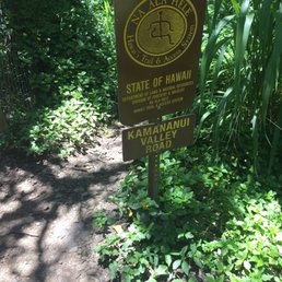
A beautiful and not too difficult trail (this is for the Moanalua Valley Trail, not the back way to Stairway to Heaven--I didn't go that far). It has a wide walking path and you can go for quite a while before needing to turn back. I did 4 miles in and 4 miles back and it was a great workout. Not too much incline, but enough to make you feel like you accomplished something. Beautiful views and there were hardly any other people on the trail, even on a Saturday. Don't park in the nearby Moanalua Park to do this trail. Park street-side and walk the short distance up. read more




1 year ago

Great hike to the ridge top, radio tower, and top of the Haiku Stairs. A little over 5 hours round trip, and my watch said it was 10.7 miles. The first two miles is basically flat, so you get a bunch of elevation right after that, then go along the ridge with a few more spots with serious incline. There are some windy spots on narrow ridges where it felt right to get low, but I never felt in danger. There's one gnarly section that's basically straight up using some muddy ropes, and you really need to have one person on the rope at a time, so you have to coordinate with other hikers going in the opposite direction. The last bit, once you can see the radio tower (unless the fog prevents you) is also muddy and slippery, but doable. At the end, the mist and fog come and go every few minutes, so you may need to wait a bit to be able to see anything, but it's a great view and definitely a bucket list hike to make it to the end. Plenty of parking along the street outside the park, just a question of how far down the street you end up. read more

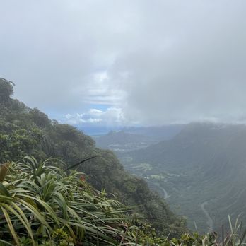


Well kept trail for the island, but still challenging. Keep in mind climbing begins over 2 miles from start point. Once you pass the sign and creek crossing go to the right, the trail behind the foliage, not the obvious one on the left. The left goes to the valley. Spikes and gloves very helpful. Not for everyone so know your limits before going. Other housekeeping items, not allowed to park in the lot for hiking, don't block driveways or mailboxes, leave at least 4 feet from driveways, pack it in pack it out, and please be respectful of the neighborhood residence. read more

5 years ago
Started this trail in an attempt to hike the legal way to Stairway to Heaven. It was very muddy and we didn't have crampons or gloves for the later parts of the hike. I felt we were moving at a very comfortable, easy and sustainable pace but eventually, about 2.5 hours in and completely muddied we decided to turn back as the conditions didn't seem super safe. I I'd definitely hike this trail again and to completion with the proper gear for the terrain. Beautiful hike, I'd say it's fairly technical in some areas due to the slippery mud and many tree branches you need to climb over and around, up and down. Bring gloves, hiking boots and probably crampons. Pants or shorts are fine. I was in my running shoes (major fail) and a white top that if you know this trail you'd give me 5 stars for keeping this clean! Looking forward to completing this hike one day. There is a water station at the start to rinse off at after the hike. Most say this is 7-10 hours. I'd say it's probably about 8 tops with a few little rest stops here and there. Oh! Bring bug repellent if you want - we both ended up with several bites. read more



1 year ago

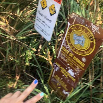
Parking is limited in the park. Street parking in this peaceful and clean neighborhood is available. I know this sounds silly but I need to say it. Just be respectful by not leaving trash, clumps of mud from your shoes on the sidewalk, or doggy poo bags on the residence wall or curb. It takes one neighbor to complain to the city to place a 3 mile radius no parking sign, near the park entrance. :-( That would place your car down by the golf course :-0 Unless you call uber for a 3 mile ride, lol... read more



7 years ago
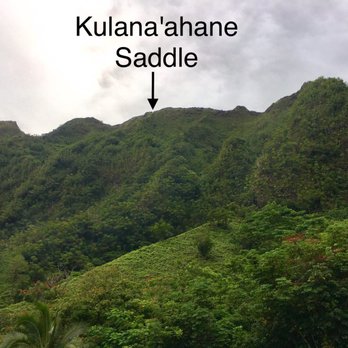
This is the starting point for Haiku, Stairway to Haven. Sign says open at 7 am but gate was open already when we got there 6:45 am and two cars were already there. If the other Yelp review says gentle, fun and great for kids and faimly, this only applies to Moanalua Valley Trail. If rained prior, there will be muddy sections. It's mostly gravel road and yes, easy walking trail for about 3 miles on wide gravel road and turns into single track with tall grass covering. If you want to do the Haiku, move on to another Yelp listing for Moanalua Middle Ridge Trail. This will take you to the top. Good luck and enjoy the nature! read more


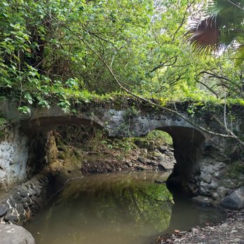
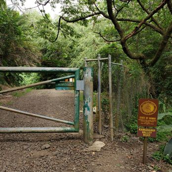

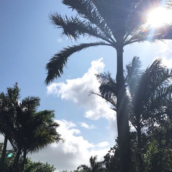
If you're not going to the Haiku stairs, this is a great walk thru Moanalua Valley for the kids. The terrain is simple as it's mostly a gravel road. The vegetation is super cool, There's a few different kinds of palm trees, ginger, wild orchids and multiple lawai patches. Some parts of the road have been repaired with concrete, I guess for run off and erosion purposes. There's usually a few streams to cross after you pass the bridges in the beginning, so if you are hiking with your kids the streams can get high pending on how much rain there's been, just something to keep in mind. But it's a beautiful place and the newly renovated playground is a plus kids too! read more


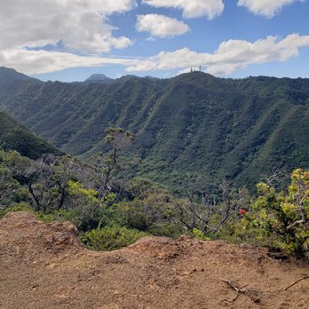
There are a few hikes one can take in this valley. So far I've done 2 of them and they were both pretty brutal. The first time I went up the middle ridge to the Koolau Summit. That was 6+ hours round trip and multiple stream crossings, jungle gym of hao bushes, narrow steep ridge and ropes to the summit. You end up literally right over the H3 tunnel on the Kaneohe side. I won't be doing that hike ever again though. Next was the Bay Rum loop. We did it clockwise starting behind the tennis court. It starts off pretty steep but shaded and many strong guavas to hold onto. Once you reach the ridgeline it's not too bad. Some narrow areas where there are old landslides reminded me of Haleakala sliding sands a little. Then as you ascend the darn scratchy uluhe fern made me wish I had full long pants or high socks. Alot of us had bloody scratches on our arms and legs. The trail gets obscured and the going is slow. The trail is marked with pink ribbons hard to get lost really. Coming back on the other ridge is more uluhe ferns sometimes waist high. Sometimes wading through California grass head high. This was very slow going. My watch said total actual moving time was 1 hr 10 min but we took a lot of breaks so I was out there almost 5 hours! After the ferns disappear you drop back into guava groves and then several sections requiring use of sturdy ropes placed by other hikers. When you see a big cliff the descent starts and it's pretty intense with potentially dangerous drops. Finally got down to the valley floor after a bamboo forest, and glad to see the historic road. The junction exited near the 4th stone bridge. I really have no desire to do either hike again. One and done. However, if you like challenges and a variety of terrain/fauna this is a good one. read more


5 years ago
Aloha! Fun hike. Can be very muddy like lots of the ridges out here on island. Definitely not a short one. I hike this trail quite often for almost 5 years now. Usually go up a few times per week. Microspikes are good to have to make it up/for traction. At minimum please wear proper hiking footwear and be prepared. Bring plenty of water and sunscreen. Feel free to reach out to me on Instagram @mike.karas for info/other questions about the hike or other hikes out here on Oahu. I've done most of the hikes on the island before. Also please pack out your trash! Too many litterbugs on the island sadly. Mahalo! read more


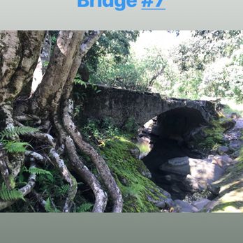
This is a pretty fun trail. It's a pretty fast and easy 6 miles out and back. It's pretty level for the most part and features some great ruins of a home in the forest marked with informational signage and also has 7 bridges with a stream weaving in and out of the trail. Most guides use them as markers along with concrete stream crossing, so a total of 15 crossings. There's many side trails so it makes great markers. The 7th and last bridge you'll hit 1.3 miles. The other thing about this trail and why the markers are relevant is that at the fifteen crossing the wider trail ends and it is the start of the back way to the Stairway to Heaven. I just went to the trail head to that portion and turned around. But I ended up going twice this weekend to bring my wife and dog. Be aware this trail is also used for pig hunting. I saw two groups hunting with packs of dogs. One group had about a dozen with gps locators and caught two wild boar and I saw some bow hunters too. But a nice trail. Bring bug spray. read more




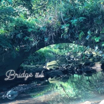

Small parking lot. Entrance looks closed, just walk through the right side. Best to hike when weather has been dry. It can get muddy and hot. You can get stranded by flooding rivers blocking your way. A lot of families and dogs seem to be enjoying a late afternoon hike/stroll. Still never made it to the top. Somehow, found myself in an open field of sorts dead end. As usual, bring sun protection and lots of hydration. I basically walk until I feel a little tired, then turn around. After that, I'm tired, but not in pain. Or at least not in pain the next day! read more


4 years ago
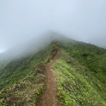
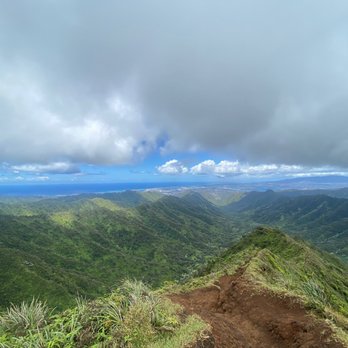
Great hike!! 3mile flat through forrest then 2miles incline up the mountain. The view is wonderful worth the hike. read more



7 years ago
We save the best hike for last. My bf and I took this trail to get to our destination. Moanalua Valley Trail was our first pathway. Such a beautiful hiking spot to just enjoy nature. One of the things I love about this Island is that everything is so natural and fresh. Some areas do get muddy so I suggest hiking boots/chains (if you're planning to reroute to a strenous pathway). Took us 3 hours to get to Stairway to heaven and another 3 hours back the same way we came up. Make sure you bring food and water to stay hydrated and please clean up after yourselves! Don't litter! Let's keep this beautiful island clean. read more






9 years ago
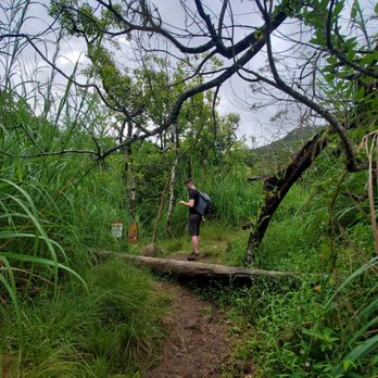
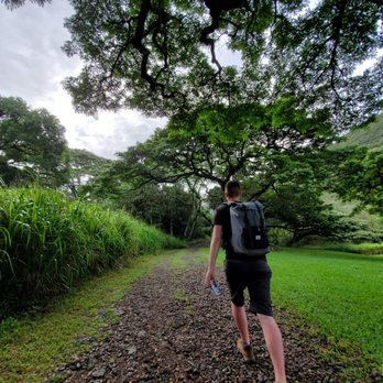
This is a nice, breezy, beautiful, easy, and long hike. We didn't complete the whole trail so I don't know how long it actually is. It wasn't really a hike, but more like a very long walk with some rocky terrains. There's these old cool looking broke down bridges that u cross. This trail allows u to admire all the plants, trees, and the little streams they have there. There aren't many hikers so be careful. The trail tracks are large and super obvious so u shouldn't get lost at all. Although as you're going passed the bridges, the trail splits around it, but it merges back into the same trail so once again, u shouldn't get lost lol. The parking lot is small so u may have to find street parking. There's a little park and a playground for the kiddies. I would highly recommend wearing shoes due to the large amounts of gravel there is. There are some muddy area, but not enough to make u all muddy or anything like that. Happy trails and be safe. read more
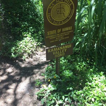


We've known about this trail for many years as it's literally in our "back yard" of Moanalua Valley. It's been in the news recently because of hikers getting lost, injured or worse. Since hearing reports of injury or tragedy on this trail, we took to researching this area a bit more as well as asking others to accompany us. However, while researching through Moanalua Gardens Foundations, our fears were soon calmed to go ahead to JUST visit the ruins of the Samuel M. Damon Estate and look for the ancient Hawaiian petroglyphs. We had NO intention of climbing up through Kulana'ahane toward the famed Haiku Stairs or looping back along the Tripler Ridge, both of which are treacherous, to us and many novice hikers. So, we stuck to JUST the Moanalua Valley Trail which is also known as the Kamananui Valley Road Trail. The Kamananui Valley Road Trail is quite flat, has an unpaved pathway/unimproved roadway (maintained by DNLR crew) and is like walking through a lush tropical forest. The complete trail is about 8 miles round trip (according to MGF) then breaks into the Kulana'ahane Trail about 2 miles in towards the left where the path is unimproved, steeper and loose ground underfoot or very muddy and prone to flash flooding. There are restrooms at the beginning and end of the trail (at the Moanalua Valley Park. There is so much history here that there are 13 numbered key posts that the Moanalua Gardens Foundation posted. There is also a booklet that you can order for $5 called "A Walk in the Past" that details the 13 key stops. The highlight to this hike is a view to the former estate of Samuel M. Damon (1845-1924), a businessman/banker/politician in the Kingdom of Hawaii. Samuel M. Damon amassed his family fortune from lands that was bequeathed by Princess Bernice Pauahi Bishop. Currently, there is probate courtroom and family "drama" that is similar to Kaui Hart Hemmings' novel, The Descendants. We found ruins of staircases, fireplaces and bridges from a time gone by. Just seeing the remnants, one could imagine the grandeur of the estate or imagine horse-drawn carriages clip-clopping along the roadway. Please don't forget your sunscreen and insect repellent or appropriate hiking clothes. If you're a cityslicker, those mosquitos will dive bomb you while you're thinking you're about to be attacked by a T-Rex as in Jurassic Park. Bring some drinking water and some snacks but don't litter! There are rules to follow for your safety and enjoyment of this trail. Be a responsible trekker and go with a buddy or group. #304 read more




7 years ago
Super trail. Total distance 19 km round trip. I've started at 4 and was at the top 7. Totally 6 hours. Rain was since 4 to 7 so hike was really dangerous in couple places. Don't go without water or in slippers. Nice and stunning views. And be careful don't recommend in . read more

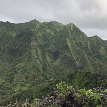

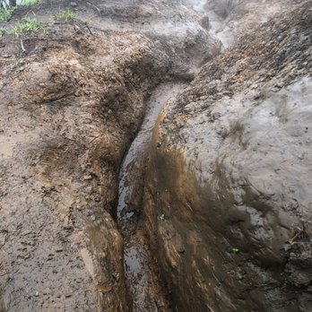


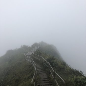

This trail is pretty good. Not very muddy in most sections, although there are parts where it's really muddy. My six year old daughter did all 6 miles round trip with no problem, so bring the kids along. The views were very nice and if you go a bit further past the trail end, there is a waterfall waiting for you. And about another mile further down you can get to the stairway! The trail could have been just a bit tougher. With the paved paths and wide trail this could be easily used as a running path. If you're looking for something that will get your heart racing, check out something else. If you are looking for something easy and straightforward, then this is for you. read more
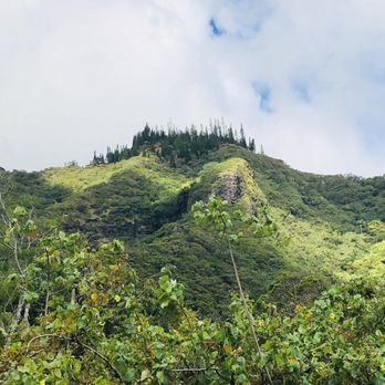


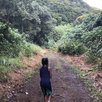
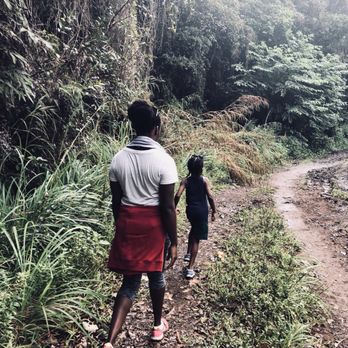


First of all let me say that anybody tells you that this hike is a beginners hike is an absolute lie, it is not. Maybe at the beginning the first hour or so it is more of a walk but once you get past a certain point be prepared. It is one of the most difficult hikes that I have ever done and I did the spartan trifecta in one weekend here in Hawaii. I was tricked into thinking this was a beginners hike so I was extremely surprised. I didn't make it up to the top we made it to about the midway point which is 2,109 feet up in the air. The wind was so bad and the clouds were coming down so it was unsafe for us to continue. That brings me to the hike down, which is by far harder than going up the rocks are slippery a lot of 90° angles the ropes that are in place are helpful but deceptive so you have to be extremely careful. If there's any type of precipitation out there you may as well just find a place to camp because it is close to impossible to not get hurt going down if it's raining. Now to the good part the views were absolutely breathtaking and I can only imagine what the views are from the complete peak, which I do plan to try to see again when I am more mentally prepared. It is at least a nine hour hike because that is how long it took for us just to get to the halfway point that's round-trip. So I'm thinking probably about five hours all the way to the top in five hours down so it's going be at least a 10 hour hike so go early. Bring plenty of water with you and a flashlight or head lamp in case you get caught in the dark. Please pay attention to the weather reports when it comes to wind advisories because on that ridge there are no trees there is nothing to hold on to. if you were to get a huge gust of wind it is extremely dangerous. When were descending, we saw several medivac helicopters going to rescue people who had fallen and or had gotten lost so just be careful. The pictures are great but they don't do the beauty justice. This is an honest review from a novice hiker but an athlete. Definitely a bucket list hike. read more


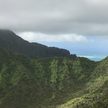


This trail is gorgeous and perfect for a nice "nature walk." Seems like a great place for dogs and families! There's a lot of bridges and we didn't go in all the way, but we passed about 8 of them before turning around. I think the first bridge is probably the nicest and we noticed a lot of people stopping to take photos. The water is pretty blue and it's flowing, but I did see a frog and dogs like to play in that water. I wouldn't suggest swimming in it. There are lots of fallen flowers along the trail that make it colorful and it's flat and paved in some areas. It could get muddy when it's wet and in some spots we had to go other routes in order to stay out of it. If you choose to go through the water and not above the bridges then your feet will also be soaked. There's a nice small park, bathroom, place to wash off and two basketball courts at the parking lot. read more


6 years ago

One of the best family friendly hiking trails, enjoyable for all ages. The entrance is within a community park that has restroom facilities (they were well cleaned), water fountains, a playground, and a very nice shaded & open grassy area. Parking is limited and a majority of hikers park along the street. Please be mindful and courteous of the residents and their homes. We took our Young Women's church group and they ranged in age from 12-16 years old. The traditional name of this valley is Kamananui and it is located in what is now referred to as Moanalua Valley. As a State hiking trail it is well maintained with clearly marked paths, no opala, and informational boards along the way sharing moolelo about its cultural history and significance. The complete hike is approximately 6 miles in so you can decide how far as a group or family how far you'd want to go. We took our group four miles in to one of the valley lookouts, it was a breath-taking view. If you hike all the way in there's a lake to swim in and cool off before hiking back out. Can't wait to do this one again! read more


My kids were on Fall Break and I was itching to hike, even if it meant dragging along 3 whiny kids. It was my first time bringing them hiking without their friends or Baby Daddy so I wasn't sure how they would handle it but they absolutely LOVED Moanalua Valley Trail (AKA Kamananui Valley Road)! The trail alone is 8mile round trip hike but it does connect to Moanalua Middle or Moanalua Saddle Road and then to Haiku Stairs. Obviously since I had my 3 kids we stayed our butts on the main trail. The trail is perfect for kids as it's easy, wide, flat and shaded....but I wouldn't consider it a hike due to the lack of challenge or elevation change. It's more of a culturally enriched nature walk complete with footbridges, streams, old ruins, fruit and more! My kids couldn't stop running to the next informational sign or across the bridges and streams! Please remember to stay respectful of the property, especially the old building ruins that Queen Bishop used to live in. Also, please do NOT make silly rock laulau or meaningless rock stackings at the streams. read more


3 years ago

Directions to trail head: Off H1 Freeway on Exit 19B, Moanalua Valley - right on Ala Aolani Street to Moanalua Valley Park. For a more detailed description on trail (FYI, trail is now opened to public): http://htmclub.org/trails/moanalua.html When you're inside the park, walk up towards the fence and you'll see the trail head opening. If you're taking a mountain bike with you, you may need to walk around the fence from another trail to the left that goes up a hill and around. That or you can slide your frame through the gate, which by the way, might be a tight fit for your bike. The trail is mainly for beginners as it's just about flat the entire way. On foot, I've been here many of times and have taken a few paths that have gone up along the ridge (Tripler ridge, etc). I have never gone all the way in but if you walk in far enough, you'll be able to connect with the Haiku Stairs in Kaneohe. Basically what your following is a service road into the valley. Along the way: great greenery, man-made bridges and one area with petroglyphs. The petroglyphs I hate to say aren't even worth checking out. The etchings aren't barely visible from years of deterioration and have already been vandalized by other carvers (according to the man showing them to me). The terrain is bumpy from the large round pebbles embedded in the ground (which is sometimes muddy) but for the most part, you're shrouded in the shade by trees. I rode my mountain bike in about a mile or so in, to a wide open grassy area that is encompassed by mountains as seen in this youtube footage: http://www.youtube.com/watch?v=57I4EtG8h6c As I was shooting this video, other hikers and I heard loud voices of men echoing deep in the valley. It sounded like they were yelling at each other in some kind of polynesian. Hunters or not, they didn't sound too friendly and I remember feeling uncomfortable. This, even with the giant knife in my backpack LOL! Got on my bike and it was pretty much all downhill from there. Also, this trail is a bit creepy and eerie at times because the trail road is so narrow, with a large area thick of woods on both sides of you. Just the smallest noise or rustling in the brush can put you on your guard. And yes, I've seen and heard boars on this trail before. Note for all of you who have never tried and are interested in mountain biking: this trail is perfect to test your endurance - as it's mostly flat, with subtle inclines. I'm a guy who hikes up ridges on foot and cycles around town on a regular basis. On my first dirt pedal ride, I found out it was a lot more work on my cardio and legs than originally anticipated. I also find it better to try and NOT concentrate too hard while maneuvering on bumpy and loose terrain. Better to just roll freely and go with the flow of things. Launch off roots if you have to. For a regular foot stroll, this trail is okay. A little boring for my taste, but with a mountain bike, it's a lot of fun! My easiest off-road bike adventure yet. 3 stars Moanalua Valley Trail, at the end of Ala Aolani Street read more




8 years ago

12 years ago
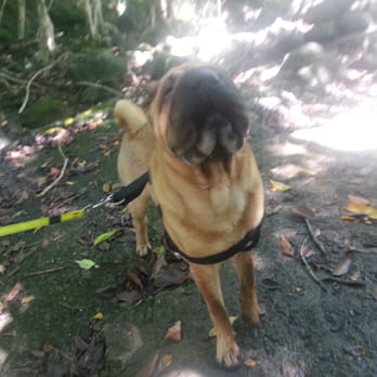
We try to come to this trail at least once a month.... It's one we can bring our fat face dog Ozzy on without him going into cardiac arrest. The trail is super easy with no obstacles or climbing involved... Super easy for all to enjoy. The are some streams that we throw our dog into to cool off. At times, they are pretty dry. read more




3 years ago

8 years ago
Only legal way to get to the Haiku stairs. I felt so accomplished after making it to the top due to the stunningly breathtaking scenery. Make sure you get proper hiking shoes preferably with clits, a pair of gloves, a sufficient amount of water and food, and a wind breaker jacket because it gets really windy on the trail and you might catch a cold or worse fall into a state of hypothermia. read more


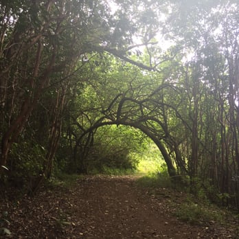
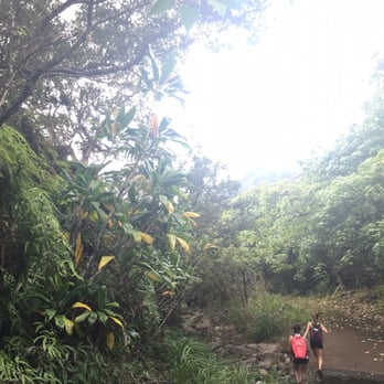
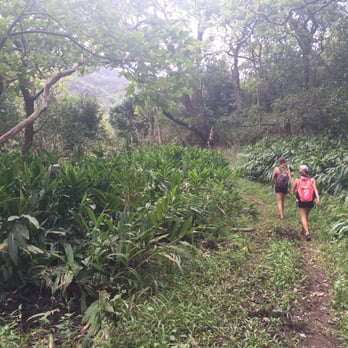
A friend suggested this hike to us and although it wasn't quite what we were expecting, we still had great time! This review is for what I believe is the Moanalua Valley Trail or Kamananui Trail, up to the Puu Pueo and then further into the valley. We had really wanted to get to the second part of the hike that takes you to the backside of the Stairway to Heaven, Kulanahame Trail, ...but we must have missed it because we only ended up going further in the valley. The hike starts at Moanalua District Park -- lots of ample parking either in the lot or street parking. This hike is pretty flat, rocky, and can be very muddy so be prepared to get dirty. Along the way we also noticed a bunch of flash flood warning signs, so it's probably best not to come after it's rained. Along the way, you'll encounter a lot of beautiful greenery, some old bridges and there is an area to stop and see the remains of an old estate / home -- be sure to stop here and take a look at the sign, which has a map of the valley and will give you an idea of where you are. You'll also come across a number of signs along the way that share information about the valley, it's history, and it's inhabitants. It looked like Puu Pueo was the point at which the state no longer maintains the trail. But there is a path that leads further to the right that we decided to follow. This took us further into the valley through a lot of tall grass and we did get closer to the mountains but eventually, the path was no longer easy to identify so we decided to turn back. Round trip we hiked for about 4 hours. Although we didn't really get to where we were hoping to get to, my girlfriends and I still had a lot of fun exploring Moanalua Valley and we still had a great time. This Kamanui Trail was actually really nice and not too strenuous, perfect for beginning hikers or those who don't go often. I mean, we even came across people walking in casual, non-workout type clothes. Upon returning to the part at the end of our hike, we did meet someone who had done the Kulahame Trail and also went down the Stairway. He gave us some advice on how to find the trail so who knows, we may be back soon to give it a try :) read more





11 years ago
This trail is called: Kamananui Valley Road Trail. http://hawaiitrails.ehawaii.gov/trail.php?TrailID=OA+12++010 Easy 8+ mile r/t hike. Very lush and beautiful. But only go if it didn't rain the day prior and it's not raining on your hike day. This is a valley hike that is right along a stream, so flash flooding is a real danger. The ending is when the Jeep road ends... there are no "end" signs. There are no spectacular views, but it's quiet and peaceful. I saw several hunters with their dogs, and all were friendly. It's a good hike for any person, child or dog that can walk 8 miles. Hawaii hiking tips: http://www.unrealhawaii.com/2010/05/beginners-guide-to-hiking-oahu/ read more


8 years ago
It was o r of the toughest hikes I ever encountered. If this is your first time; be ready: bring lots of water, food and a mentality of steel. Make sure you do this with a friend and not alone, you WILL NEED EACH OTHERS SUPPORT! I didn't get to reach to the top due to unforeseen circumstances but it was one of the greatest memorable adventures of my life ! read more


12 years ago
Awesome Hike. Lots of shade throughout the hike. Bring lots of water if attempting to hike the entire trail. Extra clothing, zip lock bag, snacks\food and really good hiking shoes is a must. Main fire road trail is easy for everyone. It's when you cross the water streams and climb the big mountain is where it gets tricky. Strava stats Distance: 12.9 Miles Elevation 2,617ft Elapsed Time 8:40:04 read more




9 years ago


12 years ago

Page 1 of 2
More info about Moanalua Valley Trail
Ala Aolani St
Moanalua, HI 96818
Directions
Hours
Outdoor Amenities
Moanalua Valley Trail Reviews in Other Languages
Ask the Community - Moanalua Valley Trail
Is there a waterfall here?
No, there are no waterfalls. But you do cross over/through a stream many times - you can go over on the bridges or walk through if you like. If it has rained heavily the stream will be flowing and I suggest you walk on the bridges.
Review Highlights - Moanalua Valley Trail
You might also consider























Why does Yelp recommend reviews?
3 reviews that are not currently recommended
The reviews below are not factored into the business's overall star rating.

9 years ago

12 years ago

11 years ago
Moanalua Valley Trail - hiking - Updated May 2026
Best of Moanalua
People found Moanalua Valley Trail by searching for…
Things to Do in Moanalua, Hawaii
Hiking Trails in Moanalua, Hawaii
Fishing Spots in Moanalua, Hawaii
Waterfall Hike in Moanalua, Hawaii
Splash Pad in Moanalua, Hawaii
Running Trails in Moanalua, Hawaii
Swimming Holes in Moanalua, Hawaii
Waterfalls in Moanalua, Hawaii
Dog Friendly Hiking Trails in Moanalua, Hawaii
Flower Fields in Moanalua, Hawaii
Secluded Spots in Moanalua, Hawaii
Secret Spots in Moanalua, Hawaii
Watch Sunset in Moanalua, Hawaii
Off Road Trails in Moanalua, Hawaii
Stair Climbing in Moanalua, Hawaii
Walking Trails in Moanalua, Hawaii
Easy Hikes in Moanalua, Hawaii
Night Hike in Moanalua, Hawaii
Bike Paths in Moanalua, Hawaii
Campgrounds in Moanalua, Hawaii
Dirt Bike Riding in Moanalua, Hawaii
Browse Nearby
BEST of Moanalua, Hawaii Coffee near Moanalua Valley Trail
BEST of Moanalua, Hawaii Restaurants near Moanalua Valley Trail
BEST of Moanalua, Hawaii Things to Do near Moanalua Valley Trail
BEST of Moanalua, Hawaii Parks near Moanalua Valley Trail
BEST of Moanalua, Hawaii Breakfast near Moanalua Valley Trail
Browse Brands
Browse Articles
People who viewed Moanalua Valley Trail also viewed

Kalauao Trail
17 reviews

Moanalua Middle Ridge
42 reviews

Pu'u Pia Trail
62 reviews
Manoa

Tripler Ridge
17 reviews

Kealia Trail
100 reviews

Wahiawa Hills Trail
11 reviews

Upper Makua Cave - Access Restricted
67 reviews

Mau'umae Trail
22 reviews

Wa‘ahila Ridge Recreation Area and Trail
8 reviews

Kawainui Marsh Trail
43 reviews