1. Gates Canyon Trail
,
Cancel
Open app
Search
Sign Up
Log In
Nearby
Bookmarks
Start a Project
Add a Business on Yelp
Add Review
Directions
Website
+2
DKT Yacht Services
Marine Surveyor with both ACMS certified surveyor and ABYC certified technician… read more
SC NorthBay
SC NorthBay is North Bay's futsal training club for youth and adults, built around… read more
Tradewinds Sailing School & Club
Clinton M. said: This is one of the best things I've done since moving to the Bay and… read more
More like Gates Canyon Trail
Swimming Holes
Hiking Trails
Sunrise View
Walking Trails
Start your review...
Get app
1 year ago
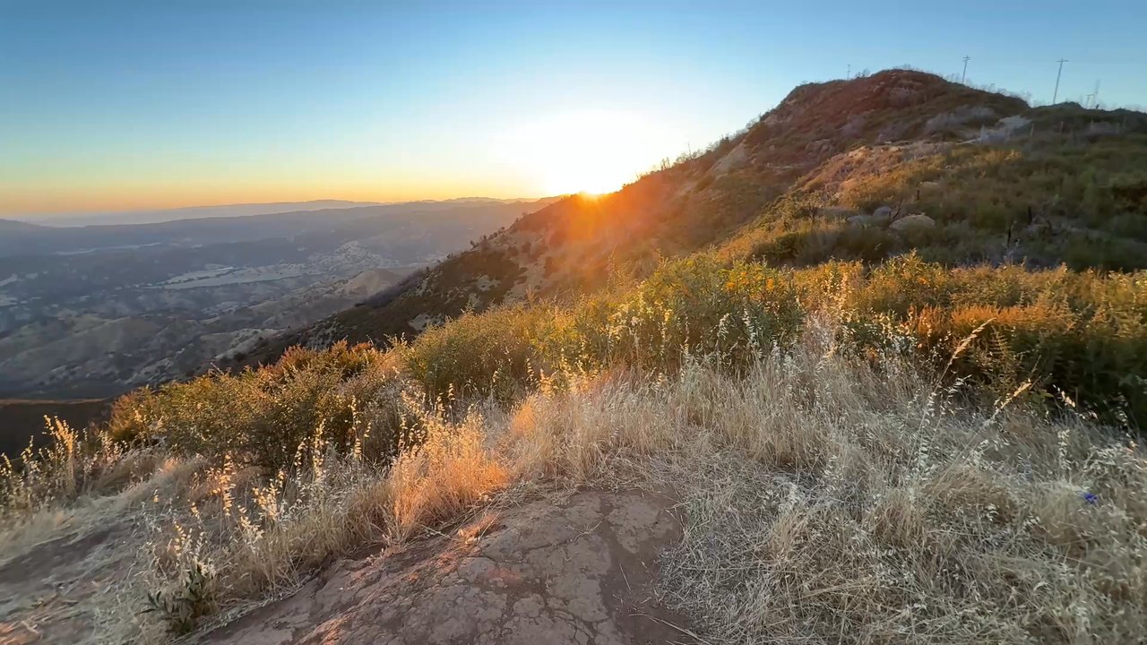
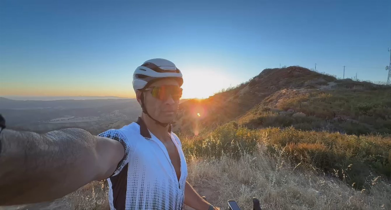
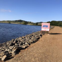
It's approximately 10 miles from Pleasant Valley Road up to Gates Canyon Peak with around 2000 feet of climbing. Towards the top, it gets pretty steep with 14% gravel road. The views are fantastic during sunset. read more
Gates Canyon Trail - Hiking Near Me
See all
Vacaville, CA 95688
Visit Website
https://trails.lacounty.gov/Trail/1717/gates-canyon-trail
Hours
What time does Gates Canyon Trail open?
What time does Gates Canyon Trail close?
Does Gates Canyon Trail have parking?
Yes, Gates Canyon Trail has parking options.
Boswell Extreme Offroad Adventure Tours and Recovery
Dreamxcape V. said: Stephen is so patient and knowledgable in what he does. The best… read more
People searched for Hiking 788 times last month within 15 miles of this business.
I recently found out about this place from a friend's Instagram story when they went. So I made…read moresure to plan a hike here for when I had time. I was able to come here in the middle of the week around noon. The GPS made this place easy to find. There is plenty of parking here at pena adobe park and lagoon valley park. The hike is located at lagoon valley park, so don't mix those up. You do have to pay $5 for parking, and the machine kiosk was broken when I went, but you can still pay through the park mobile app, which is what I did. The hike is listed as moderate, but felt borderline difficult to me (maybe I'm just out of shape). There is a lot of up hill when you first start, and because there wasn't a lot of shade combined with me going on the hottest day of the week (low 80 degrees), it did make it feel more difficult. After I parked, I was a bit confused on where to go so had to ask someone finishing up their hike for the direction. I was instructed to go up the main trail past the gate for the main trail to the lighthouse at the top. There are lots of trails here, but the one to the top of the hill is the most popular, and probably the most difficult). Once you park in the lot by the lake/pond, you cross the road to the grassy side and follow that trail to the gate that keeps the cows inside. There is another easier hike/walk your can take around the lake/pond, which is mostly flat. The views on this hike are great. Despite it being a little warmer, the breeze helped a lot. I liked the views and made it to the top after about 1 and a half hours. In total, it took me about 2 hours to finish the hike. And that's with a 20 minute break halfway going uphill. Going downhill is a lot faster. I'll be back for one of the other trails and how to bring family and friends to join.
We made a quick stop here so that I could do some birding while on a roadtrip through the area…read more What a great park! There is a great trail around the lake where you can view many waterbirds. Trees and bushes hide smaller birds and provide shade in spots. It looked like they had lots of picnic tables, playgrounds for kids etc. We were not here long, so I'm sure there was a lot more to see and do.
Hiking
Family photo
Baby swing
Moderate to Difficult hike. Big loop is ~5-mile loop with 1,300 elevation. Don't hike on warm…read moredays. VFPD.net/PIO
This is a great trail and running loop…read more Couple variations depending which way you run. Also connects with Alice chair and eagle rock. The views are great if lake berryessa and the trails can get a little technical. Make sure to watch your step. Easy to hurt yourself up on the top trail. But moderate technicals and effort 5 mile loop can usually do in 90-120 min depending how fast you want to go.
Peña Adobe Regional Park is a solid little escape when you want nature without doing the absolute…read moremost. Trails, disc golf, fishing, BBQ spots, bathrooms--it's all here--and somehow it still stays pretty quiet unless an event rolls in. It can get windy, and if you drift too close to the freeway trail, say goodbye to your peaceful moment... stick to the hills if you want the good stuff. Also, I've never personally been attacked by mosquitoes here, which feels like a glitch in the system, but I'm not questioning it. Free parking, easy layout, and enough shade to not melt. And yes, we absolutely went because it's literally our last name... felt like a family obligation. Like oh, there's a park with our name on it? Guess we own it now. Don't ask me about maintenance though. Fun fact: the park is named after Juan Felipe Peña, who built the adobe home on-site in 1842--one of the oldest surviving structures around, from when California was still under Mexican rule. It's still there, just casually outlasting everything.
This park is awesome!…read more There are clean bathrooms, picnic areas, flora and fauna, and natural shade.
Lake
Not sure why it's taken so long for me to come back to this beautiful park! I had a great hike…read moretoday, even tried a new trail! It was definitely worth it because the views at the top are amazing.
Stunning hike with a stunning landscape. You cannot go wrong. Bring sunscreen, hat, at least 2…read morewater bottles and you will have the best time. There are a number of different trails and its decently quiet. Parking is limited but you can park on the street. Small lake in the middle, we found frogs. Dog friendly!!
View
Babies
Things I like about this park: - it's halfway between the…read moreBay Area and Sacramento so it's a great place to meet friends halfway for a picnic - lots of shade from large trees - ponds with fountains providing lovely water sounds - well maintained lawn - picnic tables - lots of free street parking Things I don't like: - no bathroom - the waterfall feature isn't working - so many ants invading my space
Cute and very small park in a residential area in Suisun. There's only street parking. There's a…read morelittle stream, waterfall, and park bench to enjoy while hanging out here.
Pequeñas cascadas Suisun city
Not a bad bike trail for a suburb like Vacaville. The trail runs through a neighborhood, which is…read moregreat if you live in the same vicinity as neighborhood friends. The Napa Vine Trail and the Iron horse trail in Walnut creek are still my favorite. But Alamo is acceptable if you live in Vacaville and don't want to make the extra drive. Some parts of the trail have a slight upwards incline. May be easier to walk on all branches of the paths instead of biking up a small hill.
This a good trail. I don't quite know where the starting point is at but it is nice. Good Shaw…read morewhile running in this crazy heat!!! Not to many people walking on a mid Saturday. Cool park for the kiddos and the track is wide enough for people to pass by with problems what so ever.
Bike path (it's in the name) but fine to walk as well. Ain't no "hike."
Review gone? Who cares. Nice work jealous...
Join us on our journey to Green Valley Falls. Being the City of Vallejo's water supply, the creek…read moreand two waterfalls are closed to the public. If you want to check it out, you can sign up online for a guided tour, which only happens one or two times a year. We didn't feel like waiting, so we found our own way in... https://youtu.be/WFKupoHZrs0
Nice camp. Camp Hostess is awesome. Unfortunately the state Park rangers r lazy and well, just…read morelazy. Unbelievably loud music? They drive right by the offenders. Adjacent camp blocking access to our ADA site? Ranger doesn't care but is super hostile about parking to unload our gear, because we couldn't access the site. Visited two weeks prior to our stay. Weeds in camp were knee high. When we returned they were waist high. ZERO camp maintenance. No cleaning prior. No taking the dirt for trash. The only ranger action I witnessed was rangers standing around laughing it up. Also. The phone to the stations has been "full on f Messages" for at least 3 weeks.
Our tiny house view
Great family winery in Glen Ellen
Wine vine
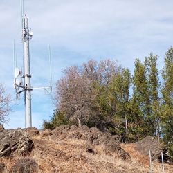
"Giant Lava Rocks--but no Lava, hardly any Volcanoes."…read more Hearing about all the lava rocks here, I just had to check it out. If there's lava rocks, there must be lava. And if there's lava, there must be volcanoes, right? This area is part of the Vacaville Open Space. The main (and only) destination is Drake's Point, which is the highest point in this vicinity. There's not a lot to see up there--just some big antennas and a crummy shed. There are several video cameras at Drake's Point. I'm pretty sure they're watching for lava flow. I was tempted to misbehave for the cameras, but I restrained myself. It would be so embarrassing to get arrested while on a hike. Anyway, you have 2 ways to see Drake's Point. There is a rocky, steep trail or a windy, easy, boring road. I took the steep way on the way up, and the gradual method on the way down. What's odd is that you have to hop a gate to access either trail. I'm pretty sure that's because of dangerous lava flow. I wore my lava-resistant Oboz hiking boots, so I was safe. The entire time I only saw one other person on my hike. There is a good reason for this--no one comes here! I'm pretty sure the other hiker was a volcanologist. It might be obvious, but keep in mind there are no restroom facilities or drinking water anywhere. So it was a disappointing hike. I just couldn't find those volcanoes. I'm pretty sure they're still up there. If you find them, could you post some photos?
This is a little hidden gem right behind the town of downtown Vacaville. The huge lava rocks are…read moretruly a sight to see. When I originally decided to visit this trail I ended up near the police station in Vacaville. After looking at the comments I realize the wrong it is actually located on Woodcrest Dr. right before Wrentham Dr. The trail is marked by a yellow gate which allows fire access for vehicles. Follow this path up and you will come to another gate on your right hand side there is a large water trough on the inside of this gate which can be used as a land-marker ( super helpful) ! Once you enter at this gate you can decide from here where you want to go. If you continue following the fire access trail you are eventually reached the top which overlooks the city of Vacaville. Its a beautiful hidden gem, totally worth my time! Definitely a good stop to bring a blanket and have a nice picnic lunch away from the busy community park
Video cameras up there, so don't do anything fishy
Old Rocky Trail map
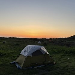
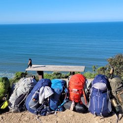
If your on the fence about backpacking this is the perfect place to try out backpacking before you…read moremake a commitment to purchase all the gear. Everything is provided and the equipment is quality! The sleeping bag kept me warm and the sleep pad kept me comfy. Even a headlamp is provided and walking poles if you desire. Dinner and breakfast were also provided. I was worried about being hungry but I never got hungry. It was fun getting to know all the women on this trip. They were all encouraging and fun to be with. Our guide Tarita did a great job helping everyone reach our destination, showing us how to set up our tents, taking lots of photos and feeding us. Overall great experience!
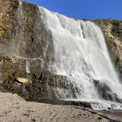
I joined about 10 wonderful ladies for an overnight backpacking trip to Alamere Falls in Point…read moreReyes with Step Into Your Journey. Tarita was an excellent leader who takes pride in teaching, supporting, educating and ensuring an appropriate pace and experience for all skill levels. She provides gear and meals for those that want and also accommodates those with their own gear at a lower price level. Looking forward to more trips with her. We had a great time and finally ww we're able to enjoy some sunshine after this very long winter!
Backpacking trip
Our group at the falls
Alamere Falls
Midnight had a blast playing tug-of-war with our eldest and fetch with mama! Fun obstacle style,…read moreoff-leash dog park with plenty of water to keep your pup hydrated! Plenty of seating too! We'll definitely be back to explore more!! SYOY! :D *Song Credit: We'll Get There Together by Kidpenny (from Audiio)
Came on 12/27/25 with my beautiful wife, lovable 8 year-old, adorable little toddler, and our…read morehandsome black tuxedo goldendoodle, Centennial Park has an area for dogs, big and small. Our handsome tuxedo doodle, is currently in the big dog section. There are plenty of balls for dogs to play with, several obstacles to navigate, and my girls to be entertained.
BEST of Vacaville, California Restaurants near Gates Canyon Trail
BEST of Vacaville, California Parks near Gates Canyon Trail
BEST of Vacaville, California Things to Do near Gates Canyon Trail
BEST of Vacaville, California Coffee near Gates Canyon Trail
BEST of Vacaville, California Swimming Holes near Gates Canyon Trail
BEST of Vacaville, California Breakfast near Gates Canyon Trail
BEST of Vacaville, California Campgrounds near Gates Canyon Trail
Swimming Holes in Vacaville, CA
Hiking Trails in Vacaville, CA
Secret Spots in Vacaville, CA
Sunrise View in Vacaville, CA
Waterfall Hike in Vacaville, CA
Fun Things to Do in Vacaville, CA
Walking Trails in Vacaville, CA
Beautiful Views in Vacaville, CA
Fishing Spots in Vacaville, CA
Running Trails in Vacaville, CA
Places to Take Pictures in Vacaville, CA
Playgrounds in Vacaville, CA
Swimming Lakes in Vacaville, CA
Rock Quarry in Vacaville, CA
Parks in Vacaville, CA
Picnic Areas in Vacaville, CA
Clay Pigeon Shooting in Vacaville, CA
Lookout Points in Vacaville, CA
Attractions in Vacaville, CA
Parks With Shade in Vacaville, CA
Handball in Vacaville, CA
Waterfront in Vacaville, CA
Sculpture Garden in Vacaville, CA
Bird Sanctuary in Vacaville, CA
Affordable Kayak Rental Services in Vacaville, California
Best Dog Hiking Trails Around Vacaville, California
Best Fishing Locations and Guides in Vacaville, California
Best Nature Trails for Hiking in Vacaville, California
Best Places for Horseback Riding in Vacaville, California
Best Sightseeing Experiences Available in Vacaville, California
Check Out Off Road Trails in Vacaville, California
Discover Dog Friendly Trails to Explore in Vacaville, California
Discover Easy Hiking Trails Near Vacaville, California
Discover Kid Friendly Hiking Trails in Vacaville, California
Discover Popular Bike Trails in Vacaville, California
Discover Scenic Mountain Bike Trails Near Vacaville, California
Discover Walking Parks in Vacaville, California Near You
Discover a Hiking Trail in Vacaville, California
Discover the Best Night Hike Trails in Vacaville, California
Dog-Friendly Hikes With Dogs in Vacaville, California
Enjoy Camping Adventures Around Vacaville, California
Enjoy Kayaking Adventures in Vacaville, California
Enjoy Off Leash Dog Hikes in Vacaville, California
Enjoy Scenic Places to Walk in Vacaville, California
Enjoy Tent Camping Spots Around Vacaville, California
Enjoy the Best Walking Path in Vacaville, California
Explore Easy Hikes Perfect for All in Vacaville, California
Explore Fun Activities to Do in Vacaville, California
Explore Popular Campgrounds Near Vacaville, California
Explore Top Dog Parks in Vacaville, California Near You
Explore the Best Beach Spots in Vacaville, California
Family Friendly Hiking With Kids in Vacaville, California
Find Top Dog Friendly Parks to Visit in Vacaville, California
Find the Best Parks for Picnics in Vacaville, California
Hiking Trails With Waterfalls in Vacaville, California
Off Leash Dog Hiking Trails in Vacaville, California
Perfect Spots to Watch Sunset in Vacaville, California
Popular Outdoor Activities to Try in Vacaville, California
Popular Picnic Spots to Visit in Vacaville, California
Popular Waterfall Hiking Trails in Vacaville, California
Safe River Swimming Areas in Vacaville, California
Safe and Fun Parks for Kids in Vacaville, California
Top Playgrounds for Kids to Enjoy in Vacaville, California
Top Swimming Spots and Pools in Vacaville, California
Top-Rated Camping Sites in Vacaville, California
Walk Dog Friendly Hiking Trails in Vacaville, California
Walk the Best Paved Walking Trails in Vacaville, California
Apple Orchards near Gates Canyon Trail
Apple Picking near Gates Canyon Trail
Archery near Gates Canyon Trail
Blow Dry Bar near Gates Canyon Trail
Corn Maze near Gates Canyon Trail
Costume Store near Gates Canyon Trail
Craft Fairs near Gates Canyon Trail
Fall Foliage near Gates Canyon Trail
Halloween Events near Gates Canyon Trail
Haunted Houses near Gates Canyon Trail
Kids Birthday Party near Gates Canyon Trail
Makeup Artists near Gates Canyon Trail
Photo Spots near Gates Canyon Trail
Pick Your Own Farms near Gates Canyon Trail
Places to Walk Around near Gates Canyon Trail
Public Shower near Gates Canyon Trail
Pumpkin Patches near Gates Canyon Trail
Scenic Night View near Gates Canyon Trail
Scenic Overlook near Gates Canyon Trail
State Parks near Gates Canyon Trail
Waterfalls near Gates Canyon Trail
Things to do in Vacaville
Brands by name
Articles by date
After an amazing weekend in Napa before a conference in San Francisco, we decided to stop at Putah…read moreCreek for a quick break in our drive. They have a series of walking trails alongside lovely nature spots. We walked to the water drainage tunnels and had a fun time sitting in the shade. This was to the left if you're coming from the parking lot. They also have a helpful map up. We didn't stay too long, but it was a fun pit stop on our drive. It was also a great place to stretch out our legs. There were parking spots available, but I didn't notice any restrooms nearby. It seems like the hikes go along a creek.
It's an awesome please with good vibes and good food. It's a place you can go with the fam.read more
I like this park because it has different levels of intensity trails from easy, moderate and…read moredifficult. It's a well kept park. There were cows vibing. Oh! And I like how there's several benches along the trails where you can vibe out and appreciate the view. Also there were picnic tables available. $5 parking, good enough parking space, Restrooms available, open from 9am-5pm Only thing I was eh about is that they don't open early enough. I wish they're open at 730 or 8 am. Overall good experience. I went in the month of January.
Special place and so grateful for all the hard work that brought this park to Solano County. The…read moretrail signs are so helpful and clear and lots of different trails to explore each visit. My first visit I did the Harmonia and Outlook trails. Good incline, challenging but not too hard, but make sure to watch your footing. Rocky and turning an ankle possible. Beautiful views. I thought the best was about halfway through Harmonia. I expected Outlook to have a better view given the name but the view was pretty obstructed. I look forward to bringing a picnic and taking my family/small kids on the all people trail that is supposed to be a smoother path. $5 to park, easy to pay with a card. Not too much shade with the table so bring a hat! Can't wait to see what it looks like when the hills are green.
It's around 17 miles from Highway 12 to the Hunter check-in station of grizzly Island Trail. There…read moreis a porta potty there, but there is no water right near the bridge. There is a restroom and water fountain. If you're biking here, it's pretty flat and windy.
It's a heterogenous mix of street and swamp and I'm here for it. It's truly a relaxing job that you…read morecan still feel an urban and rural atmosphere.
Only go in winter. No shade & no water. You got to write your own parking pass. Bring a checkbook &…read morewrite a check. If it's an event, arrive there early to ask the host if your handwritten ticket is valid & displayed properly. Be prepared for unmarked trails Go as soon as they open. If you do you might see good views & avoid the heat
Not sure how I feel about hiking at Lynch Canyon. While it is quite the open space, it seems pretty…read moredeserted. Parking is available for a $5 fee and there is a restroom located right outside the gate before you walk in. There are also a few picnic tables in the same area. We saw signs for a few different paths along the way but decided to stick to the main one since it was our first time. My favorite part was the tiny library at the entrance but the bad news is there was so much manure all along the trail that it was difficult to get around it.
We had planned to come up to Berryessa for a day of hiking, but much to our chagrin, the trail we…read morewanted to go on (Stebbins Cold Canyon) is closed until next month due to fire damage. Whatevs, let's make the most out of it. I looked up trails in the area and found this place. To reach the southern trailhead, we entered Oak Shores Park, turned left and followed signs to the northern-most parking lot at Coyote Knolls. The trailhead was by the bulletin board which has a map of the trail. We were one of the only cars in the lot, but the water in the lake is still pretty low, even with all of the rain this past winter. This trail was listed as a 2.6 mile hike (5.2 out and back) and I would classify it as easy to moderate. Just a path along (what should be) the lake. Lots of oak trees, wildflowers and groves. But the water is really low, which is kind of a bummer. Plus, when I go hiking, I like to go see a waterfall or the ocean...not just grass and trees. I guess it would have been different if the lake did not look like a bathtub mid-drain, but oh well. Also, although they say there is a spot to picnic on the trail, all we saw were some very splintery-looking old picnic tables that we didn't let the kids get on. We ate our snacks standing up in what I imagine was at one point the lake bed. We ended up getting to about 2.5 miles in and decided to turn back to conserve energy for the little ones. At the end of the trail was just another parking lot from what we were told by the other party we saw out there yesterday. All in all, I don't think we will be making the drive out here to do this trail again. If you are in the area it might be something to work in, but I don't know about making a special trip.
Andrews Park Loop Trail is a 0.5 mile trail running through down town Vacaville. Much of the trail…read moreruns along Ulatis Creek in Andrews Park. The trail does get busy at times during lunch and evening walkers but on average is a moderately trafficked trail. The trail is open year round. Pets are allowed with leashes. Unfortunately I wasn't able to walk the whole trail due to construction in the park. There are steep steps leading down to the trail. Just a note, trail is not hadicap accessible. Will return at a later date to update my review. Enjoy !
Gteat place to meet my bestie halfway between our two cities. Lovely park, clean bathrooms. A few…read morelost souls were wandering around homeless, but that seems to be the norm these days. Subtracted one star b/c for some unknown reason the lower trail is blocked off with steel slabs. It does have a brilliant playground, but we had no ankle biters with us this day! Note: be mindful of NOT leaving ANYTHING in your car to entice the "unlawful" to break into your car. And as always is a good rule, don't stow your treasures in your trunk JUST as you are leaving your parked car. ALWAYS stow items PRIOR to parking b/c the "watchers" can access trunks from breaking in. From a former crime writer I give you this valuable tip. You are welcome! Go and enjoy the outdoors wisely.
I always enjoy a hike to waterfall but it was quite disappointing that this fall was just a…read moretrickle. Though it's understandable because it is summer that the water flow is probably way better after some good rain. To get here, Google maps was help to get me to the parking lot. However, from the there i was quite confused reading others yelp or goggle reviews. Hopefully I can help those going. When driving up the hill from Napa, on the right you drive pass the Pacific Union College sign then pass by the city Angwin sign, immediately you will turn to your LEFT pass the baseball field into the gravel parking lot. From the baseball parking lot cross the street and walk along the bike path as you are walking against traffic flow. You will go back and pass the Pacific Union college sign and then you will see a bike path sign see pics. You walk on the pavement path for 6 min and then see the sign of Linda Fall preserve. See the map and the caution of the wild mushroom you should not eat. The path to the Falls is about 20 minutes in and 20 minutes out. You wil see your firstb Linda Falls sign. Then you will see a second Linda Falls sign. After the 2nd one be prepared for slippery dry dirt. You will want shoes with good grip. Soon you will be at Falls. Ther are lots of boulders to climb over to get close to the Falls. Its a small area and gets crowded. I suggest going before 11am. In my opinion age 6 and above it accurate. You will have to help kids the last 5- 10 minutes of the hike. Do not suggest infants and or in carriers. Im Glad I did this Falls hike while in Napa so I can write about and tell other people. It's a nice hike to get out with the family and friends, eat a snack or lunch at the Falls and head back. I recommend this hike just wish the beginning of the trail to get there had clear signs up.
So happy to finally be able to cross this hike off my bucket list. It was certainly worth the wait…read more It's not a long hike, but there is a little bit of climbing on rocks, especially towards the end I suggest wearing good shoes with traction The scenery along the way to the falls is lovely and changes throughout the hike. Meadows, fir trees, boulders, and ponds! We made it to the Falls on the last day of April. I would think that during the summer they wouldn't be flowing as greatly as they were now. Sitting below the falls was majestic. We also did the hike at the fork of the road, which eventually ends due to all the brush on the trail, and it was lovely as well with a beautiful pond