
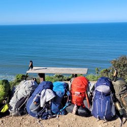
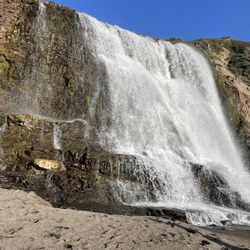
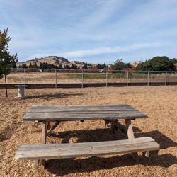
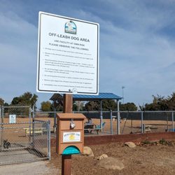
Andrews Park Loop Trail Photos


You might also consider
More like Andrews Park Loop Trail
Recommended Reviews - Andrews Park Loop Trail
Start your review...

9 years ago
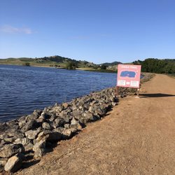
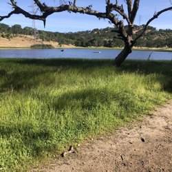
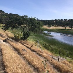
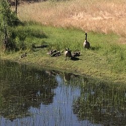
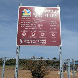
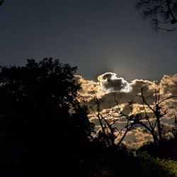
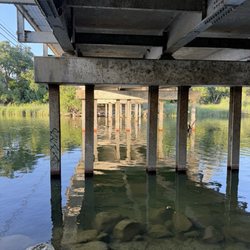
Andrews Park Loop Trail is a 0.5 mile trail running through down town Vacaville. Much of the trail runs along Ulatis Creek in Andrews Park. The trail does get busy at times during lunch and evening walkers but on average is a moderately trafficked trail. The trail is open year round. Pets are allowed with leashes. Unfortunately I wasn't able to walk the whole trail due to construction in the park. There are steep steps leading down to the trail. Just a note, trail is not hadicap accessible. Will return at a later date to update my review. Enjoy ! read more


6 years ago
More info about Andrews Park Loop Trail
614 E Monte Vista Ave
Vacaville, CA 95688
Directions
Hours
Indoor Amenities
Outdoor Amenities


Andrews Park Loop Trail - hiking - Updated July 2026
Best of Vacaville
People found Andrews Park Loop Trail by searching for…
Walking Trails in Vacaville, CA
Hiking Trails in Vacaville, CA
Running Trails in Vacaville, CA
Dog Friendly Hiking Trails in Vacaville, CA
Dog Friendly Things to Do in Vacaville, CA
Free Things to Do in Vacaville, CA
Dog Friendly Parks in Vacaville, CA
Off Leash Dog Hiking Trails in Vacaville, CA
Off Road Trails in Vacaville, CA
Things to Do Alone in Vacaville, CA
Fun Things to Do at Night in Vacaville, CA
Playgrounds for Kids in Vacaville, CA
Swimming Holes in Vacaville, CA
Trending Searches in Vacaville, CA
Blueberry Picking near Andrews Park Loop Trail
Boat Tours near Andrews Park Loop Trail
Cliff Jumping near Andrews Park Loop Trail
Cruising Spots near Andrews Park Loop Trail
Day Trips near Andrews Park Loop Trail
Dog Friendly Things To Do near Andrews Park Loop Trail
Jet Ski Rental near Andrews Park Loop Trail
Kayak Rental near Andrews Park Loop Trail
Kids Activities Indoor near Andrews Park Loop Trail
Lakes near Andrews Park Loop Trail
Off Road Trails near Andrews Park Loop Trail
Outdoor Activities near Andrews Park Loop Trail
Peach Picking near Andrews Park Loop Trail
Places To Walk Around near Andrews Park Loop Trail
Public Shower near Andrews Park Loop Trail
River Swimming near Andrews Park Loop Trail
Rock Quarry near Andrews Park Loop Trail
Scenic Night View near Andrews Park Loop Trail
Scenic Overlook near Andrews Park Loop Trail
State Parks near Andrews Park Loop Trail
Surf Shop near Andrews Park Loop Trail
Swimming Holes near Andrews Park Loop Trail
Swimming Lakes near Andrews Park Loop Trail
Things To Do On A Rainy Day near Andrews Park Loop Trail
Tubing near Andrews Park Loop Trail
Watch Sunset near Andrews Park Loop Trail
Browse Articles
Browse Nearby
BEST of Vacaville, California Coffee near Andrews Park Loop Trail
BEST of Vacaville, California Restaurants near Andrews Park Loop Trail
BEST of Vacaville, California Things to Do near Andrews Park Loop Trail
BEST of Vacaville, California Breakfast near Andrews Park Loop Trail
BEST of Vacaville, California Walking Trails near Andrews Park Loop Trail
BEST of Vacaville, California Parks near Andrews Park Loop Trail
BEST of Vacaville, California Campgrounds near Andrews Park Loop Trail
BEST of Vacaville, California Caves near Andrews Park Loop Trail
BEST of Vacaville, California Sightseeing near Andrews Park Loop Trail
Browse Brands
Related Searches in Vacaville, CA
Affordable Kayak Rental Services in Vacaville, California
Best Dog Hiking Trails Around Vacaville, California
Best Fishing Locations and Guides in Vacaville, California
Best Nature Trails for Hiking in Vacaville, California
Best Places for Horseback Riding in Vacaville, California
Best Sightseeing Experiences Available in Vacaville, California
Check Out Off Road Trails in Vacaville, California
Discover Dog Friendly Trails to Explore in Vacaville, California
Discover Easy Hiking Trails Near Vacaville, California
Discover Kid Friendly Hiking Trails in Vacaville, California
Discover Popular Bike Trails in Vacaville, California
Discover Scenic Mountain Bike Trails Near Vacaville, California
Discover Walking Parks in Vacaville, California Near You
Discover a Hiking Trail in Vacaville, California
Discover the Best Night Hike Trails in Vacaville, California
Dog-Friendly Hikes With Dogs in Vacaville, California
Enjoy Camping Adventures Around Vacaville, California
Enjoy Kayaking Adventures in Vacaville, California
Enjoy Off Leash Dog Hikes in Vacaville, California
Enjoy Scenic Places to Walk in Vacaville, California
Enjoy Tent Camping Spots Around Vacaville, California
Enjoy a Beautiful Waterfall Hike in Vacaville, California
Enjoy the Best Walking Path in Vacaville, California
Enjoy the Best Walking Trails in Vacaville, California
Explore Beautiful Parks and Green Spaces in Vacaville, California
Explore Easy Hikes Perfect for All in Vacaville, California
Explore Fun Activities to Do in Vacaville, California
Explore Popular Campgrounds Near Vacaville, California
Explore Top Dog Parks in Vacaville, California Near You
Explore the Best Beach Spots in Vacaville, California
Family Friendly Hiking With Kids in Vacaville, California
Find Top Dog Friendly Parks to Visit in Vacaville, California
Find the Best Parks for Picnics in Vacaville, California
Find the Best Playgrounds to Visit in Vacaville, California
Hiking Trails With Waterfalls in Vacaville, California
Off Leash Dog Hiking Trails in Vacaville, California
Perfect Spots to Watch Sunset in Vacaville, California
Popular Outdoor Activities to Try in Vacaville, California
Popular Picnic Spots to Visit in Vacaville, California
Popular Waterfall Hiking Trails in Vacaville, California
Safe River Swimming Areas in Vacaville, California
Safe and Fun Parks for Kids in Vacaville, California
Top Hiking Trails to Explore in Vacaville, California
Top Playgrounds for Kids to Enjoy in Vacaville, California
Top Running Trails to Explore in Vacaville, California
Top Swimming Lakes to Enjoy in Vacaville, California
Top Swimming Spots and Pools in Vacaville, California
Top-Rated Camping Sites in Vacaville, California
People who viewed Andrews Park Loop Trail also viewed
Alamo Creek Bike Trail
6 reviews
Green Valley Falls Hike
10 reviews
Grizzly Island Trail
5 reviews
Patwino Worrtla Kodoi Dihi Open Space Park
8 reviews
Lynch Canyon Open Space
21 reviews
Putah Creek
6 reviews
Gates Canyon Trail
1 review
Patwin Park
1 review
Alamo Creek Park
11 reviews
Putah Creek Riparian Reserve
11 reviews