Stebbins Cold Canyon Loop Trail Photos


More like Stebbins Cold Canyon Loop Trail
Recommended Reviews - Stebbins Cold Canyon Loop Trail
Start your review...

Reviews With Photos

This is a great trail and running loop. Couple variations depending which way you run. Also connects with Alice chair and eagle rock. The views are great if lake berryessa and the trails can get a little technical. Make sure to watch your step. Easy to hurt yourself up on the top trail. But moderate technicals and effort 5 mile loop can usually do in 90-120 min depending how fast you want to go.

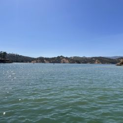
This was a great hike. People were friendly on the trails. Trail was clearly marked. We started with the steeper part first and about halfway through you can look out on berryessa and see the marina below. For next time I would bring more water and hiking poles because there were some spots that I could have benefitted from them.

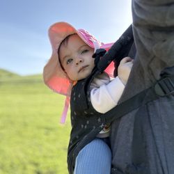
This is a great hike bc it offers beginner to more advanced trails. I took my kids (7 and 9) and we made it pretty far in but there's lots more for us to see and hike on return trips. They are super excited to come back. It gets really hot in the summer so we went early and brought lots of water.

A must hike trail in Winters, CA just maybe not in the hot summer Trails are well maintenance n marked! Flowers are bloomed around this time so go out and explore this gorgeous loop ! We always start backward for more of a steeper climb and for some extra calories burn continued on with Annie's Trail before heading down ! We hike this trail at least il couple times a year!

We went to Stebbins Cold Canyon Natural Reserve way up in Winters, CA on Sat 4/14/18. It's a 1.5hr drive from San Lorenzo, but on the way back 2hrs. There are 2 parking lots: Main parking lot which has 1 porta potty, the other parking lot is a little but up the road, they call Upper Parking Lot. Look at the graffiti art by the culverts, take your selfies, then take the Left culvert, both get to the creek, but if you are on the Right you still have to move to the Left because Trail starts on the Left side! The recommended route to me is: start at Blue Ridge Trail (Strenuous), Annie's Trail/Tuleyome Loop (strenuous), then down Homestead Trail (moderate) = 8miles. You can skip Annie's loop and just do Blue Ridge to Homestead for 5 mile loop. I didn't follow that and went up Homestead Trail and it wasn't too hard, there are lots of Stairs though. We did a short detour to see the abandoned homestead site - not much there, took a few pics and went back to the Homestead/Blue Ridge Trail. If you're short, the steps are way too high. I didn't like them at all. Then we did Tuleyome/Annie's Trail - did the loop. It's pretty tough. After the 1.25 mile marker you'll see Annie's Rock for nice stop to take pictures. The way to finish Annie's Trail loop is to go downhill, and it's all downhill for the longest time. Friend was too tired to continue going uphill on Blue Ridge Trail, so we returned on Homestead Trail. If you do both loops suppose to be 8 miles, I hope to come back in the Winter months Nov-Feb when it's dry, and no rain in the forecast. No Dogs allowed.

Stebbins Cold Canyon Loop Trail - was a nice work out, and very scenic, esp once you reached the top which over looked Lake Berryessa. I actually did the trail backwards, going up to the most scenic area first, which is about 1.5 miles up - pretty steep, but once up there, sit down, relax and enjoy. Started back up again....again going backwards....some pretty steep climbs, then finally about half way started declining. Over all the hiking was pretty strenuous, couple of the peaks, we're pretty rocky, and edgy. I started the hike around 8 am and finished around 10:30 am - temps were around 77 degrees and people were still heading up, thank god I started early. Enjoy the pictures !

If you're looking for a nice hike, or a good training spot (for my fellow terrain/Obstacle Course Racers). Then Stebbins Cold Canyon Loop Trail is the place for you. Located in Winters California (a little past woodland), Stebbins Cold Canyon Loop Trail is basically several different trails that at various points connect together. And that differ in level of difficulty and distance (Homestead Trail alone: 4 mi round trip, Blue Ridge Trail meets Homestead Trail to make a loop: 5 mi round trip, Annie's Trail: 2.75 mi). When combing two or more trails, your possible 5 mile round trip hike (or run) will turn into almost 7 or 8; so be mindful of that. I must have driven past the main area everyone talks about, but did see the resort, but kept driving. I ended up coming up to a smaller gravel parking area where I saw about 10 cars so I decided to pull in there to start my trail training session. Where I entered you could do either do the shorter Annie's trail or Homestead Trail, which would end up leading you to Blue Ridge trail. As I made my way on the beginning of my run I had to traverse through a rock bed full of huge rocks; bolders basically, but that's also because I chose to divert from the main trail going out. I ended up getting back on the trail now long after though and made my way to two huge tunnels which was kinda cool, my friend told me to expect them as she'd gone hiking here with some friends about two weeks earlier. When you see them it's like which one do you chose? Door #1 or door #2...I just chose #1, ran about 50 meters through the darkness and into the light at the end and continued on with my run. Slowly at first you make your way through the trail and gradually go up the hillside...at first. There was the occasional batch of stairs built into the trail and hillside, and then you come to a fork in the road where you can go left and continue on Annie's trail I believe. Or you can go right and make your way up Homestead trail and up the steeper climb of the mountainside. I chose Homestead trail and the more difficult climb. Before the major climb you weave in and out of narrow trails with multiple twists and turns, while having to duck under so some low level branches and even a large tree that had come down over the path. And after all of that THEN you begin the steep climb of endless steps....and I mean endless. I am very familiar with various hiking/outdoor terrains for my terrain training, and running various terrain races throughout the state in several cities to include Sacramento, Monterey, Temecula, Patterson, Pala, Plesanton, and Tahoe. And at various distance to include almost 15miles. And this little course with the steep stair climb, was a good cardio and endurance tester. My advice would be definitely bring plenty of water even though it's not a really long group of trails. More so because of the possible depending on the time of year, and time of day. And because the course does become a little more intense depending on what trail(s) you choose. I ended up bring my 70oz. Camelback with me, and added electrolyte tablets to it to replace the salt I'd losing from sweating while running. Also bring some energy/protein bars to regain calories to maintain your energy levels. Also bring sunscreen as many have mentioned there is very little shade on these trails, and you want to avoid sunburn and possible heat exhaustion or worse. People get heat stroke out here all the time according to the signs and have to be rescued. OVERALL: Great group of trails, nice scenery at time. Very sunny and out in the open so sweat sunscreen, and bring a sufficient amount of water for your activity level. And for the amount of time that you plan on being out on the trails!

Awesome hike. Fun, pretty challenging, and super rewarding. PARKING: There is a lot and if that's full, another lot up the road. BATHROOM: Port-a-potty located at the first lot. TRAILS: Clearly marked. AESTHETIC VALUE: Sky high. The views of Lake Berryessa are stunning. As others have mentioned, the trails start off via drainage pipe. That's a pretty cool spot for photos. DOGS: Only allowed on some trails. WATER: Stock up, especially in the summer. You're exposed for a while on the peak. SUNSCREEN: See previous entry. SHOES: Make sure you've got hiking shoes with good grip. We did the Blue Ridge Trail to the peak and then took the Homestead Trail down. About 5 miles. It was a bit of a tough climb at some spots but fun as hell. You can take the Blue Ridge Trail up and back down or do the same with the Homestead Trail. I recommend the loop though for the best experience with the most changes of scenery.

Be prepared to lose signal on your way here. We lost our friends because their GPS led them to another area, and we couldn't contact them! If you plan on going with a group of people, trail behind each other!! Long story short, we found them by using a phone booth nearby, and luckily they turned back to where there was still signal. Parking lot for this is really easy to miss. If you drive a bit more, there is another parking lot next to the road. You can also park there. LOVE how there were arrows to guide you along the way in the beginning. It can be a bit confusing without a clear pathway, so it is helpful to have a guide. This is a REAAALL hike! 10 minutes in, it gets very steep, very rocky and lizards were all over the place! We were already tired, but we did not want to give up. The weather was nice anyway-- sunny, but nice breeze of wind. It's surprising to actually hear the gust of wind, it sounds like a running river! We climbed for about an hour and a half. It was sooo worth it!!! The view was beautiful. It was nice going up as you see the mountains and trees, but seeing a body of water after all the hike is phenomenal. It took us about 30 mins to get down. There are some shortcuts you can take, but be very careful because they are really steep. It cuts down a lot on the time though. Overall: Would go again. One of the best hikes I have ever experienced! TIP: Take a picture of the map they have in the beginning so you have something to go back to halfway up. They stop putting the arrows at one point!

My favorite hike thus far! So many beautiful and interesting sights to take in. Definitely start the hike early! At the top of the hill, there is nearly no shade. We went on a perfect overcast spring day and didn't suffer from the heat, but if our hike took place during summer or the middle of the day , I would have been one unhappy hiker ! I would rate this hike as moderate to easy . It's about 5 miles round trip, give or take a few steps. There are definitely parts of the trail where you are climbing in challenging elevation, but nothing crazy, and because it's a loop , once you get to the top of the highest point , it's all down hill back to the little parking lot. I loved being so close to the running creek besides the trail or sometimes the trail was the creek ! Make sure you have some water resistant hiking shoes because your bound to get a little wet at the bottom of the loop and walking thru the cool tunnels . Besides the cool running water beds , I enjoyed navigating the rustic steps and boulders on the trail. There's enough variations on the trial to keep it interesting and fun for the four hours plus it took us to do the entire loop. Only bummer is that there are multiple signs saying no dogs allowed. That being said , we saw at least a dozen hikers with their loyal four legged companions! I think the reason for no dogs is that there are so many narrow parts of the trial that are rugged due to rock formations . So perhaps for safety reasons , dogs are formally not allowed. Thankfully the no dogs allowed policy does not seem to be enforced, and everyone we encountered were cool and dog lovers themselves . So if you have an active, agile, friendly dog, I think this hike is just fine for fido. I do know that there is trial close by this particular loop , where they do allow dogs, if you're a stickler for rules. Fairly easy to find the trail head. There is a small parking lot with one porta-potty available. We also saw a lot of cars parked along the side of the road. Bring water , snacks, sunscreen, and have a blast enjoying the great outdoors!

If you're looking for a great workout, this hike is for you! There are signs to direct you to the trailheads, and trails are marked along the way so you know how far you've hiked. Parking is free, and there is a main car lot and an upper car lot. Both lead you to the trail head (signs are marked). You first meet a sign that says welcome to Stebbins Cold Canyon Reserve with maps of the area. Then you walk through a water tunnel (which is completely dry during the summer), meet some rocks, then more signs for the trail head. There's a fork in the road where you can choose to start with Homestead Trail or Blue Ridge Trail, both of which have access to Annie's Trail. Breakdown of the distances: Homestead Trail alone: 4 mi round trip Blue Ridge Trail meets Homestead Trail to make a loop: 5 mi round trip Annie's Trail: 2.75 mi You can access Annie's Trail by starting with either Homestead or Blue Ridge, but I'd recommend doing Homestead/Annie in one day (6.75 mi) or Blue Ridge/Homestead: 5 mi just because you have to account for climbing uphill (in Annie's Trail and Blue Ridge. If you decide to do all 3, it'll be about 7.75 mi. Whichever trail you take, you're definitely going to get a great workout and a great view of Lake Berryessa and the mountains at the top! If you're taking Annie's Trail, I recommend stopping by Annie's Rock (very short walk from the path and it's labeled so you'll have no problem finding it). You can take a break on the rocks and soak in the view. My bf and I brought sandwiches so we had our food and picture break. I recommend lots of water (I brought 32 oz water bottle and a 21 oz hydroflask) and my boyfriend brought 48 oz (lol we didn't wanna dehydrate). For Blue Ridge/Homestead, I didn't drink all my water, but for Annie's/Homestead, we actually drank all our water. It was pretty hot so I'd also recommend starting early. The uphill climb for Annie's burned a little more for me than the Blue Ridge Trail's uphill. On Annie's Trail, at the end, there is a fork in the road where you see a gate with a "No Trespassing" sign in the distance or a trail to your left. The sign is leaned over a bit, so one guy ahead of us actually thought he hit a dead end and turned back, but no, Annie's is a loop! Take the trail to your left.. unless you wanna see what's behind the fence like I did. (It's just more land with a sign that says UC Davis trail ends here. No Trespassing.. Private property.) What I don't recommend: doing legs at the gym the day before this hike. Okay, now that you've read this review and mentally prepared yourself, go have a great workout!!

I wanted to die, no lie. I've done this 5k trail numerous times but not since the fire that occurred and they blocked off the two gates (entry). It doesn't get easier, but it's the most challenging hikes I've been to because I hate steep inclines. To start you begin at the trail that leads you through the tunnel of running water. To see a quicker view, once you get out of the tunnel go left up the rocks, then proceed right and then make another right downwards and cross over the stream to begin your Frodo journey. Be prepared--straight steep inclines to the top and barely any shade. Go early in the am, like before 7. Since the fire, less trees means less shade. About 1.5 miles up, you'll see Lake Berryessa-- just soak up the wind, the view, eat, and chill. You can keep going up and down i believe 2-3 more peaks, then down the 300+ steps of stairs (I've started that way before, and wanted to quit, so imagine no shade up, NO thanks) and it should loop you back to the parking lot. I, however, did not do that today. I decided to keep it to 3 miles. To the left, there was ALOT of burnt trees, so I don't know how it is now. Tips--Sunblock. I didn't wear any besides what was already in my makeup foundation. You'll need it. And ladies don't be that girl with a dolled up face. Your makeup will melt. H2O. Hydroflask. My favorite thing in the world when hiking is a hydroflask. Iced water throughout the journey. Go to the bathroom prior. There is one in the parking lot, but seriously disgusting. Stop by a gas station. Eat something prior. I forget to. So bring protein bars and snacks.

10 months ago
Moderate to Difficult hike. Big loop is ~5-mile loop with 1,300 elevation. Don't hike on warm days. VFPD.net/PIO read more


1 year ago


This is a great trail and running loop. Couple variations depending which way you run. Also connects with Alice chair and eagle rock. The views are great if lake berryessa and the trails can get a little technical. Make sure to watch your step. Easy to hurt yourself up on the top trail. But moderate technicals and effort 5 mile loop can usually do in 90-120 min depending how fast you want to go. read more


4 years ago
This was a great hike. People were friendly on the trails. Trail was clearly marked. We started with the steeper part first and about halfway through you can look out on berryessa and see the marina below. For next time I would bring more water and hiking poles because there were some spots that I could have benefitted from them. read more


11 months ago
This is a great hike bc it offers beginner to more advanced trails. I took my kids (7 and 9) and we made it pretty far in but there's lots more for us to see and hike on return trips. They are super excited to come back. It gets really hot in the summer so we went early and brought lots of water. read more


A must hike trail in Winters, CA just maybe not in the hot summer Trails are well maintenance n marked! Flowers are bloomed around this time so go out and explore this gorgeous loop ! We always start backward for more of a steeper climb and for some extra calories burn continued on with Annie's Trail before heading down ! We hike this trail at least il couple times a year! read more


We went to Stebbins Cold Canyon Natural Reserve way up in Winters, CA on Sat 4/14/18. It's a 1.5hr drive from San Lorenzo, but on the way back 2hrs. There are 2 parking lots: Main parking lot which has 1 porta potty, the other parking lot is a little but up the road, they call Upper Parking Lot. Look at the graffiti art by the culverts, take your selfies, then take the Left culvert, both get to the creek, but if you are on the Right you still have to move to the Left because Trail starts on the Left side! The recommended route to me is: start at Blue Ridge Trail (Strenuous), Annie's Trail/Tuleyome Loop (strenuous), then down Homestead Trail (moderate) = 8miles. You can skip Annie's loop and just do Blue Ridge to Homestead for 5 mile loop. I didn't follow that and went up Homestead Trail and it wasn't too hard, there are lots of Stairs though. We did a short detour to see the abandoned homestead site - not much there, took a few pics and went back to the Homestead/Blue Ridge Trail. If you're short, the steps are way too high. I didn't like them at all. Then we did Tuleyome/Annie's Trail - did the loop. It's pretty tough. After the 1.25 mile marker you'll see Annie's Rock for nice stop to take pictures. The way to finish Annie's Trail loop is to go downhill, and it's all downhill for the longest time. Friend was too tired to continue going uphill on Blue Ridge Trail, so we returned on Homestead Trail. If you do both loops suppose to be 8 miles, I hope to come back in the Winter months Nov-Feb when it's dry, and no rain in the forecast. No Dogs allowed. read more


6 years ago
Stebbins Cold Canyon Loop Trail - was a nice work out, and very scenic, esp once you reached the top which over looked Lake Berryessa. I actually did the trail backwards, going up to the most scenic area first, which is about 1.5 miles up - pretty steep, but once up there, sit down, relax and enjoy. Started back up again....again going backwards....some pretty steep climbs, then finally about half way started declining. Over all the hiking was pretty strenuous, couple of the peaks, we're pretty rocky, and edgy. I started the hike around 8 am and finished around 10:30 am - temps were around 77 degrees and people were still heading up, thank god I started early. Enjoy the pictures ! read more


If you're looking for a nice hike, or a good training spot (for my fellow terrain/Obstacle Course Racers). Then Stebbins Cold Canyon Loop Trail is the place for you. Located in Winters California (a little past woodland), Stebbins Cold Canyon Loop Trail is basically several different trails that at various points connect together. And that differ in level of difficulty and distance (Homestead Trail alone: 4 mi round trip, Blue Ridge Trail meets Homestead Trail to make a loop: 5 mi round trip, Annie's Trail: 2.75 mi). When combing two or more trails, your possible 5 mile round trip hike (or run) will turn into almost 7 or 8; so be mindful of that. I must have driven past the main area everyone talks about, but did see the resort, but kept driving. I ended up coming up to a smaller gravel parking area where I saw about 10 cars so I decided to pull in there to start my trail training session. Where I entered you could do either do the shorter Annie's trail or Homestead Trail, which would end up leading you to Blue Ridge trail. As I made my way on the beginning of my run I had to traverse through a rock bed full of huge rocks; bolders basically, but that's also because I chose to divert from the main trail going out. I ended up getting back on the trail now long after though and made my way to two huge tunnels which was kinda cool, my friend told me to expect them as she'd gone hiking here with some friends about two weeks earlier. When you see them it's like which one do you chose? Door #1 or door #2...I just chose #1, ran about 50 meters through the darkness and into the light at the end and continued on with my run. Slowly at first you make your way through the trail and gradually go up the hillside...at first. There was the occasional batch of stairs built into the trail and hillside, and then you come to a fork in the road where you can go left and continue on Annie's trail I believe. Or you can go right and make your way up Homestead trail and up the steeper climb of the mountainside. I chose Homestead trail and the more difficult climb. Before the major climb you weave in and out of narrow trails with multiple twists and turns, while having to duck under so some low level branches and even a large tree that had come down over the path. And after all of that THEN you begin the steep climb of endless steps....and I mean endless. I am very familiar with various hiking/outdoor terrains for my terrain training, and running various terrain races throughout the state in several cities to include Sacramento, Monterey, Temecula, Patterson, Pala, Plesanton, and Tahoe. And at various distance to include almost 15miles. And this little course with the steep stair climb, was a good cardio and endurance tester. My advice would be definitely bring plenty of water even though it's not a really long group of trails. More so because of the possible depending on the time of year, and time of day. And because the course does become a little more intense depending on what trail(s) you choose. I ended up bring my 70oz. Camelback with me, and added electrolyte tablets to it to replace the salt I'd losing from sweating while running. Also bring some energy/protein bars to regain calories to maintain your energy levels. Also bring sunscreen as many have mentioned there is very little shade on these trails, and you want to avoid sunburn and possible heat exhaustion or worse. People get heat stroke out here all the time according to the signs and have to be rescued. OVERALL: Great group of trails, nice scenery at time. Very sunny and out in the open so sweat sunscreen, and bring a sufficient amount of water for your activity level. And for the amount of time that you plan on being out on the trails! read more


8 years ago
View at the end is beautiful but the hike in is long and not very scenic. If it's warm out, be sure to bring a bunch of water. From the parking lot, it's approx 2.5 miles to the view at the end. PARKING: arrive early because the parking is very limited and this hike is pretty popular. read more


Awesome hike. Fun, pretty challenging, and super rewarding. PARKING: There is a lot and if that's full, another lot up the road. BATHROOM: Port-a-potty located at the first lot. TRAILS: Clearly marked. AESTHETIC VALUE: Sky high. The views of Lake Berryessa are stunning. As others have mentioned, the trails start off via drainage pipe. That's a pretty cool spot for photos. DOGS: Only allowed on some trails. WATER: Stock up, especially in the summer. You're exposed for a while on the peak. SUNSCREEN: See previous entry. SHOES: Make sure you've got hiking shoes with good grip. We did the Blue Ridge Trail to the peak and then took the Homestead Trail down. About 5 miles. It was a bit of a tough climb at some spots but fun as hell. You can take the Blue Ridge Trail up and back down or do the same with the Homestead Trail. I recommend the loop though for the best experience with the most changes of scenery. read more


9 years ago
Be prepared to lose signal on your way here. We lost our friends because their GPS led them to another area, and we couldn't contact them! If you plan on going with a group of people, trail behind each other!! Long story short, we found them by using a phone booth nearby, and luckily they turned back to where there was still signal. Parking lot for this is really easy to miss. If you drive a bit more, there is another parking lot next to the road. You can also park there. LOVE how there were arrows to guide you along the way in the beginning. It can be a bit confusing without a clear pathway, so it is helpful to have a guide. This is a REAAALL hike! 10 minutes in, it gets very steep, very rocky and lizards were all over the place! We were already tired, but we did not want to give up. The weather was nice anyway-- sunny, but nice breeze of wind. It's surprising to actually hear the gust of wind, it sounds like a running river! We climbed for about an hour and a half. It was sooo worth it!!! The view was beautiful. It was nice going up as you see the mountains and trees, but seeing a body of water after all the hike is phenomenal. It took us about 30 mins to get down. There are some shortcuts you can take, but be very careful because they are really steep. It cuts down a lot on the time though. Overall: Would go again. One of the best hikes I have ever experienced! TIP: Take a picture of the map they have in the beginning so you have something to go back to halfway up. They stop putting the arrows at one point! read more

My favorite hike thus far! So many beautiful and interesting sights to take in. Definitely start the hike early! At the top of the hill, there is nearly no shade. We went on a perfect overcast spring day and didn't suffer from the heat, but if our hike took place during summer or the middle of the day , I would have been one unhappy hiker ! I would rate this hike as moderate to easy . It's about 5 miles round trip, give or take a few steps. There are definitely parts of the trail where you are climbing in challenging elevation, but nothing crazy, and because it's a loop , once you get to the top of the highest point , it's all down hill back to the little parking lot. I loved being so close to the running creek besides the trail or sometimes the trail was the creek ! Make sure you have some water resistant hiking shoes because your bound to get a little wet at the bottom of the loop and walking thru the cool tunnels . Besides the cool running water beds , I enjoyed navigating the rustic steps and boulders on the trail. There's enough variations on the trial to keep it interesting and fun for the four hours plus it took us to do the entire loop. Only bummer is that there are multiple signs saying no dogs allowed. That being said , we saw at least a dozen hikers with their loyal four legged companions! I think the reason for no dogs is that there are so many narrow parts of the trial that are rugged due to rock formations . So perhaps for safety reasons , dogs are formally not allowed. Thankfully the no dogs allowed policy does not seem to be enforced, and everyone we encountered were cool and dog lovers themselves . So if you have an active, agile, friendly dog, I think this hike is just fine for fido. I do know that there is trial close by this particular loop , where they do allow dogs, if you're a stickler for rules. Fairly easy to find the trail head. There is a small parking lot with one porta-potty available. We also saw a lot of cars parked along the side of the road. Bring water , snacks, sunscreen, and have a blast enjoying the great outdoors! read more


If you're looking for a great workout, this hike is for you! There are signs to direct you to the trailheads, and trails are marked along the way so you know how far you've hiked. Parking is free, and there is a main car lot and an upper car lot. Both lead you to the trail head (signs are marked). You first meet a sign that says welcome to Stebbins Cold Canyon Reserve with maps of the area. Then you walk through a water tunnel (which is completely dry during the summer), meet some rocks, then more signs for the trail head. There's a fork in the road where you can choose to start with Homestead Trail or Blue Ridge Trail, both of which have access to Annie's Trail. Breakdown of the distances: Homestead Trail alone: 4 mi round trip Blue Ridge Trail meets Homestead Trail to make a loop: 5 mi round trip Annie's Trail: 2.75 mi You can access Annie's Trail by starting with either Homestead or Blue Ridge, but I'd recommend doing Homestead/Annie in one day (6.75 mi) or Blue Ridge/Homestead: 5 mi just because you have to account for climbing uphill (in Annie's Trail and Blue Ridge. If you decide to do all 3, it'll be about 7.75 mi. Whichever trail you take, you're definitely going to get a great workout and a great view of Lake Berryessa and the mountains at the top! If you're taking Annie's Trail, I recommend stopping by Annie's Rock (very short walk from the path and it's labeled so you'll have no problem finding it). You can take a break on the rocks and soak in the view. My bf and I brought sandwiches so we had our food and picture break. I recommend lots of water (I brought 32 oz water bottle and a 21 oz hydroflask) and my boyfriend brought 48 oz (lol we didn't wanna dehydrate). For Blue Ridge/Homestead, I didn't drink all my water, but for Annie's/Homestead, we actually drank all our water. It was pretty hot so I'd also recommend starting early. The uphill climb for Annie's burned a little more for me than the Blue Ridge Trail's uphill. On Annie's Trail, at the end, there is a fork in the road where you see a gate with a "No Trespassing" sign in the distance or a trail to your left. The sign is leaned over a bit, so one guy ahead of us actually thought he hit a dead end and turned back, but no, Annie's is a loop! Take the trail to your left.. unless you wanna see what's behind the fence like I did. (It's just more land with a sign that says UC Davis trail ends here. No Trespassing.. Private property.) What I don't recommend: doing legs at the gym the day before this hike. Okay, now that you've read this review and mentally prepared yourself, go have a great workout!! read more


I wanted to die, no lie. I've done this 5k trail numerous times but not since the fire that occurred and they blocked off the two gates (entry). It doesn't get easier, but it's the most challenging hikes I've been to because I hate steep inclines. To start you begin at the trail that leads you through the tunnel of running water. To see a quicker view, once you get out of the tunnel go left up the rocks, then proceed right and then make another right downwards and cross over the stream to begin your Frodo journey. Be prepared--straight steep inclines to the top and barely any shade. Go early in the am, like before 7. Since the fire, less trees means less shade. About 1.5 miles up, you'll see Lake Berryessa-- just soak up the wind, the view, eat, and chill. You can keep going up and down i believe 2-3 more peaks, then down the 300+ steps of stairs (I've started that way before, and wanted to quit, so imagine no shade up, NO thanks) and it should loop you back to the parking lot. I, however, did not do that today. I decided to keep it to 3 miles. To the left, there was ALOT of burnt trees, so I don't know how it is now. Tips--Sunblock. I didn't wear any besides what was already in my makeup foundation. You'll need it. And ladies don't be that girl with a dolled up face. Your makeup will melt. H2O. Hydroflask. My favorite thing in the world when hiking is a hydroflask. Iced water throughout the journey. Go to the bathroom prior. There is one in the parking lot, but seriously disgusting. Stop by a gas station. Eat something prior. I forget to. So bring protein bars and snacks. read more


Great hiking trails. The main trail (Homestead and Blue Ridge) is a 5 mile loop. There is a 2nd trail (Annie's trail) that is an additional 2.75 miles if you decide to go. Scenery was nice - natural and refreshing from the everyday crazy life that we live in. I go there to escape from reality and to enjoy the peacefulness. There's quite a lot of rocks and steep areas so bring good hiking shoes. No water fountains anywhere so bring at least 1 liter of water with you. More if you're going on Annie's trail. Only one port-a-potty at the parking lot area; there are none once you go into the trails, so better have a good bladder or time for adult diapers (just kidding). Level of difficulty: Difficult (not for beginners) Signs say No Dogs allowed but I always see people bring their dogs. Just use your brain to determine if it's really safe for your dog and be responsible and clean after it. No littering. Let's keep the forest preserved. Update - returned again and hiked the Annie's trail in addition to the 5 mile Homestead-Blue ridge loop. It's a total of 8 miles (closer to 9 if you count the hike from the parking lot). Whoawee, what a workout. Tips for Annie's trail - it is not an easy hike. I recommend it only for athletes or experienced hikers, not families with kids and elderly. There are very steep, narrow areas and they don't have wooden stairs/planks (like they do on the main Homestead-Blue ridge trails) to make it safer/easier to ascend/descend. I found myself having to grab onto tree branches and trunks to haul myself from time-to-time. Also, I recommend wearing long sleeves and pants/leggings since this trail has a lot of tree branches/shrubs/bushes covering the trail. If you wear shorts, be prepared to get cuts and scrapes from mother nature (fair warning). There's also a fair amount of poison oak on this trail. read more


Update for S/S 2016: Trails are finally reopened after long closure due to last summer's Wragg Fire that scorched a significant portion of the trail. The entrance to the trail has been moved directly below the old parking and there is also a new parking lot that gives easier access than before. What this means is that there is no need to cross the 128 highway any longer and that is a good thing. A not so good thing is that fire obliterated that little shade from the trees the trail had, and now it is about 80% bare, especially near the top where the grades are the steepest. Last time I actually saw a couple of snakes as well so watch your step and be prepared. Carry double the water that you think you need. What hasn't changed at all is the view: Stebbins is one of the best hikes in the area...It doesn't take too long to complete, but it is still challenging enough to leave you gasping for air at times. Huge thanks for UCD and all the volunteers for working on the trails and having them re-opened for us. We surely missed it during the closure! read more


I've done this loop two times. I did it a third time yesterday but I went about it counterclockwise and went back down the same way once I reached the top. If you want a chill and relaxing hike, do it this way but you probably won't break a sweat if you do cardio regularly. For a strenuous but great workout, I recommend you doing the trail clockwise! The beginning is a lot of going up on various inclines and mostly stairs but you get a great legs workout! Bring a walking stick or hiking sticks to help you with going up! It'll make the going up a lot easier! Once you get to the top, there are two little peaks that you'll have to climb up then down on. The first two times I did this hike, I got painful cramps in each calf right at the peaks! I was a bit traumatized from this but if you prepare well enough, this can be avoided! The views are amazing at the top and it's just peaceful and so serene! It's so worth it! I was a bit sad when I went back and I saw a lot of burnt and charred trees from the fire a couple of years ago. Overall it's a beautiful hike! Very well taken care of!!! Very clean! Some tips are to eat lots of bananas and do cardio the week before you plan to go, bring water but keep your backpack light, bring a sandwich to enjoy at the top, and a walking stick or hiking sticks is a must for a pleasant experience! read more


7 years ago
Very peaceful hiking trail. There's a couple different trail options depending on what kind of scenery you're more interested in. The reason for four stars is that it is not a casual easy "hike." Often I think people say hike but what they mean is trail. In this case it's definitely more of a hike! It'se moderate to difficult with inclines, slippery stones, and some mud depending on the season. If you take the main trail over looking the lake (sorry I forget the names!) There is no shade as it passes the more forest area for a high rise view of the lake. Make sure to bring water! Gallon at least if you plan to do the whole trail as there is no fountains. Nothing but nature here! ;) Also there's only one portable bathroom where you can park, but otherwise that's it. Just you and some nature. Overall it's a good hike, I came here to practice some mindfulness and get away from the city. Just be sure to come with a good hat, sun block, water, and some good shoes and you'll do fine. I'd rate it as a moderate hike, and the view was beautiful. read more


3 years ago
I have done a 10 mile hike before so naturally when my friend invited for a 5 mile hike here, I agreed. Easy right? Hike was much more difficult as it has a big incline up that seems to go on forever. Passed by lots of other hikers and such. Very pleasant. Trails are fairly easy to see and didn't get lost. The views up top are amazing. Lake and mountains. Seems to be a very popular spot. Definitely wouldn't mind going again. read more


6 years ago
Pretty cool hidden gem of a hike. About an hour or so from west sac. I highly recommended starting across the street from the bigger parking lot. This will kick your a#* the first mile or so but you get far more views in front of you vs starting near the big parking lot going right into the tunnel. We made that mistake so although their were legit views, not so much of the lake unless we stopped/turned around. read more

9 years ago
Only a short 20-25 minute drive from Davis and plenty of parking if you go on a weekday morning. Better yet... wake up at early and start hiking by 5am to catch the sunrise over the lake and be back home in time for a nice, warm shower before your 9am discussion. My favorite times to hike this trail would probably be during the cool temperatures in Spring and early Fall. The trail itself goes through so many different areas that it might seem never ending, but make sure you stop enough to look around you and take in the scenery. The trail is pretty well marked and shady, but this doesn't give you an excuse to not use sunscreen and big spray. Trust me when I say you do NOT want to be standing or sitting idly in one spot for too long unless if you want to be mosquito food. Bring plenty of water and some snacks along the way to keep you energized and don't forget to pick up after yourself. I haven't seen any stray wrappers so please continue to keep the path clean for everyone else! read more


12 years ago
If you're looking for a Challenge this is the place, highly recommend to not take kids with you, at least not on the no dog zone BlueRidge 5mile loop its very dangerous ---so now prep and go. After this adventure, hiking boots are on my list for future hikes. *Great link for more info:http://nrs.ucdavis.edu/Stebbins/visitor/hiking.html and http://on.wsj.com/1mvh2iR Tip: Pack enough snacks, water, Gatorade, coconut water etc... protein bars fruits, trail mix , beef jerky... Bring frozen water it will melt and stay cool to quench your thirst. Go Early start hike not later than 9am, I'm speaking fm experience. We hiked in the heat on May 24th,2014. Parking gets full so that shld mk you want to leave Early. leave an ice filled cooler in your car filled with extra water/food, you'll need it after the long 5mile hike. (btw, this was my 1st real Hike) & pls be careful crossing the streets, Cars speed there & I do not recall seeing warning signs to slow down for pedestrians. read more


10 years ago
APRIL UPDATE*** I'm so sad my favorite trail has been closed. Some person decided to bring a gun here. Gosh darn it!!! I hope it opens back up again soon:( read more

9 years ago
If you love to hike/explore and you're in the Sacramento area, this is a must see! My cousin and her BF took us on this Sunday hike as part of our cousins hiking club. She said it was a moderate hike and we'd follow it up with some local brews. SOLD! We arrived and parked in the lot at the bottom of the hill. There's a port-a-potty there, and for being in the woods, it's really clean! We had no problem finding parking, but it was a "chance of rain" Sunday. Hike starts approaching Homestead/Blue Ridge Trail. You walk through a huge water drainage pipe to get to the trailhead. When the water is too high, you can walk around to the trail head instead, but we opted to go through as it's way more fun. There was a huge fire here in 2015, and the land is still recovering. There's lush greens and wildflowers thanks to 2016's huge winter storms, but there's no longer any shade on the hike, and you see the charred trees all along the way, with new growth happening around them. It looks pretty awesome. We went the "moderate" route of Homestead Loop and had a delicious packed lunch at the peak, where it becomes Blue Ridge Loop. Since it was still early and we were refreshed from our break, we decided to finish the loop and do the "strenuous" Blue Ridge Loop to return to the parking lot instead of going back the way we had come. I was so glad! It was indeed harder than Homestead because of the rolling hills, but it was so worth it! You walk ON mountain ridges with Lake Berryessa to the left and lush hillsides to the right. It's an amazing view! And going down the rolling hills was way easier than it would have been going up! There's another Annie's Loop in the back, but we didn't get to it. Overall, the 5 mile loop took us 5 hours (including our breaks and lunch). It was strenuous but not impossible, and we were all so glad we did it! And on the drive back to Sacramento, you pass by (and should stop at) the local Berryessa Gap Winery/Berryessa Brewing Company for some food truck goodies and a flight of the best local wine. Perfect sunday funday hike! read more


14 years ago
I love hiking and was searching for a hiking spot around the Woodland area when I came across this place! So happy to learn that there IS a trail only 30 minutes away from Woodland and with inclines! :) I found the 3 previous reviews to be very useful, but I have a few additional tips of my own. We couldn't find the entrance, so we actually started on the right side looking from the street (see picture I posted). This happens to be the end of the trail, but I was happy to have taken it because in my opinion it was easier going up on this side. That brings me to another thought, I recommend going past 3pm because for the most part you will be in shade (exception: when you reach the top and hike along the top to later go back down). We hardly got any direct sunlight even though there was plenty of light. We were all perfectly fine with 1 liter of water and only encountered 2 lizards (maybe because we used sticks to make noise along the way?). Working backwards: the uphill was easy to do (we were of all different hiking levels), once you get to the top of the ridge you will be jumping on many rocks and it will look like you've taken the wrong turn because it is hard to decipher a trail until you get off of them for the small pockets of non-rocks, the downhill had many wooden steps made out for you because it is quite steep. Many steep areas will have loose dirt so hiking boots recommended to avoid sliding and coming home with brown socks. The lower trail will be mostly flat. The signs for mileage will read 3.25, 3.50, etc. but there are frankly not enough signs or arrows giving you confirmation that you are on the proper trail. Follow your instinct and you will be fine. Overall, I was highly impressed to learn that this is a UC Davis Natural Reserve. Nicely maintained, wide and nicely groomed paths, very shaded (if going once the sun is west of the ridge), and great views. I will definitely hike at Stebbins again! read more
. - Hiking Near Me - Winters, California")


 - Hiking Near Me - Winters, California")
 will look much like this. - Hiking Near Me - Winters, California")
I've never been on a hike before and I thought I had picked the right group of friends that would take me on an easy hike to enjoy some of mother nature's beauty. I can't blame any of them for this INTERMEDIATE hike, since it was their first time here. But I was glad we made it to the top and finished the 5 mile trail! Things you should bring: Water, a snack (preferably eat before you hike), sun screen, and wear layers. Since I've never hiked before in my life, I have nothing to compare it to. But it was definitely a challenge. I was concerned since so many people were coming back down as we were coming up. AND I get why! There were stairs like nobody's business. Glad I was with a good group of friends. We laughed up the stairs, probably because we were delirious at how many we've already climbed. And when you think you're at the top and feeling like your the king/queen of the world, there is more! I felt like we climbed three to four never ending mountains. You finally get to the top when you see a clear view of the lake- just the lake...not the boat house next to the lake. Just the lake. People stop here to take pictures, have something to eat, and gawk at the beauty of it all. We felt so high up! The hawks were circling below us as we looked down on them from the top. The terrain was definitely something to pay attention to you. You had to watch your step because of the huge loose rocks. This city girl just isn't used to all the uneven pavement...lol! The following day I felt the effects of the hike...my ass muscles and hips were really sore. Hurt so good! So thankful for the group of friends that took me on my very first hike. I know I would have turned around if it wasn't for them :) The top was definitely worth it. read more


"4.5 mile loop and strenuous" That is what my friend told me when she suggested us doing this trail. I laughed at her because we had just done half dome a month and a half ago which in itself is super strenuous. I told my friend, how hard could this trail be compared to the 18 mile hike we did a couple months back? Little did I know that this trail is literally up hill, more up hill, then down hill, then back up, and down again. Just when you hit a peak, you have to climb up another one. I think we climbed up 3 different peaks. When it says strenuous, think strenuous. It may not be as bad as the 16 miles that you'll have to hike half dome, but it's definitely a work out. The pay off though is this beautiful view of Lake Berryessa. It's seriously a site worth dragging your DSLR out. I loved this trail and for Davis students, it's only a half hour away. A bit hard to find, but make sure have your gps handy. Tips: bring a lunch and eat it on top of one of the peaks while you enjoy the view, lots of water, snacks, good hiking shoes (lots of loose rocks, you'll want the gripe to keep you from falling) and a camera. read more

10 years ago
What an amazing experience! My boyfriend and I came here yesterday at about noon to take on this treacherous hike up the mountain. There are three trails: Homestead Loop, Blue Ridge Loop, and Annie's Loop. We hiked Blue Ridge and Annie's. We made sure we were well prepared prior to. We layered ourselves with sunscreen, packed 3 liters of water and some fruit for fuel. There are a few things that you need to be aware of before coming here. First, there is literally no shade. So if you came here on a 100 degree day, like we did, then you will be feeling the burn for sure! Second, there are traces of poison oak so make sure you know what it looks like before coming here. Third, this is primarily an incline hike. There isnt much leveled ground until you get to the top so be ready to get a good leg workout in. Now onto the actual trail... This trail can be questionable at the beginning, meaning that some people could potentially get lost, but there are signs and red flags that show you the right way around, so just keep an eye out for them. Additionally, you have to walk through a water tunnel to continue through to the trail. It's pitch black once you're in there and can feel a little uneasy. We decided to run through it. After the tunnel and once you begin to hit the incline, it's pretty easy to navigate... you just continue to go up! The view of Lake Berryessa was incredible once we got to the top. We were happy to feel a breeze up there, which gave us a chance to cool off from the scorching sun. We continued up the mountain towards Annie's Loop. This requires a little skill, as we were pretty much climbing up rocks to get to the top of that side of the mountain. This would not be recommended for those with a fear of heights. I'm not too great with heights but I just didn't look down while climbing up, lol. This hike was 7.5 miles and a little over 3 hours for us. Once we got back to the car, we drank about another liter of water each to rehydrate. Being able to tackle this hike was definitely a rewarding moment for us! :) read more


11 years ago
I ventured on this hiking trail last weekend with some friends on a warm & serene Sunday morning. When you pull up to the trail entrance, parking can be a little tricky, as there's a limited amount of parking spaces near the bridge, but you can park on the two-way street (although it seems a little dangerous as this road was quite busy). If you drive to the right of the hiking entrance, around the blind corner is a pretty spacious area to park on your left! The Loop trail was absolutely gorgeous; I felt like I was in a living, breathing Hayao Miyazaki film (think Princess Mononoke but with the brighter pallete of The Wind Rises! So I guess more Totoro? Idk, it was just pwiddddy). There's plenty of areas to rest throughout the first 2-3 miles of the trail if you take the path the crosses over the pond first, but BEWARE of Poison Ivy! There's a lot of it once you begin the incline where the a steep flight of stairs forces you to travel very vertical, very fast (just avoid plants in leaves of threes and you'll be safe + sound). Once you get to the summit (close to where the photo I've shared was taken that overlooks Lake Berryessa), you can choose to go backwards or press on (this is roughly the 3/3.5 mile point). For most people, it's moderately difficult to finish, but if you are afraid of heights, the remainder can get very challenging and scary. Travel cautiously and wear very supportive hiking shoes. Also, there was a lot of mosquitos, so bug repellant would be very clutch to carry, too. Overall, it was quite a fun hike & I would come, again! read more


 - Hiking Near Me - Winters, California")
9 years ago
By far one of my favorite hikes. The drive there was not bad at all. Don't have to go through so many curved roads. It was easy to find. First parking lot you see is where you want to park. The tunnels were exciting to go through (there was water in it this time.) we did blue ridge trail loop- 5miles. (Strenuous) and it was difficult and fun- you will have to climb rocks and go through lots of stairs but it was well worth it and worth the exercise. The view was spectacular. Especially since we're out of drought. The trees and high water made it so gorgeous. Definitely go early morning. It gets very hot and bring lots of water. Would I do it again? YES!! read more


9 years ago
Visited: April 9th, 2017 Holy Cow! I used to run a hiking/adventure group for about 2.5 years. (Young & Active on Meetup). I sorta fell off the hiking train for a couple years when I moved to Midtown because I was busy galavanting to all the places I'd never been before. I posted this in my FB hiking group I started a tad earlier this year. (Nor Cal Hikers: Mostly Young & Sorta Active) I must have done this hike when I was in much better shape because I listed it as Beginner to Intermediate. IT ISN"T! haha. It's more intermediate to advanced. It was absolutely beautiful. The hike included beautiful flowers, some enclosed areas with a lot of greenery and trees, and some space where you're fully hit by the sunshine and weather. We couldn't have asked for better weather. I wouldn't recommend doing this hike on a day that's hot. The sun will get you in a bad way. We ended up nicknaming this hike "SNEAKY PEAK" because every time you think you've made it to the top, there is another drop and another incline to get to the final peak. It was so worth it though. Definitely had a feeling of accomplishment by the end of the hike. read more

 - Hiking Near Me - Winters, California")


Page 1 of 3
More info about Stebbins Cold Canyon Loop Trail
Hwy 128
Winters, CA 95694
Directions
Hours
Indoor Amenities
Outdoor Amenities
Ask the Community - Stebbins Cold Canyon Loop Trail
So is the trail actually open? We went there last month for an Easter hike, and there was a fence/gate at where we figured the trailhead was that said the trail was closed. Are folks just ignoring that and going up anyway? Thanks.
Trail is open
Review Highlights - Stebbins Cold Canyon Loop Trail


Why does Yelp recommend reviews?
7 reviews that are not currently recommended
The reviews below are not factored into the business's overall star rating.
7 years ago
8 years ago
7 years ago
8 years ago
12 years ago
11 years ago
11 years ago
Stebbins Cold Canyon Loop Trail - hiking - Updated June 2026
Best of Winters
People found Stebbins Cold Canyon Loop Trail by searching for…
Hiking Trails With Waterfalls in Winters, California
Rock Climbing in Winters, California
Dog Friendly Hiking Trails in Winters, California
Secret Spots in Winters, California
Photo Spots in Winters, California
Beautiful Views in Winters, California
Places to Take Pictures in Winters, California
Scenic Drive in Winters, California
Walking Trails in Winters, California
Watch Sunset in Winters, California
Running Trails in Winters, California
Stairs Workout in Winters, California
Off Road Trails in Winters, California
River Swimming in Winters, California
Sunrise View in Winters, California
Scenic Overlook in Winters, California
Scenic View in Winters, California
Picnic Areas in Winters, California
Lakes & Ponds in Winters, California
Running Stairs in Winters, California
Stair Climbing in Winters, California
Trending Searches in Winters, CA
Black Owned Nail Salons near Stebbins Cold Canyon Loop Trail
Boat Rental near Stebbins Cold Canyon Loop Trail
Cliff Jumping near Stebbins Cold Canyon Loop Trail
Day Trips near Stebbins Cold Canyon Loop Trail
Dog Friendly Trails near Stebbins Cold Canyon Loop Trail
Fishing Spots near Stebbins Cold Canyon Loop Trail
Jet Ski Rental near Stebbins Cold Canyon Loop Trail
Kayak Rental near Stebbins Cold Canyon Loop Trail
Lakes & Ponds near Stebbins Cold Canyon Loop Trail
Off Road Trails near Stebbins Cold Canyon Loop Trail
Outdoor Activities near Stebbins Cold Canyon Loop Trail
Places To Walk Around near Stebbins Cold Canyon Loop Trail
Public Pools near Stebbins Cold Canyon Loop Trail
Public Shower near Stebbins Cold Canyon Loop Trail
River Swimming near Stebbins Cold Canyon Loop Trail
Rock Quarry near Stebbins Cold Canyon Loop Trail
Scenic Night View near Stebbins Cold Canyon Loop Trail
Scenic Overlook near Stebbins Cold Canyon Loop Trail
Secluded Spots near Stebbins Cold Canyon Loop Trail
Soccer Store near Stebbins Cold Canyon Loop Trail
Splash Pad near Stebbins Cold Canyon Loop Trail
Strawberry Picking near Stebbins Cold Canyon Loop Trail
Sunrise View near Stebbins Cold Canyon Loop Trail
Swimming Holes near Stebbins Cold Canyon Loop Trail
Swimming Lakes near Stebbins Cold Canyon Loop Trail
U Pick Farms near Stebbins Cold Canyon Loop Trail
Watch Sunset near Stebbins Cold Canyon Loop Trail
Browse Articles
Browse Nearby
BEST of Winters, California Restaurants near Stebbins Cold Canyon Loop Trail
BEST of Winters, California Coffee near Stebbins Cold Canyon Loop Trail
BEST of Winters, California Breakfast near Stebbins Cold Canyon Loop Trail
BEST of Winters, California Fishing near Stebbins Cold Canyon Loop Trail
BEST of Winters, California Campgrounds near Stebbins Cold Canyon Loop Trail
Browse Brands
Related Searches in Winters, CA
Affordable Kayak Rental Services in Winters, California
Best Fishing Locations and Guides in Winters, California
Best Nature Trails for Hiking in Winters, California
Best Places for Horseback Riding in Winters, California
Best Waterfalls and Swimming Holes in Winters, California
Check Out Off Road Trails in Winters, California
Discover Dog Friendly Trails to Explore in Winters, California
Discover Kid Friendly Hiking Trails in Winters, California
Discover Scenic Mountain Bike Trails Near Winters, California
Discover Scenic Waterfall Spots in Winters, California
Discover a Hiking Trail in Winters, California
Discover the Best Night Hike Trails in Winters, California
Dog-Friendly Hikes With Dogs in Winters, California
Enjoy Camping Adventures Around Winters, California
Enjoy Exciting Mountain Biking Adventures in Winters, California
Enjoy Kayaking Adventures in Winters, California
Enjoy Tent Camping Spots Around Winters, California
Enjoy a Beautiful Waterfall Hike in Winters, California
Enjoy a Peaceful Nature Walk in Winters, California
Enjoy the Best Picnic Spots and Ideas in Winters, California
Enjoy the Best Walking Path in Winters, California
Enjoy the Best Walking Trails in Winters, California
Experience Thrilling White Water Rafting in Winters, California
Explore Beautiful Parks and Green Spaces in Winters, California
Explore Easy Hikes Perfect for All in Winters, California
Explore Fun Activities to Do in Winters, California
Explore Popular Campgrounds Near Winters, California
Explore the Best Beach Spots in Winters, California
Explore the Best Swimming Holes Around Winters, California
Explore the Best Trail Options in Winters, California
Family Friendly Hiking With Kids in Winters, California
Find Beautiful Views in Winters, California
Find Popular Ziplining Spots Around Winters, California
Find the Best Parks for Picnics in Winters, California
Find the Best Scenic View Locations in Winters, California
Great Places to Walk in Winters, California
Hiking Trails With Waterfalls in Winters, California
Off Leash Dog Hiking Trails in Winters, California
Plan a Scenic Drive Route Near Winters, California
Popular Outdoor Activities to Try in Winters, California
Popular Picnic Spots to Visit in Winters, California
Safe River Swimming Areas in Winters, California
Safe and Fun Parks for Kids in Winters, California
Top Climbing Spots and Gyms in Winters, California
Top Paddleboarding Activities in Winters, California
Top Running Trails to Explore in Winters, California
Top Swimming Lakes to Enjoy in Winters, California
Top Swimming Spots and Pools in Winters, California