Capay Open Space Park Photos


You might also consider
More like Capay Open Space Park
Recommended Reviews - Capay Open Space Park
Start your review...

8 months ago
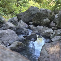
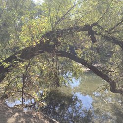
This feels like my private fishing spot. I bring my babies here in a wagon all the time. They do have an access ramp down to the creek which does need some maintenance from the start of it from the parking lot. I would like to see yolo county pave down some paths down to the creek to make it more stroller wheelchair accessible since they have rocky paths read more


10 years ago
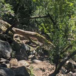
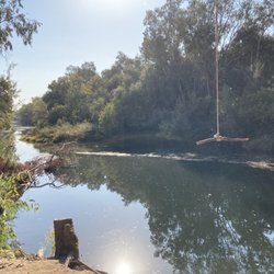
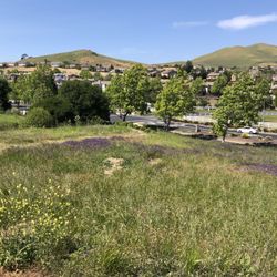
This is a nice open park area next to the creek. It is a mild flat walk to the creek. There is plenty of parking for cars and RVs and it's free. There are some scattered picnic tables. There are restrooms, but I did not go in. So I don't know the condition of them. I personally just avoid all public park/rest stop restrooms at all cost. Like all public areas, I advise hiking with a group and keep personal safety in mind. It's pretty remote. There is no ranger type person or security on duty here. read more


6 years ago
More info about Capay Open Space Park


Capay Open Space Park - hiking - Updated June 2026
Best of Esparto
People found Capay Open Space Park by searching for…
Things to Do in Esparto, California
Fishing in Esparto, California
Hiking Trails in Esparto, California
Secret Spots in Esparto, California
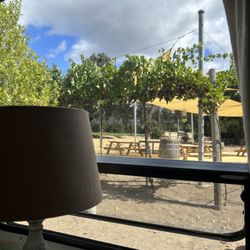
Picnic Areas in Esparto, California
Fishing Spots in Esparto, California
River Swimming in Esparto, California
Places to Take Pictures in Esparto, California
Waterfall Hike in Esparto, California
Public Running Track in Esparto, California
Bird Sanctuary in Esparto, California
Lakes & Ponds in Esparto, California
Attractions in Esparto, California
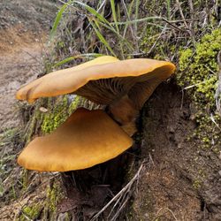
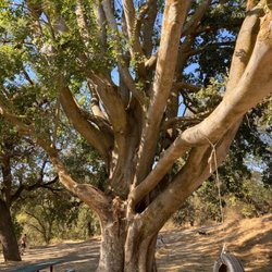
Nature Walks in Esparto, California
Walking Trails in Esparto, California
State Park in Esparto, California
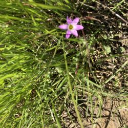
Wildflowers in Esparto, California
Public Pools in Esparto, California
Toddlers Fun Places in Esparto, California
Kids Attractions in Esparto, California
Natural Hot Springs in Esparto, California
Trending Searches in Esparto, CA
4th Of July Fireworks near Capay Open Space Park
Boat Rental near Capay Open Space Park
Cliff Jumping near Capay Open Space Park
Day Trips near Capay Open Space Park
Dog Friendly Beaches near Capay Open Space Park
Dog Friendly Trails near Capay Open Space Park
Fireworks near Capay Open Space Park
Fishing Spots near Capay Open Space Park
Jet Ski Rental near Capay Open Space Park
Kayak Rental near Capay Open Space Park
Kids Activities Outdoor near Capay Open Space Park
Lakes near Capay Open Space Park
Lakes & Ponds near Capay Open Space Park
Outdoor Activities near Capay Open Space Park
Outdoor Basketball Courts near Capay Open Space Park
Public Pools near Capay Open Space Park
Public Shower near Capay Open Space Park
River Swimming near Capay Open Space Park
Rock Quarry near Capay Open Space Park
Scenic Night View near Capay Open Space Park
Scenic Overlook near Capay Open Space Park
Secluded Spots near Capay Open Space Park
Soccer Store near Capay Open Space Park
Splash Pad near Capay Open Space Park
Strawberry Picking near Capay Open Space Park
Sunrise View near Capay Open Space Park
Swimming Holes near Capay Open Space Park
Swimming Lakes near Capay Open Space Park
Watch Sunset near Capay Open Space Park
Browse Articles
Browse Nearby
BEST of Esparto, California Restaurants near Capay Open Space Park
BEST of Esparto, California Parks near Capay Open Space Park
BEST of Esparto, California Coffee near Capay Open Space Park
BEST of Esparto, California Things to Do near Capay Open Space Park
BEST of Esparto, California Breakfast near Capay Open Space Park
BEST of Esparto, California Horseback Riding near Capay Open Space Park
BEST of Esparto, California Campgrounds near Capay Open Space Park
BEST of Esparto, California Hot Springs near Capay Open Space Park
Browse Brands
Related Searches in Esparto, CA
Best Fishing Locations and Guides in Esparto, California
Best Places for Horseback Riding in Esparto, California
Best Spots for Star Gazing in Esparto, California
Best Water Parks for Kids in Esparto, California
Check Out Great Playgrounds in Esparto, California
Check Out Off Road Trails in Esparto, California
Discover Baseball Fields Around Esparto, California
Discover Dog Friendly Trails to Explore in Esparto, California
Discover Free Parking Options in Esparto, California
Discover Fun Toddler Parks in Esparto, California for Your Little One
Discover Lakes & Ponds to Explore in Esparto, California
Discover Popular Photo Spots in Esparto, California
Discover Scenic Mountain Bike Trails Near Esparto, California
Discover Scenic Waterfall Spots in Esparto, California
Discover Soccer Fields in Esparto, California Near You
Discover Top Nature Parks to Visit in Esparto, California
Discover a Hiking Trail in Esparto, California
Discover the Best Beaches in Esparto, California
Discover the Best Kids Park Spots in Esparto, California
Discover the Best Running Track in Esparto, California
Dog-Friendly Hikes With Dogs in Esparto, California
Enjoy Exciting Mountain Biking Adventures in Esparto, California
Enjoy Kayaking Adventures in Esparto, California
Enjoy the Best Picnic Spots and Ideas in Esparto, California
Enjoy the Best Walking Trails in Esparto, California
Experience Thrilling White Water Rafting in Esparto, California
Explore Beautiful Parks and Green Spaces in Esparto, California
Explore Easy Hikes Perfect for All in Esparto, California
Explore Free Picnic Areas Around Esparto, California
Explore Outdoor Basketball Courts for All Skill Levels in Esparto, California
Explore Parks With Pull Up Bars in Esparto, California
Explore Popular Campgrounds Near Esparto, California
Explore Popular Picnic Areas Around Esparto, California
Explore Popular RV Parks Around Esparto, California
Explore Popular Recreation Centers Around Esparto, California
Explore Scenic Lakes to Visit in Esparto, California
Explore Secret Spots Worth Visiting in Esparto, California
Explore Top Gyms in Esparto, California Now
Explore Top Water Parks in Esparto, California Today
Explore the Best Boating Spots in Esparto, California
Explore the Best Swimming Holes Around Esparto, California
Family Friendly Hiking With Kids in Esparto, California
Find Beautiful Views in Esparto, California
Find Parks and Recreation Activities in Esparto, California
Find Popular Ziplining Spots Around Esparto, California
Find Top Skate Parks in Esparto, California for All Skill Levels
Find Top Skating Rinks in Esparto, California for All Ages
Find a Park With BBQ Pits in Esparto, California