Cancel

    Open app

    Search

    Cache Creek Regional Park

    4.4 (14 reviews)

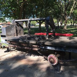
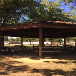
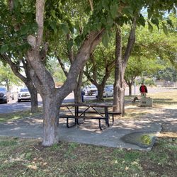
    Cache Creek Regional Park Photos
    More like Cache Creek Regional Park

    Recommended Reviews - Cache Creek Regional Park

    Your trust is our priority, so businesses can't pay to alter or remove their reviews. Learn more about reviews.
    Yelp app icon
    Browse more easily on the app
    Review Feed Illustration

    8 months ago

    Very nice place to walk my dogs,was a bit of dog shit,why can't people pick up after there pet?

    Helpful 0
    Thanks 0
    Love this 0
    Oh no 0

    1 year ago

    We have 10 spots open for this Labor Day Weekend, Aug 29-Sept 1. Group Site. Rafting included. Hit me up if interested. Tony 209-640-0549

    Helpful 0
    Thanks 0
    Love this 0
    Oh no 0

    5 years ago

    Helpful 0
    Thanks 0
    Love this 0
    Oh no 0

    15 years ago

    Helpful 0
    Thanks 0
    Love this 0
    Oh no 0

    15 years ago

    Helpful 1
    Thanks 0
    Love this 0
    Oh no 0

    13 years ago

    Helpful 0
    Thanks 0
    Love this 0
    Oh no 0

    13 years ago

    Helpful 0
    Thanks 0
    Love this 0
    Oh no 0

    8 years ago

    Helpful 0
    Thanks 0
    Love this 0
    Oh no 0

    19 years ago

    Helpful 1
    Thanks 0
    Love this 2
    Oh no 0

    13 years ago

    Helpful 0
    Thanks 0
    Love this 0
    Oh no 0
    Photo of Jason O.
    26
    13
    10

    11 years ago
    Helpful 0
    Thanks 0
    Love this 0
    Oh no 0

    15 years ago

    Helpful 2
    Thanks 0
    Love this 2
    Oh no 0
    Photo of N B.
    0
    8
    6

    10 years ago

    Helpful 0
    Thanks 0
    Love this 0
    Oh no 0

    13 years ago

    Helpful 0
    Thanks 0
    Love this 0
    Oh no 0

    Ask the Community - Cache Creek Regional Park

    Review Highlights - Cache Creek Regional Park

    “Most people do the rafting trips but we've never tried them.”

    Mentioned in 3 reviews

    Read more highlights

    Verify this business for free

    Get access to customer & competitor insights.

    Verify this business

    Sequoians Clothes Free Club

    Sequoians Clothes Free Club

    4.7(30 reviews)
    79.3 mi

    Perfect, relaxing, fun, members for 14 years. Come join us and will see why we love this place.read more

    Sequoians is an inclusive body-positive space for all ages, genders, and body types (including…read morepost-surgery or modified bodies)! It's an overall pretty chill space with a clubhouse, bocce ball, hiking, and pool/hot tub. It's member-only, and the community is tight-knit and welcoming. We have been members for the last year, and my girls (9,7,5) love going. They are treated with incredible love and respect by all the members and there are currently several families with kids, ranging from 5-14 years old. Yes, it's naked. Yes, you will see naked people. Yes, you will be naked! Kids under 18 do not have to be naked if they don't want to, but adults are expected to be clothes-free most of the time. Let me tell you why Sequoians is walking the walk on inclusivity, and why it isn't creepy. 1) Creepiness is gross and bad for all ages; sexualizing kids is wrong, full stop. 2) Creepiness is bad for business! Getting accused of improper activities is bad for business! Sequoians, and nudists in general, have a vested interest in keeping their spaces safe for everyone. 3) Inclusivity is more fun! More people can be included and feel safe, and that feels good. Therefore: Sequoians makes a big deal of vetting potential members, and everyone is educated about body positivity and etiquette. You see consent engagements in real life, in terms of playing with the kids, hanging out in shared spaces, keeping spaces clean, and working together for the benefit of everyone. Everytime we do out there, my kids say "ohhhhh we love it here!" and I do too. If you are interested in learning more, please read the website. And come visit!

    Photos
    Sequoians Clothes Free Club - Enthusiast, chef, community member

    Enthusiast, chef, community member

    Sequoians Clothes Free Club - Relaxing with my pups at The Sequoians Clothes Free Club.

    Relaxing with my pups at The Sequoians Clothes Free Club.

    Sequoians Clothes Free Club - Beautiful private trails to enjoy nature naturally.

    See all

    Beautiful private trails to enjoy nature naturally.

    Blue Ridge Trail to Fiske Peak - The bridge en route to the trailhead.

    Blue Ridge Trail to Fiske Peak

    5.0(1 review)
    0.0 mi

    This hiking trail is located within Cache Creek Regional Park which offers hiking, camping, and…read morerafting. Their website has great information in regards to the above activities, including parking and directions to trailheads: http://www.yolocounty.org/general-government/general-government-departments/parks/parks-information/cache-creek-regional-park. It's a beautiful trek, albeit challenging. The views at the peak are magnificent. BLUE RIDGE TRAIL TO FISKE PEAK: DIRECTIONS: From Woodland CA, take Route 16 West (Main St). Cache Creek Regional Park is on Route 16, approximately 40 miles from Woodland. After passing the casino, it's about 15 miles to the park's Lower Day Use Park Site. There will be a small sign on your left and you will see the parking area (bathrooms available). From there, take the dirt road on your left down to the bridge. Cross over the bridge and go left. Shortly, on the right side, you'll see the trail marker. BASIC INFO: The Blue Ridge Trail to Fiske Peak is 8 miles, out and back. About 4 hours to complete. It's a pretty steep climb with a total of 2100+ ft. elevation gain. The way up was almost entirely uphill. The hike is listed as moderate but I'd say it's a pretty challenging moderate. I did not know this at the time but after doing some research later, I learned that the trail continues as a 16-mile loop. TIPS: - Access. Since you have to walk across a bridge to get to the trailhead, you are at the mercy of water levels. I saw a review or two on AllTrails where someone said that the bridge was underwater and they couldn't get across. Not sure if there is anywhere you can obtain updates. FYI: We came on April 1st and the weather was perfect. - Register. Apparently, there is a register up at Fiske Peak but I did not learn about it until later. Make sure to sign it! - Sunblock. Bring it and use it. There were multiple areas in open sun and my boyfriend got burned. - Walking stick. Could be helpful because you've got such an incline/decline here. My boyfriend has a knee issue and the way down was particularly brutal for him. - Water. Bring as much as you can. Between the exertion and sun, you will need a lot. - Bring snacks/lunch. It'll take a lot out of you. - BUGSPRAY. Bring it or use it beforehand. Lots of bugs on this trail. Also, saw a woman who warned us about ticks because her dog had a ton on him. - WILDLIFE. This is mountain lion territory. I didn't see any warning signs but at the peak, I saw a lot of scat. Fresh and old (the desiccated, hairy stuff). We followed the path at the peak for a bit (not knowing about the loop initially) and walked right into a large swarm of insects. We got really nervous because it was very close to the poop and if I know cats, I know they like to go to the bathroom after a meal. So we thought, bugs = carcass. Either way, our cue to turn back. I was pretty paranoid the whole time because in 4 hours, we only encountered 2 other hikers. This was probably because it was Easter, haha. Saw a few small caves which seemed like perfect cat real estate. The entire walk back, I kept jingling keys and clapping. You also have a lot of large rocks on the path. Make sure to look before you step to avoid rattlesnakes. Good luck!

    Photos
    Blue Ridge Trail to Fiske Peak
    Blue Ridge Trail to Fiske Peak
    Blue Ridge Trail to Fiske Peak

    See all

    Alamere Falls - Point Reyes National Seashore - Honeysuckle  on the trail of Alamere Falls

    Alamere Falls - Point Reyes National Seashore

    4.6(565 reviews)
    71.0 mi

    If you don't mind hiking between 12 and 14 miles in a day with some incline, this is well worth the…read moretrip from the parking lot. Great views along the way for the coastal trail and you could turn this into a loop trail if you take the unofficial shortcut. This is one of the beauties of California. Recommended activities: Hiking, Running, Walking Parking options: Free parking lot

    People who have never been to Oregon will tell you that this is one of only two tidefalls (a…read morewaterfall that flows into the ocean) on the entire West Coast. People who believe AllTrails will tell you that this is one of only two tidefalls in California. (If you use Alltrails, you aren't allowed to hike with me, by the way.) Neither of these statements are anywhere close to true. As a matter of fact, there are at least two tidefalls on this one beach, and there are many more in areas that are not easily accessible to the public. Tidefalls are common along the coasts of Oregon, Washington, and Canada. There are several tall tidefalls in Cape Perpetua alone. That being said, Alamere Falls might be the biggest, prettiest publicly accessible tidefall in Northern California. I recently hiked Alamere Falls for the first time in nearly ten years, and I couldn't believe how much had seemed to change. First of all, the road to the Palomarin trail was hell in a compact vehicle. Even going like two miles per hour, I got a little motion sickness from the thousands of deep potholes. The road is so bad that it almost seems beyond repair. At this point, it's probably only suitable for high clearance vehicles, although I did not notice any signs warning of such. Secondly, I'm pretty sure I was the only sober person on the trail. The vibes were so, so weird. Consider packing your (legal) weapon of choice. Thirdly, I was certainly the only person to take the 'legal' trail down, although I gained some new perspective on this. While the trail that I took is ostensibly the trail recommended by NPS, one does have to wonder why it is so overgrown. It feels like, "Obviously, no one ever really hikes this trail," because it's nowhere near clear or well-trodden. Certain areas of the trail were so overgrown that it was impossible to see my feet, and difficult to find my footing. These areas were chalk full of poison oak, stinging nettle, poison hemlock, and a wide variety of (harmless) snakes. By contrast, much of the "social" trail was four feet wide, flat, and clear. Which made me wonder-- which trail is really safer? The cliffs at the end of the social trail are constantly crumbling. The risk of falling, breaking a leg, or at least spraining an ankle, seems high. But by contrast, the risk of spraining an ankle on the recommended trail seems high, too. And the stinging nettle hurt a lot, but only for a few hours. My personal recommendation is to take the recommended trail, but wear solid boots, long pants, and tall, colorful socks. Tuck your pants into your socks, or wear gaiters. Use permethrin or your tick repellant of choice. While the official Palomarin Trail may be very long and difficult, it's also worth the trouble. The ocean views and wildlife were unbelievable. I actually saw a mother deer nursing two spotted fawns in the middle of the trail. On the beach, I found agates, fossils, shells, giant bull kelp, snowy plovers, and lots of by-the-wind-sailors jellyfish in multiple stages of life and decomposition. The waterfall itself is pretty-- but make sure to check the tide!! I never do, and I almost always get stranded. The first time I ever hiked this trail, I actually had to climb up a cliff in terror and wait 3 hours for the tide to recede. But that doesn't need to happen to you if you remember to check the tide before you come out, while you still have service.

    Photos
    Alamere Falls - Point Reyes National Seashore - Top of the falls

    Top of the falls

    Alamere Falls - Point Reyes National Seashore - Eucalyptus Grove at beginning of the trail

    Eucalyptus Grove at beginning of the trail

    Alamere Falls - Point Reyes National Seashore

    See all

    Cache Creek Regional Park - parks - Updated September 2026

    Loading...
    Loading...
    Loading...