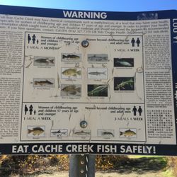
Cache Creek Natural Area Photos


You might also consider
More like Cache Creek Natural Area
Recommended Reviews - Cache Creek Natural Area
Start your review...

5 years ago
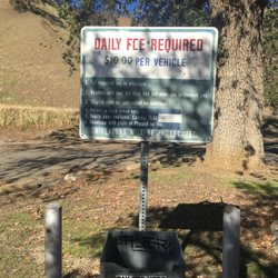
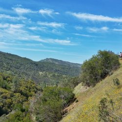
I went winter backpacking in Wilson Valley this past weekend and was absolutely amazed at how gorgeous this area is and I didn't even know it existed! Located a little less than 2 hours northwest of Sacramento in Lake County, the Cache Creek Wilderness/Nature Area is overseen by the Department of Fish & Wildlife and the Bureau of Land Management. Because it's BLM land it's absolutely free! That means both free parking and free overnight camping. You do need a valid fire permit if you plan to have a campfire or portable stove though. The area is known for 3 main trails: Redbud, Judge Davis, and Mount Konocti. On this trip I backpacked the Redbud Trail to Wilson Valley, which is approximately 14.4 miles round trip, fords Cache Creek twice, and had fantastic views of both Wilson Valley and Brushy Sky High Mountain from the top of the two ridges you cross. It's terrific. While in the Wilson Valley I was blessed to see the herd of Tule Elk that resides in the area. Never have I been this close to a herd of elk before and it was an incredible highlight to my backpacking trip. If you're looking for an ideal place to get out into nature during winter without snow - definitely check this area out. But make sure you do your research because the Cache Creek can be very unpredictable and unpassable at times. I also would highly recommend using a legit GPS unit (unless you're an expert at topographic maps) because it's easy to get lost once you cross the wilderness boundary (beyond Baton Flat) and this very remote area hardly sees any traffic. Happy trekking! read more


More info about Cache Creek Natural Area
1475 Hwy 16
Rumsey, CA 95679
Directions
Hours
Outdoor Amenities
You might also consider


Cache Creek Natural Area - hiking - Updated May 2026
Best of Rumsey
People found Cache Creek Natural Area by searching for…
Hiking Trails in Rumsey, California
Things to Do in Rumsey, California
Free Campgrounds in Rumsey, California
View Points in Rumsey, California
Picnic Areas in Rumsey, California
Scenic Overlook in Rumsey, California
Easy Hikes in Rumsey, California
Free Parking in Rumsey, California
Off Road Trails in Rumsey, California
Lookout Points in Rumsey, California
Natural Hot Springs in Rumsey, California
Lakes & Ponds in Rumsey, California
Nature Trails in Rumsey, California
Walking Trails in Rumsey, California
Fishing Lake in Rumsey, California
Waterfalls in Rumsey, California
Tent Camping in Rumsey, California