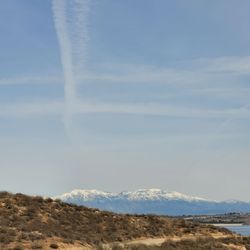
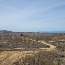
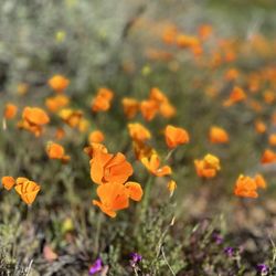
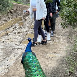
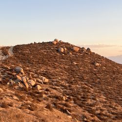
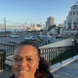
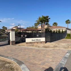
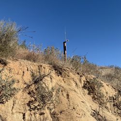
Fresno Canyon Trail Photos


You might also consider
More like Fresno Canyon Trail
Recommended Reviews - Fresno Canyon Trail
Start your review...

Reviews With Photos


What a wonderful way to begin my day. Got to the location before the sun rose and by the time we had got pretty far the sun was high in the sky. Such a lengthy and pretty moderate trail in difficulty. Definitely wonderful for families or parents wanting to bring strollers amazing for biking (which I will take advantage of soon) and so clean. I will be back regularly. Parking is a bit hard by the entrance off of Ontario I believe there is street parking but the entrance inside the neighborhood is permitted parking so be aware of that.

My favorite hike! It skyrocketed to the top of my favorites today when we saw Bigfoot on our hike! Otherwise, a nice walk. We haven't made it too far in because we have small children, but this trail works well for us with them. The lower area of the trail is wide and has fences on either side. We've never seen wildlife here (except for Bigfoot), so I think other locations are better for that. It's also a good beginner hike. Not too strenuous, and easy to keep your footing if you have an 18 month old strapped to your back.


Although currently closed due to construction on the trail as of March 2024, there's plenty of parking in the shopping plaza. I had a wonderful hot tea and pastry with my mom at Choco Bakery & Cafe before walking behind the parking lot (behind Building #4254) to find a ramp leading to the sidewalk. It's a really short walk to the trail entrance and if you download AllTrails app, the trail is an estimated 3 hr hike, 4.4 mi total. Looking forward to visiting it again since the trail looks well maintained. read more


3 years ago
Best place to park would be by the small shopping center on green river road. Other places, by hosting area behind the shopping center - please read all signs for proper parking. The park entrance can be found on green river roads, small and unknowing, it starts with a long gentle rise. Then crossing the road leads to high incline and into the mountain side. From there, choices are yours. For bikers awesome for runners and hikers...challenging and rewarding. The lack of parking area is concerning, but people are friendly and often will be kind to direct you to the right place. read more


2 years ago
Fresno Trail is a regular hiking area for me. I am especially encouraged now that they have improved the troughs caused by rainfall. It is much easier to walk there. Thanks to the city for making the effort to make it easier for us, hikers ! read more


7 years ago
What a wonderful way to begin my day. Got to the location before the sun rose and by the time we had got pretty far the sun was high in the sky. Such a lengthy and pretty moderate trail in difficulty. Definitely wonderful for families or parents wanting to bring strollers amazing for biking (which I will take advantage of soon) and so clean. I will be back regularly. Parking is a bit hard by the entrance off of Ontario I believe there is street parking but the entrance inside the neighborhood is permitted parking so be aware of that. read more


6 years ago
My favorite hike! It skyrocketed to the top of my favorites today when we saw Bigfoot on our hike! Otherwise, a nice walk. We haven't made it too far in because we have small children, but this trail works well for us with them. The lower area of the trail is wide and has fences on either side. We've never seen wildlife here (except for Bigfoot), so I think other locations are better for that. It's also a good beginner hike. Not too strenuous, and easy to keep your footing if you have an 18 month old strapped to your back. read more

5 years ago
8 years ago
Great walk w/my dog . 45 min - you can really go back into the ClevlandNat'l Forest fits linger hike! read more


8 years ago
My favorite place for hike in nature, the views are breathtaking. Great trail, significant hills, good for heart rising read more


7 years ago
it was a really good hike however i was not sure if the location i started at was the correct location to start at. the street entrance has the sign but once you find yourself at the street it says no trespassing. past this however is awesome! youll find yourself at a crossroads. straight doesnt lead anywhere and left will lead you to a decently scenic area. right goes higher into the hill. it was really beautiful and my dogs enjoyed it. please follow their adventure on Instagram at dovahpals. read more


More info about Fresno Canyon Trail
4180 Green River Rd
Corona, CA 92880
Directions
Hours
Outdoor Amenities
Ask the Community - Fresno Canyon Trail
You might also consider


Fresno Canyon Trail - hiking - Updated May 2026
Best of Corona
People found Fresno Canyon Trail by searching for…
Hiking Trails in Corona, California
Beautiful Views in Corona, California
Scenic Views in Corona, California
Free Things to Do in Corona, California
Walking Trails in Corona, California
Off Road Trails in Corona, California
Places to Take Pictures in Corona, California
View Points in Corona, California
Dog Friendly Hiking Trails in Corona, California
Empty Parking Lot in Corona, California
Stroller Friendly Hikes in Corona, California
Places to Walk Around in Corona, California
Nature Parks in Corona, California
Running Trails in Corona, California
Scenic Places to Walk in Corona, California
Things to Do Alone in Corona, California
Easy Hikes in Corona, California
Adventure in Corona, California
Trending Searches in Corona, CA
Boat Rental near Fresno Canyon Trail
Botanical Gardens near Fresno Canyon Trail
Bounce House Rentals near Fresno Canyon Trail
Campgrounds near Fresno Canyon Trail
Cheap Plants near Fresno Canyon Trail
Cherry Picking near Fresno Canyon Trail
Cliff Jumping near Fresno Canyon Trail
Flower Fields near Fresno Canyon Trail
Flower Shop near Fresno Canyon Trail
Garage Sales near Fresno Canyon Trail
Garden Center near Fresno Canyon Trail
Lakes & Ponds near Fresno Canyon Trail
Nurseries & Gardening near Fresno Canyon Trail
Outdoor Activities near Fresno Canyon Trail
Outdoor Furniture Stores near Fresno Canyon Trail
Parks near Fresno Canyon Trail
Party Equipment Rentals near Fresno Canyon Trail
Pedicure near Fresno Canyon Trail
Photo Spots near Fresno Canyon Trail
Picnic Areas near Fresno Canyon Trail
Places To Take Pictures near Fresno Canyon Trail
Rock Quarry near Fresno Canyon Trail
Running Trails near Fresno Canyon Trail
Rv Rental near Fresno Canyon Trail
Scenic Drive near Fresno Canyon Trail
Sunrise View near Fresno Canyon Trail
Swimming Holes near Fresno Canyon Trail
Table And Chair Rentals near Fresno Canyon Trail
Browse Articles
Browse Nearby
BEST of Corona, California Coffee near Fresno Canyon Trail
BEST of Corona, California Restaurants near Fresno Canyon Trail
BEST of Corona, California Things to Do near Fresno Canyon Trail
BEST of Corona, California Parks near Fresno Canyon Trail
BEST of Corona, California Breakfast near Fresno Canyon Trail
BEST of Corona, California Beaches near Fresno Canyon Trail
BEST of Corona, California Campgrounds near Fresno Canyon Trail
Browse Brands
Related Searches in Corona, CA
Affordable Kayak Rental Services in Corona, California
Best Fishing Locations and Guides in Corona, California
Best Nature Trails for Hiking in Corona, California
Best Places for Horseback Riding in Corona, California
Check Out Off Road Trails in Corona, California
Discover Dog Friendly Trails to Explore in Corona, California
Discover Kid Friendly Hiking Trails in Corona, California
Discover Scenic Hiking Trails in Corona, California
Discover Scenic Mountain Bike Trails Near Corona, California
Discover Scenic Walking Paths in Corona, California
Discover Scenic Waterfall Spots in Corona, California
Discover Top Nature Parks to Visit in Corona, California
Discover Walking Parks in Corona, California Near You
Discover a Hiking Trail in Corona, California
Discover the Best Night Hike Trails in Corona, California
Discover the Breathtaking Waterfall Trail in Corona, California
Dog-Friendly Hikes With Dogs in Corona, California
Enjoy Camping Adventures Around Corona, California
Enjoy Exciting Mountain Biking Adventures in Corona, California
Enjoy Kayaking Adventures in Corona, California
Enjoy Tent Camping Spots Around Corona, California
Enjoy a Beautiful Waterfall Hike in Corona, California
Enjoy a Peaceful Nature Walk in Corona, California
Enjoy a Scenic Walk in Corona, California
Enjoy the Best Picnic Spots and Ideas in Corona, California
Enjoy the Best Walking Trails in Corona, California
Exciting Cliff Jumping Spots in Corona, California
Explore Beautiful Parks and Green Spaces in Corona, California
Explore Easy Hikes Perfect for All in Corona, California
Explore Fun Activities to Do in Corona, California
Explore Popular Campgrounds Near Corona, California
Explore the Best Beach Spots in Corona, California
Explore the Best Swimming Holes Around Corona, California
Explore the Best Trail Options in Corona, California
Family Friendly Hiking With Kids in Corona, California
Find the Best Parks for Picnics in Corona, California
Find the Best Scenic View Locations in Corona, California
Hiking Trails With Waterfalls in Corona, California
Off Leash Dog Hiking Trails in Corona, California
Popular Outdoor Activities to Try in Corona, California
Popular Picnic Spots to Visit in Corona, California
Safe River Swimming Areas in Corona, California
Safe and Fun Parks for Kids in Corona, California
Top Climbing Spots and Gyms in Corona, California
Top Paddleboarding Activities in Corona, California
Top Running Trails to Explore in Corona, California
Top Swimming Lakes to Enjoy in Corona, California
Top Swimming Spots and Pools in Corona, California