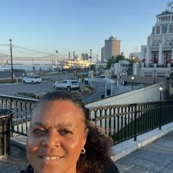
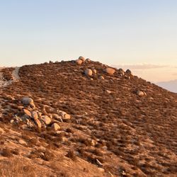
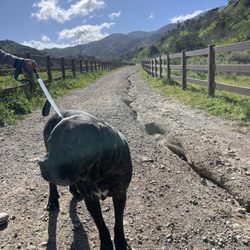
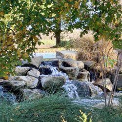
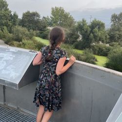
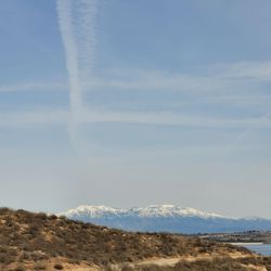
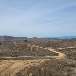
Eastvale Trail Photos


You might also consider
More like Eastvale Trail
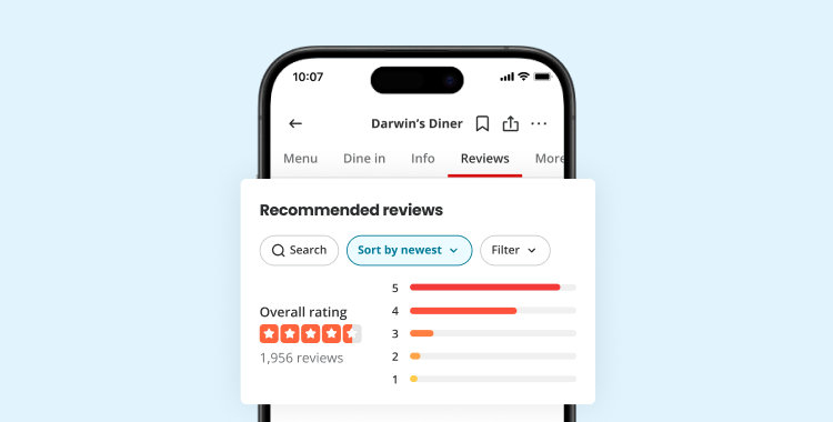
Recommended Reviews - Eastvale Trail
Start your review...


1 year ago
Great paved trail! Enjoyed trail skating with a friend and it was in good shape. I'd definitely recommend it for trail skating or a walk with friends. read more

Love this trail as it takes you alongside the Santa Ana river bed. The trail is paved so it's good for bikes and running Love this trail and recommend it for families and friends If you take the trail up north you will eventually travel into Riverside One thing to be cautious of is that there is sometimes activity in the riverbed that can be questionable read more


Very, very nice. One end of the path is at the Eastvale Community Park and the other end is at Archibald. I took off a star because there are a TON of gnats all around, which could be the dealbreaker regarding even coming here or not, so wear your sunglasses, gaiter, and probably a hat to keep them out of your face/eyes/nose! The scenery is pictueresque and many sections of the path is wider than any trail I've ever been to. I suggest you park at the Eastvale Community Park parking lot and bike or walk all the way through the walk. read more


3 years ago
5 years ago
5 years ago
3 years ago
5 years ago
6 years ago
5 years ago
6 years ago
11 years ago
Come here practically everyday with my pups for a good walk. Great area to walk with family, friends, jog, bike ride. Even have poop bags for dogs so you can walk them and disposal of their waste in the trash. read more


5 years ago
7 years ago
More info about Eastvale Trail
Santa Ana River Rd And Hamner Ave
Eastvale, CA 92880
Directions
Hours
Outdoor Amenities
Ask the Community - Eastvale Trail
Review Highlights - Eastvale Trail
You might also consider


Why does Yelp recommend reviews?
3 reviews that are not currently recommended
The reviews below are not factored into the business's overall star rating.
6 years ago
3 years ago
9 months ago
Eastvale Trail - hiking - Updated August 2026
Best of Eastvale
People found Eastvale Trail by searching for…
Places to Take Pictures in Eastvale, CA
Running Trails in Eastvale, CA
Walking Trails in Eastvale, CA
Beautiful Views in Eastvale, CA
Places to Walk Around in Eastvale, CA
Parks With Lakes in Eastvale, CA
Hiking With Kids in Eastvale, CA
Dog Friendly Hiking Trails in Eastvale, CA
Waterfall Hike in Eastvale, CA
Trending Searches in Eastvale, CA
Blueberry Picking near Eastvale Trail
Cliff Jumping near Eastvale Trail
Cruising Spots near Eastvale Trail
Dog Friendly Things To Do near Eastvale Trail
Flower Fields near Eastvale Trail
Jet Ski Rental near Eastvale Trail
Kayak Rental near Eastvale Trail
Kids Activities Indoor near Eastvale Trail
Outdoor Activities near Eastvale Trail
Peach Picking near Eastvale Trail
Picnic Areas near Eastvale Trail
River Swimming near Eastvale Trail
Rock Quarry near Eastvale Trail
Scenic Overlook near Eastvale Trail
Shopping Malls near Eastvale Trail
Sunrise View near Eastvale Trail
Swimming Holes near Eastvale Trail
Things To Do On A Rainy Day near Eastvale Trail
Browse Articles
Browse Nearby
BEST of Eastvale, California Coffee near Eastvale Trail
BEST of Eastvale, California Restaurants near Eastvale Trail
BEST of Eastvale, California Things to Do near Eastvale Trail
BEST of Eastvale, California Breakfast near Eastvale Trail
BEST of Eastvale, California Walking Trails near Eastvale Trail
BEST of Eastvale, California Parks near Eastvale Trail
BEST of Eastvale, California Campgrounds near Eastvale Trail
BEST of Eastvale, California Sightseeing near Eastvale Trail
BEST of Eastvale, California Visitor Centers near Eastvale Trail
Browse Brands
Related Searches in Eastvale, CA
Best Dog Hiking Trails Around Eastvale, California
Best Fishing Locations and Guides in Eastvale, California
Best Nature Trails for Hiking in Eastvale, California
Best Places for Horseback Riding in Eastvale, California
Check Out Off Road Trails in Eastvale, California
Discover Dog Friendly Trails to Explore in Eastvale, California
Discover Easy Hiking Trails Near Eastvale, California
Discover Kid Friendly Hiking Trails in Eastvale, California
Discover Popular Bike Trails in Eastvale, California
Discover Scenic Mountain Bike Trails Near Eastvale, California
Discover Walking Parks in Eastvale, California Near You
Discover a Hiking Trail in Eastvale, California
Discover the Best Night Hike Trails in Eastvale, California
Dog-Friendly Hikes With Dogs in Eastvale, California
Enjoy Camping Adventures Around Eastvale, California
Enjoy Kayaking Adventures in Eastvale, California
Enjoy Off Leash Dog Hikes in Eastvale, California
Enjoy Scenic Places to Walk in Eastvale, California
Enjoy Tent Camping Spots Around Eastvale, California
Enjoy a Beautiful Waterfall Hike in Eastvale, California
Enjoy the Best Walking Path in Eastvale, California
Enjoy the Best Walking Trails in Eastvale, California
Explore Beautiful Parks and Green Spaces in Eastvale, California
Explore Easy Hikes Perfect for All in Eastvale, California
Explore Fun Activities to Do in Eastvale, California
Explore Popular Campgrounds Near Eastvale, California
Explore Popular Dog Walking Trails in Eastvale, California
Explore Top Dog Parks in Eastvale, California Near You
Family Friendly Hiking With Kids in Eastvale, California
Find Beautiful Views in Eastvale, California
Find Parks and Recreation Activities in Eastvale, California
Find Top Dog Friendly Parks to Visit in Eastvale, California
Find Top-Rated Waterfalls in Eastvale, California Now
Find the Best Parks for Picnics in Eastvale, California
Hiking Trails With Waterfalls in Eastvale, California
Off Leash Dog Hiking Trails in Eastvale, California
Play at a Splash Pad Park in Eastvale, California
Popular Outdoor Activities to Try in Eastvale, California
Popular Picnic Spots to Visit in Eastvale, California
Popular Waterfall Hiking Trails in Eastvale, California
Safe River Swimming Areas in Eastvale, California
Safe and Fun Parks for Kids in Eastvale, California
Top Hiking Trails to Explore in Eastvale, California
Top Playgrounds for Kids to Enjoy in Eastvale, California
Top Running Trails to Explore in Eastvale, California
Top Swimming Lakes to Enjoy in Eastvale, California
Top Swimming Spots and Pools in Eastvale, California
Top-Rated Camping Sites in Eastvale, California


