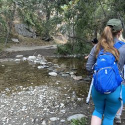
1. Fox Mountain to Condor Peak Hike

0

Tujunga, CA

Cancel

Open app

Search

Fox Mountain to Condor Peak Hike

3.5 (2 reviews)

Fox Mountain to Condor Peak Hike Photos
You might also consider

More like Fox Mountain to Condor Peak Hike

Recommended Reviews - Fox Mountain to Condor Peak Hike

Your trust is our priority, so businesses can't pay to alter or remove their reviews. Learn more about reviews.
Yelp app icon
Browse more easily on the app
Review Feed Illustration
Photo of Brian U.
0
2129
128

4 years ago
Helpful 0
Thanks 0
Love this 0
Oh no 0

10 years ago

Helpful 15
Thanks 0
Love this 13
Oh no 0

You might also consider

Verify this business for free

People searched for Hiking 8,611 times last month within 15 miles of this business.

Verify this business

Trail Canyon Falls

Trail Canyon Falls

4.4(123 reviews)
2.9 mi

A scenic trail nestled in the Tujunga Mountains, this hike was the perfect choice for my friends…read moreand me. We picked this spot because it's slightly removed from the fire damage of last year, yet still close enough to LA for a convenient trip. First things first, this trail is located in the Los Angeles mountains and requires an Adventure Pass ($5). You can pick one up at designated spots (which, by the way, supports the forest), and it must be displayed on your dashboard with the date scratched out. I saw many cars without the Adventure Pass, but from my understanding, you could get a ticket, so it's your call. I would rather get the $5 Adventure Pass than a ticket which could cost you maybe $50+. Also, I highly recommend getting there early for two reasons: 1. To secure a parking spot 2. To beat the heat. We arrived early enough to find parking, and as we set out on the trail, I was struck by how beautiful it was. The hike is about 4 miles in and out. At the start, there's little shade, but as you continue, you'll cross several streams and find shaded spots along the way. There's even a section where you'll need to use ropes to descend, eventually reaching the base of a waterfall. The trail is quite popular, so by the time we got to the waterfall, there were lots of people taking photos. The descent was manageable, but be prepared to wait for others when you head back up the ropes. There was a bit of a line to ascend, which slowed things down a little before we headed back to the car. All in all, it's a fantastic trail. Having lived in the area for many years, I'd definitely consider it one of my favorites. The variety of trails, different terrains, and water crossings make it a unique experience. Just don't forget to bring waterproof hiking boots for the water crossings. Enjoy!

BEWARE! CAR BREAK-INS! DO NOT leave valuables in the car!!…read moreMy car got broken into today, 31 May 2026 around 12-2pm. After the hike, I noticed the lock on my car door handle fell off and immediately sensed something wrong and checked my bag. They took hundreds of dollars in cash and all of my credit/debit cards. I have to take my car into the auto shop to get fixed as well. I was not aware of this trailhead being notorious for car break-ins. I was actually trying to hike Condor Peak Trailhead but couldn't find it and ended up at Trail Canyon. I had absolutely no cell signal so I couldn't even do a quick Google search on this trailhead. My first time going into a hike blind and I got robbed. I'm guessing the thieves camp out near the parking and scope out their victims. I parked right in front of the start of the trailhead. I will NOT be returning to this hike. Be careful, stay vigilant.

Photos
Trail Canyon Falls
Trail Canyon Falls
Trail Canyon Falls

See all

Switzer Falls - USDA Forest Service

Switzer Falls - USDA Forest Service

4.4(294 reviews)
4.8 mi

Perfect hike for a hot day…read more I love waterfall hikes and listening to the sound of calm, running water. The added challenge on these hikes is the multiple stream crossings. I brought some hiking poles which helped with balance and probing for loose rocks and logs. If you want to get parking in the lower lot, it's best to come before 8AM. We found parking in the second lot. An Adventure Pass or Day Pass is required. Parking is enforced. A car received a ticket for being in a No Parking zone. The start of the trail is nicely shaded. The second half is a hilly, narrow, sun exposed path which routes back into the canyon toward the Lower Switzer Falls. I'm glad they had fencing on some narrow and steep parts of the trail. We encountered an active rattlesnake which headed down the mountain, so be on the lookout. Overall, the hike takes about 3 hours for 5.5 miles. The additional hike back up to the parking lot was about 1/4 of a mile. Note: if you need to use the restroom, it's best to bring your own toilet paper and to go before you start your hike. It was kind of smelly, but if you gotta go... you gotta go.

This was my first real hike, and it was great! It was a bit confusing to get there but there were…read moreplenty of people around to help out. The water is ice cold and you need water shoes to comfortably walk around in the water. Be careful not to slip on the algae covered rocks! Still wonderful

Photos
Switzer Falls - USDA Forest Service - Lower Switzer Fall

Lower Switzer Fall

Switzer Falls - USDA Forest Service
Switzer Falls - USDA Forest Service - The grand prize, Switzer falls.

See all

The grand prize, Switzer falls.

Gabrielino Trail - I couldn't BEAR the way he looked at me

Gabrielino Trail

4.3(82 reviews)
7.3 mi

A friend and I wanted to go hiking the morning of July 4th. First, we went to Sturdivant Falls,…read morebut there was a locked gate that met us and many many other cars! I found out about Gabrielino trail from Yelp! (Thank goodness for reviews) The address led us to a small parking lot, but as we walked towards the trail, I realized that there was a much larger parking lot, but not quite sure how to get to it. The trail was very beautiful and an easy hike (Nothing to steep, unless you go off the trail down towards the stream). We saw a horse and lots of dogs. The surprising part was all of the streams throughout the trail. It made for a very peaceful and tranquil walk! I was grateful for a good amount of shade that is along the trail as well! Although it's a bit of a drive from my normal hiking areas, I would definitely love to come back here for a walk or run!

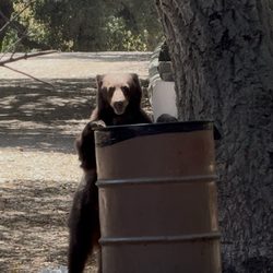
First time visiting this trail, and I brought my 11-year-old daughter along. It reminded me a lot…read moreof the Sturtevant Falls hike, but without the steep climbs, mostly flat and easy to enjoy. There are plenty of great spots to stop and take in the river, and we even came across an area with hundreds of baby frogs. The highlight was spotting a bear I'll definitely be coming back to run the trail on my own and explore farther in. One of the best things about this hike is that you can make it as long or as short as you want. You don't have to go very far to experience the beautiful scenery. It's a great outing for all ages, lots of small kids and older adults were enjoying the trail as well.

Photos
Gabrielino Trail
Gabrielino Trail
Gabrielino Trail - Rock paths

See all

Rock paths

Deukmejian Wilderness Park - Thorny wild plant. I dare you to touch it. lol ;D

Deukmejian Wilderness Park

4.5(104 reviews)
3.1 mi

Hidden secret in our own backyard. Bests of all this is free until 10pm daily. Breath taking views…read moreof LA and my fav is the view of a former winery house that is a nature center (museum like with ac). Free parking for about 40 cars. Elevation is over 2700 feet. Able to park near homes but prepared to walk steep uphill. Clean bathrooms. Hiking here is the most popular so can get busy. Trails of all types for beginners, moderate and super hikers level. About 10 miles of hiking available. I love the scenic views of the city/LA. It can get really hot because there is very little shade. Plenty of picnic tables to rent. The ones closest to house is not rentable. Half of the tables are not in the shade. Small amphitheater is there too. Very safe if you visit alone. There are bears, snakes, coyote and small critters. Wilderness park named in honor of George Deukmejian, the 35th Governor of California. Has so much history. Former vineyard and winery. 1885-1890s: French immigrant and winemaker George Le Mesnager purchased acreage in Dunsmore canyon to plant extensive vineyards. The vineyard has 81 grapevines which have been planted since 2004 and are maintained by the Stone Barn Vineyard conservancy which is a part of the historical society of the Crescenta Valley. You can still purchase Stone Barn wine bottles of Chardonnay, cabernet sauvignon, and white zin for $10-$20. City of Glendale purchased land to preserve it from developers. 2009 a severe wildfire swept through the terrain, though resilient landmarks like a historic 200-year-old oak tree survived. 2022 historic stone barn reopened to the public as the Stone Barn Nature Center. You can still see the gorgeous vineyards.

Beautiful park n trails ! Clean restrooms ! BUT, they need tree health care . The oaks tree planted…read moreare dying . 7of them. Sad to see that . It's next to the flat area where the large pepper tree is located . HELP THEM LIVE. Thanks plenty of parking . Park open till 9pm . Trees need - water bladders and mulch at least to help them survive

Photos
Deukmejian Wilderness Park - Too Kool For Skool. #2026 #dirtparkinglot

Too Kool For Skool. #2026 #dirtparkinglot

Deukmejian Wilderness Park - Welcome to Deukmejian W.P. #hikingtrailpark

Welcome to Deukmejian W.P. #hikingtrailpark

Deukmejian Wilderness Park - Swing anyone? :D #lol

See all

Swing anyone? :D #lol

Big Tujunga Canyon

Big Tujunga Canyon

4.8(5 reviews)
4.0 mi•Sunland

This was definitely a medium to hard trail in the summer because of the heat and some of the areas…read morethat require one's attention as there is a hillside next to you. We started at 9am ish and I would definitely start at 7am in the future because of the heat in august. The water fall was still there! People got in and the water was refreshing and cool. We found that tadpoles were transforming into frogs in the water so I recommend mindfulness to not step on them as they learn how to properly swim! Tips from our hike and waterfall visit: - we had sufficient water and first aid kit - we took various water breaks - we added mosquito repellent as are some - we had all trails gps to help us navigate trail first time - bring shoes with good ankle support - I would bring electrolytes next time - I would do 3-4-snacks vs. 1-2 next time

Birthday Shaynanigans at Tujunga Falls !!…read more Decided to go on a little adventure on my birthday and got out of San Diego to explore Tujunga Falls. Don't forget to get an adventure pass if you plan to park alongside the road or you'll get a ticket ! It's October so the falls were DRY. Boo. I would love to go back when we get a bit more rainfall, because the waterfalls were non-existent at this time. We ended up calling it 'invisible' falls. Other than that, the hike was great ! It's about 6 miles round trip and took us about 3 hours including taking pictures and testing out a friend's drone ! He's sooo cool ! LOL. Plenty of breathtaking views and the trails were wide enough for a group of hikers. Things to note: Start early so you can avoid the heat ! This will determine how long the hike will take you ! The sun was unforgiving so be prepared ! 'Trail' and 'waterfall' signs will help guide your way ! You'll also notice cabins at the beginning of the trail. After about a mile, you'll experience more of an incline so make sure to stay hydrated. There's barely any shade on this trail so bring a hat and sunscreen as well ! Poison ivy everywhere ! I had a traumatic experience in 6th grade camp when I got poison ivy. I made sure to cover my arms and legs this time just to take precaution. Rattlesnakes !!! We spotted one !!! Eek !! Be cautious of your surroundings. Unstable log bridges !! There was barely any water so hopping on the logs was an option, but do be careful because some are barely stable. Good to have some proper hiking shoes for this. Overall, most of the crossings and lack of water made it easy to traverse. As we got closer to the falls, we found a major descent and a climbing rope which guided us towards the waterfall (or invisible fall). The rope helped aid us up and down the mountain which was great ! Once you reach the waterfall (invisible falls) you'll enjoy the much needed shade and it was a perfect spot to take a fruit break ! We packed some oranges and apples with us ! There's plenty of spots to sit, relax, and enjoy nature ! Overall, it was a pretty good workout for moderate and advanced hikers ! We definitely made a few stops to take pictures and videos of our surroundings ! It was so calm and peaceful ! Perfect time to enjoy mother nature ! We will definitely come back to experience the REAL DEAL of the waterfalls ! Go out there and hike friends !!

Photos
Big Tujunga Canyon - Snow day

Snow day

Big Tujunga Canyon
Big Tujunga Canyon

See all

Devil's Canyon Trail

Devil's Canyon Trail

4.4(14 reviews)
5.0 mi

I wanted to find a trail that was secluded and didn't have mass crowds following me my entire hike…read more This trail is not too much further than most of the other "popular" tourist hikes available in the surrounding area, however, it is very isolated. My buddy and I hiked over 4 hours and never saw or heard a single soul. This fact alone makes the hike worth the small drive. As far as difficulty, the original hike down is pretty straight forward. There are some steep cliffs with very little room for error at certain points. While this isn't immediately frightening for the average hiker, I wouldn't recommend it for the faint of heart. Just be sure to watch your step! It will seem easy at first because you are going down the whole time. Remember, the way back up isn't your run-of-the-mill trek. . You must make your way back up the same route you originally came down. Keep this in mind and be sure your in good enough shape to complete the hike. Bring lots of water and stay hydrated. Most importantly, be sure to buy a day pass for parking or you will be fined. You can pick one up for $5 at Big 5 and other participating locations. I how you enjoy it as much as did!

It doesn't seem like many people hike through here as much since the fire…read more I ran into fresh snake holes on the trail, so be careful. Snakes usually avoid humans, so hopefully if more people start using the trail they will move somewhere safer. There's lots of tall and itchy vegetation growing near and on the trail, I reccomend to wear pants. Overall, it's a lovely trail with an amazing view. The camground is clear and spacious. The first stream crossing you'll encounter is barely a trickle. Dont worry! There's more water the further you hike and enough at the campsite to filter some water. It's not a pool anymore, but its deep enough to go halfway up your calves.

Photos
Devil's Canyon Trail

See all

Falls Creek Falls

Falls Creek Falls

3.9(11 reviews)
3.2 mi

I have a theory that this waterfall is not as popular as it should be because it has such a bland…read morename. If it had a name like Big Tujunga Thunder Falls it would definitely attract more visitors. It's all in the marketing. Fall Creek Falls is a four-tiered 250-ft waterfall. You'll only get to view up-close the lower 80-ft section of the waterfall. If you're familiar with Trail Canyon Falls (another blandly named waterfall) it's just up the road along Big Tujunga Canyon Road one mile past the reservoir. The trail descends down a dirt fire road 700ft and drops down into Big Tujunga Canyon. Once you reach the canyon floor you'll need to rockhop and bushwhack a quarter mile down stream to reach the base of the lower 80-ft waterfall. This is actually the best part of the hike. I had a lot of fun with this section. It would be smart to wear pants to reduce your exposure to poison ivy and pointy yucca plants. You can expect your shoes to get wet. The actual waterfall is what you make of it. I'm a waterfall nut so I really enjoyed it. A lot of online reviews mention that the trail was isolated. It must be gaining in popularity. There were about 8 cars parked at the trailhead when I visited on a Sunday. I passed someone about every 15-20 min. Conserve your energy for the return trip since it's all uphill. Fortunately the grade of the incline is gentle so it isn't too painful. Be sure to take in the awesome views of Big Tujunga Canyon. There's some amazing rock formations with interesting geologic patterns. Be sure to display your adventure pass. There are no bathrooms. After you leave be sure to stop by the dam overlook and also be sure to take a moment to appreciate the nearby scenic bridge off Big Tujunga Canyon Road.

Beautiful trail with views of Big Tujunga Canyon and, as promised in the name, a multi-tiered…read morewaterfall. The trail is well maintained with several parking spots at the trailhead. It's only downfall (haha) is that it's all downhill at the start and all uphill on the way back. But, don't worry, it's not super steep and the views are worth it. To see the waterfalls close up, you do have to clamber over some rocks, follow along the creek, and eventually cross the creek (bring your waterproof boots.) As of this date, the creek had a decent current, so be careful. As always, bring water and your mobile tracking device (I've watched one to many "disappeared on the trail and never seen again" videos, sorry!). And enjoy.

Photos
Falls Creek Falls
Falls Creek Falls
Falls Creek Falls

See all

Fox Mountain to Condor Peak Hike - hiking - Updated October 2026

Loading...
Loading...
Loading...