Charleston Peak Photos


You might also consider
More like Charleston Peak
Recommended Reviews - Charleston Peak
Start your review...

Reviews With Photos

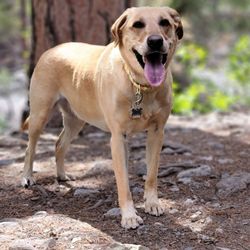
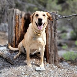
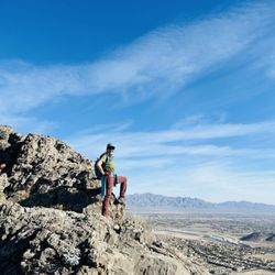
Every winter I gaze up at the snow capped Charleston Peak telling myself, "You are going to hike to the peak one day."- it became an item on my Vegas bucket list. To some it may be easy or no big deal but to me- I knew I would need to be prepared. REI became my friend and I hiked every weekend for a month with some fellow Yelpers leading up to the hike. Nothing prepared me for the high altitude. With help of Vicky- we made it slow and steady. We were greeted by dark clouds and thunder. We went up via the North Loop at 5am and came down by way of the South Loop by 7pm. My Fitbit bit had it at 17 miles which felt like a million. Things I did not like about the hike- ants, flies, bees, and these scary looking spiders. Every time I wanted to sit to take a break- some sort of insect was ready to climb all over me. The views were great. The snow was a nice treat. The people we met along the way were encouraging- although no one offered to carry me. :) The hike was so rewarding. It was peaceful and thought provoking- I thought of just about anything and everything to keep my mind off all the steps I was taking. Fitbit says I took almost 58,000 steps. I average around 12,000 a day. Be prepared with: clothing ( I changed my socks at the peak), snacks, water, hat, cell phone battery, wipes, a bag for your trash, I left a frozen bottle of water and snacks in my car for the ride back, flip flops or other shoes to give your feet relief once you get to your car. Will I ever go back? I'd have to say no. It was a once in a lifetime day for me plus Mt. Charleston has a lot more trails waiting for me to explore.

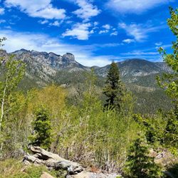
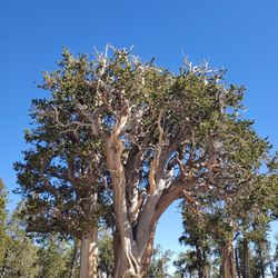
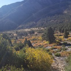
Yelp 100 Challenge 14' * 25/100 This is the perfect time of year to hit Mt. Charleston. Pack a lunch, grab your backpack, tie up your boots, go up here and leave everything behind for a day.North Loop in particular, is quite a strenuous trail - rapid elevation gains - with a great view of Bristlecone and Ponderosa pine tree coated mountains so people who have difficulty adjusting to steep terrain on higher altitude may need to keep their breathing conditions in check. On the plus side, reaching the trail is pretty straightforward. If you're coming from Las Vegas, simply take route 156 then turn right towards Lee Canyon. You will pass Hilltop Campground and Robber's Roost Trail before getting here. Finding the trail is easy and a large map is provided by the sign in case you are tight on time and need to approximate the length of your journey. This is rated 'more difficult', running about 10 miles into Mummy Spring and Cathedral rock. There are plenty of old pine logs lining up the trail in case you need to rest up. Bird enthusiasts will be happy to know that a diversity of birds live up here - from the exotic Magnolia Warblers down to the common House Finch. I expect more of them to flock around the area as the snow continues to melt, bringing running streams down the slopes. About 3 miles in, my friend and I reached an opening which provided a beautiful view of the mountains so we took some time off - ate and drew some sketches. As if the view wasn't majestic enough, it is also complimented by a cool breeze (about 70 degrees) and sounds of wind blowing through the trees. One thing you need to keep in mind is to not take the cold breeze for granted. Bring lots of water up with you and high energy foods - granola, fruits, etc. - to tackle the uphill walk that begins the moment you step foot on the trail as well as the thinning air on your way up. It also helps to have a good pair of strong-traction hiking boots to hold you down. My friend got a little light-headed about a couple of hours in so we headed back down a little early. I'm making it a pact to hike the whole 10 mile trail one day soon after my road test and come prepared.

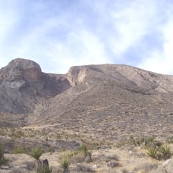
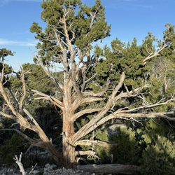
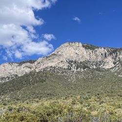
There are now only two trails to get to Charleston Peak, (South Loop is closed due to the Carpenter 1 Fire), you can start at the North Loop Trailhead or start at Trail Canyon. I would most definitely recommend starting at Trail Canyon, reason being, once you finish that hike, if you come back through Raintree, there are portions of uphill you will have to hike through and that's the last thing you want to do on the tail end of this hike. There is also a few other routes, more mountaineers routes than trail routes to the Peak, I've done the route via Big Falls, there is also a route that starts out at Ski Lee. I started the hike at Trail Canyon and followed the North Loop Trail. Heading up the 2 miles through Trail Canyon, once you hit the saddle, you will head towards your left and follow the North Loop the entire way. You will pass through Cave Springs, and start the switchbacks and hike through the area full of quacking aspen trees. Once you come to the ridge you can see the entire Kyle Canyon area, there is an old burn area (from like 15+ years ago) but the canyon still offers great views. Lots of Bristlecone, Bottle Brush Pine, wildflowers, and lots of different vegetation. This hike is entirely class 1, all trail. It's next to impossible to get lost, although I'm sure it's been done. There are a few areas closer to the peak that have some serious cliffs, if you have any kind of fear of heights, it could test you a little bit. This is a moderate to strenuous hike depending on your fitness level. It's a long hike, so be prepared. If you plan to do this during monsoon season, bring a rain coat, and if you get caught in a storm, head off the mountain. Bring 3-4 liters of water, lots of snacks, hiking poles are helpful but not necessary. Plan on spending 8-10 hours here. It's generally cold and windy at the peak. Quick Stats: Trailhead: North Loop or Trail Canyon Distance: 17.5 miles RT (from Trail Canyon, add another 2 miles if starting from North Loop) Elevation gain: 4,300 feet Elevation of peak: 11,916

This hike is no joke! Make sure you are fully prepared with snacks and water. That being said, make sure your pack isn't SO heavy that you need to shed things as you go... If you have any respiratory issues remember it is a very high altitude with a rapid 4000+ elevation gain! Standing at 11,916 feet of elevation, this is the 8th highest mountain in the state. When you get towards the top, after the enchanted Forest a.k.a. the section that was burned by the fire four years ago, make sure you take the path to the left. If you go up the shale on the right, it gets really sketchy and scary. Good items to pack include: water, I took 3 L and at 5'4" and 120 pounds it was just enough, trail mix, a peanut butter or almond butter and honey sandwich, Gummy bears or GU for energy, sliced oranges, apples, raisins, jerky, a poncho in case it rains and a few layers according to which season it is (it can get cold and windy at the top), wide brimmed hat, sunscreen and Chapstick. Optional items might be a walking-stick or poles, Advil, bandaids, extra socks, sunglasses and a few miniatures of whiskey or tequila (waiting in your car ) to celebrate your accomplishment!

7 years ago
This is a awesome hike and takes all day to do. It is the best hike in Nevada by far. Make sure you leave early like 5:00 am or 4:00 am if possible. We start at the north loop trail and head to cave springs from there. The first 5 miles is pretty strenuous as you elevate approx 800 ft per mile. If you make it 5 miles that will be a achievement in itself. After that it levels off for the next 3 miles and it's easy cruising. This is my favorite part of the hike as the views along this ridge line are amazing. You can even see lee canyon from the other side. Enjoy the beauty and cliffs and cruise for the next 3 miles. Then the last mile is brutal as you have a series of razor backs on a moon type surface to the peak. The return down the south loop side leads you along the ridge line through a creepy dead haunted Forrest that was burnt out some years back. The last 4 miles you have about 100 razor backs that bring you back down to earth. If you manage to do this trail pat yourself on the back. It's epic! read more


Every winter I gaze up at the snow capped Charleston Peak telling myself, "You are going to hike to the peak one day."- it became an item on my Vegas bucket list. To some it may be easy or no big deal but to me- I knew I would need to be prepared. REI became my friend and I hiked every weekend for a month with some fellow Yelpers leading up to the hike. Nothing prepared me for the high altitude. With help of Vicky- we made it slow and steady. We were greeted by dark clouds and thunder. We went up via the North Loop at 5am and came down by way of the South Loop by 7pm. My Fitbit bit had it at 17 miles which felt like a million. Things I did not like about the hike- ants, flies, bees, and these scary looking spiders. Every time I wanted to sit to take a break- some sort of insect was ready to climb all over me. The views were great. The snow was a nice treat. The people we met along the way were encouraging- although no one offered to carry me. :) The hike was so rewarding. It was peaceful and thought provoking- I thought of just about anything and everything to keep my mind off all the steps I was taking. Fitbit says I took almost 58,000 steps. I average around 12,000 a day. Be prepared with: clothing ( I changed my socks at the peak), snacks, water, hat, cell phone battery, wipes, a bag for your trash, I left a frozen bottle of water and snacks in my car for the ride back, flip flops or other shoes to give your feet relief once you get to your car. Will I ever go back? I'd have to say no. It was a once in a lifetime day for me plus Mt. Charleston has a lot more trails waiting for me to explore. read more


12 years ago
Yelp 100 Challenge 14' * 25/100 This is the perfect time of year to hit Mt. Charleston. Pack a lunch, grab your backpack, tie up your boots, go up here and leave everything behind for a day.North Loop in particular, is quite a strenuous trail - rapid elevation gains - with a great view of Bristlecone and Ponderosa pine tree coated mountains so people who have difficulty adjusting to steep terrain on higher altitude may need to keep their breathing conditions in check. On the plus side, reaching the trail is pretty straightforward. If you're coming from Las Vegas, simply take route 156 then turn right towards Lee Canyon. You will pass Hilltop Campground and Robber's Roost Trail before getting here. Finding the trail is easy and a large map is provided by the sign in case you are tight on time and need to approximate the length of your journey. This is rated 'more difficult', running about 10 miles into Mummy Spring and Cathedral rock. There are plenty of old pine logs lining up the trail in case you need to rest up. Bird enthusiasts will be happy to know that a diversity of birds live up here - from the exotic Magnolia Warblers down to the common House Finch. I expect more of them to flock around the area as the snow continues to melt, bringing running streams down the slopes. About 3 miles in, my friend and I reached an opening which provided a beautiful view of the mountains so we took some time off - ate and drew some sketches. As if the view wasn't majestic enough, it is also complimented by a cool breeze (about 70 degrees) and sounds of wind blowing through the trees. One thing you need to keep in mind is to not take the cold breeze for granted. Bring lots of water up with you and high energy foods - granola, fruits, etc. - to tackle the uphill walk that begins the moment you step foot on the trail as well as the thinning air on your way up. It also helps to have a good pair of strong-traction hiking boots to hold you down. My friend got a little light-headed about a couple of hours in so we headed back down a little early. I'm making it a pact to hike the whole 10 mile trail one day soon after my road test and come prepared. read more


There are now only two trails to get to Charleston Peak, (South Loop is closed due to the Carpenter 1 Fire), you can start at the North Loop Trailhead or start at Trail Canyon. I would most definitely recommend starting at Trail Canyon, reason being, once you finish that hike, if you come back through Raintree, there are portions of uphill you will have to hike through and that's the last thing you want to do on the tail end of this hike. There is also a few other routes, more mountaineers routes than trail routes to the Peak, I've done the route via Big Falls, there is also a route that starts out at Ski Lee. I started the hike at Trail Canyon and followed the North Loop Trail. Heading up the 2 miles through Trail Canyon, once you hit the saddle, you will head towards your left and follow the North Loop the entire way. You will pass through Cave Springs, and start the switchbacks and hike through the area full of quacking aspen trees. Once you come to the ridge you can see the entire Kyle Canyon area, there is an old burn area (from like 15+ years ago) but the canyon still offers great views. Lots of Bristlecone, Bottle Brush Pine, wildflowers, and lots of different vegetation. This hike is entirely class 1, all trail. It's next to impossible to get lost, although I'm sure it's been done. There are a few areas closer to the peak that have some serious cliffs, if you have any kind of fear of heights, it could test you a little bit. This is a moderate to strenuous hike depending on your fitness level. It's a long hike, so be prepared. If you plan to do this during monsoon season, bring a rain coat, and if you get caught in a storm, head off the mountain. Bring 3-4 liters of water, lots of snacks, hiking poles are helpful but not necessary. Plan on spending 8-10 hours here. It's generally cold and windy at the peak. Quick Stats: Trailhead: North Loop or Trail Canyon Distance: 17.5 miles RT (from Trail Canyon, add another 2 miles if starting from North Loop) Elevation gain: 4,300 feet Elevation of peak: 11,916 read more


This hike is no joke! Make sure you are fully prepared with snacks and water. That being said, make sure your pack isn't SO heavy that you need to shed things as you go... If you have any respiratory issues remember it is a very high altitude with a rapid 4000+ elevation gain! Standing at 11,916 feet of elevation, this is the 8th highest mountain in the state. When you get towards the top, after the enchanted Forest a.k.a. the section that was burned by the fire four years ago, make sure you take the path to the left. If you go up the shale on the right, it gets really sketchy and scary. Good items to pack include: water, I took 3 L and at 5'4" and 120 pounds it was just enough, trail mix, a peanut butter or almond butter and honey sandwich, Gummy bears or GU for energy, sliced oranges, apples, raisins, jerky, a poncho in case it rains and a few layers according to which season it is (it can get cold and windy at the top), wide brimmed hat, sunscreen and Chapstick. Optional items might be a walking-stick or poles, Advil, bandaids, extra socks, sunglasses and a few miniatures of whiskey or tequila (waiting in your car ) to celebrate your accomplishment! read more


12 years ago
11 years ago
Tough hike. Varying measurements from Trail Canyon trailhead. Anywhere for 16 round trip, all the way to 24miles. I estimate about 11. A slow hiker it took me 7 1/2 hours to summit, and 4 1/2 to return. Need to start at daybreak or sooner. I started at 7am and with a 1 hour lunch break halfway up and a 30 minute break before descent it took me 13 1/2 hours. Sunset at 7:30 so I finished with a flashlight in the dark. Packed fruit, jerky and granola and about 5-liters of water. Used about 4 liters. Trail is pretty easy to follow in terms of not getting lost. Pretty much all uphill for 12 miles. Pack an extra battery for your phone to use tracking and take pictures. Lots to see. Also there is a natural spring about a mile or two into the peak trail. That's after you've reached the Trail Canyon or North Loop connector. (Sorry, meant to add more pictures but tablet crashed so I just added them to the photo bank. I could not go back and edit to add. Doesn't look like my 360° video showed up either...) read more


9 years ago
11 years ago
More info about Charleston Peak
Ask the Community - Charleston Peak
Review Highlights - Charleston Peak
You might also consider


Why does Yelp recommend reviews?
1 review that is not currently recommended
The reviews below are not factored into the business's overall star rating.
2 years ago
Charleston Peak - hiking - Updated May 2026
Best of Mt. Charleston
People found Charleston Peak by searching for…
Things to Do in Mt. Charleston, Nevada
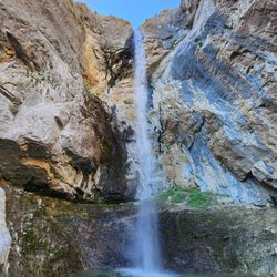
Hiking Trails With Waterfalls in Mt. Charleston, Nevada
Places to Take Pictures in Mt. Charleston, Nevada
Picnic Areas in Mt. Charleston, Nevada
Star Gazing in Mt. Charleston, Nevada
Night Hike in Mt. Charleston, Nevada
Scenic Overlook in Mt. Charleston, Nevada
Full Moon Hike in Mt. Charleston, Nevada
Off Road Trails in Mt. Charleston, Nevada
Playgrounds in Mt. Charleston, Nevada
Sunset View in Mt. Charleston, Nevada
Scenic View in Mt. Charleston, Nevada
Natural Hot Springs in Mt. Charleston, Nevada
Waterfalls and Swimming Holes in Mt. Charleston, Nevada
Caves in Mt. Charleston, Nevada
Secret Spots in Mt. Charleston, Nevada
Romantic Views in Mt. Charleston, Nevada
Swimming Lakes in Mt. Charleston, Nevada
Waterfalls in Mt. Charleston, Nevada
Gold Panning in Mt. Charleston, Nevada
Tent Camping in Mt. Charleston, Nevada
Fishing Spots in Mt. Charleston, Nevada